Oak Wood

Wood, Forest in Essex Harlow

England

Oak Wood

Sainsbury's supermarket car park, Harlow In front of the supermarket, a cycle path crosses the car park on a bridge.
Sainsbury's supermarket car park, Harlow Credit: Christopher Hilton

Oak Wood is a small village located in the county of Essex, England. Situated in the southern part of the county, Oak Wood is surrounded by picturesque landscapes and dense forests, making it a popular destination for nature lovers and outdoor enthusiasts.

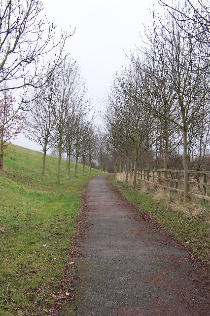
The village takes its name from the abundance of oak trees that populate the area, creating a stunning woodland scenery. These ancient oaks have been preserved and maintained over the years, adding to the village's charm and natural beauty. The forested landscape provides an ideal habitat for a variety of wildlife, including deer, foxes, and a wide array of bird species.

Despite its rural setting, Oak Wood is conveniently located within close proximity to major towns and cities. The nearby town of Chipping Ongar is only a short drive away and offers a range of amenities, including shops, schools, and leisure facilities. The village itself boasts a close-knit community, with a handful of local businesses and services to cater to residents' needs.

Oak Wood is also a popular spot for outdoor activities. The forested area surrounding the village offers numerous walking trails and cycling routes, allowing visitors to explore the natural surroundings at their own pace. The village is also home to several well-maintained parks and green spaces, providing residents with ample opportunities for recreational activities and relaxation.

In summary, Oak Wood is a charming village in Essex known for its oak woodlands and natural beauty. With its proximity to larger towns and a thriving community, it offers residents and visitors a peaceful and picturesque setting to enjoy the great outdoors.

If you have any feedback on the listing, please let us know in the comments section below.
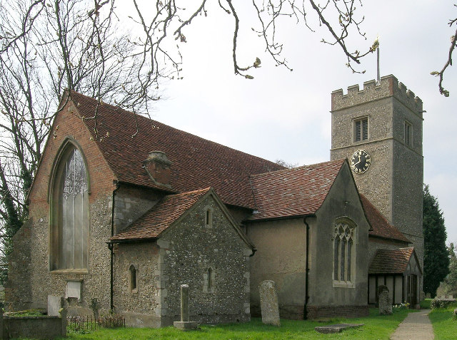
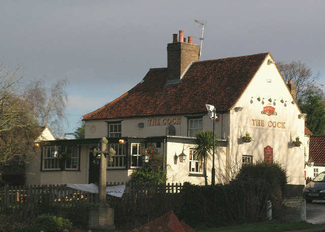
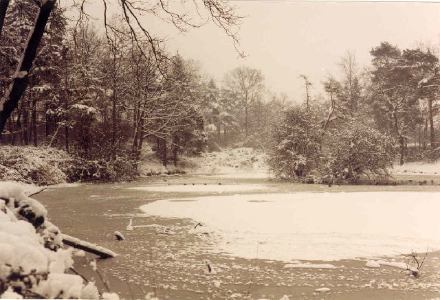
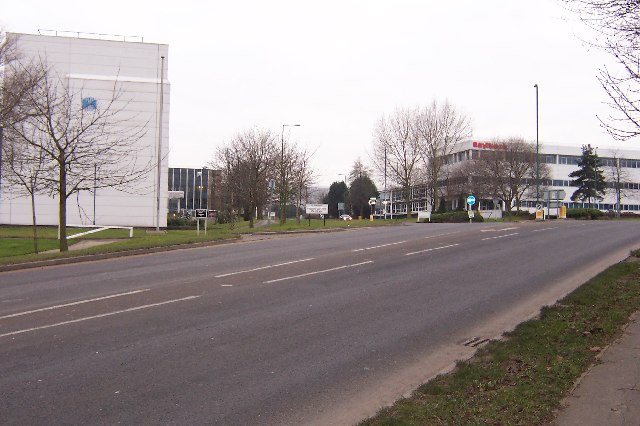
Oak Wood Images

Images are sourced within 2km of 51.772887/0.079358998 or Grid Reference TL4310. Thanks to Geograph Open Source API. All images are credited.

Sainsbury's supermarket car park, Harlow In front of the supermarket, a cycle path crosses the car park on a bridge.
Sainsbury's supermarket car park, Harlow
In front of the supermarket, a cycle path crosses the car park on a bridge.
Offices overlooking supermarket car park, Harlow
Hunsdon Mead Nature Reserve
Hunsdon Lock This canal lock is situated between the meadows of Hunsdon Mead and Eastwick Mead and is on part of both the Three Forests Way and the Stort Valley Way.
Hunsdon Lock
This canal lock is situated between the meadows of Hunsdon Mead and Eastwick Mead and is on part of both the Three Forests Way and the Stort Valley Way.
Harlow industrial area: Burnt Mill Burnt Mill is a road lined with light industrial premises in the area along the northern edge of Harlow.
On the right, the distribution centre for Faber Music.
Harlow industrial area: Burnt Mill
Burnt Mill is a road lined with light industrial premises in the area along the northern edge of Harlow. On the right, the distribution centre for Faber Music.
River Stort outside the Moorhen pub, Burnt Mill Lane, Harlow
Great Parndon, St Mary
Church of St. Mary the Virgin, Great Parndon, Harlow, Essex Not far from 'The Cock' Public House
Church of St. Mary the Virgin, Great Parndon, Harlow, Essex
Not far from 'The Cock' Public House
'The Cock' Public House, Great Parndon, Harlow, Essex
Oakwood Pond, Harlow in Winter Oakwood Pond and the surrounding wood is one of the many "nature" or green areas in Harlow New Town, thus preserving wildlife for the residents
Oakwood Pond, Harlow in Winter
Oakwood Pond and the surrounding wood is one of the many "nature" or green areas in Harlow New Town, thus preserving wildlife for the residents
Entrance to an Industrial Estate The two factories shown mark the beginning of The Pinnacles industrial estate on the north west corner of Harlow.
Entrance to an Industrial Estate
The two factories shown mark the beginning of The Pinnacles industrial estate on the north west corner of Harlow.
Winter Avenue of Trees, Jean McAlpine Park, Harlow Jean McAlpine Park is a landscaped land-fill site in Harlow. It is an area which provides good habitat for wildlife.
Winter Avenue of Trees, Jean McAlpine Park, Harlow
Jean McAlpine Park is a landscaped land-fill site in Harlow. It is an area which provides good habitat for wildlife.
The Playhouse, Harlow The Playhouse, Harlow was open in November 1971 and provides a wide and varied range of entertainment for theatre goers.
The Playhouse, Harlow
The Playhouse, Harlow was open in November 1971 and provides a wide and varied range of entertainment for theatre goers.
St. Paul's church, Harlow New Town, Essex This is the main church of Harlow New Town, designed by Humphrys and Hurst.
St. Paul's church, Harlow New Town, Essex
This is the main church of Harlow New Town, designed by Humphrys and Hurst.
Harlow: A1169 Third Avenue This is an elegant footbridge that links the New Frontiers Science Park with the GlaxoSmithKline site over the A1169 road.
Harlow: A1169 Third Avenue
This is an elegant footbridge that links the New Frontiers Science Park with the GlaxoSmithKline site over the A1169 road.
The new Water Gardens, Harlow
Harvey Harlow shopping centre In Harlow town centre.
Harvey Harlow shopping centre
In Harlow town centre.
Harlow town centre The New Water Gardens. See also <a href="https://www.geograph.org.uk/photo/403337">TL4409 : The new Water Gardens, Harlow</a>
Harlow town centre
The New Water Gardens. See also TL4409 : The new Water Gardens, Harlow
Show me another place!

Oak Wood is located at Grid Ref: TL4310 (Lat: 51.772887, Lng: 0.079358998)

Administrative County: Essex

District: Harlow

Police Authority: Essex

What 3 Words

///prone.line.income. Near Harlow, Essex

Related Wikis

Princess Alexandra Hospital, Harlow

The Princess Alexandra Hospital is an acute general hospital in Harlow, Essex, England. It is managed by the Princess Alexandra Hospital NHS Trust. �...

The Square, Harlow

The Square was a 250 capacity independent live music venue in Harlow, Essex, England. It was managed by SquareOne Entertainment LLP who took over the venue...

Harlow (UK Parliament constituency)

Harlow is a constituency represented in the House of Commons of the UK Parliament since 2010 by Robert Halfon, a Conservative. == Constituency profile... ==

Cannons Wood F.C.

Cannons Wood Football Club is a non-league football club based in Harlow, England. They are currently members of the Eastern Counties League Division One...

Harlow Town F.C.

Harlow Town Football Club is an English football club based in Harlow, Essex. The club is a member of the Eastern Counties League Division One South and...

Harlow Sportcentre

Harlow Sportcentre was a cricket ground in Harlow, Essex. The first recorded match on the ground was in 1964, when the Essex Second XI played the Warwickshire...

Harlow Stadium

Harlow Stadium is a greyhound racing track located in Harlow, Essex, England. The stadium also has executive suites, a restaurant, a number of bars and...

Harlow Jewish Community

Harlow Jewish Community, a member of the Movement for Reform Judaism, is a Reform Jewish congregation whose synagogue is at Harberts Road, Harlow, in Essex...

Nearby Amenities

Located within 500m of 51.772887,0.079358998
Direction: both
Traffic Calming: table
Lat/Long: 51.7741188/0.0812441
Noexit: yes
Lat/Long: 51.7698636/0.078989
Crossing
Crossing: marked
Crossing Markings: zebra
Lat/Long: 51.7720745/0.0864084
Noexit: yes
Lat/Long: 51.7737046/0.0849726
Post Box
Created By: Potlatch 0.7b
Lat/Long: 51.7745918/0.0803869
Place Of Worship
St Thomas More
Denomination: roman_catholic
Religion: christian
Lat/Long: 51.7708677/0.0805022
Bus Stop
Helions Road
Bus: yes
Naptan AtcoCode: 150035044003
Naptan Bearing: SW
Naptan CommonName: Helions Road
Naptan Indicator: Adj
Naptan Landmark: Helions Road
Naptan NaptanCode: esxatdwm
Naptan PlusbusZoneRef: HRLWTWN
Naptan Street: Fourth Avenue
Naptan Verified: no
Public Transport: platform
Source: naptan_import
Lat/Long: 51.7691433/0.0782271
Bus Stop
Canons Gate
Bus: yes
Naptan AtcoCode: 150035046003
Naptan Bearing: SW
Naptan CommonName: Spring Hills
Naptan Indicator: o/s
Naptan Landmark: Spring Hills
Naptan NaptanCode: esxatatp
Naptan PlusbusZoneRef: HRLWTWN
Naptan Street: Hobtoe Road
Naptan Verified: no
Public Transport: platform
Source: naptan_import
Lat/Long: 51.7751848/0.0778089
Bus Stop
Canons Gate
Bus: yes
Naptan AtcoCode: 150035046004
Naptan Bearing: NE
Naptan CommonName: Canons Gate
Naptan Indicator: o/s
Naptan Landmark: Canons Gate
Naptan NaptanCode: esxatatw
Naptan PlusbusZoneRef: HRLWTWN
Naptan Street: Hobtoe Road
Naptan Verified: no
Public Transport: platform
Source: naptan_import
Lat/Long: 51.7747719/0.0767462
Bus Stop
Kerril Croft
Bus: yes
Naptan AtcoCode: 150035046005
Naptan Bearing: NW
Naptan CommonName: Kerril Croft
Naptan Indicator: Opp
Naptan Landmark: Kerril Croft
Naptan NaptanCode: esxatawa
Naptan PlusbusZoneRef: HRLWTWN
Naptan Street: Hobtoe Road
Naptan Verified: no
Public Transport: platform
Source: naptan_import
Lat/Long: 51.7731515/0.0768457
Bus Stop
Kerril Croft
Bus: yes
Naptan AtcoCode: 150035046006
Naptan Bearing: S
Naptan CommonName: Kerril Croft
Naptan Indicator: Adj
Naptan Landmark: Kerril Croft
Naptan NaptanCode: esxatawd
Naptan PlusbusZoneRef: HRLWTWN
Naptan Street: Hobtoe Road
Naptan Verified: no
Public Transport: platform
Source: naptan_import
Lat/Long: 51.7720787/0.0775067
Bus Stop
Hodings Road Cycle Path
Bus: yes
Naptan AtcoCode: 150035046008
Naptan Bearing: S
Naptan CommonName: Hodings Road Cycle Path
Naptan Indicator: Adj
Naptan Landmark: Hodings Road Cycle Path
Naptan NaptanCode: esxatawm
Naptan PlusbusZoneRef: HRLWTWN
Naptan Street: Hodings Road
Naptan Verified: no
Public Transport: platform
Source: naptan_import
Lat/Long: 51.7702129/0.0797837
Bus Stop
Bus: yes
Naptan AtcoCode: 150035046009
Naptan Bearing: S
Naptan CommonName: School
Naptan Indicator: o/s
Naptan Landmark: School
Naptan NaptanCode: esxatawj
Naptan PlusbusZoneRef: HRLWTWN
Naptan Street: Hodings Road
Naptan Verified: no
Public Transport: platform
Source: naptan_import
Lat/Long: 51.7733401/0.0809277
Bus Stop
Ram Gorse
Bus: yes
Naptan AtcoCode: 150035047001
Naptan Bearing: E
Naptan CommonName: Ram Gorse
Naptan Crossing: Park Mead
Naptan Indicator: E-bound
Naptan Landmark: Ram Gorse
Naptan NaptanCode: esxatawp
Naptan PlusbusZoneRef: HRLWTWN
Naptan Street: Hodings Road
Naptan Verified: no
Public Transport: platform
Source: naptan_import
Lat/Long: 51.7748727/0.0837525
Bus Stop
Ram Gorse
Bus: yes
Naptan AtcoCode: 150035047002
Naptan Bearing: W
Naptan CommonName: Ram Gorse
Naptan Crossing: Park Mead
Naptan Indicator: W-bound
Naptan Landmark: Ram Gorse
Naptan NaptanCode: esxatawt
Naptan PlusbusZoneRef: HRLWTWN
Naptan Street: Hodings Road
Naptan Verified: no
Public Transport: platform
Source: naptan_import
Lat/Long: 51.7749418/0.0844225
Bus Stop
Foldcroft
Naptan AtcoCode: 1500IM1408
Naptan Bearing: W
Naptan CommonName: Foldcroft
Naptan Indicator: Adj
Naptan Landmark: Foldcroft
Naptan NaptanCode: esxatawg
Naptan PlusbusZoneRef: HRLWTWN
Naptan Street: Hobtoe Road
Naptan Verified: no
Public Transport: platform
Source: naptan_import
Lat/Long: 51.7707083/0.0793908
Bus Stop
Princess Alexandra Hospital
Bus: yes
Naptan AtcoCode: 1500IM2616
Naptan Bearing: N
Naptan CommonName: Princess Alexandra Hospital
Naptan Indicator: Forecourt
Naptan Landmark: Princess Alexandra Hospital
Naptan NaptanCode: esxatdad
Naptan PlusbusZoneRef: HRLWTWN
Naptan Street: Fourth Avenue
Naptan Verified: no
Public Transport: platform
Source: naptan_import
Lat/Long: 51.770556/0.0851263
Bus Stop
Hobtoe Road
Bus: yes
Naptan AtcoCode: 1500IM333
Naptan Bearing: SE
Naptan CommonName: Hobtoe Road
Naptan Crossing: Ram Gorse
Naptan Indicator: SE-bound
Naptan Landmark: Hobtoe Road
Naptan NaptanCode: esxatatm
Naptan PlusbusZoneRef: HRLWTWN
Naptan Street: Hobtoe Road
Naptan Verified: no
Public Transport: platform
Source: naptan_import
Lat/Long: 51.775359/0.0798566
Bus Stop
Hobtoe Road
Bus: yes
Naptan AtcoCode: 1500IM333B
Naptan Bearing: NW
Naptan CommonName: Hobtoe Road
Naptan Crossing: Ram Gorse
Naptan Indicator: NW-bound
Naptan Landmark: Hobtoe Road
Naptan NaptanCode: esxatatj
Naptan PlusbusZoneRef: HRLWTWN
Naptan Street: Hobtoe Road
Naptan Verified: no
Public Transport: platform
Source: naptan_import
Lat/Long: 51.7744065/0.0806288
Post Box
Lat/Long: 51.7751501/0.0848277
Noexit: yes
Lat/Long: 51.7754462/0.0843854
Noexit: yes
Lat/Long: 51.7750197/0.0827224
Noexit: yes
Lat/Long: 51.774992/0.0794087
Noexit: yes
Lat/Long: 51.7750821/0.0788369
Noexit: yes
Lat/Long: 51.7762005/0.0833425
Crossing
Crossing: marked
Crossing Markings: zebra
Lat/Long: 51.7709621/0.084527
Noexit: yes
Lat/Long: 51.770772/0.0775038
Noexit: yes
Lat/Long: 51.773845/0.084291
Barrier: bollard
Lat/Long: 51.7723018/0.0850056
Noexit: yes
Lat/Long: 51.7733885/0.0760089
Little Parndon
Place: suburb
Lat/Long: 51.7738126/0.0819484
Noexit: yes
Lat/Long: 51.7742233/0.0800062
Noexit: yes
Lat/Long: 51.7717611/0.0849093
Noexit: yes
Lat/Long: 51.772674/0.0865763
Noexit: yes
Lat/Long: 51.7742695/0.0832601
Crossing
Crossing: marked
Crossing Markings: zebra
Lat/Long: 51.7716864/0.0853239
Crossing
Crossing: marked
Crossing Markings: zebra
Lat/Long: 51.7722157/0.0858844
Crossing
Lat/Long: 51.7707368/0.0850943
Crossing
Crossing: marked
Lat/Long: 51.7704591/0.0847193
Crossing
Crossing: marked
Crossing Markings: zebra
Lat/Long: 51.7711228/0.08517
Crossing
Crossing: marked
Lat/Long: 51.7715637/0.085236
Noexit: yes
Lat/Long: 51.7735271/0.0841574
Noexit: yes
Lat/Long: 51.7728864/0.0855375
Noexit: yes
Lat/Long: 51.768764/0.0822506
Power: substation
Substation: minor_distribution
Lat/Long: 51.769031/0.0815143
Noexit: yes
Lat/Long: 51.7695061/0.0775874
Noexit: yes
Lat/Long: 51.7709165/0.0854029
Noexit: yes
Lat/Long: 51.7714712/0.0856303
Noexit: yes
Lat/Long: 51.7697049/0.0834217
Noexit: yes
Lat/Long: 51.7703226/0.0840779
Noexit: yes
Lat/Long: 51.7703954/0.0835162
Noexit: yes
Lat/Long: 51.7696372/0.0837157
Bus Stop
Foldcroft
Bus: yes
Naptan AtcoCode: 1500IM1408Y
Naptan BusStopType: CUS
Naptan NaptanCode: esxgwdwp
Naptan Verified: no
Public Transport: platform
Source: naptan
Lat/Long: 51.7710101/0.0782871
Noexit: yes
Lat/Long: 51.7694687/0.0765983
Crossing
Lat/Long: 51.7758182/0.0764195
Crossing
Crossing: unmarked
Crossing Island: yes
Lat/Long: 51.7760536/0.0765884
Crossing
Crossing: unmarked
Crossing Island: yes
Lat/Long: 51.7755675/0.0755031
Noexit: yes
Lat/Long: 51.7743988/0.0780835
Noexit: yes
Lat/Long: 51.7745075/0.0782364
Crossing
Crossing: unmarked
Crossing Island: yes
Lat/Long: 51.7692324/0.0791435
Noexit: yes
Lat/Long: 51.7741687/0.0802604
Noexit: yes
Lat/Long: 51.7720182/0.0836871
Crossing
Crossing: marked
Crossing Markings: zebra
Lat/Long: 51.7721278/0.0853048
Crossing
Crossing: marked
Crossing Markings: zebra
Lat/Long: 51.771336/0.0852404
Noexit: yes
Lat/Long: 51.7710057/0.0853367
Noexit: yes
Lat/Long: 51.7703369/0.0852643
Noexit: yes
Lat/Long: 51.773302/0.0856559
Noexit: yes
Lat/Long: 51.7730763/0.0862205
Noexit: yes
Lat/Long: 51.7740188/0.0809054
Direction: both
Traffic Calming: table
Lat/Long: 51.7734635/0.080889
Bench
Backrest: yes
Lat/Long: 51.7699795/0.0798311
Entrance: yes
Lat/Long: 51.770816/0.0801331
Entrance: yes
Lat/Long: 51.7709211/0.0802227
Crossing
Lat/Long: 51.7706364/0.0798091
Barrier: swing_gate
Lat/Long: 51.7753308/0.0747867
Crossing
Crossing: marked
Crossing Markings: zebra
Lat/Long: 51.7713409/0.085106
Noexit: yes
Lat/Long: 51.7716924/0.0856732
Crossing
Crossing: marked
Crossing Markings: zebra
Lat/Long: 51.7716478/0.0853668
Crossing
Crossing: marked
Lat/Long: 51.7710388/0.0850756
Noexit: yes
Lat/Long: 51.7721106/0.0832211
HE Ref: 1009239
Heritage: 2
Heritage Operator: he
Historic: tomb
Tomb: tumulus
Lat/Long: 51.7737281/0.0864941
Noexit: yes
Lat/Long: 51.7743909/0.0827109
Entrance: yes
Lat/Long: 51.7731486/0.0740527
Iceni
Artist Name: Anthony Hawken
Artwork Type: sculpture
Material: stone
Start Date: 1995
Tourism: artwork
Lat/Long: 51.7746732/0.0802442
Bench
Spy Benches
Backrest: yes
Material: wood
Seats: 8
Source: https://www.ramblers.org.uk/route-detail?routeuid=3090-Harlow-A-short-walk-to-meet-a-KGB-spy;https://www.signsexpress.co.uk/our-work/harlow-renaissance-council;https://www.bbc.co.uk/news/uk-england-essex-16440139
Source Website: https://www.bbc.co.uk/news/uk-england-essex-16440139
Website: https://www.ramblers.org.uk/route-detail?routeuid=3090-Harlow-A-short-walk-to-meet-a-KGB-spy
Lat/Long: 51.7749671/0.0847878
Direction: both
Traffic Calming: cushion
Lat/Long: 51.7739336/0.0759827
Barrier: bollard
Lat/Long: 51.7705555/0.0781811
The data included in this document is from www.openstreetmap.org. The data is made available under ODbL.

Have you been to Oak Wood?

Leave your review of Oak Wood below (or comments, questions and feedback).