Wet Wood

Wood, Forest in Sussex Wealden

England

Wet Wood

Cansiron / Butcherfield Lane, Hartfield On the right angled corner looking east along Butcherfield Lane and at the entrance (behind) to Great Cansiron Farm
Cansiron / Butcherfield Lane, Hartfield Credit: Nigel Freeman

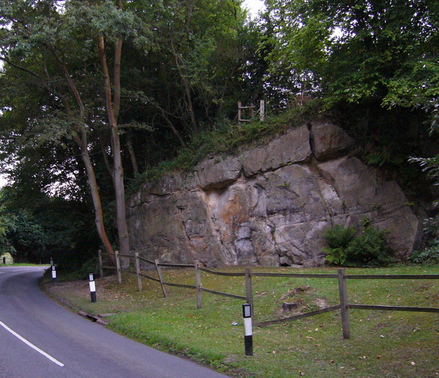
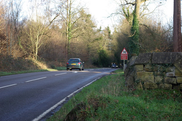
Wet Wood, located in Sussex, is a picturesque forest known for its wet and marshy terrain. It is a natural habitat for a diverse range of plant and animal species. The forest covers an expansive area of approximately 500 acres, making it a popular destination for nature enthusiasts and hikers.

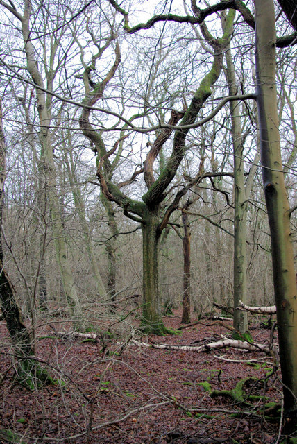
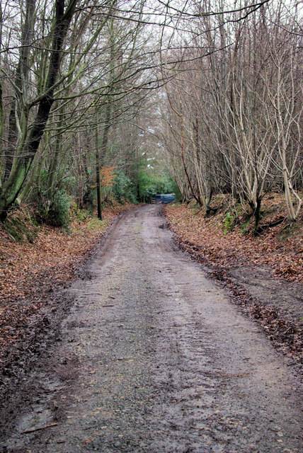
Wet Wood is characterized by its dense tree cover, primarily consisting of deciduous trees such as oak, birch, and beech. These trees provide a lush canopy that filters sunlight and creates a cool and serene atmosphere within the forest. The forest floor is adorned with a variety of flora, including ferns, mosses, and wildflowers, which thrive in the damp conditions.

The main feature of Wet Wood is its wetland ecosystem. The forest is intersected by several streams and small rivers, which contribute to the saturation of the forest floor. These water bodies also support a diverse range of aquatic life, including frogs, newts, and various species of fish.

The wet conditions of the forest make it an ideal habitat for a range of bird species, including herons, ducks, and kingfishers, which can be spotted by keen birdwatchers. Wet Wood is also home to a population of deer, badgers, and foxes, providing ample opportunities for wildlife observation.

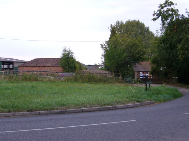
Visitors to Wet Wood can explore its various walking trails and enjoy the tranquil surroundings. The forest offers a peaceful retreat from the hustle and bustle of daily life, allowing visitors to connect with nature and experience the beauty of a wetland ecosystem.

If you have any feedback on the listing, please let us know in the comments section below.
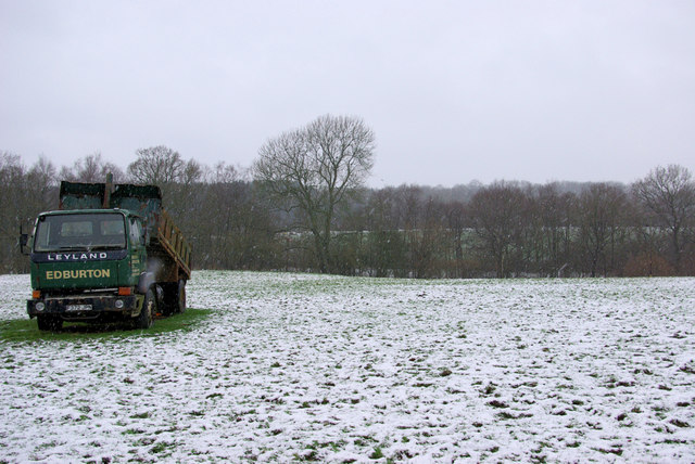
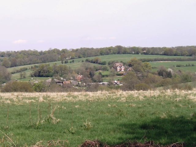
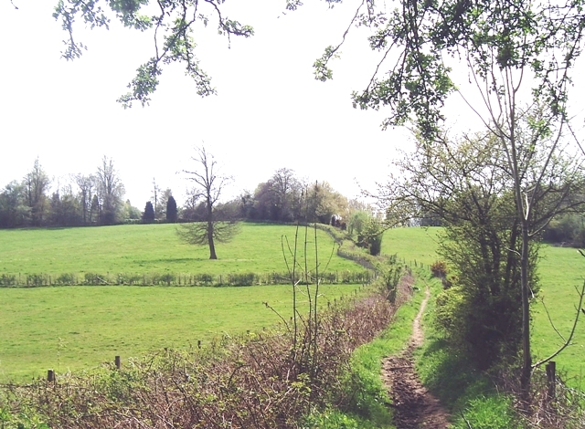
Wet Wood Images

Images are sourced within 2km of 51.129314/0.049747465 or Grid Reference TQ4338. Thanks to Geograph Open Source API. All images are credited.

Cansiron / Butcherfield Lane, Hartfield On the right angled corner looking east along Butcherfield Lane and at the entrance (behind) to Great Cansiron Farm
Cansiron / Butcherfield Lane, Hartfield
On the right angled corner looking east along Butcherfield Lane and at the entrance (behind) to Great Cansiron Farm
Wealden outcrop in Homestall Road which is in East Sussex but continue away from the photographer along that road for a couple of hundred yards and you come to Ashurst Wood, West Sussex. Stoke Brunswick School lies behind the outcrop. The rock is rusty because it contains iron ore.
Wealden outcrop
in Homestall Road which is in East Sussex but continue away from the photographer along that road for a couple of hundred yards and you come to Ashurst Wood, West Sussex. Stoke Brunswick School lies behind the outcrop. The rock is rusty because it contains iron ore.
Near Shovelstrode Farm in Homestall Road near Ashurst Wood. Shovelstrode Farm is out of shot to the right.
Near Shovelstrode Farm
in Homestall Road near Ashurst Wood. Shovelstrode Farm is out of shot to the right.
St Stephen's Church Hammerwood
St Stephen's Church
Hammerwood
Stoke Brunswick School A historic building built by Lord and Lady Dewar, combining a hunting lodge with a Hall bought down from Cheshire and landscaped gardens. Now used as a school
Stoke Brunswick School
A historic building built by Lord and Lady Dewar, combining a hunting lodge with a Hall bought down from Cheshire and landscaped gardens. Now used as a school
Bend on A264 east of Hammerwood Church A view east from the gateway into Hammerwood churchyard (its wall is on the right). The feature is the left-hand bend that the approaching car is rounding.
Bend on A264 east of Hammerwood Church
A view east from the gateway into Hammerwood churchyard (its wall is on the right). The feature is the left-hand bend that the approaching car is rounding.
In Fifty Acre Wood A rather neglected wood notable for the old iron ore diggings downhill from this spot.
In Fifty Acre Wood
A rather neglected wood notable for the old iron ore diggings downhill from this spot.
Bridleway from Kent to Sussex A view towards the end of the bridleway (also a private track) where it meets the A264 at a tricky bend.
Bridleway from Kent to Sussex
A view towards the end of the bridleway (also a private track) where it meets the A264 at a tricky bend.
Thornhill An imposing house viewed from the Vanguard Way footpath.
Thornhill
An imposing house viewed from the Vanguard Way footpath.
Dog Gate Lodge At a crossroads of tracks. The Vanguard way comes from the south and turns initially west (out of sight), a private track goes north, and a public bridleway goes east.
Dog Gate Lodge
At a crossroads of tracks. The Vanguard way comes from the south and turns initially west (out of sight), a private track goes north, and a public bridleway goes east.
Hammerwood House Hammer Wood is to the right. The Hammer reference is derived from the Wealden iron industry.
Hammerwood House
Hammer Wood is to the right. The Hammer reference is derived from the Wealden iron industry.
Owletts Cottage Not a whimsical name - there is a nearby Owlett's Farm.
Owletts Cottage
Not a whimsical name - there is a nearby Owlett's Farm.
Power Line Gap A power line heads east in the general direction of Great Cansiron Farm, hidden behind the modestly named Acre Wood in the distance.
Power Line Gap
A power line heads east in the general direction of Great Cansiron Farm, hidden behind the modestly named Acre Wood in the distance.
Cowshed, Owlett's Farm The moment they saw the camera, the cows retreated from the mangers into the depths of the shed.
Cowshed, Owlett's Farm
The moment they saw the camera, the cows retreated from the mangers into the depths of the shed.
A Lorry in a Field The lorry has not moved from this spot for over a year, and has remained half tipped.
A Lorry in a Field
The lorry has not moved from this spot for over a year, and has remained half tipped.
Cansiron Lane A snowy morning.
Cansiron Lane
A snowy morning.
Wealden farmland Taken just north of the main road from East Grinstead to Tunbridge Wells.
Wealden farmland
Taken just north of the main road from East Grinstead to Tunbridge Wells.
Vanguard Way footpath Taken from the footbridge over an un-named stream south of Hammerwood.
Vanguard Way footpath
Taken from the footbridge over an un-named stream south of Hammerwood.
Show me another place!

Wet Wood is located at Grid Ref: TQ4338 (Lat: 51.129314, Lng: 0.049747465)

Administrative County: East Sussex

District: Wealden

Police Authority: Sussex

What 3 Words

///lungs.tools.sushi. Near Forest Row, East Sussex

Related Wikis

Hammerwood

Hammerwood is a hamlet in the civil parish of Forest Row in East Sussex, England. Its nearest town is East Grinstead, which lies approximately 3.5 miles...

Hammerwood Park

Hammerwood Park is a country house in Hammerwood, near East Grinstead, in East Sussex, England. It is a Grade I listed building. One of the first houses...

Stoke Brunswick School

Stoke Brunswick School was a small co-educational day and boarding independent school for children aged 3 to 13 years, situated in Ashurst Wood, West Sussex...

Ashurst Wood

Ashurst Wood is a village and civil parish in the Mid Sussex District of West Sussex, within the historic county of Sussex, England. It is 1 mile (2 km...

Ashdown House, East Sussex

Ashdown House is a country house and former school near Forest Row, East Sussex, England, a Grade II* listed building. One of the first houses in England...

London to Lewes Way

The London to Lewes Way is a 71 kilometres (44 mi) long Roman road between Watling Street at Peckham and Lewes in Sussex. The road passes through Beckenham...

Brambletye School

Brambletye School is a coeducational day and boarding preparatory school in East Grinstead, West Sussex. It was founded as a small boys' boarding school...

Emerson College (UK)

Emerson College, UK was founded in 1962 by Francis Edmunds. It is now situated on Pixton Hill, Forest Row in East Sussex, UK. It was named after Ralph...

Nearby Amenities

Located within 500m of 51.129314,0.049747465
Power: tower
Lat/Long: 51.1270186/0.0534585
Power: tower
Lat/Long: 51.1274487/0.0498463
Power: tower
Lat/Long: 51.1279463/0.0451084
Barrier: stile
Stile: stepover
Lat/Long: 51.1293149/0.0441571
The data included in this document is from www.openstreetmap.org. The data is made available under ODbL.

Have you been to Wet Wood?

Leave your review of Wet Wood below (or comments, questions and feedback).