Marsh Green Wood

Wood, Forest in Kent Sevenoaks

England

Marsh Green Wood

Oak and bluebells near Hoopers Farm It is unusual in these parts for bluebells to grow thickly in an open field. Perhaps it was once a wood? Indeed it was. Kiln Wood is roughly square in late Victorian maps, extending over this area. Now it is a much smaller triangle behind and right of the viewpoint.
Oak and bluebells near Hoopers Farm Credit: Robin Webster

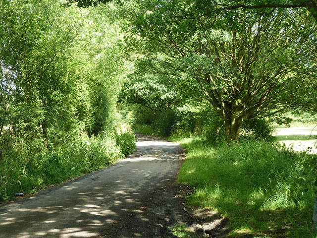
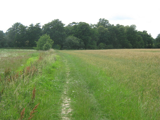
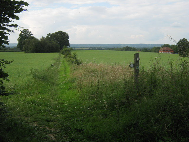
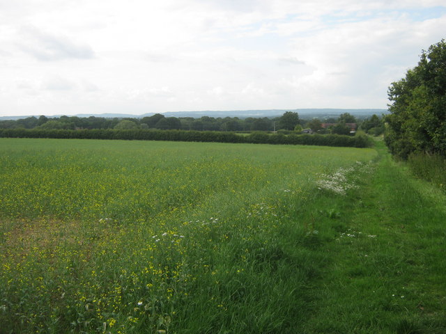
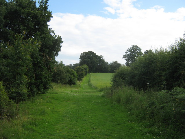
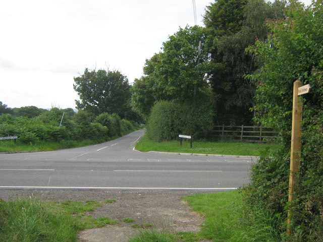
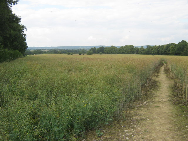
Marsh Green Wood is a beautiful woodland located in the county of Kent, England. Covering an area of approximately 50 hectares, the wood is a mix of ancient and secondary woodland, making it a diverse and ecologically significant area. It is situated near the village of Marsh Green, and is easily accessible by foot or by car.

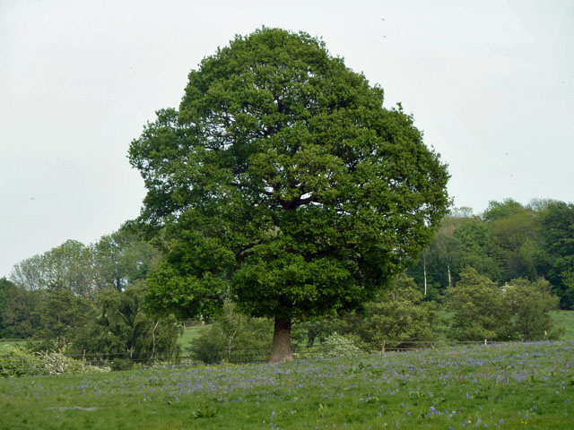
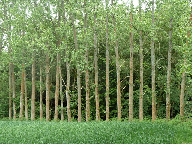
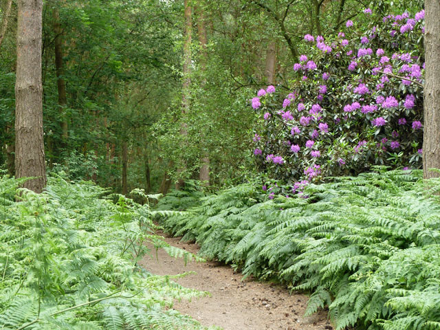
The woodland is characterized by its dense canopy of oak, ash, and birch trees, which provide shelter for a variety of woodland birds and mammals. The forest floor is covered in a rich carpet of bluebells and other wildflowers during springtime, creating a stunning display of colors.

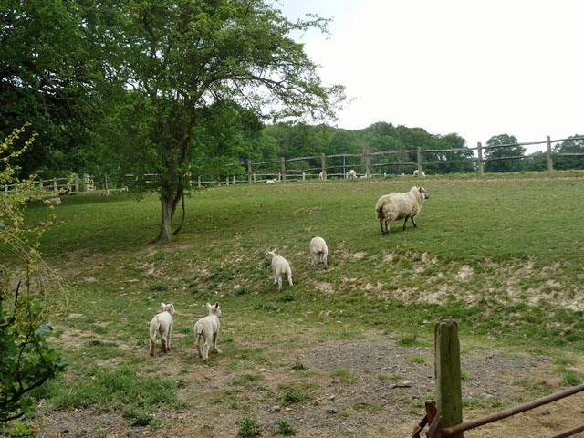
Marsh Green Wood is also home to a number of rare and protected species, including the hazel dormouse and the white admiral butterfly. The wood is managed by local conservation organizations, who work to protect and enhance the biodiversity of the area.

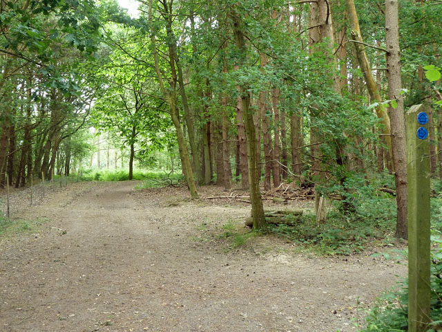
Visitors to Marsh Green Wood can enjoy a variety of activities, such as walking, birdwatching, and nature photography. There are several well-marked trails that wind through the wood, offering visitors the opportunity to explore its beauty at their own pace. Picnic areas and benches are also available, providing a perfect spot to relax and soak in the peaceful atmosphere of the woodland.

Overall, Marsh Green Wood is a haven for nature lovers and a valuable ecological resource. Its diverse flora and fauna, coupled with its tranquil setting, make it a must-visit destination for anyone seeking to connect with nature in the heart of Kent.

If you have any feedback on the listing, please let us know in the comments section below.

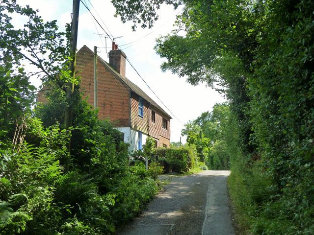
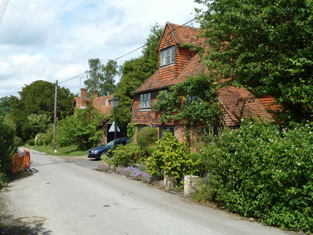
Marsh Green Wood Images

Images are sourced within 2km of 51.173303/0.051654731 or Grid Reference TQ4343. Thanks to Geograph Open Source API. All images are credited.

Oak and bluebells near Hoopers Farm It is unusual in these parts for bluebells to grow thickly in an open field. Perhaps it was once a wood? Indeed it was. Kiln Wood is roughly square in late Victorian maps, extending over this area. Now it is a much smaller triangle behind and right of the viewpoint.
Oak and bluebells near Hoopers Farm
It is unusual in these parts for bluebells to grow thickly in an open field. Perhaps it was once a wood? Indeed it was. Kiln Wood is roughly square in late Victorian maps, extending over this area. Now it is a much smaller triangle behind and right of the viewpoint.
Yellow auto-suggestion As I gazed at this photograph of oil-seed rape, for a moment I thought I could smell it. How about you?
Yellow auto-suggestion
As I gazed at this photograph of oil-seed rape, for a moment I thought I could smell it. How about you?
Starborough Castle This splendid place does bed and breakfast! According to an Australian woman who was staying there I met, not only is it a very nice place, but has very nice people.
Starborough Castle
This splendid place does bed and breakfast! According to an Australian woman who was staying there I met, not only is it a very nice place, but has very nice people.
Gauging weir, River Eden This is just before its confluence with the Eden Brook. The cows kept being a nuisance and there was an electric fence very near, so a quick shot and off!
Gauging weir, River Eden
This is just before its confluence with the Eden Brook. The cows kept being a nuisance and there was an electric fence very near, so a quick shot and off!
Trees in a regular row These appear to be Limes. They have been planted all along the wood edge.
Trees in a regular row
These appear to be Limes. They have been planted all along the wood edge.
Colour in Jules Wood Unless the path has wandered a little from where it should be, the rhododendron is in Kent and the other side of the path is Surrey.
Colour in Jules Wood
Unless the path has wandered a little from where it should be, the rhododendron is in Kent and the other side of the path is Surrey.
Ewe and lambs The post and rail fences dividing this field up into paddocks are presumably for horses - the sheep can duck straight through them.
Ewe and lambs
The post and rail fences dividing this field up into paddocks are presumably for horses - the sheep can duck straight through them.
Repositioned bridleway junction Just inside the Kent/Surrey boundary, the junction of bridleways SR650 and SR650A has been moved north from the legal line. SR650 comes from behind the viewpoint and turns to the right. The legal line of SR650A is as a left turn off SR650 about 50 m south, which would pass through a conifer plantation. The actual line of SR650A is straight on at the edge of the wood. Kent County Council have condoned this on their direction post, although their interactive map shows only the legal route.
Repositioned bridleway junction
Just inside the Kent/Surrey boundary, the junction of bridleways SR650 and SR650A has been moved north from the legal line. SR650 comes from behind the viewpoint and turns to the right. The legal line of SR650A is as a left turn off SR650 about 50 m south, which would pass through a conifer plantation. The actual line of SR650A is straight on at the edge of the wood. Kent County Council have condoned this on their direction post, although their interactive map shows only the legal route.
Kingdom Hall of Jehovah's Witnesses, Marsh Green The most northerly building in the village, facing the green.
Kingdom Hall of Jehovah's Witnesses, Marsh Green
The most northerly building in the village, facing the green.
Cottages 1 and 2, Greybury Lane There is a group of seven cottages at the top of this rise in the lane, which publicly is only a bridleway.
Cottages 1 and 2, Greybury Lane
There is a group of seven cottages at the top of this rise in the lane, which publicly is only a bridleway.
Chiswell Barn, Shernden Lane The lane is publicly only a bridleway, but it gives access to several houses, including this, one of a group around Chiswell Farm.
Chiswell Barn, Shernden Lane
The lane is publicly only a bridleway, but it gives access to several houses, including this, one of a group around Chiswell Farm.
Old main road, Marsh Green This lane around the north-western side of the village green was the only way towards Edenbridge until the straight cut-off road on the south-eastern side was built about 1900. Surprisingly, the current village green only came into being when this was done, the area being fields until then.
Old main road, Marsh Green
This lane around the north-western side of the village green was the only way towards Edenbridge until the straight cut-off road on the south-eastern side was built about 1900. Surprisingly, the current village green only came into being when this was done, the area being fields until then.
Footpath to Dormansland A path leads beside a field edge, from Cedar Lodge Farm, towards Ford Manor Road.

In the background, an unnamed wood at the junction of two streams.
Footpath to Dormansland
A path leads beside a field edge, from Cedar Lodge Farm, towards Ford Manor Road. In the background, an unnamed wood at the junction of two streams.
Footpath junction on Vanguard Way near Kiln Wood The long distance path leads from Dry Hill (along a bridleway) towards Moor Lane.
A footpath leads left towards Lingfield.

In the background on the left is Skitts Farm.
Footpath junction on Vanguard Way near Kiln Wood
The long distance path leads from Dry Hill (along a bridleway) towards Moor Lane. A footpath leads left towards Lingfield. In the background on the left is Skitts Farm.
Vanguard Way to Moor Lane The long distance path leads towards the lane, from Dry Hill.

In the background is the Moor Cottages on the lane.

Note; the OS maps show it beside Oxenleas Wood. This wood has been 'trimmed', to a smaller clump of trees.
Vanguard Way to Moor Lane
The long distance path leads towards the lane, from Dry Hill. In the background is the Moor Cottages on the lane. Note; the OS maps show it beside Oxenleas Wood. This wood has been 'trimmed', to a smaller clump of trees.
Vanguard's Way near Moors Lane cottages The long distance path leads from Moors Lane, along a bridleway up towards Dry Hill.
Vanguard's Way near Moors Lane cottages
The long distance path leads from Moors Lane, along a bridleway up towards Dry Hill.
Road junction on Moor Lane Moor Lane leads left towards Dormansland, or right to Edenbridge.
Starborough Road, leads straight on towards Starborough Farm and Haxted Watermill. 

As seen from the bridleway from Dry Hill (used by the Vanguard Way). It now heads left and then across a field towards Starbourgh Castle.
Road junction on Moor Lane
Moor Lane leads left towards Dormansland, or right to Edenbridge. Starborough Road, leads straight on towards Starborough Farm and Haxted Watermill. As seen from the bridleway from Dry Hill (used by the Vanguard Way). It now heads left and then across a field towards Starbourgh Castle.
Vanguard Way to Starbourgh Castle A field path leads from Moor Lane, towards an access road to the Castle.
Vanguard Way to Starbourgh Castle
A field path leads from Moor Lane, towards an access road to the Castle.
Show me another place!

Marsh Green Wood is located at Grid Ref: TQ4343 (Lat: 51.173303, Lng: 0.051654731)

Administrative County: Kent

District: Sevenoaks

Police Authority: Kent

What 3 Words

///sober.plank.navy. Near Edenbridge, Kent

Related Wikis

Marsh Green, Kent

Marsh Green is a small hamlet in Eden Vale, part of the parish of Edenbridge, England. The hamlet was founded in 1554 under its current name. Marsh Green...

Starborough Castle

Starborough Castle, known historically as Sterborough Castle, is a Neo-Gothic garden house of dressed sandstone near the eastern boundary of Surrey, built...

Sundridge with Ide Hill

Sundridge and Ide Hill is a civil parish in the Sevenoaks District of Kent, England. It is located in the Darenth valley and lies between Sevenoaks and...
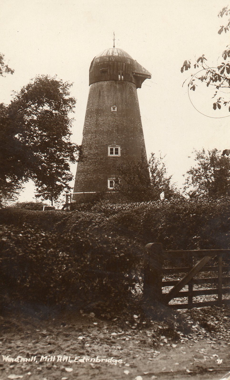
Edenbridge Windmill

Edenbridge Mill is a Grade II listed house converted tower mill in Edenbridge, Kent, England. It is on the west side of Mill Hill, just north of the hospital...

Nearby Amenities

Located within 500m of 51.173303,0.051654731
Barrier: stile
Lat/Long: 51.1771035/0.0508284
Barrier: stile
Lat/Long: 51.1756219/0.0531351
Barrier: stile
Lat/Long: 51.1766238/0.0514925
The data included in this document is from www.openstreetmap.org. The data is made available under ODbL.

Have you been to Marsh Green Wood?

Leave your review of Marsh Green Wood below (or comments, questions and feedback).