Potter's Wood

Wood, Forest in Surrey Tandridge

England

Potter's Wood

Footpath 387 towards Dencher Wood The farm buildings still shown on the 1:50000 map here have been gone for some years. There is only some hard standing - presumably former floors, this derelict feeder, and not much else. The footpath crosses a ditch by a bridge ahead and then turns right along the field parallel with the wood edge.
Footpath 387 towards Dencher Wood Credit: Robin Webster

Potter's Wood is a charming forest located in the county of Surrey, England. Covering an area of approximately 50 hectares, this enchanting woodland is nestled in the heart of the Surrey Hills Area of Outstanding Natural Beauty. It is a popular destination for nature enthusiasts, hikers, and families looking to immerse themselves in the tranquility of the countryside.

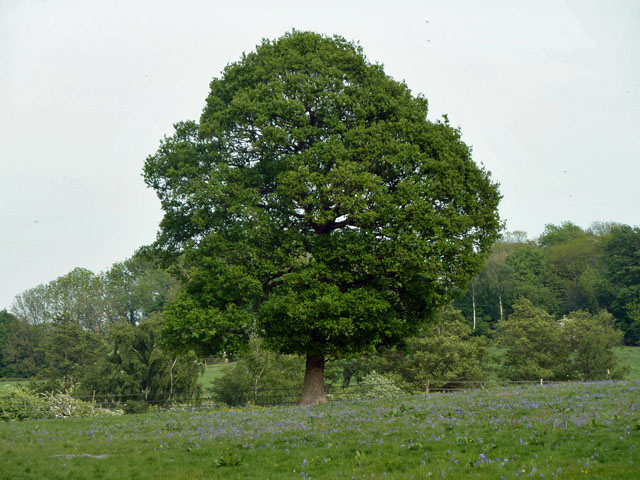
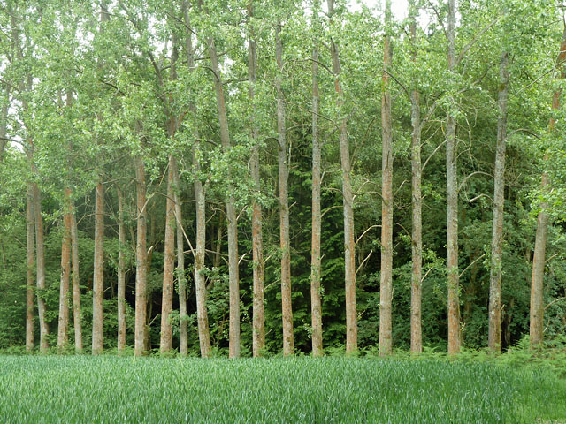
The woodland is predominantly made up of mature deciduous trees, including oak, beech, and ash, which create a dense canopy overhead, allowing only dappled sunlight to filter through. This creates a picturesque and serene atmosphere, making it a perfect escape from the hustle and bustle of everyday life.

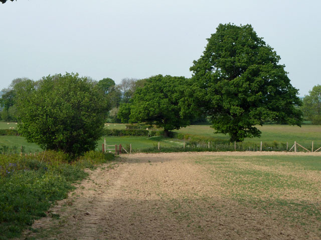
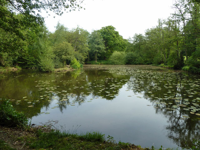
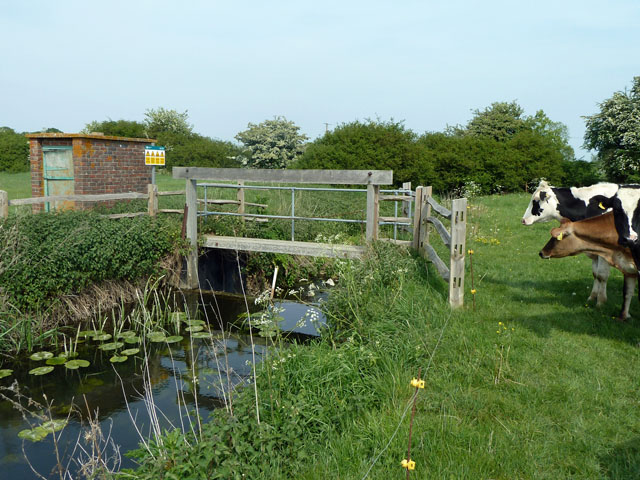
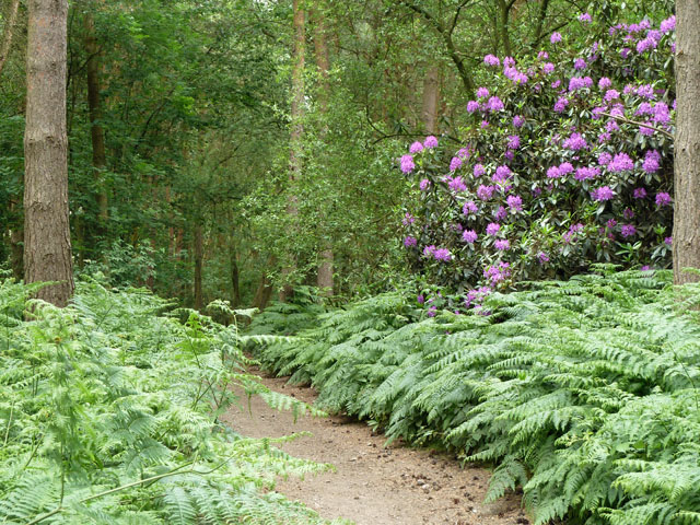
The forest floor is covered in a lush carpet of ferns, bluebells, and wildflowers, providing a vibrant and colorful display during the spring and summer months. It is also home to a diverse array of wildlife, including deer, foxes, and a wide variety of bird species, making it a haven for nature lovers and birdwatchers alike.

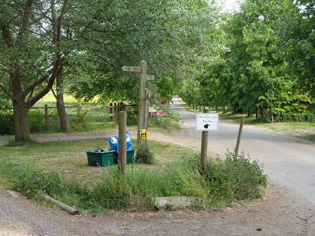
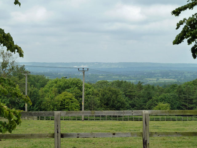
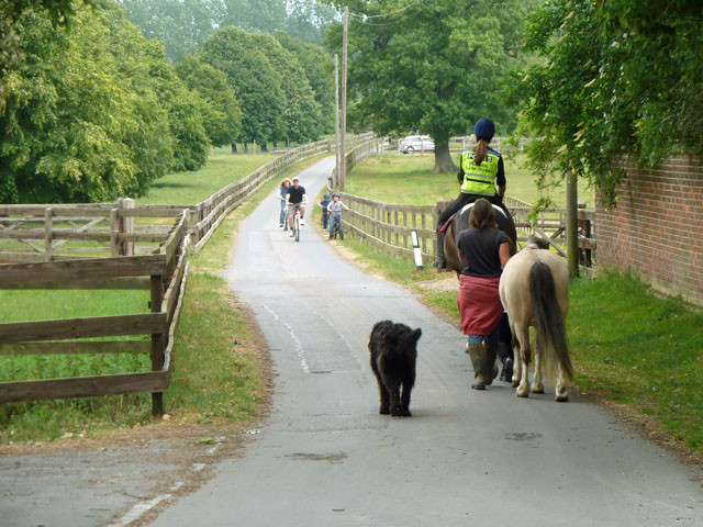
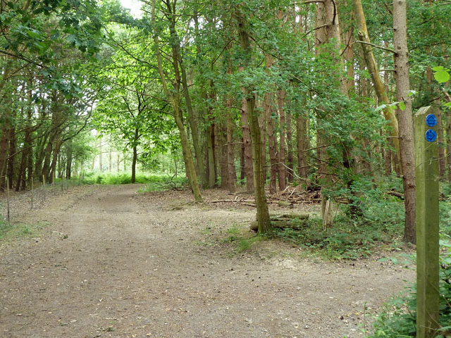
Potter's Wood offers a well-maintained network of walking trails that wind their way through the forest, allowing visitors to explore its beauty at their own pace. The paths are clearly marked and provide access to some stunning viewpoints, where visitors can admire the breathtaking vistas of the surrounding countryside.

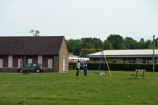
Additionally, the woodland is equipped with picnic areas and benches, making it an ideal spot for a leisurely lunch or a peaceful picnic with friends and family. There are also designated areas for children to play and explore, ensuring that there is something for everyone to enjoy.

Overall, Potter's Wood in Surrey is a true gem, providing a peaceful retreat for those seeking solace in nature's embrace.

If you have any feedback on the listing, please let us know in the comments section below.

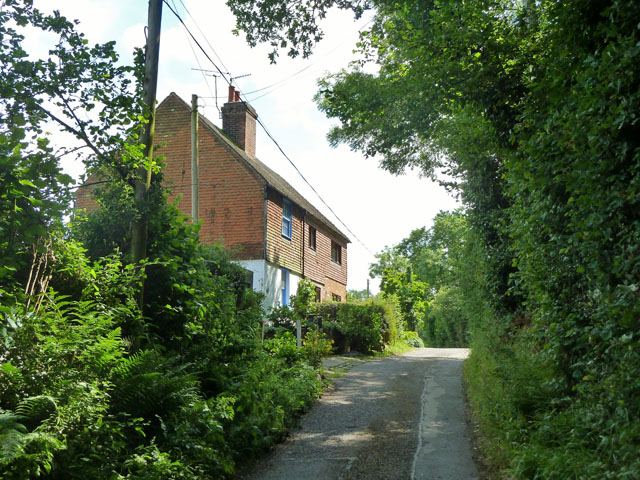
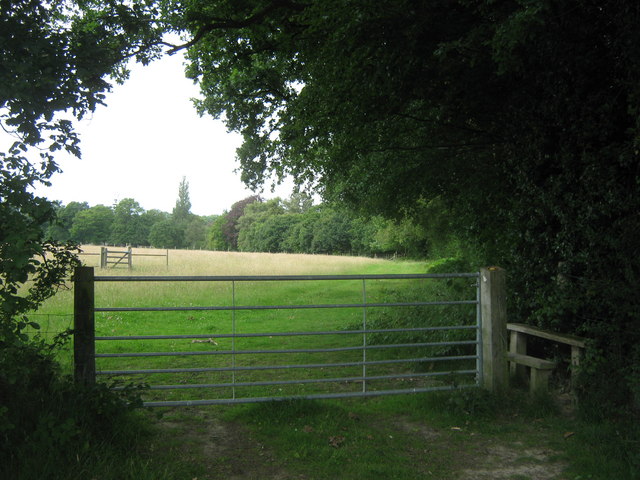
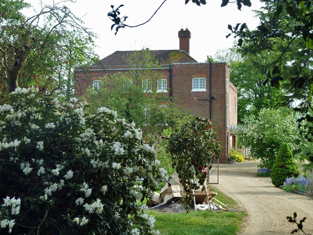
Potter's Wood Images

Images are sourced within 2km of 51.16902/0.036873798 or Grid Reference TQ4243. Thanks to Geograph Open Source API. All images are credited.

Footpath 387 towards Dencher Wood The farm buildings still shown on the 1:50000 map here have been gone for some years. There is only some hard standing - presumably former floors, this derelict feeder, and not much else. The footpath crosses a ditch by a bridge ahead and then turns right along the field parallel with the wood edge.
Footpath 387 towards Dencher Wood
The farm buildings still shown on the 1:50000 map here have been gone for some years. There is only some hard standing - presumably former floors, this derelict feeder, and not much else. The footpath crosses a ditch by a bridge ahead and then turns right along the field parallel with the wood edge.
Having a swing, St Piers NCYPE At the National Centre for Young People with Epilepsy, one of the young people has a swing, superintended by two carers and wearing a crash helmet. Footpath 381 runs along the edge of the grounds, and some of the buildings to be seen from it are rather severe, rather like military barracks. Those seen here are better examples.
Having a swing, St Piers NCYPE
At the National Centre for Young People with Epilepsy, one of the young people has a swing, superintended by two carers and wearing a crash helmet. Footpath 381 runs along the edge of the grounds, and some of the buildings to be seen from it are rather severe, rather like military barracks. Those seen here are better examples.
Footpath 379, Lingfield Footpath 381 branches left just beyond the stile ahead.
Footpath 379, Lingfield
Footpath 381 branches left just beyond the stile ahead.
The end of the public road The public Ford Manor Road from the right finishes here, but continues seamlessly as a private road and public bridleway 396 towards Ford Manor, Greathed Manor and a few other premises. A track forks left to Woodgate farm, and two public footpaths also turn left.
The end of the public road
The public Ford Manor Road from the right finishes here, but continues seamlessly as a private road and public bridleway 396 towards Ford Manor, Greathed Manor and a few other premises. A track forks left to Woodgate farm, and two public footpaths also turn left.
Pond, Greathed Manor Within the parkland surrounding Greathed and Park Manors.
Pond, Greathed Manor
Within the parkland surrounding Greathed and Park Manors.
Oak and bluebells near Hoopers Farm It is unusual in these parts for bluebells to grow thickly in an open field. Perhaps it was once a wood? Indeed it was. Kiln Wood is roughly square in late Victorian maps, extending over this area. Now it is a much smaller triangle behind and right of the viewpoint.
Oak and bluebells near Hoopers Farm
It is unusual in these parts for bluebells to grow thickly in an open field. Perhaps it was once a wood? Indeed it was. Kiln Wood is roughly square in late Victorian maps, extending over this area. Now it is a much smaller triangle behind and right of the viewpoint.
Yellow auto-suggestion As I gazed at this photograph of oil-seed rape, for a moment I thought I could smell it. How about you?
Yellow auto-suggestion
As I gazed at this photograph of oil-seed rape, for a moment I thought I could smell it. How about you?
Starborough Castle This splendid place does bed and breakfast! According to an Australian woman who was staying there I met, not only is it a very nice place, but has very nice people.
Starborough Castle
This splendid place does bed and breakfast! According to an Australian woman who was staying there I met, not only is it a very nice place, but has very nice people.
Gauging weir, River Eden This is just before its confluence with the Eden Brook. The cows kept being a nuisance and there was an electric fence very near, so a quick shot and off!
Gauging weir, River Eden
This is just before its confluence with the Eden Brook. The cows kept being a nuisance and there was an electric fence very near, so a quick shot and off!
View towards the North Downs The white in the distance beyond the central power pole is the old chalk quarry above Oxted.
View towards the North Downs
The white in the distance beyond the central power pole is the old chalk quarry above Oxted.
Bridleway traffic, Old Lodge Farm This is also a private road serving several establishments, mainly to do with horses.
Bridleway traffic, Old Lodge Farm
This is also a private road serving several establishments, mainly to do with horses.
Trees in a regular row These appear to be Limes. They have been planted all along the wood edge.
Trees in a regular row
These appear to be Limes. They have been planted all along the wood edge.
Colour in Jules Wood Unless the path has wandered a little from where it should be, the rhododendron is in Kent and the other side of the path is Surrey.
Colour in Jules Wood
Unless the path has wandered a little from where it should be, the rhododendron is in Kent and the other side of the path is Surrey.
Repositioned bridleway junction Just inside the Kent/Surrey boundary, the junction of bridleways SR650 and SR650A has been moved north from the legal line. SR650 comes from behind the viewpoint and turns to the right. The legal line of SR650A is as a left turn off SR650 about 50 m south, which would pass through a conifer plantation. The actual line of SR650A is straight on at the edge of the wood. Kent County Council have condoned this on their direction post, although their interactive map shows only the legal route.
Repositioned bridleway junction
Just inside the Kent/Surrey boundary, the junction of bridleways SR650 and SR650A has been moved north from the legal line. SR650 comes from behind the viewpoint and turns to the right. The legal line of SR650A is as a left turn off SR650 about 50 m south, which would pass through a conifer plantation. The actual line of SR650A is straight on at the edge of the wood. Kent County Council have condoned this on their direction post, although their interactive map shows only the legal route.
Kingdom Hall of Jehovah's Witnesses, Marsh Green The most northerly building in the village, facing the green.
Kingdom Hall of Jehovah's Witnesses, Marsh Green
The most northerly building in the village, facing the green.
Cottages 1 and 2, Greybury Lane There is a group of seven cottages at the top of this rise in the lane, which publicly is only a bridleway.
Cottages 1 and 2, Greybury Lane
There is a group of seven cottages at the top of this rise in the lane, which publicly is only a bridleway.
Gate and stile near Carewell Wood The stile is on a footpath leads from the B2028 Race Course Road, towards St.Piers Lane.

On the right is Carewell Wood.
Gate and stile near Carewell Wood
The stile is on a footpath leads from the B2028 Race Course Road, towards St.Piers Lane. On the right is Carewell Wood.
Bridleway junction near Burnpit Farm A bridleway leads along Moon's Lane, from Hollow Lane straight on towards Old Lodge Farm. Another bridleway leads left along a track towards Dairy Farm.
Bridleway junction near Burnpit Farm
A bridleway leads along Moon's Lane, from Hollow Lane straight on towards Old Lodge Farm. Another bridleway leads left along a track towards Dairy Farm.
Show me another place!

Potter's Wood is located at Grid Ref: TQ4243 (Lat: 51.16902, Lng: 0.036873798)

Administrative County: Surrey

District: Tandridge

Police Authority: Surrey

What 3 Words

///noon.visa.count. Near Dormansland, Surrey

Nearby Locations

Potter's Wood

Related Wikis

Starborough Castle

Starborough Castle, known historically as Sterborough Castle, is a Neo-Gothic garden house of dressed sandstone near the eastern boundary of Surrey, built...

Greathed Manor

Greathed Manor, Dormansland, Surrey, is a Victorian country house. Designed by the architect Robert Kerr in 1862–8, it is a Grade II listed building....

Marsh Green, Kent

Marsh Green is a small hamlet in Eden Vale, part of the parish of Edenbridge, England. The hamlet was founded in 1554 under its current name. Marsh Green...

Dormansland, Surrey

Dormansland is a large village and civil parish with a low population approximately one mile south of Lingfield in Surrey, England. It was founded in the...

Nearby Amenities

Located within 500m of 51.16902,0.036873798
Barrier: stile
Lat/Long: 51.1692261/0.0409259
Bus Stop
New Barns Farm
Naptan AtcoCode: 40004410045A
Naptan Bearing: E
Naptan CommonName: New Barns Farm
Naptan Indicator: Opp
Naptan Landmark: New Barns Farm
Naptan NaptanCode: surdmjpw
Naptan Street: Moor Lane
Naptan Verified: no
Public Transport: platform
Source: naptan_import
Wheelchair: no
Lat/Long: 51.1725639/0.0401641
Bus Stop
New Barns Farm
Naptan AtcoCode: 40004410045B
Naptan Bearing: W
Naptan CommonName: New Barns Farm
Naptan Indicator: adj
Naptan Landmark: New Barns Farm
Naptan NaptanCode: surdmjta
Naptan Street: Moor Lane
Naptan Verified: no
Public Transport: platform
Source: naptan_import
Wheelchair: no
Lat/Long: 51.1725492/0.0409338
Barrier: stile
Lat/Long: 51.1727004/0.0343931
Power: pole
Lat/Long: 51.1722215/0.0356278
Power: pole
Lat/Long: 51.1722098/0.0350109
Power: pole
Lat/Long: 51.1722115/0.0344396
Power: pole
Lat/Long: 51.1721761/0.0331816
Power: pole
Lat/Long: 51.1720298/0.03187
Power: pole
Lat/Long: 51.170703/0.0305021
Power: pole
Lat/Long: 51.1697107/0.0306576
Power: pole
Lat/Long: 51.1689674/0.0307167
Power: pole
Lat/Long: 51.1672216/0.0363144
Power: pole
Lat/Long: 51.1676454/0.0332326
Power: pole
Lat/Long: 51.1678927/0.0315696
Power: pole
Source: Bing
Lat/Long: 51.1724267/0.0379948
Post Box
Collection Times: Mo-Fr 09:00; Sa 07:00
Colour: red
Operator: Royal Mail
Operator Wikidata: Q638098
Ref: TN8 241
Royal Cypher: EIIR
Lat/Long: 51.1724318/0.0402832
The data included in this document is from www.openstreetmap.org. The data is made available under ODbL.

Have you been to Potter's Wood?

Leave your review of Potter's Wood below (or comments, questions and feedback).