Loampit Wood

Wood, Forest in Surrey Tandridge

England

Loampit Wood

Clacket Lane Anticlockwise The only services on the M25 and not accessible from other roads. There is the site of a Roman villa nearby and finds made during construction are on display in both the anticlockwise (eastbound) and clockwise (westbound) buildings. Clacket Lane itself runs south from the Pilgrims' Way, crossing the motorway near the services and joining the A25 about 1km further on.
Clacket Lane Anticlockwise Credit: Penny Mayes

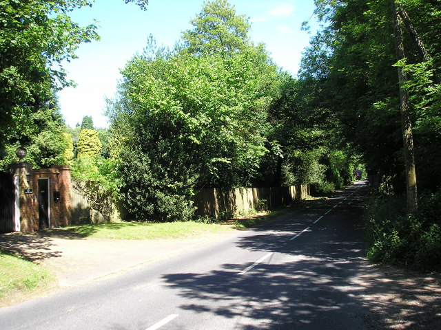
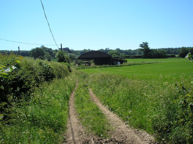
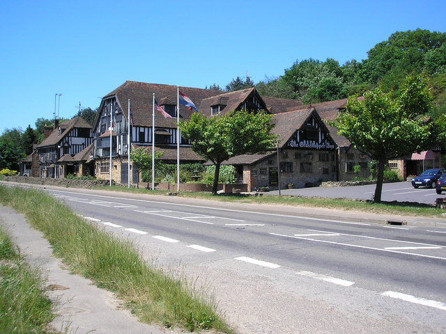
Loampit Wood is a picturesque woodland area located in Surrey, England. Spanning over 100 acres, it is a popular destination for nature enthusiasts and outdoor lovers. Situated near the town of Dorking, Loampit Wood is known for its diverse flora and fauna, making it an important habitat for various species.

The woodland is primarily composed of deciduous trees, including oak, beech, and birch, which create a beautiful canopy in the warmer months. The forest floor is adorned with an array of wildflowers, such as bluebells, primroses, and wood anemones, adding vibrant colors to the landscape.

Loampit Wood is home to a wide range of wildlife, making it an excellent spot for birdwatching and animal spotting. Visitors may catch sight of various bird species, including woodpeckers, nuthatches, and tawny owls. Additionally, the woodland provides a habitat for mammals like deer, foxes, and badgers, which can occasionally be observed in their natural environment.

The wood offers several walking trails, inviting visitors to explore its serene surroundings. These trails vary in length and difficulty, accommodating both casual strollers and avid hikers. Along the paths, informative signs provide interesting facts about the woodland's history and ecology, enhancing the experience for visitors.

Loampit Wood is managed by the local council, which ensures its preservation and maintenance. It is open to the public year-round, free of charge. Whether one seeks a tranquil getaway or an opportunity to connect with nature, Loampit Wood offers a truly enriching experience for all who visit.

If you have any feedback on the listing, please let us know in the comments section below.

Loampit Wood Images

Images are sourced within 2km of 51.257078/0.040075784 or Grid Reference TQ4252. Thanks to Geograph Open Source API. All images are credited.

Clacket Lane Anticlockwise The only services on the M25 and not accessible from other roads. There is the site of a Roman villa nearby and finds made during construction are on display in both the anticlockwise (eastbound) and clockwise (westbound) buildings. Clacket Lane itself runs south from the Pilgrims' Way, crossing the motorway near the services and joining the A25 about 1km further on.
Clacket Lane Anticlockwise
The only services on the M25 and not accessible from other roads. There is the site of a Roman villa nearby and finds made during construction are on display in both the anticlockwise (eastbound) and clockwise (westbound) buildings. Clacket Lane itself runs south from the Pilgrims' Way, crossing the motorway near the services and joining the A25 about 1km further on.
Squerryes Court, Westerham, Kent Squerryes Court is a beautiful 17th century manor house which has been the Warde family home since 1731. It is surrounded by 20 acres of attractive and historic gardens which include a lake, restored parterres and an 18th century dovecote. The house contains a fine collection of Old Master paintings from the Italian, 17th century Dutch and 18th century English schools, furniture, porcelain and tapestries.
Squerryes Court, Westerham, Kent
Squerryes Court is a beautiful 17th century manor house which has been the Warde family home since 1731. It is surrounded by 20 acres of attractive and historic gardens which include a lake, restored parterres and an 18th century dovecote. The house contains a fine collection of Old Master paintings from the Italian, 17th century Dutch and 18th century English schools, furniture, porcelain and tapestries.
Carpenters Arms at Limpsfield Common This is Limpsfield Chart or Common. A good base for the pleasant walks with the Carpenters Arms for refreshment
Carpenters Arms at Limpsfield Common
This is Limpsfield Chart or Common. A good base for the pleasant walks with the Carpenters Arms for refreshment
St Andrew's Church at Limpsfield Chart Modest but nevertheless a well proportioned church
St Andrew's Church at Limpsfield Chart
Modest but nevertheless a well proportioned church
The Bull at Limpsfield An early 16th century coaching Inn and now a very popular pub serving the beautiful village of Limpsfield
The Bull at Limpsfield
An early 16th century coaching Inn and now a very popular pub serving the beautiful village of Limpsfield
Cricket Pitch near Limpsfield Chart The quintessential English summer Sunday scene.
Cricket Pitch near Limpsfield Chart
The quintessential English summer Sunday scene.
Limpsfield - looking towards the A25 The photo shows traffic queuing at traffic lights to join the busy A25. Limpsfield is on the kent/surrey border.
Limpsfield - looking towards the A25
The photo shows traffic queuing at traffic lights to join the busy A25. Limpsfield is on the kent/surrey border.
Limpsfield Primary School - Surrey/Kent border This primary school is separate from the village and church and is on the busy A25 on a bend making it difficult to join this road.  Limpsfield village itself is on the Surrey/Kent border and is one of England's most attractive historic villages with records back to the Domesday Book.
Limpsfield Primary School - Surrey/Kent border
This primary school is separate from the village and church and is on the busy A25 on a bend making it difficult to join this road. Limpsfield village itself is on the Surrey/Kent border and is one of England's most attractive historic villages with records back to the Domesday Book.
No right of way! According to the 1:25000 OS map, this footpath is not a right of way of any kind.  However, there is ample evidence of use by walkers and cyclists, and even a few hoof-marks.  This photograph is taken looking eastwards from the point where it intersects a public bridleway running north-south.
No right of way!
According to the 1:25000 OS map, this footpath is not a right of way of any kind. However, there is ample evidence of use by walkers and cyclists, and even a few hoof-marks. This photograph is taken looking eastwards from the point where it intersects a public bridleway running north-south.
Goodley Stock Road, near Crockham Hill, Kent Goodley Stock Road is an unclassified but useful cut-off road linking the B269 back to Westerham, passing Squerryes Court on the way.  On the west side there are a number of very large private houses.
Goodley Stock Road, near Crockham Hill, Kent
Goodley Stock Road is an unclassified but useful cut-off road linking the B269 back to Westerham, passing Squerryes Court on the way. On the west side there are a number of very large private houses.
Dutch barn, Lodge Wood Estate, near Westerham, Kent This farm stands on the opposite side of the road to Squerryes Court.
Dutch barn, Lodge Wood Estate, near Westerham, Kent
This farm stands on the opposite side of the road to Squerryes Court.
The Grasshopper, Limpsfield, Surrey We are on the A25, and have crossed the border into Surrey here - by about 300 yards - to be confronted by this enormous road house.  Hardly the place to enjoy a contemplative pint, it no doubt serves some sections of the community.
The Grasshopper, Limpsfield, Surrey
We are on the A25, and have crossed the border into Surrey here - by about 300 yards - to be confronted by this enormous road house. Hardly the place to enjoy a contemplative pint, it no doubt serves some sections of the community.
A bridleway no more, Limpsfield, Surrey A forlorn wooden sign at the end of this heavily overgrown track off the A25 still reads 'public bridleway', but in fact bridleway rights here were extinguished many years ago, and this track cannot have seen a horse in the last 30 years.
A bridleway no more, Limpsfield, Surrey
A forlorn wooden sign at the end of this heavily overgrown track off the A25 still reads 'public bridleway', but in fact bridleway rights here were extinguished many years ago, and this track cannot have seen a horse in the last 30 years.
Greensand Way half way marker Plaque marking the midpoint of the Greensand Way between Haslemere and Hamstreet
Greensand Way half way marker
Plaque marking the midpoint of the Greensand Way between Haslemere and Hamstreet
Clacket Lane Services: Christmas decorations As seen on January 4, one assumes that these will be taken down very soon.
Clacket Lane Services: Christmas decorations
As seen on January 4, one assumes that these will be taken down very soon.
Clacket Lane Services: phone boxes Three phone boxes outside the main entrance to the Clacket Lane services building, on the eastbound side.
Clacket Lane Services: phone boxes
Three phone boxes outside the main entrance to the Clacket Lane services building, on the eastbound side.
Scearn Bank, Limpsfield Chart
West end of St Andrew's church Another view of <a href="https://www.geograph.org.uk/photo/41859">TQ4251 : St Andrew's Church at Limpsfield Chart</a>.  The church was built c.1895 to the design of Reginald Blomfield.  The tower was added in 1902 and the new vestries about 1960.  It was at this time within the parish of Limpsfield and Titsey (website: <span class="nowrap"><a title="http://www.parishoflimpsfield.org.uk" rel="nofollow ugc noopener" href="http://www.parishoflimpsfield.org.uk">Link</a><img style="margin-left:2px;" alt="External link" title="External link - shift click to open in new window" src="https://s1.geograph.org.uk/img/external.png" width="10" height="10"/></span> ) but acquired its own parish in 2011.
West end of St Andrew's church
Another view of TQ4251 : St Andrew's Church at Limpsfield Chart. The church was built c.1895 to the design of Reginald Blomfield. The tower was added in 1902 and the new vestries about 1960. It was at this time within the parish of Limpsfield and Titsey (website: LinkExternal link ) but acquired its own parish in 2011.
Show me another place!

Loampit Wood is located at Grid Ref: TQ4252 (Lat: 51.257078, Lng: 0.040075784)

Administrative County: Surrey

District: Tandridge

Police Authority: Surrey

What 3 Words

///cloth.safely.pills. Near Westerham, Kent

Nearby Locations

Loampit Wood

Related Wikis

Tandridge Priory

Tandridge Priory was a priory in Surrey, England. == History == Tandridge Priory was originally a hospital founded in 1189–99 by Odo de Dammartin, and...

Clacket Lane services

Clacket Lane services is a motorway service station on the M25 motorway midway between junctions 5 and 6, in Surrey, United Kingdom, adjacent to the parish...

Squerryes Estate

Squerryes Estate is a vineyard, estate, and location of Squerryes Court, a grade I listed building in Kent, England. It is a producer of English sparkling...

Squerryes Court

Squerryes Court is a late 17th-century manor house that stands just outside the town of Westerham in Kent. The house, which has been held by the same family...

Nearby Amenities

Located within 500m of 51.257078,0.040075784
Barrier: kissing_gate
Lat/Long: 51.2553356/0.0350723
Cronklands
Place: locality
Lat/Long: 51.2550312/0.0435384
The data included in this document is from www.openstreetmap.org. The data is made available under ODbL.

Have you been to Loampit Wood?

Leave your review of Loampit Wood below (or comments, questions and feedback).