Ashen Shaw

Wood, Forest in Surrey Tandridge

England

Ashen Shaw

Looking south from the North Downs Some far reaching views from the Westerham road and you can make out the M25 London orbital road in the valley below.
Looking south from the North Downs Credit: Nigel Freeman

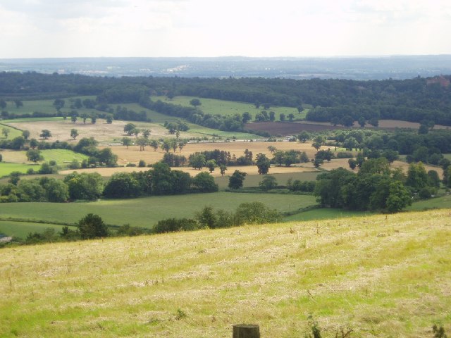
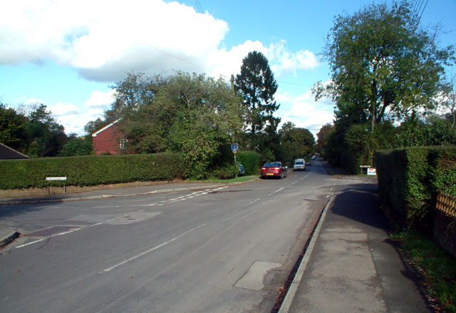
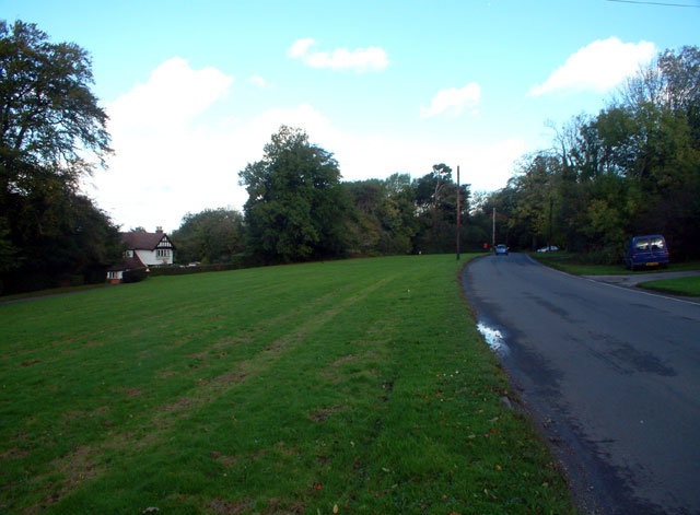
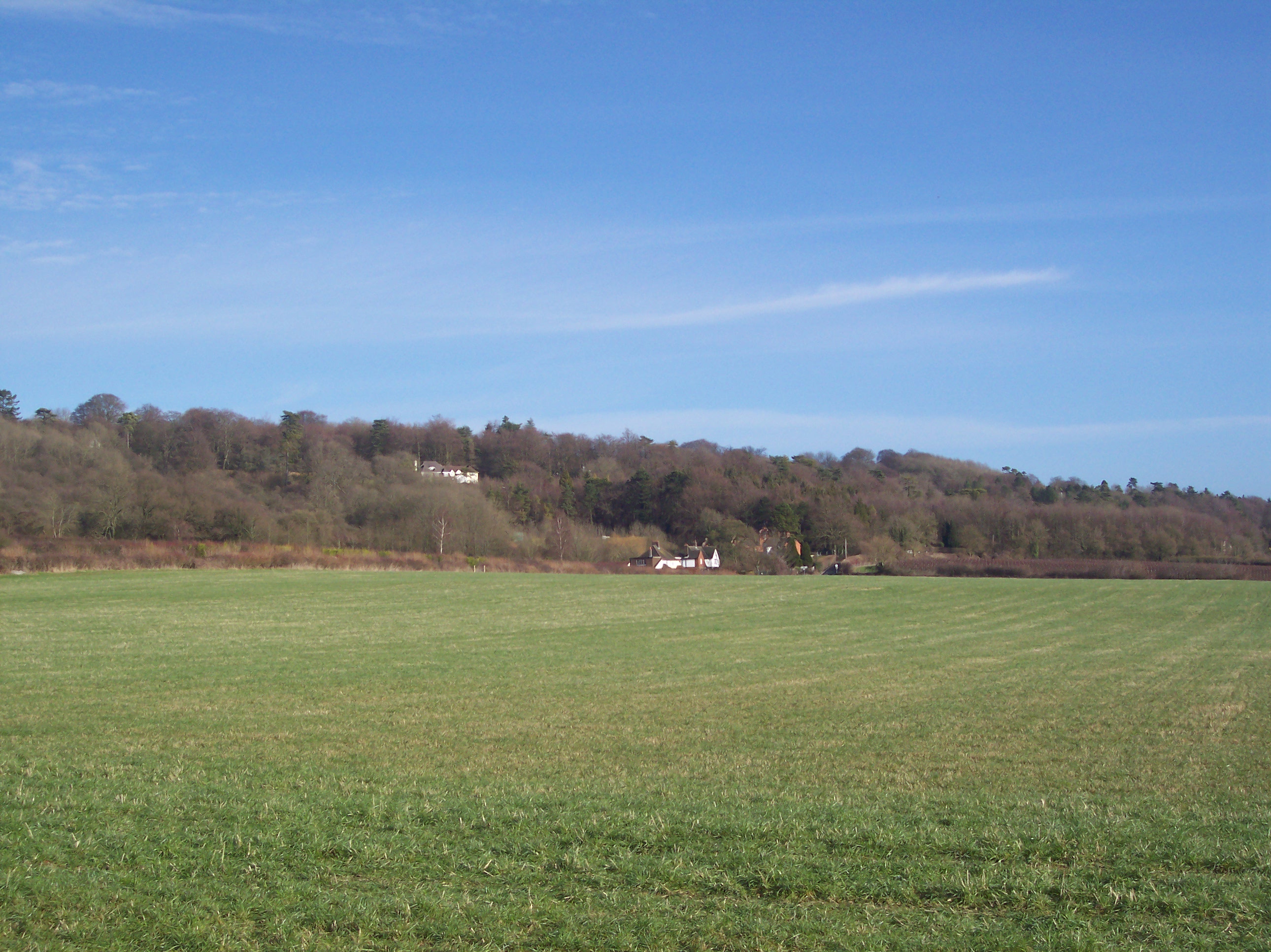
Ashen Shaw is a small woodland area located in Surrey, England. Situated within the larger region of the Surrey Hills Area of Outstanding Natural Beauty, Ashen Shaw is known for its picturesque beauty and tranquil atmosphere.

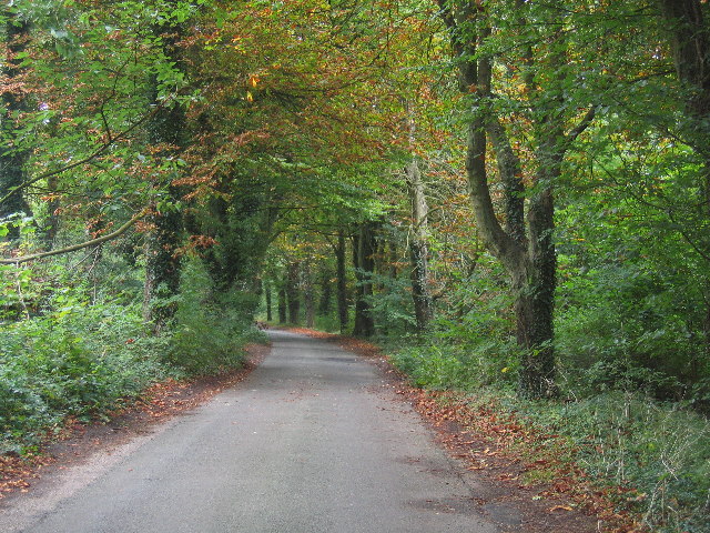
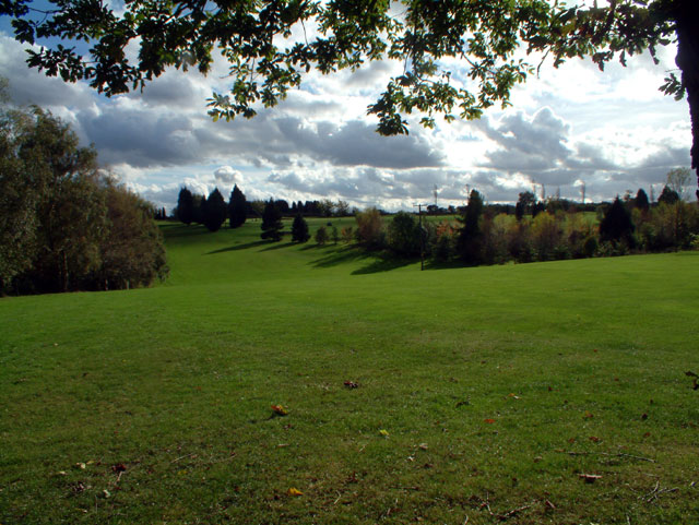
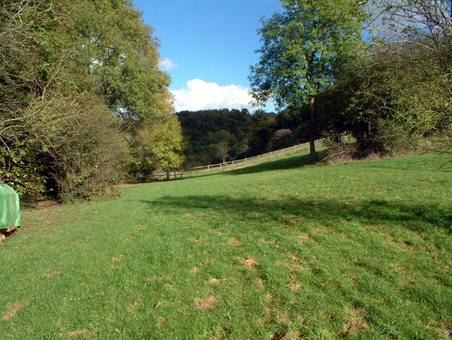
Covering an approximate area of 50 hectares, Ashen Shaw is primarily composed of dense woodland, dominated by a variety of tree species such as oak, beech, and birch. The woodland floor is adorned with a carpet of bluebells during springtime, creating a breathtaking sight for visitors.

The wood is home to a diverse range of wildlife, providing a natural habitat for numerous species. Birdwatchers can spot a variety of birds including woodpeckers, owls, and various songbirds. Small mammals like squirrels and rabbits can also be found scurrying through the undergrowth.

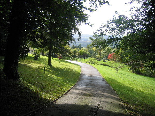
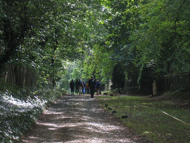
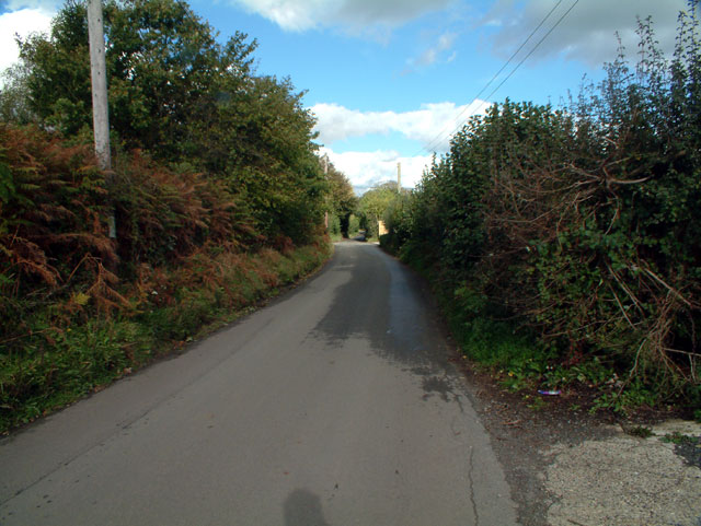
Ashen Shaw offers several walking trails and footpaths, allowing visitors to explore the woodland and immerse themselves in nature. These paths wind through the trees, offering glimpses of the surrounding Surrey countryside and providing opportunities for peaceful walks or invigorating hikes.

The wood is popular with both locals and tourists, who visit throughout the year to enjoy the natural beauty and tranquility that Ashen Shaw has to offer. It serves as a peaceful retreat from the hustle and bustle of nearby towns and cities, providing a place for relaxation and connection with nature.

Overall, Ashen Shaw in Surrey is a charming woodland area, renowned for its natural beauty, diverse wildlife, and peaceful atmosphere. It is a haven for nature lovers and a popular destination for those seeking solace in the midst of picturesque surroundings.

If you have any feedback on the listing, please let us know in the comments section below.

Ashen Shaw Images

Images are sourced within 2km of 51.297642/0.041830669 or Grid Reference TQ4257. Thanks to Geograph Open Source API. All images are credited.

Looking south from the North Downs Some far reaching views from the Westerham road and you can make out the M25 London orbital road in the valley below.
Looking south from the North Downs
Some far reaching views from the Westerham road and you can make out the M25 London orbital road in the valley below.
A leafy Surrey Lane
A leafy Surrey Lane
The driveway of Cerne Easter
The North Downs Way
The North Downs Way
The Spinning Wheel at Hawley's Corner, TN16 At the end of Gray's Road, which leads west from the A223 Westerham Hill. In front of the restaurant-cum-pub is the private Spinning Wheel Cottage.
The Spinning Wheel at Hawley's Corner, TN16
At the end of Gray's Road, which leads west from the A223 Westerham Hill. In front of the restaurant-cum-pub is the private Spinning Wheel Cottage.
Cherry Lodge golf course, TN16 See <span class="nowrap"><a title="www.cherrylodgegc.co.uk/" rel="nofollow ugc noopener" href="http://www.cherrylodgegc.co.uk/">Link</a><img style="margin-left:2px;" alt="External link" title="External link - shift click to open in new window" src="https://s1.geograph.org.uk/img/external.png" width="10" height="10"/></span>
Cherry Lodge golf course, TN16
See LinkExternal link
Park Farm, Rag Hill, Tatsfield TN16
St Mark's, Biggin Hill TN16 Maybe this should be classified as a church-with-telephone-antennae ... perhaps the vicar exchanges texts with the Almighty? Although consecrated in 1959, work was not completed on St Mark's Church until 1975. It replaced a temporary building, of timber clad in corrugated iron, which dated from 1903.
St Mark's, Biggin Hill TN16
Maybe this should be classified as a church-with-telephone-antennae ... perhaps the vicar exchanges texts with the Almighty? Although consecrated in 1959, work was not completed on St Mark's Church until 1975. It replaced a temporary building, of timber clad in corrugated iron, which dated from 1903.
RC church of St Theresa of the child Jesus In Haig Road
RC church of St Theresa of the child Jesus
In Haig Road
Polesteeple Hill, Biggin Hill, Kent TN16 Looking north from the end of Ricketts Hill Road.
Polesteeple Hill, Biggin Hill, Kent TN16
Looking north from the end of Ricketts Hill Road.
The Old Ship, Westmore Green, Tatsfield TN16
The pond at Tatsfield, TN16 Tatsfield sits high on the North Downs on the eastern tip of the District. At 240m above sea level it is one of the highest points in Surrey. Tatsfield lies close to the Pilgrims Way, and along its western boundary runs the route of the old London to Lewes Road built by the Romans. Tatsfield is now a thriving community with a population of almost 2000, a village shop, a pub and a village pond with resident ducks.
The pond at Tatsfield, TN16
Tatsfield sits high on the North Downs on the eastern tip of the District. At 240m above sea level it is one of the highest points in Surrey. Tatsfield lies close to the Pilgrims Way, and along its western boundary runs the route of the old London to Lewes Road built by the Romans. Tatsfield is now a thriving community with a population of almost 2000, a village shop, a pub and a village pond with resident ducks.
Paynesfield Road, Tatsfield TN16 Looking north from junction with Crossways (to the left) and Johns Road (right).
Paynesfield Road, Tatsfield TN16
Looking north from junction with Crossways (to the left) and Johns Road (right).
Ricketts Hill Road, Tatsfield TN16 Looking north
Ricketts Hill Road, Tatsfield TN16
Looking north
Countryside near Tatsfield TN16 This scene was taken looking north from just east of Avenue Road, which despite its grand name is just a track which leads northwards from Rag Hill Road, itself a narrow country lane.
Countryside near Tatsfield TN16
This scene was taken looking north from just east of Avenue Road, which despite its grand name is just a track which leads northwards from Rag Hill Road, itself a narrow country lane.
Buckhurst Road TN16 Looking north
Buckhurst Road TN16
Looking north
Old Tye Avenue, Biggin Hill TN16 Looking south
Old Tye Avenue, Biggin Hill TN16
Looking south
Valley Hall, Biggin Hill TN16 Valley Hall Community Centre and clinic, Sunningvale Avenue
Valley Hall, Biggin Hill TN16
Valley Hall Community Centre and clinic, Sunningvale Avenue
Show me another place!

Ashen Shaw is located at Grid Ref: TQ4257 (Lat: 51.297642, Lng: 0.041830669)

Administrative County: Surrey

District: Tandridge

Police Authority: Surrey

What 3 Words

///cost.drip.tuned. Near Biggin Hill, London

Nearby Locations

Painter's Wood Ashen Shaw

Related Wikis

South Street, Bromley

South Street is a hamlet in the far south of the London Borough of Bromley, 16.5 miles (27 km) south south-east from Charing Cross. It is the highest settlement...

Tatsfield

Tatsfield is a village and civil parish in the Tandridge District of Surrey, England. It is located 3.3 miles north west of Westerham and 3.9 miles north...

Aperfield

Aperfield is a hamlet and area in London, England, within the London Borough of Bromley, 16.2 miles (26 km) south-southeast of Charing Cross, and outside...

Betsom's Hill

Betsom's Hill is a hill on the North Downs, and the highest point in the county of Kent at 251 metres (823 ft). Situated between Westerham and Tatsfield...

Biggin Hill

Biggin Hill is a town in South East London, England, within the London Borough of Bromley. It is situated beyond London's contiguous built-up area in the...

Charles Darwin School

Charles Darwin School is the only secondary school in the Biggin Hill area of the London Borough of Bromley, England. The school consists of 1,320 secondary...

Old Jail, Biggin Hill

The Old Jail was a pub in Jail Lane, Biggin Hill, Westerham, Kent, in the London Borough of Bromley. At this time of writing, (February 2023), it is permanently...

Berry's Green

Berry's Green a small hamlet in the London Borough of Bromley in Greater London, UK, situated outside of London's contiguous built-up area. It is a fairly...

Nearby Amenities

Located within 500m of 51.297642,0.041830669
TATSFIELDNO1
Disused: yes
Man Made: petroleum_well
Ref GB Decc: LS/21-1
Source: DECC
Lat/Long: 51.2956389/0.0430833
Post Box
Collection Times: Mo-Fr 09:00; Sa 07:00; Su off
Colour: Red
Ref: TN16 157
Royal Cypher: EIIR
Royal Cypher Wikidata: Q33102113
Lat/Long: 51.2931969/0.0409331
Post Box
Collection Times: Mo-Fr 09:00; Sa 07:00; Su off
Colour: Red
Ref: TN16 155
Royal Cypher: EIIR
Royal Cypher Wikidata: Q33102113
Lat/Long: 51.2972512/0.0367913
Barrier: kissing_gate
Lat/Long: 51.2977358/0.0359737
Bus Stop
Hail & Ride Ricketts Hill Road / Manor House
Public Transport: platform
Wheelchair: no
Lat/Long: 51.2976615/0.037126
Bus Stop
Hail & Ride Ricketts Hill Road / Manor House
Public Transport: platform
Wheelchair: no
Lat/Long: 51.297385/0.0368478
Bus Stop
Hail & Ride Cudham Road
Public Transport: platform
Wheelchair: no
Lat/Long: 51.2988858/0.037936
Bus Stop
Hail & Ride Cudham Hill
Public Transport: platform
Lat/Long: 51.2996405/0.0386065
Communication: pole
Lat/Long: 51.29623/0.036402
Communication: pole
Lat/Long: 51.296808/0.0365684
Communication: pole
Lat/Long: 51.2972838/0.0368087
Communication: pole
Lat/Long: 51.2943664/0.0445706
Communication: pole
Lat/Long: 51.2954183/0.0439112
The data included in this document is from www.openstreetmap.org. The data is made available under ODbL.

Have you been to Ashen Shaw?

Leave your review of Ashen Shaw below (or comments, questions and feedback).