Epping Forest

Wood, Forest in Essex Epping Forest

England

Epping Forest

The Owl public house, Loughton Visited during a walk in Epping Forest. A nice setting and fine inside but not the most architecturally distinguished building.
The Owl public house, Loughton Credit: Chris Allen

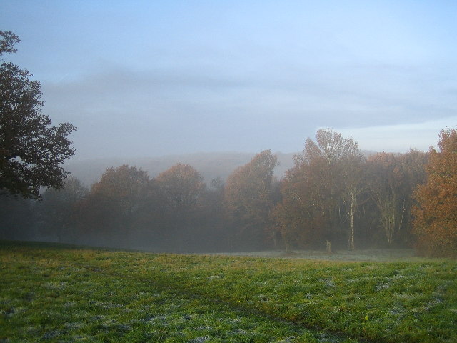
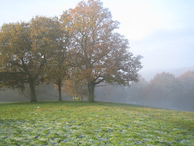
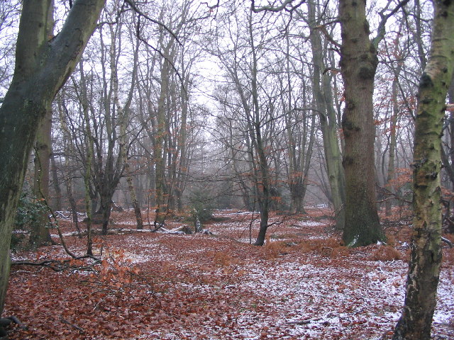
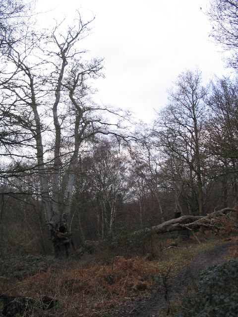
Epping Forest, located in Essex, England, is a vast woodland and forest covering approximately 2,500 hectares. It is one of the largest remaining areas of ancient woodland in the country and is known for its rich diversity of flora and fauna. The forest is a designated Site of Special Scientific Interest and a Special Area of Conservation, highlighting its ecological significance.

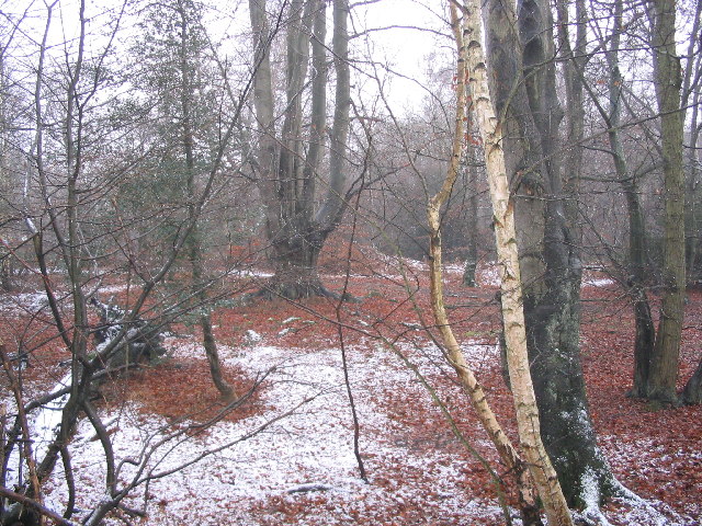
The forest is predominantly composed of oak and beech trees, with some areas featuring birch, hornbeam, and sweet chestnut. The dense canopy created by these trees provides a haven for a wide range of wildlife, including various species of birds, mammals, and insects. Deer are also commonly spotted within the forest, adding to its natural allure.

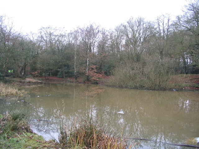
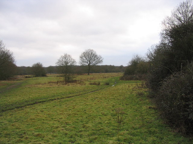
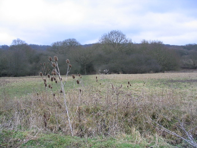
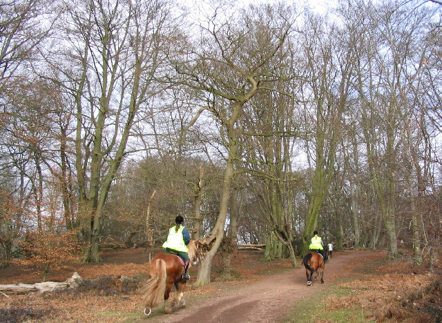
Epping Forest offers numerous recreational opportunities for visitors. There is an extensive network of trails and paths that crisscross the woodland, providing opportunities for walking, hiking, and cycling. These trails lead visitors through a diverse landscape, encompassing open meadows, ponds, and rivers, as well as dense woodlands.

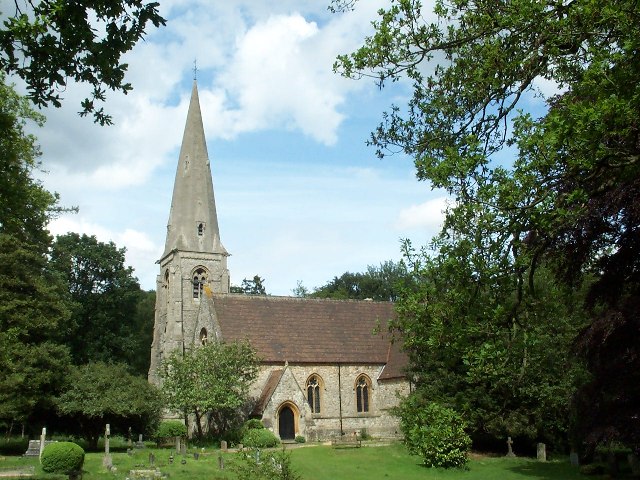
The forest is also home to ancient monuments and historical sites, including Queen Elizabeth's Hunting Lodge, a Tudor-era building that offers a glimpse into the area's royal connections. Additionally, Epping Forest is steeped in folklore and has inspired numerous literary works throughout history.

Overall, Epping Forest is a cherished natural gem in Essex, offering a tranquil escape from the hustle and bustle of nearby urban areas. Its stunning beauty, diverse wildlife, and rich history make it a popular destination for nature enthusiasts, history lovers, and those seeking solace in the midst of nature.

If you have any feedback on the listing, please let us know in the comments section below.

Epping Forest Images

Images are sourced within 2km of 51.661787/0.0428477 or Grid Reference TQ4197. Thanks to Geograph Open Source API. All images are credited.

The Owl public house, Loughton Visited during a walk in Epping Forest. A nice setting and fine inside but not the most architecturally distinguished building.
The Owl public house, Loughton
Visited during a walk in Epping Forest. A nice setting and fine inside but not the most architecturally distinguished building.
Looking down Lippitts Hill, November 2023 The leaves are only now starting to turn in mid November, possibly due to a warm October.
Looking down Lippitts Hill, November 2023
The leaves are only now starting to turn in mid November, possibly due to a warm October.
M25 From the A121 across wasteland
M25
From the A121 across wasteland
Horse paddock, High Beach Looking down off the Epping Forest ridge into the Lea valley
Horse paddock, High Beach
Looking down off the Epping Forest ridge into the Lea valley
High Beach Church High Beach Church in Epping Forest.
High Beach Church
High Beach Church in Epping Forest.
Epping Forest From Baldwins Hill Within the M25!
Epping Forest From Baldwins Hill
Within the M25!
Bench in Epping Forest from Baldwins Hill
House restoration, Baldwins Hill This building has been painted white but it has been removed to reveal interesting brickwork detail.
House restoration, Baldwins Hill
This building has been painted white but it has been removed to reveal interesting brickwork detail.
Loughton Library Near to the library, there is a swimming pool, playground, car park and High Street.
Loughton Library
Near to the library, there is a swimming pool, playground, car park and High Street.
The Robin Hood The Robin Hood roundabout is a major landmark on the Epping New Road, which runs through Epping Forest.  For motorists (at least), this might be considered the centre point of the forest.
The Robin Hood
The Robin Hood roundabout is a major landmark on the Epping New Road, which runs through Epping Forest. For motorists (at least), this might be considered the centre point of the forest.
Earl's Path Pond This pond is the remains of 19th Century gravel workings.  It is beside the Earl's Path and the Three Forests Way.  The larger pond further South at Strawberry Hill is more attractive and is surrounded by woodland. Much of the woodland here is not "ancient", but has recovered after clearances.
Earl's Path Pond
This pond is the remains of 19th Century gravel workings. It is beside the Earl's Path and the Three Forests Way. The larger pond further South at Strawberry Hill is more attractive and is surrounded by woodland. Much of the woodland here is not "ancient", but has recovered after clearances.
Epping Forest near Wake Valley Pond The tall old beech pollard is typical of this part of the forest.
Epping Forest near Wake Valley Pond
The tall old beech pollard is typical of this part of the forest.
Woodland near Wake Road The nearby Wake Arms roundabout is a major junction for the roads through Epping Forest.  Don't look for the Wake Arms though - it was demolished many years ago.  The predominant tree species varies according to the geology in the different parts of the forest.
Woodland near Wake Road
The nearby Wake Arms roundabout is a major junction for the roads through Epping Forest. Don't look for the Wake Arms though - it was demolished many years ago. The predominant tree species varies according to the geology in the different parts of the forest.
Fairmead Bottom Looking towards Fairmead Pond with the Epping New Road beyond.  This area is now grazed by longhorn cattle as part of the Epping Forest management regime.
Fairmead Bottom
Looking towards Fairmead Pond with the Epping New Road beyond. This area is now grazed by longhorn cattle as part of the Epping Forest management regime.
Epping Forest near Rushey Plain hut Beech and oak are the main trees here.  Many of the beeches are old, rather degenerate pollards.  The large example here is partly collapsed.
Epping Forest near Rushey Plain hut
Beech and oak are the main trees here. Many of the beeches are old, rather degenerate pollards. The large example here is partly collapsed.
Honey Lane Quarters Part of Epping Forest. Taken not far from the Woodbine public house on Woodridden Hill.
Honey Lane Quarters
Part of Epping Forest. Taken not far from the Woodbine public house on Woodridden Hill.
View from Pynest Green Lane This area, bordering Epping Forest, has stables with grazing land, woodland and a golf course.  Also plenty of small lanes - an easy area to get lost.
View from Pynest Green Lane
This area, bordering Epping Forest, has stables with grazing land, woodland and a golf course. Also plenty of small lanes - an easy area to get lost.
Epping Forest This is the green ride (shown on maps as the Centenary Walk) near Furze Ground, a gorse covered slope, which rises from the Tippa Burn and Hangboy Slade.  Some of the old beeches here have fallen and birch is taking over in a few places.  This is a good place for children to tip-toe along fallen tree trunks.
Epping Forest
This is the green ride (shown on maps as the Centenary Walk) near Furze Ground, a gorse covered slope, which rises from the Tippa Burn and Hangboy Slade. Some of the old beeches here have fallen and birch is taking over in a few places. This is a good place for children to tip-toe along fallen tree trunks.
Show me another place!

Epping Forest is located at Grid Ref: TQ4197 (Lat: 51.661787, Lng: 0.0428477)

Administrative County: Essex

District: Epping Forest

Police Authority: Essex

What 3 Words

///drape.narrow.terms. Near Theydon Bois, Essex

Related Wikis

Epping Forest

Epping Forest is a 2,400-hectare (5,900-acre) area of ancient woodland, and other established habitats, which straddles the border between Greater London...

Loughton Camp

Loughton Camp is an Iron Age (~500 BC) Hill fort in Epping Forest, one mile (1.6 km) northwest of the town of Loughton. The camp's earthworks cover an...
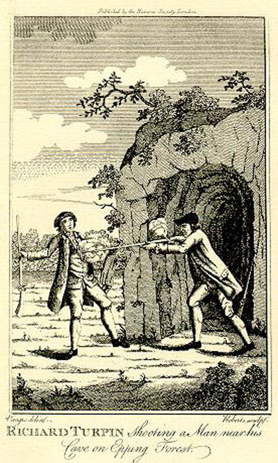
Turpin's Cave

Turpin's Cave is an area of Epping Forest in Essex which has been attributed as a hiding place of the highwayman Dick Turpin. Dick Turpin knew Epping...

High Beach

High Beach (or High Beech) is a village inside Epping Forest in south-west Essex, England. Part of the civil parish of Waltham Abbey, the village is within...

Great Monk Wood

Great Monk Wood is a wood within Epping Forest, in Essex, England. The wood, in the parish of Loughton, is centred on the Wakes Arms junction roundabout...

A121 road (England)

The A121 road is a road in England connecting Waltham Cross and Woodford Wells. == Major settlements == The main settlements on it are Waltham Abbey and...

National Jazz Archive

The National Jazz Archive is a collection of materials pertaining to jazz and blues that is kept at the Loughton Library in Essex, England. The archive...

Air Support Unit (Metropolitan Police)

The Air Support Unit (ASU) was a Central Operations branch of London's Metropolitan Police Service. The main responsibility of the unit was to provide...

Nearby Amenities

Located within 500m of 51.661787,0.0428477
High Beach
Ele: 110.0000000
Tourism: picnic_site
Lat/Long: 51.6656129/0.0396133
Traffic Calming: choker
Lat/Long: 51.6647715/0.0374802
Crossing
Lat/Long: 51.659869/0.0426976
Tourism: viewpoint
Lat/Long: 51.6655958/0.0390838
Shelly's Hill
Natural: peak
Lat/Long: 51.6580571/0.0421735
Broom Hill
Natural: peak
Lat/Long: 51.6603532/0.0440188
Mount Pleasant
Place: locality
Lat/Long: 51.6641461/0.0476837
Wellington Hill
Natural: peak
Lat/Long: 51.6650366/0.0396427
Epping Forest Field Centre Bird Viewing Point
Tourism: viewpoint
Lat/Long: 51.6641804/0.0409687
Bench
Lat/Long: 51.66346/0.0410047
Fast Food: yes
Shop: kiosk
Lat/Long: 51.6644985/0.0399954
Bench
Lat/Long: 51.6649793/0.0417879
Bench
Lat/Long: 51.6660543/0.0437877
Bench
Lat/Long: 51.6655997/0.0434073
Drinking Water
Description: Water tap on west side of toilet block
Drinking Water: yes
Man Made: water_tap
Lat/Long: 51.6647302/0.0400555
Noexit: yes
Lat/Long: 51.6647871/0.0388575
Give Way
Direction: backward
Traffic Sign: GB:1003A
Lat/Long: 51.6650127/0.0400545
Traffic Calming: table
Lat/Long: 51.6649717/0.03915
Give Way
Direction: forward
Traffic Sign: GB:1003A
Lat/Long: 51.6645101/0.0386272
Give Way
Direction: forward
Traffic Sign: GB:1003A
Lat/Long: 51.6641705/0.0378331
Bench
Lat/Long: 51.6651954/0.0423382
The data included in this document is from www.openstreetmap.org. The data is made available under ODbL.

Have you been to Epping Forest?

Leave your review of Epping Forest below (or comments, questions and feedback).