Bush Wood

Wood, Forest in Essex

England

Bush Wood

The Temple. Wanstead Park The Temple was built around 1760 as a garden house on the estate surrounding Wanstead House.
The Temple. Wanstead Park Credit: Brian Gotts

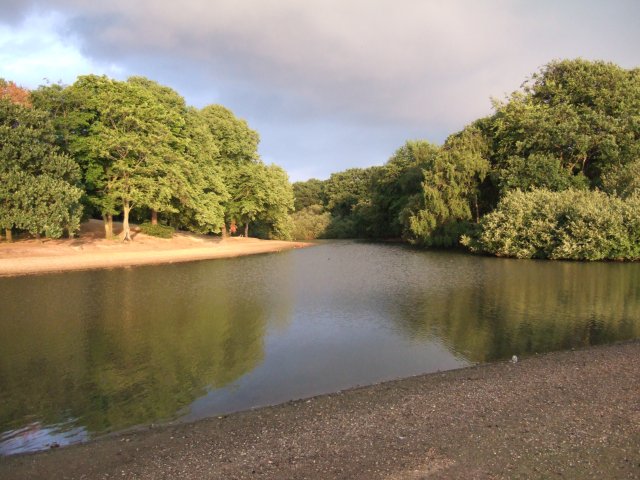
Bush Wood is a picturesque woodland located in the county of Essex, England. Situated on the outskirts of the town of Woodford, this woodland covers an area of approximately 100 acres and forms part of the larger Epping Forest. Renowned for its natural beauty and diverse ecosystem, Bush Wood is a popular destination for nature enthusiasts, hikers, and families looking to enjoy the great outdoors.

The woodland is characterized by a mix of deciduous and evergreen trees, including oak, beech, birch, and pine. This variety of tree species provides a vibrant and colorful backdrop throughout the year, with the leaves displaying a stunning array of autumnal hues during the fall season. The forest floor is carpeted with an assortment of wildflowers, creating a rich tapestry of colors and scents.

Bush Wood is home to a wide range of wildlife, making it a haven for animal lovers. Visitors may encounter various bird species, such as woodpeckers, owls, and thrushes, as well as small mammals like squirrels, rabbits, and foxes. The woodland also boasts a diverse insect population, including butterflies, bees, and beetles.

For those seeking recreational activities, Bush Wood offers numerous walking trails and paths that wind their way through the forest. These trails cater to all levels of fitness and provide an opportunity to explore the woodland's hidden gems. Additionally, the woodland features designated picnic areas, allowing visitors to relax and enjoy a meal amidst the serene surroundings.

Overall, Bush Wood in Essex is a captivating natural wonderland, offering a tranquil escape from the hustle and bustle of everyday life. With its breathtaking scenery, diverse wildlife, and leisure opportunities, it remains a cherished destination for locals and tourists alike.

If you have any feedback on the listing, please let us know in the comments section below.
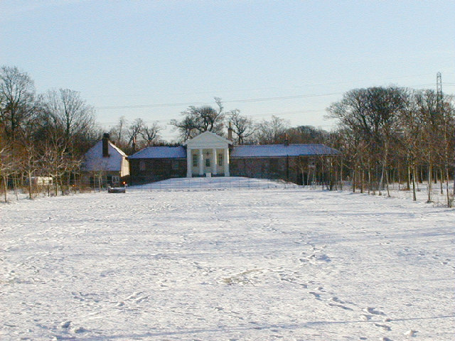
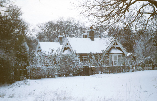
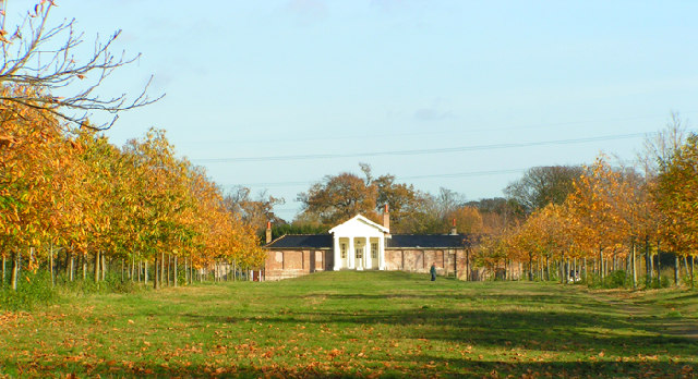
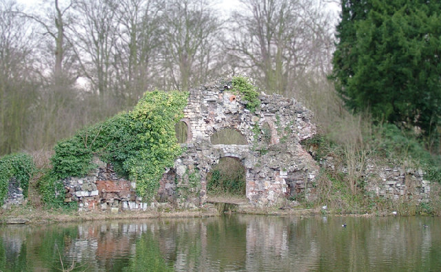
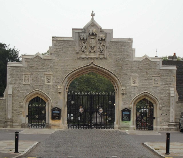
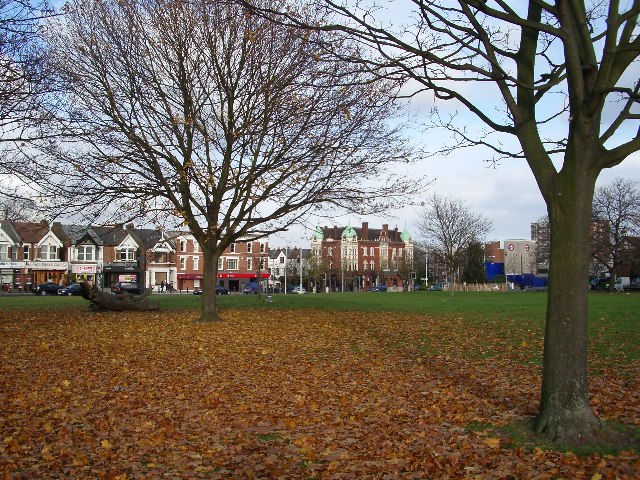
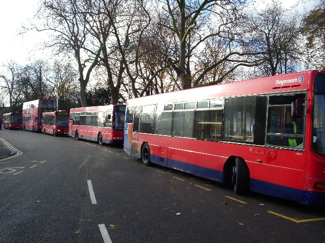
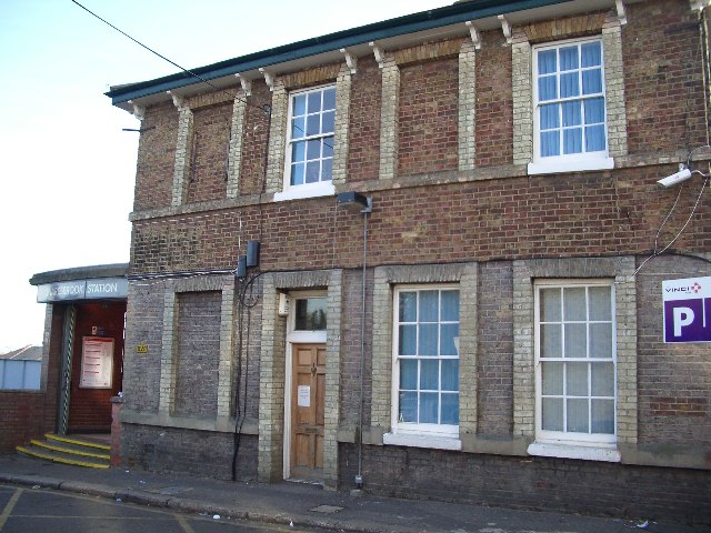
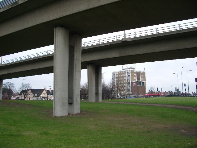
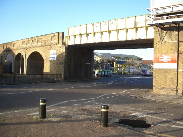
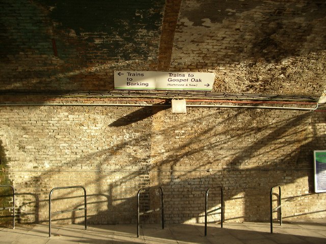
Bush Wood Images

Images are sourced within 2km of 51.567472/0.021056211 or Grid Reference TQ4087. Thanks to Geograph Open Source API. All images are credited.

The Temple. Wanstead Park The Temple was built around 1760 as a garden house on the estate surrounding Wanstead House.
The Temple. Wanstead Park
The Temple was built around 1760 as a garden house on the estate surrounding Wanstead House.
Keepers Lodge, Bushwood Built in 1881 as accommodation for Forest Keepers employed in Epping Forest
Keepers Lodge, Bushwood
Built in 1881 as accommodation for Forest Keepers employed in Epping Forest
The Temple Wanstead Park A garden house built in the 1760's by the owner of Wanstead House.
The Temple Wanstead Park
A garden house built in the 1760's by the owner of Wanstead House.
The Grotto, Wanstead park Built in the 1760's during the refurbishment of the gardens the Grotto was a boathouse with a facade of a grotto with a room above the boat dock decorated with coloured glass and flourespar set in the walls and ceilings. There were candles set in alcoves with mirrors set behind to reflect the light and the floor was set with geometric patterns of coloured pebbles. there were two fires in the early 1900's which turned the building into an attractive ruin.
The Grotto, Wanstead park
Built in the 1760's during the refurbishment of the gardens the Grotto was a boathouse with a facade of a grotto with a room above the boat dock decorated with coloured glass and flourespar set in the walls and ceilings. There were candles set in alcoves with mirrors set behind to reflect the light and the floor was set with geometric patterns of coloured pebbles. there were two fires in the early 1900's which turned the building into an attractive ruin.
Dawn at Wanstead Flats Wanstead Flats which in the 18c was called Wanstead Heath was drained and levelled at the beginning of the 20c to provide 60 football pitches for local teams. Fortunately an equivalent area was allowed to grow wild and is now a valuable breeding site for skylarks.
Dawn at Wanstead Flats
Wanstead Flats which in the 18c was called Wanstead Heath was drained and levelled at the beginning of the 20c to provide 60 football pitches for local teams. Fortunately an equivalent area was allowed to grow wild and is now a valuable breeding site for skylarks.
City of London Cemetery Gates The gates to the cemetery have just be cleaned and refurbished. The cemetery was opened in 1856 on the site of the former Aldersbrook Farm to provide burial space needed as the cemeteries in the City of London were almost full. The cemetery has seven other listed buildings inside the gates
City of London Cemetery Gates
The gates to the cemetery have just be cleaned and refurbished. The cemetery was opened in 1856 on the site of the former Aldersbrook Farm to provide burial space needed as the cemeteries in the City of London were almost full. The cemetery has seven other listed buildings inside the gates
George Green, Wanstead, London E11 This was the scene of sit-ins and violent protest during the construction of the A12(M) link road connecting M11 with central London. The new road passes under the green in a cut-and-cover tunnel.  The old log on the left marks the site of a huge ancient oak tree which was felled during construction.  The view is looking north to The George public house (centre) and Wanstead tube station (right)
George Green, Wanstead, London E11
This was the scene of sit-ins and violent protest during the construction of the A12(M) link road connecting M11 with central London. The new road passes under the green in a cut-and-cover tunnel. The old log on the left marks the site of a huge ancient oak tree which was felled during construction. The view is looking north to The George public house (centre) and Wanstead tube station (right)
Woodbine Place, Wanstead, E11 Buses resting at Woodbine Place. Don't suppose the name derives from the drivers' habit of having a smoke between trips!
Woodbine Place, Wanstead, E11
Buses resting at Woodbine Place. Don't suppose the name derives from the drivers' habit of having a smoke between trips!
The Eagle, Snaresbrook, London E11 A landmark for generations on the old A11 at Snaresbrook, The Eagle now styles itself as Toby Tavern. No-one is fooled and everybody still calls it by its right and proper name. The pub dates from the 18th century when it was a staging post for travellers between London and Newmarket.
The Eagle, Snaresbrook, London E11
A landmark for generations on the old A11 at Snaresbrook, The Eagle now styles itself as Toby Tavern. No-one is fooled and everybody still calls it by its right and proper name. The pub dates from the 18th century when it was a staging post for travellers between London and Newmarket.
Snaresbrook Station, London E11 Opened in 1856 by the Eastern Counties Railway, Snaresbrook station is on the Epping branch which was converted to become the underground Central Line in 1947.
Snaresbrook Station, London E11
Opened in 1856 by the Eastern Counties Railway, Snaresbrook station is on the Epping branch which was converted to become the underground Central Line in 1947.
No red bridge at Redbridge Redbridge roundabout looking east. The original red bridge spanned the Roding a short distance to our left. The flyover carries the M11 north and the A406 south towards a possible future Thames river crossing. Redbridge tube station is centre-right. This stretch of the Central Line opened in 1947; the tunnels had been constructed before the war and were used as a munitions assembly plant during the war.
No red bridge at Redbridge
Redbridge roundabout looking east. The original red bridge spanned the Roding a short distance to our left. The flyover carries the M11 north and the A406 south towards a possible future Thames river crossing. Redbridge tube station is centre-right. This stretch of the Central Line opened in 1947; the tunnels had been constructed before the war and were used as a munitions assembly plant during the war.
Wanstead Park station Wanstead Park station and railway arches on the little-used Gospel Oak to Barking line.  Occasionally a two-car dmu putters through, but not very predictably.
Wanstead Park station
Wanstead Park station and railway arches on the little-used Gospel Oak to Barking line. Occasionally a two-car dmu putters through, but not very predictably.
Underneath the arches Its time to make a decision; Barking or Gospel Oak (with the possibility of maybe reaching Richmond or Kew) at Wanstead Park station.
Underneath the arches
Its time to make a decision; Barking or Gospel Oak (with the possibility of maybe reaching Richmond or Kew) at Wanstead Park station.
Lake and wood in Wanstead Flats Whilst most of Wanstead Flats is grassland, waterfowl may be found on this lake.
Lake and wood in Wanstead Flats
Whilst most of Wanstead Flats is grassland, waterfowl may be found on this lake.
Clump of trees in Wanstead Flats One of the few clumps of trees in Wanstead Flats along with the grassland which is typical of the area. And a car radio aerial.
Clump of trees in Wanstead Flats
One of the few clumps of trees in Wanstead Flats along with the grassland which is typical of the area. And a car radio aerial.
Arriving in Forest Gate This is where you arrive in the northernmost part of Forest Gate, with Wanstead Flats on the left and Centre Road on the right.
Arriving in Forest Gate
This is where you arrive in the northernmost part of Forest Gate, with Wanstead Flats on the left and Centre Road on the right.
Looking across Woodford Road to Wanstead Park Station This station is only a very short walk north from Forest Gate Station.
Looking across Woodford Road to Wanstead Park Station
This station is only a very short walk north from Forest Gate Station.
Crematorium, City of London Cemetery The new crematorium building.
Crematorium, City of London Cemetery
The new crematorium building.
Show me another place!

Bush Wood is located at Grid Ref: TQ4087 (Lat: 51.567472, Lng: 0.021056211)

Unitary Authority: Redbridge

Police Authority: Metropolitan

What 3 Words

///ship.jars.artist. Near Walthamstow, London

Related Wikis

Bushwood, Leytonstone

Bushwood is an area in the north of Leytonstone in East London; determined by the curved boundary of the road called Bushwood along the edge of Wanstead...

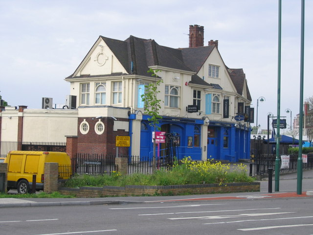
Green Man, Leytonstone

The Green Man is a pub and road junction on High Road, Leytonstone, London. The pub has been rebranded as part of the O'Neill's chain. The current 1920s...

Leytonstone Mosque

Leytonstone Mosque, situated in Bushwood, Leytonstone, in the London borough of Waltham Forest, was opened in 1976 to cater to the local Muslim community...

Leyton and Wanstead (UK Parliament constituency)

Leyton and Wanstead is a constituency in Greater London created in 1997 and represented in the House of Commons of the UK Parliament since 2010 by John...

Bearmans

Bearmans was a small department store located at 829 High Road, Leytonstone, London. == History == In 1898, Frank Bearman a 27-year-old draper opened a...

St John The Baptist's Church, Leytonstone

The Church of St John The Baptist, Leytonstone, is a 19th-century Church of England parish church in Leytonstone, East London, occupying a prominent position...
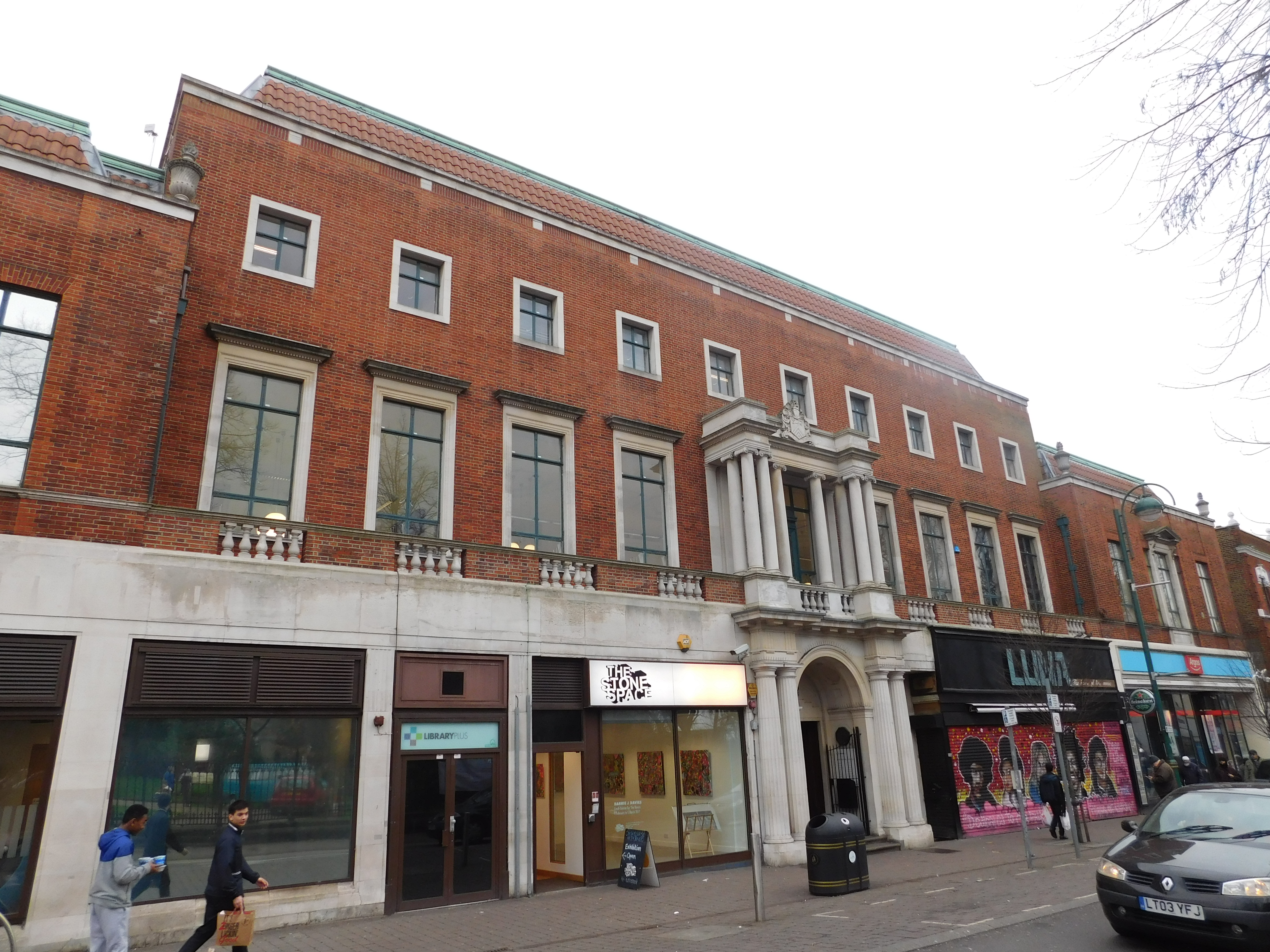
Leytonstone Library

Leytonstone Library is a public library in Leytonstone, London and a grade II* listed building. The library was built in 1934 for Leyton Urban District...

Leytonstone

Leytonstone () is an area in East London, England, within the London Borough of Waltham Forest. It adjoins Wanstead to the north-east, Forest Gate to the...

Nearby Amenities

Located within 500m of 51.567472,0.021056211
Bush Road / Green Man Roundabout
Bus: yes
Direction: backward
Local Ref: S
Public Transport: stop_position
Lat/Long: 51.570384/0.0180111
Mini Roundabout
Direction: clockwise
Lat/Long: 51.5642701/0.0249867
Ref GB Tflcid: RWG146680
Traffic Calming: hump
Lat/Long: 51.5670898/0.0188968
Crossing
Bicycle: yes
Button Operated: yes
Crossing: traffic_signals
Crossing Island: no
Crossing Markings: dots
Crossing Signals: yes
Crossing Ref: toucan
Tactile Paving: yes
Traffic Signals Vibration: yes
Lat/Long: 51.5707968/0.0170706
Crossing
Crossing: unmarked
Crossing Markings: no
Lat/Long: 51.5674128/0.0138356
Crossing
Button Operated: yes
Crossing: traffic_signals
Crossing Island: no
Crossing Markings: dots
Crossing Ref: pelican
Tactile Paving: yes
Traffic Signals Sound: yes
Traffic Signals Vibration: yes
Lat/Long: 51.566045/0.024879
Bus Stop
Blake Hall Crescent
Bench: yes
Bin: yes
Bus: yes
Local Ref: S
Naptan AtcoCode: 490004087N
Naptan Bearing: N
Naptan CommonName: Blake Hall Crescent
Naptan Indicator: Stop S
Naptan Street: BLAKE HALL ROAD
Public Transport: platform
Ref: 71229
Shelter: yes
Source Ref: naptan
Tactile Paving: no
Lat/Long: 51.5666145/0.0246156
Bus Stop
Blake Hall Crescent
Bench: yes
Bin: yes
Bus: yes
Lit: yes
Local Ref: A
Naptan AtcoCode: 490004087S
Naptan Bearing: S
Naptan CommonName: Blake Hall Crescent
Naptan Indicator: Stop A
Naptan Street: BLAKE HALL ROAD
Public Transport: platform
Ref: 56214
Shelter: yes
Source Ref: naptan
Tactile Paving: no
Lat/Long: 51.5656844/0.0249827
Bus Stop
Bush Road
Bench: yes
Bin: yes
Lit: yes
Local Ref: M
Naptan AtcoCode: 490004653N
Naptan Bearing: N
Naptan CommonName: Bush Road (Wanstead)
Naptan Indicator: Stop M
Naptan Street: BLAKE HALL ROAD
Public Transport: platform
Ref: 52519
Shelter: yes
Lat/Long: 51.5706564/0.0234075
Bus Stop
Bush Road
Bench: yes
Bin: yes
Lit: yes
Local Ref: U
Naptan AtcoCode: 490004653S
Naptan Bearing: S
Naptan CommonName: Bush Road (Wanstead)
Naptan Indicator: Stop U
Naptan Street: BLAKE HALL ROAD
Public Transport: platform
Ref: 57169
Shelter: yes
Lat/Long: 51.5705222/0.0235641
Bus Stop
Bush Road / Green Man Roundabout
Bench: yes
Bin: yes
Lit: yes
Local Ref: R
Naptan AtcoCode: 490007491R
Naptan Bearing: W
Naptan CommonName: Green Man Roundabout Bush Rd
Naptan Indicator: Stop R
Naptan Street: BUSH ROAD
Public Transport: platform
Ref: 52930
Shelter: yes
Lat/Long: 51.5704395/0.0177357
Bus Stop
Bush Road / Green Man Roundabout
Bench: yes
Bin: no
Lit: yes
Local Ref: S
Naptan AtcoCode: 490007491S
Naptan Bearing: E
Naptan CommonName: Green Man Roundabout Bush Rd
Naptan Indicator: Stop S
Naptan Street: BUSH ROAD
Public Transport: platform
Ref: 74174
Shelter: yes
Lat/Long: 51.5704484/0.0180411
Bus Stop
Windsor Road
Bench: yes
Bin: yes
Lit: yes
Local Ref: T
Naptan AtcoCode: 490008910E
Naptan Bearing: E
Naptan CommonName: Lake House Road Windsor Road
Naptan Indicator: Stop T
Naptan Street: LAKE HOUSE ROAD
Public Transport: platform
Shelter: yes
Tactile Paving: no
Lat/Long: 51.5634957/0.0244455
Post Box
Brand: Royal Mail
Brand Wikidata: Q638098
Check Date: 2021-03-14
Collection Times: Mo-Fr 17:30; Sa 11:30
Operator: Royal Mail
Operator Wikidata: Q638098
Post Box Type: pillar
Ref: E11 50
Royal Cypher: EIIR
Royal Cypher Wikidata: Q33102113
Lat/Long: 51.571471/0.0234187
Post Box
Brand: Royal Mail
Brand Wikidata: Q638098
Operator: Royal Mail
Operator Wikidata: Q638098
Post Box Design: type_b
Post Box Type: pillar
Ref: E11 48
Lat/Long: 51.5663286/0.0245922
Crossing
Bicycle: yes
Crossing: unmarked
Tactile Paving: no
Lat/Long: 51.5701546/0.0181304
Barrier: cycle_barrier
Cycle Barrier: double
Lat/Long: 51.5673095/0.01436
Barrier: entrance
Bicycle: yes
Foot: yes
Lat/Long: 51.5660757/0.0249796
Tactile Paving: yes
Lat/Long: 51.5708475/0.0171099
Traffic Calming: island
Lat/Long: 51.5637813/0.0250268
Barrier: bollard
Bicycle: yes
Bollard: fixed
Foot: yes
Lat/Long: 51.5641488/0.0248442
Barrier: entrance
Foot: yes
Lat/Long: 51.5654653/0.0241594
Barrier: bollard
Bicycle: yes
Bollard: removable
Foot: yes
Lat/Long: 51.5656472/0.014911
Crossing
Crossing: unmarked
Crossing Island: no
Tactile Paving: no
Traffic Calming: table
Lat/Long: 51.5664535/0.0188623
Noexit: yes
Lat/Long: 51.569559/0.014863
Kerb: flush
Tactile Paving: no
Lat/Long: 51.5701761/0.0181181
Crossing
Bicycle: yes
Crossing: unmarked
Tactile Paving: no
Lat/Long: 51.5702529/0.0179715
Crossing
Crossing: unmarked
Informal: yes
Kerb: yes
Tactile Paving: no
Wheelchair: no
Lat/Long: 51.5698074/0.0205082
Waste Basket
Check Date: 2023-06-24
Lat/Long: 51.5663359/0.0189705
Grit Bin
Lat/Long: 51.5664847/0.0186096
Post Box
Brand: Royal Mail
Brand Wikidata: Q638098
Collection Times: Mo-Fr 17:30; Sa 11:30
Operator: Royal Mail
Operator Wikidata: Q638098
Post Box Design: type_a
Post Box Type: pillar
Ref: E11 34
Royal Cypher: VR
Royal Cypher Wikidata: Q33102356
Lat/Long: 51.5672299/0.0187409
Grit Bin
Lat/Long: 51.5672415/0.0184903
Street Lamp
Lamp Mount: straight_mast
Lat/Long: 51.5698434/0.0151913
Street Lamp
Lamp Mount: straight_mast
Lat/Long: 51.5694537/0.0156889
Fire Hydrant
Emergency: fire_hydrant
Fire Hydrant Diameter: 4 inch
Fire Hydrant Type: underground
Lat/Long: 51.5696025/0.0156547
Street Lamp
Lamp Mount: bent_mast
Lat/Long: 51.5695917/0.0163112
Man Made: street_cabinet
Lat/Long: 51.5697144/0.0159109
Street Lamp
Lamp Mount: straight_mast
Lat/Long: 51.5697121/0.0158954
Street Lamp
Lamp Mount: straight_mast
Lat/Long: 51.5696938/0.0154428
Traffic Signals
Crossing: no
Traffic Signals: traffic_lights
Traffic Signals Direction: backward
Lat/Long: 51.5697329/0.0237827
Traffic Signals
Crossing: no
Traffic Signals: traffic_lights
Traffic Signals Direction: forward
Lat/Long: 51.5695446/0.0235249
Entrance: home
Lat/Long: 51.5694819/0.0238455
Entrance: home
Lat/Long: 51.5695429/0.0240987
Give Way
Direction: forward
Lat/Long: 51.5677686/0.0139172
Fast Food
Papi's Munchies (rear of The North Star Public House)
Addr City: London
Addr Housename: The North Star
Addr Housenumber: 24
Addr Postcode: E11 3AR
Addr Street: Browning Road
Addr Suburb: Leytonstone
Cuisine: pizza
Fhrs Id: 1270691
Source Addr: FHRS Open Data
Lat/Long: 51.5698947/0.0156011
Bench
Backrest: no
Lat/Long: 51.570465/0.0167534
Bench
Backrest: no
Lat/Long: 51.57043/0.0167024
Bench
Backrest: no
Lat/Long: 51.570405/0.0166716
Bench
Backrest: no
Lat/Long: 51.5703333/0.0166246
Bench
Backrest: yes
Lat/Long: 51.5705484/0.0171705
Bench
Backrest: yes
Lat/Long: 51.5705201/0.0169572
Bench
Backrest: no
Lat/Long: 51.570453/0.0167313
Bench
Backrest: no
Lat/Long: 51.5703012/0.016636
Bench
Backrest: no
Lat/Long: 51.5702887/0.0166736
Bench
Lat/Long: 51.5701329/0.0175091
Waste Basket
Lat/Long: 51.570147/0.0170746
Tactile Paving: yes
Lat/Long: 51.5711244/0.0168833
Traffic Signals
Crossing: no
Traffic Signals: pedestrian_crossing
Traffic Signals Direction: backward
Lat/Long: 51.5708095/0.0170165
Traffic Signals
Crossing: no
Traffic Signals: pedestrian_crossing
Traffic Signals Direction: forward
Lat/Long: 51.5707845/0.0171233
Public Bookcase
Little Library
Public Bookcase Type: wooden_cabinet
Lat/Long: 51.5662266/0.0242893
Generator Method: photovoltaic
Generator Output Electricity: yes
Generator Place: roof
Generator Solar Modules: 6
Generator Source: solar
Generator Type: solar_photovoltaic_panel
Power: generator
Lat/Long: 51.5657812/0.015594
Generator Method: photovoltaic
Generator Output Electricity: yes
Generator Place: roof
Generator Solar Modules: 8
Generator Source: solar
Generator Type: solar_photovoltaic_panel
Power: generator
Lat/Long: 51.5660684/0.0182404
Give Way
Direction: backward
Lat/Long: 51.5665202/0.0164527
Generator Method: photovoltaic
Generator Output Electricity: yes
Generator Solar Modules: 6
Generator Source: solar
Generator Type: solar_photovoltaic_panel
Power: generator
Lat/Long: 51.5667082/0.0161671
Generator Method: photovoltaic
Generator Output Electricity: yes
Generator Solar Modules: 8
Generator Source: solar
Generator Type: solar_photovoltaic_panel
Power: generator
Lat/Long: 51.5663927/0.0159964
Generator Method: photovoltaic
Generator Output Electricity: yes
Generator Place: roof
Generator Solar Modules: 8
Generator Source: solar
Generator Type: solar_photovoltaic_panel
Power: generator
Lat/Long: 51.567408/0.0158759
Generator Method: photovoltaic
Generator Output Electricity: yes
Generator Place: roof
Generator Solar Modules: 10
Generator Source: solar
Generator Type: solar_photovoltaic_panel
Power: generator
Lat/Long: 51.5658283/0.015599
Generator Method: photovoltaic
Generator Output Electricity: yes
Generator Place: roof
Generator Solar Modules: 8
Generator Source: solar
Generator Type: solar_photovoltaic_panel
Power: generator
Lat/Long: 51.5680657/0.0151789
Generator Method: photovoltaic
Generator Output Electricity: yes
Generator Place: roof
Generator Solar Modules: 8
Generator Source: solar
Generator Type: solar_photovoltaic_panel
Power: generator
Lat/Long: 51.5691236/0.0147674
Generator Method: photovoltaic
Generator Output Electricity: yes
Generator Place: roof
Generator Solar Modules: 8
Generator Source: solar
Generator Type: solar_photovoltaic_panel
Power: generator
Lat/Long: 51.5691287/0.0147145
Historic: gate_pier
Listed Status: Grade II*
Man Made: gate_pier
Lat/Long: 51.5696659/0.0236221
Historic: gate_pier
Listed Status: Grade II*
Man Made: gate_pier
Lat/Long: 51.5698091/0.0236171
Barrier: cycle_barrier
Cycle Barrier: double
Lat/Long: 51.5674054/0.0138789
Crossing
Crossing: unmarked
Crossing Island: no
Crossing Markings: no
Lat/Long: 51.5666948/0.014713
Give Way
Direction: forward
Lat/Long: 51.5665206/0.0165704
Give Way
Direction: backward
Lat/Long: 51.566524/0.0188468
Removed Barrier: cycle_barrier
Lat/Long: 51.5650056/0.0214229
Stop
Direction: forward
Lat/Long: 51.5687406/0.0143932
Give Way
Direction: backward
Lat/Long: 51.5689/0.0144249
Traffic Calming: hump
Lat/Long: 51.5690658/0.0145378
Give Way
Direction: forward
Lat/Long: 51.5687016/0.0144485
Give Way
Direction: backward
Lat/Long: 51.5686382/0.014414
Crossing
Crossing: unmarked
Crossing Markings: no
Traffic Calming: table
Lat/Long: 51.5687076/0.0143764
Addr Flats: 2
Entrance: home
Lat/Long: 51.5684747/0.0146854
Addr Flats: 1;3;4
Entrance: home
Lat/Long: 51.5685545/0.0145829
Addr Flats: 1-4
Entrance: home
Lat/Long: 51.567911/0.0160411
Entrance: home
Lat/Long: 51.5679766/0.0161677
Public Bookcase
BARA Library
Access: yes
Operator: BARA
Public Bookcase Type: wooden_cabinet
Lat/Long: 51.5664706/0.0164084
Generator Method: photovoltaic
Generator Output Electricity: yes
Generator Place: roof
Generator Solar Modules: 9
Generator Source: solar
Generator Type: solar_photovoltaic_panel
Power: generator
Lat/Long: 51.5671446/0.0170436
Entrance: home
Lat/Long: 51.5648639/0.021708
Entrance: home
Lat/Long: 51.5633379/0.0238539
Place Of Worship
Wat Buddharam
Religion: buddhist
Lat/Long: 51.5650872/0.0251953
Crossing
Crossing: unmarked
Crossing Island: no
Kerb: lowered
Tactile Paving: no
Lat/Long: 51.5636305/0.0248112
Traffic Calming: island
Lat/Long: 51.5636728/0.0249141
Entrance: home
Lat/Long: 51.5705307/0.0159067
Entrance: home
Lat/Long: 51.5699543/0.016561
Entrance: home
Lat/Long: 51.5699292/0.0165677
Entrance: home
Lat/Long: 51.5700842/0.0163917
Entrance: home
Lat/Long: 51.5700925/0.0163773
Entrance: home
Lat/Long: 51.5700238/0.0164807
Entrance: home
Lat/Long: 51.5700135/0.0164933
Entrance: home
Lat/Long: 51.5701273/0.0161723
Entrance: home
Lat/Long: 51.5701263/0.0162546
Entrance: home
Lat/Long: 51.5702671/0.0160064
Entrance: home
Lat/Long: 51.5702549/0.0160286
Entrance: home
Lat/Long: 51.5702026/0.0161244
Entrance: home
Lat/Long: 51.5701923/0.0161433
Entrance: home
Lat/Long: 51.5703627/0.0158927
Entrance: home
Lat/Long: 51.5701387/0.016232
Crossing Island: no
Proposed Highway: crossing
Lat/Long: 51.5656729/0.0166263
Traffic Signals
Crossing: no
Traffic Signals: pedestrian_crossing
Traffic Signals Direction: backward
Lat/Long: 51.5660902/0.0248749
Bicycle Parking
Bicycle Parking: stands
Capacity: 4
Covered: no
Fixme: Precise location needs to be checked with a gps survey
Lat/Long: 51.5661351/0.0250894
Bicycle Parking
Bicycle Parking: lockers
Check Date: 2022-06-04
Ref: 1941
Lat/Long: 51.5672573/0.0155034
Give Way
Direction: forward
Lat/Long: 51.5703242/0.0180108
Tactile Paving: yes
Lat/Long: 51.5707429/0.0170289
Give Way
Direction: backward
Traffic Sign: GB:1003B
Lat/Long: 51.5707184/0.0170545
Bicycle Parking
Bicycle Parking: stands
Capacity: 2
Covered: no
Lat/Long: 51.5664447/0.0188069
Crossing
Crossing: unmarked
Crossing Island: no
Tactile Paving: no
Lat/Long: 51.5665246/0.018829
Grit Bin
Lat/Long: 51.5708879/0.0169281
Give Way
Direction: forward
Lat/Long: 51.5700385/0.0174238
Camera Mount: pole
Man Made: surveillance
Surveillance Type: camera
Lat/Long: 51.5702539/0.0180989
Give Way
Direction: forward
Traffic Sign: GB:1003B
Lat/Long: 51.5701774/0.0181159
Give Way
Direction: backward
Traffic Sign: GB:1003B
Lat/Long: 51.5702442/0.0180022
Kerb: lowered
Tactile Paving: no
Lat/Long: 51.5701366/0.0181406
Kerb: lowered
Tactile Paving: no
Lat/Long: 51.570138/0.0183283
Kerb: lowered
Tactile Paving: no
Lat/Long: 51.5702089/0.0184323
Crossing
Crossing: unmarked
Crossing Island: yes
Kerb: lowered
Tactile Paving: no
Lat/Long: 51.5701705/0.0183759
Bush Road / Green Man Roundabout
Bus: yes
Direction: forward
Local Ref: R
Public Transport: stop_position
Lat/Long: 51.5705643/0.0176854
Give Way
Direction: forward
Traffic Sign: GB:1003B
Lat/Long: 51.5707333/0.0169849
Traffic Calming: island
Lat/Long: 51.5695957/0.0235147
Traffic Calming: island
Lat/Long: 51.5697246/0.0233219
Traffic Calming: hump
Lat/Long: 51.5697325/0.0251935
Traffic Calming: hump
Lat/Long: 51.569723/0.0241566
Traffic Signals
Crossing: no
Traffic Signals: traffic_lights
Traffic Signals Direction: backward
Lat/Long: 51.569728/0.0232652
Traffic Signals
Crossing: no
Traffic Signals: traffic_lights
Traffic Signals Direction: backward
Lat/Long: 51.5699082/0.0234761
Cycleway: asl
Direction: backward
Lat/Long: 51.569735/0.0236799
Cycleway: asl
Direction: backward
Lat/Long: 51.5698649/0.0234754
Barrier: kerb
Kerb: lowered
Tactile Paving: yes
Lat/Long: 51.5697778/0.0236221
Crossing
Button Operated: yes
Crossing: traffic_signals
Crossing Island: no
Crossing Markings: dots
Tactile Paving: yes
Traffic Signals Vibration: yes
Lat/Long: 51.5697352/0.0236198
Crossing
Button Operated: yes
Crossing: traffic_signals
Crossing Island: no
Crossing Markings: dots
Tactile Paving: yes
Traffic Signals Vibration: yes
Lat/Long: 51.5698301/0.0234749
Barrier: kerb
Kerb: lowered
Tactile Paving: yes
Lat/Long: 51.5698313/0.0235645
Barrier: kerb
Kerb: lowered
Tactile Paving: yes
Lat/Long: 51.569829/0.0233989
Crossing
Crossing: unmarked
Crossing Island: yes
Kerb: lowered
Tactile Paving: yes
Lat/Long: 51.5712984/0.023523
Give Way
Direction: forward
Lat/Long: 51.5714283/0.0234586
Crossing
Crossing: unmarked
Crossing Island: yes
Tactile Paving: yes
Lat/Long: 51.5708208/0.0234998
Crossing
Crossing: unmarked
Crossing Island: no
Kerb: lowered
Tactile Paving: yes
Lat/Long: 51.5709583/0.0235944
Crossing
Crossing: unmarked
Crossing Island: no
Kerb: lowered
Tactile Paving: yes
Lat/Long: 51.5714286/0.0234438
Give Way
Direction: backward
Lat/Long: 51.5709585/0.0235767
Kerb: lowered
Tactile Paving: yes
Lat/Long: 51.5708202/0.0235682
Kerb: lowered
Tactile Paving: yes
Lat/Long: 51.5708213/0.0234348
Kerb: lowered
Tactile Paving: yes
Lat/Long: 51.5712974/0.0235884
Kerb: lowered
Tactile Paving: yes
Lat/Long: 51.5712992/0.0234629
Kerb: lowered
Tactile Paving: yes
Lat/Long: 51.5714693/0.0234452
Kerb: lowered
Tactile Paving: yes
Lat/Long: 51.571394/0.023443
Kerb: lowered
Tactile Paving: yes
Lat/Long: 51.5709212/0.0235941
Kerb: lowered
Tactile Paving: yes
Lat/Long: 51.5709967/0.0235947
Bus: yes
Direction: backward
Public Transport: stop_position
Lat/Long: 51.5705255/0.0234847
Bus: yes
Direction: forward
Public Transport: stop_position
Lat/Long: 51.570662/0.0234917
Fixme: What does this connect to?
Lat/Long: 51.569908/0.0228873
Barrier: kerb
Lat/Long: 51.5697653/0.0205166
Barrier: kerb
Lat/Long: 51.5698484/0.0205044
Street Lamp
Lamp Mount: straight_mast
Lamp Type: electric
Ref: 7
Lat/Long: 51.569759/0.0202833
Noexit: yes
Lat/Long: 51.5696828/0.0199315
Noexit: yes
Lat/Long: 51.5696829/0.0192942
Entrance: main
Lat/Long: 51.5695515/0.0195337
Barrier: bollard
Lat/Long: 51.5696623/0.0195227
Bicycle Parking
Bicycle Parking: stands
Capacity: 2
Lat/Long: 51.565646/0.0165813
Barrier: bollard
Lat/Long: 51.5651812/0.020964
Crossing
Crossing: unmarked
Crossing Island: no
Crossing Markings: no
Lat/Long: 51.5666034/0.0148393
Crossing
Crossing: unmarked
Crossing Island: no
Crossing Markings: no
Lat/Long: 51.5665201/0.0149454
Traffic Signals
Crossing: no
Traffic Signals: pedestrian_crossing
Traffic Signals Direction: forward
Lat/Long: 51.5660013/0.0248811
Ref GB Tflcid: RWG146682
Traffic Calming: hump
Lat/Long: 51.5665236/0.0177609
Ref GB Tflcid: RWG146688
Traffic Calming: hump
Lat/Long: 51.5686194/0.0168056
Ref GB Tflcid: RWG146685
Traffic Calming: hump
Lat/Long: 51.5656594/0.015913
Ref GB Tflcid: RWG146672
Traffic Calming: hump
Lat/Long: 51.5680675/0.0165461
Ref GB Tflcid: RWG146687
Traffic Calming: hump
Lat/Long: 51.5667658/0.0165177
Ref GB Tflcid: RWG146668
Traffic Calming: hump
Lat/Long: 51.5694489/0.0178658
Ref GB Tflcid: RWG146670
Traffic Calming: hump
Lat/Long: 51.5687481/0.0181761
Ref GB Tflcid: RWG146677
Traffic Calming: hump
Lat/Long: 51.5672967/0.0175226
Ref GB Tflcid: RWG146767
Traffic Calming: hump
Lat/Long: 51.5673025/0.0157296
Ref GB Tflcid: RWG146679
Traffic Calming: hump
Lat/Long: 51.5676003/0.0186765
Ref GB Tflcid: RWG187178
Traffic Calming: hump
Lat/Long: 51.5683887/0.0150714
Bicycle Parking
Bicycle Parking: post_hoop
Capacity: 6
Ref GB Tflcid: RWG148912
Lat/Long: 51.56974/0.0154176
Bicycle Parking
Access: private
Bicycle Parking: shed
Bicycle Parking Stands: p_stand
Capacity: 6
Covered: yes
On Carriageway: yes
Operator: Cyclehoop Rentals
Ref GB Tflcid: RWG148913
Lat/Long: 51.5683405/0.0169295
Bicycle Parking
Access: private
Bicycle Parking: shed
Capacity: 6
Covered: yes
On Carriageway: yes
Operator: Cyclehoop Rentals
Ref GB Tflcid: RWG148914
Lat/Long: 51.5695998/0.0161722
Bicycle Parking
Access: private
Bicycle Parking: shed
Capacity: 6
Covered: yes
On Carriageway: yes
Operator: Cyclehoop Rentals
Ref GB Tflcid: RWG186395
Lat/Long: 51.5665432/0.016666
Traffic Calming: island
Lat/Long: 51.5642471/0.0251058
Traffic Calming: island
Lat/Long: 51.5643743/0.0249651
Traffic Calming: island
Lat/Long: 51.5641832/0.0249645
Give Way
Direction: forward
Lat/Long: 51.5662886/0.0247637
Give Way
Direction: forward
Lat/Long: 51.566141/0.0243533
Barrier: bollard
Lat/Long: 51.5650013/0.0214357
Kerb: lowered
Lat/Long: 51.5649618/0.0214412
Addr City: London
Addr Housenumber: 61
Addr Street: Woodcote Road
Source Addr Housenumber: NLS - OS 1:1,250/1:2,500 National Grid maps, 1947-1963
Lat/Long: 51.5716261/0.0202029
Addr City: London
Addr Housenumber: 1
Addr Street: Woodcote Road
Source Addr Housenumber: NLS - OS 1:1,250/1:2,500 National Grid maps, 1947-1963
Lat/Long: 51.5715804/0.0229029
Addr City: London
Addr Housenumber: 62
Addr Street: Woodcote Road
Source Addr Housenumber: NLS - OS 1:1,250/1:2,500 National Grid maps, 1947-1963
Lat/Long: 51.5713509/0.0201889
Addr City: London
Addr Housenumber: 2
Addr Street: Woodcote Road
Source Addr Housenumber: NLS - OS 1:1,250/1:2,500 National Grid maps, 1947-1963
Lat/Long: 51.5713013/0.0228808
Addr City: London
Addr Housenumber: 45
Addr Street: Blake Hall Road
Source Addr Housenumber: NLS - OS 1:1,250/1:2,500 National Grid maps, 1947-1963
Lat/Long: 51.5710615/0.0238391
Addr City: London
Addr Housenumber: 47
Addr Street: Blake Hall Road
Source Addr Housenumber: NLS - OS 1:1,250/1:2,500 National Grid maps, 1947-1963
Lat/Long: 51.5708238/0.0238339
Addr City: London
Addr Housenumber: 65
Addr Postcode: E11 2QW
Addr Street: Blake Hall Road
Source Addr Housenumber: NLS - OS 1:1,250/1:2,500 National Grid maps, 1947-1963
Source Addr Postcode: code-point_open
Lat/Long: 51.5698809/0.023824
Addr City: London
Addr Housenumber: 26
Addr Street: Blake Hall Road
Source Addr Housenumber: NLS - OS 1:1,250/1:2,500 National Grid maps, 1947-1963
Lat/Long: 51.5713066/0.023234
Addr City: London
Addr Housenumber: 30
Addr Street: Blake Hall Road
Source Addr Housenumber: NLS - OS 1:1,250/1:2,500 National Grid maps, 1947-1963
Lat/Long: 51.5711318/0.0232255
Addr City: London
Addr Housenumber: 28
Addr Postcode: E11 2QA
Addr Street: Woodcote Road
Source Addr Housenumber: NLS - OS 1:1,250/1:2,500 National Grid maps, 1947-1963
Source Addr Postcode: code-point_open
Lat/Long: 51.5713225/0.0217329
Addr City: London
Addr Housenumber: 37
Addr Postcode: E11 2QB
Addr Street: Woodcote Road
Source Addr Housenumber: NLS - OS 1:1,250/1:2,500 National Grid maps, 1947-1963
Source Addr Postcode: code-point_open
Lat/Long: 51.5716081/0.0212671
Addr Housenumber: 4
Addr Street: Overton Drive
Source Addr Housenumber: NLS - OS 1:1,250/1:2,500 National Grid maps, 1947-1963
Lat/Long: 51.569921/0.024401
Addr Housenumber: 16
Addr Street: Overton Drive
Source Addr Housenumber: NLS - OS 1:1,250/1:2,500 National Grid maps, 1947-1963
Lat/Long: 51.5699499/0.0253338
Addr City: London
Addr Housenumber: 34
Addr Postcode: E11 2NJ
Addr Street: Overton Drive
Source Addr Housenumber: NLS - OS 1:1,250/1:2,500 National Grid maps, 1947-1963
Source Addr Postcode: code-point_open
Lat/Long: 51.5704072/0.0261913
Addr City: London
Addr Housenumber: 6
Addr Street: Tennyson Avenue
Source Addr Housenumber: NLS - OS 1:1,250/1:2,500 National Grid maps, 1947-1963
Lat/Long: 51.5711013/0.0246942
Addr City: London
Addr Housenumber: 1
Addr Street: Tennyson Avenue
Source Addr Housenumber: NLS - OS 1:1,250/1:2,500 National Grid maps, 1947-1963
Lat/Long: 51.5707642/0.0243759
Generator Method: photovoltaic
Generator Output Electricity: yes
Generator Solar Modules: 10
Generator Source: solar
Generator Type: solar_photovoltaic_panel
Power: generator
Lat/Long: 51.5670933/0.0155451
Generator Method: photovoltaic
Generator Output Electricity: yes
Generator Solar Modules: 16
Generator Source: solar
Generator Type: solar_photovoltaic_panel
Location: roof
Power: generator
Lat/Long: 51.566119/0.0147412
The data included in this document is from www.openstreetmap.org. The data is made available under ODbL.

Have you been to Bush Wood?

Leave your review of Bush Wood below (or comments, questions and feedback).