Beechfield Wood

Wood, Forest in Surrey Tandridge

England

Beechfield Wood

Warlingham Park The old tower (1903) of the Warlingham Park Hospital (formerly known as the Croydon Mental Hospital) is still standing and can be seen for miles, but the place is now an exclusive gated residential community.
Warlingham Park Credit: Nigel Freeman

Beechfield Wood is a picturesque woodland located in the county of Surrey, England. Situated near the village of Beechfield, the wood covers an area of approximately 100 acres and is known for its diverse range of wildlife and natural beauty.

The wood is predominantly made up of beech trees, which give it its name, although there are also oak, birch, and ash trees scattered throughout. The dense canopy of foliage provides a cool and shaded environment, making it a popular spot for locals and visitors to escape the summer heat.

Beechfield Wood is crisscrossed with well-maintained footpaths, allowing visitors to explore its various trails and pathways. These paths wind through the wood, offering breathtaking views of the surrounding countryside and glimpses of wildlife such as deer, rabbits, and a variety of bird species.

The wood is also home to a rich array of plant life, with bluebells, primroses, and wild garlic carpeting the forest floor in the spring. This burst of color creates a magical atmosphere and attracts photographers and nature enthusiasts from far and wide.

In addition to its natural beauty, Beechfield Wood has historical significance. Remnants of Iron Age settlements and ancient burial mounds have been discovered within the wood, adding to its intrigue and providing a glimpse into the area's past.

Overall, Beechfield Wood in Surrey offers a tranquil and enchanting escape for nature lovers and history enthusiasts alike, with its stunning scenery, diverse wildlife, and rich cultural heritage.

If you have any feedback on the listing, please let us know in the comments section below.

Beechfield Wood Images

Images are sourced within 2km of 51.326946/-0.013350116 or Grid Reference TQ3860. Thanks to Geograph Open Source API. All images are credited.

Warlingham Park The old tower (1903) of the Warlingham Park Hospital (formerly known as the Croydon Mental Hospital) is still standing and can be seen for miles, but the place is now an exclusive gated residential community.
Warlingham Park
The old tower (1903) of the Warlingham Park Hospital (formerly known as the Croydon Mental Hospital) is still standing and can be seen for miles, but the place is now an exclusive gated residential community.
The Parish Church of St. Leonard Chelsham Located on a footpath off Church Lane Chelsham, near Warlingham
See <span class="nowrap"><a title="http://www.southwark.anglican.org/parishes/303k2_a.htm" rel="nofollow ugc noopener" href="http://www.southwark.anglican.org/parishes/303k2_a.htm">Link</a><img style="margin-left:2px;" alt="External link" title="External link - shift click to open in new window" src="https://s1.geograph.org.uk/img/external.png" width="10" height="10"/></span>
The Parish Church of St. Leonard Chelsham
Located on a footpath off Church Lane Chelsham, near Warlingham See LinkExternal link
The Bull Inn, Chelsham Common, CR6 South aspect, with cricket pitch in foreground.
The Bull Inn, Chelsham Common, CR6
South aspect, with cricket pitch in foreground.
Farm gate Some fields, intersected by a road which follows the course of an old Roman Road. The path of the roman road can be seen just behind the gate.
Farm gate
Some fields, intersected by a road which follows the course of an old Roman Road. The path of the roman road can be seen just behind the gate.
St Leonard's churchyard, Chelsham Lych gate and tombstones in the churchyard of St Leonard's parish church <a href="https://www.geograph.org.uk/photo/33783">TQ3859 : The Parish Church of St. Leonard Chelsham</a>
St Leonard's churchyard, Chelsham
Lych gate and tombstones in the churchyard of St Leonard's parish church TQ3859 : The Parish Church of St. Leonard Chelsham
Pond, Chelsham Looking, it has to be said, rather stagnant, and in need of some tender, loving care. Or, even better, dredging.
Pond, Chelsham
Looking, it has to be said, rather stagnant, and in need of some tender, loving care. Or, even better, dredging.
Chelsham Common Road, Chelsham The common is ahead and to the right.
Chelsham Common Road, Chelsham
The common is ahead and to the right.
St Leonard, Chelsham, Surrey
St Leonard, Chelsham, Surrey - Porch
St Leonard, Chelsham, Surrey - Font
St Leonard, Chelsham, Surrey - Royal Arms
St Leonard, Chelsham, Surrey - Window
St Leonard, Chelsham, Surrey - Altar frontal
St Leonard, Chelsham, Surrey - Screen
St Leonard, Chelsham, Surrey - Wall monument
St Leonard, Chelsham, Surrey - East end
Show me another place!

Beechfield Wood is located at Grid Ref: TQ3860 (Lat: 51.326946, Lng: -0.013350116)

Administrative County: Surrey

District: Tandridge

Police Authority: Surrey

What 3 Words

///cares.squad.spent. Near Warlingham, Surrey

Related Wikis

Meridian High School, Croydon

Meridian High School is a coeducational secondary school with academy status, located in the New Addington area of the London Borough of Croydon, England...

Chelsham

Chelsham is a village and former civil parish, now in the parish of Chelsham and Farleigh and the Tandridge district of Surrey, England. It is located...

Hutchinson's Bank

Hutchinson's Bank is 21.8 hectare Local Nature Reserve and Site of Metropolitan Importance for Nature Conservation in New Addington in the London Borough...

Farleigh, Surrey

Farleigh is a village and former civil parish, now in the parish of Chelsham and Farleigh in the Tandridge district of Surrey, England. It is located in...

Warlingham Park Hospital

Warlingham Park Hospital was a psychiatric hospital in Warlingham, Surrey. == History == The hospital, which was designed by George Oatley and Willie Swinton...

Saltbox Hill

Saltbox Hill is a 22.2 biological Site of Special Scientific Interest in three separate areas in Biggin Hill in the London Borough of Bromley. One area...
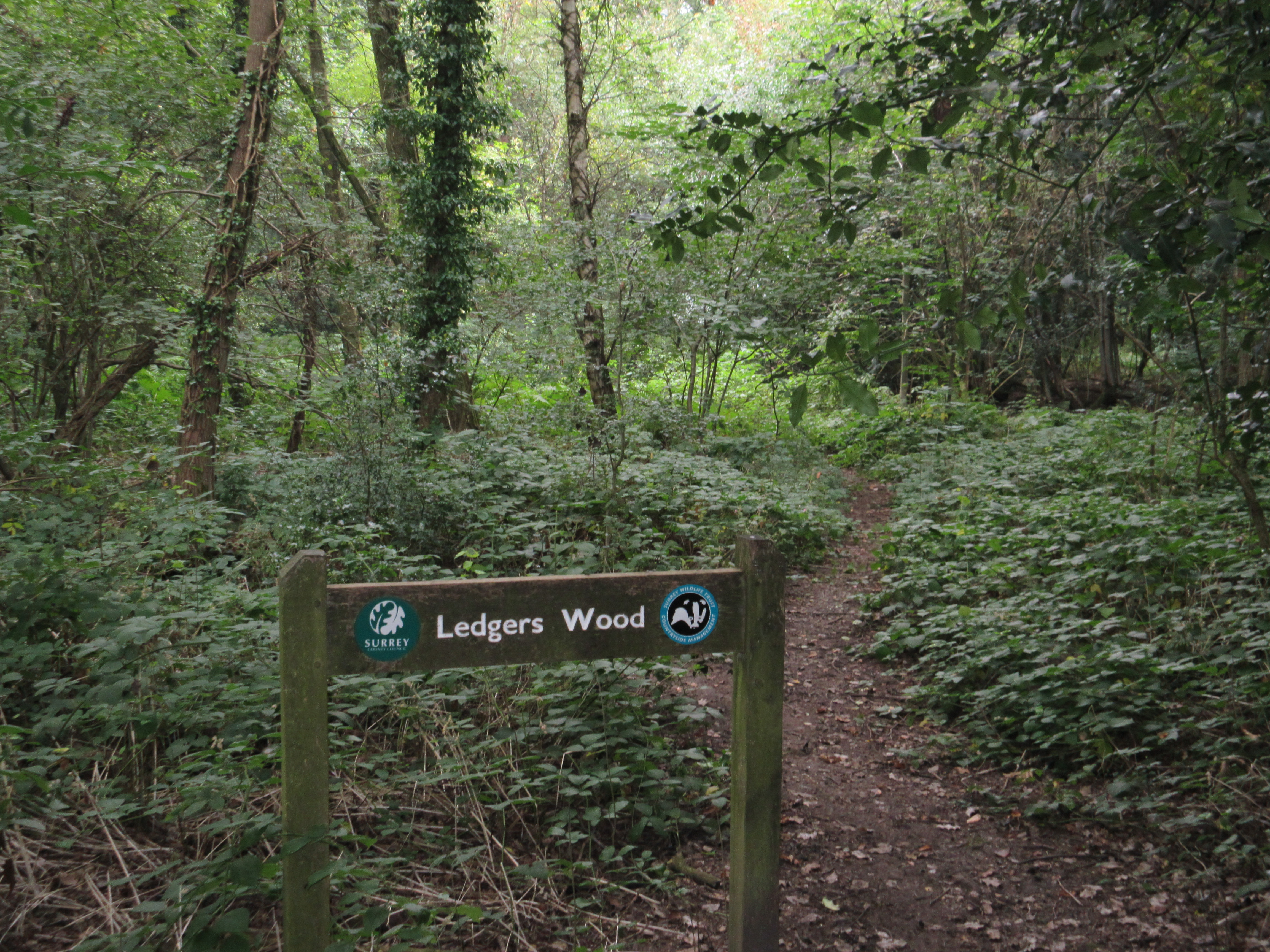
Ledgers Wood

Ledgers Wood is a 7-hectare (17-acre) nature reserve in Chelsham in Surrey. It is owned by Surrey County Council and managed by the Surrey Wildlife Trust...

New Addington Library

New Addington Library is a public library in New Addington, South London. It stands in the London Borough of Croydon and is part of the Croydon Libraries...

Nearby Amenities

Located within 500m of 51.326946,-0.013350116
Barrier: stile
Lat/Long: 51.3235945/-0.0154263
Fickleshole
Place: hamlet
Lat/Long: 51.3250731/-0.0075284
Communication: pole
Lat/Long: 51.3250448/-0.0084508
Communication: pole
Lat/Long: 51.3251873/-0.0078044
Communication: pole
Lat/Long: 51.3253666/-0.0070802
Communication: pole
Lat/Long: 51.3258158/-0.0064955
Post Box
Collection Times: Mo-Fr 16:45; Sa 11:30; Su off
Drive Through: no
Operator: Royal Mail
Post Box Type: lamp
Ref: CR6 98
Royal Cypher: EIIR
Royal Cypher Wikidata: Q33102113
Source: survey
Lat/Long: 51.3246024/-0.0074839
Coal tax post
Historic: boundary_stone
Inscription: 24 & 25 VICT CAP 42
Material: iron
Lat/Long: 51.3240025/-0.0180659
Waste Basket
Waste: trash
Lat/Long: 51.3250494/-0.0070153
The data included in this document is from www.openstreetmap.org. The data is made available under ODbL.

Have you been to Beechfield Wood?

Leave your review of Beechfield Wood below (or comments, questions and feedback).