Bograms Wood

Wood, Forest in Surrey Tandridge

England

Bograms Wood
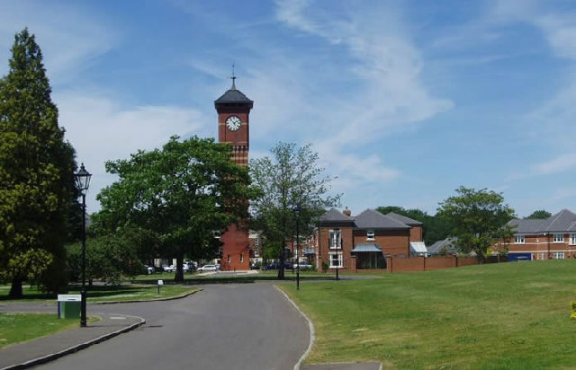
Warlingham Park The old tower (1903) of the Warlingham Park Hospital (formerly known as the Croydon Mental Hospital) is still standing and can be seen for miles, but the place is now an exclusive gated residential community.
Warlingham Park Credit: Nigel Freeman

Bograms Wood, located in Surrey, England, is a beautiful and serene forest that spans over a vast area. This woodland is known for its rich biodiversity and is a popular destination for nature enthusiasts and hikers alike. It is situated near the village of Cranleigh, making it easily accessible to locals and visitors from nearby towns.

The wood is home to a variety of tree species, including oak, beech, and birch, which create a dense canopy that provides shade and shelter for numerous animals and plants. The forest floor is adorned with a carpet of ferns, bluebells, and wildflowers, adding to its enchanting ambiance.

Bograms Wood offers a network of well-maintained walking trails that wind through the forest, allowing visitors to explore its natural wonders at their own pace. The paths vary in difficulty, catering to both casual strollers and avid hikers. Along the way, there are information boards providing interesting facts about the flora and fauna found in the wood, enhancing the educational experience for visitors.

Birdwatchers will be delighted by the wide array of avian species that call Bograms Wood their home. From woodpeckers to owls, the forest is a haven for birdlife. The tranquil atmosphere and serene surroundings make it an ideal spot for birdwatching and photography enthusiasts.

Bograms Wood is also a designated Site of Special Scientific Interest (SSSI), recognizing its ecological importance and the need for its preservation. Conservation efforts are in place to protect the delicate ecosystem and maintain the wood's natural beauty for future generations to enjoy.

Overall, Bograms Wood offers a peaceful retreat where visitors can immerse themselves in nature, witness the wonders of the forest, and appreciate the importance of conservation.

If you have any feedback on the listing, please let us know in the comments section below.

Bograms Wood Images

Images are sourced within 2km of 51.32852/-0.009636123 or Grid Reference TQ3860. Thanks to Geograph Open Source API. All images are credited.
Warlingham Park The old tower (1903) of the Warlingham Park Hospital (formerly known as the Croydon Mental Hospital) is still standing and can be seen for miles, but the place is now an exclusive gated residential community.
Warlingham Park
The old tower (1903) of the Warlingham Park Hospital (formerly known as the Croydon Mental Hospital) is still standing and can be seen for miles, but the place is now an exclusive gated residential community.
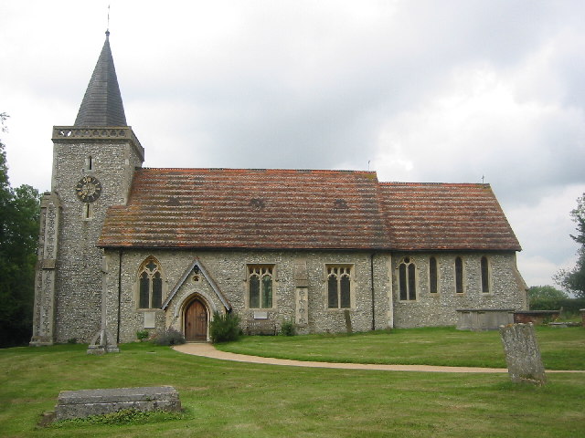
The Parish Church of St. Leonard Chelsham Located on a footpath off Church Lane Chelsham, near Warlingham
See <span class="nowrap"><a title="http://www.southwark.anglican.org/parishes/303k2_a.htm" rel="nofollow ugc noopener" href="http://www.southwark.anglican.org/parishes/303k2_a.htm">Link</a><img style="margin-left:2px;" alt="External link" title="External link - shift click to open in new window" src="https://s1.geograph.org.uk/img/external.png" width="10" height="10"/></span>
The Parish Church of St. Leonard Chelsham
Located on a footpath off Church Lane Chelsham, near Warlingham See LinkExternal link
The Bull Inn, Chelsham Common, CR6 South aspect, with cricket pitch in foreground.
The Bull Inn, Chelsham Common, CR6
South aspect, with cricket pitch in foreground.
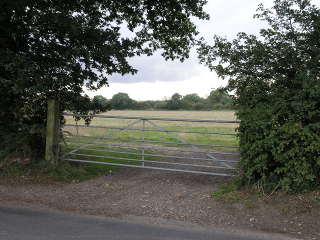
Farm gate Some fields, intersected by a road which follows the course of an old Roman Road. The path of the roman road can be seen just behind the gate.
Farm gate
Some fields, intersected by a road which follows the course of an old Roman Road. The path of the roman road can be seen just behind the gate.
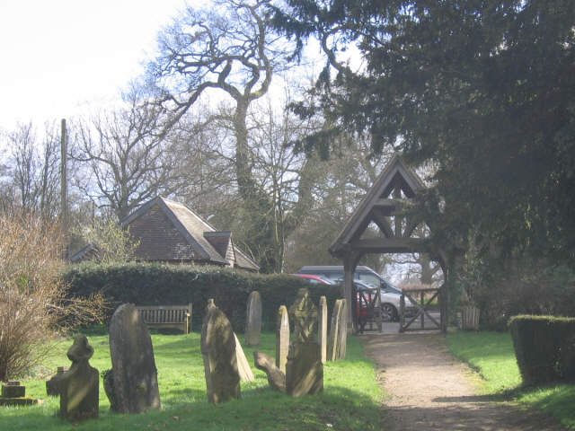
St Leonard's churchyard, Chelsham Lych gate and tombstones in the churchyard of St Leonard's parish church <a href="https://www.geograph.org.uk/photo/33783">TQ3859 : The Parish Church of St. Leonard Chelsham</a>
St Leonard's churchyard, Chelsham
Lych gate and tombstones in the churchyard of St Leonard's parish church TQ3859 : The Parish Church of St. Leonard Chelsham
St Leonard, Chelsham, Surrey
St Leonard, Chelsham, Surrey - Porch
St Leonard, Chelsham, Surrey - Font
St Leonard, Chelsham, Surrey - Royal Arms
St Leonard, Chelsham, Surrey - Window
St Leonard, Chelsham, Surrey - Altar frontal
St Leonard, Chelsham, Surrey - Screen
St Leonard, Chelsham, Surrey - Wall monument
St Leonard, Chelsham, Surrey - East end
St Leonard, Chelsham, Surrey - Chancel
Show me another place!

Bograms Wood is located at Grid Ref: TQ3860 (Lat: 51.32852, Lng: -0.009636123)

Administrative County: Surrey

District: Tandridge

Police Authority: Surrey

What 3 Words

///player.cove.levels. Near Biggin Hill, London

Related Wikis

Meridian High School, Croydon

Meridian High School is a coeducational secondary school with academy status, located in the New Addington area of the London Borough of Croydon, England...

Hutchinson's Bank

Hutchinson's Bank is 21.8 hectare Local Nature Reserve and Site of Metropolitan Importance for Nature Conservation in New Addington in the London Borough...

Saltbox Hill

Saltbox Hill is a 22.2 biological Site of Special Scientific Interest in three separate areas in Biggin Hill in the London Borough of Bromley. One area...

Chelsham

Chelsham is a village and former civil parish, now in the parish of Chelsham and Farleigh and the Tandridge district of Surrey, England. It is located...

New Addington Library

New Addington Library is a public library in New Addington, South London. It stands in the London Borough of Croydon and is part of the Croydon Libraries...

Addington Vale

Addington Vale is a 48 acres (19 ha) park situated in New Addington in the London Borough of Croydon. The park extends from King Henrys Drive in the north...

Farleigh, Surrey

Farleigh is a village and former civil parish, now in the parish of Chelsham and Farleigh in the Tandridge district of Surrey, England. It is located in...

New Addington

New Addington is an area of South London, England, within the London Borough of Croydon. It is located 5 miles south east of Croydon and is adjacent to...

Nearby Amenities

Located within 500m of 51.32852,-0.009636123
Fickleshole
Place: hamlet
Lat/Long: 51.3250731/-0.0075284
Give Way
Direction: forward
Lat/Long: 51.325193/-0.0061284
Communication: pole
Lat/Long: 51.3250448/-0.0084508
Communication: pole
Lat/Long: 51.3251873/-0.0078044
Communication: pole
Lat/Long: 51.3253666/-0.0070802
Communication: pole
Lat/Long: 51.3258158/-0.0064955
Communication: pole
Lat/Long: 51.3258051/-0.00596
Communication: pole
Lat/Long: 51.3260196/-0.0044134
Post Box
Collection Times: Mo-Fr 16:45; Sa 11:30; Su off
Drive Through: no
Operator: Royal Mail
Post Box Type: lamp
Ref: CR6 98
Royal Cypher: EIIR
Royal Cypher Wikidata: Q33102113
Source: survey
Lat/Long: 51.3246024/-0.0074839
Note: Additional node marks deviation of Low Emission Zone.
Lat/Long: 51.3315325/-0.0134554
Give Way
Direction: forward
Lat/Long: 51.325166/-0.0064024
Waste Basket
Waste: trash
Lat/Long: 51.3250494/-0.0070153
The data included in this document is from www.openstreetmap.org. The data is made available under ODbL.

Have you been to Bograms Wood?

Leave your review of Bograms Wood below (or comments, questions and feedback).