Gibbet Hill Plantation
Wood, Forest in Lincolnshire East Lindsey
England
Gibbet Hill Plantation

Gibbet Hill Plantation is a picturesque woodland located in Lincolnshire, England. Spread across a sprawling area, the plantation is known for its lush greenery and diverse flora and fauna. Nestled amidst the beautiful countryside, it offers a tranquil escape from the bustling city life.
The woodland is dominated by a variety of majestic trees, including oak, beech, and birch. These towering giants provide a dense canopy, creating a cool and shaded environment beneath. The forest floor is carpeted with a rich undergrowth of ferns, wildflowers, and mosses, adding to the enchanting atmosphere.
Gibbet Hill Plantation is home to a wide range of wildlife, making it a haven for nature enthusiasts and bird watchers. Squirrels, foxes, and rabbits can often be spotted darting through the underbrush, while a chorus of bird songs fills the air. Visitors may catch a glimpse of woodpeckers, owls, and various species of songbirds, adding to the beauty and serenity of the woodland.
The plantation offers several walking trails, allowing visitors to explore its natural wonders at their own pace. These paths wind through the forest, revealing stunning viewpoints and hidden nooks along the way. The plantation is also equipped with picnic areas, providing an ideal spot for visitors to relax and enjoy a meal amidst nature.
Gibbet Hill Plantation is not only a haven for wildlife but also a place of historical significance. The name "Gibbet Hill" originates from the gallows that once stood here, serving as a grim reminder of the area's past. Today, the woodland stands as a peaceful and rejuvenating retreat, inviting visitors to immerse themselves in its natural beauty and tranquility.
If you have any feedback on the listing, please let us know in the comments section below.
Gibbet Hill Plantation Images
Images are sourced within 2km of 53.208016/0.065884566 or Grid Reference TF3869. Thanks to Geograph Open Source API. All images are credited.


Gibbet Hill Plantation is located at Grid Ref: TF3869 (Lat: 53.208016, Lng: 0.065884566)
Administrative County: Lincolnshire
District: East Lindsey
Police Authority: Lincolnshire
What 3 Words
///ruler.hotel.completed. Near Spilsby, Lincolnshire
Nearby Locations
Related Wikis

Aswardby
Aswardby (pronounced "as-ard-bee") is a village situated 4 miles (6 km) north-west from Spilsby, in the East Lindsey district of Lincolnshire, England...

Sausthorpe
Sausthorpe is a small village and civil parish in the East Lindsey district of Lincolnshire, England, 8 miles (13 km) east of Horncastle and 3 miles (4...

Langton by Spilsby
Langton by Spilsby, sometimes called Langton by Partney, is a village and civil parish in the East Lindsey district of Lincolnshire, England. It is situated...

Harrington, Lincolnshire
Harrington is a hamlet and civil parish in the East Lindsey district of Lincolnshire, England. It is situated 6 miles (10 km) south-west from Alford, and...
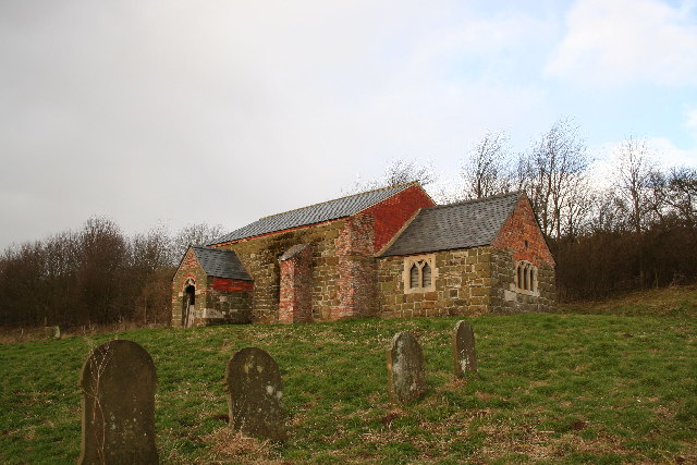
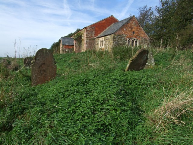
St John the Baptist's Church, Sutterby
St John the Baptist's Church is a redundant Anglican church in the village of Sutterby, Lincolnshire, England. It is recorded in the National Heritage...
Sutterby
Sutterby is a hamlet in the civil parish of Langton by Spilsby, in the East Lindsey district of Lincolnshire, England. It is situated 9 miles (14 km) south...

Dalby, Lincolnshire
Dalby is a village and civil parish in the East Lindsey district of Lincolnshire, England. It is situated approximately 3 miles (5 km) north from the town...

Raithby by Spilsby
Raithby by Spilsby or Raithby is a village and civil parish in the East Lindsey district of Lincolnshire, England. It is situated about 2 miles (3.2 km...
Nearby Amenities
Located within 500m of 53.208016,0.065884566Have you been to Gibbet Hill Plantation?
Leave your review of Gibbet Hill Plantation below (or comments, questions and feedback).