Great Wood

Wood, Forest in Sussex Mid Sussex

England

Great Wood

Chailey Heritage Chapel This is a cross-grid shot. The camera was in TQ3820.
Chailey Heritage Chapel Credit: Ian Cunliffe

Great Wood is a large forest located in the county of Sussex, England. Covering an area of approximately 3,000 acres, it is one of the most extensive woodlands in the region. The forest is renowned for its stunning natural beauty and diverse range of flora and fauna.

The wood is predominantly composed of broadleaf trees such as oak, beech, and ash, which provide a lush canopy and a rich habitat for numerous wildlife species. Deer, badgers, foxes, and rabbits are commonly sighted in the area, along with a variety of bird species including woodpeckers, owls, and thrushes.

Great Wood offers a network of well-maintained trails and paths, making it a popular destination for outdoor enthusiasts and nature lovers. These trails provide opportunities for walking, hiking, and cycling, allowing visitors to explore the forest at their own pace. The wood also has designated picnic areas, providing a tranquil spot for visitors to relax and enjoy the surroundings.

In addition to its natural beauty, Great Wood also holds historical significance. The forest was once part of the medieval hunting grounds of the local nobility, and remnants of ancient hunting lodges can still be found within the wood. These historical features add an intriguing element to the forest's charm.

Overall, Great Wood is a captivating destination that offers a peaceful escape from the hustle and bustle of modern life. Whether visitors are seeking an active outdoor adventure or a serene retreat, the wood provides a captivating and enriching experience for all who venture within its enchanting boundaries.

If you have any feedback on the listing, please let us know in the comments section below.
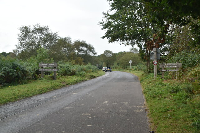
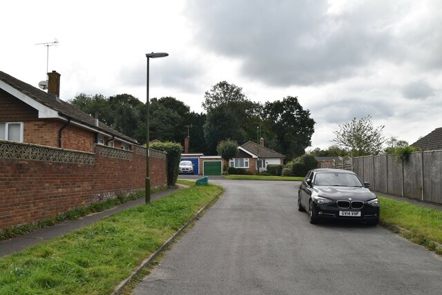
Great Wood Images

Images are sourced within 2km of 50.984838/-0.034587871 or Grid Reference TQ3822. Thanks to Geograph Open Source API. All images are credited.

Chailey Heritage Chapel This is a cross-grid shot. The camera was in TQ3820.
Chailey Heritage Chapel
This is a cross-grid shot. The camera was in TQ3820.
Oaklands
Oaklands
Car park, Chailey Common
North Common Rd Currently consisting of 450 acres of Lowland Heath that is a local nature reserve. The current common is split into five sections; Memorial Common bounded by the A272, 275 and B 2183; Pound Common lying south of the B2183 and the minor road to Wivelsfield; Romany Ridge Common to the south of the A272 and west of the minor road to Wivelsfield; Red House Common to the north of the A272, west of A275 and minor road to Horsted Keynes; and Lane End Common to the north which is detached from the rest lying east of the A275 and north of the minor road to Fletching. Another strip, Godleys Green, running between the minor roads to Wivelsfield and Plumpton Crossways respectively is also included in the reserve. Access is not open though the public can use the existing tracks and footpaths through each of the commons.

Being a poor parish Chailey has historically relied on its commons to help sustain its population and during the medieval period the extent of the common ran from the north of the parish in an arc to the east of the main village to the south. Parts of this were lost to inclosure during the early 17th century which left two large tracts known as North and South Common which survived for another 200 years when the latter was enclosed in the mid 19th century. The former remained and was used for military training during World War Two becoming an SSSI in 1955 and a local nature reserve ten years later. Consequently the North Common's landscape has retained its open lowland heath unbroken throughout the centuries.

See <span class="nowrap"><a title="http://www.chaileycommons.org.uk/index.htm" rel="nofollow ugc noopener" href="http://www.chaileycommons.org.uk/index.htm">Link</a><img style="margin-left:2px;" alt="External link" title="External link - shift click to open in new window" src="https://s1.geograph.org.uk/img/external.png" width="10" height="10"/></span>
North Common Rd
Currently consisting of 450 acres of Lowland Heath that is a local nature reserve. The current common is split into five sections; Memorial Common bounded by the A272, 275 and B 2183; Pound Common lying south of the B2183 and the minor road to Wivelsfield; Romany Ridge Common to the south of the A272 and west of the minor road to Wivelsfield; Red House Common to the north of the A272, west of A275 and minor road to Horsted Keynes; and Lane End Common to the north which is detached from the rest lying east of the A275 and north of the minor road to Fletching. Another strip, Godleys Green, running between the minor roads to Wivelsfield and Plumpton Crossways respectively is also included in the reserve. Access is not open though the public can use the existing tracks and footpaths through each of the commons. Being a poor parish Chailey has historically relied on its commons to help sustain its population and during the medieval period the extent of the common ran from the north of the parish in an arc to the east of the main village to the south. Parts of this were lost to inclosure during the early 17th century which left two large tracts known as North and South Common which survived for another 200 years when the latter was enclosed in the mid 19th century. The former remained and was used for military training during World War Two becoming an SSSI in 1955 and a local nature reserve ten years later. Consequently the North Common's landscape has retained its open lowland heath unbroken throughout the centuries. See LinkExternal link
Chailey Common Currently consisting of 450 acres of Lowland Heath that is a local nature reserve. The current common is split into five sections; Memorial Common bounded by the A272, 275 and B 2183; Pound Common lying south of the B2183 and the minor road to Wivelsfield; Romany Ridge Common to the south of the A272 and west of the minor road to Wivelsfield; Red House Common to the north of the A272, west of A275 and minor road to Horsted Keynes; and Lane End Common to the north which is detached from the rest lying east of the A275 and north of the minor road to Fletching. Another strip, Godleys Green, running between the minor roads to Wivelsfield and Plumpton Crossways respectively is also included in the reserve. Access is not open though the public can use the existing tracks and footpaths through each of the commons.

Being a poor parish Chailey has historically relied on its commons to help sustain its population and during the medieval period the extent of the common ran from the north of the parish in an arc to the east of the main village to the south. Parts of this were lost to inclosure during the early 17th century which left two large tracts known as North and South Common which survived for another 200 years when the latter was enclosed in the mid 19th century. The former remained and was used for military training during World War Two becoming an SSSI in 1955 and a local nature reserve ten years later. Consequently the North Common's landscape has retained its open lowland heath unbroken throughout the centuries.

See <span class="nowrap"><a title="http://www.chaileycommons.org.uk/index.htm" rel="nofollow ugc noopener" href="http://www.chaileycommons.org.uk/index.htm">Link</a><img style="margin-left:2px;" alt="External link" title="External link - shift click to open in new window" src="https://s1.geograph.org.uk/img/external.png" width="10" height="10"/></span>
Chailey Common
Currently consisting of 450 acres of Lowland Heath that is a local nature reserve. The current common is split into five sections; Memorial Common bounded by the A272, 275 and B 2183; Pound Common lying south of the B2183 and the minor road to Wivelsfield; Romany Ridge Common to the south of the A272 and west of the minor road to Wivelsfield; Red House Common to the north of the A272, west of A275 and minor road to Horsted Keynes; and Lane End Common to the north which is detached from the rest lying east of the A275 and north of the minor road to Fletching. Another strip, Godleys Green, running between the minor roads to Wivelsfield and Plumpton Crossways respectively is also included in the reserve. Access is not open though the public can use the existing tracks and footpaths through each of the commons. Being a poor parish Chailey has historically relied on its commons to help sustain its population and during the medieval period the extent of the common ran from the north of the parish in an arc to the east of the main village to the south. Parts of this were lost to inclosure during the early 17th century which left two large tracts known as North and South Common which survived for another 200 years when the latter was enclosed in the mid 19th century. The former remained and was used for military training during World War Two becoming an SSSI in 1955 and a local nature reserve ten years later. Consequently the North Common's landscape has retained its open lowland heath unbroken throughout the centuries. See LinkExternal link
Ham Lane The Sussex Border Path is a footpath route nearly 150 miles long around the inland boundary of the county of Sussex. The county owes its origins to the kingdom of the South Saxons and can claim to have one of the longest inland county boundaries from Emsworth to Rye. The route was devised in 1983 and is well signed along most of the route. Website <span class="nowrap"><a title="http://www.sussexborderpath.co.uk/" rel="nofollow ugc noopener" href="http://www.sussexborderpath.co.uk/">Link</a><img style="margin-left:2px;" alt="External link" title="External link - shift click to open in new window" src="https://s1.geograph.org.uk/img/external.png" width="10" height="10"/></span> 
Map: <a title="https://www.geograph.org.uk/search.php?i=40140109&page=1&displayclass=map#i=40140109&page=1&displayclass=map&zoom=2&lat=51.03263&lon=-0.05427&layers=FTTB00000000000T" href="https://www.geograph.org.uk/search.php?i=40140109&page=1&displayclass=map#i=40140109&page=1&displayclass=map&zoom=2&lat=51.03263&lon=-0.05427&layers=FTTB00000000000T">Link</a>
Ham Lane
The Sussex Border Path is a footpath route nearly 150 miles long around the inland boundary of the county of Sussex. The county owes its origins to the kingdom of the South Saxons and can claim to have one of the longest inland county boundaries from Emsworth to Rye. The route was devised in 1983 and is well signed along most of the route. Website LinkExternal link Map: Link
Ham Lane
Ham Lane
Ham Lane
Ham Lane
Ham Lane The Sussex Border Path is a footpath route nearly 150 miles long around the inland boundary of the county of Sussex. The county owes its origins to the kingdom of the South Saxons and can claim to have one of the longest inland county boundaries from Emsworth to Rye. The route was devised in 1983 and is well signed along most of the route. Website <span class="nowrap"><a title="http://www.sussexborderpath.co.uk/" rel="nofollow ugc noopener" href="http://www.sussexborderpath.co.uk/">Link</a><img style="margin-left:2px;" alt="External link" title="External link - shift click to open in new window" src="https://s1.geograph.org.uk/img/external.png" width="10" height="10"/></span> 
Map: <a title="https://www.geograph.org.uk/search.php?i=40140109&page=1&displayclass=map#i=40140109&page=1&displayclass=map&zoom=2&lat=51.03263&lon=-0.05427&layers=FTTB00000000000T" href="https://www.geograph.org.uk/search.php?i=40140109&page=1&displayclass=map#i=40140109&page=1&displayclass=map&zoom=2&lat=51.03263&lon=-0.05427&layers=FTTB00000000000T">Link</a>
Ham Lane
The Sussex Border Path is a footpath route nearly 150 miles long around the inland boundary of the county of Sussex. The county owes its origins to the kingdom of the South Saxons and can claim to have one of the longest inland county boundaries from Emsworth to Rye. The route was devised in 1983 and is well signed along most of the route. Website LinkExternal link Map: Link
Ham Lane Farm
Ham Lane Farm
Ham Lane The Sussex Border Path is a footpath route nearly 150 miles long around the inland boundary of the county of Sussex. The county owes its origins to the kingdom of the South Saxons and can claim to have one of the longest inland county boundaries from Emsworth to Rye. The route was devised in 1983 and is well signed along most of the route. Website <span class="nowrap"><a title="http://www.sussexborderpath.co.uk/" rel="nofollow ugc noopener" href="http://www.sussexborderpath.co.uk/">Link</a><img style="margin-left:2px;" alt="External link" title="External link - shift click to open in new window" src="https://s1.geograph.org.uk/img/external.png" width="10" height="10"/></span> 
Map: <a title="https://www.geograph.org.uk/search.php?i=40140109&page=1&displayclass=map#i=40140109&page=1&displayclass=map&zoom=2&lat=51.03263&lon=-0.05427&layers=FTTB00000000000T" href="https://www.geograph.org.uk/search.php?i=40140109&page=1&displayclass=map#i=40140109&page=1&displayclass=map&zoom=2&lat=51.03263&lon=-0.05427&layers=FTTB00000000000T">Link</a>
Ham Lane
The Sussex Border Path is a footpath route nearly 150 miles long around the inland boundary of the county of Sussex. The county owes its origins to the kingdom of the South Saxons and can claim to have one of the longest inland county boundaries from Emsworth to Rye. The route was devised in 1983 and is well signed along most of the route. Website LinkExternal link Map: Link
Ham Lane
Ham Lane
Ham Lane
Ham Lane
Orchard Close
Orchard Close
Sussex Border Path, Scaynes Hill The Sussex Border Path is a footpath route nearly 150 miles long around the inland boundary of the county of Sussex. The county owes its origins to the kingdom of the South Saxons and can claim to have one of the longest inland county boundaries from Emsworth to Rye. The route was devised in 1983 and is well signed along most of the route. Website <span class="nowrap"><a title="http://www.sussexborderpath.co.uk/" rel="nofollow ugc noopener" href="http://www.sussexborderpath.co.uk/">Link</a><img style="margin-left:2px;" alt="External link" title="External link - shift click to open in new window" src="https://s1.geograph.org.uk/img/external.png" width="10" height="10"/></span> 
Map: <a title="https://www.geograph.org.uk/search.php?i=40140109&page=1&displayclass=map#i=40140109&page=1&displayclass=map&zoom=2&lat=51.03263&lon=-0.05427&layers=FTTB00000000000T" href="https://www.geograph.org.uk/search.php?i=40140109&page=1&displayclass=map#i=40140109&page=1&displayclass=map&zoom=2&lat=51.03263&lon=-0.05427&layers=FTTB00000000000T">Link</a>
Sussex Border Path, Scaynes Hill
The Sussex Border Path is a footpath route nearly 150 miles long around the inland boundary of the county of Sussex. The county owes its origins to the kingdom of the South Saxons and can claim to have one of the longest inland county boundaries from Emsworth to Rye. The route was devised in 1983 and is well signed along most of the route. Website LinkExternal link Map: Link
Hillcrest Lane
Hillcrest Lane
The Farmers
The Farmers
Show me another place!

Great Wood is located at Grid Ref: TQ3822 (Lat: 50.984838, Lng: -0.034587871)

Administrative County: West Sussex

District: Mid Sussex

Police Authority: Sussex

What 3 Words

///dorm.proves.launched. Near Wivelsfield Green, East Sussex

Related Wikis

Scaynes Hill SSSI

Scaynes Hill is a 0.04-hectare (0.099-acre) geological Site of Special Scientific Interest north-west of Newick in East Sussex. It is a Geological Conservation...

Heritage Mill, North Chailey

Heritage Mill, or Beard's Mill is a grade II listed smock mill at North Chailey, Sussex, England, which is maintained as a landmark and open to the public...

Scaynes Hill

Scaynes Hill is a village in the civil parish of Lindfield Rural in the Mid Sussex District of West Sussex, England. It lies on the A272 road 2.2 miles...

Chailey Heritage School

Chailey Heritage School is a special school located in North Chailey, East Sussex, England. It is owned and operated by the Chailey Heritage Foundation...

Chailey Common

Chailey Common is a 169 hectare (417.4 acre) biological site of Special Scientific Interest in the East Sussex. It is close to the village of North Chailey...

Newick and Chailey railway station

Newick and Chailey was a railway station located in North Chailey and located near the villages of Newick and Chailey in East Sussex, England. It was part...

Sheffield Park railway station

Sheffield Park is the southern terminus of the Bluebell Railway and also the headquarters of the line. It is located on the southern bank of the River...

Great Walstead School

Great Walstead School is a private day school for girls and boys between the ages of 2½ and 13 years with a Christian ethos. It has some 400 children in...

Related Videos

Scaynes Hill dogs walk and sunset Time wrap 4k

gopro #camera #explore #sussex #travel #dog #england #happy #sunset #happyday #happydog #walking #nature #wild #love ...

Clan Line Steam Locomotive at the Bluebell Railway UK. Sussex Tourism.

Clan Line steam locomotive visiting the Bluebell Railway for a quick check up on the front bogie gave the opportunity for a record ...

Steamlights Bluebell Railway 2021

A visit to the Bluebell Railway for thier Christmas Steamlights. An incredible evening out.

Wowo campsite! #camping #vanlife

Wowo is an amazing campsite great for everyone to enjoy. join the P family for some adventures! VW T4, camping life, our family, ...

Nearby Amenities

Located within 500m of 50.984838,-0.034587871
Power: tower
Lat/Long: 50.9823914/-0.0312124
Power: tower
Lat/Long: 50.9817085/-0.0353972
Barrier: kissing_gate
Lat/Long: 50.9826499/-0.0356159
Barrier: kissing_gate
Lat/Long: 50.9841842/-0.0407701
Power: pole
Lat/Long: 50.987192/-0.0292539
Power: pole
Lat/Long: 50.987686/-0.0371962
Power: pole
Lat/Long: 50.9875959/-0.03481
Power: pole
Lat/Long: 50.987559/-0.0334202
Power: pole
Lat/Long: 50.9872961/-0.0310194
Power: pole
Lat/Long: 50.9845062/-0.0282329
Power: pole
Lat/Long: 50.9853673/-0.0279018
Power: pole
Lat/Long: 50.9836192/-0.0285922
Power: pole
Lat/Long: 50.9824515/-0.0287401
Power: pole
Lat/Long: 50.9884208/-0.0386549
Power: pole
Lat/Long: 50.9879121/-0.0376451
Barrier: stile
Lat/Long: 50.981618/-0.0316569
The data included in this document is from www.openstreetmap.org. The data is made available under ODbL.

Have you been to Great Wood?

Leave your review of Great Wood below (or comments, questions and feedback).