Bradley's Ash Belt

Wood, Forest in Lincolnshire East Lindsey

England

Bradley's Ash Belt

River Lymn NW of Partney Bridge: aerial 2016 Extends into <a href="https://www.geograph.org.uk/gridref/TF3968">TF3968</a>.
River Lymn NW of Partney Bridge: aerial 2016 Credit: Chris

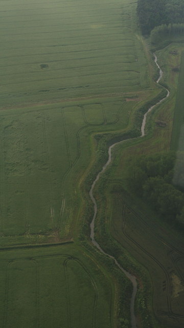
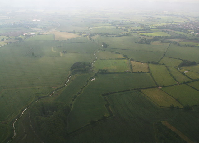
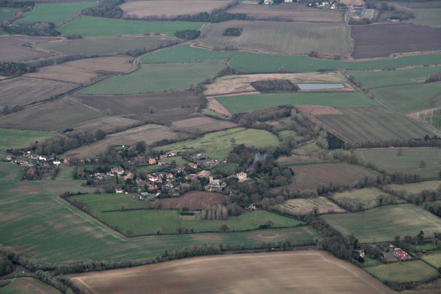
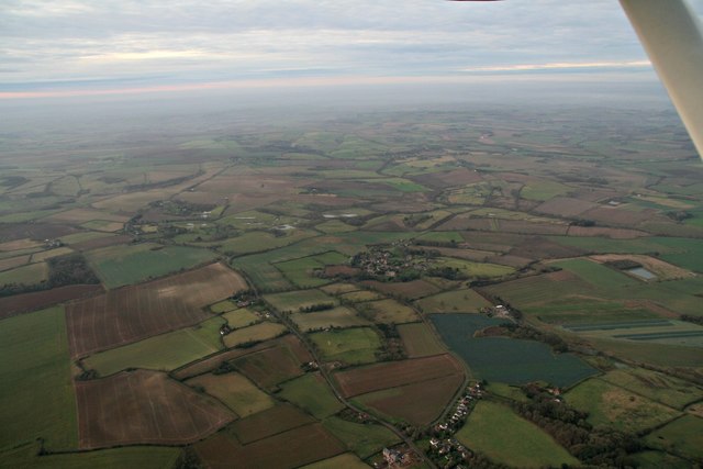
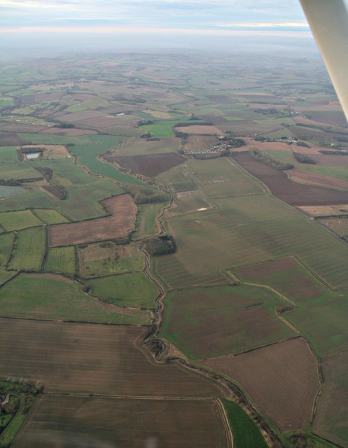
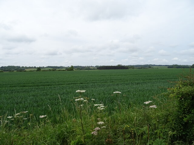
Bradley's Ash Belt is a dense wooded area located in Lincolnshire, England. Spanning over several square kilometers, it is known for its lush greenery and diverse array of tree species. The belt is situated near the village of Bradley, which gives it its name.

The woodland is predominantly composed of ash trees, with their towering trunks and distinctively serrated leaves dominating the landscape. However, interspersed among the ash trees are other species such as oak, birch, and beech, adding to the visual appeal and biodiversity of the area. This mixture of tree species creates a rich ecosystem, providing habitat for various flora and fauna.

The forest floor is covered in a thick carpet of moss, making it soft to walk on and giving it a serene and magical atmosphere. The moss also provides a habitat for insects, small mammals, and birds, attracting nature enthusiasts and birdwatchers alike.

Bradley's Ash Belt is a popular destination for outdoor recreation and leisure activities. It offers numerous hiking trails and walking paths, allowing visitors to explore the woodland and enjoy its natural beauty. The forest is also a favorite spot for picnics, birdwatching, and nature photography. In addition, it serves as a habitat for wildlife, including deer, foxes, rabbits, and a variety of bird species.

Overall, Bradley's Ash Belt is a picturesque and diverse woodland, offering a peaceful retreat for nature lovers and outdoor enthusiasts. Its lush greenery, diverse tree species, and abundant wildlife make it a must-visit destination in Lincolnshire.

If you have any feedback on the listing, please let us know in the comments section below.

Bradley's Ash Belt Images

Images are sourced within 2km of 53.199462/0.064559835 or Grid Reference TF3868. Thanks to Geograph Open Source API. All images are credited.

River Lymn NW of Partney Bridge: aerial 2016 Extends into <a href="https://www.geograph.org.uk/gridref/TF3968">TF3968</a>.
River Lymn NW of Partney Bridge: aerial 2016
Extends into TF3968.
River Lymn NW of Partney Bridge: aerial 2016 Extends into <a href="https://www.geograph.org.uk/gridref/TF3968">TF3968</a> and <a href="https://www.geograph.org.uk/gridref/TF4067">TF4067</a>.
River Lymn NW of Partney Bridge: aerial 2016
Extends into TF3968 and TF4067.
Raithby by Spilsby, Holy Trinity Church The tower of Holy Trinity church.  To the right of the disused doorway is a cut benchmark.  See <span class="nowrap"><a title="http://www.bench-marks.org.uk/bm78106" rel="nofollow ugc noopener" href="http://www.bench-marks.org.uk/bm78106">Link</a><img style="margin-left:2px;" alt="External link" title="External link - shift click to open in new window" src="https://s1.geograph.org.uk/img/external.png" width="10" height="10"/></span> for details and <a title="https://www.geograph.org.uk/photo/5081107" href="https://www.geograph.org.uk/photo/5081107">Link</a> for a close-up.
Raithby by Spilsby, Holy Trinity Church
The tower of Holy Trinity church. To the right of the disused doorway is a cut benchmark. See LinkExternal link for details and Link for a close-up.
Cut Mark: Raithby by Spilsby, Holy Trinity Church A cut benchmark to the right of the disused doorway in the west face of the church tower.  See <span class="nowrap"><a title="http://www.bench-marks.org.uk/bm78106" rel="nofollow ugc noopener" href="http://www.bench-marks.org.uk/bm78106">Link</a><img style="margin-left:2px;" alt="External link" title="External link - shift click to open in new window" src="https://s1.geograph.org.uk/img/external.png" width="10" height="10"/></span> for details of the mark and <a title="https://www.geograph.org.uk/photo/5081104" href="https://www.geograph.org.uk/photo/5081104">Link</a> for a wider view.
Cut Mark: Raithby by Spilsby, Holy Trinity Church
A cut benchmark to the right of the disused doorway in the west face of the church tower. See LinkExternal link for details of the mark and Link for a wider view.
Across Cinder Hill and the A158 towards Raithby and Mavis Enderby: aerial 2016
Raithby by Spilsby: aerial 2016
Raithby by Spilsby: aerial 2016 Taken from overhead Hundleby. Mavis Enderby centre left.
Raithby by Spilsby: aerial 2016
Taken from overhead Hundleby. Mavis Enderby centre left.
River Lymn from Partney to Sausthorpe: aerial 2016
Sausthorpe: aerial 2016
Cinder Hill, near Hagworthingham: aerial 2020
Partney Farm On the A158.
Partney Farm
On the A158.
Cereal crop off the A158 near Partney Farm
Sausthorpe Road (A158) Towards Sausthorpe.
Sausthorpe Road (A158)
Towards Sausthorpe.
Newly planted crop off Partney Road (A158)
Partney Road (A158) Towards Sausthorpe.
Partney Road (A158)
Towards Sausthorpe.
Cereal crop towards Elder's Holt woodland Off Partney Road (A158).
Cereal crop towards Elder's Holt woodland
Off Partney Road (A158).
Entering Sausthorpe On Partney Road (A158).
Entering Sausthorpe
On Partney Road (A158).
The Old Hall, Sausthorpe
Show me another place!

Bradley's Ash Belt is located at Grid Ref: TF3868 (Lat: 53.199462, Lng: 0.064559835)

Administrative County: Lincolnshire

District: East Lindsey

Police Authority: Lincolnshire

What 3 Words

///taps.impulse.assess. Near Spilsby, Lincolnshire

Related Wikis

Sausthorpe

Sausthorpe is a small village and civil parish in the East Lindsey district of Lincolnshire, England, 8 miles (13 km) east of Horncastle and 3 miles (4...

Aswardby

Aswardby (pronounced "as-ard-bee") is a village situated 4 miles (6 km) north-west from Spilsby, in the East Lindsey district of Lincolnshire, England...

Raithby by Spilsby

Raithby by Spilsby or Raithby is a village and civil parish in the East Lindsey district of Lincolnshire, England. It is situated about 2 miles (3.2 km...

Langton by Spilsby

Langton by Spilsby, sometimes called Langton by Partney, is a village and civil parish in the East Lindsey district of Lincolnshire, England. It is situated...

Chapel at Raithby Hall

The small Methodist chapel at Raithby Hall in Raithby by Spilsby is the oldest Methodist chapel in Lincolnshire, and one of the oldest in England. It is...

Hundleby

Hundleby is a village and civil parish in the East Lindsey district of Lincolnshire, England. The village is a suburb of the market town of Spilsby.Hundleby...

Thornbury Hill

Thornbury Hill is a hill in Hagworthingham, Lincolnshire, England.

Dalby, Lincolnshire

Dalby is a village and civil parish in the East Lindsey district of Lincolnshire, England. It is situated approximately 3 miles (5 km) north from the town...

Nearby Amenities

Located within 500m of 53.199462,0.064559835
Sausthorpe
Is In: Lincolnshire, England, UK
Place: hamlet
Source: Bing
Lat/Long: 53.2007653/0.0697041
St Andrews Church
Naptan AtcoCode: 270000014526
Naptan Bearing: SE
Naptan BusStopType: CUS
Naptan CommonName: St Andrews Church
Naptan Indicator: opp
Naptan Landmark: St Andrews Church
Naptan NaptanCode: linjpwda
Naptan Street: Partney Road
Naptan Verified: no
Source: naptan_import
Lat/Long: 53.2012194/0.0684659
St Andrews Church
Naptan AtcoCode: 270000014527
Naptan Bearing: NW
Naptan BusStopType: CUS
Naptan CommonName: St Andrews Church
Naptan Indicator: adj
Naptan Landmark: St Andrews Church
Naptan NaptanCode: linjpwdg
Naptan Street: Partney Road
Naptan Verified: no
Source: naptan_import
Lat/Long: 53.2011316/0.068331
Bus Stop
Sausthorpe Hall
Naptan AtcoCode: 270002700342
Naptan Bearing: N
Naptan CommonName: Sausthorpe Hall
Naptan Indicator: opp
Naptan Landmark: Hall
Naptan Street: Sausthorpe
Naptan Verified: no
Source: naptan_import
Lat/Long: 53.2028693/0.068201
Bus Stop
Sausthorpe Hall
Naptan AtcoCode: 2700LS001592
Naptan Bearing: S
Naptan CommonName: Sausthorpe Hall
Naptan Indicator: adj
Naptan Landmark: Hall
Naptan NaptanCode: linamdjp
Naptan Street: Sausthorpe
Naptan Verified: no
Source: naptan_import
Lat/Long: 53.2028487/0.0683498
Grange Farm
Alt Name: The Grange
Place: farm
Source: Bing
Lat/Long: 53.1987113/0.0710332
Note: End of Public Highway
Lat/Long: 53.2020025/0.0592838
Sausthorpe Bridge
Place: locality
Source: Bing
Lat/Long: 53.1973715/0.0619798
The data included in this document is from www.openstreetmap.org. The data is made available under ODbL.

Have you been to Bradley's Ash Belt?

Leave your review of Bradley's Ash Belt below (or comments, questions and feedback).