Astley Green

Settlement in Lancashire

England

Astley Green

Chieftain Tank at Boomers and Swingers Golf Range One of three Chieftain Tanks at the driving range which starred in the James Bond Film “Goldeneye”
Chieftain Tank at Boomers and Swingers Golf Range Credit: Anthony Parkes

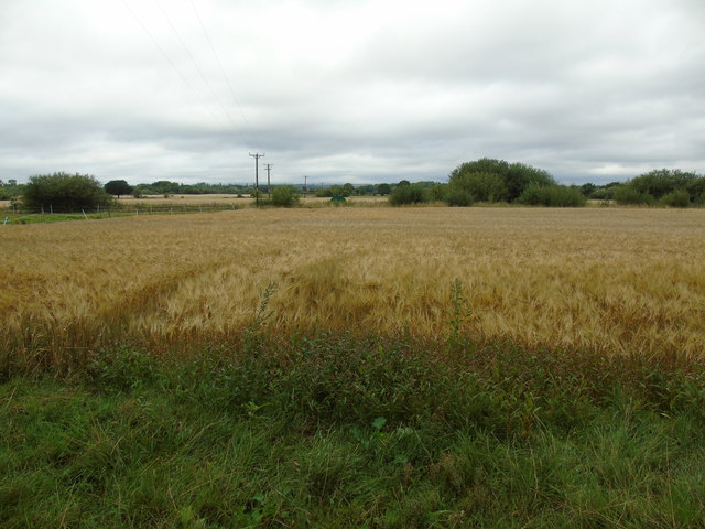
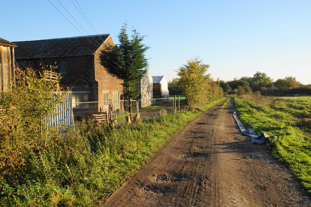
Astley Green is a small village located in the borough of Wigan, in the county of Lancashire, England. Situated approximately 10 miles northwest of Manchester, it lies within close proximity to the towns of Tyldesley and Leigh. The village is predominantly rural in nature, characterized by its picturesque countryside and charming traditional architecture.

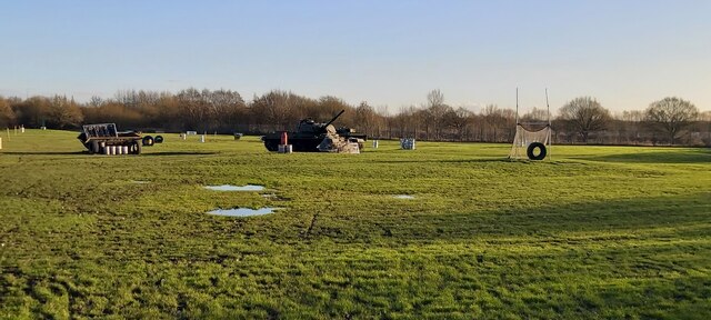
One of the notable features of Astley Green is the presence of Astley Green Colliery, a former coal mine that played a significant role in the region's industrial history. The colliery, which operated from the late 19th century until its closure in 1970, has been preserved as a museum and provides visitors with a fascinating insight into Lancashire's coal mining heritage. The site includes the impressive and iconic headgear, one of the few remaining structures of its kind in the country.

Astley Green is also home to a small community of residents who enjoy the tranquility and natural beauty of the area. The village has a primary school, providing education for local children, as well as a few local amenities such as a pub and a post office. The surrounding countryside offers opportunities for outdoor activities, including walking, cycling, and horse riding.

Overall, Astley Green is a charming and historic village in Lancashire, with its rich industrial past and idyllic rural setting attracting visitors and residents alike.

If you have any feedback on the listing, please let us know in the comments section below.

Astley Green Images

Images are sourced within 2km of 53.492707/-2.448385 or Grid Reference SJ7099. Thanks to Geograph Open Source API. All images are credited.

Chieftain Tank at Boomers and Swingers Golf Range One of three Chieftain Tanks at the driving range which starred in the James Bond Film “Goldeneye”
Chieftain Tank at Boomers and Swingers Golf Range
One of three Chieftain Tanks at the driving range which starred in the James Bond Film “Goldeneye”
Boomers and Swingers Golf Driving Range
Dam House A much altered hall with 1650 datestone but still with the long gallery on the top floor running east to west
Dam House
A much altered hall with 1650 datestone but still with the long gallery on the top floor running east to west
Dam House The south front of the hall (1650 datestone) much altered and latterly used by the NHS. Now in the hands of a heritage trust (MAHT)
Dam House
The south front of the hall (1650 datestone) much altered and latterly used by the NHS. Now in the hands of a heritage trust (MAHT)
Allwood Farm, Moss Side Taken on Moss Lane on the northern edge of Chat Moss at Moss Side, near Leigh, Greater Manchester, I am looking south to Allwood Farm (its buildings just visible to the right of shot).
Allwood Farm, Moss Side
Taken on Moss Lane on the northern edge of Chat Moss at Moss Side, near Leigh, Greater Manchester, I am looking south to Allwood Farm (its buildings just visible to the right of shot).
Astley Moss, north Taken from the designated circular pathway just north of the railway line at Astley Moss, accessible west of Rindle Road, I am looking across the moss towards Allwood Farm beyond the tree line.
Astley Moss, north
Taken from the designated circular pathway just north of the railway line at Astley Moss, accessible west of Rindle Road, I am looking across the moss towards Allwood Farm beyond the tree line.
The East Lancs Car Boot Sale The "famous" East Lancs Car Boot Sale, seen here in August 2017, is held at Marsland Green at the edge of both the Metropolitan Borough of Wigan and the county of Greater Manchester. It is so called because it is located just south of the East Lancashire Road.
The East Lancs Car Boot Sale
The "famous" East Lancs Car Boot Sale, seen here in August 2017, is held at Marsland Green at the edge of both the Metropolitan Borough of Wigan and the county of Greater Manchester. It is so called because it is located just south of the East Lancashire Road.
Moss Brook to Turf Nest Farm Taken on the bridge on Moss Brook, Moss Side, Astley, near Leigh, Greater Manchester, I am looking south west across fields of barley to Turf Nest Farm.
Moss Brook to Turf Nest Farm
Taken on the bridge on Moss Brook, Moss Side, Astley, near Leigh, Greater Manchester, I am looking south west across fields of barley to Turf Nest Farm.
Hill's Farm Taken on Moss Lane, Moss Side, Astley, near Leigh, Greater Manchester, I am looking north across the barley fields of Hill's Farm.
Hill's Farm
Taken on Moss Lane, Moss Side, Astley, near Leigh, Greater Manchester, I am looking north across the barley fields of Hill's Farm.
Great Moss Road Heading onto Astley Moss on a bright autumn afternoon. Allwood Farm is over to the left.
Great Moss Road
Heading onto Astley Moss on a bright autumn afternoon. Allwood Farm is over to the left.
Stubble by Hill's Farm Hill's Farm is largely hidden by foliage ahead. Winter Hill is seen in the far distance.
Stubble by Hill's Farm
Hill's Farm is largely hidden by foliage ahead. Winter Hill is seen in the far distance.
Farm access roads off Moss Lane Allwood Farm is to the right, and Hill's Farm to the left.
Farm access roads off Moss Lane
Allwood Farm is to the right, and Hill's Farm to the left.
Tree and track on Astley Moss
Footbridge over Moss Brook The path is quite discernible but its surface up to here is not very good because of horse hooves.
Footbridge over Moss Brook
The path is quite discernible but its surface up to here is not very good because of horse hooves.
Footpath junction near Sales House You probably wouldn't guess without the post. The path to the left requires you to negotiate an electrified wire.
Footpath junction near Sales House
You probably wouldn't guess without the post. The path to the left requires you to negotiate an electrified wire.
Footpath near Moss Brook The footpath is just discernible, but you have to climb over an electrified wire to get on it.
Footpath near Moss Brook
The footpath is just discernible, but you have to climb over an electrified wire to get on it.
Morleys Quarry A source of sand.
Morleys Quarry
A source of sand.
Track past Morley's Hall Farm
Show me another place!

Astley Green is located at Grid Ref: SJ7099 (Lat: 53.492707, Lng: -2.448385)

Unitary Authority: Wigan

Police Authority: Greater Manchester

What 3 Words

///soak.graphic.necklaces. Near Tyldesley, Manchester

Related Wikis

Astley Green Colliery

Astley Green Colliery was a coal mine in Astley, Greater Manchester, then in the historic county of Lancashire, England. It was the last colliery to be...

Astley Green Colliery Museum

The Astley Green Colliery Museum is a museum run by the Red Rose Steam Society in Astley near Tyldesley in Greater Manchester, England. (grid reference...

Leigh Rural District

Leigh Rural District was, from 1894 to 1933, a rural district of the administrative county of Lancashire, in northwest England. It spanned a rural area...

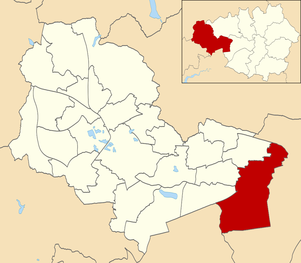
Astley Mosley Common (ward)

Astley Mosley Common is an electoral ward in Leigh, England. It forms part of Wigan Metropolitan Borough Council, as well as the parliamentary constituency...

Astley, Greater Manchester

Astley is a village in the Metropolitan Borough of Wigan, Greater Manchester, England. Within the boundaries of the historic county of Lancashire, it is...

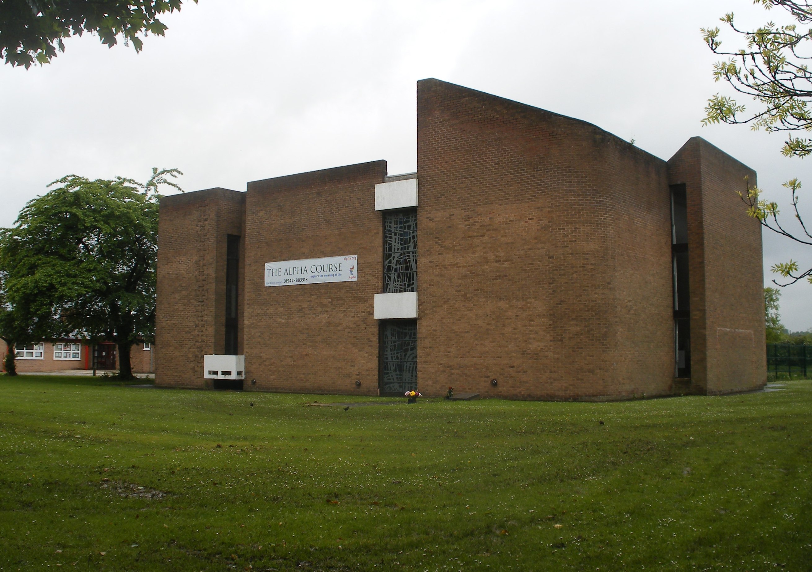
St Stephen's Church, Astley

St Stephen's Church is a parish church in Astley, Greater Manchester, England. It is an active Anglican church built in 1968 and part of Leigh deanery...

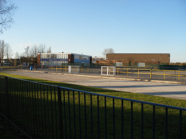
St Mary's Catholic High School, Astley

St Mary's Catholic High School is a Roman Catholic secondary school located in Astley, in the Metropolitan Borough of Wigan, Greater Manchester, England...
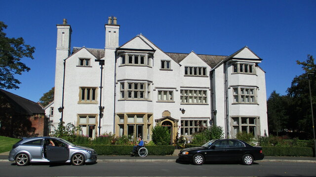
Damhouse

Damhouse or Astley Hall is a Grade II* Listed building in Astley, Greater Manchester, England. It has served as a manor house, sanatorium, and, since restoration...

Nearby Amenities

Located within 500m of 53.492707,-2.448385
Bus Stop
Higher Green Lane/Mining Museum
Bus: yes
Naptan AtcoCode: 1800WK32071
Naptan Bearing: S
Naptan CommonName: Higher Green Lane/Mining Museum
Naptan Indicator: Op House 149
Naptan Landmark: HOUSE 149
Naptan NaptanCode: mantamad
Naptan PlusbusZoneRef: MNCRPIC
Naptan ShortCommonName: Mining Museum
Naptan Street: Higher Green Lane
Naptan Verified: no
Network: TfGM
Public Transport: platform
Source: naptan_import
Lat/Long: 53.4955578/-2.448678
Bus Stop
Higher Green Lane/Mining Museum
Bus: yes
Departures Board: timetable
Naptan AtcoCode: 1800WK32081
Naptan Bearing: N
Naptan CommonName: Higher Green Lane/Mining Museum
Naptan Indicator: O/s House 155
Naptan Landmark: HOUSE 155
Naptan NaptanCode: mantamag
Naptan PlusbusZoneRef: MNCRPIC
Naptan ShortCommonName: Mining Museum
Naptan Street: Higher Green Lane
Naptan Verified: no
Network: TfGM
Public Transport: platform
Shelter: no
Source: naptan_import
Lat/Long: 53.4953054/-2.4488713
Bus Stop
First Avenue/Higher Green
Bus: yes
Naptan AtcoCode: 1800WK32101
Naptan Bearing: E
Naptan CommonName: First Avenue/Higher Green
Naptan Indicator: Ter Instruments
Naptan Landmark: TER INSTRUMENTS
Naptan NaptanCode: mantamam
Naptan PlusbusZoneRef: MNCRPIC
Naptan ShortCommonName: Higher Green
Naptan Street: FIRST AVENUE
Naptan Verified: no
Network: TfGM
Public Transport: platform
Source: naptan_import
Lat/Long: 53.4940331/-2.4501693
Lcn Ref: 244
Lat/Long: 53.4953937/-2.4487922
Barrier: block
Bicycle: yes
Foot: yes
Horse: yes
Lat/Long: 53.4920991/-2.4493408
Barrier: kissing_gate
Foot: yes
Motor Vehicle: no
Lat/Long: 53.4940988/-2.443462
Railway: switch
Lat/Long: 53.4953717/-2.4459013
Railway: switch
Lat/Long: 53.4953889/-2.4462734
Lcn Ref: 243
Lat/Long: 53.4932696/-2.4495065
Generator Method: photovoltaic
Generator Output Electricity: yes
Generator Source: solar
Generator Type: solar_photovoltaic_panel
Location: roof
Power: generator
Lat/Long: 53.4929426/-2.450331
Generator Method: photovoltaic
Generator Output Electricity: yes
Generator Source: solar
Generator Type: solar_photovoltaic_panel
Location: roof
Power: generator
Lat/Long: 53.4932426/-2.4501861
Generator Method: photovoltaic
Generator Output Electricity: yes
Generator Source: solar
Generator Type: solar_photovoltaic_panel
Location: roof
Power: generator
Lat/Long: 53.4949899/-2.4547888
Generator Method: photovoltaic
Generator Output Electricity: yes
Generator Source: solar
Generator Type: solar_photovoltaic_panel
Location: roof
Power: generator
Lat/Long: 53.4949955/-2.4547164
Railway: switch
Lat/Long: 53.495334/-2.4450432
Railway: switch
Lat/Long: 53.4953699/-2.4465849
Railway: switch
Lat/Long: 53.495838/-2.4473227
Railway: switch
Lat/Long: 53.4957837/-2.4474527
Railway: switch
Lat/Long: 53.4958019/-2.4473848
Railway: switch
Lat/Long: 53.4957559/-2.4474944
Railway: switch
Lat/Long: 53.4957774/-2.4474269
Railway: switch
Lat/Long: 53.4953278/-2.4461241
Railway: switch
Lat/Long: 53.4944277/-2.4439234
Railway: switch
Lat/Long: 53.4945587/-2.4430755
Traffic Signals
Lat/Long: 53.4940257/-2.4492376
Traffic Signals
Lat/Long: 53.4931917/-2.4495389
Archaeological Site: building
Description: whitehead hall (site_of)
Historic: archaeological_site
Lat/Long: 53.4933157/-2.4423347
Public Transport: stop_position
Railway: stop
Train: yes
Lat/Long: 53.4944933/-2.4434848
Whitehead Lane
Public Transport: station
Railway: station
Usage: tourism
Lat/Long: 53.4945115/-2.4435015
Railway: crossing
Lat/Long: 53.4944498/-2.4446561
Public Transport: stop_position
Railway: stop
Train: yes
Lat/Long: 53.4953982/-2.445832
Trencherbone Platform
Public Transport: station
Railway: station
Usage: tourism
Lat/Long: 53.4954145/-2.4458362
Railway: crossing
Lat/Long: 53.4954394/-2.4463359
Railway: switch
Lat/Long: 53.49476/-2.4475433
Fast Food
Bambu
Cuisine: chinese
Lat/Long: 53.4951629/-2.4486978
Addr City: Astley Green
Addr Housenumber: 187
Addr Street: Higher Green Lane
Lat/Long: 53.4944371/-2.4492462
Addr City: Astley Green
Addr Housenumber: 189
Addr Street: Higher Green Lane
Lat/Long: 53.4942884/-2.4492919
Post Box
Operator: Royal Mail
Operator Wikidata: Q638098
Post Box Type: wall
Royal Cypher: EIIR
Source: survey
Support: wall_mounted
Lat/Long: 53.4941139/-2.4493447
Addr City: Astley Green
Addr Housenumber: 159
Addr Street: Higher Green Lane
Lat/Long: 53.4950065/-2.4490672
Addr City: Astley Green
Addr Housenumber: 124
Addr Street: Higher Green Lane
Lat/Long: 53.4952418/-2.4486759
Addr City: Astley Green
Addr Housenumber: 136
Addr Street: Higher Green Lane
Lat/Long: 53.4947115/-2.4488624
Addr City: Astley
Addr Housenumber: 50
Addr Street: Lower Green Lane
Source: survey
Lat/Long: 53.4920988/-2.4498294
Addr City: Astley
Addr Housenumber: 54
Addr Street: Lower Green Lane
Source: survey
Lat/Long: 53.4919416/-2.4498683
Addr City: Astley
Addr Housenumber: 55
Addr Street: Lower Green Lane
Lat/Long: 53.4919124/-2.4502386
Addr City: Astley
Addr Housenumber: 31
Addr Street: Lower Green Lane
Lat/Long: 53.4923866/-2.4500782
Addr City: Astley
Addr Housenumber: 23
Addr Street: Lower Green Lane
Lat/Long: 53.4926322/-2.4499832
Addr City: Astley
Addr Housenumber: 30
Addr Street: Peel Lane
Lat/Long: 53.4944656/-2.4539411
Addr City: Astley Green
Addr Housenumber: 3
Addr Street: First Avenue
Lat/Long: 53.4941168/-2.450471
Addr City: Astley Green
Addr Housenumber: 13
Addr Street: First Avenue
Lat/Long: 53.494493/-2.4504266
Addr City: Astley Green
Addr Housenumber: 145
Addr Street: Higher Green Lane
Source: survey
Lat/Long: 53.4957536/-2.4489018
Addr City: Astley Green
Addr Housename: Bluebell Cottage
Addr Housenumber: 107
Addr Street: Higher Green Lane
Source: survey
Lat/Long: 53.4969478/-2.4484425
Addr City: Tyldesley
Addr Housenumber: 100
Addr Street: Higher Green Lane
Addr Suburb: Astley Green
Source: survey;local knowledge
Lat/Long: 53.4969086/-2.4481586
Astley Green Village Club
Addr City: Tyldesley
Addr Housenumber: 90-94
Addr Postcode: M29 7HZ
Addr Street: Higher Green Lane
Addr Suburb: Astley Green
Check Date: 2023-05-21
Club: social
Phone: +44 1942 882009
Source: survey;local knowledge
Website: https://m.facebook.com/people/Astley-Green-Village-Club/100054364308614/
Lat/Long: 53.4971325/-2.4480987
Addr City: Tyldesley
Addr Housenumber: 5
Addr Street: Corless Fold
Addr Suburb: Astley Green
Source: survey;local knowledge
Lat/Long: 53.497121/-2.447898
Addr City: Tyldesley
Addr Housenumber: 7
Addr Street: Corless Fold
Addr Suburb: Astley Green
Source: survey;local knowledge
Lat/Long: 53.4971228/-2.4476209
Addr City: Astley
Addr Housenumber: 24
Addr Street: Third Avenue
Lat/Long: 53.4950397/-2.4547627
Addr City: Astley
Addr Housenumber: 23
Addr Street: Second Avenue
Lat/Long: 53.4951036/-2.4543197
Addr City: Astley
Addr Housenumber: 23
Addr Street: Third Avenue
Lat/Long: 53.4947834/-2.4546658
Addr City: Astley
Addr Housenumber: 1
Addr Street: Second Avenue
Lat/Long: 53.494667/-2.4540912
Addr City: Astley
Addr Housenumber: 65
Addr Street: Lower Green Lane
Lat/Long: 53.4919787/-2.4506732
Addr City: Salford
Addr Housenumber: 11
Addr Street: Woodburns Row
Lat/Long: 53.490937/-2.4509693
Addr City: Astley Green
Addr Housenumber: 134
Addr Street: Higher Green Lane
Lat/Long: 53.4948962/-2.4488054
Addr City: Astley Green
Addr Housenumber: 116
Addr Street: Higher Green Lane
Lat/Long: 53.4951244/-2.4479631
Bench: yes
Leisure: picnic_table
Lit: no
Source: survey
Lat/Long: 53.4955216/-2.4463097
Bench: yes
Leisure: picnic_table
Lit: no
Source: survey
Lat/Long: 53.4955702/-2.4462662
Bench: yes
Leisure: picnic_table
Lit: no
Source: survey
Lat/Long: 53.4955067/-2.4464007
Description: Former substation associated with old mine.
Historic: ruins
Historic Civilization: modern
Source: local knowledge
Lat/Long: 53.4962989/-2.4465034
Waste Basket
Colour: Black
Operator: Wigan Council
Source: survey
Lat/Long: 53.4954168/-2.4486017
Waste Basket
Colour: Black
Operator: Wigan Council
Source: survey
Lat/Long: 53.4953972/-2.4484183
Waste Basket
Colour: Black
Operator: Wigan Council
Source: survey
Lat/Long: 53.4951516/-2.4487665
Addr City: Tyldesley
Addr Housenumber: 9
Addr Postcode: M29 7QS
Addr Street: Scott Street
Addr Suburb: Astley Green
Lat/Long: 53.4943289/-2.4498682
Addr City: Tyldesley
Addr Housename: The Old Post Office
Addr Housenumber: 197
Addr Postcode: M29 7JA
Addr Street: Higher Green Lane
Addr Suburb: Astley Green
Description: End terrace, formerly village post office to late 1990s.
Lat/Long: 53.4941277/-2.4493912
Waste Basket
Colour: Black
Operator: Wigan Council
Source: survey
Lat/Long: 53.4953292/-2.4488674
Leisure: outdoor_seating
Lat/Long: 53.4938504/-2.448719
The data included in this document is from www.openstreetmap.org. The data is made available under ODbL.

Have you been to Astley Green?

Leave your review of Astley Green below (or comments, questions and feedback).