Astley Cross

Settlement in Worcestershire Wyre Forest

England

Astley Cross

The Dog, Dunley
The Dog, Dunley Credit: Richard Rogerson

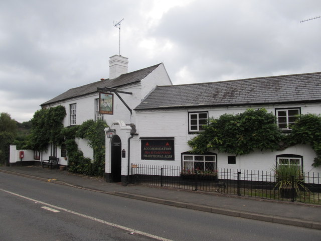
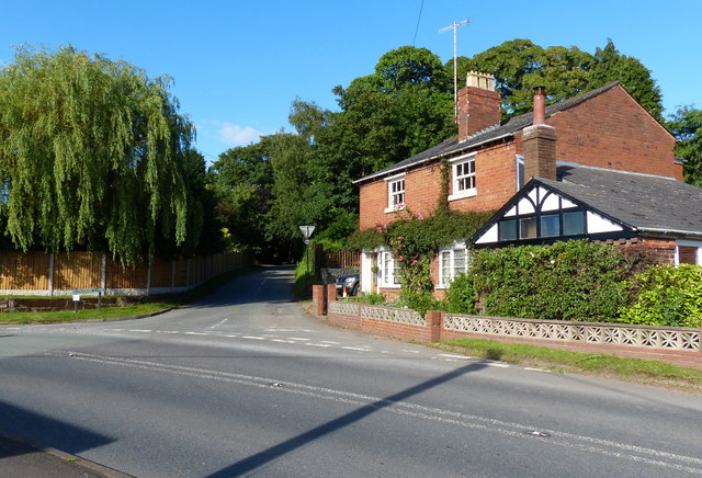
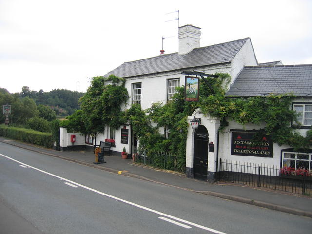
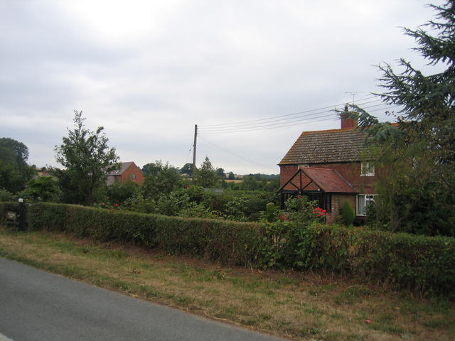
Astley Cross is a small village located in the county of Worcestershire, England. Situated about 4 miles south of the town of Kidderminster, the village is nestled in a picturesque rural setting, surrounded by fields and woodlands. It falls within the district of Wyre Forest and has a population of around 500 residents.

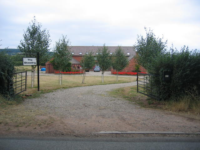
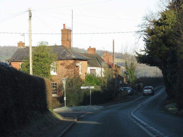
The village is primarily residential, with a mix of traditional cottages and more modern houses. Astley Cross benefits from a strong sense of community, with a village hall serving as a focal point for social events and gatherings. The hall hosts a range of activities, including exercise classes, community meetings, and celebrations.

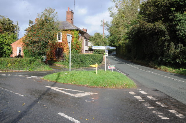
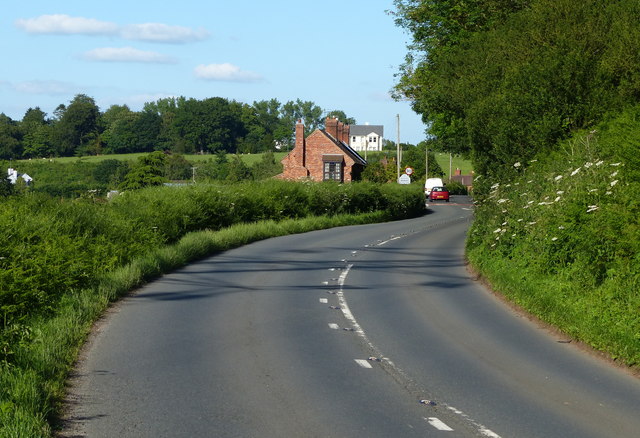
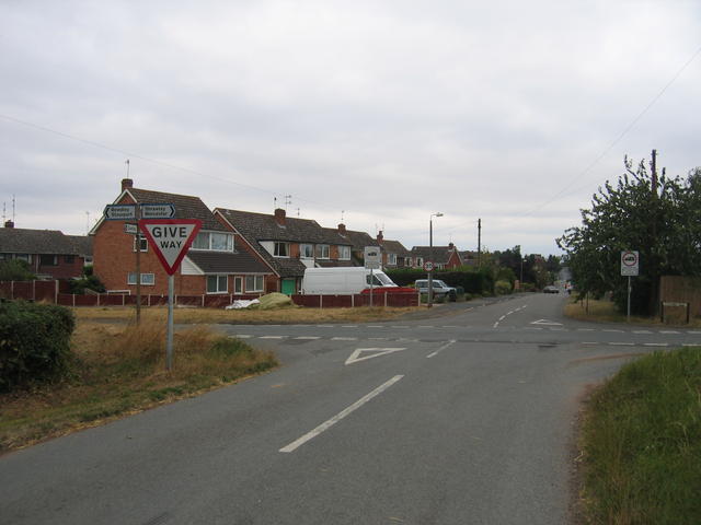
While Astley Cross does not have its own school or shops, it is in close proximity to nearby villages that offer these amenities. The village is well-connected by road, with the A442 passing through, providing easy access to surrounding areas. Additionally, there is a bus service that operates in the area, connecting Astley Cross to nearby towns and villages.

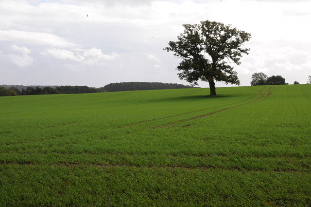
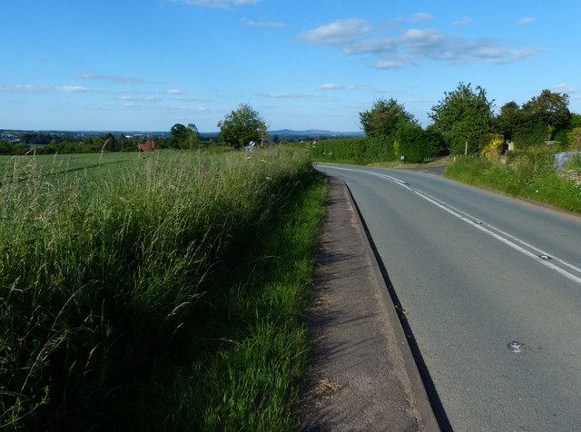
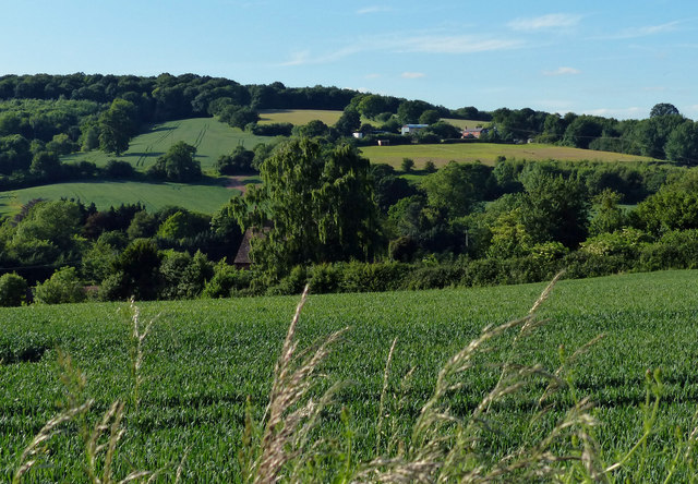
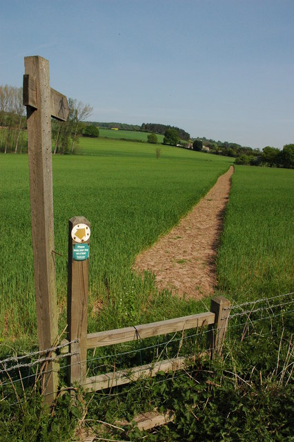
The village is surrounded by beautiful countryside, making it an ideal location for nature lovers and outdoor enthusiasts. There are several walking paths and trails that allow residents and visitors to explore the scenic surroundings. Nearby attractions include the renowned Severn Valley Railway and the historic Hartlebury Castle.

In summary, Astley Cross is a charming village in Worcestershire known for its tight-knit community, peaceful surroundings, and convenient access to amenities and nearby attractions.

If you have any feedback on the listing, please let us know in the comments section below.

Astley Cross Images

Images are sourced within 2km of 52.324417/-2.2943868 or Grid Reference SO8069. Thanks to Geograph Open Source API. All images are credited.

The Dog, Dunley
The Dog, Dunley
Road junction in Dunley House on the corner by a road junction in Dunley.
Road junction in Dunley
House on the corner by a road junction in Dunley.
Oak tree in an arable field Oak tree in an arable field between Astely Cross and Dunley.
Oak tree in an arable field
Oak tree in an arable field between Astely Cross and Dunley.
A451 at Lower Strand Cottages On the southern edge of Dunley village.
A451 at Lower Strand Cottages
On the southern edge of Dunley village.
A451 in the village of Dunley
Houses along the A451 in Dunley
Farmland in the village of Dunley
The Dog Inn, Dunley Public house along the A451.
The Dog Inn, Dunley
Public house along the A451.
Redhouse Lane junction in Dunley
Dunley Road towards Areley Kings
View north towards Areley Wood
Pool House, Astley Grade II listed Gothic Revival country house in the village of Astley, near Stourport-on-Severn
Pool House, Astley
Grade II listed Gothic Revival country house in the village of Astley, near Stourport-on-Severn
Pound Farm, Astley Astley Farm with a large mound of root Crop, probably turnips for winter feed in the yard.
Pound Farm, Astley
Astley Farm with a large mound of root Crop, probably turnips for winter feed in the yard.
The Dog Inn, Dunley This is the pub shown on the OS Map beside the Stourport - Witley road in the SE corner of the square.
The Dog Inn, Dunley
This is the pub shown on the OS Map beside the Stourport - Witley road in the SE corner of the square.
New Barns Farm The old farmhouse is on the right and the barns, now converted into <a href="https://www.geograph.org.uk/photo/218662">SO7969 : The Steadings</a> can be seen in the distance.  Behind the photographer the urban development of <a href="https://www.geograph.org.uk/photo/218636">SO7969 : Edge of Areley Kings</a> and Stourport and then much of the West Midlands commences.
New Barns Farm
The old farmhouse is on the right and the barns, now converted into SO7969 : The Steadings can be seen in the distance. Behind the photographer the urban development of SO7969 : Edge of Areley Kings and Stourport and then much of the West Midlands commences.
Edge of Areley Kings Looking the other way from <a href="https://www.geograph.org.uk/photo/218563">SO7969 : New Barns Farm</a> towards the edge of the Areley Kings area of Stourport.
Edge of Areley Kings
Looking the other way from SO7969 : New Barns Farm towards the edge of the Areley Kings area of Stourport.
The Steadings The converted barns at New Barns Farm on the edge of Stourport-on-Severn. These are the barns just visible from near <a href="https://www.geograph.org.uk/photo/218563">SO7969 : New Barns Farm</a> farmhouse.
The Steadings
The converted barns at New Barns Farm on the edge of Stourport-on-Severn. These are the barns just visible from near SO7969 : New Barns Farm farmhouse.
Footpath to Dunley
Footpath to Dunley
Show me another place!

Astley Cross is located at Grid Ref: SO8069 (Lat: 52.324417, Lng: -2.2943868)

Administrative County: Worcestershire

District: Wyre Forest

Police Authority: West Mercia

What 3 Words

///wound.honest.unveils. Near Stourport-on-Severn, Worcestershire

Nearby Locations

Astley Cross

Related Wikis

Astley Cross

Astley Cross is a village in Worcestershire, England, located on the outskirts of Stourport-on-Severn. The village lies 1 mile (1.6 km) south of the centre...

Areley Kings

Areley Kings is a village on the River Severn in the Wyre District of Worcestershire, England. It is 10 miles north of Worcester and south of Stourport...

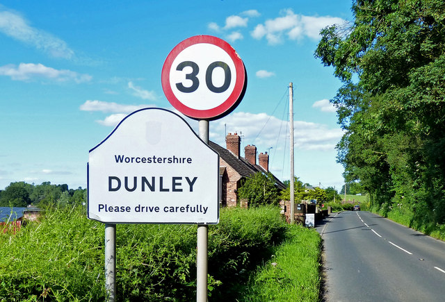
Dunley, Worcestershire

Dunley is a village, and a civil parish (with Astley), in the administrative district of Malvern Hills in the county of Worcestershire, England. ��2�...

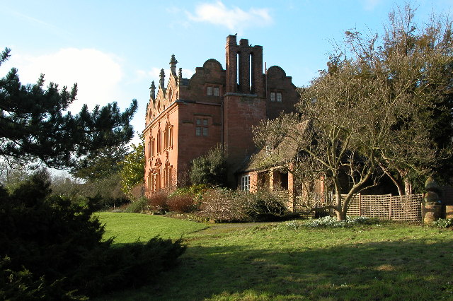
Pool House, Worcestershire

Pool House is a Grade II* listed house in Astley, in the county of Worcestershire, England.In the area close to Stourport-on-Severn, there are several...

Areley Hall

Areley Hall is a Grade II listed country house near Areley Kings in Stourport-on-Severn, Worcestershire, England. It is not to be confused with nearby...

Stourport Swifts F.C.

Stourport Swifts Football Club are a football team from Stourport-on-Severn, and one of the oldest non-league teams in the country. The Swifts currently...

Droitwich Spa F.C.

Droitwich Spa Football Club is a football club representing the town of Droitwich Spa, Worcestershire, England. They are currently members of the Midland...

Stourport Boat Club

Stourport Boat Club is a rowing club on the River Severn, based at the Riverside, Dunley Road, Stourport-on-Severn, Worcestershire. == History == The club...

Nearby Amenities

Located within 500m of 52.324417,-2.2943868
Bus Stop
Princess Way
Bus: yes
Naptan AtcoCode: 2000G045100
Naptan Bearing: NE
Naptan CommonName: Princess Way
Naptan Crossing: Princess Way
Naptan Indicator: adj
Naptan NaptanCode: wocgjdma
Naptan PlusbusZoneRef: KDRMNST
Naptan Street: Redstone Lane
Naptan Verified: no
Public Transport: platform
Source: naptan_import
Lat/Long: 52.3260414/-2.2886317
Bus Stop
Post Office
Bus: yes
Naptan AtcoCode: 2000G046000
Naptan Bearing: N
Naptan CommonName: Post Office
Naptan Indicator: Opp
Naptan Landmark: Post Office
Naptan NaptanCode: wocgjwaw
Naptan PlusbusZoneRef: KDRMNST
Naptan Street: Areley Common
Naptan Verified: no
Public Transport: platform
Source: naptan_import
Lat/Long: 52.3271253/-2.2927006
Bus Stop
Abberley Avenue
Bus: yes
Naptan AtcoCode: 2000G046002
Naptan Bearing: E
Naptan CommonName: Kings Arms
Naptan Indicator: opp
Naptan Landmark: Kings Arms
Naptan NaptanCode: wocgjwdg
Naptan PlusbusZoneRef: KDRMNST
Naptan Street: Red House Road
Naptan Verified: no
Public Transport: platform
Source: naptan_import
Lat/Long: 52.3243569/-2.2955833
Bus Stop
Callow Close
Bus: yes
Naptan AtcoCode: 2000G098002
Naptan Bearing: S
Naptan CommonName: Callow Close
Naptan Crossing: Callow Close
Naptan Indicator: adj
Naptan NaptanCode: wocdptap
Naptan PlusbusZoneRef: KDRMNST
Naptan Street: Abberley Avenue
Naptan Verified: no
Public Transport: platform
Source: naptan_import
Lat/Long: 52.3282471/-2.2971504
Bus Stop
Abberley Avenue
Bus: yes
Naptan AtcoCode: 2000G099803
Naptan Bearing: S
Naptan BusStopType: CUS
Naptan CommonName: Abberley Avenue
Naptan Crossing: Cleeve Close
Naptan Indicator: opp
Naptan NaptanCode: wocdptdj
Naptan PlusbusZoneRef: KDRMNST
Naptan Street: Abberley Avenue
Naptan Verified: no
Public Transport: platform
Source: naptan_import
Lat/Long: 52.3265601/-2.2958772
Bus Stop
Kings Arms
Bus: yes
Naptan AtcoCode: 2000G500169
Naptan Bearing: NE
Naptan CommonName: Kings Arms
Naptan Indicator: adj
Naptan Landmark: Kings Arms
Naptan NaptanCode: wocgagwp
Naptan PlusbusZoneRef: KDRMNST
Naptan Street: Red House Road
Naptan Verified: no
Public Transport: platform
Source: naptan_import
Lat/Long: 52.3243434/-2.2947256
Bus Stop
Commonside- Junction Kings Arms Lane
Bus: yes
Naptan AtcoCode: 2000G656020
Naptan Bearing: SE
Naptan CommonName: Commonside- Junction Kings Arms Lane
Naptan Indicator: Adj
Naptan Landmark: Kings Arms Lane
Naptan NaptanCode: wocdjatj
Naptan PlusbusZoneRef: KDRMNST
Naptan Street: Pearl Lane
Naptan Verified: no
Public Transport: platform
Source: naptan_import
Lat/Long: 52.3225909/-2.295443
Bus Stop
Princess Way
Bus: yes
Naptan AtcoCode: 2000G663015
Naptan Bearing: SW
Naptan CommonName: Princess Way
Naptan Crossing: Princess Way
Naptan Indicator: opp
Naptan NaptanCode: wocgamwa
Naptan PlusbusZoneRef: KDRMNST
Naptan Street: Redstone Lane
Naptan Verified: no
Public Transport: platform
Source: naptan_import
Lat/Long: 52.3259504/-2.2886769
Peacock Farm Buildings
Power: pole
Transformer: distribution
Voltage Primary: 11000
Lat/Long: 52.3200697/-2.2929992
Power: pole
Lat/Long: 52.3238425/-2.2903394
Power: pole
Lat/Long: 52.3230601/-2.2910639
Power: pole
Lat/Long: 52.3245556/-2.2897011
Location Transition: yes
Power: pole
Lat/Long: 52.3251277/-2.2891807
Power: pole
Lat/Long: 52.3207041/-2.2925858
Power: pole
Lat/Long: 52.3205816/-2.2926677
Location Transition: yes
Power: pole
Lat/Long: 52.322628/-2.2914119
Sytch Cottage
Power: pole
Transformer: distribution
Voltage Primary: 11000
Lat/Long: 52.3203609/-2.2969963
Power: pole
Lat/Long: 52.3201259/-2.2957415
Taylors Newsagents
Shop: newsagent
Lat/Long: 52.3286775/-2.2920697
Areley Kings Pharmacy
Shop: chemist
Lat/Long: 52.3277991/-2.2926349
Pub
King's Arms
Lat/Long: 52.3243116/-2.2945607
Post Office
Areley Kings Post Office
Addr City: Stourport on Severn
Addr Housenumber: 63
Addr Postcode: DY13 0NG
Addr Street: Areley Common
Brand: Post Office
Brand Wikidata: Q1783168
Opening Hours: Mo-Fr 08:30-17:30; Sa 09:00-13:00
Operator: Londis
Ref Pol Id: 8694
Website: https://www.postoffice.co.uk/branch-finder/2282089/areley-kings
Lat/Long: 52.3273335/-2.2922048
Bench
Lat/Long: 52.3249942/-2.2929251
Astley Cross
Is In: Worcestershire
Place: neighbourhood
Lat/Long: 52.3245014/-2.2932842
Bus Stop
Astley Cross
Bench: no
Bus: yes
Naptan AtcoCode: 2000G630001
Naptan Bearing: SW
Naptan CommonName: Church
Naptan Indicator: Adj
Naptan Landmark: Crossroads
Naptan NaptanCode: wocdmgja
Naptan PlusbusZoneRef: KDRMNST
Naptan Street: Redstone Lane
Naptan Verified: no
Public Transport: platform
Shelter: no
Source: naptan_import
Lat/Long: 52.3249257/-2.2923915
Bus Stop
Post Office
Bus: yes
Naptan AtcoCode: 2000G046001
Naptan Bearing: S
Naptan CommonName: Post Office
Naptan Indicator: adj
Naptan Landmark: Post Office
Naptan NaptanCode: wocgjwda
Naptan PlusbusZoneRef: KDRMNST
Naptan Street: Areley Common
Naptan Verified: no
Public Transport: platform
Source: naptan_import
Lat/Long: 52.3271748/-2.2925524
Crossing
Crossing: uncontrolled
Crossing Ref: zebra
Lat/Long: 52.3286071/-2.2922944
Generator Method: photovoltaic
Generator Output Electricity: yes
Generator Source: solar
Generator Type: solar_photovoltaic_panel
Location: roof
Power: generator
Lat/Long: 52.3236568/-2.292873
Generator Method: photovoltaic
Generator Output Electricity: yes
Generator Source: solar
Generator Type: solar_photovoltaic_panel
Location: roof
Power: generator
Lat/Long: 52.326342/-2.2961023
Generator Method: photovoltaic
Generator Output Electricity: yes
Generator Source: solar
Generator Type: solar_photovoltaic_panel
Location: roof
Power: generator
Lat/Long: 52.328096/-2.2948766
Generator Method: photovoltaic
Generator Output Electricity: yes
Generator Source: solar
Generator Type: solar_photovoltaic_panel
Location: roof
Power: generator
Lat/Long: 52.327996/-2.2942328
Generator Method: photovoltaic
Generator Output Electricity: yes
Generator Source: solar
Generator Type: solar_photovoltaic_panel
Location: roof
Power: generator
Lat/Long: 52.3239765/-2.293632
Generator Method: photovoltaic
Generator Output Electricity: yes
Generator Source: solar
Generator Type: solar_photovoltaic_panel
Location: roof
Power: generator
Lat/Long: 52.3241241/-2.2930875
Generator Method: photovoltaic
Generator Output Electricity: yes
Generator Source: solar
Generator Type: solar_photovoltaic_panel
Location: roof
Power: generator
Lat/Long: 52.3232257/-2.2923633
Generator Method: photovoltaic
Generator Output Electricity: yes
Generator Source: solar
Generator Type: solar_photovoltaic_panel
Location: roof
Power: generator
Lat/Long: 52.3231716/-2.2958851
Generator Method: photovoltaic
Generator Output Electricity: yes
Generator Source: solar
Generator Type: solar_photovoltaic_panel
Location: roof
Power: generator
Lat/Long: 52.3232913/-2.295405
Generator Method: photovoltaic
Generator Output Electricity: yes
Generator Source: solar
Generator Type: solar_photovoltaic_panel
Location: roof
Power: generator
Lat/Long: 52.3247437/-2.2963437
Generator Method: photovoltaic
Generator Output Electricity: yes
Generator Source: solar
Generator Type: solar_photovoltaic_panel
Location: roof
Power: generator
Lat/Long: 52.3247421/-2.2962552
Generator Method: photovoltaic
Generator Output Electricity: yes
Generator Source: solar
Generator Type: solar_photovoltaic_panel
Location: roof
Power: generator
Lat/Long: 52.32497/-2.2960031
Generator Method: photovoltaic
Generator Output Electricity: yes
Generator Source: solar
Generator Type: solar_photovoltaic_panel
Location: roof
Power: generator
Lat/Long: 52.3250126/-2.296274
Generator Method: photovoltaic
Generator Output Electricity: yes
Generator Source: solar
Generator Type: solar_photovoltaic_panel
Location: roof
Power: generator
Lat/Long: 52.3259683/-2.297658
Generator Method: photovoltaic
Generator Output Electricity: yes
Generator Source: solar
Generator Type: solar_photovoltaic_panel
Location: roof
Power: generator
Lat/Long: 52.3263404/-2.2965851
Generator Method: photovoltaic
Generator Output Electricity: yes
Generator Source: solar
Generator Type: solar_photovoltaic_panel
Location: roof
Power: generator
Lat/Long: 52.3276272/-2.2951622
Bench
Lat/Long: 52.3285339/-2.2942132
Bench
Lat/Long: 52.3284624/-2.2935113
Bench
Lat/Long: 52.3286156/-2.295013
Communication Mobile Phone: yes
Man Made: mast
Tower Type: communication
Lat/Long: 52.3272584/-2.2980709
Power: pole
Lat/Long: 52.320724/-2.2925753
Ramblers Gate
Place: neighbourhood
Lat/Long: 52.3217856/-2.2929696
Commonside
Place: neighbourhood
Lat/Long: 52.3223279/-2.2945487
The data included in this document is from www.openstreetmap.org. The data is made available under ODbL.

Have you been to Astley Cross?

Leave your review of Astley Cross below (or comments, questions and feedback).