Astley Bridge
Settlement in Lancashire
England
Astley Bridge

Astley Bridge is a suburban area located in the borough of Bolton, Lancashire, England. Situated approximately 2 miles north of Bolton town center, it lies on the western bank of the River Tonge. Historically, Astley Bridge was a small rural village that saw significant growth during the Industrial Revolution, thanks to the booming cotton industry in Bolton.
Today, Astley Bridge is a thriving residential area with a mix of Victorian terraced houses, semi-detached properties, and modern developments. Its close proximity to Bolton town center and excellent transport links, including a nearby train station and several bus routes, make it an attractive location for commuters working in the city.
The area boasts a range of amenities and facilities, including schools, supermarkets, shops, and restaurants. Astley Bridge also benefits from its proximity to the beautiful countryside, with nearby green spaces such as Moss Bank Park and Jumbles Country Park offering opportunities for outdoor activities and relaxation.
Despite its urbanization, Astley Bridge has managed to retain a sense of community spirit, with various local events and initiatives organized by residents. The area is also home to a number of places of worship, reflecting its diverse population.
In summary, Astley Bridge is a vibrant and sought-after residential area in Lancashire, offering a mix of housing options, convenient amenities, and access to both urban and rural attractions.
If you have any feedback on the listing, please let us know in the comments section below.
Astley Bridge Images
Images are sourced within 2km of 53.602443/-2.427634 or Grid Reference SD7111. Thanks to Geograph Open Source API. All images are credited.


Astley Bridge is located at Grid Ref: SD7111 (Lat: 53.602443, Lng: -2.427634)
Unitary Authority: Bolton
Police Authority: Greater Manchester
What 3 Words
///notice.quench.clues. Near Bolton, Manchester
Nearby Locations
Related Wikis
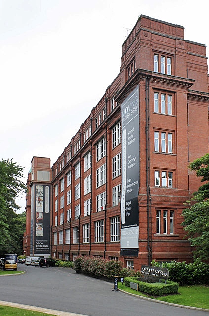
Astley Bridge Mill
Astley Bridge Mill or Holden Mill is a former cotton mill in the district of Astley Bridge in Bolton, Greater Manchester, England, which has since been...

Sharples, Greater Manchester
Sharples, a suburb of Bolton, was a township of the civil and ecclesiastical parish of Bolton le Moors in the Salford hundred of Lancashire, England. It...
Sharples School
Sharples School is a co-educational secondary school located in the Sharples area of Bolton in the English county of Greater Manchester.Established in...
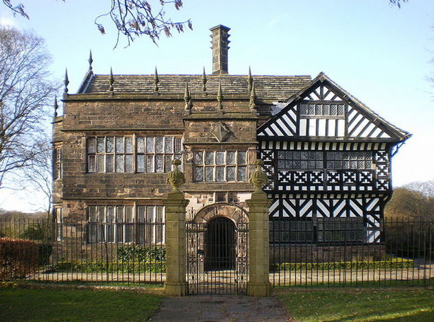
Hall i' th' Wood
Hall i' th' Wood is an early 16th-century manor house in Bolton in the historic county of Lancashire and the ceremonial county of Greater Manchester, England...
Astley Bridge
Astley Bridge is predominantly a residential district of Bolton in Greater Manchester, England. It is 2.5 miles (4 km) north of Bolton town centre, 11...

Eagley Brook
Eagley Brook (also known during the formative part of its course as Belmont Brook) is a small river of Lancashire and Greater Manchester in England. Rising...
Astley Brook
Astley Brook is a river in Greater Manchester, England.Rising at the confluence of Dean Brook and Raveden Brook near Halliwell in the Metropolitan Borough...
Astley Bridge railway station
Astley Bridge railway station served the village of Astley Bridge, England, from 1877 to 1879 on the Astley Branch Railway. == History == In 1871, the...
Nearby Amenities
Located within 500m of 53.602443,-2.427634Have you been to Astley Bridge?
Leave your review of Astley Bridge below (or comments, questions and feedback).