Burrows Hill Covert

Wood, Forest in Lincolnshire East Lindsey

England

Burrows Hill Covert

Mavis Enderby: aerial 2016
Mavis Enderby: aerial 2016 Credit: Chris

Burrows Hill Covert is a woodland area located in the county of Lincolnshire, England. Situated near the village of Burrows Hill, the covert covers a total area of approximately 100 acres. It is a part of the larger Lincolnshire Wolds Area of Outstanding Natural Beauty, known for its picturesque landscapes and diverse wildlife.

The woodland is primarily composed of native deciduous trees, such as oak, beech, and birch, which create a dense and vibrant canopy. The forest floor is covered with a rich carpet of wildflowers, ferns, and mosses, adding to the area's natural beauty and biodiversity.

Burrows Hill Covert serves as an important habitat for a wide range of flora and fauna. The wood is home to several species of birds, including woodpeckers, owls, and various songbirds. Mammals such as foxes, badgers, and deer can also be found here, along with numerous species of insects and smaller mammals.

Visitors to the covert can enjoy a peaceful and tranquil environment, perfect for walking, birdwatching, and nature photography. Several well-maintained footpaths and trails wind through the woodland, offering picturesque views and opportunities to explore the diverse ecosystems within the forest.

The management of Burrows Hill Covert is overseen by the local conservation authority, ensuring the protection and preservation of its natural resources. Regular maintenance activities, such as tree planting and invasive species control, are carried out to maintain the health and vitality of the woodland.

Overall, Burrows Hill Covert is a beautiful and ecologically significant woodland area that provides a haven for wildlife and a peaceful retreat for nature enthusiasts.

If you have any feedback on the listing, please let us know in the comments section below.

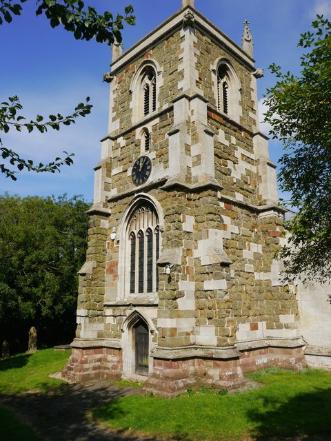
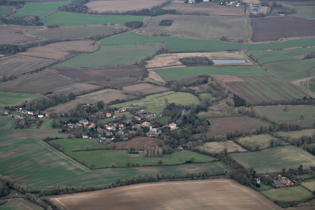
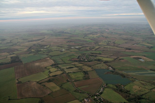
Burrows Hill Covert Images

Images are sourced within 2km of 53.184152/0.036315277 or Grid Reference TF3667. Thanks to Geograph Open Source API. All images are credited.

Mavis Enderby: aerial 2016
Raithby by Spilsby, Holy Trinity Church The tower of Holy Trinity church.  To the right of the disused doorway is a cut benchmark.  See <span class="nowrap"><a title="http://www.bench-marks.org.uk/bm78106" rel="nofollow ugc noopener" href="http://www.bench-marks.org.uk/bm78106">Link</a><img style="margin-left:2px;" alt="External link" title="External link - shift click to open in new window" src="https://s1.geograph.org.uk/img/external.png" width="10" height="10"/></span> for details and <a title="https://www.geograph.org.uk/photo/5081107" href="https://www.geograph.org.uk/photo/5081107">Link</a> for a close-up.
Raithby by Spilsby, Holy Trinity Church
The tower of Holy Trinity church. To the right of the disused doorway is a cut benchmark. See LinkExternal link for details and Link for a close-up.
Cut Mark: Raithby by Spilsby, Holy Trinity Church A cut benchmark to the right of the disused doorway in the west face of the church tower.  See <span class="nowrap"><a title="http://www.bench-marks.org.uk/bm78106" rel="nofollow ugc noopener" href="http://www.bench-marks.org.uk/bm78106">Link</a><img style="margin-left:2px;" alt="External link" title="External link - shift click to open in new window" src="https://s1.geograph.org.uk/img/external.png" width="10" height="10"/></span> for details of the mark and <a title="https://www.geograph.org.uk/photo/5081104" href="https://www.geograph.org.uk/photo/5081104">Link</a> for a wider view.
Cut Mark: Raithby by Spilsby, Holy Trinity Church
A cut benchmark to the right of the disused doorway in the west face of the church tower. See LinkExternal link for details of the mark and Link for a wider view.
Cut Mark: Raithby, Raithby Road Cut bench mark near the front door of a cottage in Raithby by Spilsby.  See <a title="https://www.geograph.org.uk/photo/5109098" href="https://www.geograph.org.uk/photo/5109098">Link</a> for a view of the cottages and <span class="nowrap"><a title="http://www.bench-marks.org.uk/bm27588" rel="nofollow ugc noopener" href="http://www.bench-marks.org.uk/bm27588">Link</a><img style="margin-left:2px;" alt="External link" title="External link - shift click to open in new window" src="https://s1.geograph.org.uk/img/external.png" width="10" height="10"/></span> for details of the mark.
Cut Mark: Raithby, Raithby Road
Cut bench mark near the front door of a cottage in Raithby by Spilsby. See Link for a view of the cottages and LinkExternal link for details of the mark.
Cottages in Raithby by Spilsby The right-hand cottage carries a cut bench mark close to the extension.  See <a title="https://www.geograph.org.uk/photo/5109093" href="https://www.geograph.org.uk/photo/5109093">Link</a> for a close-up and <span class="nowrap"><a title="http://www.bench-marks.org.uk/bm27588" rel="nofollow ugc noopener" href="http://www.bench-marks.org.uk/bm27588">Link</a><img style="margin-left:2px;" alt="External link" title="External link - shift click to open in new window" src="https://s1.geograph.org.uk/img/external.png" width="10" height="10"/></span> for details of the mark.
Cottages in Raithby by Spilsby
The right-hand cottage carries a cut bench mark close to the extension. See Link for a close-up and LinkExternal link for details of the mark.
Sow Dale: aerial 2016
Raithby by Spilsby: aerial 2016
Raithby by Spilsby: aerial 2016 Taken from overhead Hundleby. Mavis Enderby centre left.
Raithby by Spilsby: aerial 2016
Taken from overhead Hundleby. Mavis Enderby centre left.
Mavis Enderby across Wheelabout Wood: aerial 2016
Raithby by Spilsby: aerial 2016 From Hundleby.
Raithby by Spilsby: aerial 2016
From Hundleby.
B1195 towards Mavis Enderby Approaching from the North West.
B1195 towards Mavis Enderby
Approaching from the North West.
St Michael and All Angels church, Mavis Enderby View from the south.
St Michael and All Angels church, Mavis Enderby
View from the south.
Interior, St Michael and All Angels church, Mavis Enderby 
Grade II*listed

There is no mention of the church in the Domesday book, but there are indications that the first building was early Norman. The church is first documented in 1280.

The church is constructed with greenstone with brickwork and ashlar dressings. The roof is slate.
There is a western tower, nave with south aisle, chancel, vestry, and south porch.
The tower is of three stages dating from the 15th century, it was largely rebuilt in the 19th century. It has a plain parapet and crocketted pinnacles. 
There is a date stone of 1684 on a plaque which marks the rebuilding of the tower which had collapsed. On the second stage of the tower there is another date stone of 1894 from when the upper part was rebuilt.

There a three bay south arcade with octagonal piers from the 15th century.
The nave also has three 19th-century dormer windows on the south side which were in inserted in 1911.

The chancel was rebuilt in 1870 by James Fowler, the 15th century chancel arch being retained. There is a modern rood loft and screen, the original rood stairs are still present. Either side of the rood are two wooden carved Angels, probably dating from the 15th century and taken from Louth church.
In the 19th century porch there is a Norman holy water stoup.

There is a 14th century octagonal font set on a Minton tile dias.

In 1877 the church underwent major restoration which included new roofs, porch, installation of heating, new floors plus other improvements. This was not finished until 1894 due to financial issues.
Interior, St Michael and All Angels church, Mavis Enderby
Grade II*listed There is no mention of the church in the Domesday book, but there are indications that the first building was early Norman. The church is first documented in 1280. The church is constructed with greenstone with brickwork and ashlar dressings. The roof is slate. There is a western tower, nave with south aisle, chancel, vestry, and south porch. The tower is of three stages dating from the 15th century, it was largely rebuilt in the 19th century. It has a plain parapet and crocketted pinnacles. There is a date stone of 1684 on a plaque which marks the rebuilding of the tower which had collapsed. On the second stage of the tower there is another date stone of 1894 from when the upper part was rebuilt. There a three bay south arcade with octagonal piers from the 15th century. The nave also has three 19th-century dormer windows on the south side which were in inserted in 1911. The chancel was rebuilt in 1870 by James Fowler, the 15th century chancel arch being retained. There is a modern rood loft and screen, the original rood stairs are still present. Either side of the rood are two wooden carved Angels, probably dating from the 15th century and taken from Louth church. In the 19th century porch there is a Norman holy water stoup. There is a 14th century octagonal font set on a Minton tile dias. In 1877 the church underwent major restoration which included new roofs, porch, installation of heating, new floors plus other improvements. This was not finished until 1894 due to financial issues.
Chancel, St Michael and All Angels church, Mavis Enderby 
Grade II*listed

There is no mention of the church in the Domesday book, but there are indications that the first building was early Norman. The church is first documented in 1280.

The church is constructed with greenstone with brickwork and ashlar dressings. The roof is slate.
There is a western tower, nave with south aisle, chancel, vestry, and south porch.
The tower is of three stages dating from the 15th century, it was largely rebuilt in the 19th century. It has a plain parapet and crocketted pinnacles. 
There is a date stone of 1684 on a plaque which marks the rebuilding of the tower which had collapsed. On the second stage of the tower there is another date stone of 1894 from when the upper part was rebuilt.

There a three bay south arcade with octagonal piers from the 15th century.
The nave also has three 19th-century dormer windows on the south side which were in inserted in 1911.

The chancel was rebuilt in 1870 by James Fowler, the 15th century chancel arch being retained. There is a modern rood loft and screen, the original rood stairs are still present. Either side of the rood are two wooden carved Angels, probably dating from the 15th century and taken from Louth church.
In the 19th century porch there is a Norman holy water stoup.

There is a 14th century octagonal font set on a Minton tile dias.

In 1877 the church underwent major restoration which included new roofs, porch, installation of heating, new floors plus other improvements. This was not finished until 1894 due to financial issues.
Chancel, St Michael and All Angels church, Mavis Enderby
Grade II*listed There is no mention of the church in the Domesday book, but there are indications that the first building was early Norman. The church is first documented in 1280. The church is constructed with greenstone with brickwork and ashlar dressings. The roof is slate. There is a western tower, nave with south aisle, chancel, vestry, and south porch. The tower is of three stages dating from the 15th century, it was largely rebuilt in the 19th century. It has a plain parapet and crocketted pinnacles. There is a date stone of 1684 on a plaque which marks the rebuilding of the tower which had collapsed. On the second stage of the tower there is another date stone of 1894 from when the upper part was rebuilt. There a three bay south arcade with octagonal piers from the 15th century. The nave also has three 19th-century dormer windows on the south side which were in inserted in 1911. The chancel was rebuilt in 1870 by James Fowler, the 15th century chancel arch being retained. There is a modern rood loft and screen, the original rood stairs are still present. Either side of the rood are two wooden carved Angels, probably dating from the 15th century and taken from Louth church. In the 19th century porch there is a Norman holy water stoup. There is a 14th century octagonal font set on a Minton tile dias. In 1877 the church underwent major restoration which included new roofs, porch, installation of heating, new floors plus other improvements. This was not finished until 1894 due to financial issues.
West window, St Michael and All Angels church, Mavis Enderby The Ascension, by James Powell, 1914. Made by Clayton & Powell.
West window, St Michael and All Angels church, Mavis Enderby
The Ascension, by James Powell, 1914. Made by Clayton & Powell.
East window, St Michael and All Angels church, Mavis Enderby An unusual design depicting Christ in Glory with St Michael.
further detail unknown.
East window, St Michael and All Angels church, Mavis Enderby
An unusual design depicting Christ in Glory with St Michael. further detail unknown.
Stained glass window, St Michael and All Angels church, Mavis Enderby A window featuring The Lord's Prayer, depicting The Agony in the Garden.
Note the use of "Abba Father", the word Abba is an Aramaic word that would most closely be translated as “Daddy”.
Stained glass window, St Michael and All Angels church, Mavis Enderby
A window featuring The Lord's Prayer, depicting The Agony in the Garden. Note the use of "Abba Father", the word Abba is an Aramaic word that would most closely be translated as “Daddy”.
Stained glass window, St Michael and All Angels church, Mavis Enderby Crucifixion scene based on part of the Litany "By thy Cross and Passion, good Lord deliver us".
The artist appears to be the same as <a href="https://www.geograph.org.uk/photo/5428851">TF3666 : Stained glass window, St Michael and All Angels church, Mavis Enderby</a>.
Stained glass window, St Michael and All Angels church, Mavis Enderby
Crucifixion scene based on part of the Litany "By thy Cross and Passion, good Lord deliver us". The artist appears to be the same as TF3666 : Stained glass window, St Michael and All Angels church, Mavis Enderby.
Show me another place!

Burrows Hill Covert is located at Grid Ref: TF3667 (Lat: 53.184152, Lng: 0.036315277)

Administrative County: Lincolnshire

District: East Lindsey

Police Authority: Lincolnshire

What 3 Words

///finishes.demotion.extreme. Near Spilsby, Lincolnshire

Related Wikis

Mavis Enderby

Mavis Enderby is a hamlet and civil parish in the East Lindsey district of Lincolnshire, England. It lies in the Lincolnshire Wolds, 4.5 miles (7 km) east...

Raithby by Spilsby

Raithby by Spilsby or Raithby is a village and civil parish in the East Lindsey district of Lincolnshire, England. It is situated about 2 miles (3.2 km...

Chapel at Raithby Hall

The small Methodist chapel at Raithby Hall in Raithby by Spilsby is the oldest Methodist chapel in Lincolnshire, and one of the oldest in England. It is...

Lusby, Lincolnshire

Lusby is a village and former civil parish, now in the parish of Lusby with Winceby, in the East Lindsey district of Lincolnshire, England. It is situated...

Nearby Amenities

Located within 500m of 53.184152,0.036315277
Northfield Farm Airstrip
Addr City: Mavis Enderby
Aeroway: aerodrome
Lat/Long: 53.1871658/0.031761
The data included in this document is from www.openstreetmap.org. The data is made available under ODbL.

Have you been to Burrows Hill Covert?

Leave your review of Burrows Hill Covert below (or comments, questions and feedback).