Basin Holt

Wood, Forest in Lincolnshire East Lindsey

England

Basin Holt

Mavis Enderby: aerial 2021
Mavis Enderby: aerial 2021 Credit: Chris

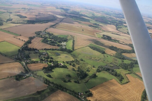
Basin Holt is a small village located in the county of Lincolnshire, England. Situated within a rural setting, it is known for its picturesque woodlands and serene forest areas. The village is nestled amidst the gently rolling hills and offers a peaceful and tranquil environment for its residents and visitors.

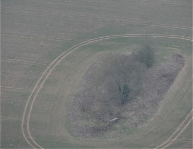
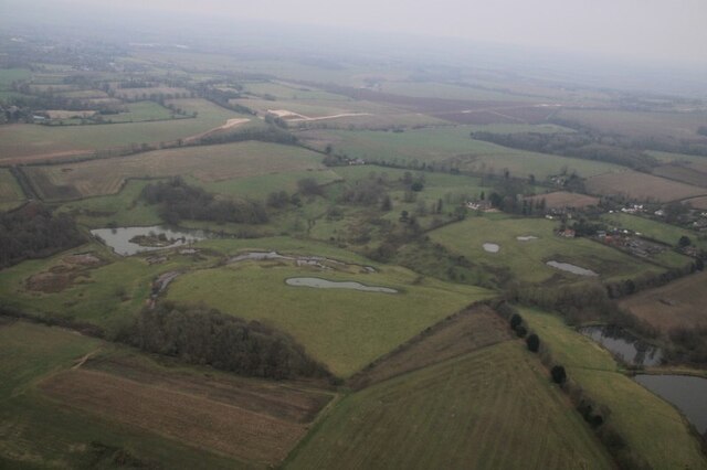
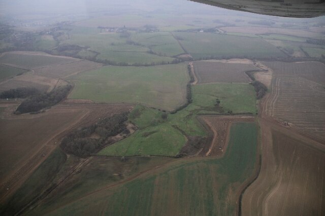
The woodlands surrounding Basin Holt are a prominent feature and provide an idyllic setting for nature lovers and outdoor enthusiasts. The lush vegetation and diverse array of trees create a rich and vibrant ecosystem, attracting a variety of bird species and wildlife. Walking trails and footpaths wind their way through the forest, allowing visitors to explore and immerse themselves in the natural beauty of the area.

Despite its small size, Basin Holt boasts a close-knit community that takes pride in preserving the village's charm and character. The local residents are friendly and welcoming, creating a warm and inviting atmosphere.

The village itself has a few amenities, including a small convenience store and a traditional pub, where locals and visitors can enjoy a pint of ale or a hearty meal. Additionally, Basin Holt is within close proximity to larger towns and cities, providing easy access to a wider range of services and facilities.

Overall, Basin Holt, Lincolnshire (Wood, Forest) offers a peaceful retreat for those seeking a tranquil escape amidst nature's beauty. Its woodlands and forest areas provide a haven for wildlife and a peaceful haven for residents and visitors alike.

If you have any feedback on the listing, please let us know in the comments section below.

Basin Holt Images

Images are sourced within 2km of 53.188734/0.045423625 or Grid Reference TF3667. Thanks to Geograph Open Source API. All images are credited.

Mavis Enderby: aerial 2021
Field NW of Hundleby: aerial 2021
Possible barrow near Northfield Farm, Mavis Enderby: aerial 2022
Fields NNW of Raithby by Spilsby: aerial 2022
Fields NE of Mavis Enderby: aerial 2022
Valley east of Lusby: aerial 2022
Bridleway to Toynton All Saints
Path to the church, Raithby by Spilsby
Field of maize, Raithby by Spilsby
Raithby by Spilsby: aerial 2023
Holy Trinity church, Raithby by Spilsby View from the south.
Holy Trinity church, Raithby by Spilsby
View from the south.
Interior, Holy Trinity Church, Raithby by Spilsby View east.
Interior, Holy Trinity Church, Raithby by Spilsby
View east.
West window, Holy Trinity Church, Raithby by Spilsby Glass by Kempe in memory of Mary Jeanette Rawnsley, 1896 showing incarnation scenes.
West window, Holy Trinity Church, Raithby by Spilsby
Glass by Kempe in memory of Mary Jeanette Rawnsley, 1896 showing incarnation scenes.
Chancel ceiling and screen, Holy Trinity Church, Raithby by Spilsby Grade II*listed

Raithby is mentioned in the Domesday book, and the church dates from the twelfth century onwards, and was rebuilt in 1873. The chancel was enlarged and the organ chamber was added in 1886, and the tower was renewed in 1895.

The church is built in greenstone with ashlar dressings, and lead roofs.

There is a western tower, nave, aisles, chancel, south porch, and vestry.
The tower is of three stages with a plain parapet, corner gargoyles and crocketted pinnacles. There are three bells.

The nave has three bay arcades with octagonal piers which are probably original Norman. The south aisle has one round and one square, probably from the restoration.
The chancel has a painted ceiling and rood screen. The reredos is probably by Temple Moore.
There is no organ anymore, the organ front is a dummy.

The Lych gate is from 1907.
Chancel ceiling and screen, Holy Trinity Church, Raithby by Spilsby
Grade II*listed Raithby is mentioned in the Domesday book, and the church dates from the twelfth century onwards, and was rebuilt in 1873. The chancel was enlarged and the organ chamber was added in 1886, and the tower was renewed in 1895. The church is built in greenstone with ashlar dressings, and lead roofs. There is a western tower, nave, aisles, chancel, south porch, and vestry. The tower is of three stages with a plain parapet, corner gargoyles and crocketted pinnacles. There are three bells. The nave has three bay arcades with octagonal piers which are probably original Norman. The south aisle has one round and one square, probably from the restoration. The chancel has a painted ceiling and rood screen. The reredos is probably by Temple Moore. There is no organ anymore, the organ front is a dummy. The Lych gate is from 1907.
East window, Holy Trinity Church, Raithby by Spilsby Depicting Christ in majesty.
Details unknown. The dedication is obscured by the reredos.
East window, Holy Trinity Church, Raithby by Spilsby
Depicting Christ in majesty. Details unknown. The dedication is obscured by the reredos.
Stained glass window,Holy Trinity Church, Raithby by Spilsby The Ascension and The Resurrection. In memory of Coleridge J. Kennard, d. 1890.
Artist unknown.
Stained glass window,Holy Trinity Church, Raithby by Spilsby
The Ascension and The Resurrection. In memory of Coleridge J. Kennard, d. 1890. Artist unknown.
Organ Façade, Holy Trinity Church, Raithby by Spilsby Originally there was a Bryceson Organ from 1888, but this was removed about 50 years ago, leaving just the pipe façade and case.
Organ Façade, Holy Trinity Church, Raithby by Spilsby
Originally there was a Bryceson Organ from 1888, but this was removed about 50 years ago, leaving just the pipe façade and case.
Interior, Holy Trinity Church, Raithby by Spilsby Looking west from the chancel.
Interior, Holy Trinity Church, Raithby by Spilsby
Looking west from the chancel.
Show me another place!

Basin Holt is located at Grid Ref: TF3667 (Lat: 53.188734, Lng: 0.045423625)

Administrative County: Lincolnshire

District: East Lindsey

Police Authority: Lincolnshire

What 3 Words

///cookery.fluctuate.vegetable. Near Spilsby, Lincolnshire

Related Wikis

Raithby by Spilsby

Raithby by Spilsby or Raithby is a village and civil parish in the East Lindsey district of Lincolnshire, England. It is situated about 2 miles (3.2 km...

Chapel at Raithby Hall

The small Methodist chapel at Raithby Hall in Raithby by Spilsby is the oldest Methodist chapel in Lincolnshire, and one of the oldest in England. It is...

Mavis Enderby

Mavis Enderby is a hamlet and civil parish in the East Lindsey district of Lincolnshire, England. It lies in the Lincolnshire Wolds, 4.5 miles (7 km) east...

Sausthorpe

Sausthorpe is a small village and civil parish in the East Lindsey district of Lincolnshire, England, 8 miles (13 km) east of Horncastle and 3 miles (4...

Nearby Amenities

Located within 500m of 53.188734,0.045423625
Power: pole
Lat/Long: 53.1922192/0.0412059
Power: pole
Lat/Long: 53.1917807/0.0427343
Power: pole
Lat/Long: 53.1926389/0.0435
Power: pole
Lat/Long: 53.193035/0.0449779
Power: pole
Lat/Long: 53.1912255/0.0446775
Power: pole
Lat/Long: 53.1919355/0.0459768
Power: pole
Lat/Long: 53.1926702/0.0472967
Power: pole
Lat/Long: 53.1905023/0.0453212
Power: pole
Lat/Long: 53.1914494/0.0450957
Power: pole
Lat/Long: 53.1915522/0.0435534
Power: pole
Lat/Long: 53.1896916/0.0460427
Power: pole
Lat/Long: 53.1888776/0.0467629
Power: pole
Lat/Long: 53.1862691/0.0484353
Power: pole
Lat/Long: 53.1872583/0.0479122
Power: pole
Lat/Long: 53.18807/0.0474831
Power: pole
Lat/Long: 53.185345/0.0489114
Raithby Crossroads
Place: locality
Source: Bing
Lat/Long: 53.1878344/0.0486618
Direction: WSW
Generator Method: photovoltaic
Generator Output Electricity: yes
Generator Solar Modules: 5
Generator Source: solar
Generator Type: solar_photovoltaic_panel
Location: roof
Power: generator
Lat/Long: 53.1863113/0.050239
Direction: SSE
Generator Method: photovoltaic
Generator Output Electricity: yes
Generator Solar Modules: 10
Generator Source: solar
Generator Type: solar_photovoltaic_panel
Location: roof
Power: generator
Lat/Long: 53.1862289/0.0502303
The data included in this document is from www.openstreetmap.org. The data is made available under ODbL.

Have you been to Basin Holt?

Leave your review of Basin Holt below (or comments, questions and feedback).