Standgrove Wood

Wood, Forest in Sussex Mid Sussex

England

Standgrove Wood

Bridleway 42 Ar This, together with its continuation 33Ba, follows the east side of Ardingly Reservoir.
Bridleway 42 Ar Credit: Robin Webster

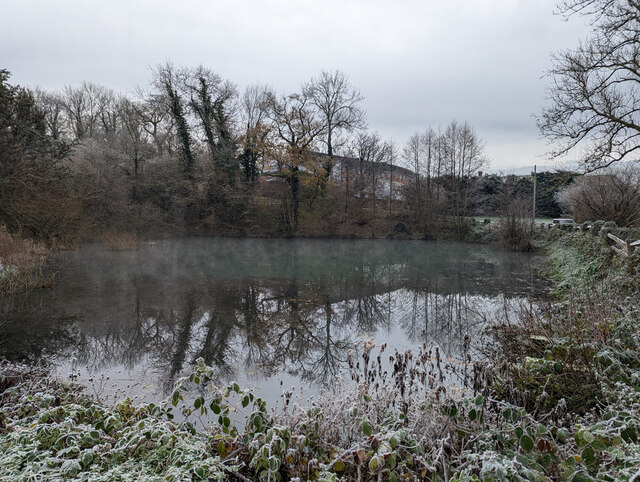
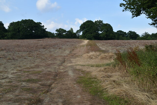
Standgrove Wood is a picturesque woodland located in Sussex, England. Covering an area of approximately 100 hectares, it is a diverse and vibrant ecosystem that offers a tranquil retreat for nature enthusiasts and visitors alike.

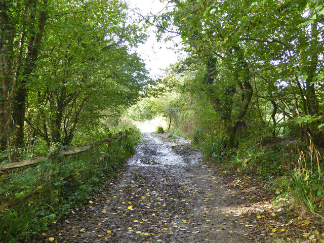
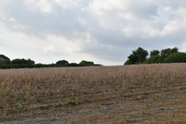
The wood is characterized by its dense canopy of oak, beech, and chestnut trees, which provide ample shade and shelter for a wide variety of flora and fauna. Bluebells carpet the forest floor during the spring months, creating a stunning display of color and fragrance. In addition to the bluebells, the woodland is home to an array of wildflowers, including primroses, wood anemones, and wild garlic, which add to the woodland's natural beauty.

Standgrove Wood is also home to a diverse range of wildlife. Red foxes, badgers, and grey squirrels can often be spotted scurrying through the undergrowth, while a plethora of bird species, including woodpeckers, thrushes, and owls, can be heard chirping and singing from the treetops. The wood is designated as a Site of Special Scientific Interest (SSSI), highlighting its importance for conservation.

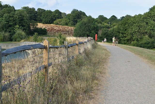
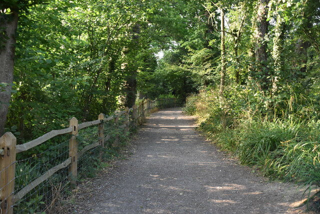
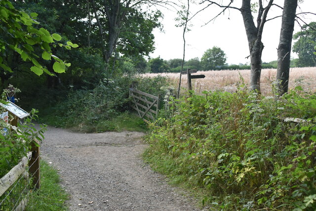
For those seeking recreational activities, Standgrove Wood offers numerous walking trails and paths that wind their way through the forest, allowing visitors to explore its natural wonders at their own pace. The wood is also a popular spot for birdwatching, photography, and picnicking, providing a peaceful and idyllic setting for outdoor enthusiasts.

Overall, Standgrove Wood is a captivating woodland that showcases the beauty and biodiversity of Sussex. Its enchanting atmosphere and abundant wildlife make it a haven for nature lovers and a must-visit destination for anyone seeking solace in the great outdoors.

If you have any feedback on the listing, please let us know in the comments section below.

Standgrove Wood Images

Images are sourced within 2km of 51.039115/-0.083487056 or Grid Reference TQ3428. Thanks to Geograph Open Source API. All images are credited.

Bridleway 42 Ar This, together with its continuation 33Ba, follows the east side of Ardingly Reservoir.
Bridleway 42 Ar
This, together with its continuation 33Ba, follows the east side of Ardingly Reservoir.
Ardingly Reservoir
Ardingly Reservoir
Field near Townhouse Farm Looking up from the path by Ardingly Reservoir.
Field near Townhouse Farm
Looking up from the path by Ardingly Reservoir.
Ardingly Reservoir - from the dam
Houses on High Street
Ardingly Post Office
Saucelands Pond Ardingly College is beyond.
Saucelands Pond
Ardingly College is beyond.
Ardingly Reservoir overflow tower Ardingly Reservoir is a 198-acre (0.80 km2) reservoir that feeds the River Ouse in West Sussex, 5 miles (8 km) north of Haywards Heath. The villages of Ardingly and Balcombe are immediately to the east and north of the reservoir respectively. The reservoir was created in 1978 by damming Shell Brook, a tributary of the River Ouse which flows into the Ouse about 500m south of the Reservoir.

The Ardingly Activity Centre provides watersports for the public including wind surfing, canoeing, powerboating and dinghy sailing.

The reservoir is a popular fishing venue offering 3 miles (5 km) of freshwater fishing for carp, tench, pike, roach, rudd, eel, gudgeon, European perch and bream.

The west bank of the reservoir is private property of the Balcombe Estate but the north, south and east shores offer public rights of way and bridleways. Ornithologists are catered for with two bird hides situated on the east bank.

The site is a local Nature Reserve <span class="nowrap"><a title="http://en.wikipedia.org/wiki/Ardingly_Reservoir" rel="nofollow ugc noopener" href="http://en.wikipedia.org/wiki/Ardingly_Reservoir">Link</a><img style="margin-left:2px;" alt="External link" title="External link - shift click to open in new window" src="https://s1.geograph.org.uk/img/external.png" width="10" height="10"/></span>
Ardingly Reservoir overflow tower
Ardingly Reservoir is a 198-acre (0.80 km2) reservoir that feeds the River Ouse in West Sussex, 5 miles (8 km) north of Haywards Heath. The villages of Ardingly and Balcombe are immediately to the east and north of the reservoir respectively. The reservoir was created in 1978 by damming Shell Brook, a tributary of the River Ouse which flows into the Ouse about 500m south of the Reservoir. The Ardingly Activity Centre provides watersports for the public including wind surfing, canoeing, powerboating and dinghy sailing. The reservoir is a popular fishing venue offering 3 miles (5 km) of freshwater fishing for carp, tench, pike, roach, rudd, eel, gudgeon, European perch and bream. The west bank of the reservoir is private property of the Balcombe Estate but the north, south and east shores offer public rights of way and bridleways. Ornithologists are catered for with two bird hides situated on the east bank. The site is a local Nature Reserve LinkExternal link
Ardingly Reservoir Ardingly Reservoir is a 198-acre (0.80 km2) reservoir that feeds the River Ouse in West Sussex, 5 miles (8 km) north of Haywards Heath. The villages of Ardingly and Balcombe are immediately to the east and north of the reservoir respectively. The reservoir was created in 1978 by damming Shell Brook, a tributary of the River Ouse which flows into the Ouse about 500m south of the Reservoir.

The Ardingly Activity Centre provides watersports for the public including wind surfing, canoeing, powerboating and dinghy sailing.

The reservoir is a popular fishing venue offering 3 miles (5 km) of freshwater fishing for carp, tench, pike, roach, rudd, eel, gudgeon, European perch and bream.

The west bank of the reservoir is private property of the Balcombe Estate but the north, south and east shores offer public rights of way and bridleways. Ornithologists are catered for with two bird hides situated on the east bank.

The site is a local Nature Reserve <span class="nowrap"><a title="http://en.wikipedia.org/wiki/Ardingly_Reservoir" rel="nofollow ugc noopener" href="http://en.wikipedia.org/wiki/Ardingly_Reservoir">Link</a><img style="margin-left:2px;" alt="External link" title="External link - shift click to open in new window" src="https://s1.geograph.org.uk/img/external.png" width="10" height="10"/></span>
Ardingly Reservoir
Ardingly Reservoir is a 198-acre (0.80 km2) reservoir that feeds the River Ouse in West Sussex, 5 miles (8 km) north of Haywards Heath. The villages of Ardingly and Balcombe are immediately to the east and north of the reservoir respectively. The reservoir was created in 1978 by damming Shell Brook, a tributary of the River Ouse which flows into the Ouse about 500m south of the Reservoir. The Ardingly Activity Centre provides watersports for the public including wind surfing, canoeing, powerboating and dinghy sailing. The reservoir is a popular fishing venue offering 3 miles (5 km) of freshwater fishing for carp, tench, pike, roach, rudd, eel, gudgeon, European perch and bream. The west bank of the reservoir is private property of the Balcombe Estate but the north, south and east shores offer public rights of way and bridleways. Ornithologists are catered for with two bird hides situated on the east bank. The site is a local Nature Reserve LinkExternal link
Ardingly Reservoir Dam
Ardingly Reservoir Ardingly Reservoir is a 198-acre (0.80 km2) reservoir that feeds the River Ouse in West Sussex, 5 miles (8 km) north of Haywards Heath. The villages of Ardingly and Balcombe are immediately to the east and north of the reservoir respectively. The reservoir was created in 1978 by damming Shell Brook, a tributary of the River Ouse which flows into the Ouse about 500m south of the Reservoir.

The Ardingly Activity Centre provides watersports for the public including wind surfing, canoeing, powerboating and dinghy sailing.

The reservoir is a popular fishing venue offering 3 miles (5 km) of freshwater fishing for carp, tench, pike, roach, rudd, eel, gudgeon, European perch and bream.

The west bank of the reservoir is private property of the Balcombe Estate but the north, south and east shores offer public rights of way and bridleways. Ornithologists are catered for with two bird hides situated on the east bank.

The site is a local Nature Reserve <span class="nowrap"><a title="http://en.wikipedia.org/wiki/Ardingly_Reservoir" rel="nofollow ugc noopener" href="http://en.wikipedia.org/wiki/Ardingly_Reservoir">Link</a><img style="margin-left:2px;" alt="External link" title="External link - shift click to open in new window" src="https://s1.geograph.org.uk/img/external.png" width="10" height="10"/></span>
Ardingly Reservoir
Ardingly Reservoir is a 198-acre (0.80 km2) reservoir that feeds the River Ouse in West Sussex, 5 miles (8 km) north of Haywards Heath. The villages of Ardingly and Balcombe are immediately to the east and north of the reservoir respectively. The reservoir was created in 1978 by damming Shell Brook, a tributary of the River Ouse which flows into the Ouse about 500m south of the Reservoir. The Ardingly Activity Centre provides watersports for the public including wind surfing, canoeing, powerboating and dinghy sailing. The reservoir is a popular fishing venue offering 3 miles (5 km) of freshwater fishing for carp, tench, pike, roach, rudd, eel, gudgeon, European perch and bream. The west bank of the reservoir is private property of the Balcombe Estate but the north, south and east shores offer public rights of way and bridleways. Ornithologists are catered for with two bird hides situated on the east bank. The site is a local Nature Reserve LinkExternal link
Footpath, Ardingly Reservoir
Footpath waymarker
Footpath waymarker
Field by Ardingly Reservoir
Footpath to Ardingly
Ardingly Reservoir Ardingly Reservoir is a 198-acre (0.80 km2) reservoir that feeds the River Ouse in West Sussex, 5 miles (8 km) north of Haywards Heath. The villages of Ardingly and Balcombe are immediately to the east and north of the reservoir respectively. The reservoir was created in 1978 by damming Shell Brook, a tributary of the River Ouse which flows into the Ouse about 500m south of the Reservoir.

The Ardingly Activity Centre provides watersports for the public including wind surfing, canoeing, powerboating and dinghy sailing.

The reservoir is a popular fishing venue offering 3 miles (5 km) of freshwater fishing for carp, tench, pike, roach, rudd, eel, gudgeon, European perch and bream.

The west bank of the reservoir is private property of the Balcombe Estate but the north, south and east shores offer public rights of way and bridleways. Ornithologists are catered for with two bird hides situated on the east bank.

The site is a local Nature Reserve <span class="nowrap"><a title="http://en.wikipedia.org/wiki/Ardingly_Reservoir" rel="nofollow ugc noopener" href="http://en.wikipedia.org/wiki/Ardingly_Reservoir">Link</a><img style="margin-left:2px;" alt="External link" title="External link - shift click to open in new window" src="https://s1.geograph.org.uk/img/external.png" width="10" height="10"/></span>
Ardingly Reservoir
Ardingly Reservoir is a 198-acre (0.80 km2) reservoir that feeds the River Ouse in West Sussex, 5 miles (8 km) north of Haywards Heath. The villages of Ardingly and Balcombe are immediately to the east and north of the reservoir respectively. The reservoir was created in 1978 by damming Shell Brook, a tributary of the River Ouse which flows into the Ouse about 500m south of the Reservoir. The Ardingly Activity Centre provides watersports for the public including wind surfing, canoeing, powerboating and dinghy sailing. The reservoir is a popular fishing venue offering 3 miles (5 km) of freshwater fishing for carp, tench, pike, roach, rudd, eel, gudgeon, European perch and bream. The west bank of the reservoir is private property of the Balcombe Estate but the north, south and east shores offer public rights of way and bridleways. Ornithologists are catered for with two bird hides situated on the east bank. The site is a local Nature Reserve LinkExternal link
Townhouse Farmhouse
Townhouse Farmhouse
Track to Ardingly
Track to Ardingly
Show me another place!

Standgrove Wood is located at Grid Ref: TQ3428 (Lat: 51.039115, Lng: -0.083487056)

Administrative County: West Sussex

District: Mid Sussex

Police Authority: Sussex

What 3 Words

///tinkle.scoping.nerd. Near Ardingly, West Sussex

Related Wikis

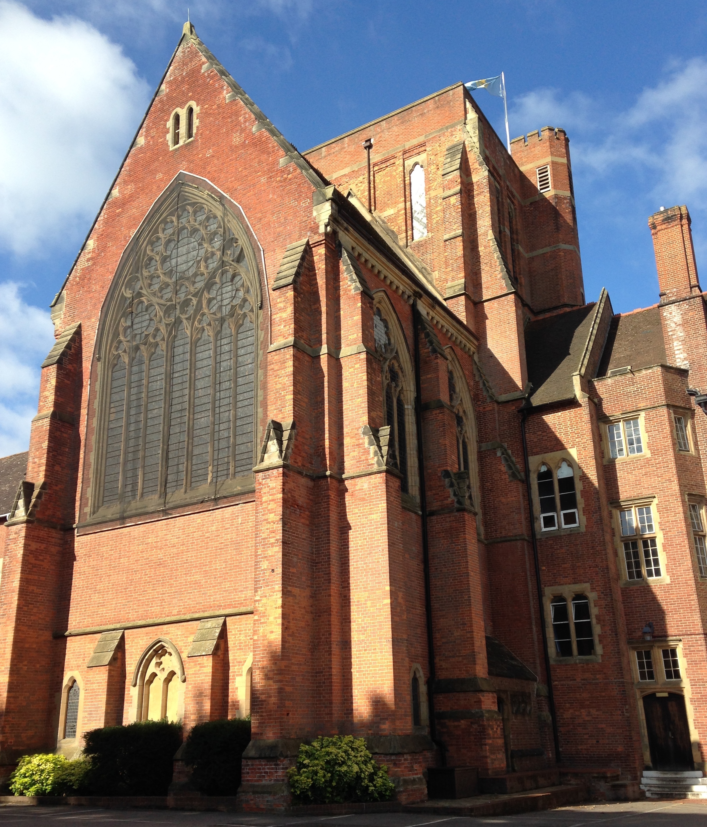
Ardingly College Chapel

The Chapel of S. Saviour is the chapel to Ardingly College in West Sussex, England, and is considered an example of Gothic Revival architecture. The chapel...

Ardingly College

Ardingly College () is a fee-charging boarding and day school in the English public school tradition located near Ardingly, West Sussex, England. The school...

Ardingly railway station

Ardingly was a railway station which served the West Sussex village of Ardingly in England. It was opened on 3 September 1883 by the London, Brighton and...

Ardingly

Ardingly ( AR-ding-lye) is an English village and civil parish in the Mid Sussex district of West Sussex, England. The village is in the High Weald Area...

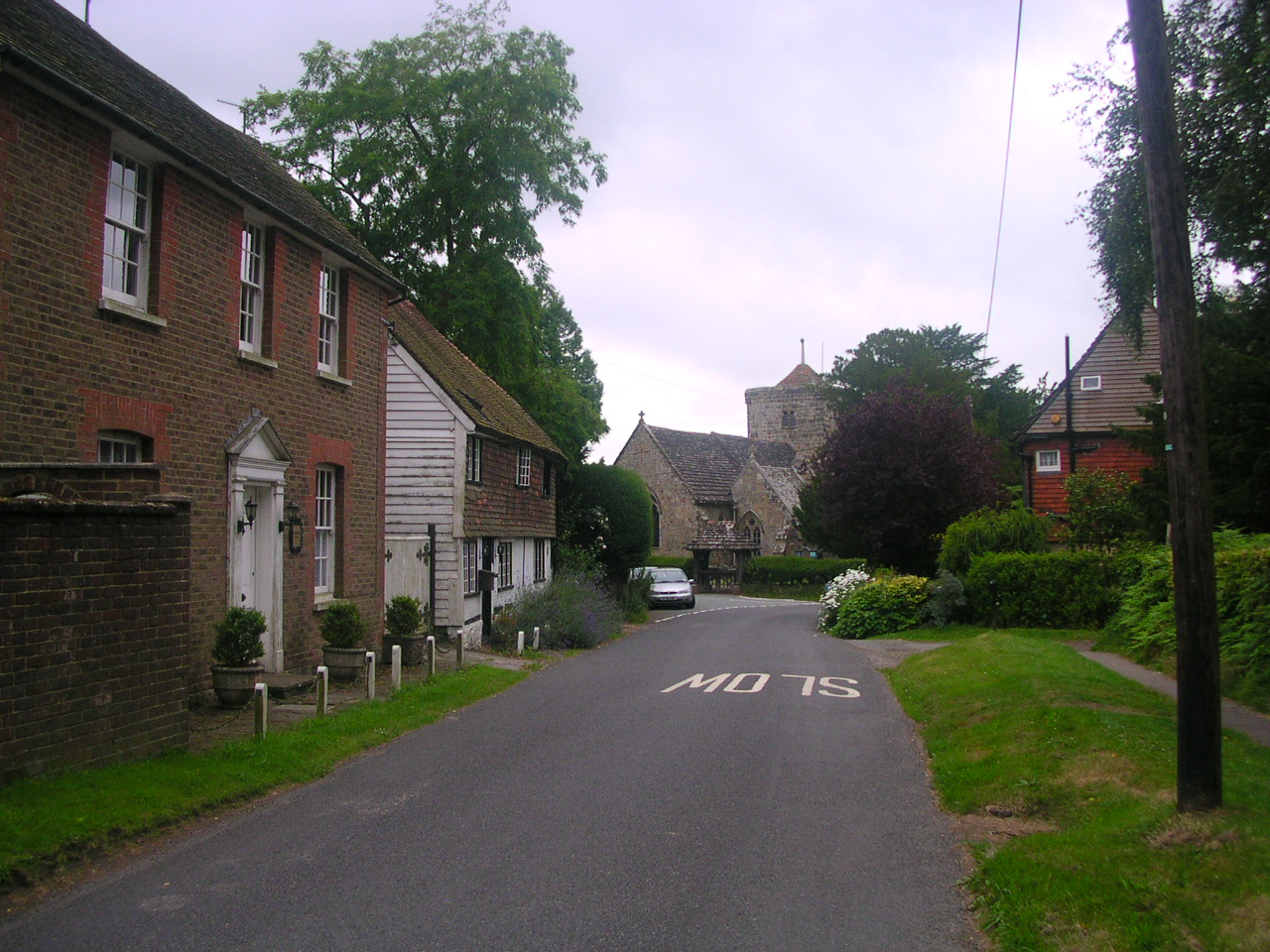
St Peter's Church, Ardingly

St Peter's Church is the Church of England parish church of the parish of Ardingly in Mid Sussex, one of seven local government districts in the English...

South of England Show

The South of England Show is a county show held annually at its own showground in Ardingly, Sussex during June.The show was founded in 1967 and is organised...

Balcombe Place

Balcombe Place is a Grade II* Listed Building, built in 1856 in West Sussex, with a south view across the Ouse Valley. It now forms part of The Balcombe...
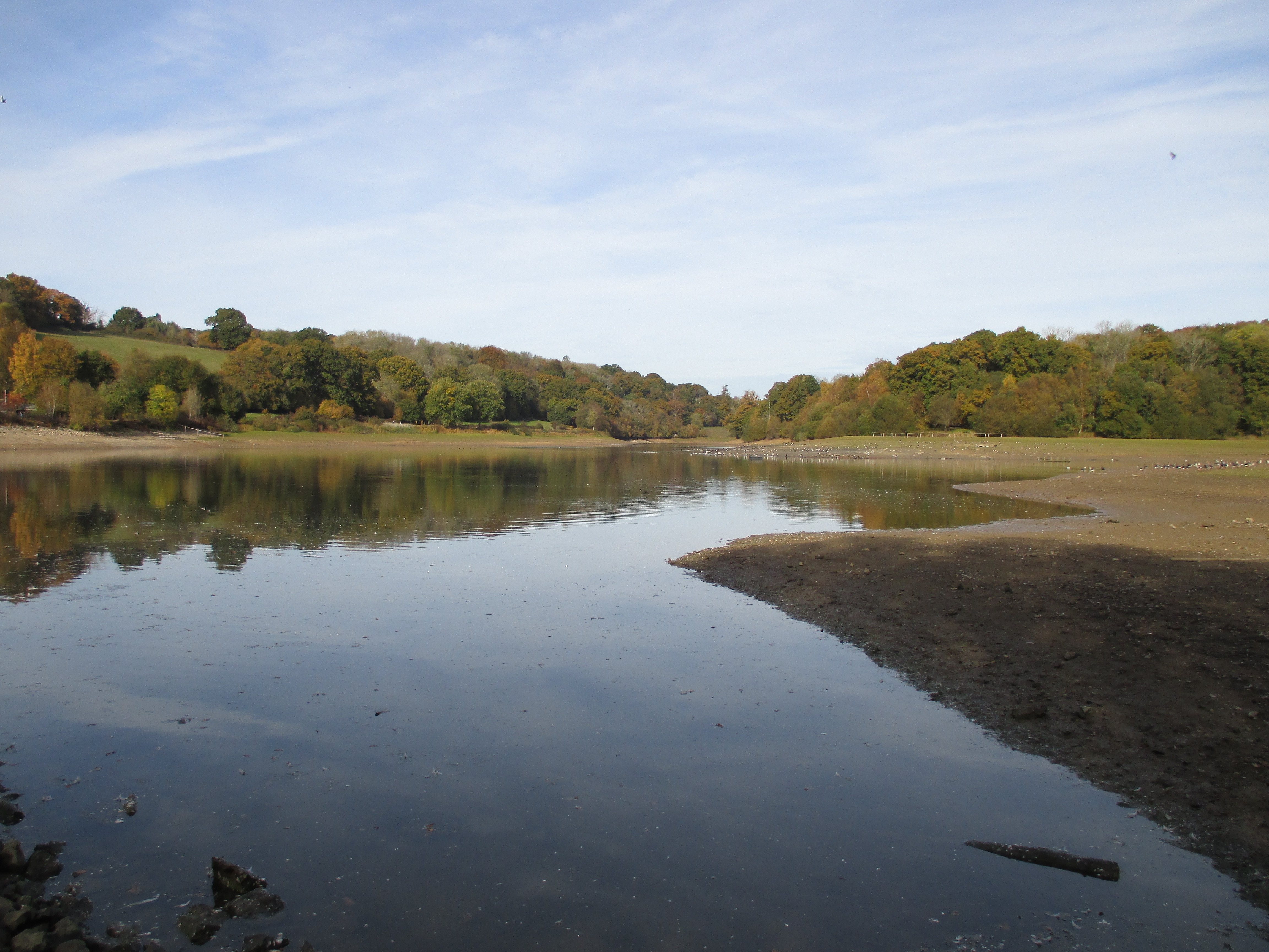
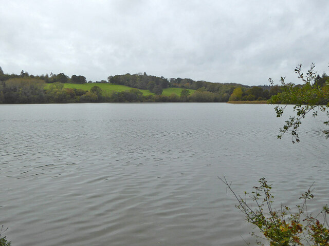
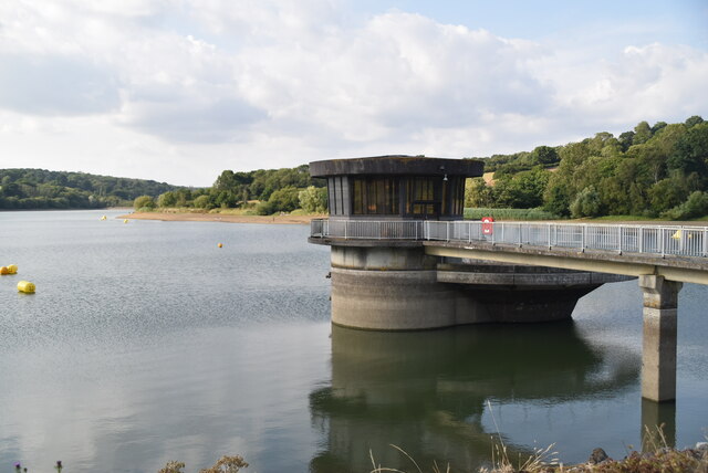
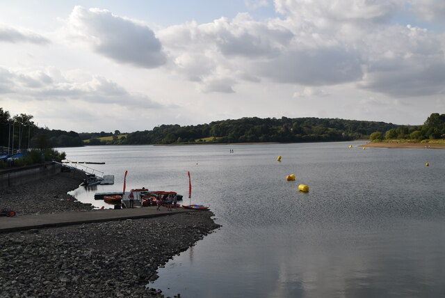
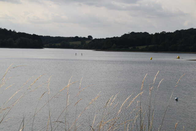
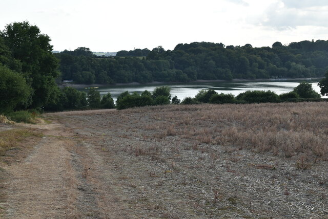
Ardingly Reservoir

Ardingly Reservoir is west of Ardingly in West Sussex. The southern end is a 74.5-hectare (184-acre) Local Nature Reserve owned and managed by South East...

Related Videos

Walking with Jen: Ardingly Reservoir and Ouse Valley Viaduct!

Come along with us to the the Ardingly Reservoir and Ouse Valley Viaduct! I've been reliably informed I mispronounced the ...

Nearby Amenities

Located within 500m of 51.039115,-0.083487056
Ardingly College
Naptan AtcoCode: 4400EG0403
Naptan Bearing: SW
Naptan BusStopType: CUS
Naptan CommonName: Ardingly College
Naptan Indicator: opp
Naptan Landmark: Hail & Ride
Naptan NaptanCode: wsxdwtgm
Naptan Street: College Lane
Naptan Verified: no
Source: naptan_import
Lat/Long: 51.0412896/-0.0865327
Ardingly College
Naptan AtcoCode: 4400EG0404
Naptan Bearing: NE
Naptan BusStopType: CUS
Naptan CommonName: Ardingly College
Naptan Indicator: adj
Naptan Landmark: Hail & Ride
Naptan NaptanCode: wsxdwtgp
Naptan Street: College Lane
Naptan Verified: no
Source: naptan_import
Lat/Long: 51.0413009/-0.0866749
Barrier: stile
Lat/Long: 51.0395798/-0.0794507
Barrier: stile
Lat/Long: 51.0396539/-0.078177
Traffic Signals
Traffic Signals: pedestrian_crossing
Lat/Long: 51.0403535/-0.0873679
Power: pole
Lat/Long: 51.043227/-0.0857968
Library
Lat/Long: 51.0407468/-0.089146
Dance Teaching: yes
Leisure: dance
Lat/Long: 51.040235/-0.088993
The data included in this document is from www.openstreetmap.org. The data is made available under ODbL.

Have you been to Standgrove Wood?

Leave your review of Standgrove Wood below (or comments, questions and feedback).