Burygreen Plantation

Wood, Forest in Hertfordshire Broxbourne

England

Burygreen Plantation

The Great Cambridge Road, Cheshunt
The Great Cambridge Road, Cheshunt Credit: David Howard

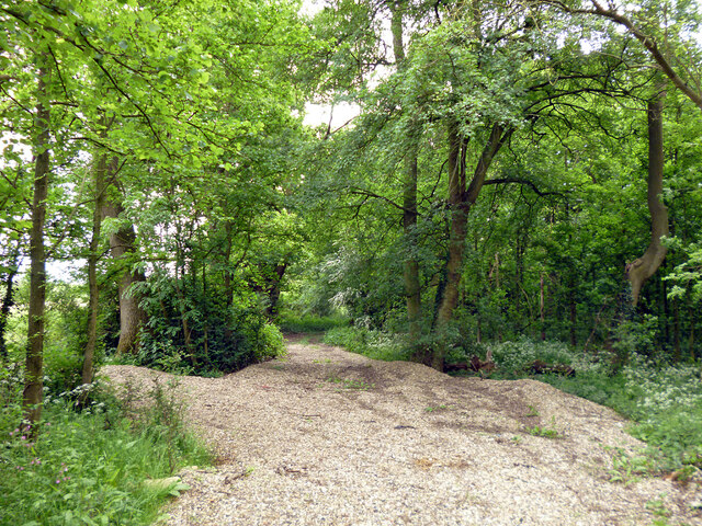
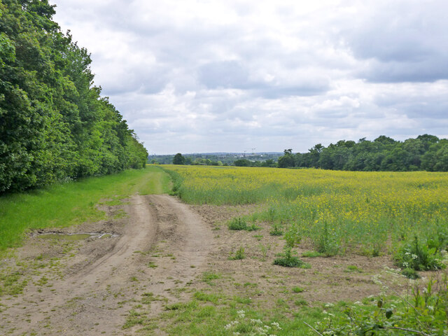
Burygreen Plantation is a picturesque woodland located in Hertfordshire, England. Situated near the village of Cheshunt, it covers an extensive area of approximately 200 acres. The plantation is predominantly made up of broadleaf trees, creating a diverse and vibrant forest ecosystem.

The woodland is well-known for its stunning natural beauty, attracting visitors from near and far. It offers a tranquil and peaceful environment, making it a popular spot for nature lovers, hikers, and photographers. The plantation is home to a variety of wildlife, including deer, rabbits, squirrels, and numerous bird species.

Burygreen Plantation boasts a network of well-maintained footpaths, allowing visitors to explore the woodland at their own pace. The paths wind through the trees, offering opportunities to admire the flora and fauna and enjoy the fresh air. Many visitors also take advantage of the picnic areas, where they can relax and enjoy a meal amidst the beauty of nature.

In addition to its natural charm, Burygreen Plantation has historical significance. The site was once part of a larger estate dating back to the 16th century. Today, remnants of the estate can still be found within the woodland, including the foundations of an old mansion and a small pond.

Overall, Burygreen Plantation is a captivating woodland that offers a blend of natural beauty and historical interest. Its well-preserved forest, diverse wildlife, and tranquil atmosphere make it an ideal destination for those seeking a peaceful retreat or an opportunity to connect with nature.

If you have any feedback on the listing, please let us know in the comments section below.

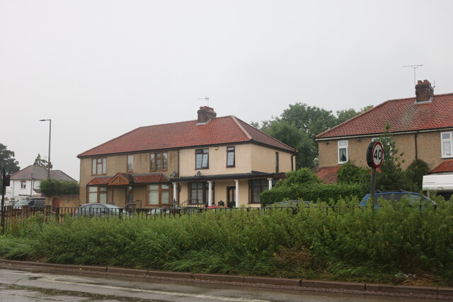
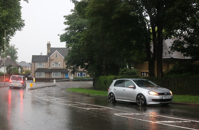
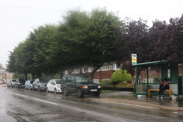
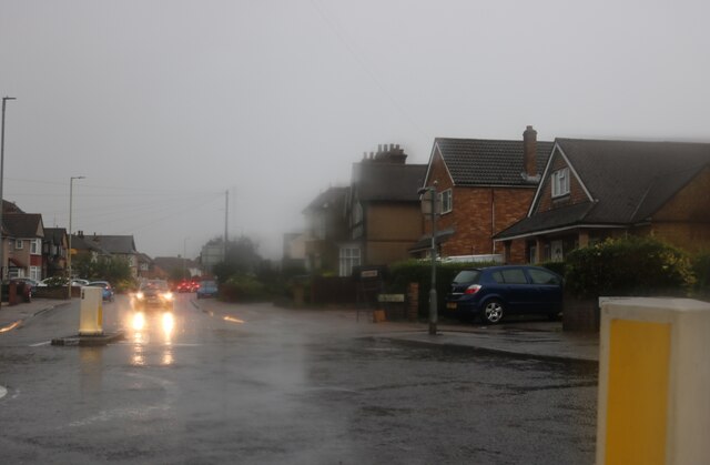
Burygreen Plantation Images

Images are sourced within 2km of 51.695703/-0.060346251 or Grid Reference TL3401. Thanks to Geograph Open Source API. All images are credited.

The Great Cambridge Road, Cheshunt
College Road, Cheshunt
Churchgate, Cheshunt Wet wet wet
Churchgate, Cheshunt
Wet wet wet
Roundabout on Churchgate, Cheshunt
High Street, Waltham Cross
Hunger Cure cafe on High Street, Waltham Cross
Waltham Cross Job Centre
Flats on Crossbrook Street, Cheshunt
Hedworth Avenue at the junction of High Street, Cheshunt
High Street, Cheshunt
St George's House, Cheshunt
High Street, Cheshunt
Roundabout on High Street, Cheshunt
Clarendon Road, Cheshunt
Track into a wood called Cattlins At the eastern edge of the wood.
Track into a wood called Cattlins
At the eastern edge of the wood.
Field edge track by Dysons Osiers A wood called Cattlins is over to the right.
Field edge track by Dysons Osiers
A wood called Cattlins is over to the right.
Show me another place!

Burygreen Plantation is located at Grid Ref: TL3401 (Lat: 51.695703, Lng: -0.060346251)

Administrative County: Hertfordshire

District: Broxbourne

Police Authority: Hertfordshire

What 3 Words

///noisy.singer.many. Near Waltham Cross, Hertfordshire

Related Wikis

St Mary's Church of England High School

St Mary's Church of England High School is a mixed secondary school and sixth form located in Cheshunt, Hertfordshire, England. It is a Church of England...

Theobalds Brook

Theobalds Brook is a minor tributary of the River Lea which rises in the hills south of Goffs Oak in Hertfordshire, England.

Theobalds House

Theobalds House (also known as Theobalds Palace) in the parish of Cheshunt in the English county of Hertfordshire, north of London, was a significant stately...

F.C. Broxbourne Borough

Football Club Broxbourne Borough was a football club based in Broxbourne, Hertfordshire, England. They played at Goffs Lane in Cheshunt. == History... ==

Goffs-Churchgate Academy

Goffs-Churchgate Academy is a secondary school with academy status located in Cheshunt, Hertfordshire, England with around 600 students. == History... ==

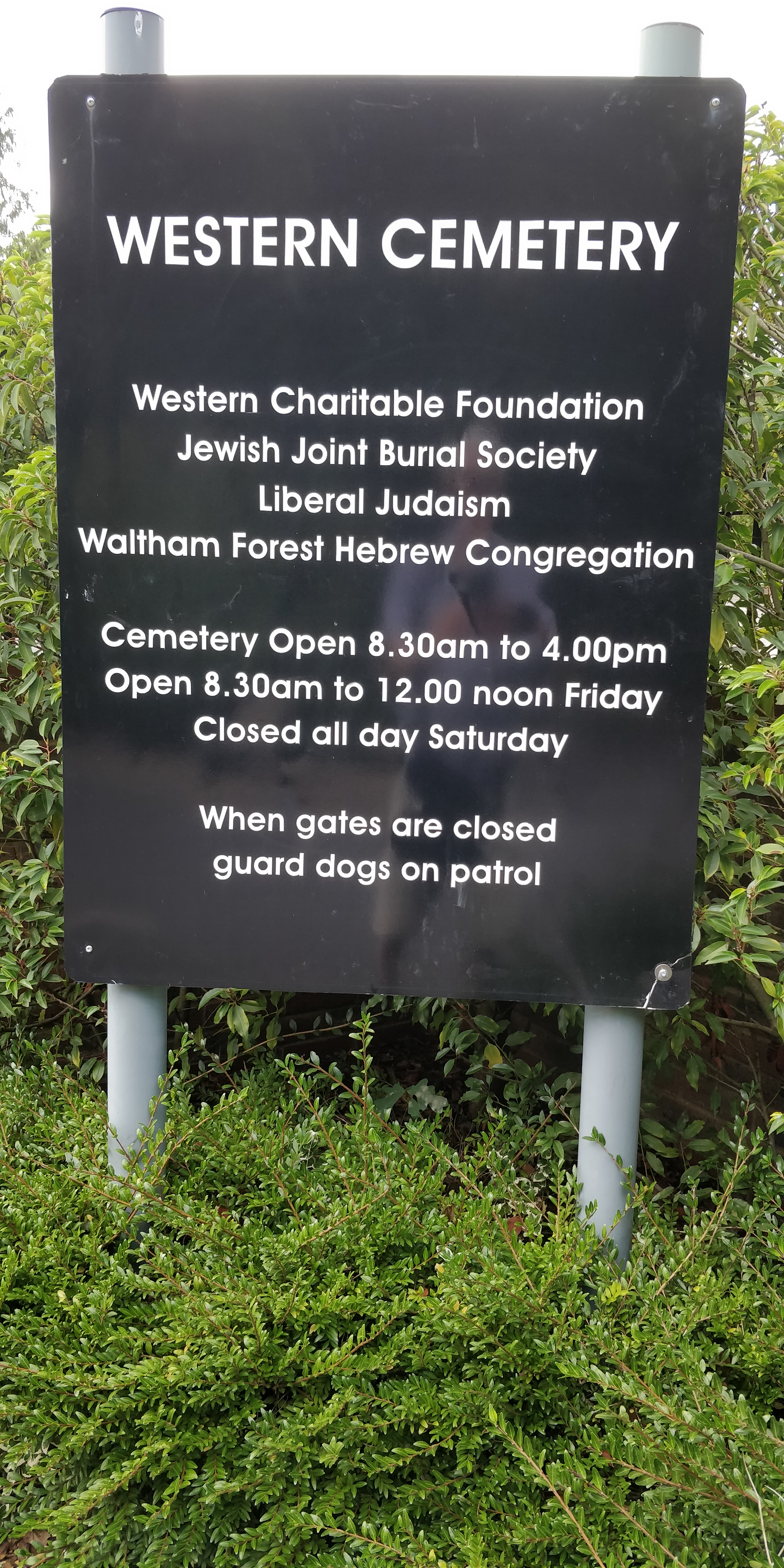
Western Cemetery (Cheshunt)

Western Cemetery is a Jewish cemetery at Bulls Cross Ride in Cheshunt in the Borough of Broxbourne, Hertfordshire EN7 5HT, England. It was established...

Goffs Academy

Goffs Academy is a selective secondary school and sixth form with academy status located in Cheshunt, Hertfordshire, England with around 1,300 students...

Bishops' College, Cheshunt

Bishops' College, Cheshunt was an Anglican theological College set up to train clergy to serve in the Church of England. It was housed in buildings formerly...

Nearby Amenities

Located within 500m of 51.695703,-0.060346251
Created By: YahooApplet 1.0
Lat/Long: 51.6987789/-0.0630253
Created By: YahooApplet 1.0
Lat/Long: 51.6978357/-0.0618936
Crossing
Bicycle: yes
Crossing: unmarked
Horse: yes
Lat/Long: 51.6959806/-0.0566183
Created By: YahooApplet 1.0
Lat/Long: 51.6972558/-0.0610909
Created By: YahooApplet 1.0
Lat/Long: 51.696511/-0.0596946
Created By: YahooApplet 1.0
Lat/Long: 51.6958168/-0.0584122
Created By: YahooApplet 1.0
Lat/Long: 51.6950158/-0.0569712
Created By: YahooApplet 1.0
Lat/Long: 51.6943171/-0.0555845
Created By: YahooApplet 1.0
Lat/Long: 51.694257/-0.0547972
Created By: YahooApplet 1.0
Lat/Long: 51.6951938/-0.0565306
Created By: YahooApplet 1.0
Lat/Long: 51.6952981/-0.0667485
Created By: YahooApplet 1.0
Lat/Long: 51.6961759/-0.0662335
Created By: YahooApplet 1.0
Lat/Long: 51.6969739/-0.0655468
Created By: YahooApplet 1.0
Lat/Long: 51.6976389/-0.0649031
Created By: YahooApplet 1.0
Lat/Long: 51.6976389/-0.0643881
Created By: YahooApplet 1.0
Lat/Long: 51.6981443/-0.0640448
Created By: YahooApplet 1.0
Lat/Long: 51.6986762/-0.063959
Created By: YahooApplet 1.0
Lat/Long: 51.6990752/-0.0639161
Created By: YahooApplet 1.0
Lat/Long: 51.6992082/-0.0636586
Created By: YahooApplet 1.0
Lat/Long: 51.6995987/-0.0622203
Created By: YahooApplet 1.0
Lat/Long: 51.6994817/-0.0599457
Created By: YahooApplet 1.0
Lat/Long: 51.6997051/-0.06307
Created By: YahooApplet 1.0
Lat/Long: 51.6993583/-0.0573178
Created By: YahooApplet 1.0
Lat/Long: 51.6991784/-0.0577914
Created By: YahooApplet 1.0
Lat/Long: 51.6990724/-0.0581118
Created By: YahooApplet 1.0
Lat/Long: 51.6990259/-0.0584014
Created By: YahooApplet 1.0
Lat/Long: 51.6990392/-0.0587984
Noexit: yes
Lat/Long: 51.6990244/-0.0593207
Created By: YahooApplet 1.0
Lat/Long: 51.6985338/-0.0584336
Noexit: yes
Lat/Long: 51.6983052/-0.058008
Created By: YahooApplet 1.0
Lat/Long: 51.6996243/-0.0575646
Created By: YahooApplet 1.0
Lat/Long: 51.6969977/-0.0602114
Created By: YahooApplet 1.0
Lat/Long: 51.6961455/-0.0586037
Created By: YahooApplet 1.0
Lat/Long: 51.6959327/-0.0582003
Created By: YahooApplet 1.0
Lat/Long: 51.6941714/-0.0548578
Created By: YahooApplet 1.0
Lat/Long: 51.6992387/-0.0634408
Created By: YahooApplet 1.0
Lat/Long: 51.6982679/-0.0624538
Created By: YahooApplet 1.0
Lat/Long: 51.6973768/-0.0611556
Created By: YahooApplet 1.0
Lat/Long: 51.6992853/-0.0632906
Created By: YahooApplet 1.0
Lat/Long: 51.6988331/-0.0628722
Created By: YahooApplet 1.0
Lat/Long: 51.6983277/-0.0623358
Created By: YahooApplet 1.0
Lat/Long: 51.6979154/-0.0617886
Created By: YahooApplet 1.0
Lat/Long: 51.6974632/-0.061059
Noexit: yes
Lat/Long: 51.6979621/-0.0552707
Noexit: yes
Lat/Long: 51.698824/-0.0559572
Noexit: yes
Lat/Long: 51.698871/-0.0575226
Crossing
Bicycle: yes
Crossing: unmarked
Horse: yes
Lat/Long: 51.6951472/-0.0569113
Crossing
Bicycle: yes
Crossing: unmarked
Horse: yes
Lat/Long: 51.6952492/-0.0568157
Parking
Lat/Long: 51.698402/-0.0627811
Crossing
Bicycle: yes
Crossing: unmarked
Horse: yes
Lat/Long: 51.6958867/-0.0566388
Power: pole
Lat/Long: 51.6942738/-0.0640031
Power: pole
Lat/Long: 51.6947518/-0.0666615
Power: pole
Lat/Long: 51.6945165/-0.0653389
Power: pole
Lat/Long: 51.6933461/-0.0588748
Power: pole
Lat/Long: 51.6939646/-0.0622919
Power: pole
Lat/Long: 51.6930568/-0.0573834
Power: pole
Lat/Long: 51.693662/-0.060586
Mini Roundabout
Lat/Long: 51.6999362/-0.0615429
Noexit: yes
Lat/Long: 51.699588/-0.0582482
Noexit: yes
Lat/Long: 51.698326/-0.0590652
Noexit: yes
Lat/Long: 51.698242/-0.0547844
Noexit: yes
Lat/Long: 51.6958605/-0.055204
Noexit: yes
Lat/Long: 51.6982842/-0.0575806
Noexit: yes
Lat/Long: 51.6982776/-0.061142
Noexit: yes
Lat/Long: 51.6980872/-0.0613163
Noexit: yes
Lat/Long: 51.6980739/-0.0611004
Noexit: yes
Lat/Long: 51.6982069/-0.0615255
Noexit: yes
Lat/Long: 51.6981338/-0.061327
Noexit: yes
Lat/Long: 51.6983241/-0.0617106
The data included in this document is from www.openstreetmap.org. The data is made available under ODbL.

Have you been to Burygreen Plantation?

Leave your review of Burygreen Plantation below (or comments, questions and feedback).