Biggin Wood

Wood, Forest in Surrey

England

Biggin Wood

Brigstock Road, Thornton Heath Brigstock Road in Thornton Heath, in the suburbs of south London.
Brigstock Road, Thornton Heath Credit: Malc McDonald

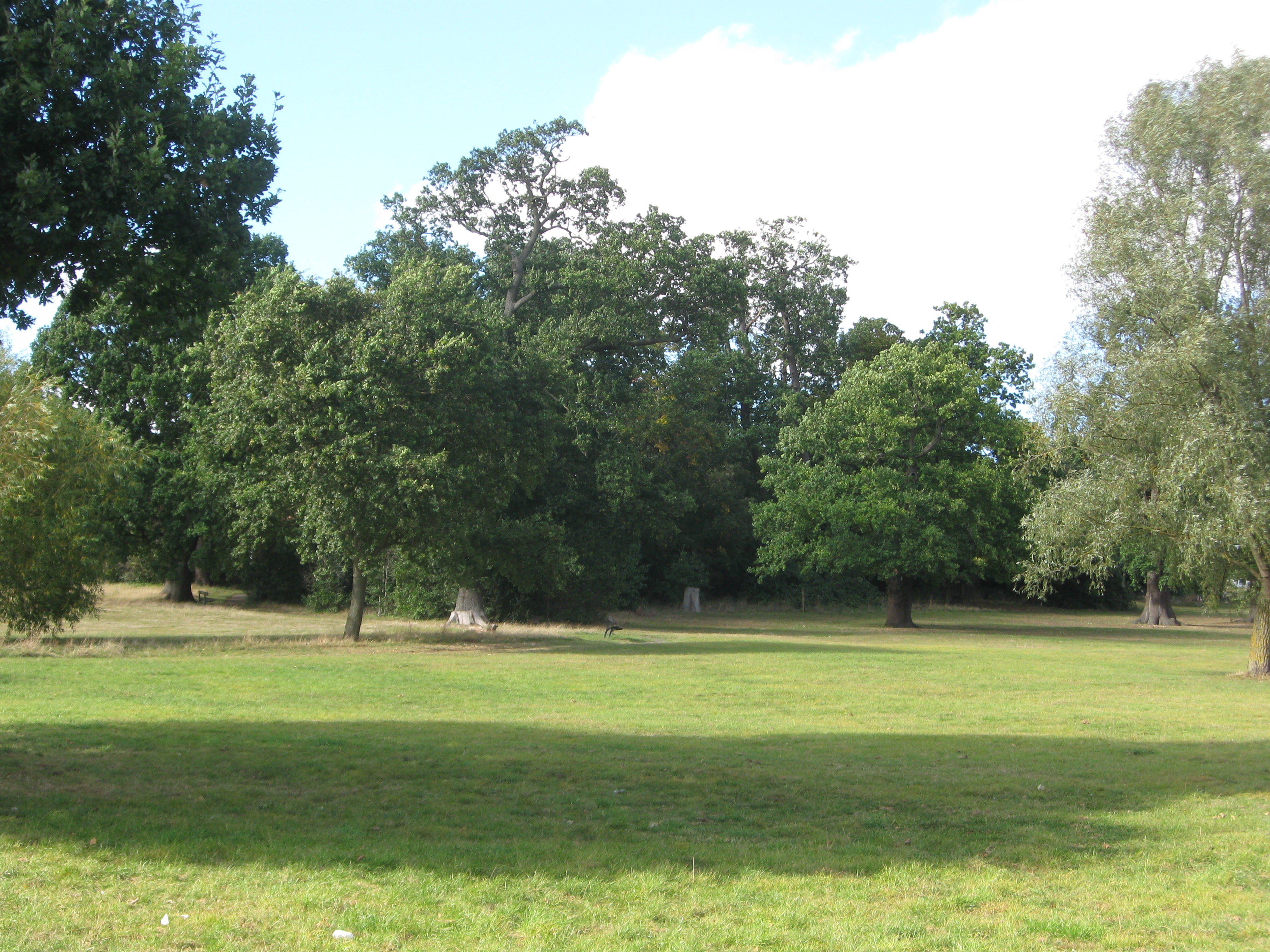
Biggin Wood is a picturesque woodland located in Surrey, England. Situated near the village of Biggin Hill, it covers an area of approximately 100 hectares and forms part of the wider North Downs Area of Outstanding Natural Beauty.

The woodland is predominantly made up of deciduous trees, including oak, beech, and birch, which create a stunning canopy during the summer months. These trees provide a vibrant display of colors in autumn, attracting visitors from far and wide to witness the natural beauty.

Biggin Wood is home to a diverse range of wildlife, including various bird species such as woodpeckers, tawny owls, and red kites. The woodland also supports a thriving population of small mammals, including foxes, rabbits, and squirrels, which can often be spotted darting between the trees.

Visitors to Biggin Wood can explore a network of well-maintained footpaths, allowing them to experience the tranquility of the woodland and enjoy its natural wonders. The wood also offers several picnic spots and benches, providing a perfect setting for a relaxing outdoor lunch.

In addition to its natural beauty, Biggin Wood has historical significance. It was once part of the hunting grounds for the aristocracy and has remnants of old deer parks within its boundaries. These remnants serve as a reminder of the area's past and add a touch of nostalgia to the woodland's charm.

Biggin Wood is a popular destination for nature lovers, walkers, and families seeking a peaceful retreat. Its combination of stunning scenery, diverse wildlife, and historical significance make it a must-visit location for those exploring the Surrey countryside.

If you have any feedback on the listing, please let us know in the comments section below.
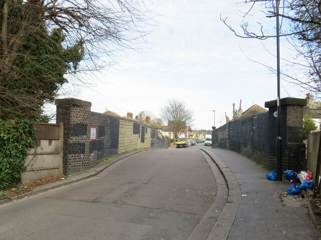
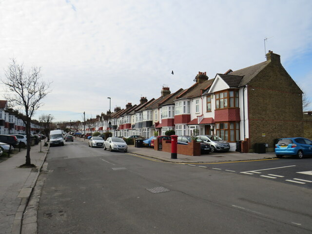
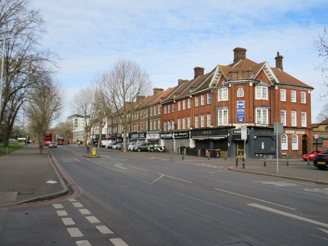
Biggin Wood Images

Images are sourced within 2km of 51.415468/-0.10763879 or Grid Reference TQ3170. Thanks to Geograph Open Source API. All images are credited.

Brigstock Road, Thornton Heath Brigstock Road in Thornton Heath, in the suburbs of south London.
Brigstock Road, Thornton Heath
Brigstock Road in Thornton Heath, in the suburbs of south London.
Grange Road, Upper Norwood Grange Road is a residential road on a hillside in Upper Norwood, in the suburbs of south London.
Grange Road, Upper Norwood
Grange Road is a residential road on a hillside in Upper Norwood, in the suburbs of south London.
Green Lane, Norbury Green Lane forms part of the short B273 road through Norbury, in the suburbs of south London.
Green Lane, Norbury
Green Lane forms part of the short B273 road through Norbury, in the suburbs of south London.
Camden Gardens, Norbury Camden Gardens is a minor residential road in Norbury, in the suburbs of south London.  The houses are semi-detached.
Camden Gardens, Norbury
Camden Gardens is a minor residential road in Norbury, in the suburbs of south London. The houses are semi-detached.
Norbury Avenue, Norbury Norbury Avenue is a residential road in Norbury, in the suburbs of south London.

This image was taken on a February day.  Trees were bare for the winter season.
Norbury Avenue, Norbury
Norbury Avenue is a residential road in Norbury, in the suburbs of south London. This image was taken on a February day. Trees were bare for the winter season.
Sandfield Road, Norbury Sandfield Road is a minor road in Norbury, in the suburbs of south London.  Here, it crosses a railway line on a narrow bridge.  The railway is the main line from London's Victoria station to Croydon, Gatwick Airport and the south coast.
Sandfield Road, Norbury
Sandfield Road is a minor road in Norbury, in the suburbs of south London. Here, it crosses a railway line on a narrow bridge. The railway is the main line from London's Victoria station to Croydon, Gatwick Airport and the south coast.
Norbury Crescent, Norbury Norbury Crescent is a residential road in Norbury, in the suburbs of south London.
Norbury Crescent, Norbury
Norbury Crescent is a residential road in Norbury, in the suburbs of south London.
Strathyre Avenue, Norbury Strathyre Avenue is a residential street in Norbury, in the suburbs of south London.
Strathyre Avenue, Norbury
Strathyre Avenue is a residential street in Norbury, in the suburbs of south London.
Strathyre Avenue, Norbury Strathyre Avenue is a residential street in Norbury, in the suburbs of south London.
Strathyre Avenue, Norbury
Strathyre Avenue is a residential street in Norbury, in the suburbs of south London.
Strathyre Avenue, Norbury Strathyre Avenue is a residential street in Norbury, in the suburbs of south London.  In the distance, a television transmission mast is visible.
Strathyre Avenue, Norbury
Strathyre Avenue is a residential street in Norbury, in the suburbs of south London. In the distance, a television transmission mast is visible.
London Road, Norbury London Road is on the route of the main A23 road as it passes through Norbury in the south London suburbs.

This image was taken on a February day.  Trees were bare for the winter season.
London Road, Norbury
London Road is on the route of the main A23 road as it passes through Norbury in the south London suburbs. This image was taken on a February day. Trees were bare for the winter season.
Pollards Hill West, Norbury Pollards Hill West is a residential road in Norbury, in the south London suburbs.

This image was taken on a February afternoon.  Trees were bare for the winter season.
Pollards Hill West, Norbury
Pollards Hill West is a residential road in Norbury, in the south London suburbs. This image was taken on a February afternoon. Trees were bare for the winter season.
Pollards Hill North, Norbury Pollards Hill North is a residential road in Norbury, in the suburbs of south London.

On the horizon to the right of the image is a television transmission mast.

This image was taken on a February afternoon.  Trees were bare for the winter season.
Pollards Hill North, Norbury
Pollards Hill North is a residential road in Norbury, in the suburbs of south London. On the horizon to the right of the image is a television transmission mast. This image was taken on a February afternoon. Trees were bare for the winter season.
Viewpoint at Pollards Hill, Norbury A path leading to a view point at Pollards Hill, in the suburbs of south London.  The pillar to the left of the image is a trigonometry point.
Viewpoint at Pollards Hill, Norbury
A path leading to a view point at Pollards Hill, in the suburbs of south London. The pillar to the left of the image is a trigonometry point.
Pollards Hill North, Norbury Pollards Hill North is a residential road in Norbury, in the suburbs of south London.

This image was taken on a February afternoon.  Trees were bare for the winter period.

On the horizon is a television transmission mast.
Pollards Hill North, Norbury
Pollards Hill North is a residential road in Norbury, in the suburbs of south London. This image was taken on a February afternoon. Trees were bare for the winter period. On the horizon is a television transmission mast.
Ena Road, Norbury Ena Road is a residential road in Norbury, in the suburbs of south London.
Ena Road, Norbury
Ena Road is a residential road in Norbury, in the suburbs of south London.
Norbury Court Road, Norbury Norbury Court Road is a residential road in Norbury, in the suburbs of south London.
Norbury Court Road, Norbury
Norbury Court Road is a residential road in Norbury, in the suburbs of south London.
Darcy Road, Norbury Darcy Road is a residential road in Norbury, in south London.
Darcy Road, Norbury
Darcy Road is a residential road in Norbury, in south London.
Show me another place!

Biggin Wood is located at Grid Ref: TQ3170 (Lat: 51.415468, Lng: -0.10763879)

Unitary Authority: Croydon

Police Authority: Metropolitan

What 3 Words

///cabin.verge.decide. Near Thornton Heath, London

Nearby Locations

Norwood Grove Biggin Wood

Related Wikis

Biggin Wood

Biggin Wood (also known as Biggin Woods) is an area of ancient oak woodland situated within the London Borough of Croydon. The London Wildlife Trust is...

St Joseph's College, Upper Norwood

St Joseph's College is a 11-18 Voluntary-Aided, Lasallian, all boys' secondary school and sixth form with academy status, located in the Upper Norwood...

Norwood Grove

Norwood Grove is an ornamental urban park in the northern extent of the London Borough of Croydon, by whom it is managed, although the most westerly part...

J. W. Hobbs' Ground

J. W. Hobbs' Ground was a cricket ground in Norbury, Surrey. The ground was constructed in 1885 within the grounds of Norbury Hall by local philanthropist...

Norbury

Norbury is an area of south London. It shares the postcode London SW16 with neighbouring Streatham. Norbury is 6.7 miles (10.8 km) south of Charing Cross...

Norbury High School for Girls

Norbury High School for Girls is a secondary school with academy status for girls aged 11–19. It is located in Thornton Heath, Greater London, England...

Convent Wood

Convent Wood is a small area of ancient woodland in the London Borough of Croydon. The wood is in the freehold of the Sisters of Our Lady of Fidelity some...

Harris Academy Beulah Hill

Harris Academy Beulah Hill is a coeducational secondary school located in the Upper Norwood area of the London Borough of Croydon, England. The school...

Nearby Amenities

Located within 500m of 51.415468,-0.10763879
Traffic Calming: hump
Lat/Long: 51.4184812/-0.106716
Ref GB Tflcid: RWG215081
Traffic Calming: hump
Lat/Long: 51.4131353/-0.1042079
Ref GB Tflcid: RWG215248
Traffic Calming: hump
Lat/Long: 51.4133313/-0.1034593
Traffic Calming: hump
Lat/Long: 51.4135912/-0.1018603
Turning Circle
Lat/Long: 51.4143558/-0.1057946
Ref GB Tflcid: RWG215112
Traffic Calming: hump
Lat/Long: 51.4138837/-0.104748
Mini Roundabout
Direction: clockwise
Lat/Long: 51.4134787/-0.1059298
Ref GB Tflcid: RWG215108
Traffic Calming: hump
Lat/Long: 51.4135512/-0.1066816
Ref GB Tflcid: RWG215110
Traffic Calming: hump
Lat/Long: 51.4136424/-0.1052185
Traffic Calming: table
Lat/Long: 51.4146064/-0.102744
Turning Circle
Lat/Long: 51.4142782/-0.1030673
Ref GB Tflcid: RWG215122
Traffic Calming: hump
Lat/Long: 51.4178696/-0.1046725
Ref GB Tflcid: RWG215252
Traffic Calming: hump
Lat/Long: 51.4133388/-0.1018259
Post Box
Collection Times: Mo-Fr 17:30, Sa 12:00
Operator: Royal Mail
Operator Wikidata: Q638098
Ref: SW16 82
Royal Cypher: GR
Royal Cypher Wikidata: Q33102273
Lat/Long: 51.4155989/-0.1106899
Post Box
Operator: Royal Mail
Operator Wikidata: Q638098
Lat/Long: 51.4130499/-0.1123169
Crossing
Crossing: uncontrolled
Crossing Ref: zebra
Lat/Long: 51.4114452/-0.1092145
Bus Stop
Biggin Hill
Bus: yes
Local Ref: NL
Naptan AtcoCode: 490003992N
Naptan Bearing: N
Naptan CommonName: Biggin Hill (SE19)
Naptan Indicator: Stop NL
Naptan Verified: no
Public Transport: platform
Lat/Long: 51.418915/-0.1050343
Bus Stop
Biggin Hill
Bench: no
Bus: yes
Local Ref: SA
Naptan AtcoCode: 490003992S
Naptan Bearing: S
Naptan CommonName: Biggin Hill (SE19)
Naptan Indicator: Stop SA
Naptan Verified: no
Public Transport: platform
Shelter: no
Lat/Long: 51.418824/-0.1036414
Bus Stop
Kensington Avenue
Naptan AtcoCode: 490008650N
Naptan Bearing: N
Naptan CommonName: Kensington Avenue
Naptan Verified: no
Public Transport: platform
Lat/Long: 51.4118112/-0.1100935
Bus Stop
Kensington Avenue
Naptan AtcoCode: 490008650S
Naptan Bearing: N
Naptan CommonName: Kensington Avenue
Naptan Verified: no
Public Transport: platform
Lat/Long: 51.4112578/-0.108698
Bus Stop
Norbury Hill
Bench: yes
Bin: no
Lit: yes
Naptan AtcoCode: 490010300N
Naptan Bearing: N
Naptan CommonName: Norbury Hill
Naptan Verified: no
Public Transport: platform
Shelter: yes
Tactile Paving: yes
Lat/Long: 51.4134149/-0.1134321
Bus Stop
Norbury Hill
Bench: yes
Naptan AtcoCode: 490010300S
Naptan Bearing: N
Naptan CommonName: Norbury Hill
Naptan Verified: no
Public Transport: platform
Shelter: yes
Lat/Long: 51.4140056/-0.1143069
Post Box
Brand: Royal Mail
Brand Wikidata: Q638098
Collection Times: Mo-Fr 17:30; Sa 11:30
Drive Through: no
Operator: Royal Mail
Operator Wikidata: Q638098
Post Box Design: type_b
Post Box Type: pillar
Ref: SE19 16
Royal Cypher: GR
Royal Cypher Wikidata: Q33102273
Source: survey
Lat/Long: 51.4188687/-0.1040135
Crossing
Crossing: unmarked
Tactile Paving: yes
Lat/Long: 51.4135511/-0.113725
Ref GB Tflcid: RWG215114
Traffic Calming: hump
Lat/Long: 51.4143834/-0.1045883
Crossing
Crossing: marked
Crossing Island: yes
Crossing Markings: yes
Tactile Paving: yes
Lat/Long: 51.4188797/-0.1044163
Barrier: bollard
Lat/Long: 51.4183311/-0.1122325
Barrier: bollard
Bollard: removable
Lat/Long: 51.4191928/-0.1110907
Crossing
Crossing: unmarked
Crossing Island: yes
Tactile Paving: yes
Lat/Long: 51.4135251/-0.1134912
Crossing
Crossing: unmarked
Crossing Island: yes
Tactile Paving: yes
Lat/Long: 51.4136476/-0.1137391
Crossing
Crossing: unmarked
Tactile Paving: yes
Lat/Long: 51.4135605/-0.1137115
Crossing
Crossing: unmarked
Crossing Island: no
Tactile Paving: yes
Lat/Long: 51.4136538/-0.1135769
Bench
Backrest: yes
Lat/Long: 51.4172599/-0.1049238
Bench
Backrest: yes
Lat/Long: 51.4169974/-0.1138015
Crossing
Crossing: unmarked
Crossing Markings: no
Tactile Paving: no
Lat/Long: 51.4186919/-0.1034091
Crossing
Crossing: unmarked
Crossing Markings: no
Tactile Paving: no
Lat/Long: 51.4186356/-0.1030214
Generator Method: photovoltaic
Generator Output Electricity: yes
Generator Source: solar
Generator Type: solar_photovoltaic_panel
Power: generator
Lat/Long: 51.4122612/-0.1031674
Generator Method: photovoltaic
Generator Output Electricity: yes
Generator Source: solar
Generator Type: solar_photovoltaic_panel
Power: generator
Lat/Long: 51.4118332/-0.1044226
Generator Method: photovoltaic
Generator Output Electricity: yes
Generator Source: solar
Generator Type: solar_photovoltaic_panel
Power: generator
Lat/Long: 51.4119987/-0.109685
Generator Method: photovoltaic
Generator Output Electricity: yes
Generator Source: solar
Generator Type: solar_photovoltaic_panel
Power: generator
Lat/Long: 51.4130224/-0.1088604
Generator Method: photovoltaic
Generator Output Electricity: yes
Generator Source: solar
Generator Type: solar_photovoltaic_panel
Power: generator
Lat/Long: 51.4130076/-0.1079981
Generator Method: photovoltaic
Generator Output Electricity: yes
Generator Source: solar
Generator Type: solar_photovoltaic_panel
Power: generator
Lat/Long: 51.4176686/-0.1013993
Generator Method: photovoltaic
Generator Output Electricity: yes
Generator Source: solar
Generator Type: solar_photovoltaic_panel
Power: generator
Lat/Long: 51.4144431/-0.1039826
Generator Method: photovoltaic
Generator Output Electricity: yes
Generator Source: solar
Generator Type: solar_photovoltaic_panel
Power: generator
Lat/Long: 51.4144167/-0.1037444
Noexit: yes
Lat/Long: 51.4190949/-0.1100236
Bench
Backrest: yes
Lat/Long: 51.4161425/-0.1050781
Bench
Backrest: yes
Lat/Long: 51.4160212/-0.1054708
Bench
Backrest: yes
Lat/Long: 51.4161511/-0.1052124
Entrance: yes
Lat/Long: 51.4159555/-0.1055222
Entrance: yes
Lat/Long: 51.4160526/-0.104975
Bench
Backrest: yes
Lat/Long: 51.4161461/-0.105359
Bench
Backrest: yes
Lat/Long: 51.4160791/-0.1056509
Give Way
Direction: forward
Lat/Long: 51.4183709/-0.1069311
Traffic Calming: hump
Lat/Long: 51.4181029/-0.107205
Traffic Calming: bump
Lat/Long: 51.416818/-0.1138083
Traffic Calming: bump
Lat/Long: 51.4165911/-0.1132596
Traffic Calming: bump
Lat/Long: 51.416363/-0.112606
Give Way
Direction: forward
Lat/Long: 51.4162343/-0.1121427
Give Way
Direction: backward
Lat/Long: 51.4161783/-0.1122142
Traffic Calming: bump
Lat/Long: 51.4160889/-0.111835
Traffic Calming: bump
Lat/Long: 51.4158214/-0.1110819
Give Way
Direction: backward
Lat/Long: 51.4157033/-0.1107492
Give Way
Direction: forward
Lat/Long: 51.4156614/-0.1106274
Barrier: kerb
Kerb: lowered
Tactile Paving: no
Lat/Long: 51.4157949/-0.1106536
Barrier: kerb
Kerb: lowered
Tactile Paving: no
Lat/Long: 51.4162344/-0.1120326
Barrier: kerb
Kerb: lowered
Tactile Paving: no
Lat/Long: 51.4167691/-0.1135284
Barrier: kerb
Kerb: lowered
Tactile Paving: no
Lat/Long: 51.416131/-0.1121378
Crossing
Crossing: unmarked
Crossing Island: no
Tactile Paving: no
Lat/Long: 51.4161651/-0.1122311
Crossing
Crossing: unmarked
Lat/Long: 51.4167841/-0.1135632
Barrier: kerb
Kerb: lowered
Tactile Paving: no
Lat/Long: 51.4161982/-0.1123219
Barrier: kerb
Kerb: lowered
Tactile Paving: no
Lat/Long: 51.4162877/-0.1121727
Crossing
Crossing: unmarked
Crossing Island: no
Tactile Paving: no
Lat/Long: 51.4162631/-0.1121055
Barrier: kerb
Kerb: lowered
Tactile Paving: no
Lat/Long: 51.4157206/-0.1104946
Give Way
Direction: forward
Lat/Long: 51.4152507/-0.1093968
Crossing
Crossing: unmarked
Crossing Island: no
Tactile Paving: no
Lat/Long: 51.4157537/-0.1105654
Give Way
Direction: backward
Lat/Long: 51.4161855/-0.1040505
Crossing
Crossing: unmarked
Crossing Markings: no
Tactile Paving: no
Lat/Long: 51.4182529/-0.1044189
Crossing
Crossing: unmarked
Crossing Island: no
Crossing Markings: no
Tactile Paving: no
Lat/Long: 51.4181027/-0.1044919
Crossing
Crossing: unmarked
Crossing Island: no
Crossing Markings: no
Lat/Long: 51.4176485/-0.1046926
Give Way
Direction: forward
Lat/Long: 51.4187348/-0.1031194
Telephone
Booth: KX100
Operator: BT
Operator Wikidata: Q593786
Lat/Long: 51.4137829/-0.1015232
Give Way
Direction: forward
Lat/Long: 51.4134581/-0.102481
Traffic Calming: hump
Lat/Long: 51.4140509/-0.1010691
Traffic Calming: hump
Lat/Long: 51.4139342/-0.101494
Give Way
Direction: backward
Lat/Long: 51.4145795/-0.1027704
Traffic Calming: hump
Lat/Long: 51.4158815/-0.1041232
Crossing
Crossing: unmarked
Crossing Island: yes
Crossing Markings: no
Tactile Paving: yes
Lat/Long: 51.4190776/-0.1061306
Give Way
Direction: forward
Lat/Long: 51.4191112/-0.1061144
Crossing
Crossing: unmarked
Crossing Island: yes
Crossing Markings: no
Tactile Paving: yes
Lat/Long: 51.4190863/-0.1057947
Traffic Calming: hump
Lat/Long: 51.4189276/-0.106254
Ref GB Tflcid: RWG215106
Traffic Calming: hump
Lat/Long: 51.414549/-0.1122793
Ref GB Tflcid: RWG215109
Traffic Calming: hump
Lat/Long: 51.4154044/-0.1110519
Ref GB Tflcid: RWG215104
Traffic Calming: hump
Lat/Long: 51.4137798/-0.1133943
Ref GB Tflcid: RWG215111
Traffic Calming: hump
Lat/Long: 51.4159335/-0.1103147
Ref GB Tflcid: RWG215115
Traffic Calming: hump
Lat/Long: 51.4174009/-0.108221
Ref GB Tflcid: RWG215096
Traffic Calming: hump
Lat/Long: 51.412878/-0.1088991
Ref GB Tflcid: RWG215236
Traffic Calming: hump
Lat/Long: 51.41498/-0.1008082
Ref GB Tflcid: RWG215116
Traffic Calming: hump
Lat/Long: 51.4148944/-0.1044114
Ref GB Tflcid: RWG215099
Traffic Calming: hump
Lat/Long: 51.4132/-0.107971
Ref GB Tflcid: RWG215080
Traffic Calming: hump
Lat/Long: 51.4127662/-0.10539
Ref GB Tflcid: RWG215113
Traffic Calming: hump
Lat/Long: 51.4166906/-0.1092588
Ref GB Tflcid: RWG215234
Traffic Calming: hump
Lat/Long: 51.415817/-0.1005566
Ref GB Tflcid: RWG215103
Traffic Calming: hump
Lat/Long: 51.4133786/-0.1074505
Ref GB Tflcid: RWG215242
Traffic Calming: hump
Lat/Long: 51.4148476/-0.1034267
Ref GB Tflcid: RWG215127
Traffic Calming: hump
Lat/Long: 51.4153445/-0.1042726
Ref GB Tflcid: RWG215243
Traffic Calming: hump
Lat/Long: 51.4150169/-0.1040548
Ref GB Tflcid: RWG215074
Traffic Calming: hump
Lat/Long: 51.4116278/-0.10904
Ref GB Tflcid: RWG215078
Traffic Calming: hump
Lat/Long: 51.4125178/-0.1061792
Ref GB Tflcid: RWG215093
Traffic Calming: hump
Lat/Long: 51.4125375/-0.1098807
Ref GB Tflcid: RWG215092
Traffic Calming: hump
Lat/Long: 51.412242/-0.1104525
Ref GB Tflcid: RWG215077
Traffic Calming: hump
Lat/Long: 51.4121938/-0.1071916
Ref GB Tflcid: RWG215072
Traffic Calming: hump
Lat/Long: 51.4114166/-0.1099769
The data included in this document is from www.openstreetmap.org. The data is made available under ODbL.

Have you been to Biggin Wood?

Leave your review of Biggin Wood below (or comments, questions and feedback).