Watford Wood

Wood, Forest in Sussex Mid Sussex

England

Watford Wood

Seven Acres/Four Acres The name of the fields according to Wivelsfield's 1843 tithe map that have been joined together to make a larger unit. Seven Acres was in the foreground, Four Acres near to Little Otehall Farm in the distance.
Seven Acres/Four Acres Credit: Simon Carey

Watford Wood is a charming forest located in the county of Sussex, England. Covering an area of approximately 500 acres, this woodland is a haven for nature lovers and outdoor enthusiasts alike. Its picturesque landscape is characterized by a mix of mature trees, including oak, beech, and sweet chestnut, which create a dense and lush canopy that provides shade and shelter to a variety of wildlife.

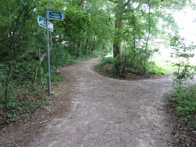
The woodland is crisscrossed by a network of meandering footpaths and trails, inviting visitors to explore its natural beauty. These pathways offer a chance to immerse oneself in the tranquil surroundings, with the sound of birdsong and the rustling of leaves providing a soothing backdrop. In spring, the forest floor comes alive with a vibrant display of wildflowers, adding bursts of color to the verdant setting.

Watford Wood is also home to a diverse range of wildlife. Birdwatchers can spot species such as tawny owls, woodpeckers, and nuthatches, while keen-eyed observers may catch a glimpse of roe deer or foxes roaming through the undergrowth. The forest is managed by local conservation organizations, ensuring that the delicate balance of the ecosystem is maintained.

For those looking to escape the hustle and bustle of everyday life, Watford Wood offers a peaceful retreat. Whether it's a leisurely stroll, a picnic in a secluded clearing, or simply a moment of solitude amidst nature, this woodland provides a sanctuary for visitors seeking solace in the great outdoors.

If you have any feedback on the listing, please let us know in the comments section below.

Watford Wood Images

Images are sourced within 2km of 50.970211/-0.12573578 or Grid Reference TQ3120. Thanks to Geograph Open Source API. All images are credited.

Seven Acres/Four Acres The name of the fields according to Wivelsfield's 1843 tithe map that have been joined together to make a larger unit. Seven Acres was in the foreground, Four Acres near to Little Otehall Farm in the distance.
Seven Acres/Four Acres
The name of the fields according to Wivelsfield's 1843 tithe map that have been joined together to make a larger unit. Seven Acres was in the foreground, Four Acres near to Little Otehall Farm in the distance.
Ote Hall Farm Cottages Former farm labourers cottages on the drive to Great Ote Hall. They are marked on the 1875 OS map so probably originate sometime during the Victorian era.
Ote Hall Farm Cottages
Former farm labourers cottages on the drive to Great Ote Hall. They are marked on the 1875 OS map so probably originate sometime during the Victorian era.
Little Oat Hall The name of the field according to Wivelsfield's 1843 tithe map that lies to the immediate west of <a href="https://www.geograph.org.uk/photo/2365272">TQ3319 : Little Ote Hall</a> from which it gets its name. This is a remnant of the former field which once stretched westwards alongside Janes Lane but has lost that portion to development.
Little Oat Hall
The name of the field according to Wivelsfield's 1843 tithe map that lies to the immediate west of TQ3319 : Little Ote Hall from which it gets its name. This is a remnant of the former field which once stretched westwards alongside Janes Lane but has lost that portion to development.
Little Ote Hall Viewed from Janes Lane. The former farm dates from the medieval period though the current house was rebuilt in either the 18th or 19th century.
Little Ote Hall
Viewed from Janes Lane. The former farm dates from the medieval period though the current house was rebuilt in either the 18th or 19th century.
Bend and bridge on Janes Lane Janes Lane runs from the B2112 to Wivelsfield station at Burgess Hill.
Bend and bridge on Janes Lane
Janes Lane runs from the B2112 to Wivelsfield station at Burgess Hill.
Stile entry into small wood near Acorns
Alder trees bordering bridleway to Burgess Hill
Property fence around the most easterly house in Burgess Hill
Footpath branching away bridleway on edge of Burgess Hill
Footpath crossing Janes Lane into Ote Hall Farm The footpath forms part of the boundary between West and East Sussex.
Footpath crossing Janes Lane into Ote Hall Farm
The footpath forms part of the boundary between West and East Sussex.
Boundary sign for West and East Sussex The sign below Burgess Hill is Worlds End a suburb of Burgess Hill.
Boundary sign for West and East Sussex
The sign below Burgess Hill is Worlds End a suburb of Burgess Hill.
Farm yard at Ote Hall Farm
St.Wilfrid's Roman Catholic Church, Burgess Hill, Sussex An attractive building, located on Station Road.
St.Wilfrid's Roman Catholic Church, Burgess Hill, Sussex
An attractive building, located on Station Road.
St.Wilfrid's Roman Catholic Church, Burgess Hill, Sussex An attractive building, located on Station Road.
St.Wilfrid's Roman Catholic Church, Burgess Hill, Sussex
An attractive building, located on Station Road.
The Railway, Burgess Hill, Sussex Located on the corner of Station Road, opposite the railway station.
The Railway, Burgess Hill, Sussex
Located on the corner of Station Road, opposite the railway station.
Station Road, Burgess Hill, Sussex Looking in the direction of 'The Railway' public house, which stands opposite the railway station.
Station Road, Burgess Hill, Sussex
Looking in the direction of 'The Railway' public house, which stands opposite the railway station.
The Railway, Burgess Hill, Sussex Located on Station Road, opposite the railway station.
The Railway, Burgess Hill, Sussex
Located on Station Road, opposite the railway station.
Burgess Hill Railway Station, Sussex Looking towards the station, from the direction of Station Road.
Burgess Hill Railway Station, Sussex
Looking towards the station, from the direction of Station Road.
Show me another place!

Watford Wood is located at Grid Ref: TQ3120 (Lat: 50.970211, Lng: -0.12573578)

Administrative County: West Sussex

District: Mid Sussex

Police Authority: Sussex

What 3 Words

///unless.bump.cabin. Near Burgess Hill, West Sussex

Related Wikis

Bedelands Farm Nature Reserve

Bedelands Farm Nature Reserve is a 35.2-hectare (87-acre) Local Nature Reserve on the northern outskirts of Burgess Hill in West Sussex. It is owned and...

Burgess Hill Town F.C.

Burgess Hill Town Football Club is an English football club currently playing in the Isthmian League South East Division. The club plays its home games...

World's End, West Sussex

World's End is a neighbourhood located in Burgess Hill, West Sussex. It is thought that the name arrived with the railway – it was here that the 'up' line...

Wivelsfield railway station

Wivelsfield railway station is a railway station on the Brighton Main Line in West Sussex, England. Located in northern Burgess Hill, it primarily serves...

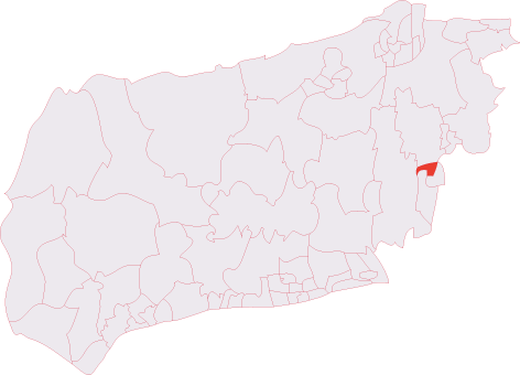
Burgess Hill Town (electoral division)

Burgess Hill Town is an electoral division of West Sussex in the United Kingdom, and returns one member to sit on West Sussex County Council. == Extent... ==

Providence Strict Baptist Chapel, Burgess Hill

Providence Strict Baptist Chapel is a former Strict Baptist place of worship in the town of Burgess Hill in Mid Sussex, one of seven local government districts...

Abbotsford, West Sussex

Abbotsford is a settlement in West Sussex, England. Although once of a distinct identity, the name is now rarely used to describe the area and it would...

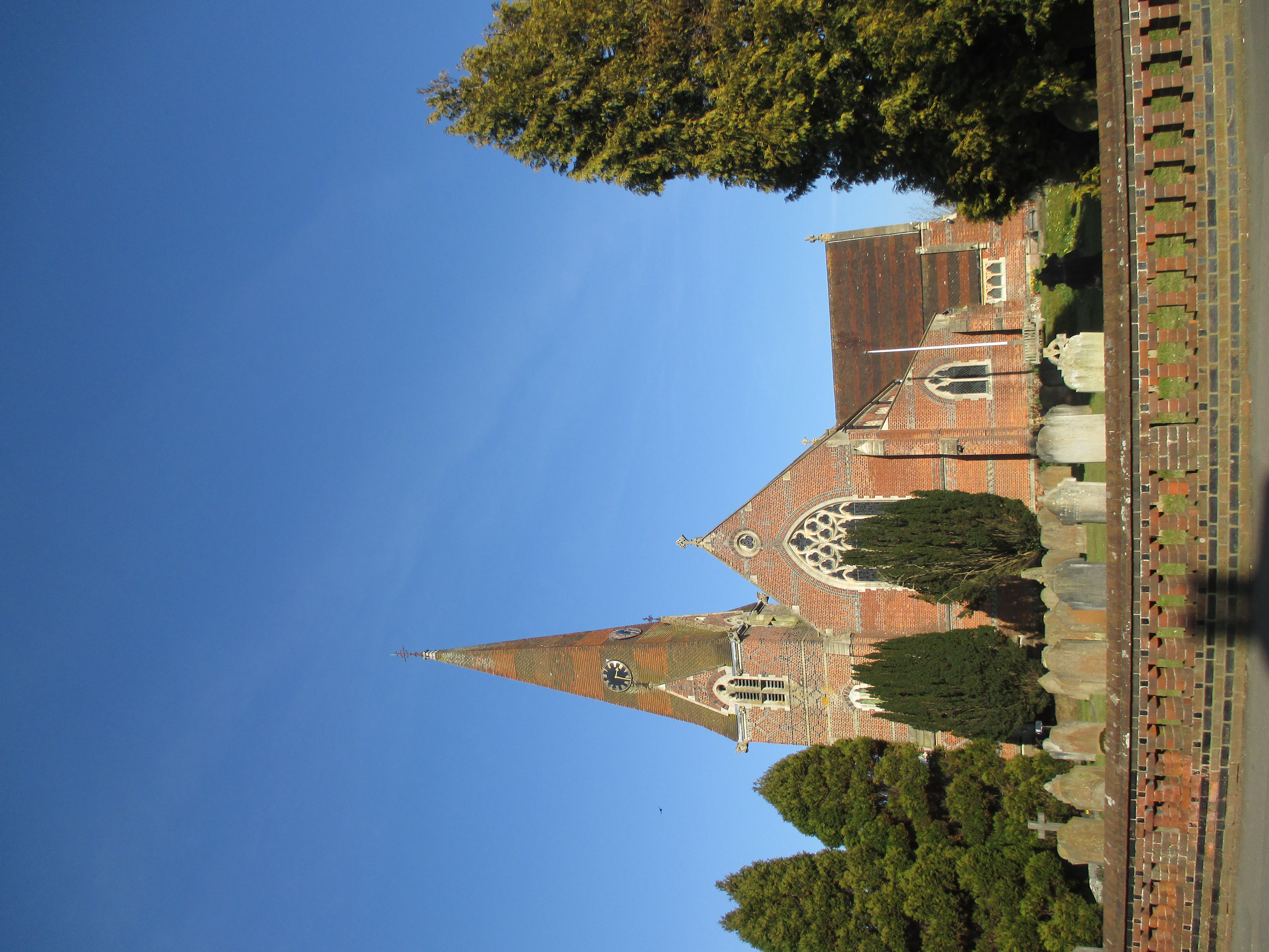
St John the Evangelist's Church, Burgess Hill

St John the Evangelist's Church is the Church of England parish church of Burgess Hill, West Sussex, England. It is a Gothic Revival church built of local...

Nearby Amenities

Located within 500m of 50.970211,-0.12573578
Bus Stop
Dumbrills Close
Bus: yes
Naptan AtcoCode: 4400MS0079
Naptan Bearing: E
Naptan CommonName: Maple Drive
Naptan Indicator: adj The Hawthorns
Naptan Landmark: The Hawthorns
Naptan NaptanCode: wsxdjwap
Naptan Street: Maple Drive
Naptan Verified: no
Public Transport: platform
Shelter: no
Source: naptan_import
Lat/Long: 50.9660553/-0.1284614
Bus Stop
Leylands Wood
Bus: yes
Naptan AtcoCode: 4400MS0080
Naptan Bearing: W
Naptan CommonName: Leylands Park
Naptan Indicator: outside No. 163-171
Naptan Landmark: Maple Drive
Naptan NaptanCode: wsxdjwat
Naptan Street: Maple Drive
Naptan Verified: no
Public Transport: platform
Source: naptan_import
Lat/Long: 50.9662764/-0.1270302
Bus Stop
Leylands Wood
Bus: yes
Naptan AtcoCode: 4400MS0081
Naptan Bearing: E
Naptan CommonName: Leylands Park
Naptan Indicator: next to road to football ground
Naptan Landmark: Maple Drive
Naptan NaptanCode: wsxdjwaw
Naptan Street: Maple Drive
Naptan Verified: no
Public Transport: platform
Source: naptan_import
Lat/Long: 50.9664586/-0.1256005
Barrier: height_restrictor
Maxheight: 2
Lat/Long: 50.966803/-0.125408
Post Box
Brand: Royal Mail
Brand Wikidata: Q638098
Brand Wikipedia: en:Royal Mail
Operator: Royal Mail
Operator Wikidata: Q638098
Post Box Type: pillar
Ref: RH15 170
Royal Cypher: EIIR
Royal Cypher Wikidata: Q33102113
Lat/Long: 50.9660367/-0.1243969
Passing Place
Lat/Long: 50.9690158/-0.1193993
Bench
Lat/Long: 50.9663956/-0.1243595
Bench
Lat/Long: 50.9663753/-0.1244983
Crossing
Crossing: traffic_signals
Crossing Island: no
Crossing Ref: puffin
Kerb: flush
Tactile Paving: yes
Lat/Long: 50.9660857/-0.1281776
Power: pole
Lat/Long: 50.9691525/-0.1265602
Power: pole
Lat/Long: 50.9698689/-0.1258245
Power: pole
Lat/Long: 50.9703692/-0.1253104
Power: pole
Lat/Long: 50.9708238/-0.1248509
Power: pole
Lat/Long: 50.9714412/-0.1242233
Power: pole
Lat/Long: 50.9724013/-0.1232197
The data included in this document is from www.openstreetmap.org. The data is made available under ODbL.

Have you been to Watford Wood?

Leave your review of Watford Wood below (or comments, questions and feedback).