Lathbury Holt

Wood, Forest in Lincolnshire East Lindsey

England

Lathbury Holt

Ridge and furrow, South Elkington: aerial 2023 (1)
Ridge and furrow, South Elkington: aerial 2023 (1) Credit: Simon Tomson

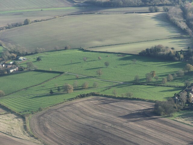
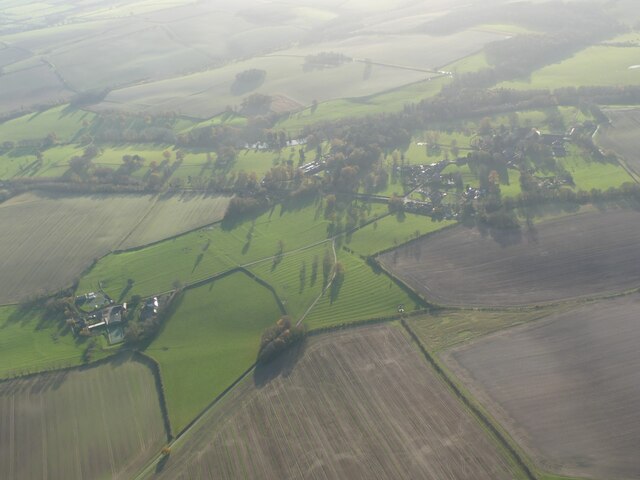
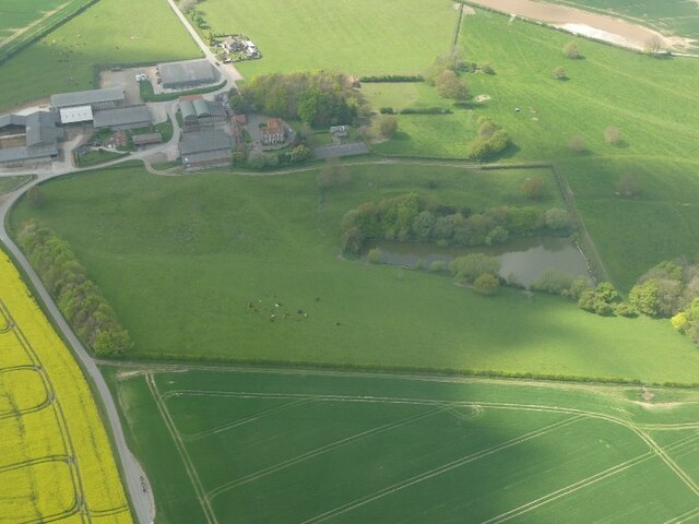
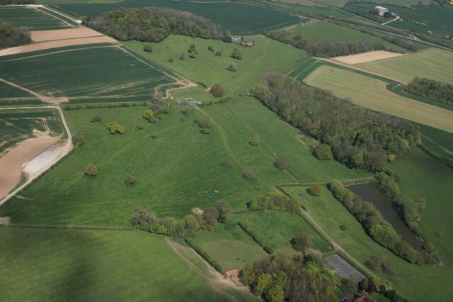
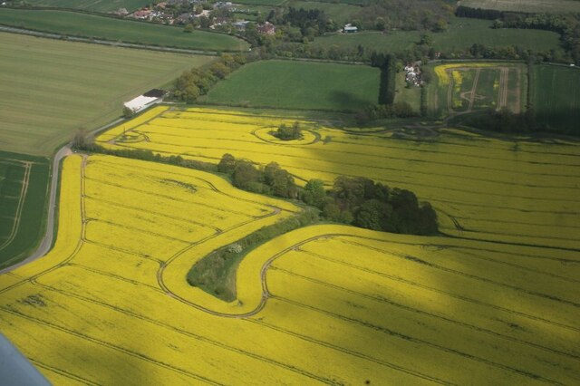
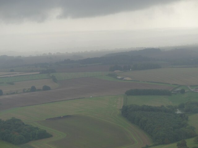
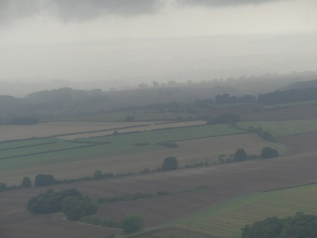
Lathbury Holt is a quaint woodland area located in Lincolnshire, England. Situated in the heart of the county, this forested region is known for its picturesque beauty and serene atmosphere. Spanning over several hectares, Lathbury Holt is a haven for nature enthusiasts and those seeking tranquility amidst the bustling city life.

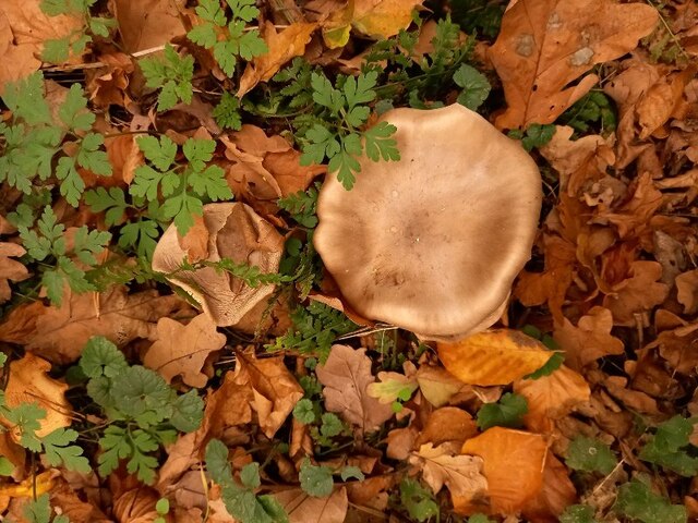
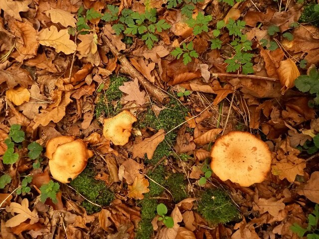
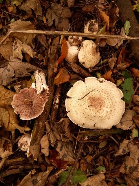
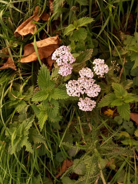
The woodland is primarily composed of a mix of broadleaf and coniferous trees, creating a diverse ecosystem that supports a wide range of flora and fauna. Oak, beech, and birch trees dominate the landscape, their vibrant hues adding to the enchanting allure of the forest. The forest floor is adorned with a carpet of ferns, wildflowers, and moss, creating a lush and vibrant undergrowth.

Lathbury Holt is a popular destination for outdoor activities such as hiking, picnicking, and birdwatching. Numerous walking trails meander through the woods, offering visitors the opportunity to explore the forest's natural wonders at their own pace. The forest is home to a variety of bird species, including woodpeckers, owls, and warblers, making it a haven for birdwatchers.

The forest is also rich in wildlife, with sightings of deer, foxes, and squirrels being quite common. In addition to its natural beauty, Lathbury Holt boasts a rich history, with remnants of ancient settlements and archaeological sites scattered throughout the area.

Overall, Lathbury Holt is a hidden gem in Lincolnshire, offering a peaceful retreat for those looking to immerse themselves in nature and explore the enchanting woodlands of England.

If you have any feedback on the listing, please let us know in the comments section below.

Lathbury Holt Images

Images are sourced within 2km of 53.388789/-0.026264482 or Grid Reference TF3189. Thanks to Geograph Open Source API. All images are credited.

Ridge and furrow, South Elkington: aerial 2023 (1)
Ridge and furrow, South Elkington: aerial 2023 (2)
Ridge and furrow, South Elkington: aerial 2023 (3)
Site of Acthorpe Medieval Village: aerial 2022 (2) See: <span class="nowrap"><a title="https://www.heritagegateway.org.uk/Gateway/Results_Single.aspx?uid=MLI41161&resourceID=1006" rel="nofollow ugc noopener" href="https://www.heritagegateway.org.uk/Gateway/Results_Single.aspx?uid=MLI41161&resourceID=1006">Link</a><img style="margin-left:2px;" alt="External link" title="External link - shift click to open in new window" src="https://s1.geograph.org.uk/img/external.png" width="10" height="10"/></span>
Site of Acthorpe Medieval Village: aerial 2022 (2)
See: LinkExternal link
Site of Acthorpe Medieval Village: aerial 2022 (1) See: <span class="nowrap"><a title="https://www.heritagegateway.org.uk/Gateway/Results_Single.aspx?uid=MLI41161&resourceID=1006" rel="nofollow ugc noopener" href="https://www.heritagegateway.org.uk/Gateway/Results_Single.aspx?uid=MLI41161&resourceID=1006">Link</a><img style="margin-left:2px;" alt="External link" title="External link - shift click to open in new window" src="https://s1.geograph.org.uk/img/external.png" width="10" height="10"/></span>
Site of Acthorpe Medieval Village: aerial 2022 (1)
See: LinkExternal link
Site of Acthorpe Medieval Village: aerial 2022 (3) See: <span class="nowrap"><a title="https://www.heritagegateway.org.uk/Gateway/Results_Single.aspx?uid=MLI41161&resourceID=1006" rel="nofollow ugc noopener" href="https://www.heritagegateway.org.uk/Gateway/Results_Single.aspx?uid=MLI41161&resourceID=1006">Link</a><img style="margin-left:2px;" alt="External link" title="External link - shift click to open in new window" src="https://s1.geograph.org.uk/img/external.png" width="10" height="10"/></span>
Site of Acthorpe Medieval Village: aerial 2022 (3)
See: LinkExternal link
Site of Acthorpe Medieval Village: aerial 2022 (4) See: <span class="nowrap"><a title="https://www.heritagegateway.org.uk/Gateway/Results_Single.aspx?uid=MLI41161&resourceID=1006" rel="nofollow ugc noopener" href="https://www.heritagegateway.org.uk/Gateway/Results_Single.aspx?uid=MLI41161&resourceID=1006">Link</a><img style="margin-left:2px;" alt="External link" title="External link - shift click to open in new window" src="https://s1.geograph.org.uk/img/external.png" width="10" height="10"/></span>
Site of Acthorpe Medieval Village: aerial 2022 (4)
See: LinkExternal link
Site of Acthorpe Medieval Village: aerial 2022 (5) Ridge and furrow.

See: <span class="nowrap"><a title="https://www.heritagegateway.org.uk/Gateway/Results_Single.aspx?uid=MLI41161&resourceID=1006" rel="nofollow ugc noopener" href="https://www.heritagegateway.org.uk/Gateway/Results_Single.aspx?uid=MLI41161&resourceID=1006">Link</a><img style="margin-left:2px;" alt="External link" title="External link - shift click to open in new window" src="https://s1.geograph.org.uk/img/external.png" width="10" height="10"/></span>
Site of Acthorpe Medieval Village: aerial 2022 (5)
Ridge and furrow. See: LinkExternal link
Towards Fanthorpe Farm: aerial 2022
Across Acthorpe: aerial 2022 (1)
Across Acthorpe: aerial 2022 (2)
Railway sign by disused Louth-Grimsby line at Fotherby
Mushrooms in Yalta Wood, Fotherby (1)
Mushrooms in Yalta Wood, Fotherby (2)
Mushrooms in Yalta Wood, Fotherby (3)
Pink-tinged yarrow by Yalta Wood, Fotherby Achillea millefolium.
Pink-tinged yarrow by Yalta Wood, Fotherby
Achillea millefolium.
Former railway, and Fairfield Industrial Estate, Louth: aerial 2022
Fairfield Industrial Estate, Louth: aerial 2022
Show me another place!

Lathbury Holt is located at Grid Ref: TF3189 (Lat: 53.388789, Lng: -0.026264482)

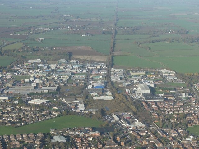
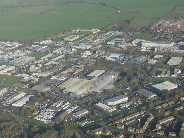
Administrative County: Lincolnshire

District: East Lindsey

Police Authority: Lincolnshire

What 3 Words

///station.frightens.ducks. Near Louth, Lincolnshire

Related Wikis

Acthorpe

Acthorpe is a hamlet in the East Lindsey district of Lincolnshire, England. It is situated approximately 2 miles (3 km) north-west from the town of Louth...

Louth North railway station

Louth North railway station is the future southern terminus of the Lincolnshire Wolds Railway where it will occupy a new site on the Fairfield industrial...

Fotherby Halt railway station

Fotherby Halt was a railway halt on the East Lincolnshire Railway which served the village of Fotherby in Lincolnshire between 1905 and 1961. The station...

Fotherby

Fotherby is a village and civil parish in the East Lindsey district of Lincolnshire, England. It is situated just east from the A16 road, 13 miles (21...

Brackenborough with Little Grimsby

Brackenborough with Little Grimsby is a civil parish in the East Lindsey district of Lincolnshire, England.According to the 2001 census, the parish had...

Brackenborough, Lincolnshire

Brackenborough is a hamlet in the civil parish of Brackenborough with Little Grimsby, in the East Lindsey district of Lincolnshire, England. At the census...

County Hospital Louth

County Hospital Louth is a healthcare facility in High Holme Road, Louth, Lincolnshire, England. It is managed by United Lincolnshire Hospitals NHS Trust...

Wolds College

The Wolds College was a further education college based in Louth, Lincolnshire. == History == It was built from November 2007 next door to Cordeaux School...

Related Videos

MILLY HAD OTHER IDEAS WHERE TO GO ON HOLIDAY 😪

This week we hit a big problem only 500 yards from work But thanks to Crouch recovery Clutchfix Ltd And East coast Commercials ...

#happy #holy #days #shorts

Don't wait for these events days to be Holy. The world needs more unconditional love so for Christmas I asked Santa for .

Barefoot Chronicles 048 - St Mary's Church, Fotherby 👣✝️⛪️☀️

On the next Barefoot Chronicles adventure, this edition visits Fotherby in Lincolnshire and the village church of St Mary's.

Nearby Amenities

Located within 500m of 53.388789,-0.026264482
Power: pole
Lat/Long: 53.3861266/-0.0216597
Power: pole
Lat/Long: 53.3868025/-0.023371
Power: pole
Lat/Long: 53.3873866/-0.0248289
Power: pole
Lat/Long: 53.3879998/-0.0263425
Power: pole
Lat/Long: 53.389301/-0.0271549
Power: pole
Lat/Long: 53.3904528/-0.0278457
Power: pole
Lat/Long: 53.3917323/-0.0286875
Acthorpe Wood Cottage
Place: isolated_dwelling
Lat/Long: 53.3918996/-0.0291592
The data included in this document is from www.openstreetmap.org. The data is made available under ODbL.

Have you been to Lathbury Holt?

Leave your review of Lathbury Holt below (or comments, questions and feedback).