Entry Head

Settlement in Midlothian

Scotland

Entry Head

Dalmahoy Hill and Tarmac Quarry buildings The quarry is identified as Ravelrig Quarry on the current OS 1:25000 map, and is in the next square to the SE. It is a huge hole <a href="https://www.geograph.org.uk/photo/887642">NT1466 : Dalmahoy Quarry</a> and was not there when I last went up the hill in the 1970s; it is also not on the 2001 edition of the map.
Dalmahoy Hill and Tarmac Quarry buildings Credit: M J Richardson

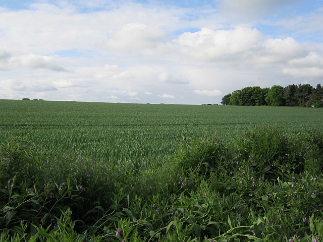
Entry Head is a small village located in the Midlothian region of Scotland. Situated approximately 10 miles south of Edinburgh, it lies within the parish of Penicuik. The village is nestled in a scenic setting, surrounded by lush green fields and rolling hills.

Entry Head is known for its peaceful and tranquil atmosphere, attracting residents seeking a serene countryside lifestyle while remaining close to urban amenities. The village consists of a cluster of traditional stone-built houses, giving it a charming and rustic feel.

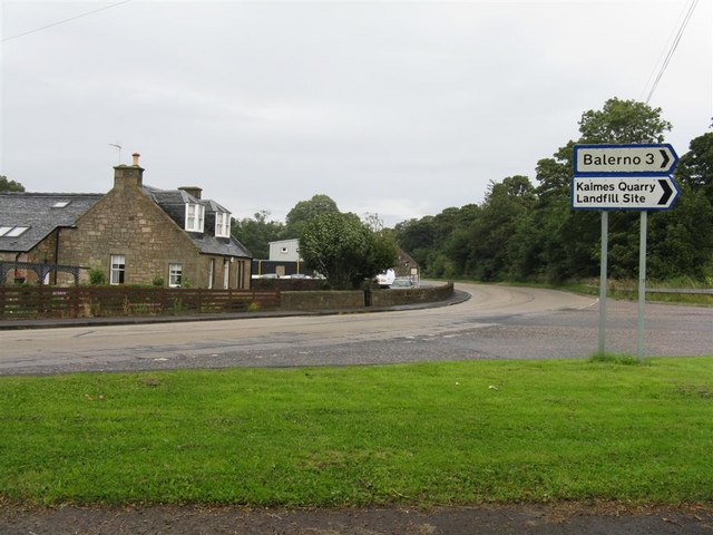
The village is well-connected to neighboring areas by road, with the A701 passing through the village, providing easy access to Edinburgh and other major towns in the region. Additionally, regular bus services operate, offering convenient transportation options for residents.

While Entry Head is predominantly residential, there are a few local amenities available within close proximity. Residents can find a small convenience store, providing essential groceries and everyday items. For more extensive shopping needs, the larger town of Penicuik is just a short drive away, offering a wider range of shops, supermarkets, and services.

The surrounding countryside offers ample opportunities for outdoor activities, such as hiking, cycling, and nature walks. The Pentland Hills Regional Park is also nearby, providing stunning landscapes and recreational facilities for residents and visitors alike.

Overall, Entry Head offers a picturesque and peaceful village lifestyle, ideal for those seeking a quiet retreat within easy reach of both countryside and city amenities.

If you have any feedback on the listing, please let us know in the comments section below.
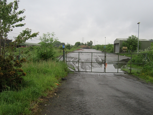
Entry Head Images

Images are sourced within 2km of 55.906394/-3.3771763 or Grid Reference NT1469. Thanks to Geograph Open Source API. All images are credited.

Dalmahoy Hill and Tarmac Quarry buildings The quarry is identified as Ravelrig Quarry on the current OS 1:25000 map, and is in the next square to the SE. It is a huge hole <a href="https://www.geograph.org.uk/photo/887642">NT1466 : Dalmahoy Quarry</a> and was not there when I last went up the hill in the 1970s; it is also not on the 2001 edition of the map.
Dalmahoy Hill and Tarmac Quarry buildings
The quarry is identified as Ravelrig Quarry on the current OS 1:25000 map, and is in the next square to the SE. It is a huge hole NT1466 : Dalmahoy Quarry and was not there when I last went up the hill in the 1970s; it is also not on the 2001 edition of the map.
Hardstanding beside the railway Marked on the map as a waste transfer station but looking hardly used now. One of the Dalmahoy quarries was filled in by a landfill site, so the waste may have all gone below the ground by now.
Hardstanding beside the railway
Marked on the map as a waste transfer station but looking hardly used now. One of the Dalmahoy quarries was filled in by a landfill site, so the waste may have all gone below the ground by now.
Railway west of Edinburgh The railway runs to Carstairs as part of the West Coast Mainline with a non electric branch heading to Glasgow via Shotts. These are two of the four routes between Glasgow and Edinburgh.
Railway west of Edinburgh
The railway runs to Carstairs as part of the West Coast Mainline with a non electric branch heading to Glasgow via Shotts. These are two of the four routes between Glasgow and Edinburgh.
Wheat, Bonnington Mains
A71 and parkland near the Linburn Centre
St Mary's Episcopal Church Dalmahoy Stained glass made and installed by the parishioners.
St Mary's Episcopal Church Dalmahoy
Stained glass made and installed by the parishioners.
St Mary's Episcopal Church Dalmahoy The Church viewed from the Churchyard looking east.
St Mary's Episcopal Church Dalmahoy
The Church viewed from the Churchyard looking east.
St Mary's Episcopal Church Dalmahoy St Mary's churchyard.
St Mary's Episcopal Church Dalmahoy
St Mary's churchyard.
The Gatehouse Dalmahoy Estate The Gatehouse at the entrance to the Dalmahoy estate.
The Gatehouse Dalmahoy Estate
The Gatehouse at the entrance to the Dalmahoy estate.
Dalmahoy Country Estate Entrance and sign to the Dalmahoy Country Club and Hotel.
Dalmahoy Country Estate
Entrance and sign to the Dalmahoy Country Club and Hotel.
Dalmahoy Country Estate Entrance road to the Hotel and the golf courses.
Dalmahoy Country Estate
Entrance road to the Hotel and the golf courses.
Dalmahoy Country Club Flags outside the Hotel.
Dalmahoy Country Club
Flags outside the Hotel.
Dalmahoy Country Club Lovely double staircase to the rear of the Hotel.
Dalmahoy Country Club
Lovely double staircase to the rear of the Hotel.
Dalmahoy Country Club Statue of James Braid at the putting greens with the Hotel in the background.
Dalmahoy Country Club
Statue of James Braid at the putting greens with the Hotel in the background.
Dalmahoy Golf Course The golf course viewed looking west from opposite the restaurant.
Dalmahoy Golf Course
The golf course viewed looking west from opposite the restaurant.
Dalmahoy Country Club And Hotel Front of the hotel featuring the lovely arches leading to the entrance.
Dalmahoy Country Club And Hotel
Front of the hotel featuring the lovely arches leading to the entrance.
Dalmahoy Golf Course Starters building for the golfers.
Dalmahoy Golf Course
Starters building for the golfers.
Weak bridge
Weak bridge
Show me another place!

Entry Head is located at Grid Ref: NT1469 (Lat: 55.906394, Lng: -3.3771763)

Unitary Authority: City of Edinburgh

Police Authority: Edinburgh

What 3 Words

///angel.walled.pokes. Near Ratho, Edinburgh

Nearby Locations

Entry Head

Related Wikis

1992 Solheim Cup

The second Solheim Cup golf match took place from 2 October to 4 October 1992 at Dalmahoy Country Club, Edinburgh, Scotland. The European team beat the...
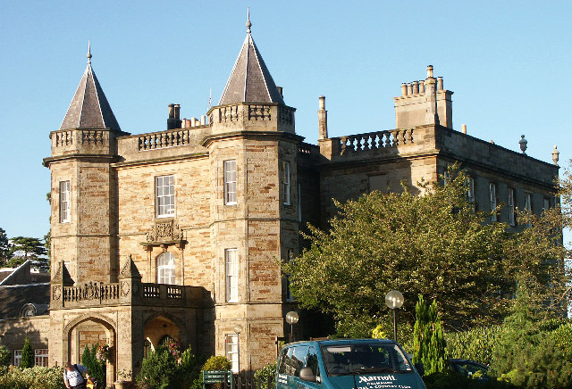
Dalmahoy

Dalmahoy (Scottish Gaelic: Dail MoThua) is a hotel and former country house near Edinburgh, Scotland. It is located off the A71 road, 3.5 kilometres (2...

Burnwynd

Burnwynd is a village on the border between the City of Edinburgh council area and West Lothian, Scotland. It is situated on the A71 road. Burnwynd is...

Haltoun House

Haltoun House, or Hatton House (or occasionally Argile House), was a Scottish baronial mansion set in a park, with extensive estates in the vicinity of...

Nearby Amenities

Located within 500m of 55.906394,-3.3771763
Mini Roundabout
Lat/Long: 55.9041838/-3.3718034
Power: pole
Lat/Long: 55.9069089/-3.3814447
Frequency: 50
Phases: 2
Power: pole
Transformer: distribution
Voltage Primary: 11000
Voltage Secondary: 400
Lat/Long: 55.9065736/-3.3801036
Power: pole
Lat/Long: 55.9064579/-3.3843308
Location Transition: yes
Power: pole
Lat/Long: 55.9062097/-3.3786956
Power: pole
Lat/Long: 55.9066819/-3.3828878
Power: pole
Lat/Long: 55.9065631/-3.3836533
Generator Method: wind_turbine
Generator Source: wind
Power: generator
Lat/Long: 55.909908/-3.380296
Addr Housenumber: 7
Lat/Long: 55.9070824/-3.37457
Frequency: 50
Phases: 2
Power: pole
Transformer: distribution
Voltage Primary: 11000
Voltage Secondary: 400
Lat/Long: 55.90815/-3.3773987
The data included in this document is from www.openstreetmap.org. The data is made available under ODbL.

Have you been to Entry Head?

Leave your review of Entry Head below (or comments, questions and feedback).