Five Acre Wood

Wood, Forest in Middlesex Welwyn Hatfield

England

Five Acre Wood

Church of St Thomas A Becket, Northaw It's there if you look closely
Church of St Thomas A Becket, Northaw Credit: David Howard

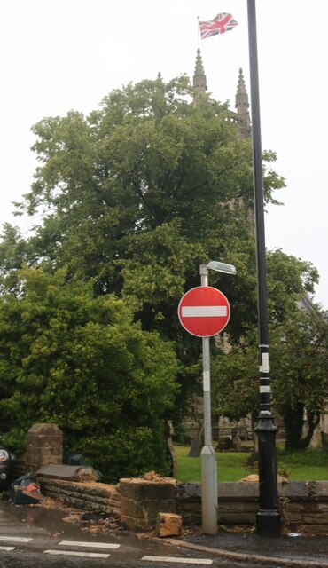
Five Acre Wood, located in Middlesex, is a picturesque forest spanning approximately five acres. Situated in the heart of the county, the woodland offers a serene and natural escape from the bustling urban environment nearby. The wood is a popular destination for nature enthusiasts, hikers, and families seeking a tranquil retreat.

The woodland boasts a diverse range of flora and fauna, making it an ideal habitat for various species. Towering oak and beech trees dominate the landscape, providing ample shade and shelter for the woodland creatures. Visitors can expect to encounter a variety of bird species, including woodpeckers, thrushes, and owls, as they explore the forest.

Several well-maintained walking trails wind their way through the wood, allowing visitors to explore its beauty at their leisure. These trails are suitable for all fitness levels and are often frequented by joggers and dog walkers. Along the paths, visitors can also find informative signage detailing the woodland's history, ecology, and points of interest.

Five Acre Wood is equipped with basic amenities to cater to the needs of visitors. There are picnic tables and benches scattered throughout the forest, providing the perfect spot for a leisurely lunch surrounded by nature's tranquility. Additionally, the wood features a small parking area, ensuring easy access for those arriving by car.

Overall, Five Acre Wood is a hidden gem in Middlesex, offering a peaceful and rejuvenating experience for nature lovers. Its pristine beauty, diverse wildlife, and well-maintained trails make it a popular destination for locals and tourists alike, seeking solace in the enchanting embrace of nature.

If you have any feedback on the listing, please let us know in the comments section below.

Five Acre Wood Images

Images are sourced within 2km of 51.695939/-0.1605705 or Grid Reference TL2701. Thanks to Geograph Open Source API. All images are credited.

Church of St Thomas A Becket, Northaw It's there if you look closely
Church of St Thomas A Becket, Northaw
It's there if you look closely
Northaw Green and memorial
Judge's pub, Northaw Finally fully open after the lockdowns
Judge's pub, Northaw
Finally fully open after the lockdowns
Closed shop on High Street, Potters Bar
About to join the M25 from the A111
Potters Bar bus garage
Potty's car park on Barnet Road, Potters Bar Potty's is on the corner of the road and is a pancake house.
Potty's car park on Barnet Road, Potters Bar
Potty's is on the corner of the road and is a pancake house.
Shops on Hatfield Road, Potters Bar
Allure hairdressers on Hatfield Road, Potters Bar
Potters Bar - Eunice & Franklin topple scaffolding On Friday (18/2/22) as Storm Eunice swept across the UK, this upper section of Potters Bar High Street was closed as a large construction of scaffolding was teetering, and some had already fallen along (I believe) with part of the building's roof.
I don't know if the road was later re-opened, but in the small hours of Monday (21/2/22) Storm Franklin went one better - bringing down a whole section of the scaffolding and spraying it across the High Street into Oakmere Park on the opposite side of the road. Needless to say, the road is definitely closed again and I would think it will remain that way for quite some time.
Potters Bar - Eunice & Franklin topple scaffolding
On Friday (18/2/22) as Storm Eunice swept across the UK, this upper section of Potters Bar High Street was closed as a large construction of scaffolding was teetering, and some had already fallen along (I believe) with part of the building's roof. I don't know if the road was later re-opened, but in the small hours of Monday (21/2/22) Storm Franklin went one better - bringing down a whole section of the scaffolding and spraying it across the High Street into Oakmere Park on the opposite side of the road. Needless to say, the road is definitely closed again and I would think it will remain that way for quite some time.
The entrance to Potters Bar FC This was the closest I could see to an actual entrance. There were no signs or clues otherwise besides the one opposite.
The entrance to Potters Bar FC
This was the closest I could see to an actual entrance. There were no signs or clues otherwise besides the one opposite.
Potters Bar FC car park The entrance to the stadium to the right of the block is a well kept secret.
Potters Bar FC car park
The entrance to the stadium to the right of the block is a well kept secret.
The entrance to Potters Bar FC
The Walks, Potters Bar
Parkfield Medical Centre, Potters Bar
Northaw Road West
Northaw Road West
Houses on Strafford Gate
Show me another place!

Five Acre Wood is located at Grid Ref: TL2701 (Lat: 51.695939, Lng: -0.1605705)

Administrative County: Hertfordshire

District: Welwyn Hatfield

Police Authority: Hertfordshire

What 3 Words

///tries.flows.score. Near Potters Bar, Hertfordshire

Related Wikis

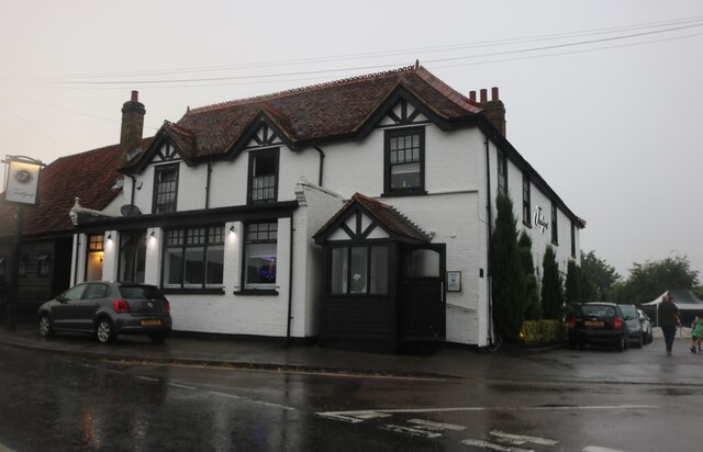
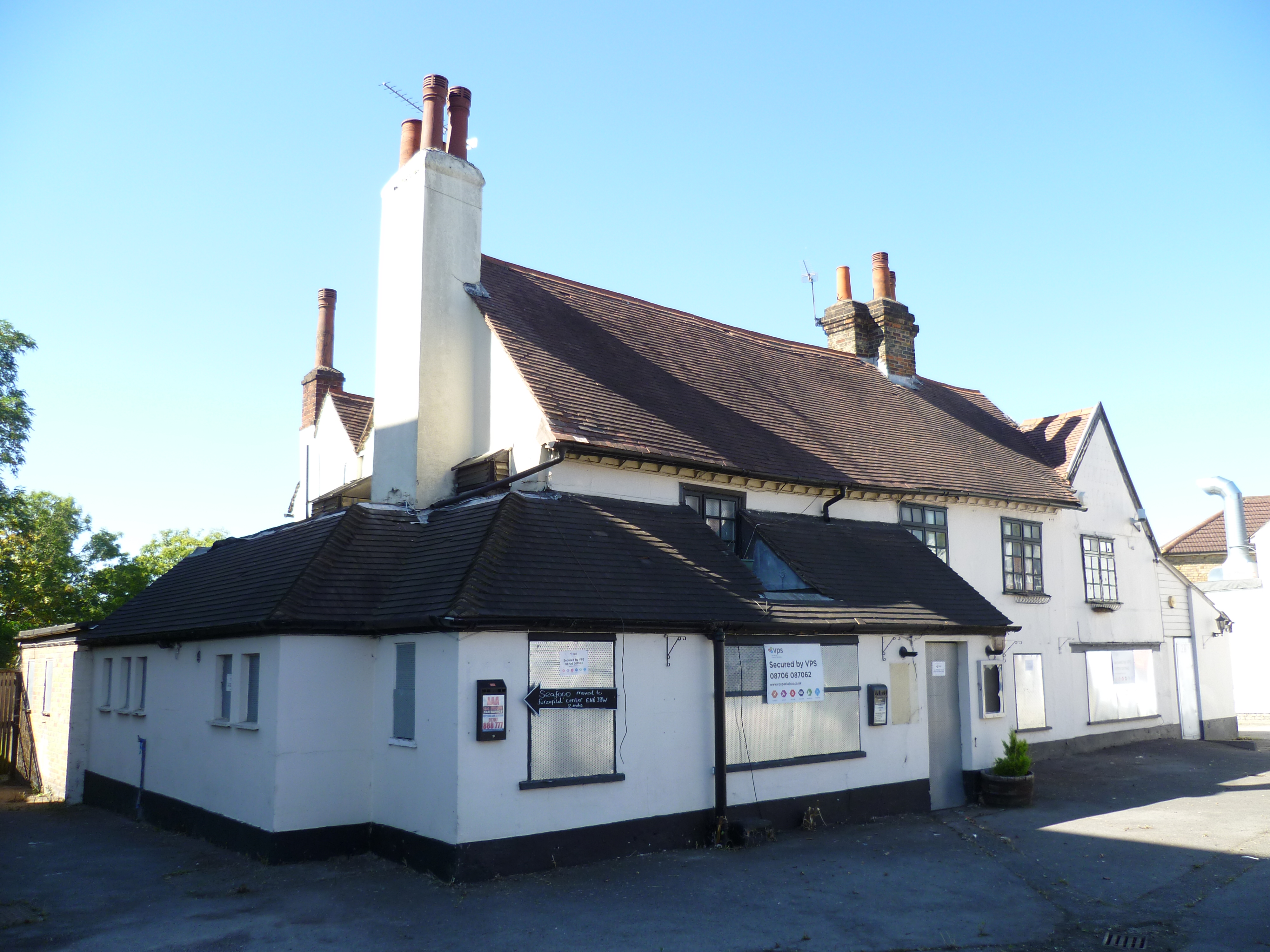
The Chequers, Potters Bar

The Chequers was a public house which occupied a Grade II listed building in Potters Bar, England. Originally opening in the 1700s, the pub moved site...

Northaw

Northaw is a village in the Welwyn Hatfield district of Hertfordshire, England. It is part of the civil parish of Northaw and Cuffley (where at the 2011...
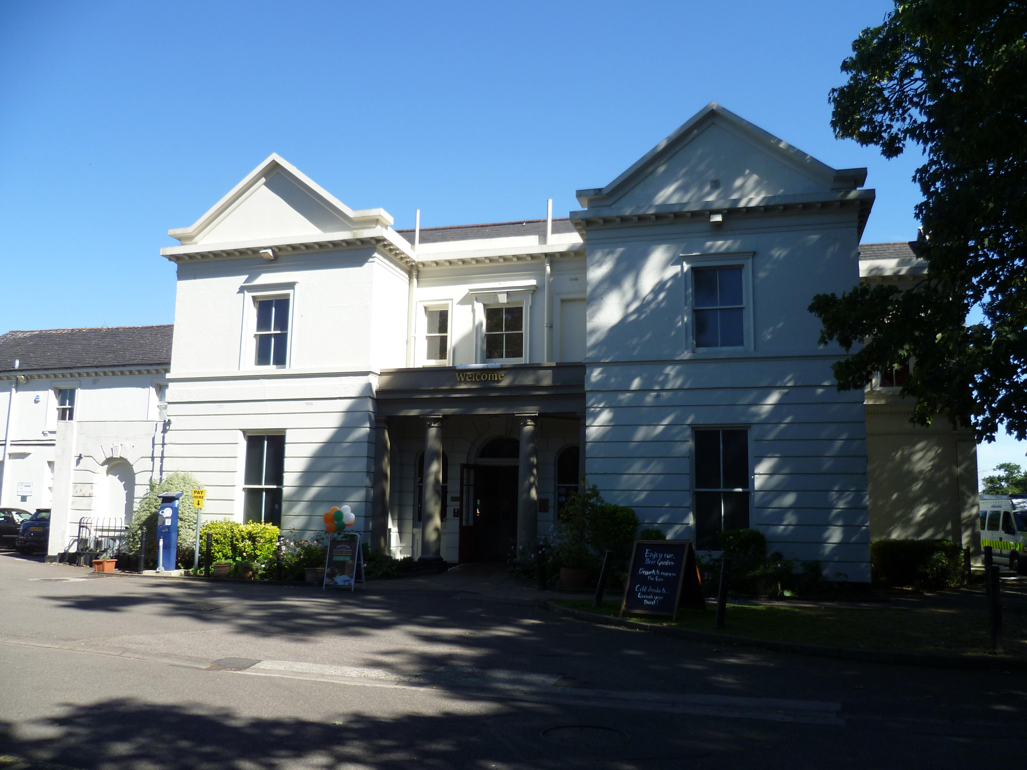
Oakmere House

Oakmere House is a public house and restaurant in Potters Bar, England, and a grade II listed building with Historic England. The pub is under the management...

The Dower House, Northaw

The Dower House is a Grade II* listed house in Cooper's Lane between Potters Bar and Northaw in Hertfordshire, England. It was built in 1749 and was formerly...

The Green Man, Potters Bar

The Green Man is a disused public house in High Street, Potters Bar, England, and a Grade II listed building with Historic England. It was built in the...

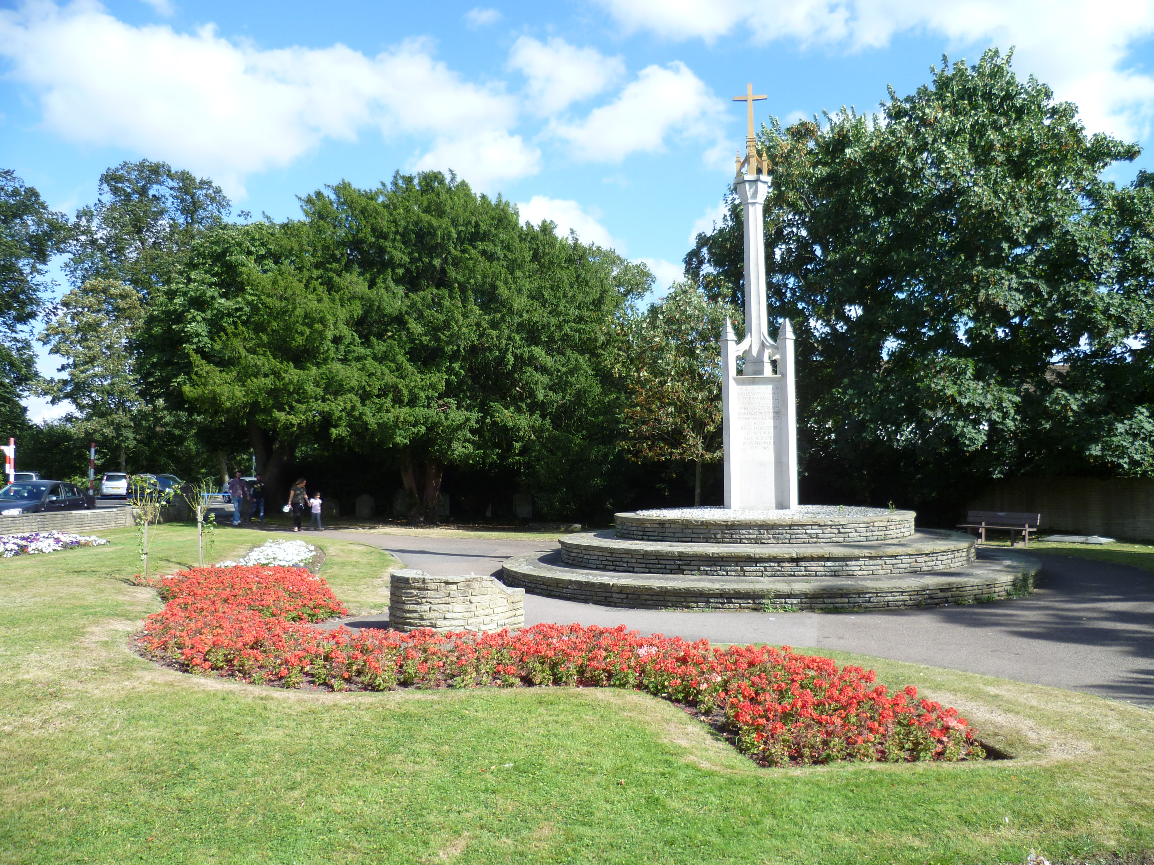
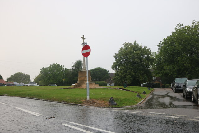
Potters Bar War Memorial

Potters Bar war memorial is located in St John's Churchyard in High Street, Potters Bar, England. The memorial was designed by the Arts and Crafts architect...

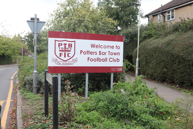
Potters Bar Town F.C.

Potters Bar Town Football Club is an English football club based in Potters Bar, Hertfordshire, England. They were formed in 1960 as Mount Grace Old Scholars...

Ladbrooke School

Ladbrooke School is a former school in High Street, Potters Bar, England, and a grade II listed building with Historic England. == References == ��2�...

Nearby Amenities

Located within 500m of 51.695939,-0.1605705
Ele: 91.943237
Lat/Long: 51.699585/-0.1627858
Turning Circle
Lat/Long: 51.6960701/-0.1660104
Bus Stop
Bowmans Close
Bus: yes
Naptan AtcoCode: 210021000310
Naptan Bearing: E
Naptan CommonName: Bowmans Close
Naptan Crossing: Bowmans Close
Naptan Indicator: adj
Naptan Landmark: Bowmans Close
Naptan NaptanCode: hrtgpwaw
Naptan PlusbusZoneRef: POTRSBR
Naptan ShortCommonName: NA
Naptan Street: Oakmere Lane
Naptan Verified: no
Public Transport: platform
Shelter: no
Source: naptan_import
Lat/Long: 51.6961993/-0.1672843
Oakmere Primary School
Naptan AtcoCode: 210021000315
Naptan Bearing: S
Naptan BusStopType: CUS
Naptan CommonName: Oakmere Primary School
Naptan Crossing: Marsh Close
Naptan Indicator: adj
Naptan Landmark: Marsh Close
Naptan NaptanCode: hrtgpwda
Naptan PlusbusZoneRef: POTRSBR
Naptan ShortCommonName: NA
Naptan Street: Chace Avenue
Naptan Verified: no
Source: naptan_import
Lat/Long: 51.6942051/-0.1656866
Direction: 190
Generator Method: photovoltaic
Generator Output Electricity: yes
Generator Solar Modules: 6
Generator Source: solar
Generator Type: solar_photovoltaic_panel
Location: roof
Power: generator
Lat/Long: 51.6967543/-0.1654775
Direction: 100
Generator Method: photovoltaic
Generator Output Electricity: yes
Generator Solar Modules: 6
Generator Source: solar
Generator Type: solar_photovoltaic_panel
Location: roof
Power: generator
Lat/Long: 51.6967714/-0.1654273
Direction: 270
Generator Method: photovoltaic
Generator Output Electricity: yes
Generator Solar Modules: 7
Generator Source: solar
Generator Type: solar_photovoltaic_panel
Location: roof
Power: generator
Lat/Long: 51.6964192/-0.1634422
Direction: 90
Generator Method: photovoltaic
Generator Output Electricity: yes
Generator Solar Modules: 7
Generator Source: solar
Generator Type: solar_photovoltaic_panel
Location: roof
Power: generator
Lat/Long: 51.6964192/-0.1633802
Direction: 185
Generator Method: photovoltaic
Generator Output Electricity: yes
Generator Solar Modules: 12
Generator Source: solar
Generator Type: solar_photovoltaic_panel
Location: roof
Power: generator
Lat/Long: 51.6971599/-0.165543
Direction: 150
Generator Method: photovoltaic
Generator Output Electricity: yes
Generator Solar Modules: 12
Generator Source: solar
Generator Type: solar_photovoltaic_panel
Location: roof
Power: generator
Lat/Long: 51.6929119/-0.163804
Direction: 185
Generator Method: photovoltaic
Generator Output Electricity: yes
Generator Solar Modules: 4
Generator Source: solar
Generator Type: solar_photovoltaic_panel
Location: roof
Power: generator
Lat/Long: 51.6938416/-0.1655648
Turning Circle
Lat/Long: 51.6952286/-0.1670621
Direction: 145
Generator Method: photovoltaic
Generator Output Electricity: yes
Generator Solar Modules: 10
Generator Source: solar
Generator Type: solar_photovoltaic_panel
Location: roof
Power: generator
Lat/Long: 51.6950812/-0.1654713
Direction: 195
Generator Method: photovoltaic
Generator Output Electricity: yes
Generator Solar Modules: 10
Generator Source: solar
Generator Type: solar_photovoltaic_panel
Location: roof
Power: generator
Lat/Long: 51.6961413/-0.165821
Crossing
Crossing: unmarked
Lat/Long: 51.694332/-0.1657078
Crossing
Crossing: unmarked
Lat/Long: 51.6944186/-0.1655628
Crossing
Crossing: unmarked
Lat/Long: 51.69615/-0.1673803
Crossing
Crossing: unmarked
Lat/Long: 51.6938161/-0.1657436
Crossing
Crossing: unmarked
Lat/Long: 51.6941149/-0.1657797
Entrance: yes
Lat/Long: 51.6938575/-0.1664222
Entrance: yes
Lat/Long: 51.693929/-0.166158
Crossing
Crossing: unmarked
Lat/Long: 51.693579/-0.1659912
Bus Stop
Stamford Close
Public Transport: platform
Lat/Long: 51.6952256/-0.1661065
Addr Housenumber: 7
Addr Postcode: EN6 5BX
Addr Street: Chace Avenue
Addr Substreet: Sutton Court
Lat/Long: 51.6939467/-0.1656228
Addr Housenumber: 8-11
Addr Postcode: EN6 5BX
Addr Street: Chace Avenue
Addr Substreet: Sutton Court
Lat/Long: 51.6939155/-0.1656513
Addr Housenumber: 12
Addr Postcode: EN6 5BX
Addr Street: Chace Avenue
Addr Substreet: Sutton Court
Lat/Long: 51.693833/-0.1655807
Crossing
Crossing: marked
Lat/Long: 51.6992569/-0.1638709
Barrier: bollard
Lat/Long: 51.6976571/-0.1577104
Barrier: horse_stile
Lat/Long: 51.697576/-0.1577686
Barrier: motorcycle_barrier
Lat/Long: 51.6975805/-0.1577354
Barrier: horse_stile
Lat/Long: 51.6953409/-0.1554483
Noexit: yes
Lat/Long: 51.6993867/-0.1650808
Crossing
Crossing: unmarked
Lat/Long: 51.6981658/-0.1660069
Crossing
Crossing: unmarked
Lat/Long: 51.6978796/-0.1660657
The data included in this document is from www.openstreetmap.org. The data is made available under ODbL.

Have you been to Five Acre Wood?

Leave your review of Five Acre Wood below (or comments, questions and feedback).