Ash Holt

Wood, Forest in Lincolnshire

England

Ash Holt

Equestrian facility near Ashby-cum-Fenby: aerial 2021
Equestrian facility near Ashby-cum-Fenby: aerial 2021 Credit: Simon Tomson

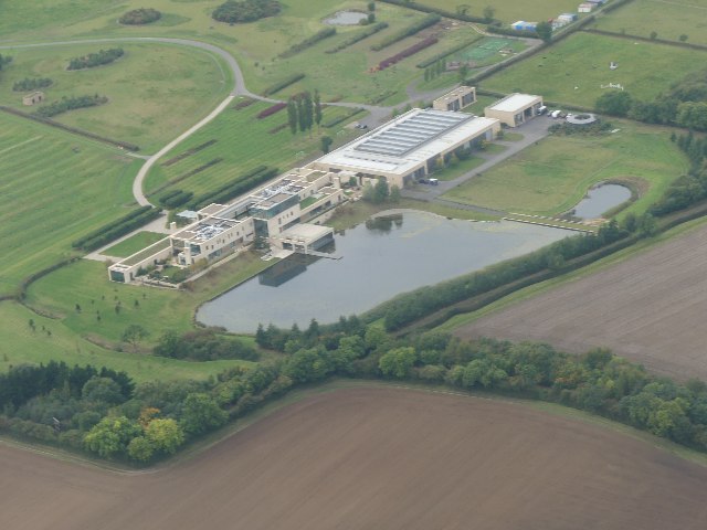
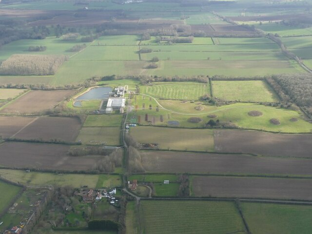
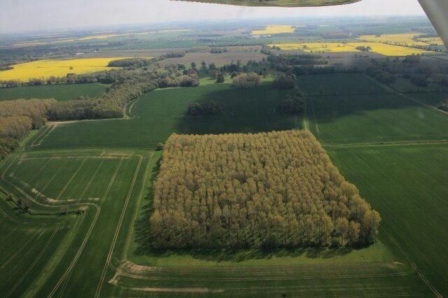
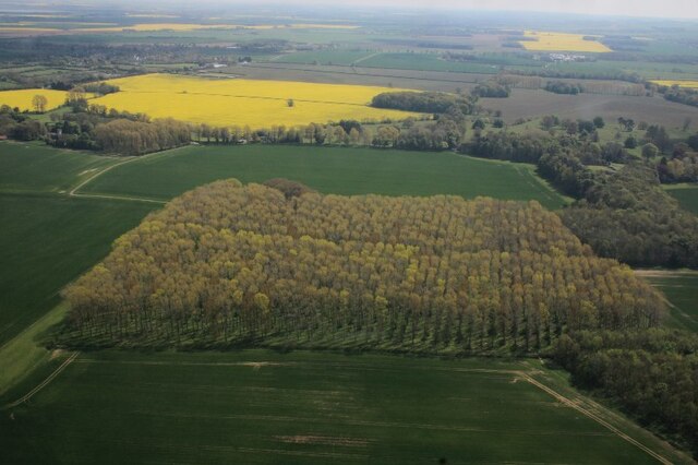
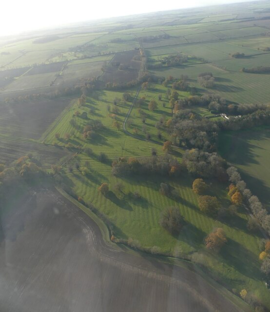
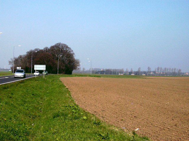
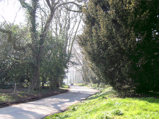
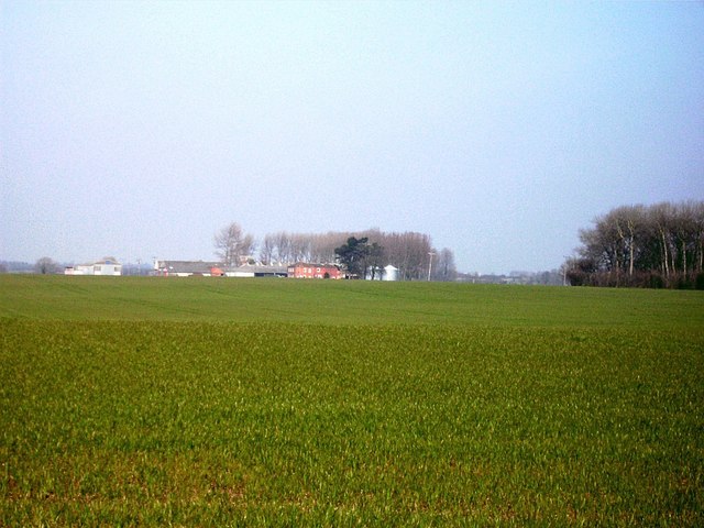
Ash Holt is a small woodland area situated in Lincolnshire, England. It is located near the village of Ashby de la Launde, approximately 10 miles southeast of Lincoln. Covering an area of about 100 acres, Ash Holt is primarily composed of a mix of deciduous and coniferous trees, creating a picturesque forest landscape.

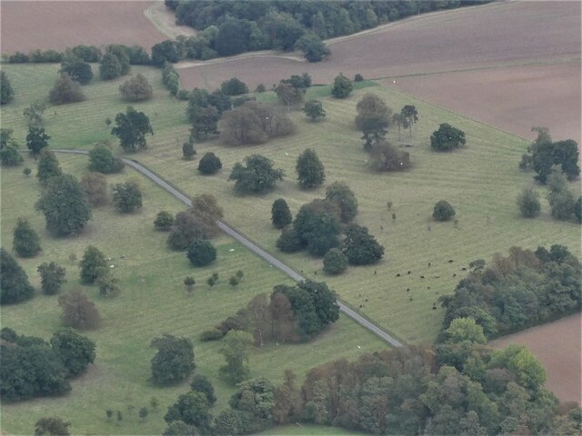
The woodland is home to an array of wildlife, including various bird species, mammals, and insects. Visitors to Ash Holt can often spot creatures such as deer, squirrels, rabbits, and a variety of birds, making it a popular destination for nature enthusiasts and birdwatchers.

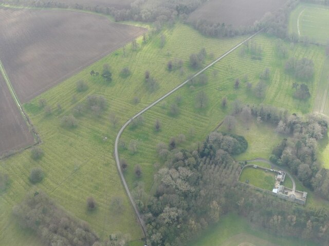
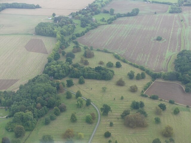
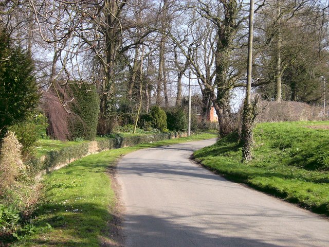
The forest features several well-maintained walking trails, allowing visitors to explore and enjoy the natural beauty of the area. These trails wind through the trees, providing a peaceful and tranquil atmosphere. The woodland also has designated picnic areas, making it an ideal spot for families and groups to relax and enjoy a meal surrounded by nature.

Ash Holt is managed by the Forestry Commission, ensuring the preservation and conservation of the woodland. The commission undertakes regular maintenance and tree planting activities to sustain the health of the forest. Additionally, educational programs and events are organized to raise awareness about the importance of preserving natural habitats and wildlife.

Overall, Ash Holt provides a serene and scenic escape from the bustling city life, offering visitors the opportunity to immerse themselves in the beauty of nature and discover the diverse ecosystem that thrives within its boundaries.

If you have any feedback on the listing, please let us know in the comments section below.

Ash Holt Images

Images are sourced within 2km of 53.488006/-0.083853207 or Grid Reference TA2700. Thanks to Geograph Open Source API. All images are credited.

Equestrian facility near Ashby-cum-Fenby: aerial 2021
Across Ashby cum Fenby to the equestrian facility at South Farm: aerial 2022
Equestrian facility at South Farm, Ashby cum Fenby: aerial 2022 See also <a href="https://www.geograph.org.uk/photo/7144747">TF2599 : Across Ashby cum Fenby to the equestrian facility at South Farm: aerial 2022</a>.
Equestrian facility at South Farm, Ashby cum Fenby: aerial 2022
Ridge and furrow, Grainsby Park: aerial 2022 See: <span class="nowrap"><a title="https://www.heritagegateway.org.uk/Gateway/Results_Single.aspx?uid=MLI41213&resourceID=1006" rel="nofollow ugc noopener" href="https://www.heritagegateway.org.uk/Gateway/Results_Single.aspx?uid=MLI41213&resourceID=1006">Link</a><img style="margin-left:2px;" alt="External link" title="External link - shift click to open in new window" src="https://s1.geograph.org.uk/img/external.png" width="10" height="10"/></span> and
<span class="nowrap"><a title="https://www.heritagegateway.org.uk/Gateway/Results_Single.aspx?uid=MLI41219&resourceID=1006" rel="nofollow ugc noopener" href="https://www.heritagegateway.org.uk/Gateway/Results_Single.aspx?uid=MLI41219&resourceID=1006">Link</a><img style="margin-left:2px;" alt="External link" title="External link - shift click to open in new window" src="https://s1.geograph.org.uk/img/external.png" width="10" height="10"/></span>
Ridge and furrow, Grainsby Park: aerial 2022
See: LinkExternal link and LinkExternal link
Grainsby Church and Manor Farm: aerial 2022
Fenby Wood: aerial 2022
Wood north of Grainsby: aerial 2022
Grainsby Park: aerial 2022 See: <span class="nowrap"><a title="https://www.heritagegateway.org.uk/Gateway/Results_Single.aspx?uid=MLI41219&resourceID=1006" rel="nofollow ugc noopener" href="https://www.heritagegateway.org.uk/Gateway/Results_Single.aspx?uid=MLI41219&resourceID=1006">Link</a><img style="margin-left:2px;" alt="External link" title="External link - shift click to open in new window" src="https://s1.geograph.org.uk/img/external.png" width="10" height="10"/></span>
Grainsby Park: aerial 2022
See: LinkExternal link
Grainsby: aerial 2022 (2)
Grainsby: aerial 2023 See: <span class="nowrap"><a title="https://www.heritagegateway.org.uk/Gateway/Results_Single.aspx?uid=MLI41219&resourceID=1006," rel="nofollow ugc noopener" href="https://www.heritagegateway.org.uk/Gateway/Results_Single.aspx?uid=MLI41219&resourceID=1006,">Link</a><img style="margin-left:2px;" alt="External link" title="External link - shift click to open in new window" src="https://s1.geograph.org.uk/img/external.png" width="10" height="10"/></span>
<span class="nowrap"><a title="https://www.heritagegateway.org.uk/Gateway/Results_Single.aspx?uid=MLI43495&resourceID=1006" rel="nofollow ugc noopener" href="https://www.heritagegateway.org.uk/Gateway/Results_Single.aspx?uid=MLI43495&resourceID=1006">Link</a><img style="margin-left:2px;" alt="External link" title="External link - shift click to open in new window" src="https://s1.geograph.org.uk/img/external.png" width="10" height="10"/></span> and
<span class="nowrap"><a title="https://www.heritagegateway.org.uk/Gateway/Results_Single.aspx?uid=MLI41213&resourceID=1006" rel="nofollow ugc noopener" href="https://www.heritagegateway.org.uk/Gateway/Results_Single.aspx?uid=MLI41213&resourceID=1006">Link</a><img style="margin-left:2px;" alt="External link" title="External link - shift click to open in new window" src="https://s1.geograph.org.uk/img/external.png" width="10" height="10"/></span>
Grainsby: aerial 2023
See: LinkExternal link LinkExternal link and LinkExternal link
St.Nicholas' church, Grainsby, Lincs. A fascinating archaeological puzzle with a Norman south doorway (missing the shafts described by Pevsner) and what looks like an early English tower, but it once had a high nave with a steep pitched roof. Bits of zig-zag moulding re-set and a north side refaced in brick in 1834.
St.Nicholas' church, Grainsby, Lincs.
A fascinating archaeological puzzle with a Norman south doorway (missing the shafts described by Pevsner) and what looks like an early English tower, but it once had a high nave with a steep pitched roof. Bits of zig-zag moulding re-set and a north side refaced in brick in 1834.
Cornflowers near Grainsby
Footbridge  Looking SW from the top NE corner of the grid square which is all farmland.
Footbridge
Looking SW from the top NE corner of the grid square which is all farmland.
Busy road This is the main A16 trunk road between Grimsby and Louth taken from the cross-roads near Grainsby looking north.  The very open nature of the scene here contrasts with the very busy road which carries a lot of very heavy traffic.
Busy road
This is the main A16 trunk road between Grimsby and Louth taken from the cross-roads near Grainsby looking north. The very open nature of the scene here contrasts with the very busy road which carries a lot of very heavy traffic.
Village lane The entrance to Grainsby taken looking east towards the A16, and a very typical English village scene.  The quietness is a great relief from the busy road nearby.
Village lane
The entrance to Grainsby taken looking east towards the A16, and a very typical English village scene. The quietness is a great relief from the busy road nearby.
Grainsby church Taken from the roadway the church (St. Nicholas) is a jigsaw of mixed archaelology.  The pole that can be seen next to the trees on the right shows the course of the footpath to Ashby-cum-Fenby.
Grainsby church
Taken from the roadway the church (St. Nicholas) is a jigsaw of mixed archaelology. The pole that can be seen next to the trees on the right shows the course of the footpath to Ashby-cum-Fenby.
Long and winding lane The narrow lane through Grainsby continues west out of the village and heads towards Wold Newton, some 4 miles away.
Long and winding lane
The narrow lane through Grainsby continues west out of the village and heads towards Wold Newton, some 4 miles away.
Waithe Grange Farm Long distance photograph taken from the Ashby-cum-Fenby footpath out of Grainsby.  The farm is situated on the Waithe road about 1 mile away.
Waithe Grange Farm
Long distance photograph taken from the Ashby-cum-Fenby footpath out of Grainsby. The farm is situated on the Waithe road about 1 mile away.
Show me another place!

Ash Holt is located at Grid Ref: TA2700 (Lat: 53.488006, Lng: -0.083853207)

Unitary Authority: North East Lincolnshire

Police Authority: Humberside

What 3 Words

///toned.rainwater.curry. Near Holton le Clay, Lincolnshire

Nearby Locations

Ash Holt

Related Wikis

Waithe

Waithe (or Waythe) is a hamlet and civil parish in the East Lindsey district of Lincolnshire, England. It is on the A16, 1 mile (1.6 km) south from Holton...

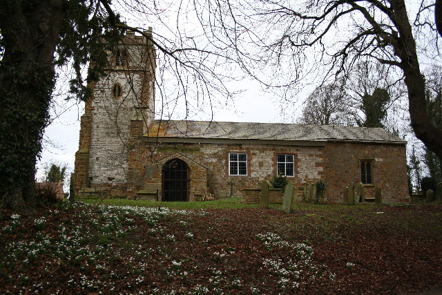
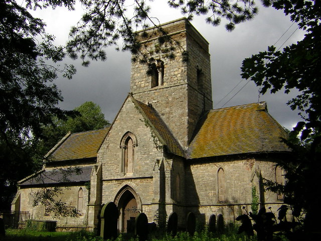
St Martin's Church, Waithe

St Martin's Church is a redundant Anglican church in the village of Waithe, Lincolnshire, England. It is recorded in the National Heritage List for England...

Grainsby

Grainsby is a hamlet and civil parish in the East Lindsey district of Lincolnshire, England. It is situated 5 miles (8 km) south from Grimsby, and just...

RAF Grimsby

Royal Air Force Grimsby or more simply RAF Grimsby is a former Royal Air Force station located near Grimsby, Lincolnshire, England. The site was operational...

Ashby cum Fenby

Ashby cum Fenby is a village and civil parish in North East Lincolnshire, England, approximately 5 miles (8 km) south from Grimsby, and just east of the...

Brigsley

Brigsley is a village and civil parish in North East Lincolnshire, England, and on the B1203 road, 1 mile (1.6 km) south from Waltham. According to the...

Holton-le-Clay railway station

Holton-le-Clay was a railway station on the East Lincolnshire Railway which served the English villages of Holton-le-Clay and Tetney in Lincolnshire between...

Church of St Peter, Holton-le-Clay

The Church of St Peter is the Grade II* listed Anglican parish church for the village of Holton-le-Clay in Lincolnshire. It is dedicated to St Peter and...

Nearby Amenities

Located within 500m of 53.488006,-0.083853207
Power: pole
Lat/Long: 53.486147/-0.0890888
Power: pole
Lat/Long: 53.4866051/-0.0867683
Power: pole
Lat/Long: 53.4871032/-0.0844937
Power: pole
Lat/Long: 53.4875508/-0.0821803
Power: pole
Lat/Long: 53.4880069/-0.0798774
Power: pole
Lat/Long: 53.4884713/-0.0777371
Bratton House Farm
Place: isolated_dwelling
Source: Bing
Lat/Long: 53.4906301/-0.0780045
The data included in this document is from www.openstreetmap.org. The data is made available under ODbL.

Have you been to Ash Holt?

Leave your review of Ash Holt below (or comments, questions and feedback).