Pookchurch Wood

Wood, Forest in Sussex Mid Sussex

England

Pookchurch Wood

Tanyard Lane, Staplefield A private road, but public footpath 6CR.
Tanyard Lane, Staplefield Credit: Robin Webster

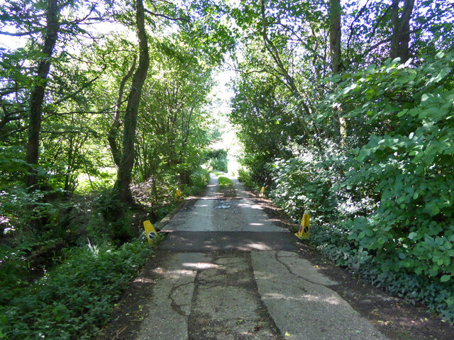
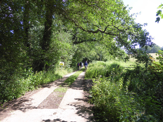
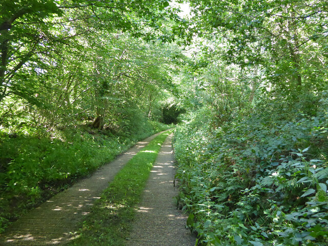
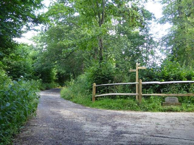
Pookchurch Wood is a picturesque woodland located in Sussex, England. Nestled in the South Downs National Park, this ancient woodland spans an area of approximately 200 acres. The wood is situated just south of the village of Hurstpierpoint and is easily accessible by both car and foot.

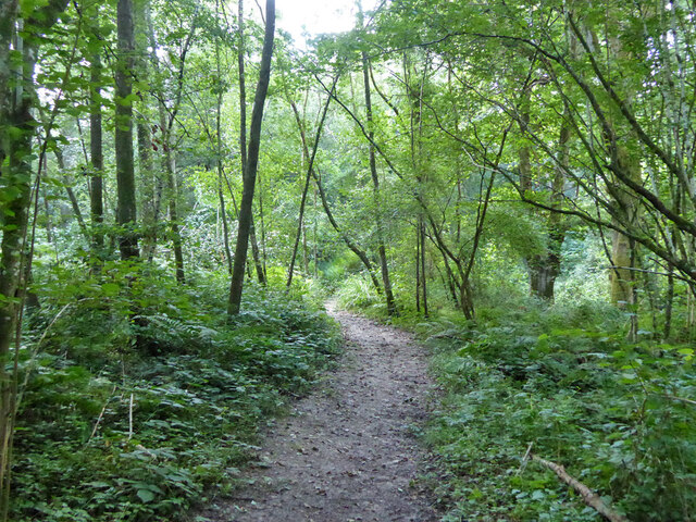
The wood is well-known for its diverse range of flora and fauna, making it a popular spot for nature enthusiasts. Its dense canopy of oak and beech trees provides a sanctuary for various bird species, including woodpeckers, owls, and finches. The forest floor is adorned with a carpet of bluebells during the spring months, creating a stunning visual spectacle.

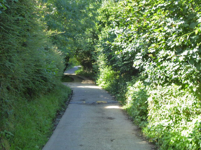
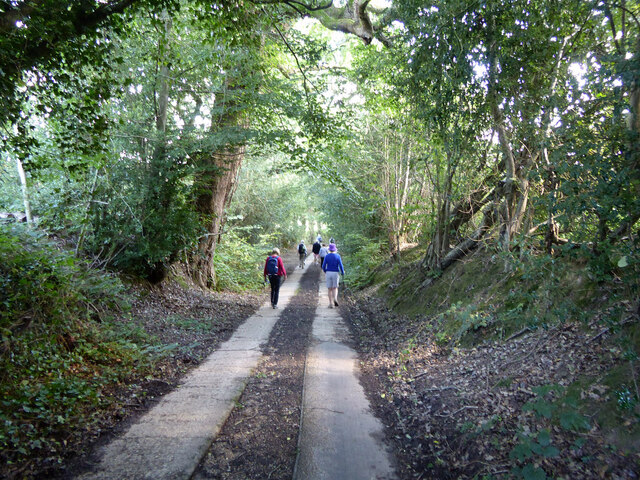
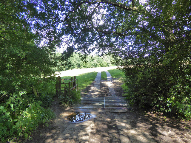
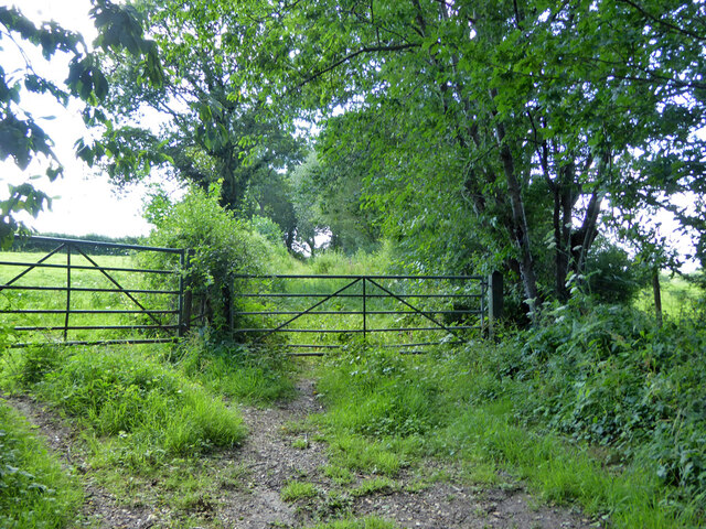
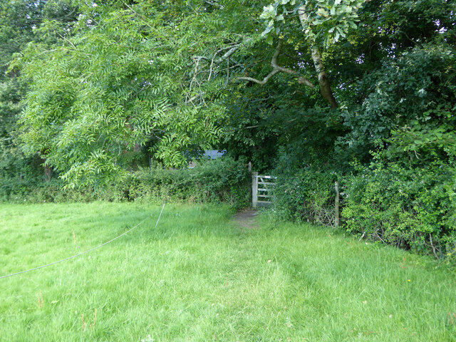
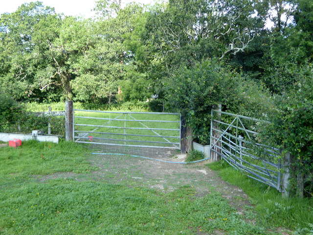
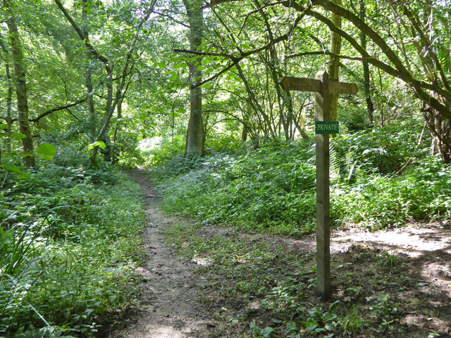
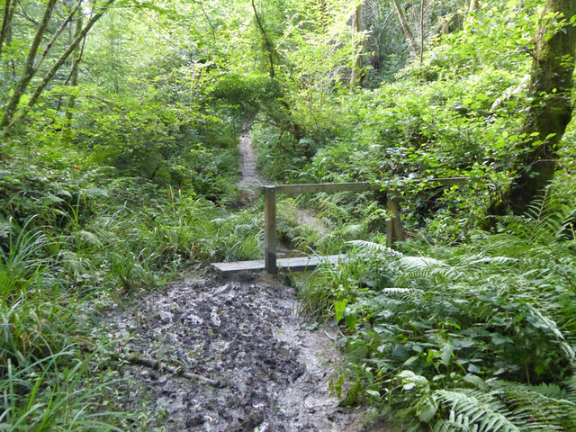
Pookchurch Wood is crisscrossed by a network of footpaths, allowing visitors to explore its tranquil surroundings. The main trail leads through the heart of the wood, offering glimpses of ancient woodland features such as moss-covered tree trunks and fallen logs. There are also several clearings within the wood, perfect for picnics or simply taking in the peaceful atmosphere.

The wood has a rich history, with evidence of human activity dating back centuries. In fact, it is believed that the name "Pookchurch" derives from an old Saxon word meaning "place of the spirits." This adds an air of mystique to the woodland, enhancing its allure.

Overall, Pookchurch Wood is a captivating destination for those seeking a retreat into nature. Its beauty, biodiversity, and historical significance make it a true gem within the Sussex countryside.

If you have any feedback on the listing, please let us know in the comments section below.

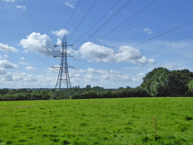
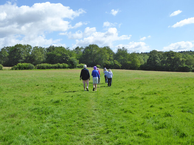
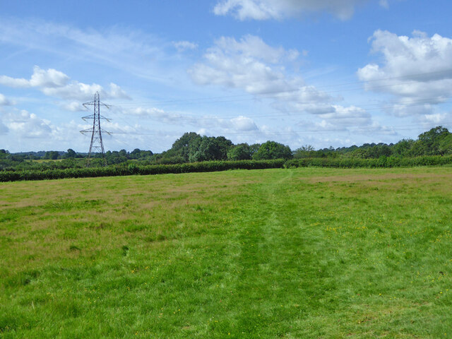
Pookchurch Wood Images

Images are sourced within 2km of 51.051006/-0.1901774 or Grid Reference TQ2629. Thanks to Geograph Open Source API. All images are credited.

Tanyard Lane, Staplefield A private road, but public footpath 6CR.
Tanyard Lane, Staplefield
A private road, but public footpath 6CR.
Tanyard Cottages, Tanyard Lane, Staplefield
Tanyard Lane, Staplefield For the public, only a footpath - 6CR.
Tanyard Lane, Staplefield
For the public, only a footpath - 6CR.
Track and footpath branching off Tanyard Lane The track goes to Oldhouse, footpath 3CR to Handcross.
Track and footpath branching off Tanyard Lane
The track goes to Oldhouse, footpath 3CR to Handcross.
Tanyard Lane bridge over Foxhole Gill A bridge with no parapets, and a fair drop to the stream below.
Tanyard Lane bridge over Foxhole Gill
A bridge with no parapets, and a fair drop to the stream below.
Tanyard Lane towards Allens Farm The yellow sign warns of deep ditches to either side, which is true, in some places sheer off the concrete strips. This private farm access is also public footpath 4CR.
Tanyard Lane towards Allens Farm
The yellow sign warns of deep ditches to either side, which is true, in some places sheer off the concrete strips. This private farm access is also public footpath 4CR.
Tanyard Lane Private access to Allens and Dillion's Farms, it is also public footpath 4CR.
Tanyard Lane
Private access to Allens and Dillion's Farms, it is also public footpath 4CR.
Path and track junction near Allens Farm Straight on is private access to Dillion's Farm. Left is footpath 2CR to Handcross. Right is access to Allens Farm, shared part of the way with footpath 5CR which may be used as part of a route to Balcombe.
Path and track junction near Allens Farm
Straight on is private access to Dillion's Farm. Left is footpath 2CR to Handcross. Right is access to Allens Farm, shared part of the way with footpath 5CR which may be used as part of a route to Balcombe.
Short green lane near Allens Farm With no public status, and not much used anyway, this was the start of a route, mainly field edges, to Staplefield Upper Common. This has apparently withered away.
Short green lane near Allens Farm
With no public status, and not much used anyway, this was the start of a route, mainly field edges, to Staplefield Upper Common. This has apparently withered away.
Footpath 5CR near Allens Farm Through the gate the path drops down four or five steps to the farm approach track.
Footpath 5CR near Allens Farm
Through the gate the path drops down four or five steps to the farm approach track.
Barns at Allens Farm
Gate on footpath 5CR near Allens Farm
Power line near Allens Farm
Walkers on footpath 5CR Towards Ditton Place, Brantridge Lane and it is part of a route to Balcombe. The official route goes round the field edges on the left, but nobody seems to go that way with the field in permanent grass.
Walkers on footpath 5CR
Towards Ditton Place, Brantridge Lane and it is part of a route to Balcombe. The official route goes round the field edges on the left, but nobody seems to go that way with the field in permanent grass.
Footpath 5CR towards Staplefield or Handcross The official route goes round the field edges on the right, but nobody seems to go that way with the field in permanent grass.
Footpath 5CR towards Staplefield or Handcross
The official route goes round the field edges on the right, but nobody seems to go that way with the field in permanent grass.
Public and private paths In gill woodland, public footpath 5CR crosses the gill, the private path runs along the western shoulder. The quite significant gill has no mapped name.
Public and private paths
In gill woodland, public footpath 5CR crosses the gill, the private path runs along the western shoulder. The quite significant gill has no mapped name.
Gill footbridge, path 5CR By rights the mud should have dried up by late July, but there had been some very wet days.
Gill footbridge, path 5CR
By rights the mud should have dried up by late July, but there had been some very wet days.
Footpath 5CR in unnamed gill Running down to cross the stream to the right.
Footpath 5CR in unnamed gill
Running down to cross the stream to the right.
Show me another place!

Pookchurch Wood is located at Grid Ref: TQ2629 (Lat: 51.051006, Lng: -0.1901774)

Administrative County: West Sussex

District: Mid Sussex

Police Authority: Sussex

What 3 Words

///lunching.cages.indicated. Near Handcross, West Sussex

Related Wikis

Cow Wood and Harry's Wood

Cow Wood and Harry's Wood is a 75.5-hectare (187-acre) biological Site of Special Scientific Interest east of Handcross in West Sussex. it is in the High...

Nymans

Nymans is an English garden to the east of the village of Handcross, and in the civil parish of Slaugham in West Sussex, England. The garden was developed...

Handcross Hill bus crash

On 12 July 1906, a bus crashed into a tree on Handcross Hill in Sussex, England, killing 10 people and injuring a further 26 in the worst road crash in...

Handcross

Handcross is a village in the Mid Sussex District of West Sussex, England. It lies on the A23 road 4.2 miles (6.8 kilometres) south of Crawley. At the...

Handcross Park School

Handcross Park School is an independent co-educational preparatory school in Handcross, between Crawley, Horsham and Haywards Heath in West Sussex, England...

Staplefield

Staplefield is a village in the Mid Sussex District of West Sussex, England, situated 6 kilometres (3.7 mi) north-west of Haywards Heath on the B2114...
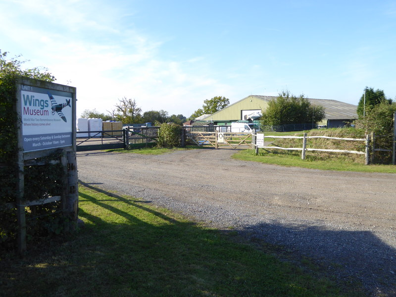
Wings Museum

The Wings Museum is an aviation museum located in Sussex, United Kingdom. It is housed in a 12,000 square feet (1,100 m2) hangar-like former farm building...

Slaugham

Slaugham () is a village and civil parish in the Mid Sussex District of West Sussex, England. It is located 7 miles (11 km) to the south of Crawley, on...

Nearby Amenities

Located within 500m of 51.051006,-0.1901774
Bus Stop
Combers
Bus: yes
Naptan AtcoCode: 4400HR0993
Naptan Bearing: SE
Naptan BusStopType: CUS
Naptan CommonName: Combers
Naptan Indicator: adj
Naptan Landmark: Hail & Ride
Naptan NaptanCode: wsxgapdp
Naptan Street: B2114
Naptan Verified: no
Public Transport: platform
Source: naptan_import
Lat/Long: 51.047581/-0.1942058
Bus Stop
Combers
Bus: yes
Naptan AtcoCode: 4400HR0994
Naptan Bearing: NW
Naptan BusStopType: CUS
Naptan CommonName: Combers
Naptan Indicator: opp
Naptan Landmark: Hail & Ride
Naptan NaptanCode: wsxgapdt
Naptan Street: B2114
Naptan Verified: no
Public Transport: platform
Source: naptan_import
Lat/Long: 51.047394/-0.1943272
Leisure: bird_hide
Lat/Long: 51.0503817/-0.1835108
Barrier: sally_port
Bicycle: no
Foot: yes
Lat/Long: 51.0501594/-0.1961537
Direction: 90
Tourism: viewpoint
Wheelchair: yes
Wheelchair Description: On recommended wheelchair route. Some uneven slabs in last 10m. Stone balastrade may obstruct view, but, equally good view towards Ouse Valley Viaduct from nearby asphalt path.
Lat/Long: 51.0495977/-0.1942169
Bicycle: no
Entrance: exit
Foot: yes
Note: Step free entrance avoiding steps on south side. photo 3151043 on 4/12/19 shows accessibility fro wheelchair entry
Wheelchair: limited
Wheelchair Description: Ramp - accessible entrance to ground floor only. Exhibition area on first floor is currently via steep stairs
Lat/Long: 51.0495824/-0.195638
Barrier: sally_port
Bicycle: no
Foot: yes
Source: Trace and GPX 20110208
Lat/Long: 51.049579/-0.1958008
Barrier: sally_port
Bicycle: no
Foot: yes
Source: Trace and GPX 20110208
Lat/Long: 51.0494143/-0.1958887
Barrier: sally_port
Bicycle: no
Foot: yes
Source: Trace and GPX 20110208
Lat/Long: 51.0493935/-0.1955914
Bench
Backrest: yes
Lat/Long: 51.0506232/-0.1910026
Barrier: kissing_gate
Lat/Long: 51.0508312/-0.1911063
Bench
Backrest: yes
Lat/Long: 51.0523327/-0.1945295
Door: door
Entrance: entrance
Note: photo shows accessibility issue
Wheelchair: no
Wheelchair Description: 3 steps from path, accessible entrance to ground floor only via ramp on west side of building
Lat/Long: 51.0494604/-0.1953237
Nymans House & Gallery
Tourism: attraction
Wheelchair: limited
Wheelchair Description: Ramped entrance on west side. Accessible entrance to ground floor only. Exhibition area on first floor is currently via steep stairs. Lift access is planned
Lat/Long: 51.0495375/-0.1954537
Bench
Lat/Long: 51.051384/-0.1881855
Bench
Lat/Long: 51.0519009/-0.1839654
Bench
Lat/Long: 51.0539827/-0.1889831
Leisure: picnic_table
Lat/Long: 51.0527143/-0.1889677
Toilets
Wheelchair: yes
Lat/Long: 51.049731/-0.1953984
Information: guidepost
Lat/Long: 51.0527399/-0.1962565
The data included in this document is from www.openstreetmap.org. The data is made available under ODbL.

Have you been to Pookchurch Wood?

Leave your review of Pookchurch Wood below (or comments, questions and feedback).