Cow Wood

Wood, Forest in Sussex Mid Sussex

England

Cow Wood

Tanyard Lane, Staplefield A private road, but public footpath 6CR.
Tanyard Lane, Staplefield Credit: Robin Webster

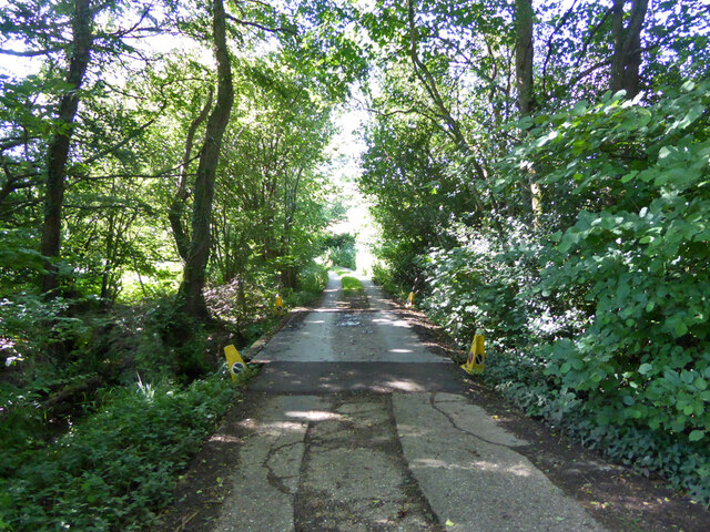
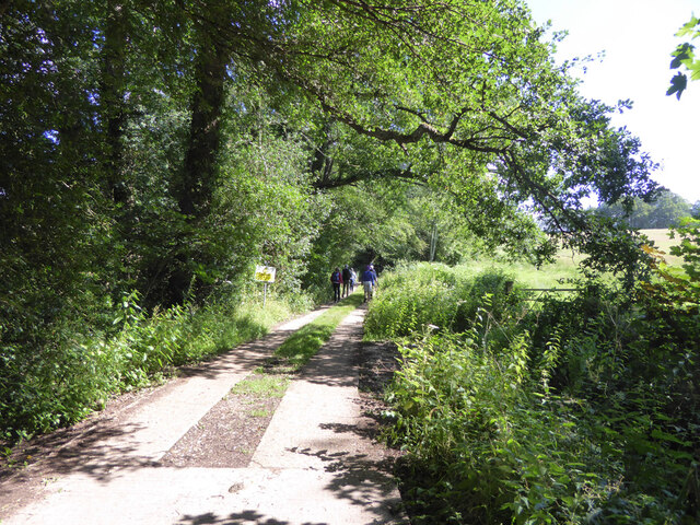
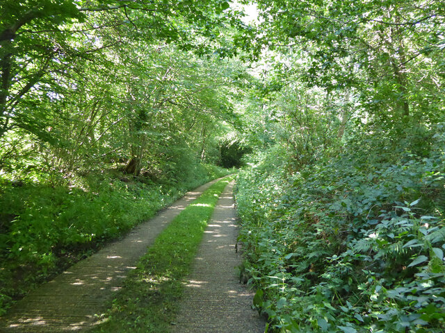
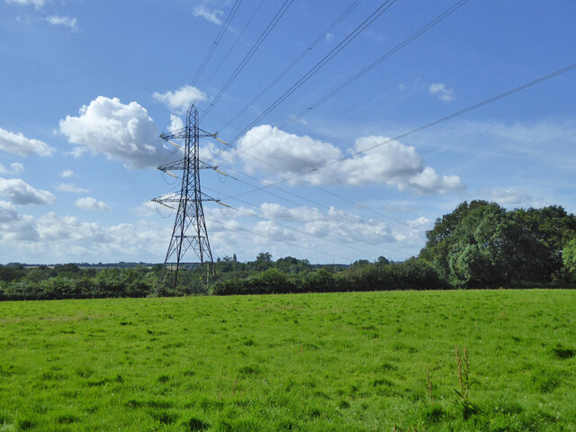
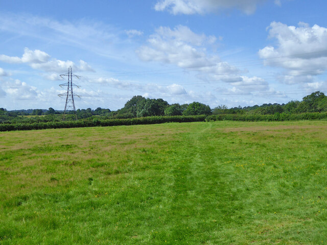
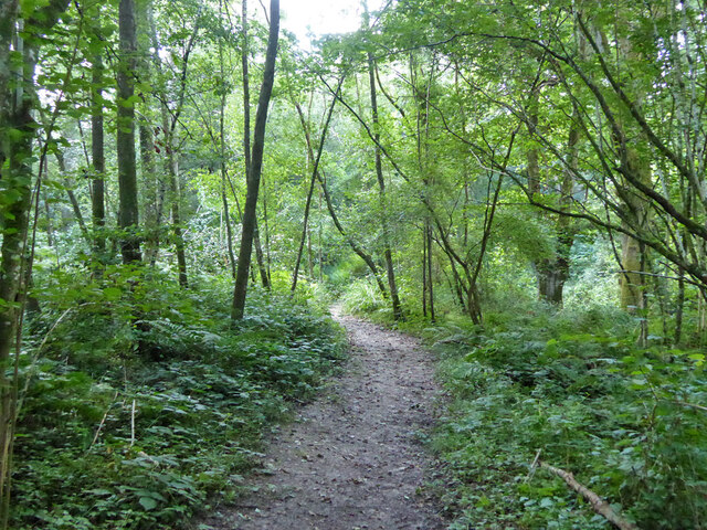
Cow Wood is a dense woodland situated in Sussex, England. Covering an area of approximately 100 acres, it is known for its diverse range of trees and abundant wildlife. The woodland is primarily composed of broadleaf trees, including oak, beech, and ash, which create a picturesque landscape throughout the year.

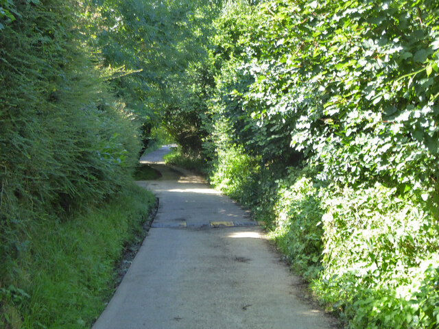
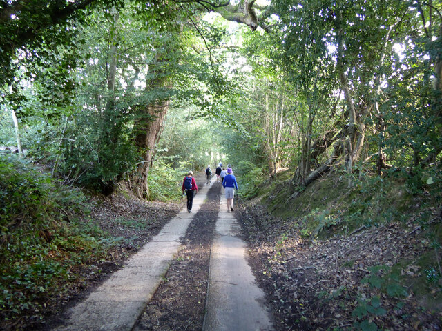
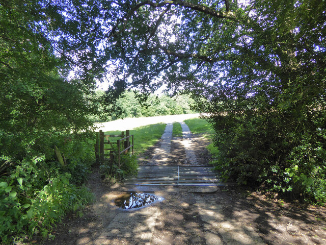
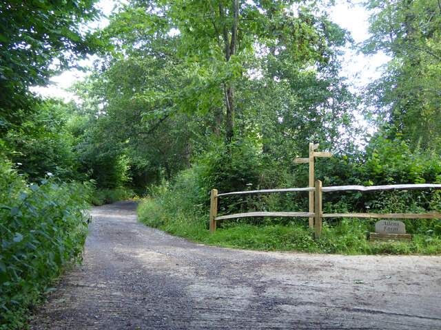
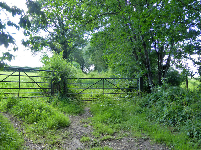
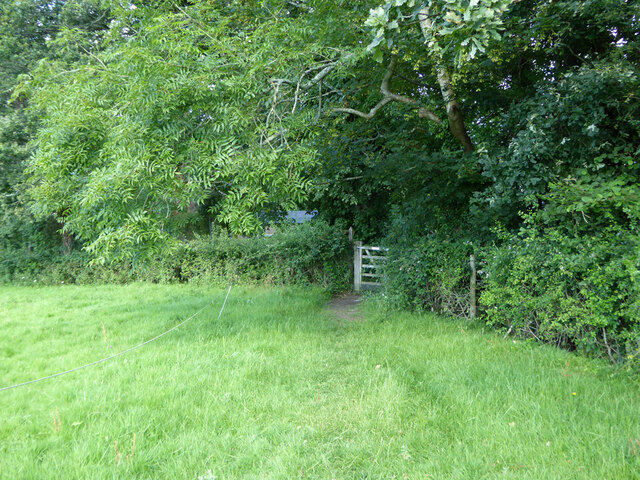
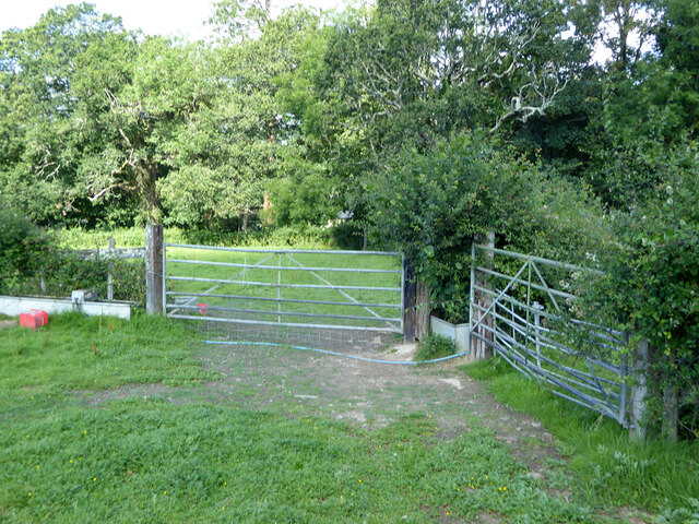
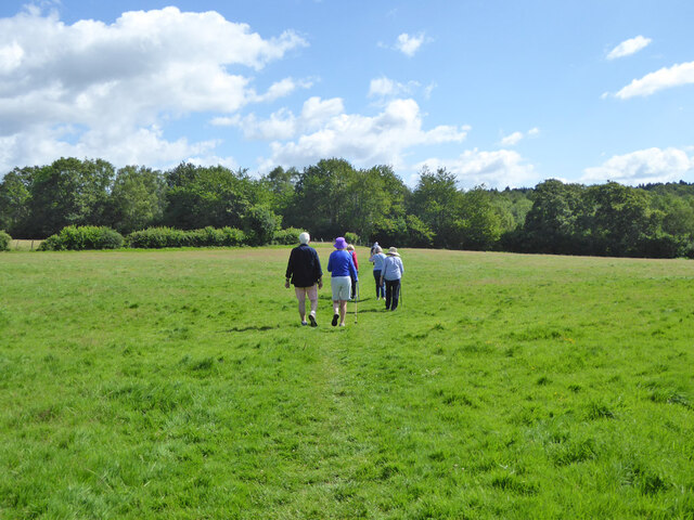
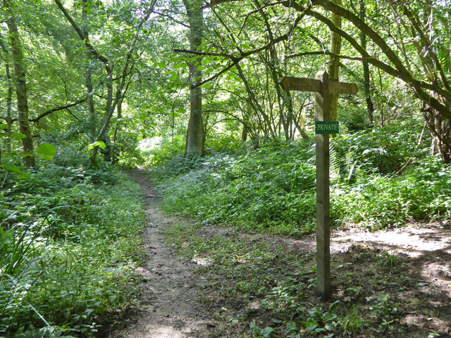
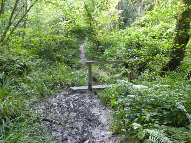
Cow Wood is a popular destination for nature enthusiasts and hikers, offering a network of well-maintained trails that wind through the forest. These trails provide visitors with the opportunity to explore the woodland's natural beauty while enjoying the tranquility it offers. The dense vegetation and towering trees create a sense of seclusion, making Cow Wood an ideal escape from the hustle and bustle of everyday life.

The woodland is also home to a variety of wildlife, including deer, foxes, badgers, and a wide range of bird species. Birdwatchers flock to Cow Wood to catch a glimpse of rare species, such as the lesser spotted woodpecker and the tawny owl, which can be found nesting within the woodland.

In addition to its natural beauty and wildlife, Cow Wood is also of historical significance. It is believed to have ancient origins, with archaeological evidence suggesting human activity in the area dating back thousands of years. The woodland has been well-preserved, allowing visitors to experience a sense of the past as they walk among the ancient trees.

Overall, Cow Wood in Sussex offers a captivating blend of natural beauty, abundant wildlife, and historical significance. It is a place where visitors can connect with nature and immerse themselves in the tranquility of the forest.

If you have any feedback on the listing, please let us know in the comments section below.

Cow Wood Images

Images are sourced within 2km of 51.052773/-0.19277672 or Grid Reference TQ2629. Thanks to Geograph Open Source API. All images are credited.

Tanyard Lane, Staplefield A private road, but public footpath 6CR.
Tanyard Lane, Staplefield
A private road, but public footpath 6CR.
Tanyard Cottages, Tanyard Lane, Staplefield
Tanyard Lane, Staplefield For the public, only a footpath - 6CR.
Tanyard Lane, Staplefield
For the public, only a footpath - 6CR.
Track and footpath branching off Tanyard Lane The track goes to Oldhouse, footpath 3CR to Handcross.
Track and footpath branching off Tanyard Lane
The track goes to Oldhouse, footpath 3CR to Handcross.
Tanyard Lane bridge over Foxhole Gill A bridge with no parapets, and a fair drop to the stream below.
Tanyard Lane bridge over Foxhole Gill
A bridge with no parapets, and a fair drop to the stream below.
Tanyard Lane towards Allens Farm The yellow sign warns of deep ditches to either side, which is true, in some places sheer off the concrete strips. This private farm access is also public footpath 4CR.
Tanyard Lane towards Allens Farm
The yellow sign warns of deep ditches to either side, which is true, in some places sheer off the concrete strips. This private farm access is also public footpath 4CR.
Tanyard Lane Private access to Allens and Dillion's Farms, it is also public footpath 4CR.
Tanyard Lane
Private access to Allens and Dillion's Farms, it is also public footpath 4CR.
Path and track junction near Allens Farm Straight on is private access to Dillion's Farm. Left is footpath 2CR to Handcross. Right is access to Allens Farm, shared part of the way with footpath 5CR which may be used as part of a route to Balcombe.
Path and track junction near Allens Farm
Straight on is private access to Dillion's Farm. Left is footpath 2CR to Handcross. Right is access to Allens Farm, shared part of the way with footpath 5CR which may be used as part of a route to Balcombe.
Short green lane near Allens Farm With no public status, and not much used anyway, this was the start of a route, mainly field edges, to Staplefield Upper Common. This has apparently withered away.
Short green lane near Allens Farm
With no public status, and not much used anyway, this was the start of a route, mainly field edges, to Staplefield Upper Common. This has apparently withered away.
Footpath 5CR near Allens Farm Through the gate the path drops down four or five steps to the farm approach track.
Footpath 5CR near Allens Farm
Through the gate the path drops down four or five steps to the farm approach track.
Barns at Allens Farm
Gate on footpath 5CR near Allens Farm
Power line near Allens Farm
Walkers on footpath 5CR Towards Ditton Place, Brantridge Lane and it is part of a route to Balcombe. The official route goes round the field edges on the left, but nobody seems to go that way with the field in permanent grass.
Walkers on footpath 5CR
Towards Ditton Place, Brantridge Lane and it is part of a route to Balcombe. The official route goes round the field edges on the left, but nobody seems to go that way with the field in permanent grass.
Footpath 5CR towards Staplefield or Handcross The official route goes round the field edges on the right, but nobody seems to go that way with the field in permanent grass.
Footpath 5CR towards Staplefield or Handcross
The official route goes round the field edges on the right, but nobody seems to go that way with the field in permanent grass.
Public and private paths In gill woodland, public footpath 5CR crosses the gill, the private path runs along the western shoulder. The quite significant gill has no mapped name.
Public and private paths
In gill woodland, public footpath 5CR crosses the gill, the private path runs along the western shoulder. The quite significant gill has no mapped name.
Gill footbridge, path 5CR By rights the mud should have dried up by late July, but there had been some very wet days.
Gill footbridge, path 5CR
By rights the mud should have dried up by late July, but there had been some very wet days.
Footpath 5CR in unnamed gill Running down to cross the stream to the right.
Footpath 5CR in unnamed gill
Running down to cross the stream to the right.
Show me another place!

Cow Wood is located at Grid Ref: TQ2629 (Lat: 51.052773, Lng: -0.19277672)

Administrative County: West Sussex

District: Mid Sussex

Police Authority: Sussex

What 3 Words

///spurring.deck.journey. Near Handcross, West Sussex

Related Wikis

Cow Wood and Harry's Wood

Cow Wood and Harry's Wood is a 75.5-hectare (187-acre) biological Site of Special Scientific Interest east of Handcross in West Sussex. it is in the High...

Nymans

Nymans is an English garden to the east of the village of Handcross, and in the civil parish of Slaugham in West Sussex, England. The garden was developed...

Handcross Hill bus crash

On 12 July 1906, a bus crashed into a tree on Handcross Hill in Sussex, England, killing 10 people and injuring a further 26 in the worst road crash in...

Handcross

Handcross is a village in the Mid Sussex District of West Sussex, England. It lies on the A23 road 4.2 miles (6.8 kilometres) south of Crawley. At the...

Handcross Park School

Handcross Park School is an independent co-educational preparatory school in Handcross, between Crawley, Horsham and Haywards Heath in West Sussex, England...

Staplefield

Staplefield is a village in the Mid Sussex District of West Sussex, England, situated 6 kilometres (3.7 mi) north-west of Haywards Heath on the B2114...
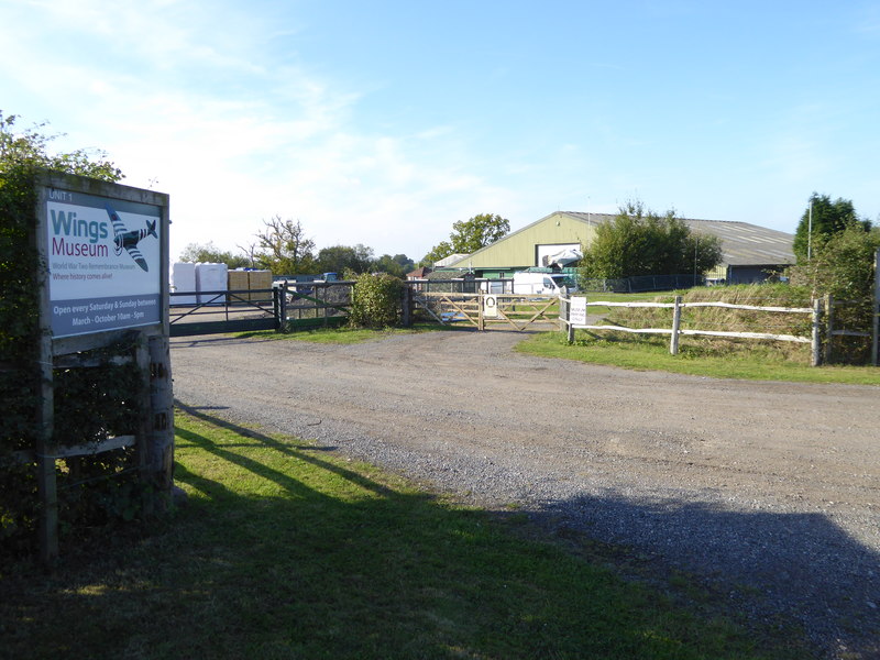
Wings Museum

The Wings Museum is an aviation museum located in Sussex, United Kingdom. It is housed in a 12,000 square feet (1,100 m2) hangar-like former farm building...

Slaugham

Slaugham () is a village and civil parish in the Mid Sussex District of West Sussex, England. It is located 7 miles (11 km) to the south of Crawley, on...

Nearby Amenities

Located within 500m of 51.052773,-0.19277672
Nymans Gardens
Created By: Potlatch 0.10b
Operator: National Trust
Toilets Wheelchair: no
Tourism: attraction
Wheelchair: limited
Lat/Long: 51.0507003/-0.197702
Toilets
Car park toilets
Addr City: Handcross
Addr Street: Nymans Gardens
Changing Table: yes
Fee: no
Toilets Wheelchair: yes
Wheelchair: yes
Wheelchair Description: Sloped access from dedicated Blue Badge spaces.
Lat/Long: 51.0523438/-0.1996508
Barrier: entrance
Bicycle: no
Entrance: exit
Foot: yes
Lat/Long: 51.0520924/-0.1993889
Barrier: sally_port
Bicycle: no
Foot: yes
Lat/Long: 51.0501594/-0.1961537
Direction: 90
Tourism: viewpoint
Wheelchair: yes
Wheelchair Description: On recommended wheelchair route. Some uneven slabs in last 10m. Stone balastrade may obstruct view, but, equally good view towards Ouse Valley Viaduct from nearby asphalt path.
Lat/Long: 51.0495977/-0.1942169
Bicycle: no
Entrance: exit
Foot: yes
Note: Step free entrance avoiding steps on south side. photo 3151043 on 4/12/19 shows accessibility fro wheelchair entry
Wheelchair: limited
Wheelchair Description: Ramp - accessible entrance to ground floor only. Exhibition area on first floor is currently via steep stairs
Lat/Long: 51.0495824/-0.195638
Barrier: sally_port
Bicycle: no
Foot: yes
Source: Trace and GPX 20110208
Lat/Long: 51.0495767/-0.1958058
Barrier: sally_port
Bicycle: no
Foot: yes
Source: Trace and GPX 20110208
Lat/Long: 51.0494143/-0.1958887
Barrier: sally_port
Bicycle: no
Foot: yes
Source: Trace and GPX 20110208
Lat/Long: 51.0493935/-0.1955914
Bench
Backrest: yes
Lat/Long: 51.0506232/-0.1910026
Barrier: kissing_gate
Lat/Long: 51.0508312/-0.1911063
Bench
Backrest: yes
Lat/Long: 51.0523327/-0.1945295
Door: door
Entrance: entrance
Note: photo shows accessibility issue
Wheelchair: no
Wheelchair Description: 3 steps from path, accessible entrance to ground floor only via ramp on west side of building
Lat/Long: 51.0494604/-0.1953237
Nymans House & Gallery
Tourism: attraction
Wheelchair: limited
Wheelchair Description: Ramped entrance on west side. Accessible entrance to ground floor only. Exhibition area on first floor is currently via steep stairs. Lift access is planned
Lat/Long: 51.0495375/-0.1954537
Addr City: Haywards Heath
Addr Housename: Oakley Cottages
Addr Postcode: RH17 6BL
Addr Street: High Street
Addr Village: Handcross
Lat/Long: 51.0542404/-0.1994585
Addr City: Haywards Heath
Addr Housename: Rose Cottage
Addr Postcode: RH17 6BL
Addr Street: High Street
Addr Village: Handcross
Lat/Long: 51.0544191/-0.1993176
Bench
Lat/Long: 51.051384/-0.1881855
Bench
Lat/Long: 51.0539827/-0.1889831
Bench
Lat/Long: 51.0545508/-0.1946912
Leisure: picnic_table
Lat/Long: 51.0527143/-0.1889677
Barrier: entrance
Bicycle: no
Entrance: yes
Foot: yes
Lat/Long: 51.0521127/-0.1990415
Toilets
Wheelchair: yes
Lat/Long: 51.049731/-0.1953984
Information: guidepost
Lat/Long: 51.0527399/-0.1962565
Board Type: nature
Description: Nymams wood
Information: board
Tourism: information
Lat/Long: 51.0529216/-0.1978893
The data included in this document is from www.openstreetmap.org. The data is made available under ODbL.

Have you been to Cow Wood?

Leave your review of Cow Wood below (or comments, questions and feedback).