Chase Wood
Wood, Forest in Middlesex Hertsmere
England
Chase Wood
Chase Wood, located in Middlesex, England, is a charming forested area known for its natural beauty and recreational opportunities. Covering an expansive area, the wood is a popular destination for nature enthusiasts, hikers, and families looking to escape the hustle and bustle of city life.
The wood features a diverse range of tree species, including oak, beech, and birch, creating a rich and vibrant ecosystem. The tall, majestic trees provide shade during the summer months and transform into a breathtaking display of colors during autumn. The forest floor is home to an array of wildflowers, ferns, and mosses, adding to the enchanting atmosphere.
Traversing the wood, visitors can find numerous well-maintained trails that cater to different levels of fitness and preferences. These trails offer opportunities for peaceful walks, invigorating jogs, or even cycling. Along the way, one might come across small streams, charming bridges, and picturesque picnic spots, perfect for a quiet afternoon in nature.
Chase Wood is also home to a variety of wildlife. Birdwatchers can delight in spotting various species, including woodpeckers, owls, and warblers. Squirrels and rabbits are a common sight, while lucky visitors might even catch a glimpse of a deer or fox roaming in the distance.
Maintained by local authorities, the wood has designated parking areas and well-placed signposts, ensuring ease of access and navigation. It is advised to check for any specific guidelines or restrictions before visiting, particularly during peak seasons.
Overall, Chase Wood offers a tranquil retreat from urban life, providing a haven for nature lovers and outdoor enthusiasts alike.
If you have any feedback on the listing, please let us know in the comments section below.
Chase Wood Images
Images are sourced within 2km of 51.682423/-0.16973987 or Grid Reference TQ2699. Thanks to Geograph Open Source API. All images are credited.


Chase Wood is located at Grid Ref: TQ2699 (Lat: 51.682423, Lng: -0.16973987)
Administrative County: Hertfordshire
District: Hertsmere
Police Authority: Hertfordshire
What 3 Words
///couple.advice.trades. Near Potters Bar, Hertfordshire
Nearby Locations
Related Wikis

Potters Bar Old Baptist Church
The Potters Bar Old Baptist Church, as it is now known, is a former church in Hertfordshire, England. It was designed by W. Allen Dixon in 1868. Dixon...

Ganwick House
Ganwick House is a late-18th-century house in Wagon Road, Ganwick Corner (Gannic Corner), near Chipping Barnet, England. As of 2018, it was in use as a...
The Lion, Potters Bar
The Lion is a former public house on the corner of Barnet Road and Southgate Road in Potters Bar, Hertfordshire, England, and a grade II listed building...
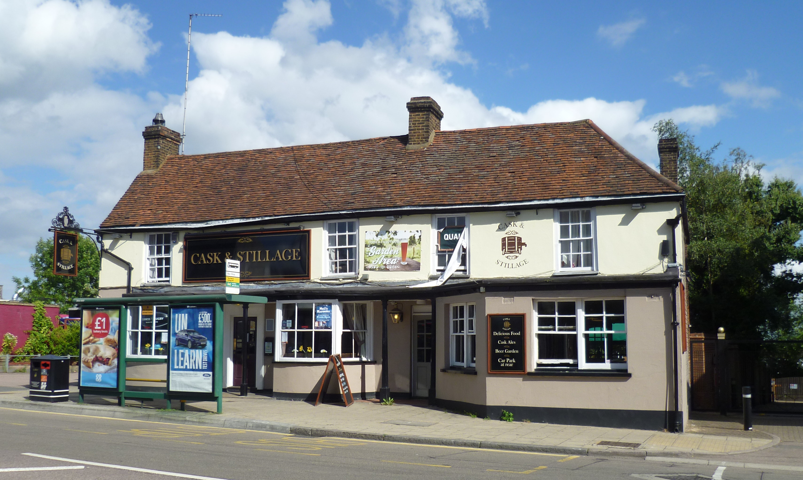
The White Horse, Potters Bar
The White Horse, now known as The Cask and Stillage, is a public house in High Street, Potters Bar, England, and a grade II listed building with Historic...

Ladbrooke School
Ladbrooke School is a former school in High Street, Potters Bar, England, and a grade II listed building with Historic England. == References == ��2�...
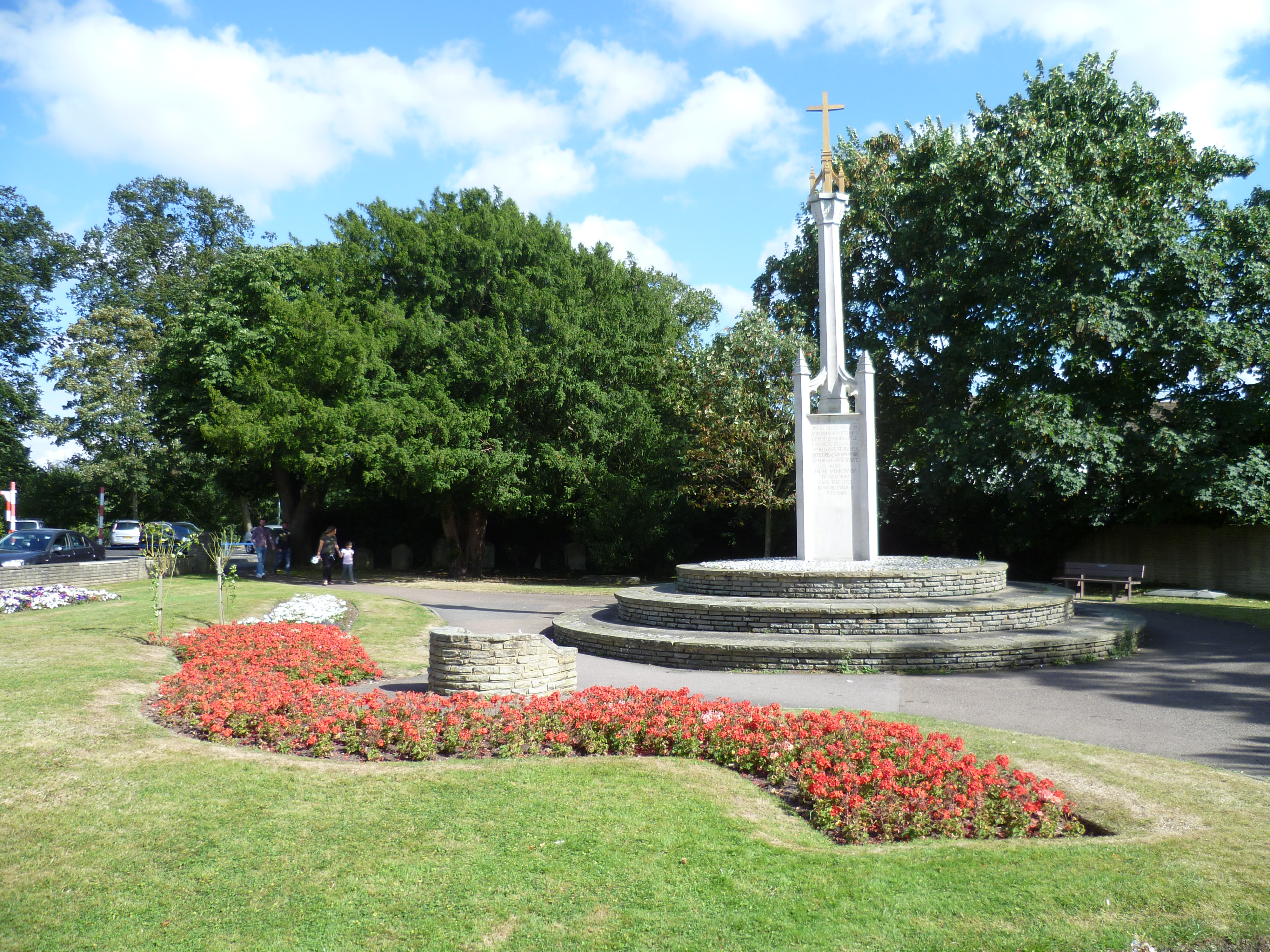
Potters Bar War Memorial
Potters Bar war memorial is located in St John's Churchyard in High Street, Potters Bar, England. The memorial was designed by the Arts and Crafts architect...
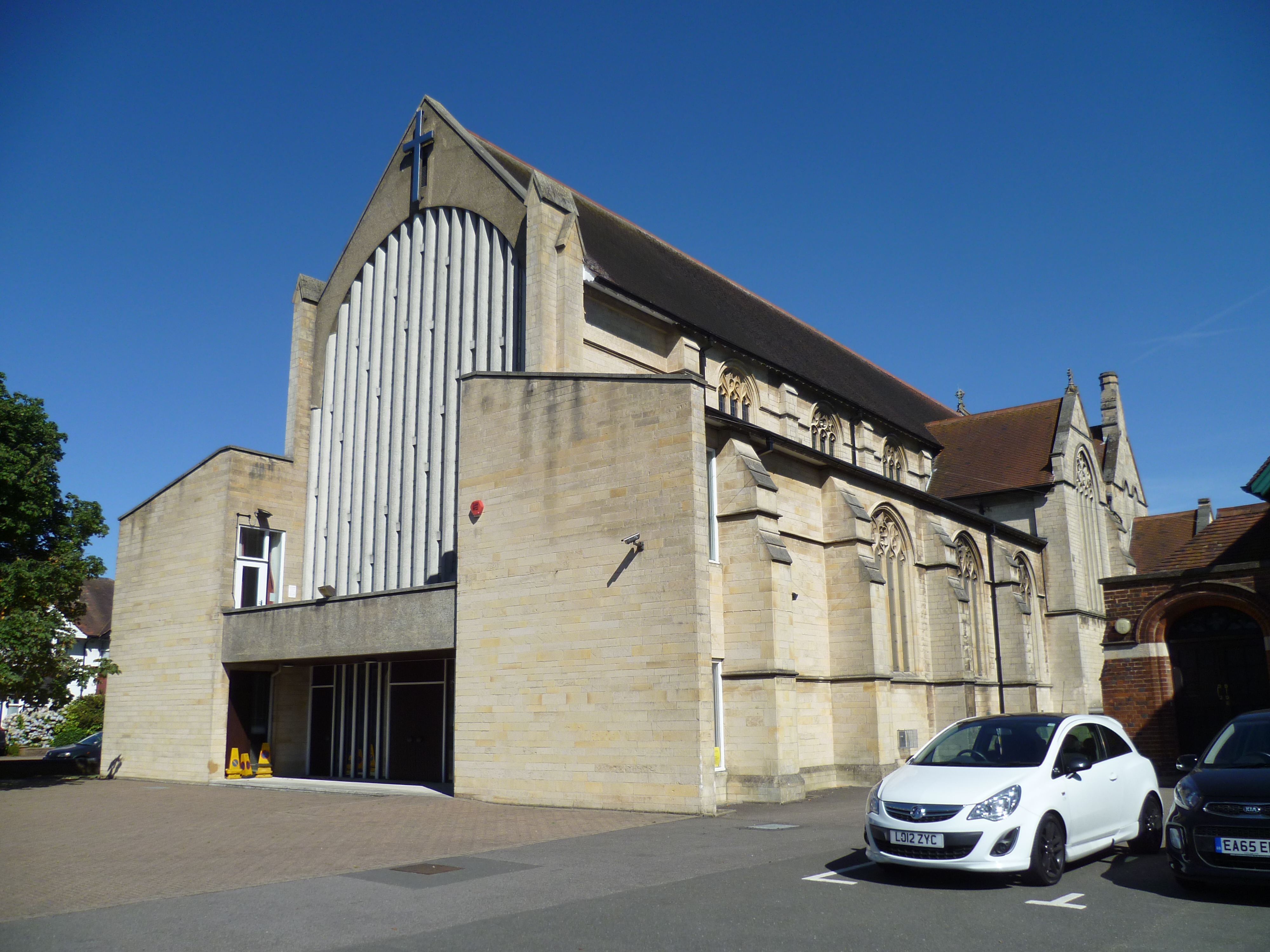
St. Mary's Church, Potters Bar
St. Mary's Church is a Church of England church in The Walk, Potters Bar, England. It is in the Diocese of St. Albans. Services are in the Catholic tradition...
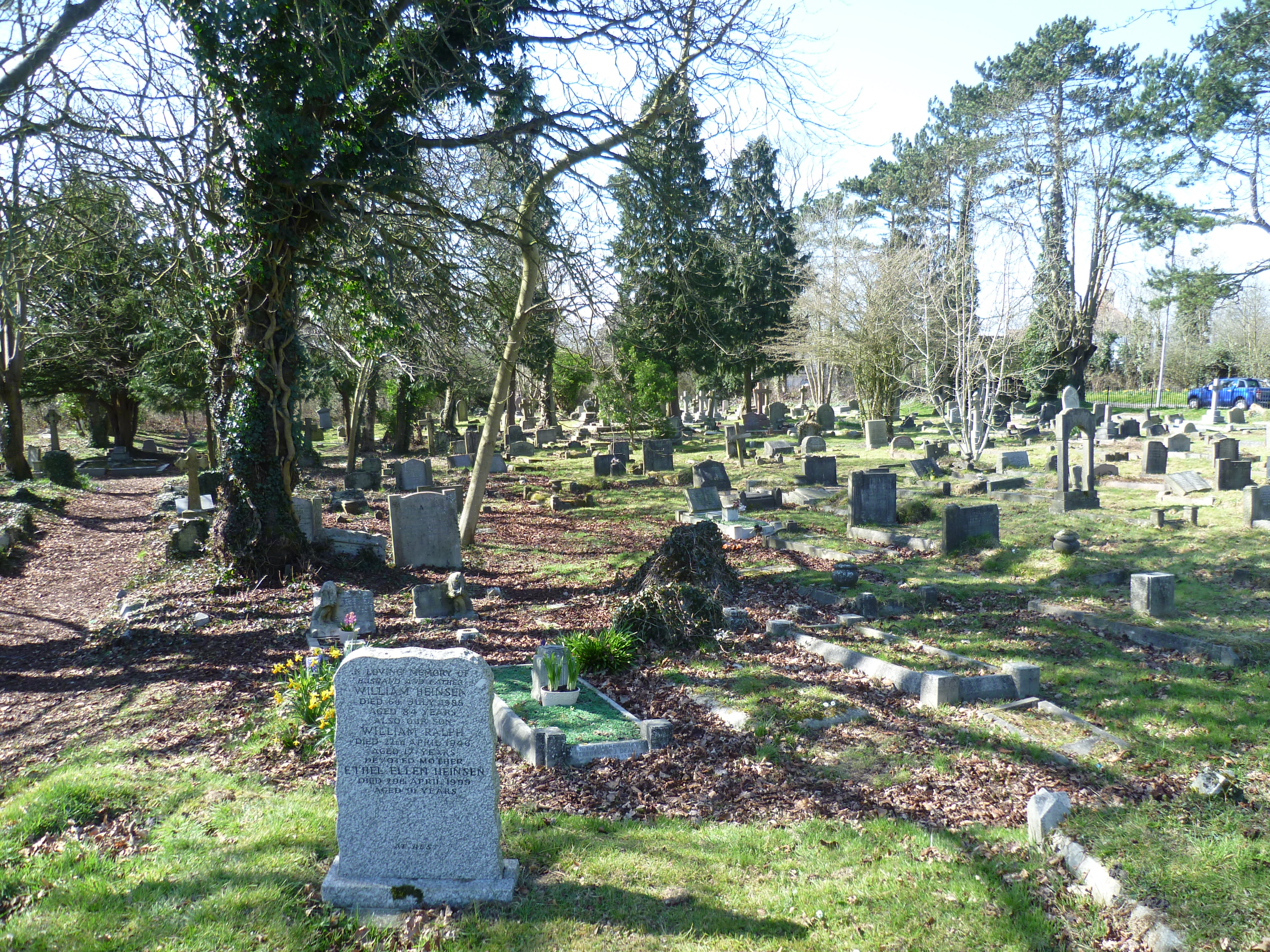
Mutton Lane Cemetery
Mutton Lane Cemetery, officially known as St Mary's Cemetery, is a cemetery in Mutton Lane, Potters Bar, Hertfordshire, that is associated with nearby...
Nearby Amenities
Located within 500m of 51.682423,-0.16973987Have you been to Chase Wood?
Leave your review of Chase Wood below (or comments, questions and feedback).