Mobbsbury Wood

Wood, Forest in Hertfordshire Stevenage

England

Mobbsbury Wood

Hydean Way Shops Typical of local shops in Stevenage new town.  Above a parade of shops including a small supermarket, take away food outlet and Post Office there are maisonettes accessed from the rear.  To the right there are 2/3 bedroomed homes.
Hydean Way Shops Credit: Robin Hall

Mobbsbury Wood is a beautiful woodland located in Hertfordshire, England. Spread over an area of approximately 50 acres, it is a popular destination for nature lovers and outdoor enthusiasts. The wood is situated near the small village of Mobbsbury, which adds to its charm and tranquility.

The wood is predominantly made up of deciduous trees, including oak, beech, and birch. These trees create a dense canopy that provides shade and shelter to various flora and fauna. The forest floor is covered in a carpet of wildflowers, ferns, and mosses, creating a vibrant and diverse ecosystem.

Numerous walking trails crisscross the wood, allowing visitors to explore its natural beauty at their own pace. These trails take you through enchanting pathways surrounded by towering trees and offer breathtaking views of the surrounding countryside. The wood is also home to a variety of wildlife, including deer, foxes, and a multitude of bird species.

Mobbsbury Wood is not only a haven for nature enthusiasts but also a place of historical significance. It is believed that the wood has been in existence for centuries, and remnants of ancient settlements have been found within its boundaries.

Visitors to Mobbsbury Wood can enjoy picnicking, birdwatching, or simply immersing themselves in the peaceful ambiance of the forest. The wood is accessible throughout the year, although it is particularly stunning during the spring and autumn seasons when the trees are adorned with vibrant foliage.

Overall, Mobbsbury Wood is a hidden gem in Hertfordshire, offering a tranquil escape into nature and a chance to reconnect with its rich history.

If you have any feedback on the listing, please let us know in the comments section below.

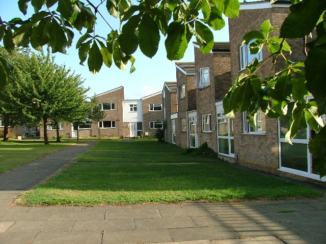
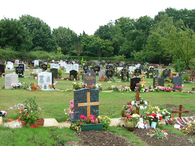
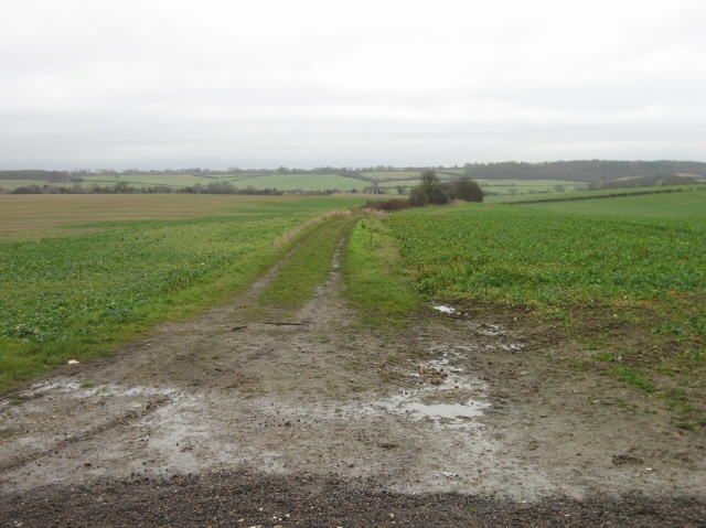
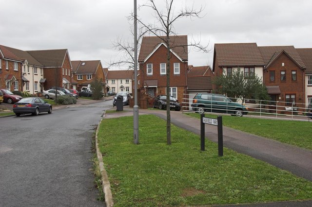
Mobbsbury Wood Images

Images are sourced within 2km of 51.911296/-0.17360665 or Grid Reference TL2525. Thanks to Geograph Open Source API. All images are credited.

Hydean Way Shops Typical of local shops in Stevenage new town.  Above a parade of shops including a small supermarket, take away food outlet and Post Office there are maisonettes accessed from the rear.  To the right there are 2/3 bedroomed homes.
Hydean Way Shops
Typical of local shops in Stevenage new town. Above a parade of shops including a small supermarket, take away food outlet and Post Office there are maisonettes accessed from the rear. To the right there are 2/3 bedroomed homes.
Fairlands Valley Park This large lake is used by sailors and fishermen.  This photo is taken facing south.  To the rear there are two smaller lakes.  The park is very popular in the summer.
Fairlands Valley Park
This large lake is used by sailors and fishermen. This photo is taken facing south. To the rear there are two smaller lakes. The park is very popular in the summer.
Silam Rd. To the right are houses not untypical of Stevenage new town.  Looming over Silam Rd is one of a pair of high rise flats close to the town centre.
Silam Rd.
To the right are houses not untypical of Stevenage new town. Looming over Silam Rd is one of a pair of high rise flats close to the town centre.
Parishes Mead. Parishes mead is a newer development on the east side of Stevenage.  There is a mixture of private and social housing here.
Parishes Mead.
Parishes mead is a newer development on the east side of Stevenage. There is a mixture of private and social housing here.
Mildmay Road. These houses were built in a variety of styles.  These are not untypical but some of the architectural styles bring their own maintenance problems.
Mildmay Road.
These houses were built in a variety of styles. These are not untypical but some of the architectural styles bring their own maintenance problems.
Fortuna Close One of the more modern parts of Stevenage and with some more imaginative building - three storeys!
Fortuna Close
One of the more modern parts of Stevenage and with some more imaginative building - three storeys!
Hampson Park / Pin Green Water Tower. Although this water tower is right on the edge of this square I have used it because it dominates the locality.  The large flat construction on the left, behind the fence, is a covered reservoir.  The tower is now bristling with aerials of all sorts.
Hampson Park / Pin Green Water Tower.
Although this water tower is right on the edge of this square I have used it because it dominates the locality. The large flat construction on the left, behind the fence, is a covered reservoir. The tower is now bristling with aerials of all sorts.
Mastercare warehousing Although this photograph is actually taken (just) from neighbouring TL2526, this warehouse is typical of this industrial estate.  Not all are grey and red.  Some are grey and another colour!
Mastercare warehousing
Although this photograph is actually taken (just) from neighbouring TL2526, this warehouse is typical of this industrial estate. Not all are grey and red. Some are grey and another colour!
Weston Rd Cemetery Although Weston Rd Cemetery takes up a relatively small portion of this square, Stevenage has lots and lots of houses but only two cemeteries.
Weston Rd Cemetery
Although Weston Rd Cemetery takes up a relatively small portion of this square, Stevenage has lots and lots of houses but only two cemeteries.
Ferrier Rd This could be any road in this area.  Plans seem to have been bought as a job lot.
Ferrier Rd
This could be any road in this area. Plans seem to have been bought as a job lot.
Telford Avenue. On the edge of TL2525..  I wasn't going any further into this estate.  I always get lost even though it's not that big by local standards.  This estate, in common with others in the area suffers from the increase in car ownership.  Parking is awkward, the roads not wide and the layout is twisting.
Telford Avenue.
On the edge of TL2525.. I wasn't going any further into this estate. I always get lost even though it's not that big by local standards. This estate, in common with others in the area suffers from the increase in car ownership. Parking is awkward, the roads not wide and the layout is twisting.
The Crown, Aston End
Just Outside Stevenage On the Stevenage boundary, looking across TL2725 from Stevenage Road and you are in open country.
Just Outside Stevenage
On the Stevenage boundary, looking across TL2725 from Stevenage Road and you are in open country.
Trig point at Lonsdale School I swear that tree was not there when I took the photo.

This Trig point is in the playing field of a special needs school caring for 75 children between the ages of 2 and 19 from London, Bedfordshire and Hertfordshire.
Trig point at Lonsdale School
I swear that tree was not there when I took the photo. This Trig point is in the playing field of a special needs school caring for 75 children between the ages of 2 and 19 from London, Bedfordshire and Hertfordshire.
St Nicholas' Church, Stevenage At the rear of the church yard there is a memorial to EM Forster.
St Nicholas' Church, Stevenage
At the rear of the church yard there is a memorial to EM Forster.
Lytch Gate, St Nicholas' Church Stevenage. This solid structure leads straight onto a muddy path.  (At least after it has been raining.).
Lytch Gate, St Nicholas' Church Stevenage.
This solid structure leads straight onto a muddy path. (At least after it has been raining.).
United Reformed Church On the corner of Cuttys Lane and Bedwell Crescent.
United Reformed Church
On the corner of Cuttys Lane and Bedwell Crescent.
Telephone Exchange. Mostly redundant now I believe.
Telephone Exchange.
Mostly redundant now I believe.
Show me another place!

Mobbsbury Wood is located at Grid Ref: TL2525 (Lat: 51.911296, Lng: -0.17360665)

Administrative County: Hertfordshire

District: Stevenage

Police Authority: Hertfordshire

What 3 Words

///newly.yards.focal. Near Stevenage, Hertfordshire

Related Wikis

The Nobel School

The Nobel School is a co-educational secondary school and sixth form located in Stevenage in the English county of Hertfordshire. == History == The Nobel...

Marriotts School

Marriotts School is a secondary school in Stevenage, Hertfordshire, England. The school was rebuilt along with Lonsdale School (for special needs children...

Pryor's Wood

Pryor's Wood is an 8.7-hectare (21-acre) nature reserve in Great Ashby, near Stevenage in Hertfordshire. It was formerly managed by the Herts and Middlesex...

St Nicholas' Church, Stevenage

St Nicholas' Church is an Anglican parish church in Stevenage, a town in Hertfordshire, England. It occupies a hilltop site above Old Stevenage. It is...

Rooks Nest House

Rooks Nest House is a house on Weston Road, Stevenage, Hertfordshire. It was the childhood home of the author E. M. Forster (1879–1970) who described it...

Barclay Academy

Barclay Academy is a secondary school and sixth form located in Stevenage, Hertfordshire, England. The current head teacher is Dr. Matthew Laban. Opening...

Aston End

Aston End is a hamlet in Hertfordshire, England. It is in the civil parish of Aston. It features a pub and a butchers, as well as a few houses. == References... ==

Great Ashby

Great Ashby is a civil parish in Stevenage in the North Hertfordshire district, in the county of Hertfordshire, England. The name Great Ashby was coined...

Nearby Amenities

Located within 500m of 51.911296,-0.17360665
Crossing
Crossing: unmarked
Crossing Island: no
Tactile Paving: no
Lat/Long: 51.9126064/-0.1785808
Crossing
Crossing: unmarked
Crossing Island: no
Tactile Paving: no
Lat/Long: 51.9091868/-0.1719055
Crossing
Crossing: uncontrolled
Crossing Island: no
Crossing Ref: zebra
Kerb: lowered
Tactile Paving: yes
Lat/Long: 51.9106134/-0.1697278
Traffic Calming: island
Lat/Long: 51.9134098/-0.1704824
Crossing
Crossing: unmarked
Crossing Island: no
Tactile Paving: no
Traffic Calming: hump
Lat/Long: 51.9082492/-0.1699957
Mini Roundabout
Direction: clockwise
Lat/Long: 51.9127416/-0.1793985
Mini Roundabout
Direction: clockwise
Lat/Long: 51.9121289/-0.1795983
Crossing
Crossing: unmarked
Crossing Island: no
Kerb: lowered
Tactile Paving: no
Lat/Long: 51.9126033/-0.1782453
Bus Stop
Hudson Road
Bench: yes
Bus: yes
Naptan AtcoCode: 210021201580
Naptan Bearing: E
Naptan CommonName: Hudson Road
Naptan Crossing: Mobbsbury Centre
Naptan Indicator: E-bound
Naptan Landmark: Mobbsbury Centre
Naptan NaptanCode: hrtgadat
Naptan PlusbusZoneRef: STEVNGE
Naptan ShortCommonName: NA
Naptan Street: Hudson Road
Naptan Verified: no
Network: SB1
Operator: Arriva
Public Transport: platform
Shelter: yes
Source: naptan_import
Tactile Paving: yes
Lat/Long: 51.9135655/-0.1709796
Bus Stop
The Glebe Centre
Bench: yes
Bin: yes
Bus: yes
Lit: yes
Naptan AtcoCode: 210021201600
Naptan Bearing: SE
Naptan CommonName: The Glebe Centre
Naptan Crossing: The Swan Tavern PH
Naptan Indicator: o/s
Naptan Landmark: The Swan Tavern PH
Naptan NaptanCode: hrtgadaw
Naptan PlusbusZoneRef: STEVNGE
Naptan ShortCommonName: NA
Naptan Street: Chells Way
Naptan Verified: no
Public Transport: platform
Shelter: yes
Source: naptan_import
Tactile Paving: yes
Lat/Long: 51.9089199/-0.1711975
Bus Stop
Chells Way
Bench: no
Bin: yes
Lit: yes
Naptan AtcoCode: 210021202360
Naptan Bearing: S
Naptan CommonName: Chells Way
Naptan Crossing: Moss Bury Education Centre
Naptan Indicator: S-bound
Naptan Landmark: Moss Bury Education Centre
Naptan NaptanCode: hrtdwpma
Naptan PlusbusZoneRef: STEVNGE
Naptan ShortCommonName: NA
Naptan Street: Fairlands Way
Shelter: no
Source: naptan_import
Tactile Paving: no
Lat/Long: 51.9133709/-0.1789765
Bus Stop
The Glebe Centre
Bench: yes
Bin: yes
Bus: yes
Lit: yes
Naptan AtcoCode: 210021202390
Naptan Bearing: NE
Naptan CommonName: The Glebe Centre
Naptan Crossing: Ross Court
Naptan Indicator: opp
Naptan Landmark: Ross Court
Naptan NaptanCode: hrtdwpmd
Naptan PlusbusZoneRef: STEVNGE
Naptan ShortCommonName: NA
Naptan Street: Mobbsbury Way
Naptan Verified: no
Public Transport: platform
Shelter: yes
Source: naptan_import
Tactile Paving: yes
Lat/Long: 51.9094384/-0.1713486
Bus Stop
The Glebe Centre
Bench: no
Bin: no
Lit: yes
Local Ref: NR
Naptan AtcoCode: 210021202400
Naptan Bearing: NW
Naptan CommonName: The Glebe Centre
Naptan Crossing: Mobbsbury Way
Naptan Indicator: nr
Naptan Landmark: Mobbsbury Way
Naptan NaptanCode: hrtdwpmg
Naptan PlusbusZoneRef: STEVNGE
Naptan ShortCommonName: NA
Naptan Street: Chells Way
Naptan Verified: no
Shelter: no
Source: naptan_import
Tactile Paving: no
Lat/Long: 51.9095158/-0.1725109
Bus Stop
Brunel Road
Bench: yes
Bin: yes
Lit: yes
Local Ref: NR
Naptan AtcoCode: 210021202420
Naptan Bearing: NW
Naptan CommonName: Brunel Road
Naptan Crossing: Drakes Drive
Naptan Indicator: nr
Naptan Landmark: Drakes Drive
Naptan NaptanCode: hrtdwpmj
Naptan PlusbusZoneRef: STEVNGE
Naptan ShortCommonName: NA
Naptan Street: Chells Way
Naptan Verified: no
Shelter: yes
Source: naptan_import
Tactile Paving: no
Lat/Long: 51.9118078/-0.1770851
Bus Stop
Chells Way
Bench: yes
Bin: no
Check Date Shelter: 2021-01-02
Lit: yes
Naptan AtcoCode: 210021202440
Naptan Bearing: N
Naptan CommonName: Chells Way
Naptan Crossing: Moss Bury JMI School
Naptan Indicator: opp
Naptan Landmark: Moss Bury JMI School
Naptan NaptanCode: hrtdwpmt
Naptan PlusbusZoneRef: STEVNGE
Naptan ShortCommonName: NA
Naptan Street: Fairlands Way
Shelter: yes
Source: naptan_import
Tactile Paving: no
Lat/Long: 51.9132544/-0.1792941
Bus Stop
Nobel School
Bench: yes
Bin: no
Bus: yes
Lit: yes
Local Ref: NR
Naptan AtcoCode: 210021203060
Naptan Bearing: NE
Naptan CommonName: Nobel School
Naptan Crossing: Lodge Farm Infants' and Junior Schools
Naptan Indicator: nr
Naptan Landmark: Lodge Farm Infants' and Junior Schools
Naptan NaptanCode: hrtdwmpt
Naptan PlusbusZoneRef: STEVNGE
Naptan ShortCommonName: NA
Naptan Street: Mobbsbury Way
Naptan Verified: no
Public Transport: platform
Shelter: yes
Source: naptan_import
Tactile Paving: yes
Lat/Long: 51.9114644/-0.1691612
Crossing
Bicycle: yes
Crossing: unmarked
Crossing Island: yes
Kerb: lowered
Tactile Paving: yes
Lat/Long: 51.9154701/-0.1709736
Traffic Calming: island
Lat/Long: 51.9079681/-0.1693687
Post Box
Collection Times: Mo-Fr 18:30; Sa 12:00
Post Box Type: lamp
Ref: SG2 350
Royal Cypher: EIIR
Royal Cypher Wikidata: Q33102113
Lat/Long: 51.913742/-0.171047
Post Box
Collection Times: Mo-Fr 09:00; Sa 07:00
Post Box Type: pillar
Ref: SG2 349
Royal Cypher: EIIR
Royal Cypher Wikidata: Q33102113
Lat/Long: 51.912575/-0.17661
Post Box
Collection Times: Mo-Fr 18:00; Sa 12:15
Post Box Type: pillar
Ref: SG2 346
Lat/Long: 51.9085085/-0.1755718
Post Box
Check Date: 2021-01-28
Collection Times: Mo-Fr 16:30, Sa 11:30
Post Box Type: pillar
Ref: SG2 344
Lat/Long: 51.9085319/-0.1700958
Library
Stevenage Mobile Library
Opening Hours: Th 10:00-13:00,14:00-16:30
Operator: Hertfordshire County Council
Wheelchair: yes
Lat/Long: 51.908349/-0.1700572
Crossing
Crossing: unmarked
Crossing Island: yes
Kerb: lowered
Tactile Paving: no
Lat/Long: 51.9139317/-0.1708094
Crossing
Crossing: unmarked
Crossing Island: no
Tactile Paving: no
Lat/Long: 51.9119345/-0.1771848
Gill's Stores
Shop: convenience
Wheelchair: yes
Lat/Long: 51.9140098/-0.1711882
Fast Food
Rupa Tandora
Addr City: Stevenage
Addr Housenumber: 87
Addr Postcode: SG2 0HY
Addr Street: Mobbsbury Way
Cuisine: indian
Fhrs Id: 349210
Source Addr: FHRS Open Data
Wheelchair: yes
Lat/Long: 51.9139659/-0.1711681
Anne Marie
Phone: +44 1438 314 711
Shop: hairdresser
Wheelchair: yes
Lat/Long: 51.9138314/-0.1711598
Waste Basket
Check Date: 2021-01-09
Lat/Long: 51.9154203/-0.170877
Newton General Stores
Addr City: Stevenage
Addr Housenumber: 48
Addr Postcode: SG2 0BX
Addr Street: Newton Road
Fhrs Id: 717280
Shop: convenience
Source Addr: FHRS Open Data
Lat/Long: 51.9086473/-0.1753381
Crossing
Crossing: unmarked
Crossing Island: no
Tactile Paving: no
Lat/Long: 51.912155/-0.1801228
Crossing
Crossing: uncontrolled
Crossing Island: no
Crossing Ref: zebra
Tactile Paving: yes
Lat/Long: 51.9116191/-0.1765148
Crossing
Crossing: unmarked
Crossing Island: yes
Tactile Paving: no
Lat/Long: 51.9091745/-0.1715342
Traffic Calming: island
Lat/Long: 51.9114548/-0.1692171
Bench
Backrest: yes
Lat/Long: 51.9153947/-0.1708234
Restaurant
Gangnam
Addr City: Stevenage
Addr Housenumber: 22-24
Addr Parentstreet: Chells Way
Addr Postcode: SG2 0DJ
Addr Street: The Glebe
Cuisine: korean
Email: gangnamstevenage@gmail.com
Fhrs Id: 927237
Opening Hours: Mo-Sa 18:00-22:00
Phone: +44 1438 747 215
Website: https://www.gangnamstevenage.co.uk
Lat/Long: 51.9087724/-0.1703283
Siobhan's
Addr City: Stevenage
Addr Parentstreet: Chells Way
Addr Street: The Glebe
Shop: hairdresser
Lat/Long: 51.9088122/-0.1705939
Nisa Local
Addr City: Stevenage
Addr Housenumber: 7-9
Addr Parentstreet: Chells Way
Addr Postcode: SG2 0DL
Addr Street: The Glebe
Fhrs Id: 349211
Shop: convenience
Source Addr: FHRS Open Data
Lat/Long: 51.9088494/-0.1705456
Fast Food
Golden Fry
Addr City: Stevenage
Addr Housenumber: 3
Addr Parentstreet: Chells Way
Addr Postcode: SG2 0DL
Addr Street: The Glebe
Cuisine: fish_and_chips
Fhrs Id: 743764
Source Addr: FHRS Open Data
Lat/Long: 51.9087716/-0.1706502
Stevenage Halal Meat & Groceries
Addr City: Stevenage
Addr Parentstreet: Chells Way
Addr Street: The Glebe
Shop: butcher
Lat/Long: 51.9087319/-0.1706971
Note: 'Under Consultation' from 20191103 - may be removed in 42 days
Old Phone: +44 1438 314034
Removed Amenity: telephone
Lat/Long: 51.9087299/-0.1705535
Tesco Express Stevenage Chells
Addr City: Stevenage
Addr Postcode: SG2 0LU
Addr Street: Chells Way
Brand: Tesco Express
Brand Wikidata: Q98456772
Brand Wikipedia: en:Tesco
Contact Website: https://www.tesco.com/store-locator/stevenage/mobbsbury-way
Fhrs Id: 510265
Opening Hours: Mo-Su,PH 06:00-23:00
Shop: convenience
Source Addr: FHRS Open Data
Wheelchair: yes
Lat/Long: 51.9091183/-0.1711383
Entrance: main
Lat/Long: 51.9091149/-0.1712187
Atm
Operator: Tesco
Lat/Long: 51.9091795/-0.1712269
Waste Basket
Lat/Long: 51.9152336/-0.1758483
Waste Basket
Lat/Long: 51.9133768/-0.1789375
Waste Basket
Lat/Long: 51.9117988/-0.1770633
Bench
Backrest: yes
Colour: brown
Lat/Long: 51.9108561/-0.1743483
Waste Basket
Lat/Long: 51.910837/-0.1743067
Bench
Backrest: yes
Colour: green
Material: metal
Lat/Long: 51.9090852/-0.1719283
Waste Basket
Lat/Long: 51.9090662/-0.1718867
Crossing
Crossing: unmarked
Crossing Island: yes
Tactile Paving: no
Lat/Long: 51.9091675/-0.1718594
Crossing
Crossing: unmarked
Crossing Island: no
Tactile Paving: no
Traffic Calming: hump
Lat/Long: 51.9090388/-0.1715402
Waste Basket
Lat/Long: 51.9089379/-0.1711652
Grit Bin
Lat/Long: 51.908765/-0.1708353
Crossing
Crossing: unmarked
Crossing Island: yes
Tactile Paving: no
Traffic Calming: hump
Lat/Long: 51.9086429/-0.1707942
Waste Basket
Lat/Long: 51.9084638/-0.1705483
Crossing
Crossing: unmarked
Crossing Island: yes
Tactile Paving: no
Lat/Long: 51.9081348/-0.169803
Bench
Backrest: yes
Material: metal
Lat/Long: 51.9090657/-0.1700461
Waste Basket
Lat/Long: 51.9091965/-0.1698744
Bench
Backrest: no
Material: metal
Lat/Long: 51.9091704/-0.1699086
Bench
Backrest: no
Material: metal
Lat/Long: 51.9092444/-0.169816
Bicycle Parking
Covered: no
Lat/Long: 51.9092871/-0.1697584
Waste Basket
Lat/Long: 51.9093764/-0.1696531
Polar Bear
Artwork Type: sculpture
Tourism: artwork
Lat/Long: 51.909074/-0.1700923
Bench
Backrest: yes
Lat/Long: 51.9100846/-0.1701768
Waste Basket
Lat/Long: 51.9104263/-0.1697852
Bicycle Parking
Covered: no
Lat/Long: 51.9089234/-0.1703377
Waste Basket
Lat/Long: 51.9087758/-0.1705335
Waste Basket
Lat/Long: 51.9089036/-0.1703692
Waste Basket
Lat/Long: 51.9089842/-0.1702613
Waste Basket
Lat/Long: 51.9090794/-0.1701432
Bench
Backrest: yes
Material: metal
Lat/Long: 51.9090986/-0.1701192
Bench
Backrest: no
Material: metal
Lat/Long: 51.9089584/-0.1702891
Bench
Backrest: no
Material: metal
Lat/Long: 51.9088182/-0.1704698
Bench
Backrest: yes
Lat/Long: 51.9082562/-0.169759
Traffic Calming: island
Lat/Long: 51.9121375/-0.1797711
Traffic Calming: island
Lat/Long: 51.9120415/-0.1796175
Traffic Calming: island
Lat/Long: 51.9127171/-0.1792393
Traffic Calming: island
Lat/Long: 51.9128071/-0.1793755
Waste Basket
Lat/Long: 51.9093408/-0.1711678
Waste Basket
Lat/Long: 51.9094281/-0.1713637
Crossing
Crossing: uncontrolled
Crossing Island: no
Crossing Ref: zebra
Kerb: lowered
Tactile Paving: yes
Lat/Long: 51.9097507/-0.1708275
Barrier: cycle_barrier
Lat/Long: 51.9102149/-0.1703486
Crossing
Crossing: unmarked
Crossing Island: yes
Kerb: yes
Tactile Paving: yes
Lat/Long: 51.9101848/-0.1702842
Traffic Calming: island
Lat/Long: 51.9104601/-0.1699212
Traffic Calming: island
Lat/Long: 51.9107558/-0.1695917
Traffic Calming: island
Lat/Long: 51.9120682/-0.1693219
Traffic Calming: island
Lat/Long: 51.9149275/-0.1709683
Waste Basket
Lat/Long: 51.9110319/-0.1694915
Waste Basket
Lat/Long: 51.9118443/-0.1691978
Crossing
Crossing: uncontrolled
Crossing Island: no
Crossing Ref: zebra
Kerb: lowered
Tactile Paving: yes
Lat/Long: 51.9118221/-0.1692368
Waste Basket
Lat/Long: 51.9122968/-0.1694982
Recycling
Recycling Type: container
Lat/Long: 51.9137123/-0.1708976
Recycling
Recycling Type: container
Lat/Long: 51.9137102/-0.1708721
Recycling
Recycling Type: container
Lat/Long: 51.9137102/-0.1708473
Waste Basket
Lat/Long: 51.9152328/-0.1711665
Waste Basket
Lat/Long: 51.9139522/-0.1700816
Waste Basket
Lat/Long: 51.9137032/-0.1710431
Waste Basket
Lat/Long: 51.9135807/-0.1709895
Fast Food
Domino's
Addr Country: GB
Brand: Domino's
Brand Wikidata: Q839466
Brand Wikipedia: en:Domino's Pizza
Contact Website: https://www.dominos.co.uk/pizza-near-me/stevenage/85-mobbsbury-way
Cuisine: pizza
Lat/Long: 51.9138785/-0.1711585
Envi-Ous
Phone: +44 1438 364 914
Shop: yes
Lat/Long: 51.9137462/-0.1711437
Waste Basket
Lat/Long: 51.9128246/-0.1733767
Access: yes
Leisure: playground
Lat/Long: 51.9129123/-0.1753762
Club: scout
Lat/Long: 51.9119758/-0.171082
Barrier: cycle_barrier
Lat/Long: 51.9107559/-0.1723469
Barrier: cycle_barrier
Lat/Long: 51.9106324/-0.1721098
Bench
Backrest: yes
Colour: green
Material: metal
Lat/Long: 51.9111146/-0.1726672
Bench
Backrest: yes
Colour: green
Material: metal
Lat/Long: 51.9110774/-0.1729354
Waste Basket
Lat/Long: 51.910964/-0.1727772
Waste Basket
Lat/Long: 51.9107183/-0.1737978
Recycling
Recycling Cardboard: yes
Recycling Magazines: yes
Recycling Paper: yes
Recycling Type: container
Lat/Long: 51.909328/-0.1710565
Recycling
Recycling Glass: yes
Recycling Type: container
Lat/Long: 51.9093201/-0.1710378
Recycling
Recycling Beverage Cartons: yes
Recycling Cans: yes
Recycling Plastic Bottles: yes
Recycling Plastic Packaging: yes
Recycling Type: container
Lat/Long: 51.909311/-0.1710217
Recycling
Recycling Clothes: yes
Recycling Shoes: yes
Recycling Type: container
Lat/Long: 51.9092999/-0.1709969
Tourism: artwork
Lat/Long: 51.9090033/-0.1703927
Bench
Backrest: yes
Material: metal
Lat/Long: 51.9086277/-0.1701774
Bench
Backrest: yes
Material: metal
Lat/Long: 51.909053/-0.1700618
Bench
Backrest: yes
Material: metal
Lat/Long: 51.9090859/-0.1701349
Waste Basket
Lat/Long: 51.9086454/-0.1702137
Waste Basket
Lat/Long: 51.9087303/-0.1703773
Grit Bin
Lat/Long: 51.9085867/-0.1699404
Bicycle Parking
Bicycle Parking: stands
Capacity: 8
Covered: no
Lat/Long: 51.9085242/-0.1700557
Waste Basket
Lat/Long: 51.9084899/-0.1701
Atm
Lat/Long: 51.9086941/-0.1701774
Addr City: Stevenage
Addr Parentstreet: Chells Way
Addr Street: The Glebe
Shop: vacant
Lat/Long: 51.9085209/-0.1699421
Home Improvement Centre
Addr City: Stevenage
Addr Housenumber: 2
Addr Parentstreet: Chells Way
Addr Street: The Glebe
Phone: +44 1438 745 511
Shop: doityourself
Lat/Long: 51.9084581/-0.1700185
Restaurant
Gate of India
Addr City: Stevenage
Addr Parentstreet: Chells Way
Addr Street: The Glebe
Cuisine: indian
Phone: +44 1438 317 619
Lat/Long: 51.9087394/-0.1702492
Addr City: Stevenage
Addr Housenumber: 18
Addr Parentstreet: Chells Way
Addr Street: The Glebe
Shop: yes
Lat/Long: 51.9086988/-0.1701821
Restaurant
Golden's Place
Addr City: Stevenage
Addr Parentstreet: Chells Way
Addr Street: The Glebe
Cuisine: chinese
Lat/Long: 51.9086756/-0.1701312
The Living Room
Addr City: Stevenage
Addr Parentstreet: Chells Way
Addr Street: The Glebe
Shop: charity
Lat/Long: 51.9086426/-0.1700655
Pharmacy
Coopers Pharmacy
Addr City: Stevenage
Addr Housenumber: 12
Addr Parentstreet: Chells Way
Addr Street: The Glebe
Fixme: Check the phone number the picture was not clear.
Phone: +44 1438 354 395
Lat/Long: 51.9086095/-0.1700011
Waste Basket
Lat/Long: 51.9085507/-0.1756458
Waste Basket
Lat/Long: 51.9070912/-0.1741786
Waste Basket
Lat/Long: 51.9139133/-0.1790723
Waste Basket
Lat/Long: 51.9124411/-0.1669843
Cafe
The Glebe Cafe
Lat/Long: 51.9091335/-0.1698243
Restaurant
Times sqaure Pizza and kebabs
Cuisine: pizza
Lat/Long: 51.9089623/-0.1704415
The data included in this document is from www.openstreetmap.org. The data is made available under ODbL.

Have you been to Mobbsbury Wood?

Leave your review of Mobbsbury Wood below (or comments, questions and feedback).