Hanginghill Wood

Wood, Forest in Hertfordshire Stevenage

England

Hanginghill Wood

Hydean Way Shops Typical of local shops in Stevenage new town.  Above a parade of shops including a small supermarket, take away food outlet and Post Office there are maisonettes accessed from the rear.  To the right there are 2/3 bedroomed homes.
Hydean Way Shops Credit: Robin Hall

Hanginghill Wood is a picturesque woodland located in the county of Hertfordshire, England. Covering an area of approximately 100 acres, this woodland is a popular destination for nature lovers and outdoor enthusiasts. The wood is situated on the outskirts of the town of Hertford, providing a tranquil escape from urban life.

This ancient woodland is characterized by a diverse range of tree species, including oak, beech, birch, and ash. The tall, majestic trees create a dense canopy that filters sunlight and creates a cool, shady atmosphere within the wood. The forest floor is covered in a thick layer of leaf litter, forming a natural carpet and providing a habitat for a variety of plants and animals.

Hanginghill Wood is renowned for its rich biodiversity. It is home to a wide range of bird species, including woodpeckers, owls, and various songbirds. The wood also provides a habitat for mammals such as foxes, badgers, and squirrels. Birdwatchers and wildlife enthusiasts often visit the wood to observe and appreciate the diverse flora and fauna.

The wood is crisscrossed by a network of walking trails, allowing visitors to explore its natural beauty. These trails lead through ancient groves, open clearings, and alongside a tranquil stream that flows through the wood. The wood offers scenic viewpoints and opportunities for peaceful picnics, making it a popular spot for families and nature lovers.

Overall, Hanginghill Wood is a beautiful and serene woodland that offers a haven of tranquility and natural beauty in the heart of Hertfordshire.

If you have any feedback on the listing, please let us know in the comments section below.

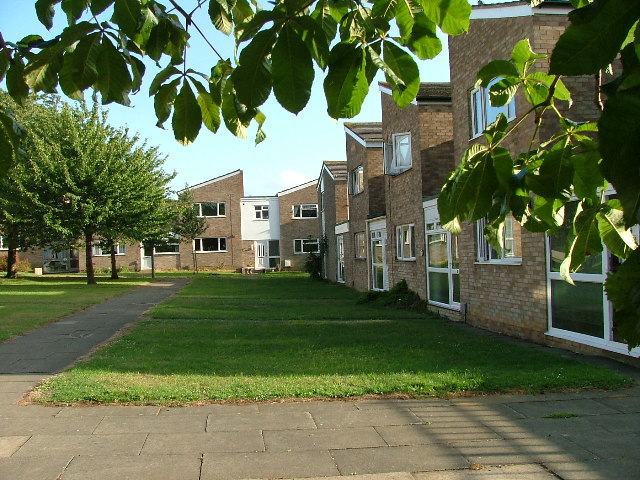
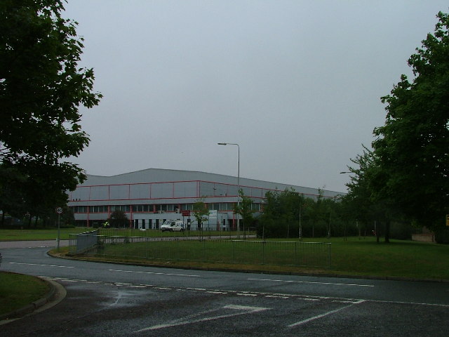
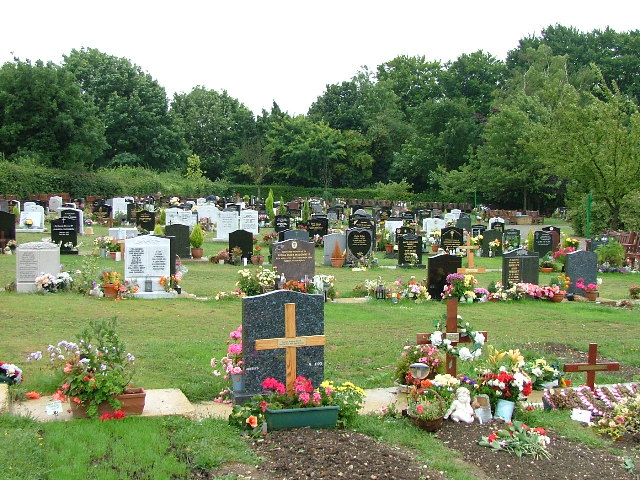
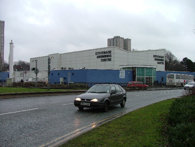
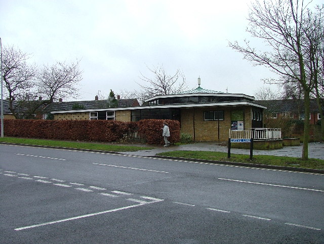
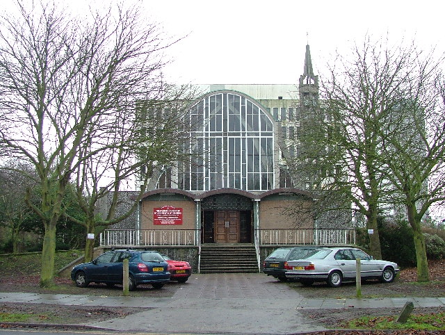
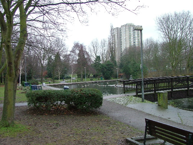
Hanginghill Wood Images

Images are sourced within 2km of 51.910778/-0.17734962 or Grid Reference TL2525. Thanks to Geograph Open Source API. All images are credited.

Hydean Way Shops Typical of local shops in Stevenage new town.  Above a parade of shops including a small supermarket, take away food outlet and Post Office there are maisonettes accessed from the rear.  To the right there are 2/3 bedroomed homes.
Hydean Way Shops
Typical of local shops in Stevenage new town. Above a parade of shops including a small supermarket, take away food outlet and Post Office there are maisonettes accessed from the rear. To the right there are 2/3 bedroomed homes.
South end of Fairlands Valley Park. This photograph was taken facing north into Fairlands Valley Park from the car park used for Stevenage Borough FC (see TL2422).  This park is also used for travelling fairs and circuses.
South end of Fairlands Valley Park.
This photograph was taken facing north into Fairlands Valley Park from the car park used for Stevenage Borough FC (see TL2422). This park is also used for travelling fairs and circuses.
Fairlands Valley Park This large lake is used by sailors and fishermen.  This photo is taken facing south.  To the rear there are two smaller lakes.  The park is very popular in the summer.
Fairlands Valley Park
This large lake is used by sailors and fishermen. This photo is taken facing south. To the rear there are two smaller lakes. The park is very popular in the summer.
Silam Rd. To the right are houses not untypical of Stevenage new town.  Looming over Silam Rd is one of a pair of high rise flats close to the town centre.
Silam Rd.
To the right are houses not untypical of Stevenage new town. Looming over Silam Rd is one of a pair of high rise flats close to the town centre.
Parishes Mead. Parishes mead is a newer development on the east side of Stevenage.  There is a mixture of private and social housing here.
Parishes Mead.
Parishes mead is a newer development on the east side of Stevenage. There is a mixture of private and social housing here.
Mildmay Road. These houses were built in a variety of styles.  These are not untypical but some of the architectural styles bring their own maintenance problems.
Mildmay Road.
These houses were built in a variety of styles. These are not untypical but some of the architectural styles bring their own maintenance problems.
Fortuna Close One of the more modern parts of Stevenage and with some more imaginative building - three storeys!
Fortuna Close
One of the more modern parts of Stevenage and with some more imaginative building - three storeys!
Hampson Park / Pin Green Water Tower. Although this water tower is right on the edge of this square I have used it because it dominates the locality.  The large flat construction on the left, behind the fence, is a covered reservoir.  The tower is now bristling with aerials of all sorts.
Hampson Park / Pin Green Water Tower.
Although this water tower is right on the edge of this square I have used it because it dominates the locality. The large flat construction on the left, behind the fence, is a covered reservoir. The tower is now bristling with aerials of all sorts.
Mastercare warehousing Although this photograph is actually taken (just) from neighbouring TL2526, this warehouse is typical of this industrial estate.  Not all are grey and red.  Some are grey and another colour!
Mastercare warehousing
Although this photograph is actually taken (just) from neighbouring TL2526, this warehouse is typical of this industrial estate. Not all are grey and red. Some are grey and another colour!
Weston Rd Cemetery Although Weston Rd Cemetery takes up a relatively small portion of this square, Stevenage has lots and lots of houses but only two cemeteries.
Weston Rd Cemetery
Although Weston Rd Cemetery takes up a relatively small portion of this square, Stevenage has lots and lots of houses but only two cemeteries.
Ferrier Rd This could be any road in this area.  Plans seem to have been bought as a job lot.
Ferrier Rd
This could be any road in this area. Plans seem to have been bought as a job lot.
Telford Avenue. On the edge of TL2525..  I wasn't going any further into this estate.  I always get lost even though it's not that big by local standards.  This estate, in common with others in the area suffers from the increase in car ownership.  Parking is awkward, the roads not wide and the layout is twisting.
Telford Avenue.
On the edge of TL2525.. I wasn't going any further into this estate. I always get lost even though it's not that big by local standards. This estate, in common with others in the area suffers from the increase in car ownership. Parking is awkward, the roads not wide and the layout is twisting.
Trig point at Lonsdale School I swear that tree was not there when I took the photo.

This Trig point is in the playing field of a special needs school caring for 75 children between the ages of 2 and 19 from London, Bedfordshire and Hertfordshire.
Trig point at Lonsdale School
I swear that tree was not there when I took the photo. This Trig point is in the playing field of a special needs school caring for 75 children between the ages of 2 and 19 from London, Bedfordshire and Hertfordshire.
Stevenage Swimming Pool The bus to the right is dropping children off for a drowning lesson.
Stevenage Swimming Pool
The bus to the right is dropping children off for a drowning lesson.
Religious Society of Friends meeting house Unprepossessing and in the shadow (almost literally) of the larger, church next door (St Andrew and St George)
Religious Society of Friends meeting house
Unprepossessing and in the shadow (almost literally) of the larger, church next door (St Andrew and St George)
Parish Church of St Andrew and St George - Stevenage. Below the church is Stevenage museum.
Parish Church of St Andrew and St George - Stevenage.
Below the church is Stevenage museum.
Town Park The 1940's map shows a stream running through this square and park.  All that remains visible is this long duck pond
Town Park
The 1940's map shows a stream running through this square and park. All that remains visible is this long duck pond
Stevenage Fire Station This taken from the top of the market car park.  From time to time firemen can be seen practising putting out fires in cars and small towers.
Stevenage Fire Station
This taken from the top of the market car park. From time to time firemen can be seen practising putting out fires in cars and small towers.
Show me another place!

Hanginghill Wood is located at Grid Ref: TL2525 (Lat: 51.910778, Lng: -0.17734962)

Administrative County: Hertfordshire

District: Stevenage

Police Authority: Hertfordshire

What 3 Words

///happen.claim.social. Near Stevenage, Hertfordshire

Related Wikis

The Nobel School

The Nobel School is a co-educational secondary school and sixth form located in Stevenage in the English county of Hertfordshire. == History == The Nobel...

Marriotts School

Marriotts School is a secondary school in Stevenage, Hertfordshire, England. The school was rebuilt along with Lonsdale School (for special needs children...

Pryor's Wood

Pryor's Wood is an 8.7-hectare (21-acre) nature reserve in Great Ashby, near Stevenage in Hertfordshire. It was formerly managed by the Herts and Middlesex...

St Nicholas' Church, Stevenage

St Nicholas' Church is an Anglican parish church in Stevenage, a town in Hertfordshire, England. It occupies a hilltop site above Old Stevenage. It is...

Barclay Academy

Barclay Academy is a secondary school and sixth form located in Stevenage, Hertfordshire, England. The current head teacher is Dr. Matthew Laban. Opening...

Rooks Nest House

Rooks Nest House is a house on Weston Road, Stevenage, Hertfordshire. It was the childhood home of the author E. M. Forster (1879–1970) who described it...

Stevenage Clock Tower

Stevenage Clock Tower is a Grade II listed structure in Town Square in the centre of Stevenage New Town. A panel on the tower records the visit of Elizabeth...

List of local nature reserves in Hertfordshire

Hertfordshire is a county in eastern England. It is bordered by Bedfordshire to the north, Cambridgeshire to the north-east, Essex to the east, Buckinghamshire...

Nearby Amenities

Located within 500m of 51.910778,-0.17734962
Barrier: bollard
Lat/Long: 51.9070454/-0.1795894
Barrier: bollard
Lat/Long: 51.9069891/-0.1792729
Crossing
Crossing: unmarked
Crossing Island: no
Tactile Paving: no
Lat/Long: 51.9126064/-0.1785808
Crossing
Crossing: unmarked
Crossing Island: no
Tactile Paving: no
Lat/Long: 51.9091868/-0.1719055
Mini Roundabout
Direction: clockwise
Lat/Long: 51.9127416/-0.1793985
Mini Roundabout
Direction: clockwise
Lat/Long: 51.9121289/-0.1795983
Crossing
Crossing: unmarked
Crossing Island: no
Kerb: lowered
Tactile Paving: no
Lat/Long: 51.9126033/-0.1782453
Bus Stop
Fairlands Centre
Bench: no
Bin: yes
Lit: yes
Naptan AtcoCode: 210021202060
Naptan Bearing: NW
Naptan CommonName: Fairlands Centre
Naptan Crossing: The King Pin PH
Naptan Indicator: adj
Naptan Landmark: The King Pin PH
Naptan NaptanCode: hrtdwtja
Naptan PlusbusZoneRef: STEVNGE
Naptan ShortCommonName: NA
Naptan Street: Archer Road
Shelter: yes
Source: naptan_import
Tactile Paving: no
Lat/Long: 51.9098883/-0.1833826
Bus Stop
Fairlands Centre
Bench: yes
Bin: yes
Lit: yes
Naptan AtcoCode: 210021202660
Naptan Bearing: SE
Naptan CommonName: Fairlands Centre
Naptan Crossing: The King Pin
Naptan Indicator: opp
Naptan Landmark: The King Pin
Naptan NaptanCode: hrtdwpdm
Naptan PlusbusZoneRef: STEVNGE
Naptan ShortCommonName: NA
Naptan Street: Archer Road
Shelter: yes
Source: naptan_import
Tactile Paving: no
Lat/Long: 51.9098115/-0.182921
Bus Stop
The Glebe Centre
Bench: yes
Bin: yes
Bus: yes
Lit: yes
Naptan AtcoCode: 210021201600
Naptan Bearing: SE
Naptan CommonName: The Glebe Centre
Naptan Crossing: The Swan Tavern PH
Naptan Indicator: o/s
Naptan Landmark: The Swan Tavern PH
Naptan NaptanCode: hrtgadaw
Naptan PlusbusZoneRef: STEVNGE
Naptan ShortCommonName: NA
Naptan Street: Chells Way
Naptan Verified: no
Public Transport: platform
Shelter: yes
Source: naptan_import
Tactile Paving: yes
Lat/Long: 51.9089199/-0.1711975
Bus Stop
Webb Rise
Bench: yes
Bin: yes
Lit: yes
Naptan AtcoCode: 210021202080
Naptan Bearing: N
Naptan CommonName: Webb Rise
Naptan Crossing: Hampson Park
Naptan Indicator: N-bound
Naptan Landmark: Hampson Park
Naptan NaptanCode: hrtdwtjg
Naptan PlusbusZoneRef: STEVNGE
Naptan ShortCommonName: NA
Naptan Street: Meredith Road
Shelter: yes
Source: naptan_import
Tactile Paving: no
Lat/Long: 51.9128186/-0.183718
Bus Stop
Chells Way
Bench: no
Bin: yes
Lit: yes
Naptan AtcoCode: 210021202360
Naptan Bearing: S
Naptan CommonName: Chells Way
Naptan Crossing: Moss Bury Education Centre
Naptan Indicator: S-bound
Naptan Landmark: Moss Bury Education Centre
Naptan NaptanCode: hrtdwpma
Naptan PlusbusZoneRef: STEVNGE
Naptan ShortCommonName: NA
Naptan Street: Fairlands Way
Shelter: no
Source: naptan_import
Tactile Paving: no
Lat/Long: 51.9133709/-0.1789765
Bus Stop
The Glebe Centre
Bench: yes
Bin: yes
Bus: yes
Lit: yes
Naptan AtcoCode: 210021202390
Naptan Bearing: NE
Naptan CommonName: The Glebe Centre
Naptan Crossing: Ross Court
Naptan Indicator: opp
Naptan Landmark: Ross Court
Naptan NaptanCode: hrtdwpmd
Naptan PlusbusZoneRef: STEVNGE
Naptan ShortCommonName: NA
Naptan Street: Mobbsbury Way
Naptan Verified: no
Public Transport: platform
Shelter: yes
Source: naptan_import
Tactile Paving: yes
Lat/Long: 51.9094384/-0.1713486
Bus Stop
The Glebe Centre
Bench: no
Bin: no
Lit: yes
Local Ref: NR
Naptan AtcoCode: 210021202400
Naptan Bearing: NW
Naptan CommonName: The Glebe Centre
Naptan Crossing: Mobbsbury Way
Naptan Indicator: nr
Naptan Landmark: Mobbsbury Way
Naptan NaptanCode: hrtdwpmg
Naptan PlusbusZoneRef: STEVNGE
Naptan ShortCommonName: NA
Naptan Street: Chells Way
Naptan Verified: no
Shelter: no
Source: naptan_import
Tactile Paving: no
Lat/Long: 51.9095158/-0.1725109
Bus Stop
Brunel Road
Bench: yes
Bin: yes
Lit: yes
Local Ref: NR
Naptan AtcoCode: 210021202420
Naptan Bearing: NW
Naptan CommonName: Brunel Road
Naptan Crossing: Drakes Drive
Naptan Indicator: nr
Naptan Landmark: Drakes Drive
Naptan NaptanCode: hrtdwpmj
Naptan PlusbusZoneRef: STEVNGE
Naptan ShortCommonName: NA
Naptan Street: Chells Way
Naptan Verified: no
Shelter: yes
Source: naptan_import
Tactile Paving: no
Lat/Long: 51.9118078/-0.1770851
Bus Stop
Chells Way
Bench: yes
Bin: no
Check Date Shelter: 2021-01-02
Lit: yes
Naptan AtcoCode: 210021202440
Naptan Bearing: N
Naptan CommonName: Chells Way
Naptan Crossing: Moss Bury JMI School
Naptan Indicator: opp
Naptan Landmark: Moss Bury JMI School
Naptan NaptanCode: hrtdwpmt
Naptan PlusbusZoneRef: STEVNGE
Naptan ShortCommonName: NA
Naptan Street: Fairlands Way
Shelter: yes
Source: naptan_import
Tactile Paving: no
Lat/Long: 51.9132544/-0.1792941
Bus Stop
Webb Rise
Bench: yes
Bin: yes
Lit: yes
Naptan AtcoCode: 210021202640
Naptan Bearing: S
Naptan CommonName: Webb Rise
Naptan Crossing: Webb Rise
Naptan Indicator: S-bound
Naptan Landmark: Webb Rise
Naptan NaptanCode: hrtdwpdg
Naptan PlusbusZoneRef: STEVNGE
Naptan ShortCommonName: NA
Naptan Street: Meredith Road
Shelter: yes
Source: naptan_import
Tactile Paving: no
Lat/Long: 51.912565/-0.1835974
Noexit: yes
Lat/Long: 51.9151699/-0.1788928
Fairlands Valley Farmhouse
Alt Name: Digswell Arts Trust
Building: yes
Lat/Long: 51.9080019/-0.1802468
Access: no
Barrier: bollard
Bicycle: yes
Foot: yes
Material: concrete
Lat/Long: 51.9091773/-0.1813737
Noexit: yes
Lat/Long: 51.9109593/-0.1821155
Noexit: yes
Lat/Long: 51.9115049/-0.1820972
Noexit: yes
Lat/Long: 51.9149841/-0.1799298
Post Box
Collection Times: Mo-Fr 09:00; Sa 07:00
Post Box Type: pillar
Ref: SG2 349
Royal Cypher: EIIR
Royal Cypher Wikidata: Q33102113
Lat/Long: 51.912575/-0.17661
Post Box
Collection Times: Mo-Fr 18:00; Sa 12:15
Post Box Type: pillar
Ref: SG2 346
Lat/Long: 51.9085085/-0.1755718
Post Box
Collection Times: Mo-Fr 17:30; Sa 12:15
Post Box Type: pillar
Ref: SG1 355
Lat/Long: 51.912216/-0.18316
Post Box
Collection Times: Mo-Fr 18:30; Sa 12:00
Post Box Type: pillar
Ref: SG1 357
Lat/Long: 51.909592/-0.183645
Post Office
Fixme: Surveyed 2009. May have closed by now 2010-07
Lat/Long: 51.9096377/-0.1836984
Bench
Backrest: yes
Colour: gray
Material: metal
Seats: 3
Lat/Long: 51.9069337/-0.1787899
Bench
Backrest: yes
Colour: gray
Material: metal
Seats: 3
Lat/Long: 51.906968/-0.1787434
Crossing
Crossing: unmarked
Crossing Island: no
Tactile Paving: no
Lat/Long: 51.9119345/-0.1771848
Newton General Stores
Addr City: Stevenage
Addr Housenumber: 48
Addr Postcode: SG2 0BX
Addr Street: Newton Road
Fhrs Id: 717280
Shop: convenience
Source Addr: FHRS Open Data
Lat/Long: 51.9086473/-0.1753381
Crossing
Crossing: unmarked
Crossing Island: no
Tactile Paving: no
Lat/Long: 51.912155/-0.1801228
Crossing
Crossing: uncontrolled
Crossing Island: no
Crossing Ref: zebra
Tactile Paving: yes
Lat/Long: 51.9116191/-0.1765148
Kerb: raised
Lat/Long: 51.9116008/-0.1841773
Crossing
Crossing: unmarked
Crossing Island: yes
Tactile Paving: no
Lat/Long: 51.9091745/-0.1715342
Bench
Backrest: no
Colour: silver
Material: metal
Seats: 3
Lat/Long: 51.9086723/-0.1802007
Bench
Backrest: no
Colour: silver
Material: metal
Seats: 3
Lat/Long: 51.9084977/-0.1801979
Bench
Backrest: yes
Colour: silver
Material: metal
Seats: 3
Lat/Long: 51.907434/-0.179109
Bench
Backrest: yes
Lat/Long: 51.9078123/-0.17925
Access: no
Barrier: kissing_gate
Foot: yes
Lat/Long: 51.9124076/-0.183951
Tesco Express Stevenage Chells
Addr City: Stevenage
Addr Postcode: SG2 0LU
Addr Street: Chells Way
Brand: Tesco Express
Brand Wikidata: Q98456772
Brand Wikipedia: en:Tesco
Contact Website: https://www.tesco.com/store-locator/stevenage/mobbsbury-way
Fhrs Id: 510265
Opening Hours: Mo-Su,PH 06:00-23:00
Shop: convenience
Source Addr: FHRS Open Data
Wheelchair: yes
Lat/Long: 51.9091183/-0.1711383
Entrance: main
Lat/Long: 51.9091149/-0.1712187
Atm
Operator: Tesco
Lat/Long: 51.9091795/-0.1712269
Waste Basket
Lat/Long: 51.9133768/-0.1789375
Waste Basket
Lat/Long: 51.9117988/-0.1770633
Bench
Backrest: yes
Colour: brown
Lat/Long: 51.9108561/-0.1743483
Waste Basket
Lat/Long: 51.910837/-0.1743067
Bench
Backrest: yes
Colour: green
Material: metal
Lat/Long: 51.9090852/-0.1719283
Waste Basket
Lat/Long: 51.9090662/-0.1718867
Crossing
Crossing: unmarked
Crossing Island: yes
Tactile Paving: no
Lat/Long: 51.9091675/-0.1718594
Crossing
Crossing: unmarked
Crossing Island: no
Tactile Paving: no
Traffic Calming: hump
Lat/Long: 51.9090388/-0.1715402
Waste Basket
Lat/Long: 51.9089379/-0.1711652
Grit Bin
Lat/Long: 51.908765/-0.1708353
Bench
Backrest: yes
Lat/Long: 51.9100846/-0.1701768
Grit Bin
Lat/Long: 51.9098298/-0.1829763
Waste Basket
Lat/Long: 51.9098207/-0.1829454
Pharmacy
Archer Rd Pharmacy
Lat/Long: 51.9098538/-0.1834872
Londis
Addr City: Stevenage
Addr Housenumber: 279
Addr Postcode: SG1 5HF
Addr Street: Archer Road
Brand: Londis
Brand Wikidata: Q21008564
Fhrs Id: 349285
Operator: Londis
Shop: supermarket
Source Addr: FHRS Open Data
Lat/Long: 51.9098745/-0.1835717
Waste Basket
Lat/Long: 51.9098765/-0.1833913
Bench
Backrest: yes
Colour: green
Material: metal
Lat/Long: 51.9110046/-0.1843295
Waste Basket
Lat/Long: 51.9109839/-0.1843321
Traffic Calming: island
Lat/Long: 51.9121375/-0.1797711
Traffic Calming: island
Lat/Long: 51.9120415/-0.1796175
Traffic Calming: island
Lat/Long: 51.9127171/-0.1792393
Traffic Calming: island
Lat/Long: 51.9128071/-0.1793755
Waste Basket
Lat/Long: 51.9093408/-0.1711678
Waste Basket
Lat/Long: 51.9094281/-0.1713637
Crossing
Crossing: uncontrolled
Crossing Island: no
Crossing Ref: zebra
Kerb: lowered
Tactile Paving: yes
Lat/Long: 51.9097507/-0.1708275
Barrier: cycle_barrier
Lat/Long: 51.9102149/-0.1703486
Crossing
Crossing: unmarked
Crossing Island: yes
Kerb: yes
Tactile Paving: yes
Lat/Long: 51.9101848/-0.1702842
Waste Basket
Lat/Long: 51.9128246/-0.1733767
Access: yes
Leisure: playground
Lat/Long: 51.9129123/-0.1753762
Club: scout
Lat/Long: 51.9119758/-0.171082
Barrier: cycle_barrier
Lat/Long: 51.9107559/-0.1723469
Barrier: cycle_barrier
Lat/Long: 51.9106324/-0.1721098
Bench
Backrest: yes
Colour: green
Material: metal
Lat/Long: 51.9111146/-0.1726672
Bench
Backrest: yes
Colour: green
Material: metal
Lat/Long: 51.9110774/-0.1729354
Waste Basket
Lat/Long: 51.910964/-0.1727772
Waste Basket
Lat/Long: 51.9107183/-0.1737978
Recycling
Recycling Cardboard: yes
Recycling Magazines: yes
Recycling Paper: yes
Recycling Type: container
Lat/Long: 51.909328/-0.1710565
Recycling
Recycling Glass: yes
Recycling Type: container
Lat/Long: 51.9093201/-0.1710378
Recycling
Recycling Beverage Cartons: yes
Recycling Cans: yes
Recycling Plastic Bottles: yes
Recycling Plastic Packaging: yes
Recycling Type: container
Lat/Long: 51.909311/-0.1710217
Recycling
Recycling Clothes: yes
Recycling Shoes: yes
Recycling Type: container
Lat/Long: 51.9092999/-0.1709969
Waste Basket
Lat/Long: 51.9085507/-0.1756458
Waste Basket
Lat/Long: 51.9070912/-0.1741786
Waste Basket
Lat/Long: 51.9128362/-0.1837152
Waste Basket
Lat/Long: 51.9125454/-0.1835764
Waste Basket
Lat/Long: 51.9139133/-0.1790723
The data included in this document is from www.openstreetmap.org. The data is made available under ODbL.

Have you been to Hanginghill Wood?

Leave your review of Hanginghill Wood below (or comments, questions and feedback).