Fourteen Acre Wood

Wood, Forest in Sussex Mid Sussex

England

Fourteen Acre Wood

House on Staplefield Road This is called "Brook Cottage", according to the large scale map.
House on Staplefield Road Credit: Ian Cunliffe

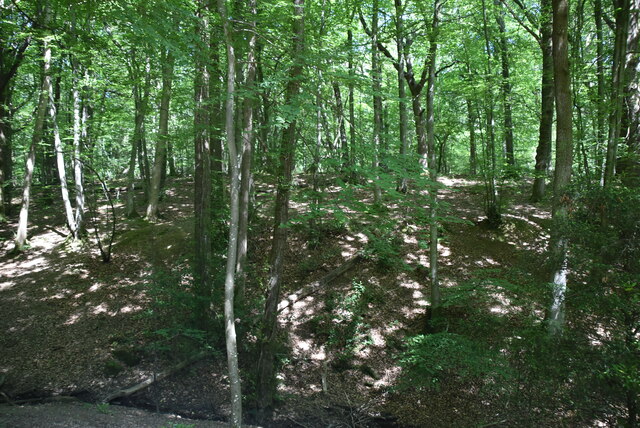
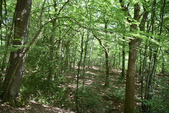
Fourteen Acre Wood, located in Sussex, is a picturesque forest spanning approximately fourteen acres. Nestled amidst the rolling hills of the English countryside, this woodland is a haven for nature enthusiasts and offers a tranquil escape from the bustling city life.

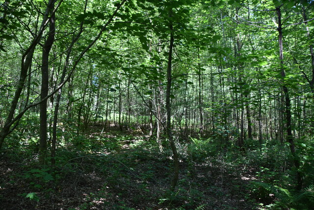
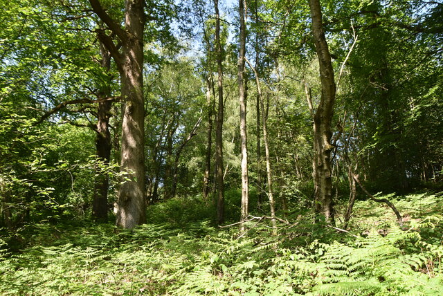
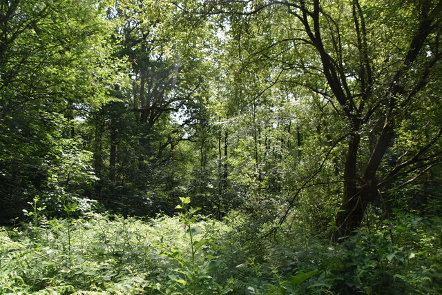
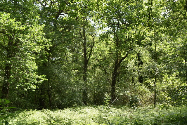
The wood boasts a diverse range of flora and fauna, making it a delightful destination for wildlife enthusiasts and botanists alike. Towering oak and beech trees dominate the landscape, their canopies forming a dense cover that filters sunlight and creates a cool, shaded atmosphere. Underneath these majestic giants, a rich understory of ferns, bluebells, and wildflowers thrives, painting the forest floor with bursts of vibrant colors during spring and summer.

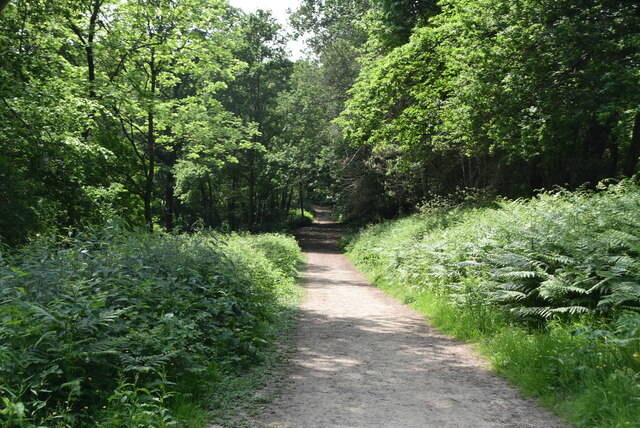
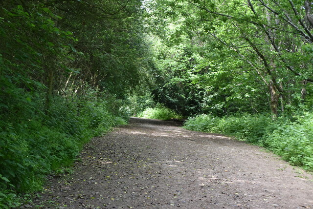
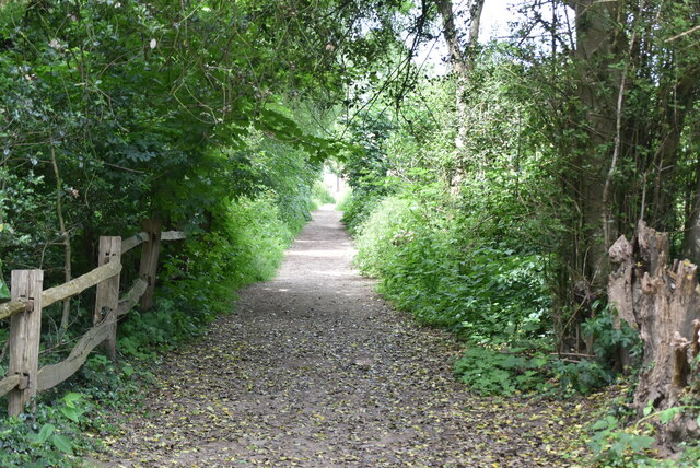
Several well-maintained trails wind their way through Fourteen Acre Wood, offering visitors the opportunity to explore its natural beauty. These paths meander through the forest, leading to clearings, babbling brooks, and hidden glens. Birdsong fills the air, providing a soothing soundtrack as visitors walk along the trails, while squirrels dart among the branches, adding a touch of playfulness to the serene atmosphere.

Fourteen Acre Wood also features a small pond, which serves as a watering hole for various species of birds and small mammals. With a bit of luck and patience, visitors may catch a glimpse of kingfishers, herons, or even elusive otters that call this woodland their home.

For those seeking tranquility and a connection with nature, Fourteen Acre Wood in Sussex offers a peaceful retreat, where one can immerse themselves in the beauty of the natural world.

If you have any feedback on the listing, please let us know in the comments section below.

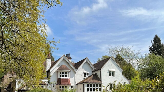
Fourteen Acre Wood Images

Images are sourced within 2km of 51.051599/-0.2188616 or Grid Reference TQ2429. Thanks to Geograph Open Source API. All images are credited.

House on Staplefield Road This is called "Brook Cottage", according to the large scale map.
House on Staplefield Road
This is called "Brook Cottage", according to the large scale map.
Equipment at the water treatment plant This is a small site - I couldn't see much else apart from the two green tanks. It smells a bit too, but luckily it's quite a way from any houses
Equipment at the water treatment plant
This is a small site - I couldn't see much else apart from the two green tanks. It smells a bit too, but luckily it's quite a way from any houses
Nymans Woodland Nymans Woods are 90 hectares of ancient woodland attached to Nymans Gardens, which is managed by the National Trust.
Nymans Woodland
Nymans Woods are 90 hectares of ancient woodland attached to Nymans Gardens, which is managed by the National Trust.
Nymans Woodland Nymans Woods are 90 hectares of ancient woodland attached to Nymans Gardens, which is managed by the National Trust.
Nymans Woodland
Nymans Woods are 90 hectares of ancient woodland attached to Nymans Gardens, which is managed by the National Trust.
Nymans Woodland Nymans Woods are 90 hectares of ancient woodland attached to Nymans Gardens, which is managed by the National Trust.
Nymans Woodland
Nymans Woods are 90 hectares of ancient woodland attached to Nymans Gardens, which is managed by the National Trust.
Nymans Woodland Nymans Woods are 90 hectares of ancient woodland attached to Nymans Gardens, which is managed by the National Trust.
Nymans Woodland
Nymans Woods are 90 hectares of ancient woodland attached to Nymans Gardens, which is managed by the National Trust.
Nymans Woodland Nymans Woods are 90 hectares of ancient woodland attached to Nymans Gardens, which is managed by the National Trust.
Nymans Woodland
Nymans Woods are 90 hectares of ancient woodland attached to Nymans Gardens, which is managed by the National Trust.
Sussex Ouse Valley Way, Nymans Woodland Opened in 2005, the Sussex Ouse Valley Way is a beautiful 42 mile journey that broadly follows the River Ouse from its source close to Lower Beeding in the High Weald to the sea at Seaford Bay. It is signed using a picture of the Ouse Valley Viaduct. Website: <span class="nowrap"><a title="http://www.sussexousevalleyway.co.uk/index.htm" rel="nofollow ugc noopener" href="http://www.sussexousevalleyway.co.uk/index.htm">Link</a><img style="margin-left:2px;" alt="External link" title="External link - shift click to open in new window" src="https://s1.geograph.org.uk/img/external.png" width="10" height="10"/></span>
Sussex Ouse Valley Way, Nymans Woodland
Opened in 2005, the Sussex Ouse Valley Way is a beautiful 42 mile journey that broadly follows the River Ouse from its source close to Lower Beeding in the High Weald to the sea at Seaford Bay. It is signed using a picture of the Ouse Valley Viaduct. Website: LinkExternal link
Welcome to Nymans Woodland Nymans Woods are 90 hectares of ancient woodland attached to Nymans Gardens, which is managed by the National Trust.
Welcome to Nymans Woodland
Nymans Woods are 90 hectares of ancient woodland attached to Nymans Gardens, which is managed by the National Trust.
Sussex Ouse Valley Way Opened in 2005, the Sussex Ouse Valley Way is a beautiful 42 mile journey that broadly follows the River Ouse from its source close to Lower Beeding in the High Weald to the sea at Seaford Bay. It is signed using a picture of the Ouse Valley Viaduct. Website: <span class="nowrap"><a title="http://www.sussexousevalleyway.co.uk/index.htm" rel="nofollow ugc noopener" href="http://www.sussexousevalleyway.co.uk/index.htm">Link</a><img style="margin-left:2px;" alt="External link" title="External link - shift click to open in new window" src="https://s1.geograph.org.uk/img/external.png" width="10" height="10"/></span>
Sussex Ouse Valley Way
Opened in 2005, the Sussex Ouse Valley Way is a beautiful 42 mile journey that broadly follows the River Ouse from its source close to Lower Beeding in the High Weald to the sea at Seaford Bay. It is signed using a picture of the Ouse Valley Viaduct. Website: LinkExternal link
Village sign, Handcross
B2110, B2114 junction The B2110 runs 25 miles from Langton Green <a href="https://www.geograph.org.uk/photo/5257058">TQ5338 : Crockers Hatch Corner</a>, west of Tunbridge Wells, to Lower Beeding. It skirts the northern edge of the Ashdown Forest. It runs through the villages of Groombridge, Hartfield, Withyham and Coleman's Hatch, then Hand Cross, Turners Hill and East Grinstead.
<span class="nowrap"><a title="http://www.sabre-roads.org.uk/wiki/index.php?title=B2110" rel="nofollow ugc noopener" href="http://www.sabre-roads.org.uk/wiki/index.php?title=B2110">Link</a><img style="margin-left:2px;" alt="External link" title="External link - shift click to open in new window" src="https://s1.geograph.org.uk/img/external.png" width="10" height="10"/></span>
B2110, B2114 junction
The B2110 runs 25 miles from Langton Green TQ5338 : Crockers Hatch Corner, west of Tunbridge Wells, to Lower Beeding. It skirts the northern edge of the Ashdown Forest. It runs through the villages of Groombridge, Hartfield, Withyham and Coleman's Hatch, then Hand Cross, Turners Hill and East Grinstead. LinkExternal link
B2110, B2114 junction The B2114 runs 4 miles from Slough Green to Pease Pottage.
<span class="nowrap"><a title="https://www.sabre-roads.org.uk/wiki/index.php?title=B2114" rel="nofollow ugc noopener" href="https://www.sabre-roads.org.uk/wiki/index.php?title=B2114">Link</a><img style="margin-left:2px;" alt="External link" title="External link - shift click to open in new window" src="https://s1.geograph.org.uk/img/external.png" width="10" height="10"/></span>
B2110, B2114 junction
The B2114 runs 4 miles from Slough Green to Pease Pottage. LinkExternal link
The Red Lion The second most popular name for a pub, this name became popular when James I ordered red lions to be displayed outside all public places.
The Red Lion
The second most popular name for a pub, this name became popular when James I ordered red lions to be displayed outside all public places.
High St Handcross is a village in West Sussex, on the A23, 4 miles south of Crawley.
Wikipedia: <span class="nowrap"><a title="https://en.wikipedia.org/wiki/Handcross" rel="nofollow ugc noopener" href="https://en.wikipedia.org/wiki/Handcross">Link</a><img style="margin-left:2px;" alt="External link" title="External link - shift click to open in new window" src="https://s1.geograph.org.uk/img/external.png" width="10" height="10"/></span>
High St
Handcross is a village in West Sussex, on the A23, 4 miles south of Crawley. Wikipedia: LinkExternal link
Spar, Handcross Handcross is a village in West Sussex, on the A23, 4 miles south of Crawley.
Wikipedia: <span class="nowrap"><a title="https://en.wikipedia.org/wiki/Handcross" rel="nofollow ugc noopener" href="https://en.wikipedia.org/wiki/Handcross">Link</a><img style="margin-left:2px;" alt="External link" title="External link - shift click to open in new window" src="https://s1.geograph.org.uk/img/external.png" width="10" height="10"/></span>
Spar, Handcross
Handcross is a village in West Sussex, on the A23, 4 miles south of Crawley. Wikipedia: LinkExternal link
Show me another place!

Fourteen Acre Wood is located at Grid Ref: TQ2429 (Lat: 51.051599, Lng: -0.2188616)

Administrative County: West Sussex

District: Mid Sussex

Police Authority: Sussex

What 3 Words

///coconuts.jabs.sharpens. Near Handcross, West Sussex

Related Wikis

Handcross Hill bus crash

On 12 July 1906, a bus crashed into a tree on Handcross Hill in Sussex, England, killing 10 people and injuring a further 26 in the worst road crash in...
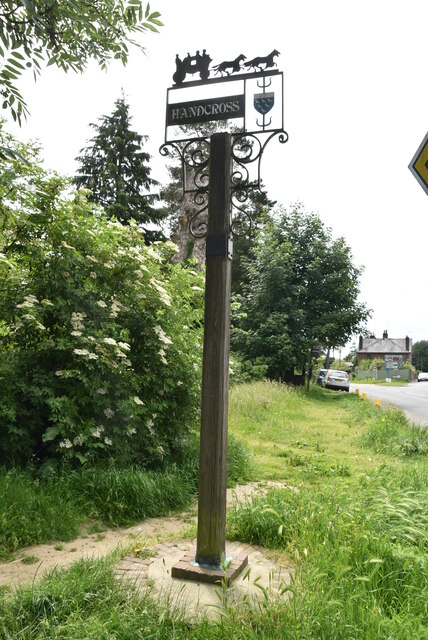
Handcross

Handcross is a village in the Mid Sussex District of West Sussex, England. It lies on the A23 road 4.2 miles (6.8 kilometres) south of Crawley. At the...

Nymans

Nymans is an English garden to the east of the village of Handcross, and in the civil parish of Slaugham in West Sussex, England. The garden was developed...

Slaugham

Slaugham () is a village and civil parish in the Mid Sussex District of West Sussex, England. It is located 7 miles (11 km) to the south of Crawley, on...

St Mary's Church, Slaugham

St Mary's Church is an Anglican church in the village of Slaugham in Mid Sussex, one of seven local government districts in the English county of West...

Handcross Park School

Handcross Park School is an independent co-educational preparatory school in Handcross, between Crawley, Horsham and Haywards Heath in West Sussex, England...

Cow Wood and Harry's Wood

Cow Wood and Harry's Wood is a 75.5-hectare (187-acre) biological Site of Special Scientific Interest east of Handcross in West Sussex. it is in the High...

Staplefield

Staplefield is a village in the Mid Sussex District of West Sussex, England, situated 6 kilometres (3.7 mi) north-west of Haywards Heath on the B2114...

Nearby Amenities

Located within 500m of 51.051599,-0.2188616
Bus Stop
Badgers Plantation
Bus: yes
Naptan AtcoCode: 4400HR0491
Naptan Bearing: NE
Naptan BusStopType: CUS
Naptan CommonName: Badgers Plantation
Naptan Indicator: adj Carterslodge Lane
Naptan Landmark: Carterslodge Lane
Naptan NaptanCode: wsxawmjp
Naptan Street: Horsham Road
Naptan Verified: no
Public Transport: platform
Source: naptan_import
Lat/Long: 51.0478356/-0.2219458
Bus Stop
Badgers Plantation
Bus: yes
Naptan AtcoCode: 4400HR0492
Naptan Bearing: SW
Naptan BusStopType: CUS
Naptan CommonName: Badgers Plantation
Naptan Indicator: Opp Carterslodge Lane
Naptan Landmark: Carterslodge Lane
Naptan NaptanCode: wsxawmjt
Naptan Street: Horsham Road
Naptan Verified: no
Public Transport: platform
Source: naptan_import
Lat/Long: 51.0477632/-0.22192
Bus Stop
Truckers Hatch
Bus: yes
Naptan AtcoCode: 4400HR0980
Naptan Bearing: NE
Naptan BusStopType: CUS
Naptan CommonName: Truckers Hatch
Naptan Indicator: adj
Naptan Landmark: Hail & Ride
Naptan NaptanCode: wsxgamwp
Naptan Street: Horsham Road
Naptan Verified: no
Public Transport: platform
Source: naptan_import
Lat/Long: 51.0495818/-0.2155583
Access: no
Barrier: stile
Foot: designated
Lat/Long: 51.0476062/-0.2172912
Access: no
Barrier: kissing_gate
Foot: designated
Lat/Long: 51.048782/-0.2180597
Blackfriars Bridge
Place: locality
Lat/Long: 51.0544612/-0.2141457
Truckers Ghyll
Place: isolated_dwelling
Lat/Long: 51.0503257/-0.2195976
Ashfold Farm
Place: farm
Lat/Long: 51.0477331/-0.2183769
The data included in this document is from www.openstreetmap.org. The data is made available under ODbL.

Have you been to Fourteen Acre Wood?

Leave your review of Fourteen Acre Wood below (or comments, questions and feedback).