Wellsyke Wood

Wood, Forest in Lincolnshire East Lindsey

England

Wellsyke Wood

Sandy Lane
Sandy Lane Credit: Alex McGregor

Wellsyke Wood is a picturesque woodland located in the county of Lincolnshire, England. It covers an area of approximately 50 acres and is situated in the heart of the Lincolnshire Wolds, a designated Area of Outstanding Natural Beauty. The wood is characterized by its diverse array of tree species, including oak, beech, birch, and ash, which create a rich and vibrant canopy overhead.

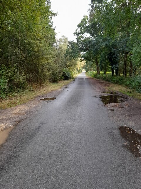
The wood is known for its tranquil atmosphere and is a popular destination for nature enthusiasts and walkers seeking peace and solitude. Its well-maintained network of pathways offers visitors the opportunity to explore the wood's natural beauty at their own pace. Along the trails, one can discover a variety of flora and fauna, such as bluebells, primroses, and woodpeckers, which add to the area's allure.

Wellsyke Wood also boasts a small stream that meanders through its heart, adding to the charm and tranquility of the surroundings. The stream provides a habitat for various aquatic species and serves as a watering hole for the woodland's resident wildlife, including deer, rabbits, and foxes.

The wood has a rich history, with evidence of human occupation dating back centuries. It has been managed sustainably for generations, with periodic thinning and selective felling to maintain a healthy woodland ecosystem. Wellsyke Wood is also part of a larger network of woodlands in the area, contributing to the overall biodiversity of the region.

Overall, Wellsyke Wood offers visitors a chance to escape the hustle and bustle of everyday life and immerse themselves in the beauty and tranquility of nature.

If you have any feedback on the listing, please let us know in the comments section below.

Wellsyke Wood Images

Images are sourced within 2km of 53.159126/-0.1628962 or Grid Reference TF2264. Thanks to Geograph Open Source API. All images are credited.

Sandy Lane
Sandy Lane
Viking Way
Viking Way
Sandy Lane
Sandy Lane
Highhall Farm
Highhall Farm
Woodhall Spa, Tower on the Moor: aerial 2022 There are theories that it was built as a lookout, for defence purposes, or for fun (like a folly), but the most convincing theory is that it is the remains of a hunting lodge - <span class="nowrap"><a title="https://www.heritagegateway.org.uk/Gateway/Results_Single.aspx?uid=MLI43570&resourceID=1006" rel="nofollow ugc noopener" href="https://www.heritagegateway.org.uk/Gateway/Results_Single.aspx?uid=MLI43570&resourceID=1006">Link</a><img style="margin-left:2px;" alt="External link" title="External link - shift click to open in new window" src="https://s1.geograph.org.uk/img/external.png" width="10" height="10"/></span>

The "Moor" is now a golf course. A good place to view the tower from the ground is from the footpath along the old railway track.

See also <a href="https://www.geograph.org.uk/photo/3089843">TF2163 : Woodhall Spa, Tower on the Moor: aerial 2012</a>
Woodhall Spa, Tower on the Moor: aerial 2022
There are theories that it was built as a lookout, for defence purposes, or for fun (like a folly), but the most convincing theory is that it is the remains of a hunting lodge - LinkExternal link The "Moor" is now a golf course. A good place to view the tower from the ground is from the footpath along the old railway track. See also TF2163 : Woodhall Spa, Tower on the Moor: aerial 2012
Direction Sign – Signpost west of Red Mill Bridge in Kirkby on Bain parish Located on the west side of the T junction of Roughton Road and Rime's Lane, west of Red Mill Bridge in Kirkby on Bain parish. 3 arms but no finial. See also <a title="https://www.geograph.org.uk/photo/3022252" href="https://www.geograph.org.uk/photo/3022252">Link</a>.

Milestone Society National ID: LI_TF2363
Direction Sign – Signpost west of Red Mill Bridge in Kirkby on Bain parish
Located on the west side of the T junction of Roughton Road and Rime's Lane, west of Red Mill Bridge in Kirkby on Bain parish. 3 arms but no finial. See also Link. Milestone Society National ID: LI_TF2363
Direction Sign – Signpost on the B1191 Horncastle Road at Martin Moor Located at Martin Moor, on the northwest side of the T junction of the B1191 Horncastle Road and Moor Lane, in Roughton parish. 3 arms but no finial. See also <a title="https://www.geograph.org.uk/photo/464517" href="https://www.geograph.org.uk/photo/464517">Link</a>.

Milestone Society National ID: LI_TF2264
Direction Sign – Signpost on the B1191 Horncastle Road at Martin Moor
Located at Martin Moor, on the northwest side of the T junction of the B1191 Horncastle Road and Moor Lane, in Roughton parish. 3 arms but no finial. See also Link. Milestone Society National ID: LI_TF2264
Direction Sign – Signpost on the B1191 Horncastle Road at Martin Moo Located at Martin Moor, on the southeast side of the T junction of the B1191 Horncastle Road and Sandy Lane, in Roughton parish. 3 arms but no finial.

Milestone Society National ID: LI_TF2164
Direction Sign – Signpost on the B1191 Horncastle Road at Martin Moo
Located at Martin Moor, on the southeast side of the T junction of the B1191 Horncastle Road and Sandy Lane, in Roughton parish. 3 arms but no finial. Milestone Society National ID: LI_TF2164
River Bain, disused Horncastle Canal and some earthworks SW of Haltham: aerial 2022
River Bain and disused Horncastle Canal N of Haltham: aerial 2022
Cut Mark: Roughton, Moor Lane, Farm Building Cut bench mark on the end of a farm building on Moor Lane.  See <a title="https://www.geograph.org.uk/photo/7351094" href="https://www.geograph.org.uk/photo/7351094">Link</a> for a wider view and <span class="nowrap"><a title="https://www.bench-marks.org.uk/bm180176" rel="nofollow ugc noopener" href="https://www.bench-marks.org.uk/bm180176">Link</a><img style="margin-left:2px;" alt="External link" title="External link - shift click to open in new window" src="https://s1.geograph.org.uk/img/external.png" width="10" height="10"/></span> for details of the mark.
Cut Mark: Roughton, Moor Lane, Farm Building
Cut bench mark on the end of a farm building on Moor Lane. See Link for a wider view and LinkExternal link for details of the mark.
Farm Building on Moor Lane There is a cut bench mark on the end of this farm building on Moor Lane.  See <a title="https://www.geograph.org.uk/photo/7351090" href="https://www.geograph.org.uk/photo/7351090">Link</a> for a closer view and <span class="nowrap"><a title="https://www.bench-marks.org.uk/bm180176" rel="nofollow ugc noopener" href="https://www.bench-marks.org.uk/bm180176">Link</a><img style="margin-left:2px;" alt="External link" title="External link - shift click to open in new window" src="https://s1.geograph.org.uk/img/external.png" width="10" height="10"/></span> for details of the mark.
Farm Building on Moor Lane
There is a cut bench mark on the end of this farm building on Moor Lane. See Link for a closer view and LinkExternal link for details of the mark.
Cut Mark: Haltham, St Benedict's Church Cut bench mark on the buttress at the south-east angle of this church.  See <a title="https://www.geograph.org.uk/photo/7351109" href="https://www.geograph.org.uk/photo/7351109">Link</a> for a wider view and <span class="nowrap"><a title="https://www.bench-marks.org.uk/bm180177" rel="nofollow ugc noopener" href="https://www.bench-marks.org.uk/bm180177">Link</a><img style="margin-left:2px;" alt="External link" title="External link - shift click to open in new window" src="https://s1.geograph.org.uk/img/external.png" width="10" height="10"/></span> for details of the mark.
Cut Mark: Haltham, St Benedict's Church
Cut bench mark on the buttress at the south-east angle of this church. See Link for a wider view and LinkExternal link for details of the mark.
The East End of Haltham St Benedict's Church There is a cut bench mark on the buttress at the south-east angle of this church.  See <a title="https://www.geograph.org.uk/photo/7351106" href="https://www.geograph.org.uk/photo/7351106">Link</a> for a closer view and <span class="nowrap"><a title="https://www.bench-marks.org.uk/bm180177" rel="nofollow ugc noopener" href="https://www.bench-marks.org.uk/bm180177">Link</a><img style="margin-left:2px;" alt="External link" title="External link - shift click to open in new window" src="https://s1.geograph.org.uk/img/external.png" width="10" height="10"/></span> for details of the mark.
The East End of Haltham St Benedict's Church
There is a cut bench mark on the buttress at the south-east angle of this church. See Link for a closer view and LinkExternal link for details of the mark.
Haltham, St Benedict's Church The church has a squat low wooden belfry, not tall enough to qualify for the church with a tower symbol on Ordnance Survey maps and is shown with the + symbol for other place of worship.
Haltham, St Benedict's Church
The church has a squat low wooden belfry, not tall enough to qualify for the church with a tower symbol on Ordnance Survey maps and is shown with the + symbol for other place of worship.
River Bain, Kirkby on Bain Ahead is Red Mill Bridge which carries Rime's Lane over the River Bain, connecting Kirkby on Bain with Haltham and the A153 - the only road crossing between Coningsby and Thornton, just south of Horncastle. This stretch of the river was canalised at the end of the 18th century as part of a scheme fully opened in 1802 as the Horncastle Canal. It was never very successful financially although for some years there was regular traffic, mainly coal to Horncastle and agricultural products heading south. The opening of a railway branch to Horncastle in 1854 led to a terminal decline and the navigation was formally abandoned in 1889. Although plans for restoration as a cruising waterway have been put forward, it will be a long time, if ever, before boats reach Horncastle again.
River Bain, Kirkby on Bain
Ahead is Red Mill Bridge which carries Rime's Lane over the River Bain, connecting Kirkby on Bain with Haltham and the A153 - the only road crossing between Coningsby and Thornton, just south of Horncastle. This stretch of the river was canalised at the end of the 18th century as part of a scheme fully opened in 1802 as the Horncastle Canal. It was never very successful financially although for some years there was regular traffic, mainly coal to Horncastle and agricultural products heading south. The opening of a railway branch to Horncastle in 1854 led to a terminal decline and the navigation was formally abandoned in 1889. Although plans for restoration as a cruising waterway have been put forward, it will be a long time, if ever, before boats reach Horncastle again.
The Ebrington Arms, Kirkby on Bain The Ebrington Arms is an attractive village pub dating from around 1610. Potential visitors should check the opening hours which are somewhat quirky.
The Ebrington Arms, Kirkby on Bain
The Ebrington Arms is an attractive village pub dating from around 1610. Potential visitors should check the opening hours which are somewhat quirky.
Kirkby Lane, Kirkby on Bain This lane connects Kirkby on Bain with Woodhall Spa passing mainly through woodland and beside Kirkby Moor. This view is just west of Kirkby on Bain village where motorists are warned of horse riders and pedestrians.
Kirkby Lane, Kirkby on Bain
This lane connects Kirkby on Bain with Woodhall Spa passing mainly through woodland and beside Kirkby Moor. This view is just west of Kirkby on Bain village where motorists are warned of horse riders and pedestrians.
Show me another place!

Wellsyke Wood is located at Grid Ref: TF2264 (Lat: 53.159126, Lng: -0.1628962)

Administrative County: Lincolnshire

District: East Lindsey

Police Authority: Lincolnshire

What 3 Words

///trickles.gladiator.portable. Near Woodhall Spa, Lincolnshire

Related Wikis

Wellsyke Wood

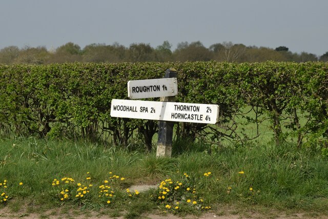
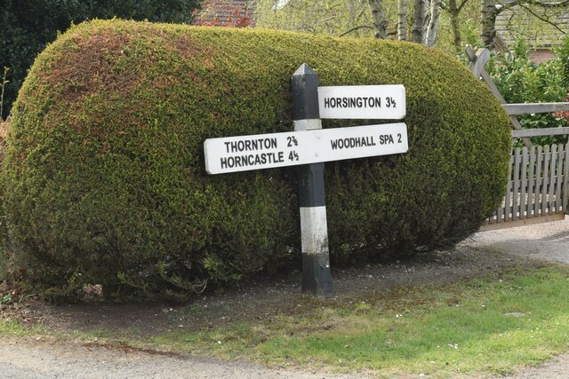
Wellsyke Wood is a small woodland on Roughton Moor to the east of the village of Woodhall Spa, Lincolnshire. At the eastern end of the wood there is a...

Kirkby Moor, Lincolnshire

Kirkby Moor is an elevated area of lowland heath, woodland and farmland in central Lincolnshire between the villages of Woodhall Spa to the west and Kirkby...

Big Rous Holt

Big Rous Holt is a small woodland beside the B1191 (Horncastle Road) to the north east of the village of Woodhall Spa in Lincolnshire on Roughton Moor...

Roughton Scrubs

Roughton Scrubs is a small woodland beside the B1191 (Horncastle Road) to the north east of the village of Woodhall Spa in Lincolnshire on Roughton Moor...

Roughton, Lincolnshire

Roughton ( ROOT-ən) is a village and civil parish in the East Lindsey district of Lincolnshire, England. The parish population was 644 in 2011.The village...

St Benedict's Church, Haltham-on-Bain

St Benedict's Church is a redundant Anglican church in the village of Haltham-on-Bain, Lincolnshire, England. It is recorded in the National Heritage...

Haltham

Haltham is a village and civil parish in the East Lindsey district of Lincolnshire, England. The population of the civil parish at the 2011 census was...

Highall Wood

Highall Wood is a woodland to the north east of the village of Woodhall Spa, Lincolnshire. It is bordered by Park Plantation to the east and White Hall...

Nearby Amenities

Located within 500m of 53.159126,-0.1628962
Power: pole
Source: Bing
Lat/Long: 53.1618283/-0.1669715
Power: pole
Source: Bing
Lat/Long: 53.1617117/-0.1680202
Power: pole
Source: Bing
Lat/Long: 53.1613118/-0.1690848
Power: pole
Source: Bing
Lat/Long: 53.1597956/-0.1677521
Power: pole
Source: Bing
Lat/Long: 53.1605217/-0.1690061
Fairfields Farm
Place: farm
Source: Bing
Lat/Long: 53.1607968/-0.1678478
Fixme: Name of farm?
Place: farm
Source: Bing
Lat/Long: 53.1592437/-0.1685397
Wellsyke Court
Place: isolated_dwelling
Source: Bing
Lat/Long: 53.1578922/-0.1643345
The Gardens
Place: isolated_dwelling
Source: Bing
Lat/Long: 53.1567197/-0.1658785
Wellsyke Farm
Place: farm
Source: Bing
Lat/Long: 53.1554809/-0.1591179
The data included in this document is from www.openstreetmap.org. The data is made available under ODbL.

Have you been to Wellsyke Wood?

Leave your review of Wellsyke Wood below (or comments, questions and feedback).