St Leonard's Forest

Wood, Forest in Sussex Horsham

England

St Leonard's Forest

Grouse Road A minor road that links Hammerpond Road at Bucks Head to Pease Pottage, the latter an old entrance to St Leonard's Forest. Old Copse is on the right.
Grouse Road Credit: Simon Carey

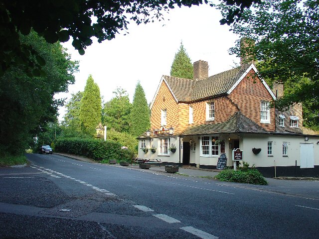
St Leonard's Forest, located in Sussex, England, is a picturesque woodland area that covers an approximate area of 1,000 acres. It is situated between the towns of Horsham and Crawley, making it easily accessible for visitors from nearby areas. The forest is named after the local St Leonard's Church, which has been standing adjacent to the woodland for centuries.

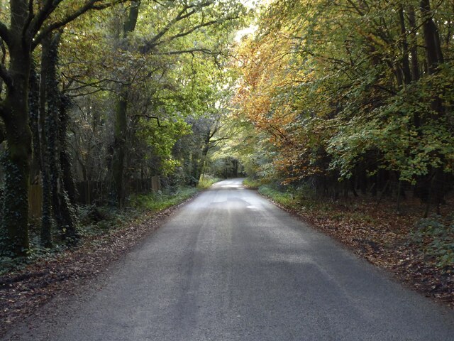
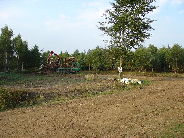
This ancient forest is renowned for its diverse range of flora and fauna, making it a popular destination for nature lovers and outdoor enthusiasts. The forest is predominantly composed of broadleaf trees, including oak, beech, and birch, which provide a dense canopy and create a serene and shady atmosphere. The undergrowth is adorned with a variety of wildflowers, adding color and vibrancy to the forest floor.

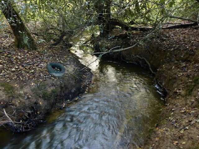
St Leonard's Forest is home to a multitude of wildlife species, including deer, foxes, badgers, and a plethora of bird species. It is also known for its diverse insect population, with butterflies and dragonflies being particularly abundant.

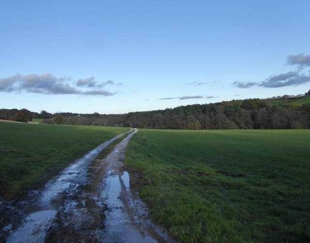
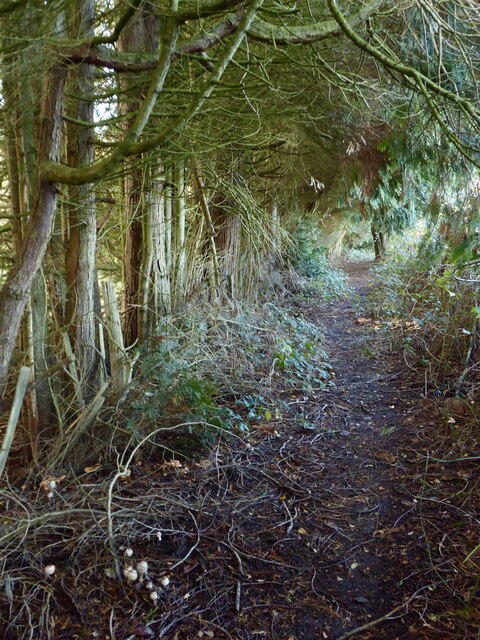
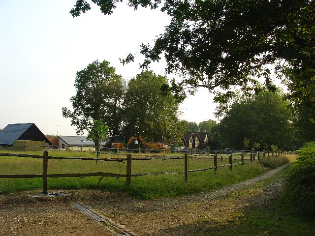
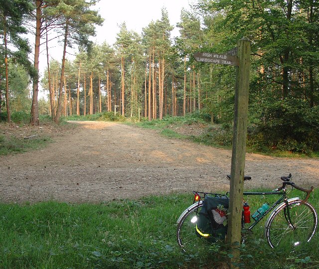
The forest offers numerous walking trails that meander through its enchanting surroundings, catering to both casual strollers and seasoned hikers. These paths provide opportunities to explore the forest's hidden gems, such as secluded ponds and ancient gnarled trees.

Due to its natural beauty and tranquil ambiance, St Leonard's Forest is a popular destination for outdoor activities such as picnicking, bird-watching, and photography. It also serves as a valuable recreational space for locals, providing an escape from the hustle and bustle of nearby towns.

In summary, St Leonard's Forest is a captivating woodland area in Sussex, offering a diverse range of flora and fauna, scenic walking trails, and opportunities for outdoor recreation.

If you have any feedback on the listing, please let us know in the comments section below.

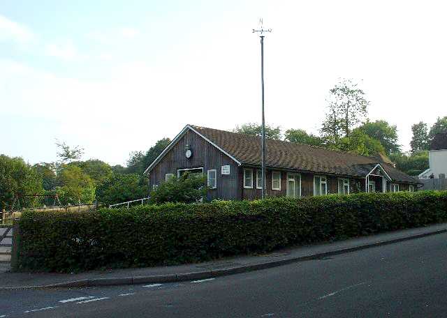
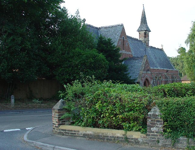
St Leonard's Forest Images

Images are sourced within 2km of 51.068751/-0.25171697 or Grid Reference TQ2231. Thanks to Geograph Open Source API. All images are credited.

Grouse Road A minor road that links Hammerpond Road at Bucks Head to Pease Pottage, the latter an old entrance to St Leonard's Forest. Old Copse is on the right.
Grouse Road
A minor road that links Hammerpond Road at Bucks Head to Pease Pottage, the latter an old entrance to St Leonard's Forest. Old Copse is on the right.
St Leonard's Forest An open area of the forest located on the western side of Newstead Gill.
St Leonard's Forest
An open area of the forest located on the western side of Newstead Gill.
Newstead Gill A part of the River Arun catchment area that rises to the south of Pease Pottage and feeds Hammer Pond before joining Goldings Stream.
Newstead Gill
A part of the River Arun catchment area that rises to the south of Pease Pottage and feeds Hammer Pond before joining Goldings Stream.
Public Footpath 1702 Linking the High Weald Landscape Trail to the east of Grouse Road with Hammerpond Road, crossing Newstead Gill and Carterslodge Gill in the process. Plenty of fungi on the ground.
Public Footpath 1702
Linking the High Weald Landscape Trail to the east of Grouse Road with Hammerpond Road, crossing Newstead Gill and Carterslodge Gill in the process. Plenty of fungi on the ground.
The Dragon Public House, Colgate, West Sussex At one of the main crossroads of this small village. The pub is named after the dragon which was said to live in the nearby St. Leonards Forest.
The Dragon Public House, Colgate, West Sussex
At one of the main crossroads of this small village. The pub is named after the dragon which was said to live in the nearby St. Leonards Forest.
Water Tower, Beacon Hill, Colgate, West Sussex This concrete water tower is built near to the highest point on Beacon Hill (146m above sea level). Colgate is situated on top of a long ridge of wealdland that stretches E-W between Pease Pottage and the outskirts of Horsham. Water pressure in the area would be quite low without the use of a water tower.
Water Tower, Beacon Hill, Colgate, West Sussex
This concrete water tower is built near to the highest point on Beacon Hill (146m above sea level). Colgate is situated on top of a long ridge of wealdland that stretches E-W between Pease Pottage and the outskirts of Horsham. Water pressure in the area would be quite low without the use of a water tower.
Forest Grange, in the heart of St Leonards Forest, Near Horsham, West Sussex Earlier maps (e.g. 1993) show this as the site of Forest Grange School. Later maps have dropped school from the name. It didn't looked like it was being used as a school at the time the picture was taken.
Forest Grange, in the heart of St Leonards Forest, Near Horsham, West Sussex
Earlier maps (e.g. 1993) show this as the site of Forest Grange School. Later maps have dropped school from the name. It didn't looked like it was being used as a school at the time the picture was taken.
Forestry Operations, St Leonards Forest, Near Horsham, West Sussex The forest is run by the Forestry Commission for commercial timber extraction. Here we see a lorry on the main access track (also a public bridleway) being loaded up with logs.
Forestry Operations, St Leonards Forest, Near Horsham, West Sussex
The forest is run by the Forestry Commission for commercial timber extraction. Here we see a lorry on the main access track (also a public bridleway) being loaded up with logs.
Track Junction in St Leonard Forest. Part of the High Weald Landscape Trail The main bridleway through the middle of the forest intersects with several public footpaths. Here we see where one of the paths (part of the route of the High Weald Landscape Trail) leads off along an intersceting track. The View also shows the characteristic trees in this forest, which are mainly pine.
Track Junction in St Leonard Forest. Part of the High Weald Landscape Trail
The main bridleway through the middle of the forest intersects with several public footpaths. Here we see where one of the paths (part of the route of the High Weald Landscape Trail) leads off along an intersceting track. The View also shows the characteristic trees in this forest, which are mainly pine.
Bridle Road To Bucks Head Through St Leonards Forest, West Sussex The start of the main route through the forest from near The Dragon pub. This is a public bridleway.
Bridle Road To Bucks Head Through St Leonards Forest, West Sussex
The start of the main route through the forest from near The Dragon pub. This is a public bridleway.
Ancient Boundary? Earthwall Adjacent to Bridleway Between Beacon Hill and the St Leonards Forest Bridleway Earthwalls are often found in forested areas an can signify the presence of a very old boundary line. They often feature distinctive trees (e.g. pollards, or yews). Here we see an earthwall in a beech wood. The public right of way (bridleway) runs close to and parallel to the earthwall for some way.
Ancient Boundary? Earthwall Adjacent to Bridleway Between Beacon Hill and the St Leonards Forest Bridleway
Earthwalls are often found in forested areas an can signify the presence of a very old boundary line. They often feature distinctive trees (e.g. pollards, or yews). Here we see an earthwall in a beech wood. The public right of way (bridleway) runs close to and parallel to the earthwall for some way.
Colgate Village Hall, Colgate, West Sussex This village hall is the centre for a lot of village life and is appropriately in the centre of the village! This particular hall building replaced one that was bombed during the second world war.
Colgate Village Hall, Colgate, West Sussex
This village hall is the centre for a lot of village life and is appropriately in the centre of the village! This particular hall building replaced one that was bombed during the second world war.
St Saviours Church, Colgate, West Sussex Centrally located in the village: almost opposite one of the two main road junctions; and near to the village hall. Brick built with a slate roof.
St Saviours Church, Colgate, West Sussex
Centrally located in the village: almost opposite one of the two main road junctions; and near to the village hall. Brick built with a slate roof.
Bridleway through Holmbush Forest, near Colgate, West Sussex This bridleway runs through Holmbush forest from Colgate to the main road between Crawley and Horsham (A264).
Bridleway through Holmbush Forest, near Colgate, West Sussex
This bridleway runs through Holmbush forest from Colgate to the main road between Crawley and Horsham (A264).
Woodsman's Hut, St Leonard's Forest. Forestry Commission Workshop.
Woodsman's Hut, St Leonard's Forest.
Forestry Commission Workshop.
Bridleway near junction of Grouse Lane and Blackhouse Road, Colgate, West Sussex View taken looking SSE. This bridleway leads to Newstead Farm (approx 1200m).
Bridleway near junction of Grouse Lane and Blackhouse Road, Colgate, West Sussex
View taken looking SSE. This bridleway leads to Newstead Farm (approx 1200m).
Junction of Grouse Road and Woodland Lane, Near Colgate, West Sussex Woodland Lane is a narrow metalled no through private road. A Post box is situated at the junction  to serve the needs of around a dozen dwellings along Woodland Lane.
Junction of Grouse Road and Woodland Lane, Near Colgate, West Sussex
Woodland Lane is a narrow metalled no through private road. A Post box is situated at the junction to serve the needs of around a dozen dwellings along Woodland Lane.
Lower Grouse Farm, Grouse Road, Near Colgate, West Sussex A collection of farm buildings, including a barn and farmhouse on the south side of the road. View taken from the north, looking S.
Lower Grouse Farm, Grouse Road, Near Colgate, West Sussex
A collection of farm buildings, including a barn and farmhouse on the south side of the road. View taken from the north, looking S.
Show me another place!

St Leonard's Forest is located at Grid Ref: TQ2231 (Lat: 51.068751, Lng: -0.25171697)

Administrative County: West Sussex

District: Horsham

Police Authority: Sussex

What 3 Words

///milkman.cork.races. Near Handcross, West Sussex

Related Wikis

St Leonard's Forest

St Leonard's Forest is at the western end of the Wealden Forest Ridge which runs from Horsham to Tonbridge, and is part of the High Weald Area of Outstanding...

Colgate, West Sussex

Colgate is a small village and civil parish in the Horsham district of West Sussex, England, about four miles (6 km) north east of Horsham. A small village...

St Leonard's Forest SSSI

St Leonard's Forest SSSI is an 85.4-hectare (211-acre) biological Site of Special Scientific Interest east of Horsham in West Sussex. The SSSI is in two...

Mannings Heath Golf & Wine Estate

Mannings Heath Golf & Wine Estate is located in Mannings Heath, Horsham in the south of England. The 500 acre parkland site includes two golf courses and...

St Leonard's Park Ponds

St Leonard's Park Ponds is a 3.9-hectare (9.6-acre) biological Site of Special Scientific Interest east of Horsham in West Sussex.These ponds and adjacent...

Horsham and Crawley (UK Parliament constituency)

Horsham and Crawley was a parliamentary constituency centred on the towns of Horsham and Crawley in West Sussex. It returned one Member of Parliament...

Faygate

Faygate is a village in the Horsham district of West Sussex, England. It lies on the A264 road 3.4 miles (5.4 km) south west of Crawley. It has a railway...

Roffey Road Halt railway station

Roffey Road Halt is a now disused station on the Arun Valley Line in West Sussex, England and was the second station north from Horsham on the stretch...

Nearby Amenities

Located within 500m of 51.068751,-0.25171697
Old Springfield Farm
Place: farm
Lat/Long: 51.0677446/-0.2584114
Barrier: stile
Lat/Long: 51.0688634/-0.2573757
Hiking: yes
Information: guidepost
Source: GPS
Tourism: information
Lat/Long: 51.0688852/-0.2573741
Barnsnap
Place: hamlet
Lat/Long: 51.0672652/-0.2469753
Upper Warren Farm
Place: farm
Lat/Long: 51.0721786/-0.25477
Springfield Farm
Place: farm
Lat/Long: 51.0705343/-0.2572349
The data included in this document is from www.openstreetmap.org. The data is made available under ODbL.

Have you been to St Leonard's Forest?

Leave your review of St Leonard's Forest below (or comments, questions and feedback).