Fullers Shaw

Wood, Forest in Sussex Horsham

England

Fullers Shaw

Bewbush Barn Church An old barn conversion. The barn predates the surrounding housing by several decade. Money was raised by the local church community over several years with the church opening in the late 1990s, and making one of the more interesting parish churches around
Bewbush Barn Church Credit: Michael of Crawley

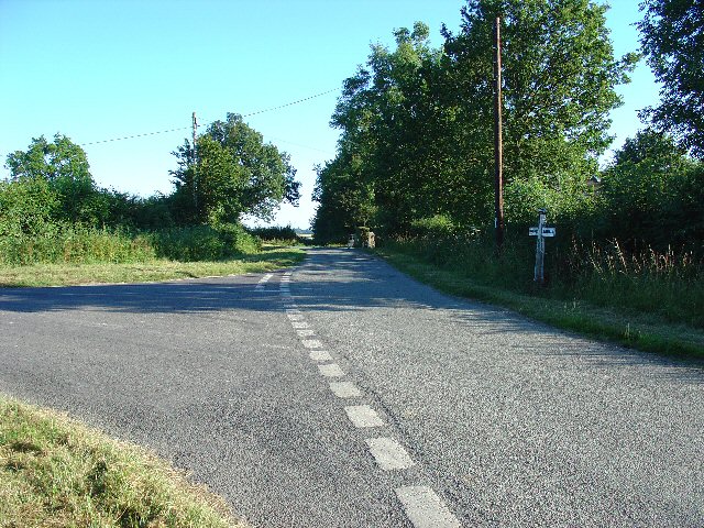
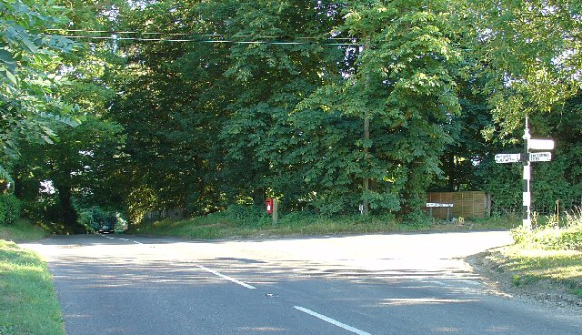
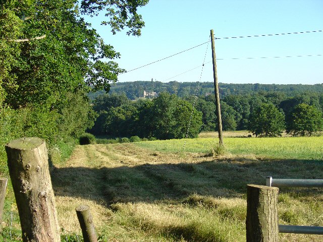
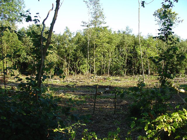
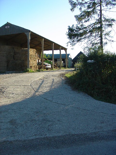
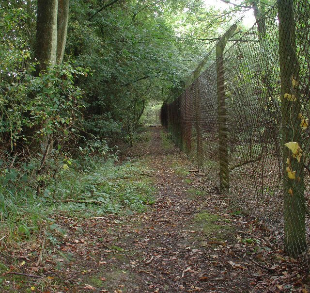
Fullers Shaw is a picturesque woodland located in Sussex, England. Situated within the larger area of Sussex Wood, Fullers Shaw is known for its dense forest and diverse flora and fauna. The woodland covers an expansive area, providing a serene and tranquil environment for nature enthusiasts and visitors alike.

The forest is primarily composed of native tree species such as oak, beech, and pine, creating a rich and varied canopy that provides shelter for numerous wildlife species. The forest floor is adorned with a carpet of wildflowers, ferns, and mosses, adding to the beauty and biodiversity of the area.

Fullers Shaw is a haven for wildlife, with various species calling it home. It is home to a range of bird species, including woodpeckers, owls, and songbirds. Small mammals such as squirrels, rabbits, and hedgehogs can also be spotted within the woodland. Additionally, the forest provides a habitat for a variety of insects, including butterflies and dragonflies.

The woodland offers a range of walking trails and paths, allowing visitors to explore its natural beauty at their own pace. These trails lead visitors through the different sections of the forest, providing opportunities to observe the diverse plant and animal life.

Fullers Shaw is a popular destination for nature lovers, hikers, and photographers who seek to immerse themselves in the beauty of Sussex Wood. Its scenic landscapes, vibrant flora, and abundant wildlife make it an enchanting place to visit and appreciate the wonders of nature.

If you have any feedback on the listing, please let us know in the comments section below.

Fullers Shaw Images

Images are sourced within 2km of 51.099458/-0.25571498 or Grid Reference TQ2234. Thanks to Geograph Open Source API. All images are credited.

Bewbush Barn Church An old barn conversion. The barn predates the surrounding housing by several decade. Money was raised by the local church community over several years with the church opening in the late 1990s, and making one of the more interesting parish churches around
Bewbush Barn Church
An old barn conversion. The barn predates the surrounding housing by several decade. Money was raised by the local church community over several years with the church opening in the late 1990s, and making one of the more interesting parish churches around
The Cherry Tree Public House, Near Faygate, West Sussex. A wayside inn on the N side of the A264 dual carriageway
The Cherry Tree Public House, Near Faygate, West Sussex.
A wayside inn on the N side of the A264 dual carriageway
Faygate Station, Faygate, West Sussex Not pretty, but functional. The small village of Faygate is surprisingly industrial (easy access to the railway and main A264 road probably the reason) for its location and the station fits in with the theme. On the Line between Horsham and Crawley (London Victoria - Littlehampton/Bognor Regis)
Faygate Station, Faygate, West Sussex
Not pretty, but functional. The small village of Faygate is surprisingly industrial (easy access to the railway and main A264 road probably the reason) for its location and the station fits in with the theme. On the Line between Horsham and Crawley (London Victoria - Littlehampton/Bognor Regis)
Water Tower, Beacon Hill, Colgate, West Sussex This concrete water tower is built near to the highest point on Beacon Hill (146m above sea level). Colgate is situated on top of a long ridge of wealdland that stretches E-W between Pease Pottage and the outskirts of Horsham. Water pressure in the area would be quite low without the use of a water tower.
Water Tower, Beacon Hill, Colgate, West Sussex
This concrete water tower is built near to the highest point on Beacon Hill (146m above sea level). Colgate is situated on top of a long ridge of wealdland that stretches E-W between Pease Pottage and the outskirts of Horsham. Water pressure in the area would be quite low without the use of a water tower.
Gate house to the Holmbush estate, off A264, between Crawley and Horsham The gatehouse to the original main drive up to the house on the Holmwood estate.
Gate house to the Holmbush estate, off A264, between Crawley and Horsham
The gatehouse to the original main drive up to the house on the Holmwood estate.
Holmbush Potteries Industrial Estate, Crawley. Conveniently situated off the main A264 road between Crawley and Horsham. Features a large builders merchants premises and several smaller trading and industrial units.
Holmbush Potteries Industrial Estate, Crawley.
Conveniently situated off the main A264 road between Crawley and Horsham. Features a large builders merchants premises and several smaller trading and industrial units.
Wimland Farm, Near Faygate, West Sussex A standard sized farmstead for the area, and one where farming appears to still be the main activity. Small pond behind the bushes on the left. View taken from the public road immediately to the N.
Wimland Farm, Near Faygate, West Sussex
A standard sized farmstead for the area, and one where farming appears to still be the main activity. Small pond behind the bushes on the left. View taken from the public road immediately to the N.
Phone Mast, Wimland Farm, Near Faygate, West Sussex Phone mast in amongst the farm buildings of the main farmstead.
Phone Mast, Wimland Farm, Near Faygate, West Sussex
Phone mast in amongst the farm buildings of the main farmstead.
Road Junction near Wimland Farm, Faygate, West Sussex All narrow (single track) roads. The sign was a bit dilapidated - the central limb (to Faygate) was missing.
Road Junction near Wimland Farm, Faygate, West Sussex
All narrow (single track) roads. The sign was a bit dilapidated - the central limb (to Faygate) was missing.
Road Junction, Near Carylls Lea, Faygate, West Sussex The metalled bridleway (see square TQ2235) comes out at this junction. Directions go to Faygate, Wimland, and Rusper.
Road Junction, Near Carylls Lea, Faygate, West Sussex
The metalled bridleway (see square TQ2235) comes out at this junction. Directions go to Faygate, Wimland, and Rusper.
Field adjacent to bridleway near Carylls Lea junction, Faygate, West Sussex This corner of the field is in the SW corner of the grid square, but there were several similar open fields on either side of the public right of way (which runs along a metalled farm track at this point). The view looks down across the wide shallow valley that the A264 Crawley-Horsham road runs through. In the distance, the large house of the Holmwood estate can just be made out on the far hillside. To the Left (E) of the field is a small wood. View taken looking SSE from the bridleway.
Field adjacent to bridleway near Carylls Lea junction, Faygate, West Sussex
This corner of the field is in the SW corner of the grid square, but there were several similar open fields on either side of the public right of way (which runs along a metalled farm track at this point). The view looks down across the wide shallow valley that the A264 Crawley-Horsham road runs through. In the distance, the large house of the Holmwood estate can just be made out on the far hillside. To the Left (E) of the field is a small wood. View taken looking SSE from the bridleway.
Woodland S of bridleway between Ifield West (Crawley) and Carylls Lea junction (Faygate), West Sussex. One of many small pieces of woodland that are scattered over this part of rural Sussex. This wood is adjacent to the field in one of the other photos for this square. Mainly young deciduous trees, this area recently cleared.
Woodland S of bridleway between Ifield West (Crawley) and Carylls Lea junction (Faygate), West Sussex.
One of many small pieces of woodland that are scattered over this part of rural Sussex. This wood is adjacent to the field in one of the other photos for this square. Mainly young deciduous trees, this area recently cleared.
Bridleway crossing the Crawley - Horsham Railway line, Ifield West, Crawley, West Sussex A small level crossing to cater for bridleway traffic (pedestrians, horses, bicycles, but no motor vehicles). Access to the line via gates. Users are left to check that the line is clear for themselves. This bridleway from Ifield West ultimately ends up at Colgate (3km south) and is on the same route as the one shown for grid square TQ2333
Bridleway crossing the Crawley - Horsham Railway line, Ifield West, Crawley, West Sussex
A small level crossing to cater for bridleway traffic (pedestrians, horses, bicycles, but no motor vehicles). Access to the line via gates. Users are left to check that the line is clear for themselves. This bridleway from Ifield West ultimately ends up at Colgate (3km south) and is on the same route as the one shown for grid square TQ2333
Bridleway through trees from Ifield West (Crawley) to Carylls Lea Junction (Faygate). This bridleway has several different surfaces, starting from a wide earth track (here) through two parallel concrete strips (near Kilnwood End) and finishing with a fully metalled road (Kilnwood to Carylls Lea). At this point the bridleway passes through a long thin strip of woodland (mature deciduous trees), with fields on either side. The bridleway joins on to the one that crosses the railway line shown on one of the other photos.
Bridleway through trees from Ifield West (Crawley) to Carylls Lea Junction (Faygate).
This bridleway has several different surfaces, starting from a wide earth track (here) through two parallel concrete strips (near Kilnwood End) and finishing with a fully metalled road (Kilnwood to Carylls Lea). At this point the bridleway passes through a long thin strip of woodland (mature deciduous trees), with fields on either side. The bridleway joins on to the one that crosses the railway line shown on one of the other photos.
Tern Road, Ifield West, Crawley, West Sussex - 1980/90 housing. Ifield West was one of the later neighbourhoods to be built in Crawley, on its extreme western side. Of typically modern style the packing density of the houses appears to be greater than many of the original neighbourhoods.
Tern Road, Ifield West, Crawley, West Sussex - 1980/90 housing.
Ifield West was one of the later neighbourhoods to be built in Crawley, on its extreme western side. Of typically modern style the packing density of the houses appears to be greater than many of the original neighbourhoods.
Barn at Coombers Farm, Faygate, West Sussex Many of the farms marked on the map in this area have now become solely residential properties, with no indication of any farming activity. Coombers Farm, however, has this sturdy (and used) modern style barn.
Barn at Coombers Farm, Faygate, West Sussex
Many of the farms marked on the map in this area have now become solely residential properties, with no indication of any farming activity. Coombers Farm, however, has this sturdy (and used) modern style barn.
Bus stop and road approaching Faygate northbound The bus stop hut has now been taken down after the car above managed to "park" itself within!
Bus stop and road approaching Faygate northbound
The bus stop hut has now been taken down after the car above managed to "park" itself within!
Public Footpath to Ifield at Lambs Green, West Sussex This path starts at Lambs Green next to The Lamb public house. The early part of the route (shown here) passes between two fences in a wooded area. View taken looking N (back towards Lambs Green).
Public Footpath to Ifield at Lambs Green, West Sussex
This path starts at Lambs Green next to The Lamb public house. The early part of the route (shown here) passes between two fences in a wooded area. View taken looking N (back towards Lambs Green).
Show me another place!

Fullers Shaw is located at Grid Ref: TQ2234 (Lat: 51.099458, Lng: -0.25571498)

Administrative County: West Sussex

District: Horsham

Police Authority: Sussex

What 3 Words

///entire.verve.reclaimed. Near Bewbush, West Sussex

Nearby Locations

Fullers Shaw Ash Copse

Related Wikis

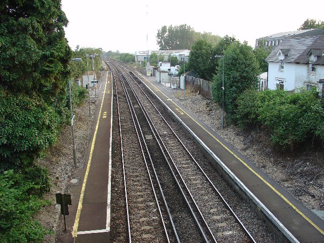
Faygate railway station

Faygate Station is located on the Arun Valley Line, between Littlehaven and Ifield, 34 miles 28 chains (55.3 km) down the line from London Bridge, measured...
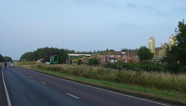
Faygate

Faygate is a village in the Horsham district of West Sussex, England. It lies on the A264 road 3.4 miles (5.4 km) south west of Crawley. It has a railway...

Kilnwood Vale

Kilnwood Vale is part of the Horsham district of West Sussex, England. It borders the High Weald Area of Outstanding Natural Beauty along the A264 east...

House Copse

House Copse is a 12.5-hectare (31-acre) biological Site of Special Scientific Interest west of Crawley in West Sussex.This ancient wood was formerly managed...

Kilnwood Vale railway station

Kilnwood Vale is a proposed railway station in Kilnwood Vale, Horsham, West Sussex which would serve the neighbourhoods of Kilnwood Vale and Bewbush. The...

Horsham and Crawley (UK Parliament constituency)

Horsham and Crawley was a parliamentary constituency centred on the towns of Horsham and Crawley in West Sussex. It returned one Member of Parliament...

Lambs Green

Lambs Green is a hamlet in the civil parish of Rusper and the Horsham District of West Sussex, England. It lies on the Rusper to Ifield road 3.1 miles...

Colgate, West Sussex

Colgate is a small village and civil parish in the Horsham district of West Sussex, England, about four miles (6 km) north east of Horsham. A small village...

Nearby Amenities

Located within 500m of 51.099458,-0.25571498
Barrier: stile
Lat/Long: 51.0978852/-0.2582659
Barrier: stile
Bicycle: no
Foot: yes
Wheelchair: no
Lat/Long: 51.1039063/-0.2565321
Caryll's Lea
Place: isolated_dwelling
Lat/Long: 51.1021039/-0.2597668
Railway: crossing
Lat/Long: 51.0978324/-0.2582305
Railway: crossing
Lat/Long: 51.0978004/-0.2582075
Caryll's Lea Farm
Place: farm
Lat/Long: 51.1005906/-0.2615165
Power: pole
Lat/Long: 51.1031202/-0.2591669
Power: pole
Lat/Long: 51.102039/-0.2592653
Power: pole
Lat/Long: 51.1011443/-0.2593237
Power: pole
Lat/Long: 51.100786/-0.2593554
Power: pole
Lat/Long: 51.0998966/-0.2594188
Power: pole
Lat/Long: 51.0992218/-0.2599577
Power: pole
Lat/Long: 51.098346/-0.2593921
Power: pole
Lat/Long: 51.0974807/-0.2588151
Power: pole
Lat/Long: 51.0966702/-0.2578935
Power: pole
Lat/Long: 51.0958767/-0.2569524
Power: pole
Lat/Long: 51.0950776/-0.2560388
Barrier: stile
Lat/Long: 51.0977694/-0.2581877
The data included in this document is from www.openstreetmap.org. The data is made available under ODbL.

Have you been to Fullers Shaw?

Leave your review of Fullers Shaw below (or comments, questions and feedback).