Queen's Wood

Wood, Forest in Surrey Reigate and Banstead

England

Queen's Wood

The North Downs
The North Downs Credit: Matthew Chadwick

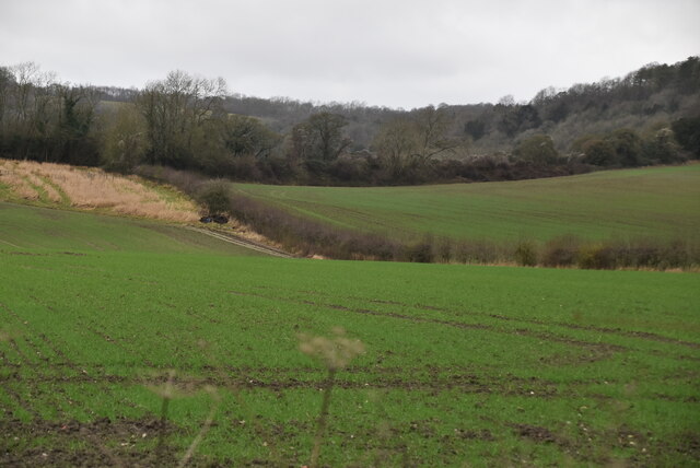
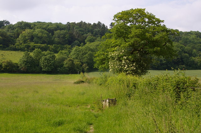
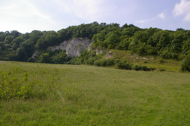
Queen's Wood is a picturesque woodland located in the county of Surrey, England. Situated near the town of Caterham, it covers an area of approximately 52 hectares and forms part of the larger Greensand Ridge. The wood is managed by the Surrey Wildlife Trust and is renowned for its natural beauty and diverse ecosystem.

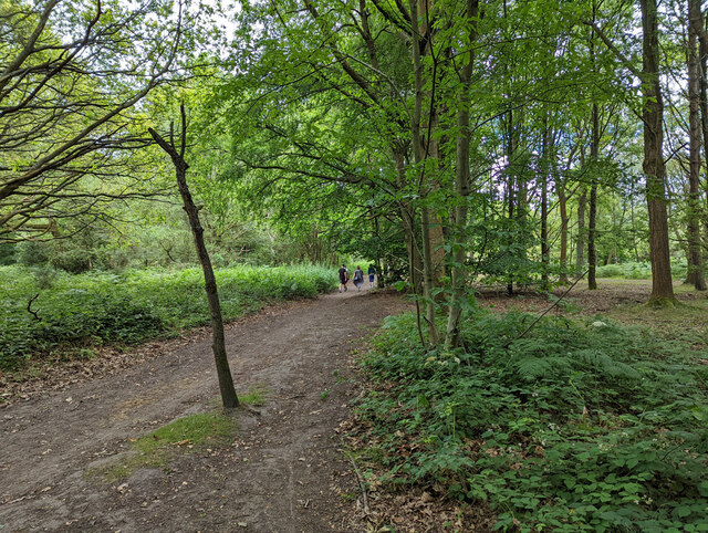
As visitors enter Queen's Wood, they are greeted by a dense canopy of mature broadleaf trees, including oak, beech, and birch. The forest floor is adorned with a rich carpet of bluebells during the spring, creating a breathtaking spectacle. The wood also boasts a variety of other wildflowers, such as wood anemones and primroses, adding vibrant pops of color throughout the year.

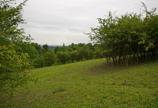
The woodland is home to a wide range of wildlife, making it an ideal destination for nature enthusiasts. Birdwatchers can spot species such as woodpeckers, tawny owls, and nuthatches among the treetops, while small mammals like squirrels and hedgehogs scurry through the undergrowth. The wood is also known for its butterfly population, with species such as the silver-washed fritillary and purple hairstreak gracing the area.

Queen's Wood offers several well-marked trails, allowing visitors to explore its natural wonders at their own pace. The paths wind through the forest, passing by tranquil ponds and ancient trees, creating a peaceful and serene atmosphere. The wood is easily accessible, with ample parking available nearby, making it a popular destination for both locals and tourists seeking a tranquil escape in nature.

If you have any feedback on the listing, please let us know in the comments section below.

Queen's Wood Images

Images are sourced within 2km of 51.26738/-0.26107629 or Grid Reference TQ2153. Thanks to Geograph Open Source API. All images are credited.

The North Downs
The North Downs
Hopeful Pond, Headley Heath The sign was illegible.
Hopeful Pond, Headley Heath
The sign was illegible.
Bridleway 492. Headley Heath Heading south from by the main car park.
Bridleway 492. Headley Heath
Heading south from by the main car park.
M25 clockwise - Sturt's Lane Bridge Giving access to Frith Park off to the left.
M25 clockwise - Sturt's Lane Bridge
Giving access to Frith Park off to the left.
M25 clockwise - sign gantry Reference 4565A, as stencilled on an upright. 4565B applies to the other carriageway. Deciphering the number using the distance markers at intervals along the road, the 565 seems to locate the feature at 56.5 km from datum, the 4 at a guess the type of feature.
M25 clockwise - sign gantry
Reference 4565A, as stencilled on an upright. 4565B applies to the other carriageway. Deciphering the number using the distance markers at intervals along the road, the 565 seems to locate the feature at 56.5 km from datum, the 4 at a guess the type of feature.
M25 clockwise
M25 clockwise
Kemp's Farm
Kemp's Farm
Buckland Lane
Buckland Lane
Farmland below the North Downs
Farmland below North Downs
Mount Hill Wood
Mount Hill Wood
Church spire at Headley A prominent landmark in the area seen from near and far.
Church spire at Headley
A prominent landmark in the area seen from near and far.
Hillside north of Lodgebottom Road looking west
Hillside north of Lodgebottom Road
looking west
Headley Heath: Dean Wood Heath
Headley Heath Deeply incised dry valleys on Headley Heath. Grass and deciduous woodland clothe the sandy hills and valleys.
Headley Heath
Deeply incised dry valleys on Headley Heath. Grass and deciduous woodland clothe the sandy hills and valleys.
Headley Heath, North Downs Sandy-surfaced area, covered with bracken, grassland and woodland. Many bridleways and paths criss-cross the area.
Headley Heath, North Downs
Sandy-surfaced area, covered with bracken, grassland and woodland. Many bridleways and paths criss-cross the area.
Bridleway on Headley Heath
Path, Headley Heath One of the many paths on this largely wooded part of the heath.
Path, Headley Heath
One of the many paths on this largely wooded part of the heath.
Show me another place!

Queen's Wood is located at Grid Ref: TQ2153 (Lat: 51.26738, Lng: -0.26107629)

Administrative County: Surrey

District: Reigate and Banstead

Police Authority: Surrey

What 3 Words

///lied.hurt.scam. Near Tadworth, Surrey

Related Wikis

Fraser Down

Fraser Down is a 10-hectare (25-acre) nature reserve north of Betchworth in Surrey. It is managed by the Surrey Wildlife Trust. It is part of the Mole...

Dawcombe

Dawcombe is a 23-hectare (57-acre) nature reserve north-west of Reigate in Surrey. It is managed by the Surrey Wildlife Trust. It is part of the Mole...

Betchworth Quarry and Lime Kilns

Betchworth Quarry and Lime Kilns is a 27-hectare (67-acre) nature reserve north of Betchworth in Surrey. Betchworth Quarry only is managed by Surrey Wildlife...

Headley, Surrey

Headley is a village and civil parish in the North Downs in Surrey, England. The nearest settlements are, to the west, Mickleham and Leatherhead; to the...

1909 News of the World Match Play

The 1909 News of the World Match Play was the seventh News of the World Match Play tournament. It was played from Tuesday 5 to Thursday 7 October at Walton...

1913 News of the World Match Play

The 1913 News of the World Match Play was the eleventh News of the World Match Play tournament. It was played from Tuesday 7 to Thursday 9 October at Walton...

1905 News of the World Match Play

The 1905 News of the World Match Play was the third News of the World Match Play tournament. It was played from Tuesday 3 to Thursday 5 October at Walton...

1919 News of the World Match Play

The 1919 News of the World Match Play was the twelfth News of the World Match Play tournament. It was played from Monday 29 September to Thursday 2 October...

Nearby Amenities

Located within 500m of 51.26738,-0.26107629
Power: pole
Lat/Long: 51.2683823/-0.2639822
Power: pole
Source: gps
Lat/Long: 51.2701384/-0.2647118
Power: pole
Lat/Long: 51.2656542/-0.2637505
Power: pole
Lat/Long: 51.2630693/-0.2608551
Power: pole
Lat/Long: 51.2631445/-0.2593273
Bus Stop
Pebble Close
Naptan AtcoCode: 40004408918A
Naptan Bearing: W
Naptan CommonName: Pebble Close
Naptan Indicator: Just Before
Naptan Landmark: Pebble Close
Naptan NaptanCode: surdgjdm
Naptan Street: Headley Common Road
Naptan Verified: no
Public Transport: platform
Source: naptan_import
Toilets Wheelchair: no
Wheelchair: no
Wheelchair Description: No bus stops at this point. Grass verge with kerb.
Lat/Long: 51.2638122/-0.2630466
Bus Stop
Pebble Close
Naptan AtcoCode: 40004408919A
Naptan Bearing: E
Naptan CommonName: Pebble Close
Naptan Indicator: Just after
Naptan Landmark: Pebble Close
Naptan NaptanCode: surdgjdp
Naptan Street: Headley Common Road
Naptan Verified: no
Public Transport: platform
Source: naptan_import
Toilets Wheelchair: no
Wheelchair: no
Wheelchair Description: No bus stops signs.
Lat/Long: 51.2637295/-0.2640226
Post Box
Collection Times: Mo-Fr 09:00; Sa 07:00
Operator: Royal Mail
Post Box Type: pillar
Ref: KT20 72D
Royal Cypher: GR
Royal Cypher Wikidata: Q33102273
Wheelchair: limited
Lat/Long: 51.2634545/-0.264152
Fire Hydrant
Emergency: fire_hydrant
Fire Hydrant Diameter: 75
Fire Hydrant Position: lane
Fire Hydrant Type: underground
Lat/Long: 51.2651567/-0.2581866
Barrier: stile
Lat/Long: 51.2698892/-0.2561771
Power: pole
Source: gps;Bing
Lat/Long: 51.2693547/-0.2561295
Power: pole
Source: gps;Bing
Lat/Long: 51.2685626/-0.2550848
Give Way
Direction: forward
Lat/Long: 51.2636558/-0.2622698
Give Way
Direction: forward
Lat/Long: 51.2635162/-0.2619546
The data included in this document is from www.openstreetmap.org. The data is made available under ODbL.

Have you been to Queen's Wood?

Leave your review of Queen's Wood below (or comments, questions and feedback).