Lower Plantation

Wood, Forest in Hertfordshire North Hertfordshire

England

Lower Plantation

Roundabout on St Michael's Road, Hitchin
Roundabout on St Michael's Road, Hitchin Credit: David Howard

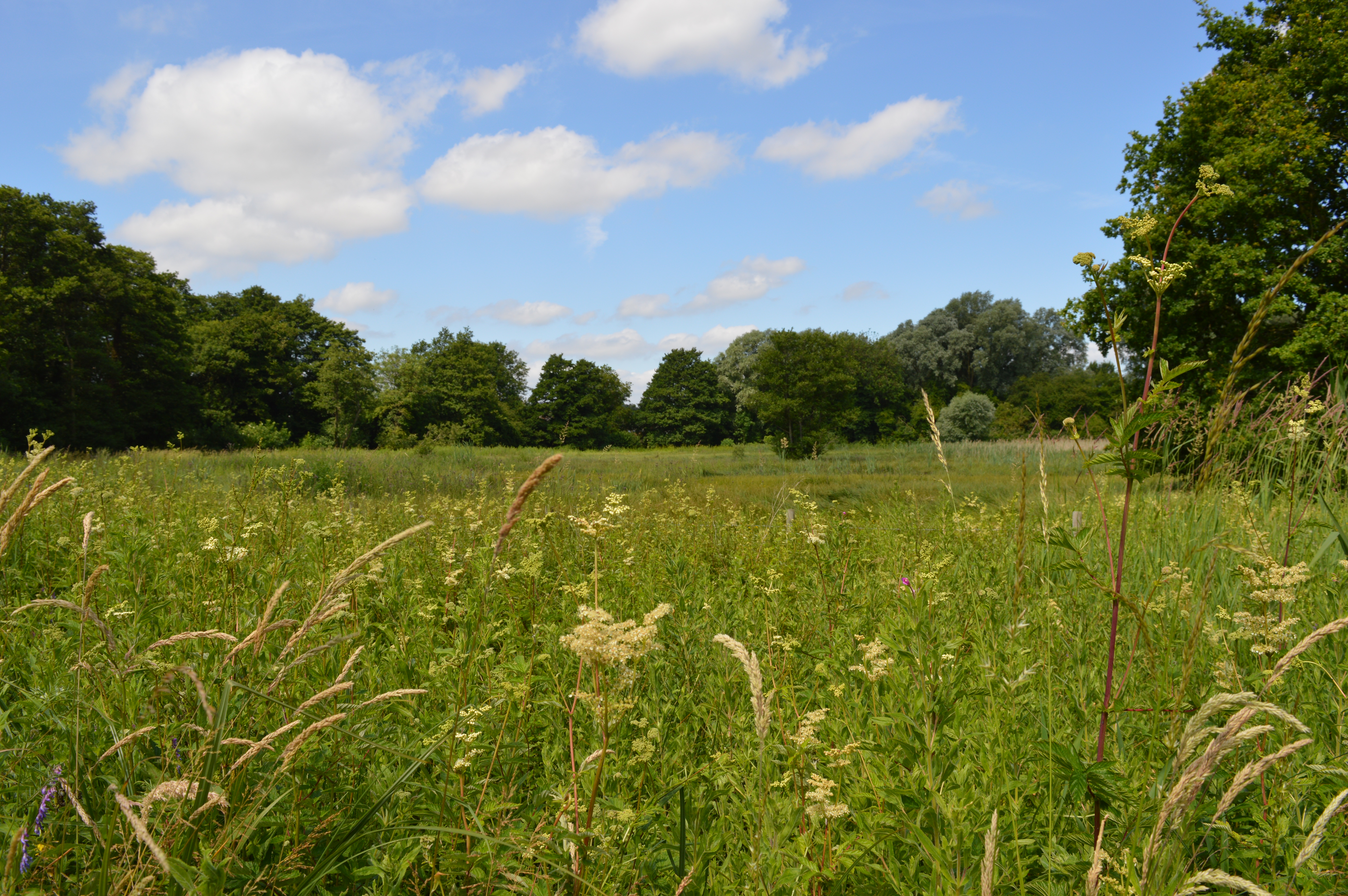
Lower Plantation is a scenic woodland area located in Hertfordshire, England. Situated in the southeastern part of the county, it covers an extensive area of lush greenery and is part of a larger forested region. The woodland is known for its diverse range of flora and fauna, making it a popular destination for nature enthusiasts and outdoor lovers.

The landscape of Lower Plantation is predominantly characterized by a mix of deciduous and coniferous trees, including oak, beech, pine, and spruce. These trees provide a canopy that offers shade and shelter to a variety of wildlife species. Visitors to the woodland can expect to encounter squirrels, rabbits, deer, and a multitude of bird species, including woodpeckers and owls.

The woodland is crisscrossed by a network of winding trails, allowing visitors to explore its beauty on foot or by bike. These trails lead to scenic spots, such as picturesque ponds and serene clearings, providing opportunities for relaxation and tranquility. Additionally, there are designated picnic areas where visitors can enjoy a leisurely lunch amidst the natural surroundings.

Lower Plantation also boasts a rich history, with evidence of human habitation dating back centuries. Remnants of ancient settlements and archaeological finds have been discovered within the woodland, providing insight into the area's past.

Overall, Lower Plantation in Hertfordshire offers a breathtaking natural environment, a haven for wildlife, and a peaceful retreat for those seeking solace in the beauty of nature.

If you have any feedback on the listing, please let us know in the comments section below.

Lower Plantation Images

Images are sourced within 2km of 51.953365/-0.23470706 or Grid Reference TL2129. Thanks to Geograph Open Source API. All images are credited.

Roundabout on St Michael's Road, Hitchin
North Hertfordshire College, Hitchin
Park by the River Purwell, Hitchin The river is to the right going under the bridge.
Park by the River Purwell, Hitchin
The river is to the right going under the bridge.
Old houses on Cambridge Road, Hitchin
Wymondley Wood This was taken from the Upper Plantation looking across to the lower one. The variety of young trees beyond the gate are part of an educational nature reserve.
Wymondley Wood
This was taken from the Upper Plantation looking across to the lower one. The variety of young trees beyond the gate are part of an educational nature reserve.
Cottages in Great Wymondley These pretty old cottages are smack in the middle of this square in a small village with a lovely pub and (sadly) dried up duck pond.  The road through the village is used as a rat run by people travelling between the local towns in the mornings and evenings.
Cottages in Great Wymondley
These pretty old cottages are smack in the middle of this square in a small village with a lovely pub and (sadly) dried up duck pond. The road through the village is used as a rat run by people travelling between the local towns in the mornings and evenings.
Keats Way - Poets Estate. One of two estates on this square separated by the river Purwell and Purwell Meadows.
Keats Way - Poets Estate.
One of two estates on this square separated by the river Purwell and Purwell Meadows.
Great Wymondley / Gravely Rd. This square is devoid of any features (although the OS have marked a"conduit" that is inaccessible to the public).  This road runs under the A1(M).
Great Wymondley / Gravely Rd.
This square is devoid of any features (although the OS have marked a"conduit" that is inaccessible to the public). This road runs under the A1(M).
Over the fields towards the railway line. Pylons (which seem to be a feature of the area), telephone mast, field and railway embankment.
Over the fields towards the railway line.
Pylons (which seem to be a feature of the area), telephone mast, field and railway embankment.
Roxley Court. Was a convent.  Now rather swanky apartments.
Roxley Court.
Was a convent. Now rather swanky apartments.
From the Arch Road bridge. On the left the slow train in the centre an express and to the right some men working and keeping well away from the trains.  This is the main Kings Cross - north line.
From the Arch Road bridge.
On the left the slow train in the centre an express and to the right some men working and keeping well away from the trains. This is the main Kings Cross - north line.
Delamere House - Great Wymondley The low buildings to the right seem to be offices.  The main house is rather grand.
Delamere House - Great Wymondley
The low buildings to the right seem to be offices. The main house is rather grand.
St Who's? Church Great Wymondley I did ask locally but nobody seems to know which saint this church is dedicated to.  The main door seems to be out of bound and I wonder if this place is on its way out.
St Who's? Church Great Wymondley
I did ask locally but nobody seems to know which saint this church is dedicated to. The main door seems to be out of bound and I wonder if this place is on its way out.
Iron grave markers I have only seen these iron grave markers in one other place <a href="https://www.geograph.org.uk/photo/2035">TQ0343 : Shamley Green</a> Fairfield Park Graveyard.
Iron grave markers
I have only seen these iron grave markers in one other place TQ0343 : Shamley Green Fairfield Park Graveyard.
Motte and Bailey. It really is difficult to photographs of these features which are now no more than grassy humps on the ground.
Motte and Bailey.
It really is difficult to photographs of these features which are now no more than grassy humps on the ground.
The Green Man Good sausages.
The Green Man
Good sausages.
Monument to two airmen. The legend reads:-

In Memory of Captain Hamilton and Lieut Wyness Stuart of The Royal Flying Corps. Who lost their lives whilst serving their country as aviators Sept 8th 1912.
Erected by local subscription.

This stands by the side of the road between Great Wymondley and Willian.
Monument to two airmen.
The legend reads:- In Memory of Captain Hamilton and Lieut Wyness Stuart of The Royal Flying Corps. Who lost their lives whilst serving their country as aviators Sept 8th 1912. Erected by local subscription. This stands by the side of the road between Great Wymondley and Willian.
Show me another place!

Lower Plantation is located at Grid Ref: TL2129 (Lat: 51.953365, Lng: -0.23470706)

Administrative County: Hertfordshire

District: North Hertfordshire

Police Authority: Hertfordshire

What 3 Words

///bits.darker.grape. Near Letchworth, Hertfordshire

Related Wikis

Wymondley Roman Villa

Wymondley Roman Villa is a ruined Roman villa near Hitchin, Hertfordshire, England. It is also known as Ninesprings Roman Villa. It is situated in the...

Purwell Ninesprings

Purwell Ninesprings is a 6.4-hectare (16-acre) nature reserve managed by the Herts and Middlesex Wildlife Trust on the edge of Hitchin, Hertfordshire...

Great Wymondley

Great Wymondley is a village and former civil parish situated near Hitchin, now in the parish of Wymondley, in the North Hertfordshire district, in the...

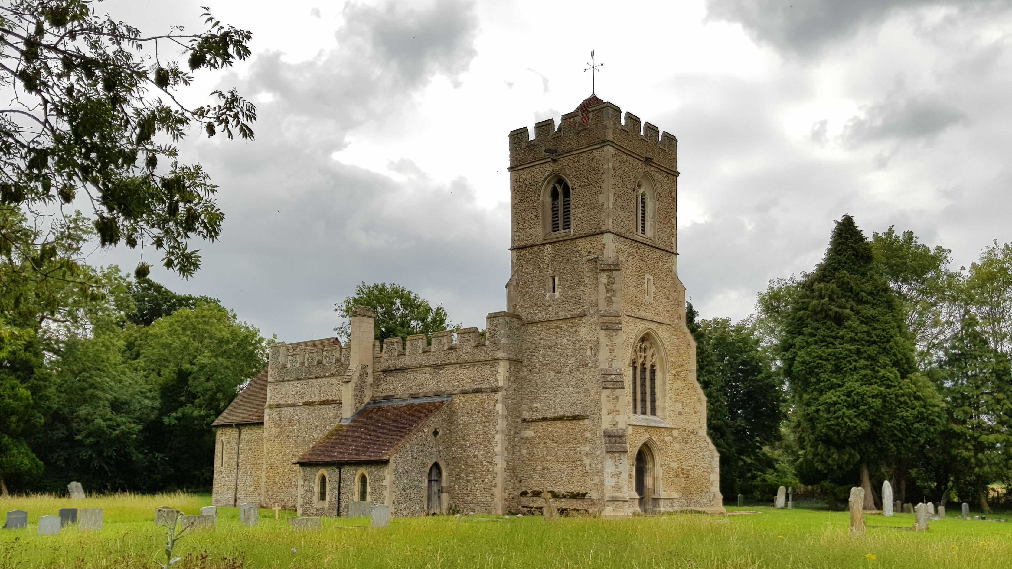
Church of St Mary, Letchworth

The Church of St Mary the Virgin is the Church of England parish church of Letchworth in Hertfordshire. A church appears to have been on the site since...

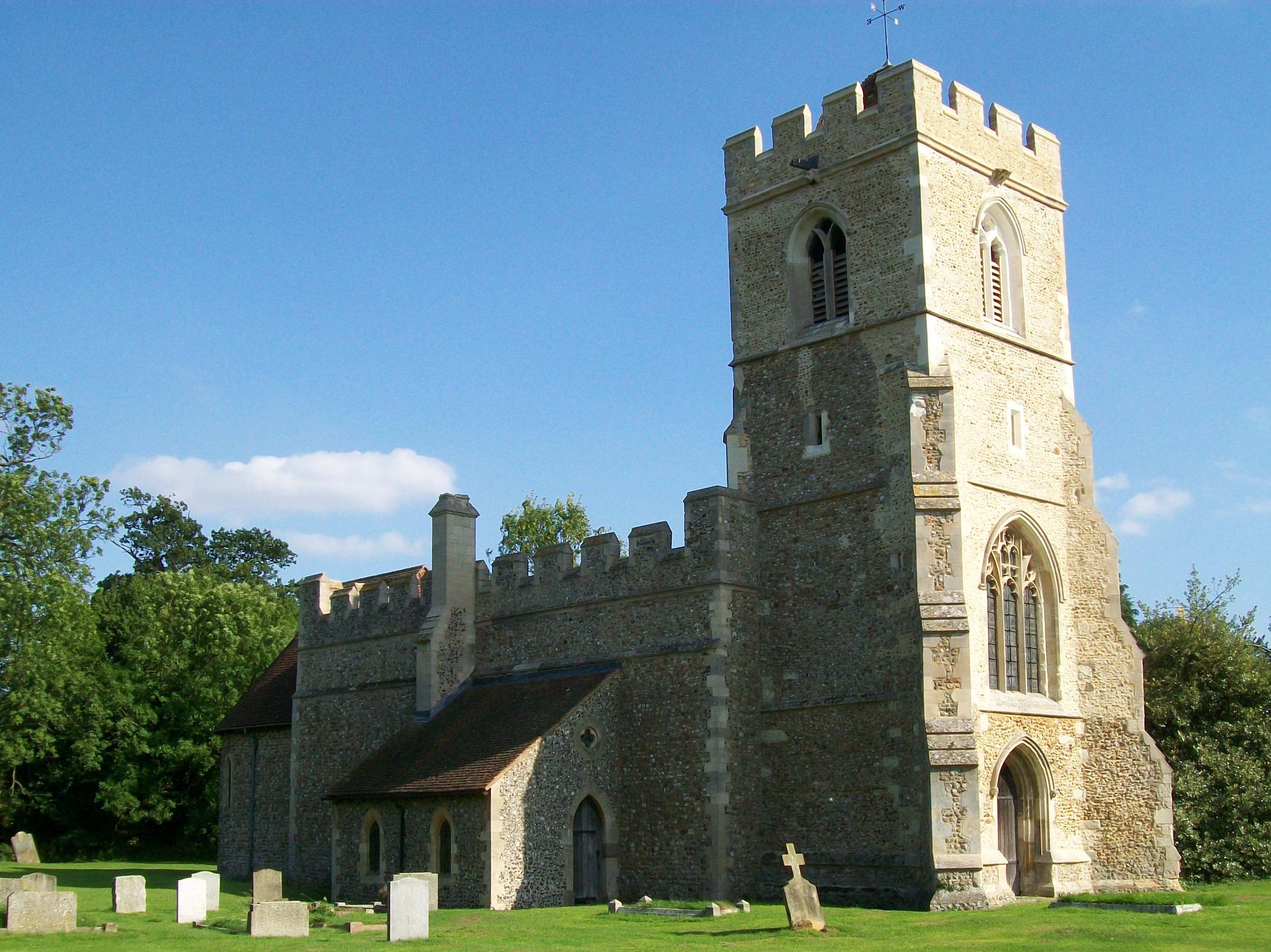
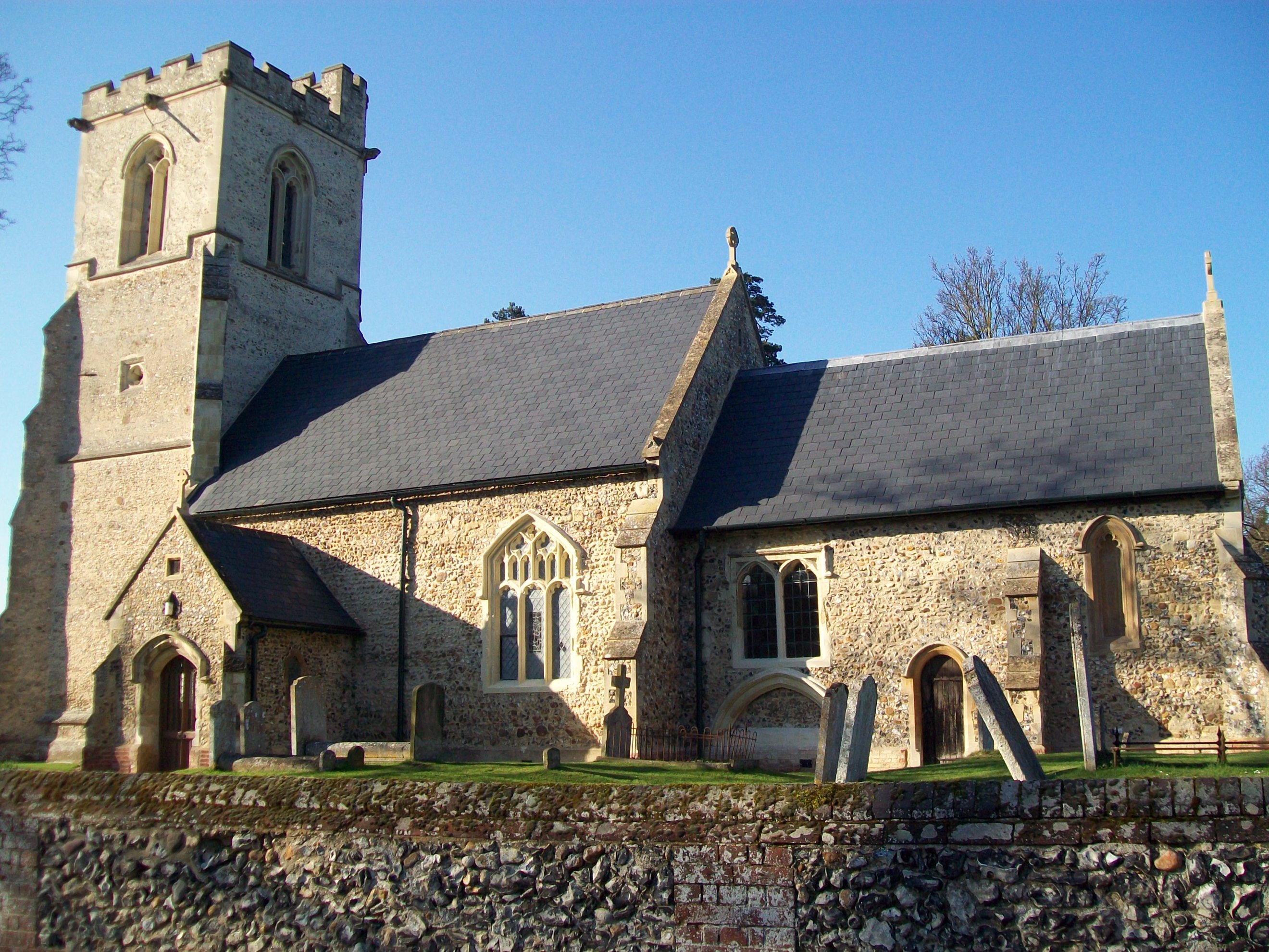
Church of St Mary the Virgin, Great Wymondley

St Mary's Church is an active Anglican church in Great Wymondley, Hertfordshire, England. It is a Grade I listed building. == History == In 1199, Reginald...

Willian, Hertfordshire

Willian is a village and former civil parish, adjoining the town of Letchworth, in the North Hertfordshire district of Hertfordshire, England. Along with...

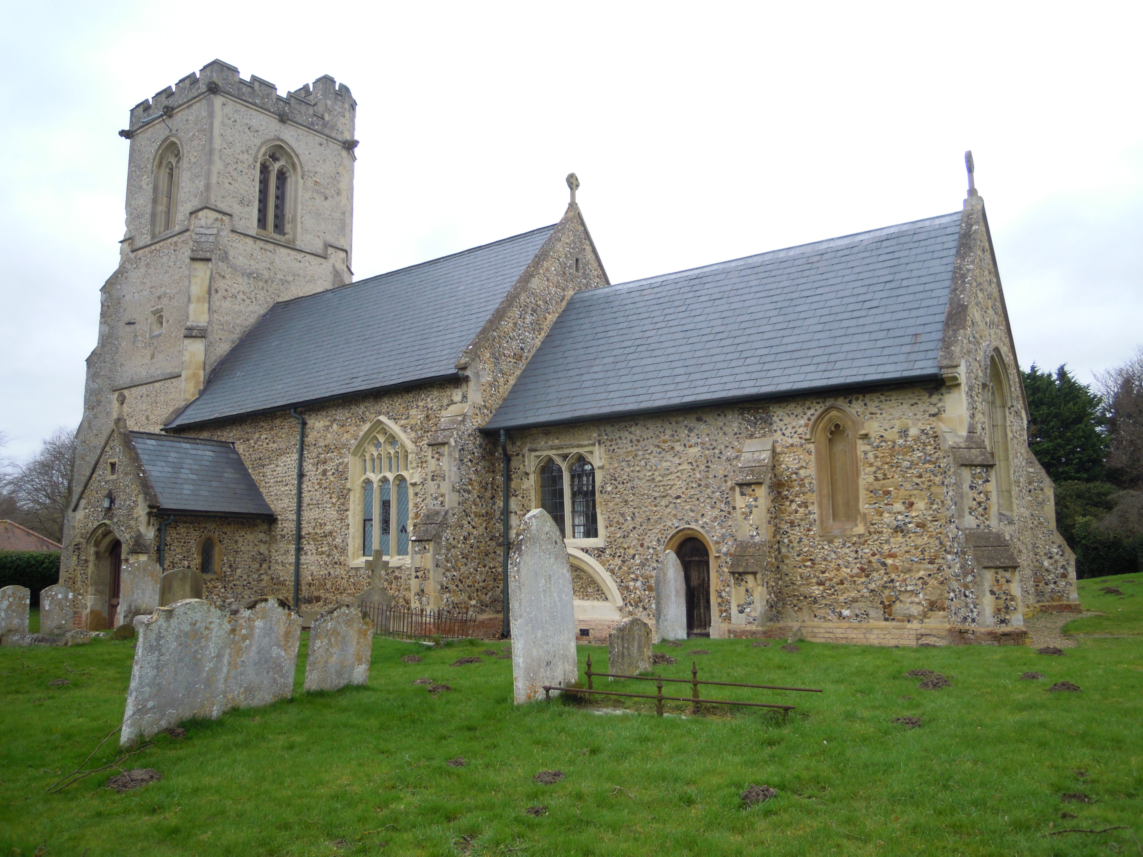
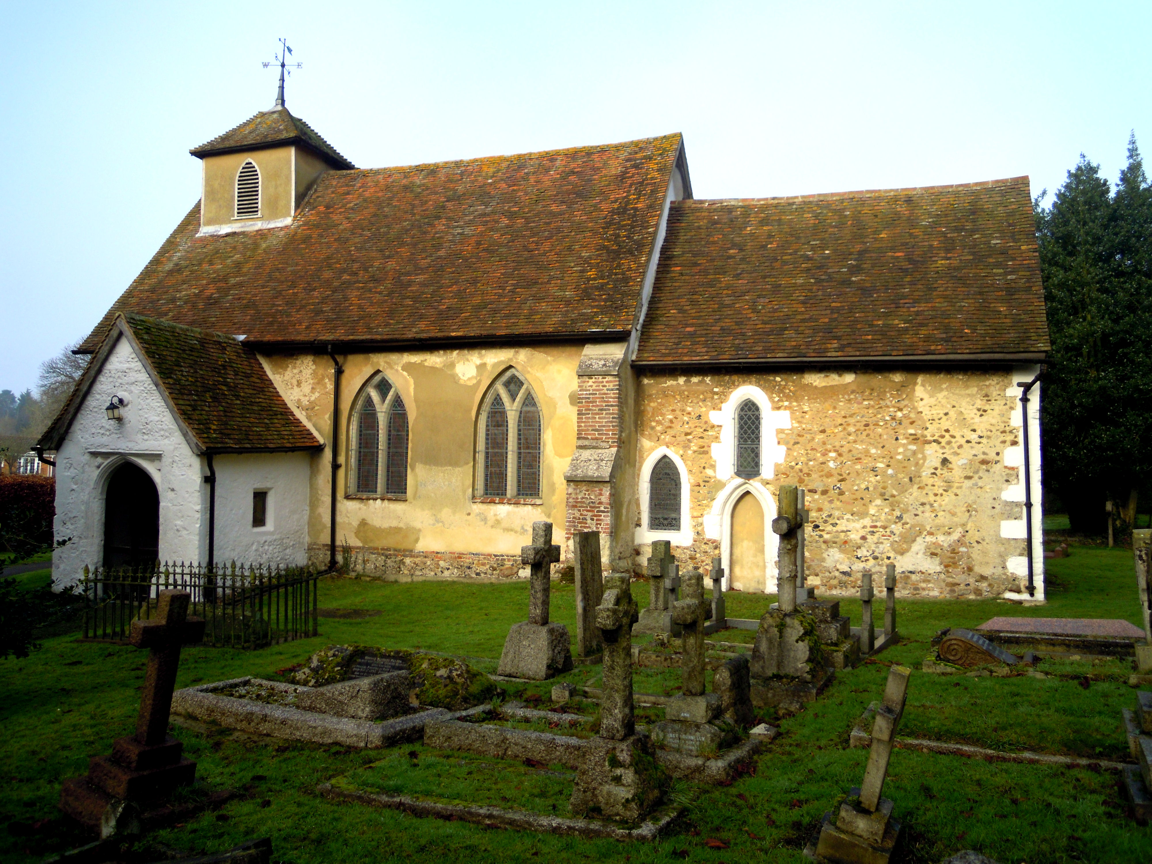
Church of All Saints, Willian

The Church of All Saints is the Anglican parish church for the village of Willian in Hertfordshire. The benefice is united with St Paul's church in nearby...

Purwell Meadows

Purwell Meadows is an 8.6-hectare (21-acre) nature reserve in Hitchin, Hertfordshire, England. It was declared a Local Nature Reserve in 1994. It is owned...

Nearby Amenities

Located within 500m of 51.953365,-0.23470706
Bench
Lat/Long: 51.955563/-0.2389277
Tourism: picnic_site
Lat/Long: 51.9526748/-0.2356455
Bench
Backrest: yes
Material: wood
Lat/Long: 51.9514272/-0.2376214
Bench
Backrest: yes
Material: wood
Lat/Long: 51.9518924/-0.2360526
Bench
Backrest: yes
Check Date: 2023-01-22
Material: wood
Lat/Long: 51.951944/-0.2346714
Power: tower
Lat/Long: 51.9508989/-0.2293629
Waste Basket
Check Date: 2020-12-26
Lat/Long: 51.9520719/-0.2336919
Waste Basket
Lat/Long: 51.9527249/-0.2367175
Bench
Lat/Long: 51.9526935/-0.2346361
Board Type: plants
Information: board
Tourism: information
Lat/Long: 51.951981/-0.2336651
Power: pole
Lat/Long: 51.9542176/-0.2286145
Power: pole
Lat/Long: 51.9554954/-0.2322864
Power: pole
Lat/Long: 51.9561015/-0.2356911
Power: pole
Lat/Long: 51.9550044/-0.2308568
Power: pole
Lat/Long: 51.9557891/-0.2331698
Power: pole
Lat/Long: 51.9559792/-0.2384724
Power: pole
Lat/Long: 51.954616/-0.2297383
Power: pole
Lat/Long: 51.9560425/-0.2370876
Power: pole
Lat/Long: 51.955923/-0.2398404
Power: pole
Lat/Long: 51.956158/-0.2343358
The data included in this document is from www.openstreetmap.org. The data is made available under ODbL.

Have you been to Lower Plantation?

Leave your review of Lower Plantation below (or comments, questions and feedback).