Paulshill Copse

Wood, Forest in Sussex Horsham

England

Paulshill Copse

Oaks, Monk's Gate (1) There are quite a number of fine old specimens in the area, perhaps relics of former parkland.
Oaks, Monk's Gate (1) Credit: Stephen Richards

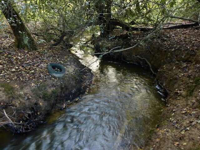
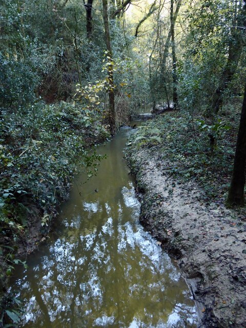
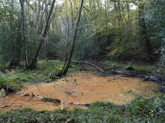
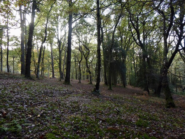
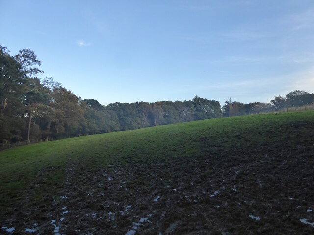
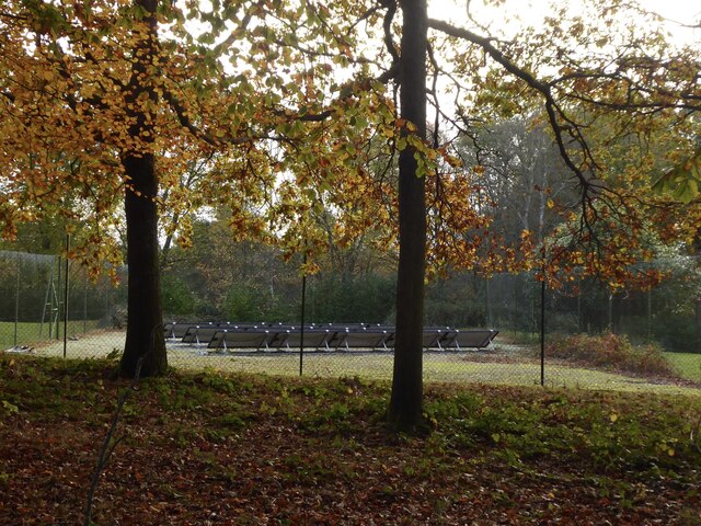
Paulshill Copse is a serene woodland located in Sussex, England. Spanning over a vast area, this copse is a delightful retreat for nature enthusiasts and those seeking a peaceful escape. The copse is home to a diverse range of flora and fauna, making it a haven for wildlife and a treat for any nature lover.

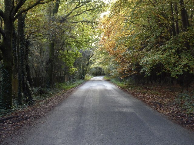
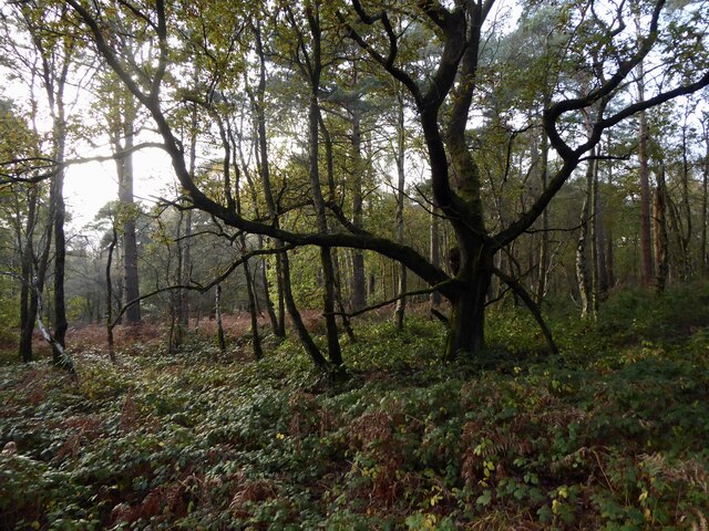
The woodland is primarily composed of deciduous trees, including oak, beech, and ash, which create a stunning canopy that filters the sunlight and casts enchanting shadows on the forest floor. The undergrowth is abundant with ferns, bluebells, and wildflowers, adding a burst of color and fragrance to the surroundings.

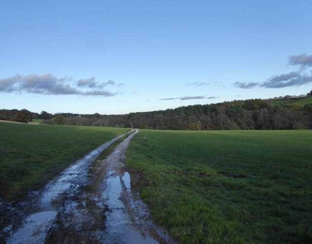
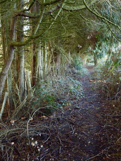
Traversing through Paulshill Copse, visitors will discover a network of well-maintained footpaths that wind their way through the trees. These paths offer a chance to immerse oneself in the peaceful ambiance of the woodland, while also providing an opportunity to spot various species of birds, butterflies, and small mammals that call the copse their home.

The copse is a popular spot for recreational activities such as hiking, jogging, and birdwatching. It provides an ideal setting for picnics and family outings, with several designated areas equipped with picnic tables and benches. Additionally, there are designated spots for camping and barbecues, allowing visitors to extend their stay and fully embrace the beauty of the copse.

Paulshill Copse truly encapsulates the essence of a quintessential English woodland. Its tranquil atmosphere, breathtaking scenery, and abundant wildlife make it a must-visit destination for nature enthusiasts and those seeking solace amidst nature's splendor.

If you have any feedback on the listing, please let us know in the comments section below.

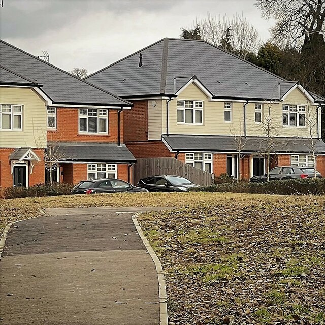
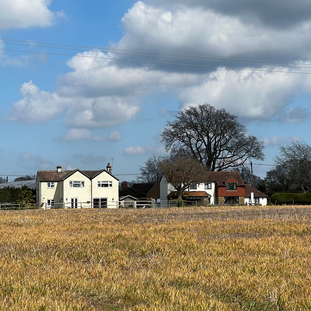
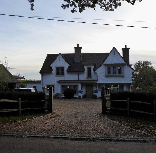
Paulshill Copse Images

Images are sourced within 2km of 51.047191/-0.27087565 or Grid Reference TQ2128. Thanks to Geograph Open Source API. All images are credited.

Oaks, Monk's Gate (1) There are quite a number of fine old specimens in the area, perhaps relics of former parkland.
Oaks, Monk's Gate (1)
There are quite a number of fine old specimens in the area, perhaps relics of former parkland.
Oaks, Monk's Gate (2) There are quite a number of fine old specimens in the area, perhaps relics of former parkland.
Oaks, Monk's Gate (2)
There are quite a number of fine old specimens in the area, perhaps relics of former parkland.
New houses in Coolhurst Close
Rears of houses on the A281
Inholms Gill A tributary of the River Arun that rises in St Leonard's Forest.
Inholms Gill
A tributary of the River Arun that rises in St Leonard's Forest.
Track, St Leonard's Forest The surfaced track heads north from the car park on Hammerpond Road to Mick's Cross.
Track, St Leonard's Forest
The surfaced track heads north from the car park on Hammerpond Road to Mick's Cross.
Grouse Road A minor road that links Hammerpond Road at Bucks Head to Pease Pottage, the latter an old entrance to St Leonard's Forest. Old Copse is on the right.
Grouse Road
A minor road that links Hammerpond Road at Bucks Head to Pease Pottage, the latter an old entrance to St Leonard's Forest. Old Copse is on the right.
St Leonard's Forest An open area of the forest located on the western side of Newstead Gill.
St Leonard's Forest
An open area of the forest located on the western side of Newstead Gill.
Newstead Gill A part of the River Arun catchment area that rises to the south of Pease Pottage and feeds Hammer Pond before joining Goldings Stream.
Newstead Gill
A part of the River Arun catchment area that rises to the south of Pease Pottage and feeds Hammer Pond before joining Goldings Stream.
Public Footpath 1702 Linking the High Weald Landscape Trail to the east of Grouse Road with Hammerpond Road, crossing Newstead Gill and Carterslodge Gill in the process. Plenty of fungi on the ground.
Public Footpath 1702
Linking the High Weald Landscape Trail to the east of Grouse Road with Hammerpond Road, crossing Newstead Gill and Carterslodge Gill in the process. Plenty of fungi on the ground.
St Leonard's Forest An area of the forest located to the north of Carterslodge Gill and east of Newstead Gill.
St Leonard's Forest
An area of the forest located to the north of Carterslodge Gill and east of Newstead Gill.
Carterslodge Gill Part of the River Arun catchment area that rises near Handcross and feeds Hammer Pond.
Carterslodge Gill
Part of the River Arun catchment area that rises near Handcross and feeds Hammer Pond.
Boggy Area, Hammerhill Wood Located to the immediate south of Carterslodge Gill.
Boggy Area, Hammerhill Wood
Located to the immediate south of Carterslodge Gill.
Hammerhill Wood Located on the southern side of Carterslodge Gill.
Hammerhill Wood
Located on the southern side of Carterslodge Gill.
Field next to Hammerhill Wood Not named as Lower Beeding parish was only formed in 1838 and thus was not surveyed for tithes. The mist is actually smoke from a nearby bonfire.
Field next to Hammerhill Wood
Not named as Lower Beeding parish was only formed in 1838 and thus was not surveyed for tithes. The mist is actually smoke from a nearby bonfire.
Hammerpond Road A minor road linking Alford Crossways to the eastern edge of Horsham passing three former hammer ponds.
Hammerpond Road
A minor road linking Alford Crossways to the eastern edge of Horsham passing three former hammer ponds.
Jacksons Farmhouse, Hammerpond Road Dating from the 19th century.
Jacksons Farmhouse, Hammerpond Road
Dating from the 19th century.
Solar Panels, Woodbank, Hammerpond Road An old tennis court now used for generating electricity.
Solar Panels, Woodbank, Hammerpond Road
An old tennis court now used for generating electricity.
Show me another place!

Paulshill Copse is located at Grid Ref: TQ2128 (Lat: 51.047191, Lng: -0.27087565)

Administrative County: West Sussex

District: Horsham

Police Authority: Sussex

What 3 Words

///inflating.populate.sandbags. Near Horsham, West Sussex

Related Wikis

Mannings Heath Golf & Wine Estate

Mannings Heath Golf & Wine Estate is located in Mannings Heath, Horsham in the south of England. The 500 acre parkland site includes two golf courses and...

Mannings Heath

Mannings Heath is a village in the civil parish of Nuthurst and the Horsham District of West Sussex, England. The village is on the A281 road, 2 miles...

St Leonard's Forest SSSI

St Leonard's Forest SSSI is an 85.4-hectare (211-acre) biological Site of Special Scientific Interest east of Horsham in West Sussex. The SSSI is in two...

Monk's Gate

Monk's Gate is a hamlet in the civil parish of Nuthurst, in the Horsham District of West Sussex, England. It lies on the A281 road 3 miles (5 km) southeast...

Lower Beeding

Lower Beeding is a village and civil parish in the Horsham District of West Sussex, England. The village lies on the B2110, B2115 and A281 roads 3.5 miles...

St Leonard's Forest

St Leonard's Forest is at the western end of the Wealden Forest Ridge which runs from Horsham to Tonbridge, and is part of the High Weald Area of Outstanding...

Newells Preparatory School

Newells Preparatory School came to Lower Beeding, Sussex, in 1946. It has been at Handcross and known as Handcross Park School since 1968. It merged with...

St Leonard's Park Ponds

St Leonard's Park Ponds is a 3.9-hectare (9.6-acre) biological Site of Special Scientific Interest east of Horsham in West Sussex.These ponds and adjacent...

Nearby Amenities

Located within 500m of 51.047191,-0.27087565
Post Box
Post Box Type: lamp
Ref: RH13 165
Royal Cypher: EIIR
Royal Cypher Wikidata: Q33102113
Lat/Long: 51.0486487/-0.2641109
Forest Farm
Place: farm
Lat/Long: 51.0447845/-0.2746992
The data included in this document is from www.openstreetmap.org. The data is made available under ODbL.

Have you been to Paulshill Copse?

Leave your review of Paulshill Copse below (or comments, questions and feedback).