Dykes Plantation
Wood, Forest in Yorkshire
England
Dykes Plantation

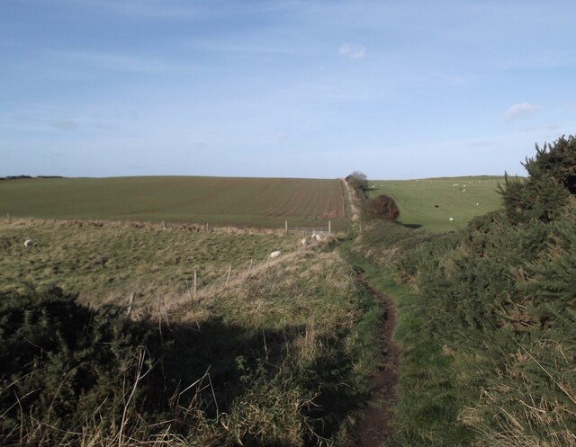
Dykes Plantation, located in Yorkshire, England, is a picturesque woodland area known for its serene beauty and vibrant flora. Situated in the heart of the county, this forested destination spans over a considerable area, attracting both locals and tourists alike.
The plantation features a diverse range of tree species, including oak, ash, birch, and beech, which create a dense canopy overhead. This lush vegetation provides a haven for numerous wildlife species, making it a popular spot for nature enthusiasts and birdwatchers. Visitors can expect to spot various bird species, such as woodpeckers, owls, and thrushes, making their homes within the woodland.
Dykes Plantation also offers a network of walking trails, allowing visitors to explore the area at their own pace. The well-marked paths wind through the forest, offering glimpses of enchanting wildflowers and native plants along the way. The plantation is particularly enchanting during spring and summer when the forest floor is carpeted with vivid bluebells and vibrant wildflowers.
Aside from its natural beauty, Dykes Plantation also holds historical significance. The area was once used as a hunting ground for local nobility, and remnants of ancient hunting lodges can still be found scattered throughout the woodland, adding a touch of intrigue and charm to the site.
Overall, Dykes Plantation in Yorkshire is a captivating destination for nature lovers, providing a tranquil escape from the hustle and bustle of everyday life. With its stunning landscapes, diverse wildlife, and rich history, this woodland area offers a refreshing and rejuvenating experience for all who visit.
If you have any feedback on the listing, please let us know in the comments section below.
Dykes Plantation Images
Images are sourced within 2km of 54.136645/-0.1455744 or Grid Reference TA2172. Thanks to Geograph Open Source API. All images are credited.


Dykes Plantation is located at Grid Ref: TA2172 (Lat: 54.136645, Lng: -0.1455744)
Division: East Riding
Unitary Authority: East Riding of Yorkshire
Police Authority: Humberside
What 3 Words
///hikes.restriction.repeat. Near Bempton, East Yorkshire
Nearby Locations
Related Wikis
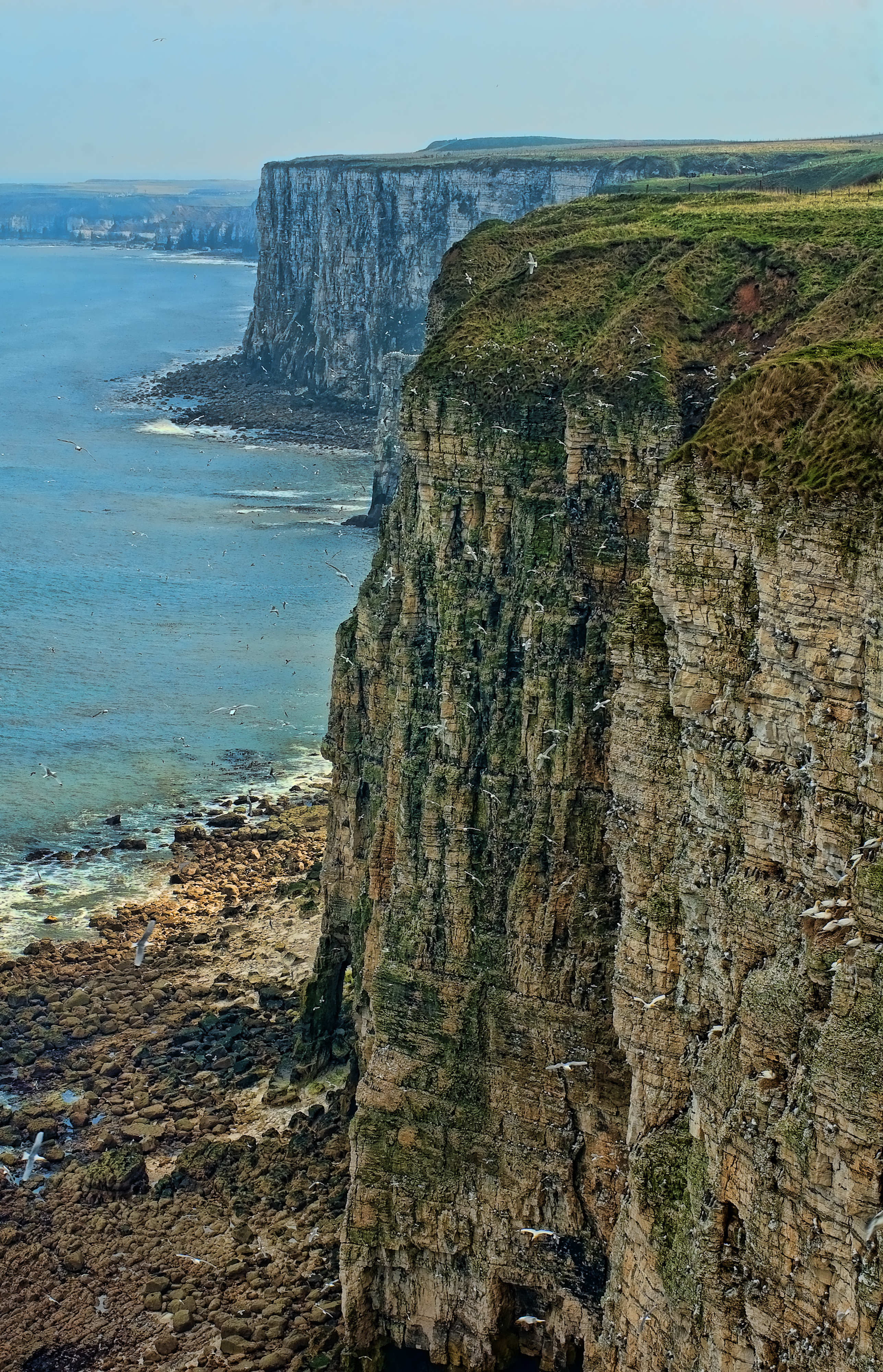
Bempton Cliffs
Bempton Cliffs is a section of precipitous coast at Bempton in the East Riding of Yorkshire, England. It is run by the RSPB as a nature reserve and is...

Bempton
Bempton is a village and civil parish in the East Riding of Yorkshire, England, near the border with North Yorkshire. It is near the North Sea coast and...
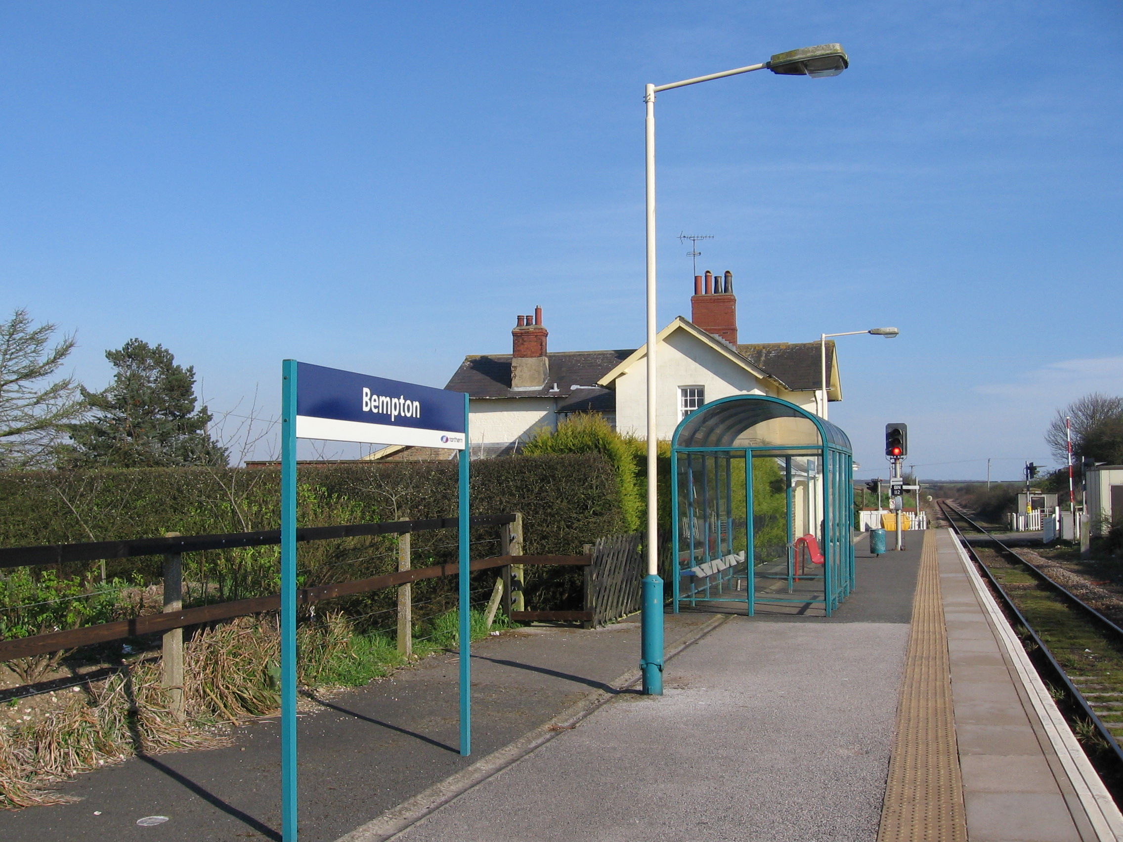
Bempton railway station
Bempton railway station serves the village of Bempton in the East Riding of Yorkshire, England. It is located on the Yorkshire Coast Line and is operated...

Yorkshire Coast
The Yorkshire Coast runs from the Tees estuary to the Humber estuary, on the east coast of England. The cliffs at Boulby are the highest on the east coast...

RAF Bempton
Royal Air Force Bempton or more simply RAF Bempton is a former Royal Air Force station situated at Bempton in the East Riding of Yorkshire, England, 6...

Flamborough
Flamborough is a village and civil parish in the East Riding of Yorkshire, England. It is situated approximately 4 miles (6 km) north-east of Bridlington...
Buckton, East Riding of Yorkshire
Buckton is a small village and former civil parish, now in the parish of Bempton, in the East Riding of Yorkshire, England. It is near the North Sea coast...

Flamborough railway station
Flamborough railway station was located in the village of Marton, and was originally named after that location. However, there were several other railway...
Have you been to Dykes Plantation?
Leave your review of Dykes Plantation below (or comments, questions and feedback).