Aspley
Settlement in Nottinghamshire
England
Aspley

Aspley is a residential area located in Nottinghamshire, England. Situated approximately three miles northwest of Nottingham city center, it forms part of the wider City of Nottingham metropolitan area. Aspley is bordered by the neighborhoods of Bilborough to the west, Broxtowe to the north, and Basford to the east.
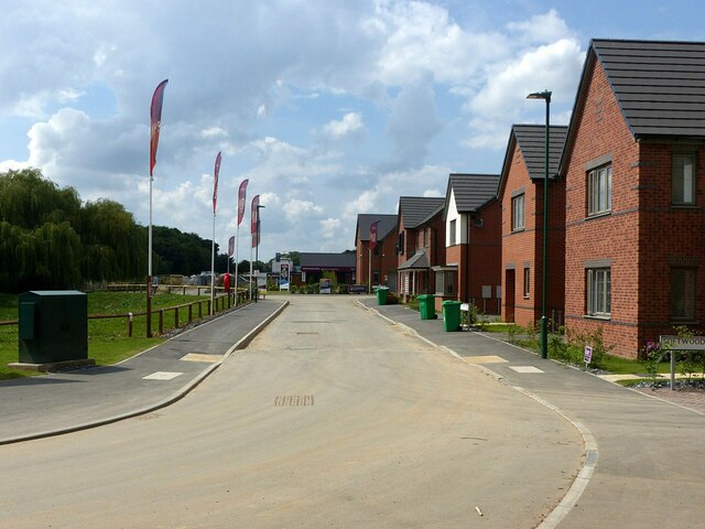
The area is predominantly residential, with a mix of housing types including detached houses, semi-detached houses, and terraced homes. Aspley has a diverse population, comprising a blend of families, young professionals, and retirees. The community benefits from a range of amenities, including schools, shops, and recreational facilities.
Aspley is well-connected with the rest of Nottingham via several bus routes, providing easy access to the city center and other nearby areas. Additionally, the area is conveniently located near major road networks, such as the A610 and A6514, facilitating travel to other parts of Nottinghamshire and beyond.
Nature lovers can enjoy the nearby Aspley Woods, a vast area of woodland that provides opportunities for walking, cycling, and exploring nature. The area also boasts several parks and green spaces, offering residents ample opportunities for outdoor activities and relaxation.
Overall, Aspley offers a peaceful and community-oriented living environment, with a range of amenities and convenient transportation links. Its proximity to Nottingham city center and surrounding areas makes it an attractive location for individuals and families looking for a suburban setting with easy access to urban amenities.
If you have any feedback on the listing, please let us know in the comments section below.
Aspley Images
Images are sourced within 2km of 52.972602/-1.194342 or Grid Reference SK5442. Thanks to Geograph Open Source API. All images are credited.


Aspley is located at Grid Ref: SK5442 (Lat: 52.972602, Lng: -1.194342)
Unitary Authority: Nottingham
Police Authority: Nottinghamshire
What 3 Words
///down.sweat.about. Near Basford, Nottinghamshire
Related Wikis

Melbourne Park (Nottingham)
Melbourne Park is a large public space in Aspley, Nottingham, England. The park is approximately 500 by 600 metres (1,600 by 2,000 ft). In addition to...

St Margaret's Church, Aspley
St. Margaret's Church, Aspley is a parish church in the Church of England in Aspley, Nottingham. == History == St Margaret's was built in 1936 by E. H...

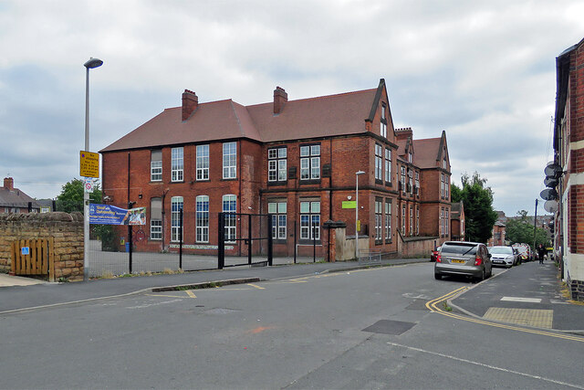
Bluecoat Aspley Academy
Bluecoat Aspley Academy is a Church of England secondary school and sixth form located in the Aspley area of Nottingham, England, dating back to 1706....
Whitemoor, Nottingham
Whitemoor is an area of the City of Nottingham. It lies next to Old Basford to the north, New Basford and Hyson Green to the east, Aspley to the west and...
Aspley, Nottingham
Aspley is a council estate and a ward of the city of Nottingham, Nottinghamshire, England. It is located within the boundaries of Nottingham City Council...
William Crane Comprehensive School
William Crane School, Minver Crescent, Aspley, Nottingham, Nottingham NG8 5PN, was a school consisting of infants, juniors and seniors. The school was...
John Player Ground
John Player Ground was a cricket ground in Nottingham, Nottinghamshire. The first recorded match on the ground was in 1955, when the Midlands and East...
Nottingham Girls' Academy
Nottingham Girls' Academy (formerly Manning Comprehensive School) is a girls' secondary school and sixth form with academy status, located in the Aspley...
Nearby Amenities
Located within 500m of 52.972602,-1.194342Have you been to Aspley?
Leave your review of Aspley below (or comments, questions and feedback).