Bushygrove Shaw
Wood, Forest in Sussex Horsham
England
Bushygrove Shaw
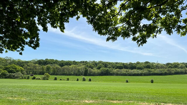
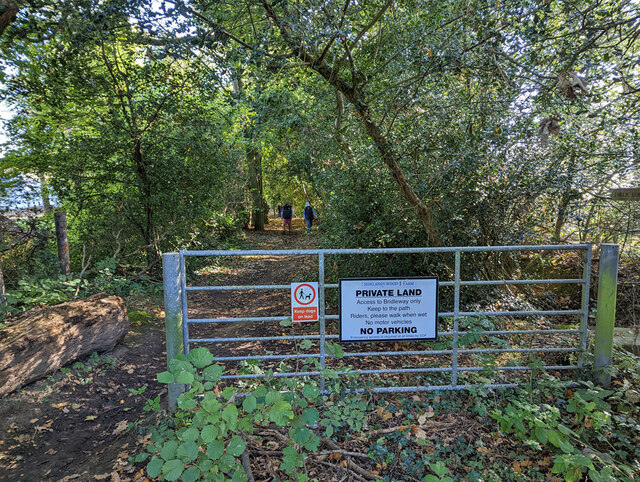
Bushygrove Shaw is a picturesque woodland located in Sussex, England. Covering an area of approximately 50 acres, this densely populated forest is a haven for nature enthusiasts and wildlife lovers alike.
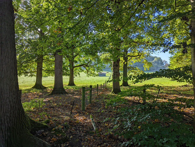
The shaw is characterized by its dense canopy of tall, mature trees, which include a variety of native species such as oak, birch, and beech. These trees provide a habitat for a multitude of bird species, including woodpeckers, owls, and warblers. The forest floor is carpeted with a rich layer of mosses, ferns, and wildflowers, creating a vibrant and diverse ecosystem.
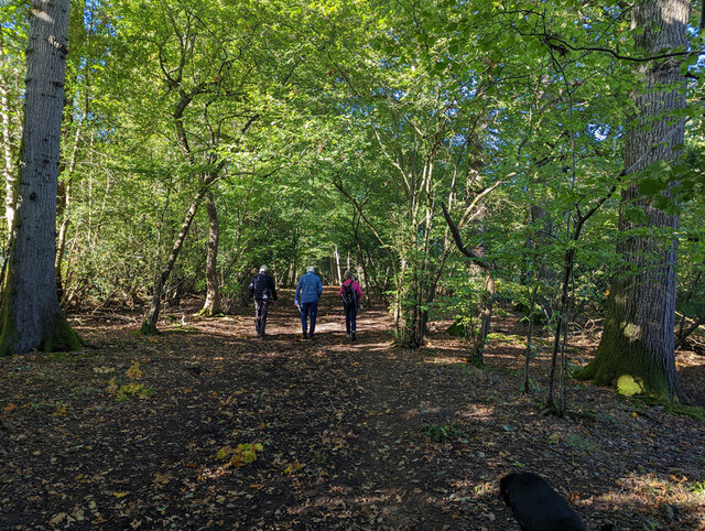
Tranquil walking trails meander through the forest, offering visitors the opportunity to explore the natural beauty of the wood. These paths are well-maintained and provide access to various viewpoints and picnic areas, allowing visitors to immerse themselves in the serene surroundings.
Bushygrove Shaw is also home to a variety of mammal species, including deer, foxes, and badgers. The forest provides a safe haven for these animals, with its abundance of food sources and secluded areas for nesting and burrowing.
The shaw is particularly popular during the spring and summer months when the forest comes alive with the sounds of birdsong and the vibrant colors of blooming wildflowers. It is a tranquil escape from the hustle and bustle of city life, offering visitors a chance to reconnect with nature and appreciate the beauty of the Sussex countryside.
Overall, Bushygrove Shaw is a natural gem nestled in the heart of Sussex, offering a peaceful retreat for those seeking solace in the beauty of the woodlands.
If you have any feedback on the listing, please let us know in the comments section below.
Bushygrove Shaw Images
Images are sourced within 2km of 50.997854/-0.27805453 or Grid Reference TQ2023. Thanks to Geograph Open Source API. All images are credited.


Bushygrove Shaw is located at Grid Ref: TQ2023 (Lat: 50.997854, Lng: -0.27805453)
Administrative County: West Sussex
District: Horsham
Police Authority: Sussex
What 3 Words
///conducted.winded.harsh. Near Cowfold, West Sussex
Nearby Locations
Related Wikis

Cowfold
Cowfold is a village and civil parish between Billingshurst and Haywards Heath in the Horsham District of West Sussex, England. The village is at the intersection...

Crabtree, West Sussex
Crabtree is a hamlet in the parish of Lower Beeding and in Horsham District of West Sussex, England. It lies on the A281 road 4.4 miles (7.1 km) southeast...

Maplehurst, West Sussex
Maplehurst is a hamlet in the civil parish of Nuthurst, and the Horsham District of West Sussex, England. The hamlet is on the Copsale to Nuthurst road...

West Grinstead railway station
West Grinstead was a railway station on the Steyning Line which served the village of West Grinstead. It had a goods yard with a cattle loading bay and...

Leonardslee
Leonardslee is an English country house and English landscape garden and woodland garden in Lower Beeding, near Horsham, West Sussex, England. The Grade...

St Hugh's Charterhouse
St Hugh's Charterhouse, Parkminster, is the only post-Reformation Carthusian monastery in the United Kingdom. It is located in the parish of Cowfold, West...

Nuthurst
Nuthurst is a village and civil parish in the Horsham district of West Sussex, England. The north of the parish borders Horsham town, with Nuthurst village...

Littleworth, West Sussex
Littleworth is a hamlet in the Horsham District of West Sussex, England. It lies on the Partridge Green to Maplehurst road 2.9 miles (4.7 km) north of...
Nearby Amenities
Located within 500m of 50.997854,-0.27805453Have you been to Bushygrove Shaw?
Leave your review of Bushygrove Shaw below (or comments, questions and feedback).