Costal Wood

Wood, Forest in Surrey Mole Valley

England

Costal Wood

Tyrrell's Wood Golf Club The club house is in the distance.
Tyrrell's Wood Golf Club Credit: James Emmans

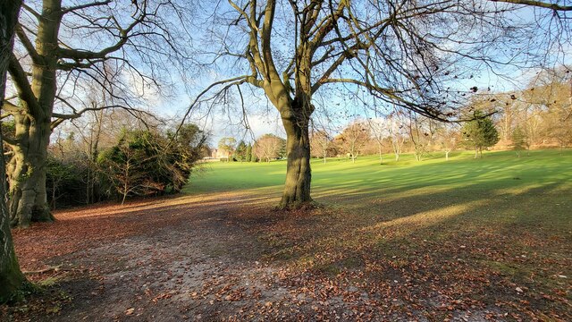
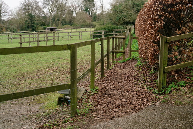
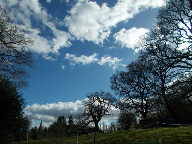
Coastal Wood, located in Surrey, is a picturesque forested area renowned for its natural beauty and tranquil surroundings. Situated along the coast, this wood is characterized by a diverse range of flora and fauna, making it an ideal destination for nature lovers and wildlife enthusiasts.

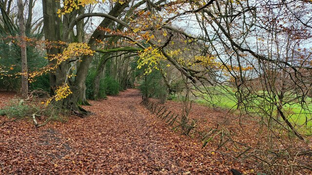
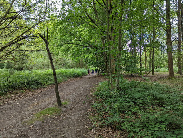
The wood boasts a vast variety of trees, including oak, beech, and pine, which create a dense canopy overhead, providing shade and shelter for the countless species that inhabit the area. The forest floor is carpeted with vibrant wildflowers, adding to the enchanting atmosphere.

Visitors to Coastal Wood can explore its numerous walking trails and immerse themselves in the peaceful ambiance while taking in the breathtaking scenery. These trails cater to all levels of fitness, from leisurely strolls to more challenging hikes, ensuring there is something for everyone.

The wood is also home to an array of wildlife, including deer, foxes, and various bird species. Birdwatchers can spot a variety of feathered creatures, such as woodpeckers, owls, and kestrels, among others. The wood's proximity to the coast further enhances its ecological diversity, as it attracts coastal birds like gulls and sandpipers.

In addition to its natural wonders, Coastal Wood offers various recreational activities, such as picnicking, photography, and nature study. The serene environment makes it an ideal spot for meditation and relaxation, allowing visitors to escape the hustle and bustle of everyday life.

Overall, Coastal Wood in Surrey is a captivating destination that offers an immersive experience in nature, with its stunning landscapes, diverse wildlife, and opportunities for outdoor recreation and relaxation.

If you have any feedback on the listing, please let us know in the comments section below.

Costal Wood Images

Images are sourced within 2km of 51.279581/-0.26758415 or Grid Reference TQ2054. Thanks to Geograph Open Source API. All images are credited.

Tyrrell's Wood Golf Club The club house is in the distance.
Tyrrell's Wood Golf Club
The club house is in the distance.
Bridleway on the northern edge of Cherkley Woods Beech leaves forming a thick carpet.

The path is near the car park on Mill Way.
Bridleway on the northern edge of Cherkley Woods
Beech leaves forming a thick carpet. The path is near the car park on Mill Way.
Hopeful Pond, Headley Heath The sign was illegible.
Hopeful Pond, Headley Heath
The sign was illegible.
Bridleway 492. Headley Heath Heading south from by the main car park.
Bridleway 492. Headley Heath
Heading south from by the main car park.
Mere Pond Pond in Walton-on-the-Hill, once the village water supply, seen here virtually dry in the exceptionally dry summer of 2022.
Mere Pond
Pond in Walton-on-the-Hill, once the village water supply, seen here virtually dry in the exceptionally dry summer of 2022.
Mere Pond Pond in Walton-on-the-Hill, once the village water supply, seen here virtually dry in the exceptionally dry summer of 2022.
Mere Pond
Pond in Walton-on-the-Hill, once the village water supply, seen here virtually dry in the exceptionally dry summer of 2022.
M25 clockwise - Sturt's Lane Bridge Giving access to Frith Park off to the left.
M25 clockwise - Sturt's Lane Bridge
Giving access to Frith Park off to the left.
M25 clockwise - sign gantry Reference 4565A, as stencilled on an upright. 4565B applies to the other carriageway. Deciphering the number using the distance markers at intervals along the road, the 565 seems to locate the feature at 56.5 km from datum, the 4 at a guess the type of feature.
M25 clockwise - sign gantry
Reference 4565A, as stencilled on an upright. 4565B applies to the other carriageway. Deciphering the number using the distance markers at intervals along the road, the 565 seems to locate the feature at 56.5 km from datum, the 4 at a guess the type of feature.
M25 clockwise
M25 clockwise
M25 clockwise - sign gantry Reference 4577A, as stencilled on an upright. 4577B applies to the other carriageway. Deciphering the number using the distance markers at intervals along the road, the 577 seems to locate the feature at 57.7 km from datum, the 4 at a guess the type of feature.
M25 clockwise - sign gantry
Reference 4577A, as stencilled on an upright. 4577B applies to the other carriageway. Deciphering the number using the distance markers at intervals along the road, the 577 seems to locate the feature at 57.7 km from datum, the 4 at a guess the type of feature.
Ebbisham Lane To the west of Tadworth, this lane runs up to the outskirts of Epsom Downs. Langley Vale Wood lies to both sides of this lane.
Ebbisham Lane
To the west of Tadworth, this lane runs up to the outskirts of Epsom Downs. Langley Vale Wood lies to both sides of this lane.
Langley Vale Wood View towards Walton Downs, across an area of recent tree planting; one of several areas of woodland creation within this large wood.
Langley Vale Wood
View towards Walton Downs, across an area of recent tree planting; one of several areas of woodland creation within this large wood.
Footpath Near Tadworth Seen from Ebbisham Lane.
Footpath Near Tadworth
Seen from Ebbisham Lane.
Coal Tax Post No.136 Located at Withybed Corner, on the edge of Tadworth.
Coal Tax Post No.136
Located at Withybed Corner, on the edge of Tadworth.
Walton on the Hill Mere Pond is to the right of the road.
Walton on the Hill
Mere Pond is to the right of the road.
Public footpath across Headley Park
Church spire at Headley A prominent landmark in the area seen from near and far.
Church spire at Headley
A prominent landmark in the area seen from near and far.
Mere Pond, Walton on the Hill
Show me another place!

Costal Wood is located at Grid Ref: TQ2054 (Lat: 51.279581, Lng: -0.26758415)

Administrative County: Surrey

District: Mole Valley

Police Authority: Surrey

What 3 Words

///jump.reward.same. Near Tadworth, Surrey

Related Wikis

Headley, Surrey

Headley is a village and civil parish in the North Downs in Surrey, England. The nearest settlements are, to the west, Mickleham and Leatherhead; to the...

Walton-on-the-Hill

Walton-on-the-Hill, Surrey, is a village in England midway between the market towns of Reigate and Epsom. The village is a dispersed cluster on the North...

Headley Court

Defence Medical Rehabilitation Centre Headley Court (abbreviated to DMRC Headley Court, and more commonly known as Headley Court), formerly RAF Headley...

1909 News of the World Match Play

The 1909 News of the World Match Play was the seventh News of the World Match Play tournament. It was played from Tuesday 5 to Thursday 7 October at Walton...

1913 News of the World Match Play

The 1913 News of the World Match Play was the eleventh News of the World Match Play tournament. It was played from Tuesday 7 to Thursday 9 October at Walton...

1905 News of the World Match Play

The 1905 News of the World Match Play was the third News of the World Match Play tournament. It was played from Tuesday 3 to Thursday 5 October at Walton...

1919 News of the World Match Play

The 1919 News of the World Match Play was the twelfth News of the World Match Play tournament. It was played from Monday 29 September to Thursday 2 October...

1911 News of the World Match Play

The 1911 News of the World Match Play was the ninth News of the World Match Play tournament, played from 3 to 5 October 1911 at the Walton Heath Golf Club...

Nearby Amenities

Located within 500m of 51.279581,-0.26758415
Power: pole
Lat/Long: 51.2757013/-0.2653469
Power: pole
Source: gps;Bing
Lat/Long: 51.2769275/-0.2646699
Material: steel
Power: pole
Source: Bing
Lat/Long: 51.278751/-0.263597
Power: pole
Lat/Long: 51.2811026/-0.2621111
Phone
Emergency: phone
Operator: National Highways
Operator Wikidata: Q5760006
Lat/Long: 51.2798567/-0.2629646
Phone
Emergency: phone
Operator: National Highways
Operator Wikidata: Q5760006
Lat/Long: 51.2792484/-0.2617605
Phone
Emergency: phone
Operator: National Highways
Operator Wikidata: Q5760006
Lat/Long: 51.2828866/-0.2663605
Phone
Emergency: phone
Operator: National Highways
Operator Wikidata: Q5760006
Lat/Long: 51.283016/-0.2657275
Bus Stop
The Cock Inn
Naptan AtcoCode: 40004408121B
Naptan Bearing: S
Naptan BusStopType: CUS
Naptan CommonName: Cock Horse
Naptan Indicator: O/s
Naptan Landmark: Cock Horse
Naptan NaptanCode: surgpgmp
Naptan Street: Church Lane
Naptan Verified: no
Physically Present: no
Public Transport: platform
Source: naptan_import
Wheelchair: no
Wheelchair Description: No footway, close to blind brow. No bus stop sign on this side, timetable at bus stop opposite.
Lat/Long: 51.2796246/-0.2745246
Barrier: kissing_gate
Lat/Long: 51.2765084/-0.2704953
Barrier: kissing_gate
Foot: yes
Lat/Long: 51.27567/-0.2698195
Phone
Emergency: phone
Operator: National Highways
Operator Wikidata: Q5760006
Lat/Long: 51.2808097/-0.2631614
Barrier: kissing_gate
Lat/Long: 51.2782985/-0.271717
Post Box
Operator: Royal Mail
Post Box Design: type_n
Post Box Mounting: pier
Post Box Type: lamp
Ref: KT18 102
Royal Cypher: no
Lat/Long: 51.2788603/-0.2740028
Alan's Gate
Barrier: kissing_gate
Lat/Long: 51.2764533/-0.2704484
Barrier: kissing_gate
Lat/Long: 51.279864/-0.2729607
Bus Stop
The Cock Inn
Public Transport: platform
Wheelchair: limited
Wheelchair Description: No footway. Near blind brow.
Lat/Long: 51.2795203/-0.2746657
Parking
St Mary the Virgin Car Park
Addr City: Headley
Addr Street: Church Lane
Surface: asphalt
Wheelchair: yes
Wheelchair Description: Two dedicated Blue Badge spaces.
Lat/Long: 51.2799175/-0.2740242
Note: Wheelchair lift
Wheelchair: yes
Lat/Long: 51.279624/-0.2744143
Parking
Addr Street: Church Lane
Wheelchair: yes
Wheelchair Description: Path from dedicated Blue Badge spaces to wheelchair lift to outside seating area at pub.
Lat/Long: 51.2793152/-0.2740671
Bus Stop
Broome Close
Addr Street: Church Lane
Bench: yes
Public Transport: platform
Shelter: yes
Wheelchair: yes
Wheelchair Description: Step-free to stopping point opposite.
Lat/Long: 51.2772709/-0.2730848
Bus Stop
Broome Close
Addr Street: Church Lane
Public Transport: platform
Wheelchair: yes
Wheelchair Description: No bus stop sign on this side. Step-free from shelter with timetable and bus stop opposite.
Lat/Long: 51.2772777/-0.272895
Bench
Backrest: yes
Seats: 3
Source: gps
Lat/Long: 51.2800642/-0.273419
Cafe
Headley Village Stores and Tea Room
Addr City: Headley
Addr Postcode: KT18 6LD
Addr Street: Church Lane
Opening Hours: Mo 10:30-17:30; Tu-Th 09:30-17:30; Sa-Su 08:30-17:00
Phone: +44 1372 377 338
Website: https://gahoashoo.wixsite.com/headleytearoom
Lat/Long: 51.2788921/-0.2738859
Headley Village Stores & Tea Room
Addr City: Headley
Addr Postcode: KT18 6LD
Addr Street: Church Lane
Opening Hours: Mo 10:30-17:30; Tu-Th 09:30-17:30; Sa-Su 08:30-17:00
Phone: +44 1372 377 338
Shop: convenience
Toilets Wheelchair: no
Website: https://gahoashoo.wixsite.com/headleytearoom
Wheelchair: limited
Lat/Long: 51.2788411/-0.2739053
Defibrillator
Defibrillator Location: outside Headley Village Hall
Emergency: defibrillator
Indoor: no
Lat/Long: 51.2787691/-0.2739324
Entrance: yes
Lat/Long: 51.2787405/-0.2739466
The data included in this document is from www.openstreetmap.org. The data is made available under ODbL.

Have you been to Costal Wood?

Leave your review of Costal Wood below (or comments, questions and feedback).