Littleridge Wood

Wood, Forest in Hertfordshire Hertsmere

England

Littleridge Wood

On the clockwise M25 one mile from junction 23
On the clockwise M25 one mile from junction 23 Credit: Rob Purvis

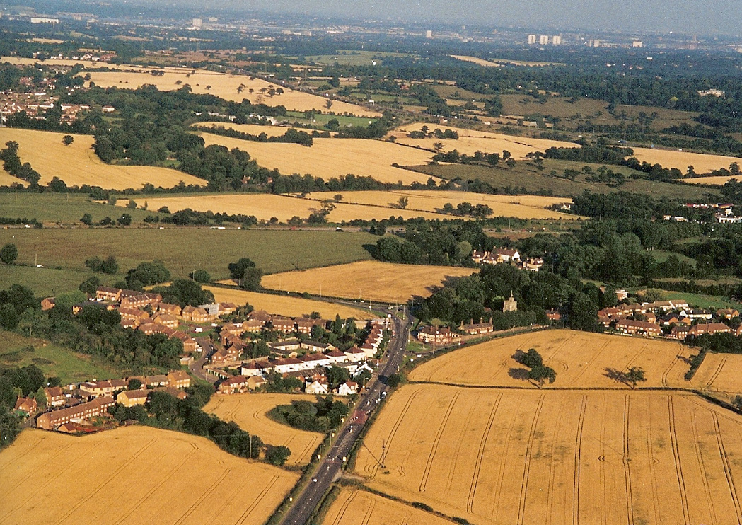
Littleridge Wood, located in Hertfordshire, England, is a charming woodland area known for its natural beauty and diverse flora and fauna. Situated near the village of Littleridge, the wood offers a peaceful retreat for nature enthusiasts and outdoor adventurers alike.

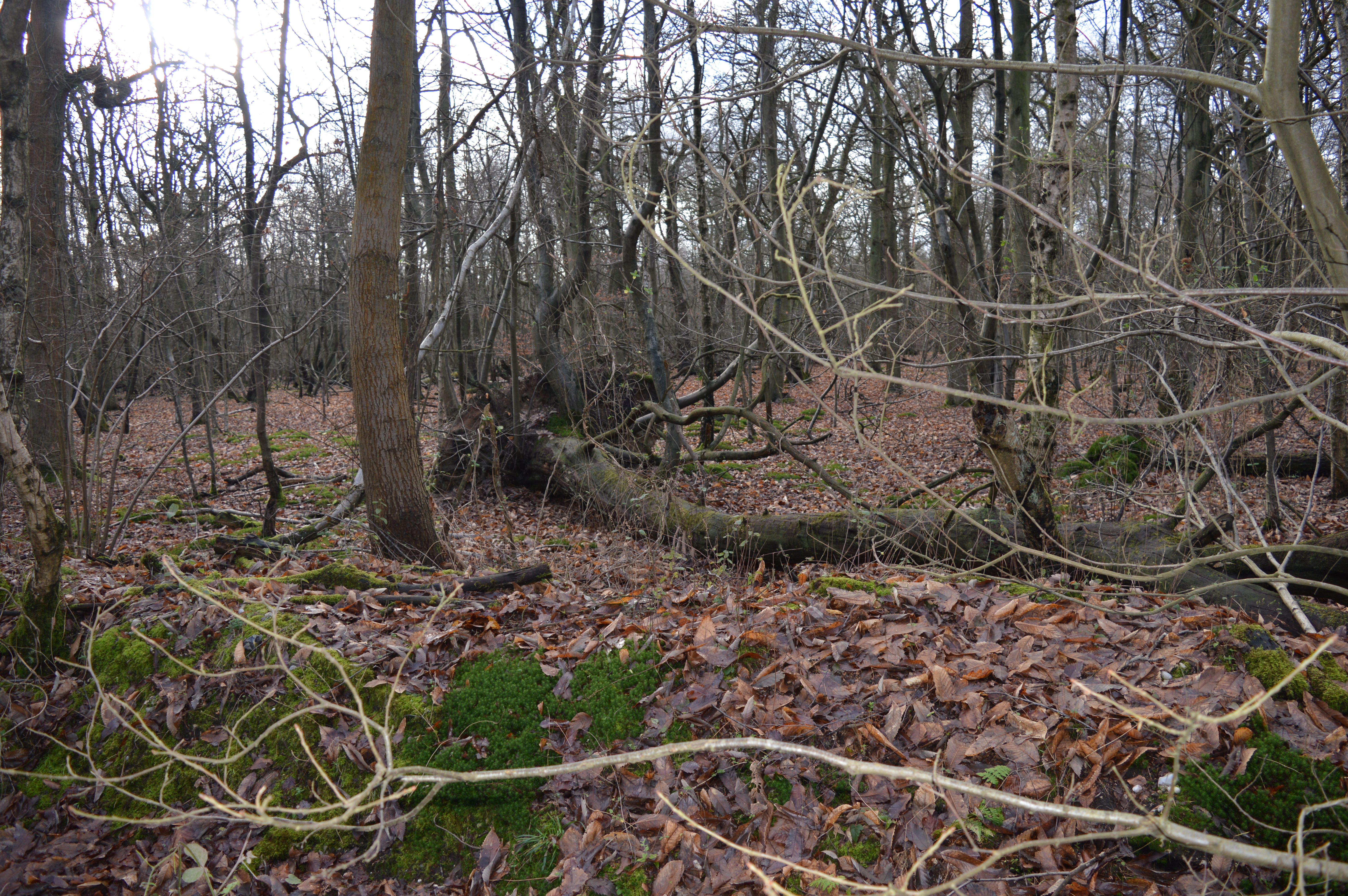
Covering an area of approximately 50 acres, Littleridge Wood is primarily composed of deciduous trees, such as oak, beech, and birch. The wood features a well-maintained network of paths and trails, allowing visitors to easily explore its enchanting surroundings. These paths wind through the woodland, leading to various points of interest, including a serene pond and a small clearing that serves as a picnic area.

The wood is home to a rich variety of wildlife, making it a haven for nature lovers. Birdwatchers can spot a range of species, from common garden birds to rarer sightings like woodpeckers and owls. Squirrels are a common sight, playfully darting among the trees, and if lucky, visitors may even catch a glimpse of a shy deer or fox.

Littleridge Wood is a popular destination for families, offering a range of recreational activities for all ages. Children can enjoy playing in the designated areas, while adults can take advantage of the peaceful surroundings for relaxing walks or nature photography.

Managed by the local conservation trust, Littleridge Wood is well-preserved and cared for. The trust organizes regular events and educational programs to promote awareness of the wood's ecological importance and to encourage its sustainable use.

Overall, Littleridge Wood is a natural gem in Hertfordshire, providing a tranquil escape from the hustle and bustle of daily life while offering a unique opportunity to connect with nature.

If you have any feedback on the listing, please let us know in the comments section below.

Littleridge Wood Images

Images are sourced within 2km of 51.690153/-0.25461601 or Grid Reference TL2000. Thanks to Geograph Open Source API. All images are credited.

On the clockwise M25 one mile from junction 23
Traffic queue at junction 23 on the M25
Sign Gantry on the M25 Clockwise Officially named the London Orbital and frequently derided as nothing more than a very big car park, the M25 is a 117-mile orbital motorway that encircles London; one of the world's biggest ring roads (Europe's second longest orbital road after the Berliner Ring, which is 122 miles). It is not, however, a continuous loop of motorway as the Dartford Crossing section (comprising the Dartford Tunnels and the Queen Elizabeth II Bridge) over the Thames and its approach roads are designated as the A282. 

Constructed between 1975 and 1986, the M25 is reputedly the most expensive motorway Britain ever built, costing a total of £909m or roughly £7.5m per mile, but at the time of its planning, the demand for the road was considerably underestimated so that when it was finally completed in 1986, it was already out of date. Demand outstripped capacity within a few years and ever since then it's been very heavily congested. 

The M25 is one of the UK’s busiest motorways, carrying up to 200,000 vehicles and 10,000 HGVs per day (AADT - Annual Average Daily Traffic flow) on the section near to Heathrow Airport. Since its opening in the 1980s, the southern, western and eastern sections have been widened to largely dual four lane (D4M) standard, but much of the motorway retains its dual three lane road (D3M) cross-section as originally built. 

The M25 was home to England's first Variable Speed Limits on motorways between the A3 and M4 in the early 1990s.

<span class="nowrap"><a title="http://www.cbrd.co.uk/motorway/m25/" rel="nofollow ugc noopener" href="http://www.cbrd.co.uk/motorway/m25/">Link</a><img style="margin-left:2px;" alt="External link" title="External link - shift click to open in new window" src="https://s1.geograph.org.uk/img/external.png" width="10" height="10"/></span>  cbrd
<span class="nowrap"><a title="http://www.sabre-roads.org.uk/wiki/index.php?title=M25" rel="nofollow ugc noopener" href="http://www.sabre-roads.org.uk/wiki/index.php?title=M25">Link</a><img style="margin-left:2px;" alt="External link" title="External link - shift click to open in new window" src="https://s1.geograph.org.uk/img/external.png" width="10" height="10"/></span>  SABRE
Sign Gantry on the M25 Clockwise
Officially named the London Orbital and frequently derided as nothing more than a very big car park, the M25 is a 117-mile orbital motorway that encircles London; one of the world's biggest ring roads (Europe's second longest orbital road after the Berliner Ring, which is 122 miles). It is not, however, a continuous loop of motorway as the Dartford Crossing section (comprising the Dartford Tunnels and the Queen Elizabeth II Bridge) over the Thames and its approach roads are designated as the A282. Constructed between 1975 and 1986, the M25 is reputedly the most expensive motorway Britain ever built, costing a total of £909m or roughly £7.5m per mile, but at the time of its planning, the demand for the road was considerably underestimated so that when it was finally completed in 1986, it was already out of date. Demand outstripped capacity within a few years and ever since then it's been very heavily congested. The M25 is one of the UK’s busiest motorways, carrying up to 200,000 vehicles and 10,000 HGVs per day (AADT - Annual Average Daily Traffic flow) on the section near to Heathrow Airport. Since its opening in the 1980s, the southern, western and eastern sections have been widened to largely dual four lane (D4M) standard, but much of the motorway retains its dual three lane road (D3M) cross-section as originally built. The M25 was home to England's first Variable Speed Limits on motorways between the A3 and M4 in the early 1990s. LinkExternal link cbrd LinkExternal link SABRE
Clockwise M25 approaching Bignell's Corner (Junction 23) Bignell's Corner (also known as South Mimms Interchange) is a large three-level roundabout interchange providing full access between the M25, A1(M), A1081, South Mimms services and local roads. It is junction 1 of the A1(M) and junction 23 of the M25 (<span class="nowrap"><a title="https://www.sabre-roads.org.uk/wiki/index.php?title=Bignells_Corner" rel="nofollow ugc noopener" href="https://www.sabre-roads.org.uk/wiki/index.php?title=Bignells_Corner">Link</a><img style="margin-left:2px;" alt="External link" title="External link - shift click to open in new window" src="https://s1.geograph.org.uk/img/external.png" width="10" height="10"/></span> SABRE).
Clockwise M25 approaching Bignell's Corner (Junction 23)
Bignell's Corner (also known as South Mimms Interchange) is a large three-level roundabout interchange providing full access between the M25, A1(M), A1081, South Mimms services and local roads. It is junction 1 of the A1(M) and junction 23 of the M25 (LinkExternal link SABRE).
London Orbital Motorway at Bignell's Corner (South Mimms Interchange) Bignell's Corner (also known as South Mimms Interchange) is a large three-level roundabout interchange providing full access between the M25, A1(M), A1081, South Mimms services and local roads. It is junction 1 of the A1(M) and junction 23 of the M25 (<span class="nowrap"><a title="https://www.sabre-roads.org.uk/wiki/index.php?title=Bignells_Corner" rel="nofollow ugc noopener" href="https://www.sabre-roads.org.uk/wiki/index.php?title=Bignells_Corner">Link</a><img style="margin-left:2px;" alt="External link" title="External link - shift click to open in new window" src="https://s1.geograph.org.uk/img/external.png" width="10" height="10"/></span> SABRE).
London Orbital Motorway at Bignell's Corner (South Mimms Interchange)
Bignell's Corner (also known as South Mimms Interchange) is a large three-level roundabout interchange providing full access between the M25, A1(M), A1081, South Mimms services and local roads. It is junction 1 of the A1(M) and junction 23 of the M25 (LinkExternal link SABRE).
South Mimms church
South Mimms church
Church of St Margaret   Ridge Herts Quite an unassuming little church in a tiny village
Church of St Margaret Ridge Herts
Quite an unassuming little church in a tiny village
The Old Guinea Pub at Ridge, Herts A board just out of sight to the left says that bookings are taken for meals. Which rules out the casual visitor.
The Old Guinea Pub at Ridge, Herts
A board just out of sight to the left says that bookings are taken for meals. Which rules out the casual visitor.
Village Hall at Ridge The two storey structure is rather unusual for a village hall.
Village Hall at Ridge
The two storey structure is rather unusual for a village hall.
Black Lion Pub    Shenley. This pub is in the old village on the opposite side of the B5378 from the "newer" village {ex hospital site}
Black Lion Pub Shenley.
This pub is in the old village on the opposite side of the B5378 from the "newer" village {ex hospital site}
The Stud Farm in Rectory Lane  Shenley One horse was being exercised just to the left of the picture
The Stud Farm in Rectory Lane Shenley
One horse was being exercised just to the left of the picture
Shenley Hill  Business premises. The business is related to transport but I have no further clue.
Shenley Hill Business premises.
The business is related to transport but I have no further clue.
Shenley Lodge  School  Ridgehill Ambience is good and the children at this school must reap the benefit.
Shenley Lodge School Ridgehill
Ambience is good and the children at this school must reap the benefit.
Dawn at South Mimms View of the service building at South Mimms on the M25 motorway
Dawn at South Mimms
View of the service building at South Mimms on the M25 motorway
Shenley Cage and Pond Viewed looking northwards over the village Pond, the Cage is one of the last remaining round gaolhouses in the country. Given its location outside the Queen Adelaide public house there is an ironic tablet in the wall of the gaolhouse advising passers-by to "Be Sober".
Shenley Cage and Pond
Viewed looking northwards over the village Pond, the Cage is one of the last remaining round gaolhouses in the country. Given its location outside the Queen Adelaide public house there is an ironic tablet in the wall of the gaolhouse advising passers-by to "Be Sober".
Southridge Animal Centre This RSPCA centre is based on the site of the former Southridge Farm on Packhorse Lane at Ridge.
Southridge Animal Centre
This RSPCA centre is based on the site of the former Southridge Farm on Packhorse Lane at Ridge.
Deeves Hall Barn At the junction of Mimms Lane, Earls Lane and Deeves Hall Lane.
Deeves Hall Barn
At the junction of Mimms Lane, Earls Lane and Deeves Hall Lane.
Redwell Wood This track leads past a lodge north into Redwell Wood from a sharp bend in Blackhorse Lane at South Mimms.
Redwell Wood
This track leads past a lodge north into Redwell Wood from a sharp bend in Blackhorse Lane at South Mimms.
Show me another place!

Littleridge Wood is located at Grid Ref: TL2000 (Lat: 51.690153, Lng: -0.25461601)

Administrative County: Hertfordshire

District: Hertsmere

Police Authority: Hertfordshire

What 3 Words

///forces.ankle.margin. Near Shenley, Hertfordshire

Related Wikis

Clare Hall Manor

Clare Hall Manor is a former health facility in Blanche Lane, South Mimms, Hertfordshire, England. It is a Grade II listed building. == History == The...
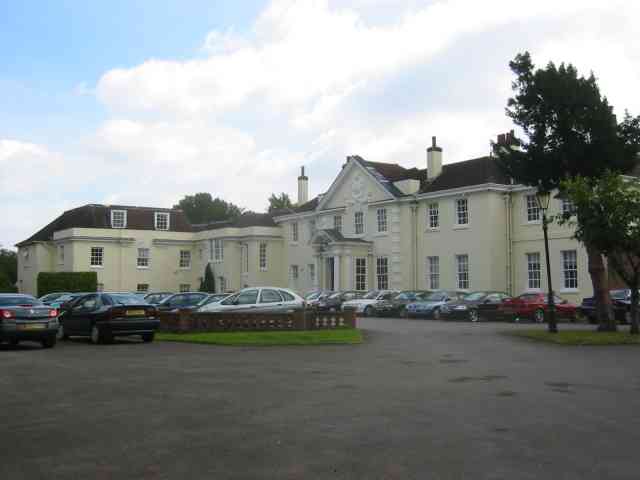
Shenley Hall

Shenley Hall is a Grade II listed English country house at Shenley in Hertfordshire. == History == Built in the 19th century, the hall benefited from additions...

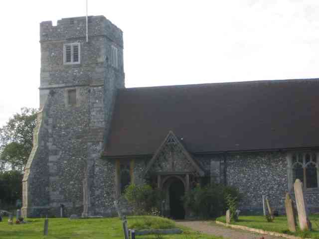
Ridge, Hertfordshire

Ridge is a village and former civil parish, now in the parish of South Mimms and Ridge, in the Hertsmere borough of Hertfordshire, situated between Potters...

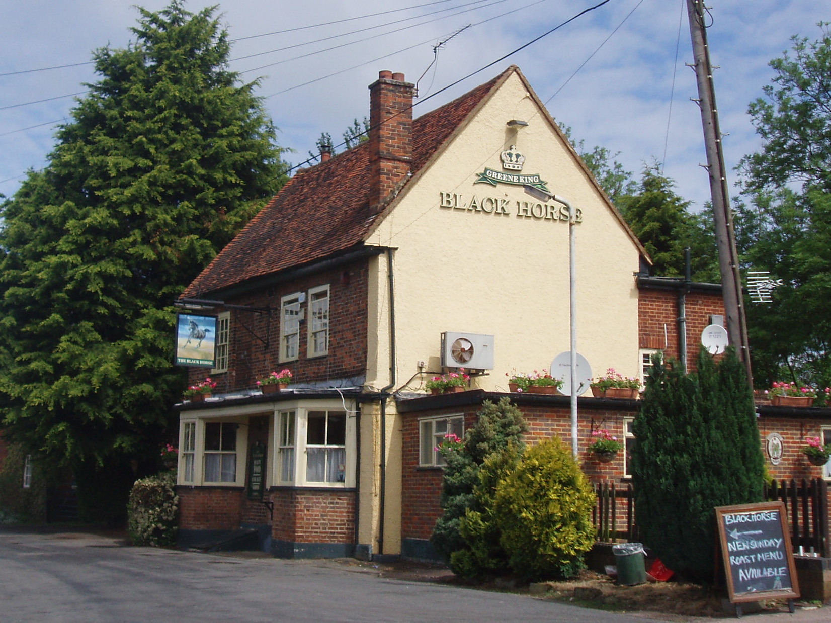
Black Horse, South Mimms

The Black Horse is a Grade II listed public house on Blackhorse Lane in South Mimms, Hertfordshire, England. == History == The pub can be dated to the...
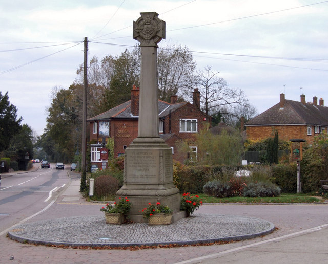
Shenley

Shenley is a village and civil parish in Hertfordshire, England, between Barnet and St Albans. The village is located 14 miles from Central London. As...

South Mimms

South Mimms is a village and former civil parish, now in the parish of South Mimms and Ridge, in the borough of Hertsmere in Hertfordshire in the East...

Watling Chase Community Forest

Watling Chase Community Forest is an area of 72 square miles located in north London and south Hertfordshire around the towns of Potters Bar, Radlett,...

Redwell Wood

Redwell Wood is a 52.8-hectare (130-acre) biological Site of Special Scientific Interest near South Mimms in Hertfordshire. The local planning authority...

Nearby Amenities

Located within 500m of 51.690153,-0.25461601
Power: tower
Lat/Long: 51.6857431/-0.2558395
Power: pole
Lat/Long: 51.6903615/-0.2481714
Power: pole
Lat/Long: 51.6900905/-0.2496788
Power: pole
Lat/Long: 51.6894154/-0.2533266
Power: pole
Lat/Long: 51.6890563/-0.2549225
Power: pole
Lat/Long: 51.6888318/-0.2559015
Power: pole
Lat/Long: 51.688451/-0.2574652
Power: pole
Lat/Long: 51.6881085/-0.2589244
Power: pole
Lat/Long: 51.6877626/-0.2603459
The data included in this document is from www.openstreetmap.org. The data is made available under ODbL.

Have you been to Littleridge Wood?

Leave your review of Littleridge Wood below (or comments, questions and feedback).