Orchard Copse
Wood, Forest in Surrey Mole Valley
England
Orchard Copse

Orchard Copse is a picturesque woodland located in the county of Surrey, England. Situated on the outskirts of a small village, the copse is a popular destination for nature enthusiasts and those seeking tranquility amidst the beauty of nature.
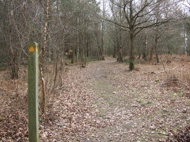
Covering an area of approximately 20 acres, Orchard Copse is characterized by its dense canopy of trees, predominantly oak and beech, creating a serene and shady environment even on the sunniest of days. The woodland floor is covered with a rich carpet of moss, ferns, and wildflowers, adding to its enchanting appeal.
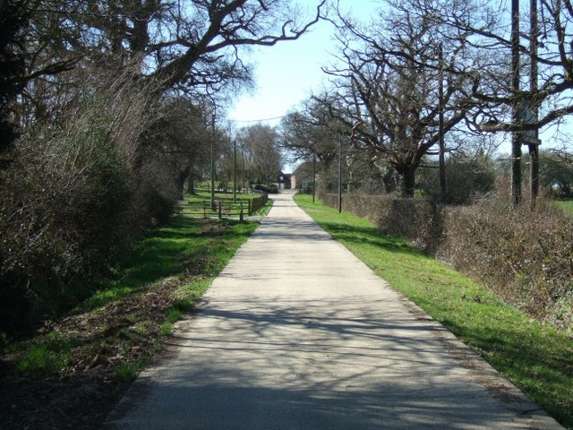
A network of well-maintained footpaths and trails wind their way through Orchard Copse, allowing visitors to explore its natural wonders at their leisure. These trails provide easy access to the copse's most notable features, such as a babbling brook that runs through its heart, offering a soothing soundtrack to accompany a leisurely stroll.
Wildlife thrives within Orchard Copse, as it provides a diverse habitat for a variety of species. Birdwatchers can spot a range of avian species, including woodpeckers, owls, and thrushes, while the patient observer may catch a glimpse of the elusive roe deer or squirrels darting amongst the trees.
The copse is also home to a variety of flora, with bluebells carpeting the forest floor in the spring and vibrant autumnal hues painting the trees in the fall. This ever-changing landscape ensures that Orchard Copse is a visually stunning destination throughout the year.
Overall, Orchard Copse offers a peaceful retreat for visitors, providing a chance to immerse themselves in the natural beauty of Surrey's woodlands. Whether hiking, birdwatching, or simply enjoying the serenity, a visit to Orchard Copse is sure to leave a lasting impression.
If you have any feedback on the listing, please let us know in the comments section below.
Orchard Copse Images
Images are sourced within 2km of 51.192085/-0.27636299 or Grid Reference TQ2045. Thanks to Geograph Open Source API. All images are credited.


Orchard Copse is located at Grid Ref: TQ2045 (Lat: 51.192085, Lng: -0.27636299)
Administrative County: Surrey
District: Mole Valley
Police Authority: Surrey
What 3 Words
///tiles.finest.rushed. Near Holmwood, Surrey
Nearby Locations
Related Wikis

Newdigate
Newdigate is a village and civil parish in the Mole Valley borough of Surrey lying in a relatively flat part of the Weald to the east of the A24 road between...

Wotton Hundred
The Hundred of Wotton, Wotton Hundred or Dorking Hundred was a hundred in Surrey, England. The hundred comprised a south-central portion of the county...

Newdigate Brickworks
Newdigate Brickworks is a 24-hectare (59-acre) nature reserve in Newdigate in Surrey. It is managed by the Surrey Wildlife Trust.The clay pits of this...
Leigh, Surrey
Leigh is a village and civil parish in Surrey, between Reigate, Dorking and Charlwood in the east of Mole Valley district. The village centre is suburban...

Holmwood railway station
Holmwood railway station serves the villages of Beare Green and South Holmwood in Surrey, England, on the Sutton and Mole Valley Lines between Dorking...

South Holmwood
South Holmwood () is a semi-rural village in Surrey, England. It can be considered cognate with its wider civil parish, which stretches to the east to...
Moon Hall School
Moon Hall School, since 1952 an independent co-educational preparatory school at Leigh, near Reigate in Surrey, is currently, as of 2021, a special school...

Inholms Clay Pit
Inholms Clay Pit is a 8.4-hectare (21-acre) Local Nature Reserve south of Dorking in Surrey. It is owned by Mole Valley District Council and from 2009...
Nearby Amenities
Located within 500m of 51.192085,-0.27636299Have you been to Orchard Copse?
Leave your review of Orchard Copse below (or comments, questions and feedback).