Broomfield Hill Wood

Wood, Forest in Surrey

England

Broomfield Hill Wood

A238 at Coombe Coombe Lane West heads towards Kingston, seen from just west of the junction with Warren Road.
A238 at Coombe Credit: Derek Harper

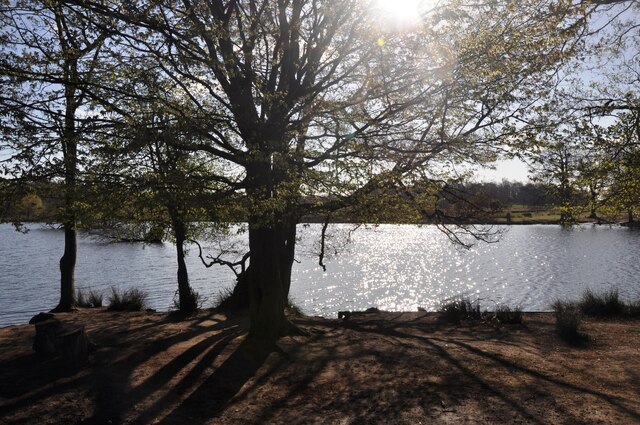
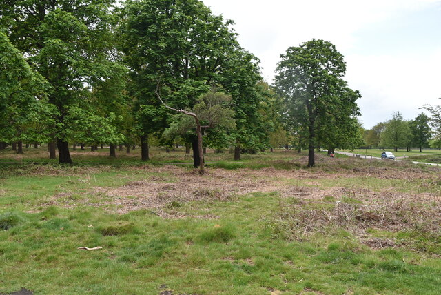
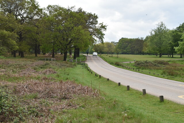
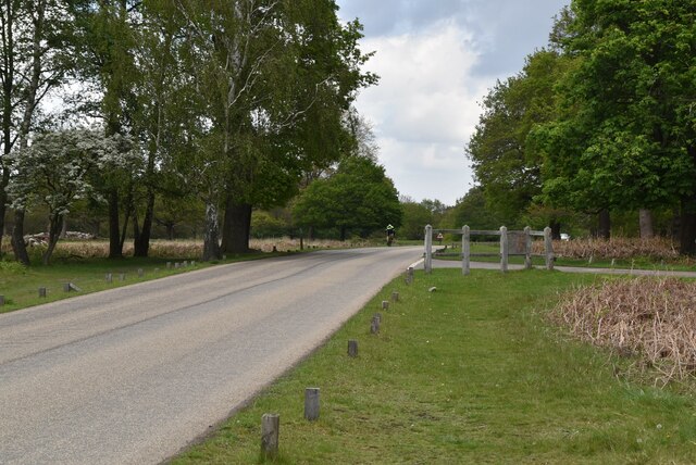
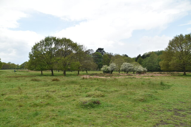
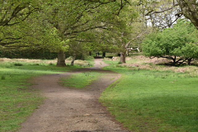
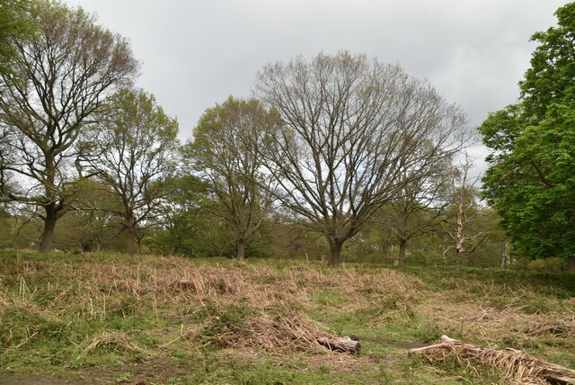
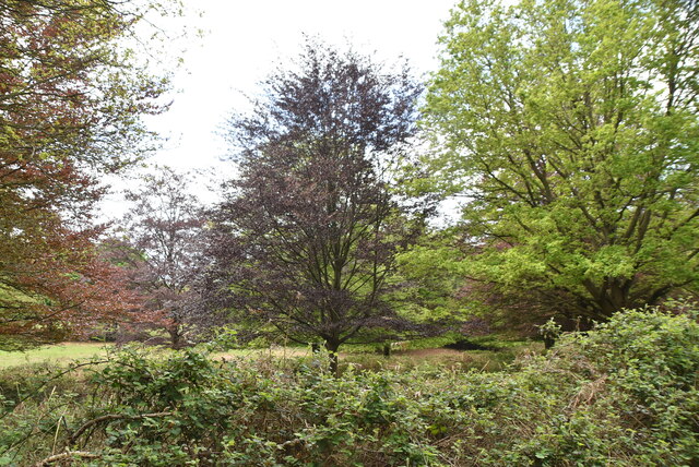
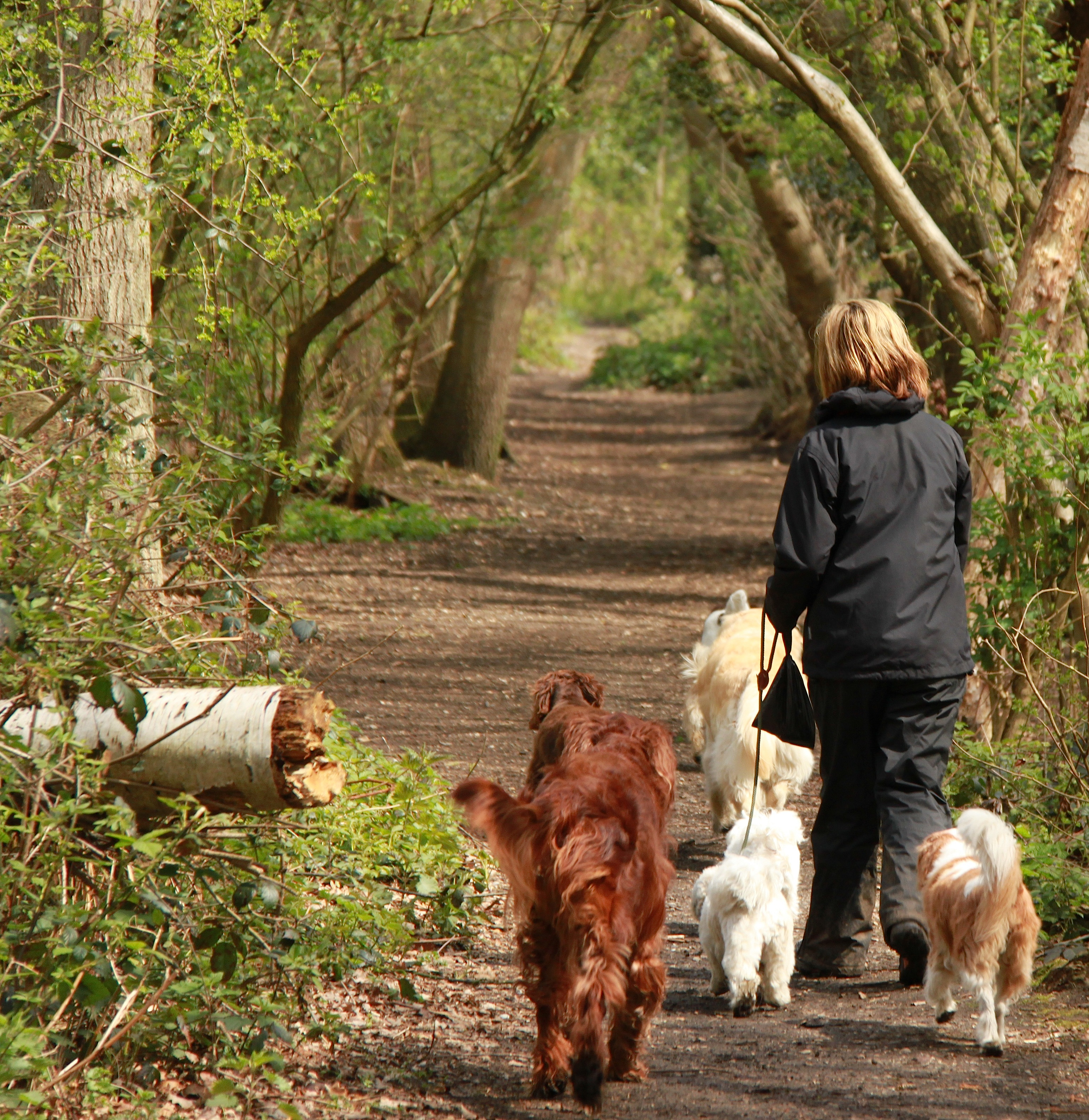
Broomfield Hill Wood is a picturesque forest located in Surrey, England. Situated on the southern slopes of Richmond Park, it covers an area of approximately 50 hectares. The wood is known for its diverse range of tree species, including oak, beech, and birch, that create a lush and vibrant landscape.

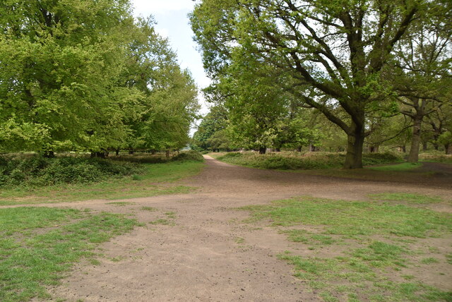
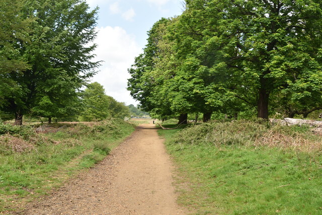
The forest offers a tranquil escape from the bustling city life, attracting nature enthusiasts and hikers throughout the year. Its well-maintained pathways provide visitors with the opportunity to explore the wood's natural beauty and discover its hidden gems. One of the highlights of Broomfield Hill Wood is the stunning viewpoint at the top of the hill, which offers panoramic views of the surrounding countryside.

The wood is also home to a rich variety of wildlife. Birdwatchers can spot numerous species, such as woodpeckers, nuthatches, and owls, while small mammals like squirrels and foxes can often be seen scurrying through the undergrowth. Additionally, the wood is a haven for insect species, including butterflies and dragonflies, adding to its ecological significance.

Broomfield Hill Wood has a long history, with evidence of human activity dating back to prehistoric times. It has been managed by the Royal Parks for many years, ensuring its preservation and conservation. The forest also serves as an important recreational area for local residents and visitors alike, providing a perfect setting for picnics, walks, and nature photography.

Overall, Broomfield Hill Wood is a captivating forest in Surrey, offering a peaceful retreat and a chance to reconnect with nature in a beautiful and serene environment.

If you have any feedback on the listing, please let us know in the comments section below.

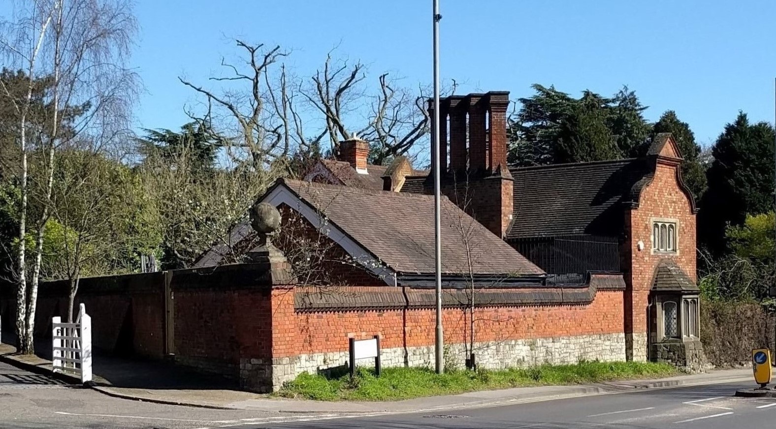
Broomfield Hill Wood Images

Images are sourced within 2km of 51.432956/-0.26742812 or Grid Reference TQ2071. Thanks to Geograph Open Source API. All images are credited.

A238 at Coombe Coombe Lane West heads towards Kingston, seen from just west of the junction with Warren Road.
A238 at Coombe
Coombe Lane West heads towards Kingston, seen from just west of the junction with Warren Road.
Pen Ponds in Richmond Park Sun through the trees around Pen Ponds.
Pen Ponds in Richmond Park
Sun through the trees around Pen Ponds.
Ladderstile Gate Lodge
Water trough, Ladderstile Gate The Metropolitan Drinking Fountain and Cattle Trough Association was founded in 1859 initially to provide clean drinking water in public places for people in London, but soon extended to include animals and also outside London itself. It is still active (now known as The Drinking Fountain Association), with the objectives of:

• The promotion of the provision of drinking water for people and animals in the United Kingdom and Overseas
• The preservation of the Association's archive materials, artefacts, drinking fountains, cattle troughs and other installations.

For full details of its history, see <span class="nowrap"><a title="http://drinkingfountains.org/Attachments(PDF)/DFA%20HIstory.pdf" rel="nofollow ugc noopener" href="http://drinkingfountains.org/Attachments(PDF)/DFA%20HIstory.pdf">Link</a><img style="margin-left:2px;" alt="External link" title="External link - shift click to open in new window" src="https://s1.geograph.org.uk/img/external.png" width="10" height="10"/></span>.
Water trough, Ladderstile Gate
The Metropolitan Drinking Fountain and Cattle Trough Association was founded in 1859 initially to provide clean drinking water in public places for people in London, but soon extended to include animals and also outside London itself. It is still active (now known as The Drinking Fountain Association), with the objectives of: • The promotion of the provision of drinking water for people and animals in the United Kingdom and Overseas • The preservation of the Association's archive materials, artefacts, drinking fountains, cattle troughs and other installations. For full details of its history, see LinkExternal link.
Richmond Park Richmond Park is a 2,360 acre (3.69 sq mi) park within London. It is the largest of the Royal Parks in London and Britain's second largest urban walled park after Sutton Park, Birmingham. It is close to Richmond, Ham, Kingston upon Thames, Wimbledon, Roehampton and East Sheen. The park is famous for its red and fallow deer, which number over six hundred. The park is a National Nature Reserve. There is access to the park through several gates and many footpaths cross the park.
Website & map: <span class="nowrap"><a title="http://www.royalparks.gov.uk/Richmond-Park.aspx" rel="nofollow ugc noopener" href="http://www.royalparks.gov.uk/Richmond-Park.aspx">Link</a><img style="margin-left:2px;" alt="External link" title="External link - shift click to open in new window" src="https://s1.geograph.org.uk/img/external.png" width="10" height="10"/></span> 
Wikipedia: <span class="nowrap"><a title="http://en.wikipedia.org/wiki/Richmond_Park" rel="nofollow ugc noopener" href="http://en.wikipedia.org/wiki/Richmond_Park">Link</a><img style="margin-left:2px;" alt="External link" title="External link - shift click to open in new window" src="https://s1.geograph.org.uk/img/external.png" width="10" height="10"/></span>
Richmond Park
Richmond Park is a 2,360 acre (3.69 sq mi) park within London. It is the largest of the Royal Parks in London and Britain's second largest urban walled park after Sutton Park, Birmingham. It is close to Richmond, Ham, Kingston upon Thames, Wimbledon, Roehampton and East Sheen. The park is famous for its red and fallow deer, which number over six hundred. The park is a National Nature Reserve. There is access to the park through several gates and many footpaths cross the park. Website & map: LinkExternal link Wikipedia: LinkExternal link
Broomfield Hill Richmond Park is a 2,360 acre (3.69 sq mi) park within London. It is the largest of the Royal Parks in London and Britain's second largest urban walled park after Sutton Park, Birmingham. It is close to Richmond, Ham, Kingston upon Thames, Wimbledon, Roehampton and East Sheen. The park is famous for its red and fallow deer, which number over six hundred. The park is a National Nature Reserve. There is access to the park through several gates and many footpaths cross the park.
Website & map: <span class="nowrap"><a title="http://www.royalparks.gov.uk/Richmond-Park.aspx" rel="nofollow ugc noopener" href="http://www.royalparks.gov.uk/Richmond-Park.aspx">Link</a><img style="margin-left:2px;" alt="External link" title="External link - shift click to open in new window" src="https://s1.geograph.org.uk/img/external.png" width="10" height="10"/></span> 
Wikipedia: <span class="nowrap"><a title="http://en.wikipedia.org/wiki/Richmond_Park" rel="nofollow ugc noopener" href="http://en.wikipedia.org/wiki/Richmond_Park">Link</a><img style="margin-left:2px;" alt="External link" title="External link - shift click to open in new window" src="https://s1.geograph.org.uk/img/external.png" width="10" height="10"/></span>
Broomfield Hill
Richmond Park is a 2,360 acre (3.69 sq mi) park within London. It is the largest of the Royal Parks in London and Britain's second largest urban walled park after Sutton Park, Birmingham. It is close to Richmond, Ham, Kingston upon Thames, Wimbledon, Roehampton and East Sheen. The park is famous for its red and fallow deer, which number over six hundred. The park is a National Nature Reserve. There is access to the park through several gates and many footpaths cross the park. Website & map: LinkExternal link Wikipedia: LinkExternal link
Richmond Park Richmond Park is a 2,360 acre (3.69 sq mi) park within London. It is the largest of the Royal Parks in London and Britain's second largest urban walled park after Sutton Park, Birmingham. It is close to Richmond, Ham, Kingston upon Thames, Wimbledon, Roehampton and East Sheen. The park is famous for its red and fallow deer, which number over six hundred. The park is a National Nature Reserve. There is access to the park through several gates and many footpaths cross the park.
Website & map: <span class="nowrap"><a title="http://www.royalparks.gov.uk/Richmond-Park.aspx" rel="nofollow ugc noopener" href="http://www.royalparks.gov.uk/Richmond-Park.aspx">Link</a><img style="margin-left:2px;" alt="External link" title="External link - shift click to open in new window" src="https://s1.geograph.org.uk/img/external.png" width="10" height="10"/></span> 
Wikipedia: <span class="nowrap"><a title="http://en.wikipedia.org/wiki/Richmond_Park" rel="nofollow ugc noopener" href="http://en.wikipedia.org/wiki/Richmond_Park">Link</a><img style="margin-left:2px;" alt="External link" title="External link - shift click to open in new window" src="https://s1.geograph.org.uk/img/external.png" width="10" height="10"/></span>
Richmond Park
Richmond Park is a 2,360 acre (3.69 sq mi) park within London. It is the largest of the Royal Parks in London and Britain's second largest urban walled park after Sutton Park, Birmingham. It is close to Richmond, Ham, Kingston upon Thames, Wimbledon, Roehampton and East Sheen. The park is famous for its red and fallow deer, which number over six hundred. The park is a National Nature Reserve. There is access to the park through several gates and many footpaths cross the park. Website & map: LinkExternal link Wikipedia: LinkExternal link
Richmond Park
Richmond Park
Richmond Park Richmond Park is a 2,360 acre (3.69 sq mi) park within London. It is the largest of the Royal Parks in London and Britain's second largest urban walled park after Sutton Park, Birmingham. It is close to Richmond, Ham, Kingston upon Thames, Wimbledon, Roehampton and East Sheen. The park is famous for its red and fallow deer, which number over six hundred. The park is a National Nature Reserve. There is access to the park through several gates and many footpaths cross the park.
Website & map: <span class="nowrap"><a title="http://www.royalparks.gov.uk/Richmond-Park.aspx" rel="nofollow ugc noopener" href="http://www.royalparks.gov.uk/Richmond-Park.aspx">Link</a><img style="margin-left:2px;" alt="External link" title="External link - shift click to open in new window" src="https://s1.geograph.org.uk/img/external.png" width="10" height="10"/></span> 
Wikipedia: <span class="nowrap"><a title="http://en.wikipedia.org/wiki/Richmond_Park" rel="nofollow ugc noopener" href="http://en.wikipedia.org/wiki/Richmond_Park">Link</a><img style="margin-left:2px;" alt="External link" title="External link - shift click to open in new window" src="https://s1.geograph.org.uk/img/external.png" width="10" height="10"/></span>
Richmond Park
Richmond Park is a 2,360 acre (3.69 sq mi) park within London. It is the largest of the Royal Parks in London and Britain's second largest urban walled park after Sutton Park, Birmingham. It is close to Richmond, Ham, Kingston upon Thames, Wimbledon, Roehampton and East Sheen. The park is famous for its red and fallow deer, which number over six hundred. The park is a National Nature Reserve. There is access to the park through several gates and many footpaths cross the park. Website & map: LinkExternal link Wikipedia: LinkExternal link
Richmond Park
Richmond Park
Richmond Park Richmond Park is a 2,360 acre (3.69 sq mi) park within London. It is the largest of the Royal Parks in London and Britain's second largest urban walled park after Sutton Park, Birmingham. It is close to Richmond, Ham, Kingston upon Thames, Wimbledon, Roehampton and East Sheen. The park is famous for its red and fallow deer, which number over six hundred. The park is a National Nature Reserve. There is access to the park through several gates and many footpaths cross the park.
Website & map: <span class="nowrap"><a title="http://www.royalparks.gov.uk/Richmond-Park.aspx" rel="nofollow ugc noopener" href="http://www.royalparks.gov.uk/Richmond-Park.aspx">Link</a><img style="margin-left:2px;" alt="External link" title="External link - shift click to open in new window" src="https://s1.geograph.org.uk/img/external.png" width="10" height="10"/></span> 
Wikipedia: <span class="nowrap"><a title="http://en.wikipedia.org/wiki/Richmond_Park" rel="nofollow ugc noopener" href="http://en.wikipedia.org/wiki/Richmond_Park">Link</a><img style="margin-left:2px;" alt="External link" title="External link - shift click to open in new window" src="https://s1.geograph.org.uk/img/external.png" width="10" height="10"/></span>
Richmond Park
Richmond Park is a 2,360 acre (3.69 sq mi) park within London. It is the largest of the Royal Parks in London and Britain's second largest urban walled park after Sutton Park, Birmingham. It is close to Richmond, Ham, Kingston upon Thames, Wimbledon, Roehampton and East Sheen. The park is famous for its red and fallow deer, which number over six hundred. The park is a National Nature Reserve. There is access to the park through several gates and many footpaths cross the park. Website & map: LinkExternal link Wikipedia: LinkExternal link
Show me another place!

Broomfield Hill Wood is located at Grid Ref: TQ2071 (Lat: 51.432956, Lng: -0.26742812)

Unitary Authority: Richmond upon Thames

Police Authority: Metropolitan

What 3 Words

///panels.wooden.serves. Near Kingston upon Thames, London

Related Wikis

Isabella Plantation

Isabella Plantation is a woodland garden in Richmond Park in south west London. It is managed by The Royal Parks. Originally located in a boggy part of...

Canbury School

Canbury School is a small, independent day school in Kingston upon Thames, Greater London with a maximum of 75 pupils on roll. == History == Canbury School...

Kingston Vale

Kingston Vale with Kingston Hill is a district in the Royal Borough of Kingston upon Thames in south-west London. It is a residential area between Richmond...

White Lodge, Richmond Park

White Lodge is a Grade I listed Georgian house situated in Richmond Park, in the London Borough of Richmond upon Thames. Formerly a royal residence, it...

Thatched House Lodge

Thatched House Lodge is a Grade II-listed building, dating from the 17th century, in Richmond Park in the London Borough of Richmond upon Thames in London...

Fishpond Wood and Beverley Meads

Fishpond Wood and Beverley Meads is a 5.8 hectare local nature reserve adjacent to Wimbledon Common in the London Borough of Merton. It is owned and managed...

Coombe, Kingston upon Thames

Coombe is a historic neighbourhood in the Royal Borough of Kingston upon Thames in south west London, England. It sits on high ground, east of Norbiton...

Holy Cross Preparatory School

Holy Cross Preparatory School is an independent preparatory school for girls aged 4–11 in Coombe, London, England. == History == Holy Cross Preparatory...

Nearby Amenities

Located within 500m of 51.432956,-0.26742812
Turning Circle
Lat/Long: 51.4316857/-0.2616256
Bus Stop
Kingston University
Bus: yes
Local Ref: C
Naptan AtcoCode: 490008831N
Naptan Bearing: N
Naptan CommonName: Kingston University
Naptan Indicator: Stop C
Naptan Street: KINGSTON HILL
Naptan Verified: no
Public Transport: platform
Wheelchair: yes
Lat/Long: 51.4291377/-0.2692451
Bus Stop
Kingston University
Bus: yes
Local Ref: R
Naptan AtcoCode: 490008831S
Naptan Bearing: S
Naptan CommonName: Kingston University
Naptan Indicator: Stop R
Naptan Street: KINGSTON HILL
Naptan Verified: no
Public Transport: platform
Wheelchair: yes
Lat/Long: 51.4296717/-0.2676238
Bus Stop
Woodview Close
Bus: yes
Local Ref: D
Naptan AtcoCode: 490014914N
Naptan Bearing: N
Naptan CommonName: Woodview Close
Naptan Indicator: Stop D
Naptan Street: KINGSTON VALE
Naptan Verified: no
Public Transport: platform
Ref: 49785
Source Ref: naptan
Wheelchair: yes
Lat/Long: 51.43233/-0.2640244
Bus Stop
Woodview Close
Bench: yes
Bus: yes
Local Ref: Q
Naptan AtcoCode: 490014914S
Naptan Bearing: S
Naptan CommonName: Woodview Close
Naptan Indicator: Stop Q
Naptan Street: KINGSTON VALE
Naptan Verified: no
Public Transport: platform
Ref: 57735
Shelter: yes
Source Ref: naptan
Wheelchair: yes
Lat/Long: 51.4326996/-0.2631467
Post Box
Mapillary: 505376537282646
Post Box Type: pillar
Ref: SW15 40
Survey Date: 2021-02-01
Lat/Long: 51.4326285/-0.2635744
Crossing
Crossing: unmarked
Crossing Markings: no
Lat/Long: 51.4288179/-0.2678609
Ref GB Tflcid: RWG134875
Traffic Calming: hump
Lat/Long: 51.4323413/-0.2697574
Bench
Lat/Long: 51.4323254/-0.273175
Entrance: yes
Lat/Long: 51.429882/-0.2624211
Crossing
Crossing: unmarked
Crossing Markings: no
Traffic Calming: table
Lat/Long: 51.4288399/-0.2696894
Crossing
Crossing: uncontrolled
Crossing Island: no
Crossing Ref: zebra
Tactile Paving: yes
Lat/Long: 51.4336628/-0.2613785
Barrier: bollard
Fixme: Check exact location
Lat/Long: 51.4302425/-0.2667442
Crossing
Crossing: uncontrolled
Crossing Island: no
Crossing Ref: zebra
Lat/Long: 51.4336232/-0.2613352
Crossing
Bicycle: yes
Crossing: unmarked
Crossing Island: no
Crossing Markings: no
Lat/Long: 51.4300232/-0.2669095
Barrier: bollard
Lat/Long: 51.4313458/-0.2652482
Crossing
Bicycle: yes
Crossing: uncontrolled
Crossing Island: no
Crossing Ref: parallel
Lat/Long: 51.4301443/-0.2668029
Crossing
Crossing: uncontrolled
Crossing Island: no
Crossing Ref: zebra
Lat/Long: 51.4336912/-0.2614096
Crossing
Crossing: uncontrolled
Crossing Island: no
Crossing Ref: zebra
Lat/Long: 51.4319499/-0.2643988
Tactile Paving: yes
Lat/Long: 51.431921/-0.264336
Barrier: bollard
Fixme: Check exact location
Lat/Long: 51.4301862/-0.2666358
Barrier: bollard
Lat/Long: 51.4293594/-0.268699
Barrier: bollard
Lat/Long: 51.4321226/-0.2642705
Barrier: bollard
Lat/Long: 51.4301316/-0.2669363
Barrier: bollard
Lat/Long: 51.429276/-0.2686264
Barrier: bollard
Lat/Long: 51.4294612/-0.2684468
Barrier: bollard
Lat/Long: 51.4290323/-0.2694855
Barrier: bollard
Lat/Long: 51.4291614/-0.2691658
Bicycle Parking
Access: yes
Bicycle Parking: stands
Capacity: 6
Covered: no
Lit: no
Lat/Long: 51.4317864/-0.2686041
Post Box
Collection Times: Mo-Fr 09:00; Sa 07:00
Operator: Royal Mail
Operator Wikidata: Q638098
Post Box Type: pillar
Ref: KT2 8D
Royal Cypher: GVIR
Royal Cypher Wikidata: Q33102169
Lat/Long: 51.4287657/-0.2697849
Waste Basket
Lat/Long: 51.4318408/-0.2682986
Bench
Backrest: yes
Material: wood
Seats: 4
Lat/Long: 51.4322793/-0.2672007
Waste Basket
Lat/Long: 51.4322686/-0.2694789
Advertising: board
Lat/Long: 51.4324484/-0.2694176
Bench
Lat/Long: 51.4325077/-0.2706147
Bench
Lat/Long: 51.4324921/-0.2714325
Bench
Backrest: yes
Material: wood
Seats: 4
Lat/Long: 51.4323563/-0.2725208
Bench
Backrest: yes
Material: wood
Seats: 4
Lat/Long: 51.4321801/-0.2734144
Waste Basket
Lat/Long: 51.4320284/-0.2739306
Dorich House Museum
Addr City: London
Addr Housenumber: 67
Addr Postcode: SW15 3RN
Addr Street: Kingston Vale
Fhrs Id: 1385580
Museum: art
Opening Hours: Th-Sa 11:00-17:00
Operator: Kingston University London
Tourism: museum
Website: https://www.dorichhousemuseum.org.uk/
Wheelchair: no
Lat/Long: 51.4333199/-0.2630796
Give Way
Direction: forward
Lat/Long: 51.4334602/-0.2604648
Give Way
Direction: forward
Lat/Long: 51.4338577/-0.2608313
Crossing
Crossing: unmarked
Crossing Markings: no
Lat/Long: 51.4313071/-0.2635364
Crossing
Crossing: unmarked
Crossing Markings: no
Lat/Long: 51.4334451/-0.2604924
Crossing
Crossing: unmarked
Crossing Markings: no
Traffic Calming: table
Lat/Long: 51.4338373/-0.2608084
Tactile Paving: yes
Lat/Long: 51.4336147/-0.2613258
Tactile Paving: yes
Lat/Long: 51.4336958/-0.2614146
Barrier: bollard
Lat/Long: 51.4320158/-0.2642211
Barrier: bollard
Lat/Long: 51.4318732/-0.2644022
Tactile Paving: yes
Lat/Long: 51.4319737/-0.2644505
Crossing
Crossing: uncontrolled
Crossing Island: no
Crossing Ref: zebra
Lat/Long: 51.4301704/-0.2667559
Tactile Paving: yes
Lat/Long: 51.4301441/-0.2667171
Tactile Paving: yes
Lat/Long: 51.4301949/-0.2667921
Tactile Paving: yes
Lat/Long: 51.4293507/-0.2684874
Give Way
Direction: forward
Lat/Long: 51.4294615/-0.2681027
Give Way
Direction: forward
Lat/Long: 51.4293774/-0.2680095
Tactile Paving: yes
Lat/Long: 51.4294063/-0.2685457
Bus Stop
Bus: yes
Public Transport: platform
Lat/Long: 51.4287851/-0.2662309
Bus Stop
Bus: yes
Public Transport: platform
Lat/Long: 51.4291258/-0.266169
Crossing
Crossing: unmarked
Crossing Markings: no
Lat/Long: 51.4289421/-0.2679809
Crossing
Crossing: unmarked
Crossing Markings: no
Lat/Long: 51.4288975/-0.2662733
Entrance: yes
Lat/Long: 51.429353/-0.265628
Entrance: yes
Lat/Long: 51.4287216/-0.2658217
Entrance: yes
Lat/Long: 51.4288119/-0.2651391
Entrance: yes
Lat/Long: 51.4290861/-0.2655004
Entrance: yes
Lat/Long: 51.4290015/-0.2655709
Entrance: yes
Lat/Long: 51.4289367/-0.2648293
Entrance: yes
Lat/Long: 51.4290122/-0.2641232
Entrance: yes
Lat/Long: 51.4293042/-0.2647105
Leisure: pitch
Sport: table_tennis
Lat/Long: 51.428878/-0.2645616
Bus Stop
Broomfield Hill Car Park
Fixme: Location approximate
Public Transport: platform
Lat/Long: 51.4326255/-0.2692167
Motorcycle Parking
Lat/Long: 51.4290735/-0.2673199
Elevator
Lat/Long: 51.4292921/-0.2654044
Atm
Lat/Long: 51.4294174/-0.2630454
Rememberance Garden
Historic: memorial
Lat/Long: 51.4290537/-0.267612
Elevator
Lat/Long: 51.4292481/-0.2646262
Bench
Lat/Long: 51.4285786/-0.2673761
Crossing
Crossing: uncontrolled
Crossing Markings: yes
Lat/Long: 51.4293501/-0.2661182
Entrance: yes
Lat/Long: 51.4299037/-0.2668209
Barrier: bollard
Lat/Long: 51.4293824/-0.2683691
Crossing
Lat/Long: 51.4294866/-0.268118
Crossing
Crossing: uncontrolled
Lat/Long: 51.4293546/-0.2685761
Crossing
Crossing: uncontrolled
Lat/Long: 51.4293785/-0.2685166
Motorcycle Parking
Lat/Long: 51.4294907/-0.2673693
Bench
Lat/Long: 51.4290611/-0.2675697
Bench
Lat/Long: 51.4290486/-0.2676515
Entrance: yes
Lat/Long: 51.428591/-0.2684436
Elevator
Lat/Long: 51.4291371/-0.266944
Entrance: yes
Lat/Long: 51.4297925/-0.2638088
Entrance: yes
Lat/Long: 51.4297504/-0.2633372
Entrance: yes
Lat/Long: 51.4296434/-0.2627282
Bench
Lat/Long: 51.4297385/-0.2624283
Entrance: yes
Lat/Long: 51.4298594/-0.2622394
Entrance: yes
Lat/Long: 51.4294256/-0.2637178
Entrance: yes
Lat/Long: 51.4294721/-0.2641261
Entrance: yes
Lat/Long: 51.4294886/-0.2644432
Entrance: yes
Lat/Long: 51.4293975/-0.264405
Crossing
Crossing: unmarked
Crossing Markings: no
Lat/Long: 51.4297932/-0.2663238
The data included in this document is from www.openstreetmap.org. The data is made available under ODbL.

Have you been to Broomfield Hill Wood?

Leave your review of Broomfield Hill Wood below (or comments, questions and feedback).