David's Dingle

Wood, Forest in Hertfordshire St. Albans

England

David's Dingle

Roundabout on Lamer Lane, Wheathampstead Looking towards Lower Luton Road
Roundabout on Lamer Lane, Wheathampstead Credit: David Howard

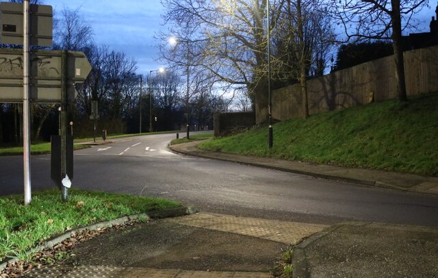
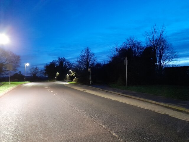
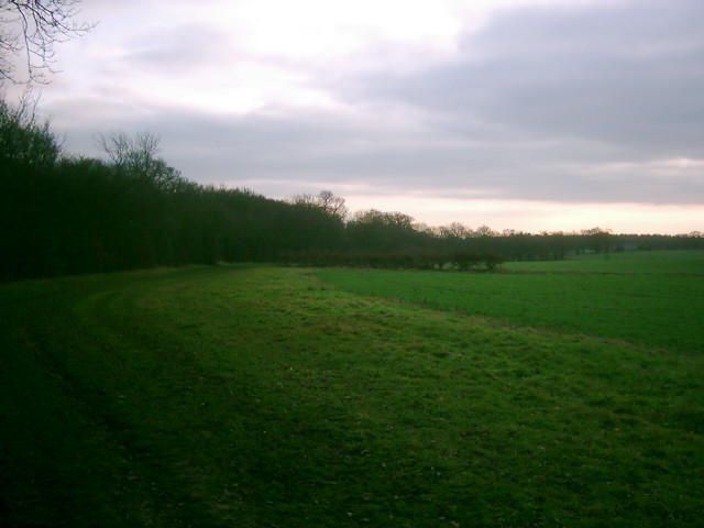
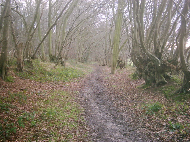
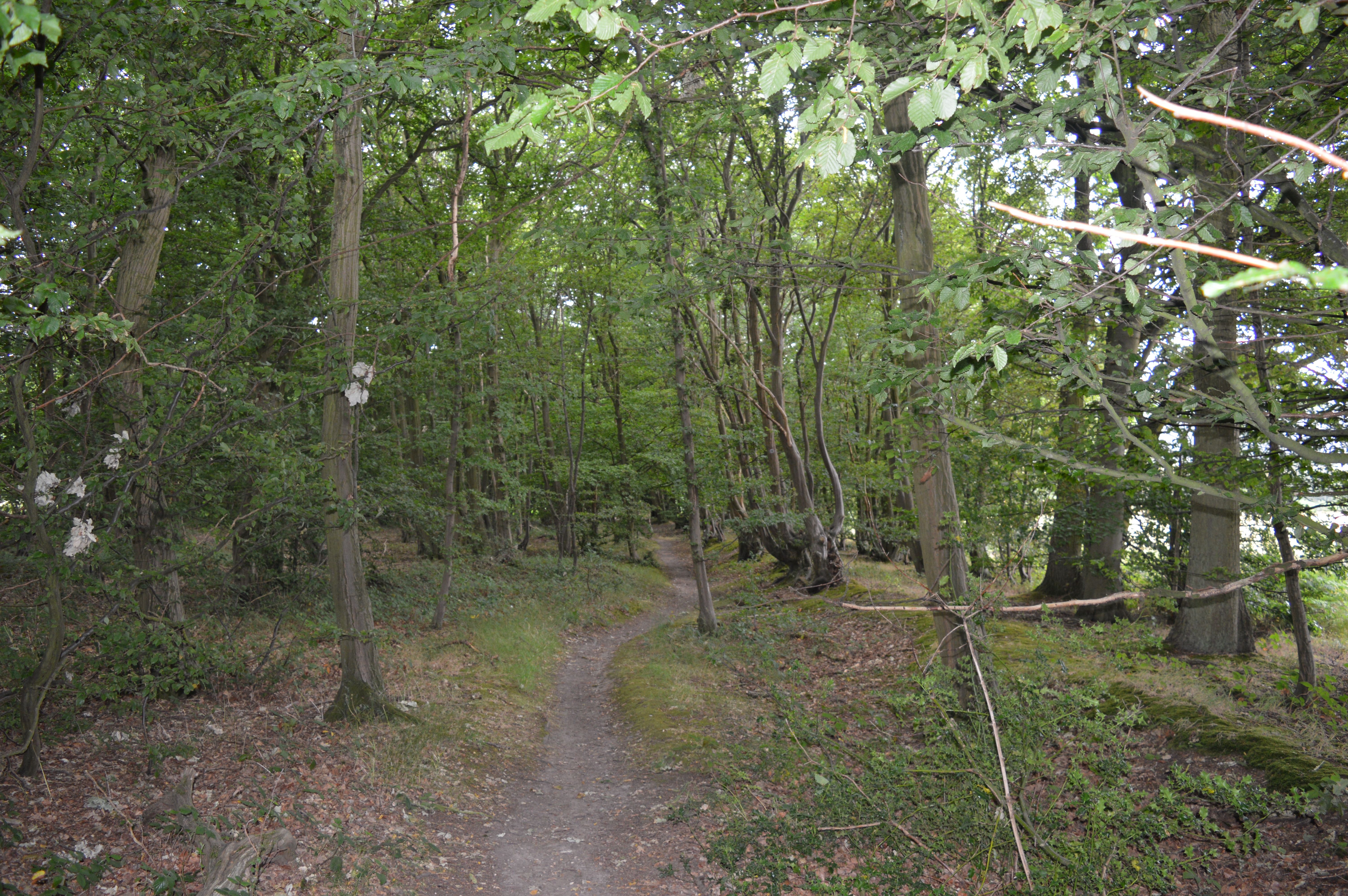
David's Dingle is a picturesque woodland area located in Hertfordshire, England. Nestled in the heart of the county, this woodland is known for its natural beauty and peaceful atmosphere.

Covering a sprawling area, David's Dingle is predominantly made up of dense forest, with tall, mature trees creating a canopy overhead. The woodland is home to a diverse range of flora and fauna, providing a rich habitat for various species. Visitors can expect to encounter a variety of native wildlife, including squirrels, birds, and occasional deer sightings.

The woodland features well-maintained walking trails that wind through the trees, allowing visitors to explore the area at their own pace. These trails are suitable for all levels of fitness and offer a serene escape from the bustling urban environments nearby. The paths are lined with wildflowers and ferns, adding to the natural beauty of the surroundings.

David's Dingle is a popular spot for nature enthusiasts, hikers, and families looking for a tranquil day out. The peacefulness of the woodland makes it an ideal location for picnics, leisurely walks, and nature photography. The shaded areas provide relief from the sun during hot summer days, while the changing colors of the leaves make it a stunning destination during the autumn months.

Overall, David's Dingle in Hertfordshire is a beautiful woodland destination that offers a peaceful retreat from the busy outside world. With its diverse wildlife, well-maintained trails, and natural charm, it is a place that promises to captivate and provide a memorable experience for all who visit.

If you have any feedback on the listing, please let us know in the comments section below.

David's Dingle Images

Images are sourced within 2km of 51.807212/-0.26863594 or Grid Reference TL1913. Thanks to Geograph Open Source API. All images are credited.

Roundabout on Lamer Lane, Wheathampstead Looking towards Lower Luton Road
Roundabout on Lamer Lane, Wheathampstead
Looking towards Lower Luton Road
Frost's estate agents, Wheathampstead All the Frost's I've seen have been in Surrey, I didn't know they were up here as well.
Frost's estate agents, Wheathampstead
All the Frost's I've seen have been in Surrey, I didn't know they were up here as well.
Nonno's Pizza, Wheathampstead
The Hill, Wheathampstead
Shops on Station Road, Wheathampstead
Coleman Green : cottages dated 1877
Coleman Green : John Bunyan's Chimney Grade II listed structure - <span class="nowrap"><a title="https://historicengland.org.uk/listing/the-list/list-entry/1175683?section=official-list-entry" rel="nofollow ugc noopener" href="https://historicengland.org.uk/listing/the-list/list-entry/1175683?section=official-list-entry">Link</a><img style="margin-left:2px;" alt="External link" title="External link - shift click to open in new window" src="https://s1.geograph.org.uk/img/external.png" width="10" height="10"/></span>.
Coleman Green : John Bunyan's Chimney
Grade II listed structure - LinkExternal link.
Waterend Looking North from TL204136 to the ford at Waterend on the River Lea, West of Welwyn Garden City. It's dry, but the water only has to rise a foot or so to flood the road - hence the little footbridge so people can cross without getting their feet wet.
Waterend
Looking North from TL204136 to the ford at Waterend on the River Lea, West of Welwyn Garden City. It's dry, but the water only has to rise a foot or so to flood the road - hence the little footbridge so people can cross without getting their feet wet.
Waterend house The large house just North of the ford (TL204137)
Waterend house
The large house just North of the ford (TL204137)
Greenway bridge Looking South to a bridge at TL209145 which carries the Ayot Greenway - a length of old railway line converted into cycle path and bridleway, covering most of the way from Wheathampstead to Welwyn Garden City.
Greenway bridge
Looking South to a bridge at TL209145 which carries the Ayot Greenway - a length of old railway line converted into cycle path and bridleway, covering most of the way from Wheathampstead to Welwyn Garden City.
Brocket Hall, Lemsford This is the view one gets from the highway.
Brocket Hall, Lemsford
This is the view one gets from the highway.
River from Waterend Ford View of the River Lea taken from Waterend Ford looking South-East
River from Waterend Ford
View of the River Lea taken from Waterend Ford looking South-East
Wellhead This is the head mechanism for a well. Largely complete but the cover is missing. Locally made and originally driven by a separate (steam traction?) engine, possibly as a water source for a steam plough? Located near the top of a hill just south of Threegroves Wood. There is a concrete structure about two metres high, possibly for a water tank. TL203148
Wellhead
This is the head mechanism for a well. Largely complete but the cover is missing. Locally made and originally driven by a separate (steam traction?) engine, possibly as a water source for a steam plough? Located near the top of a hill just south of Threegroves Wood. There is a concrete structure about two metres high, possibly for a water tank. TL203148
Open land near Long Grove Plantation The photograph is taken just south of Upper Cromer Hyde Farm looking south towards long grove plantation. The plantation straddles TL2012 and TL2011
Open land near Long Grove Plantation
The photograph is taken just south of Upper Cromer Hyde Farm looking south towards long grove plantation. The plantation straddles TL2012 and TL2011
Old Road in Long Grove Plantation This wide footpath runs south from near Upper Cromer Hyde Farm to Symondshyde Farm. This section is wide with evidence of ditches and banks topped with laid hedges. It appears to have been a maintained as a road or track. As the path leaves the plantation it narrows and becomes a narrow footpath.
Old Road in Long Grove Plantation
This wide footpath runs south from near Upper Cromer Hyde Farm to Symondshyde Farm. This section is wide with evidence of ditches and banks topped with laid hedges. It appears to have been a maintained as a road or track. As the path leaves the plantation it narrows and becomes a narrow footpath.
Old laid hedge in Long Grove Plantation This is taken on the footpath/old road from Upper Cromer Hyde Farm to Symondshyde Farm in Long Grove Plantation. The photograph seems to show evidence of a very old laid hedge alongside the path. There are similar remains on both sides of the path.
Old laid hedge in Long Grove Plantation
This is taken on the footpath/old road from Upper Cromer Hyde Farm to Symondshyde Farm in Long Grove Plantation. The photograph seems to show evidence of a very old laid hedge alongside the path. There are similar remains on both sides of the path.
Public bridleway, leading to Waterend Lane
Show me another place!

David's Dingle is located at Grid Ref: TL1913 (Lat: 51.807212, Lng: -0.26863594)

Administrative County: Hertfordshire

District: St. Albans

Police Authority: Hertfordshire

What 3 Words

///liability.behind.gave. Near Wheathampstead, Hertfordshire

Nearby Locations

Gray's Wood David's Dingle

Related Wikis

Devil's Dyke, Hertfordshire

Devil's Dyke is the remains of a prehistoric defensive ditch which lies at the east side of the village of Wheathampstead, Hertfordshire, England. It is...
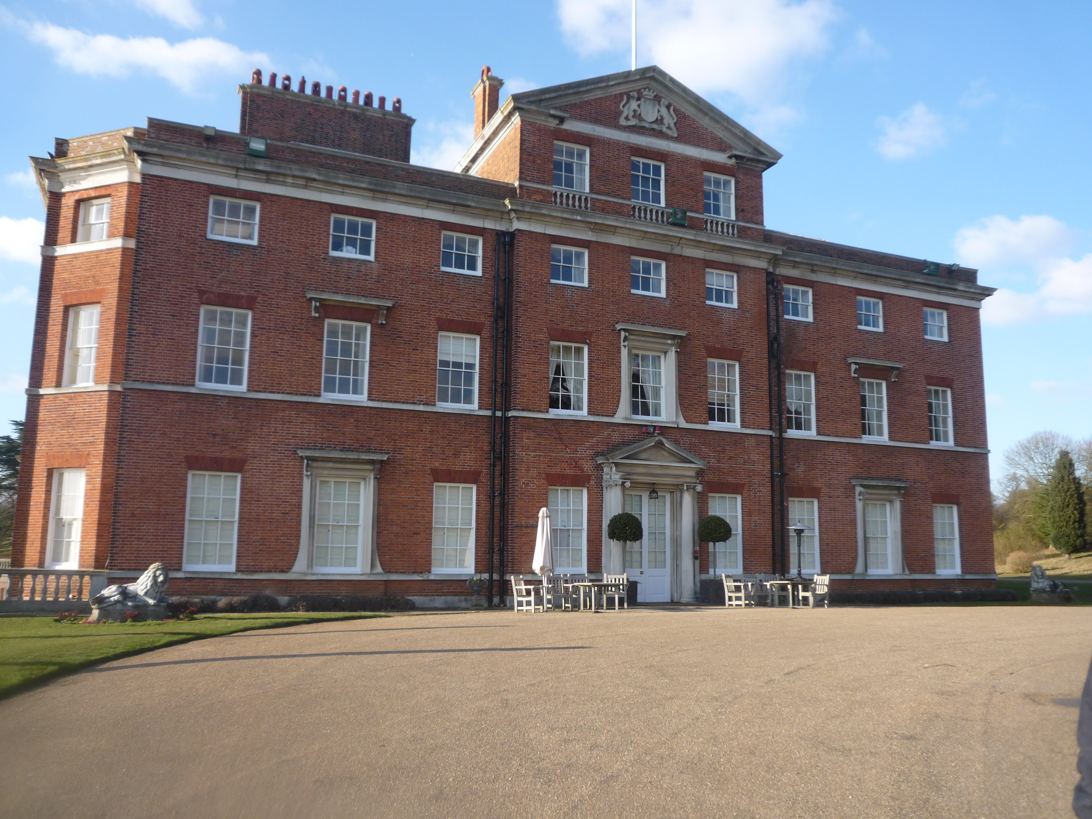
Brocket Hall

Brocket Hall is a neo-classical country house set in a large park at the western side of the urban area of Welwyn Garden City in Hertfordshire, England...
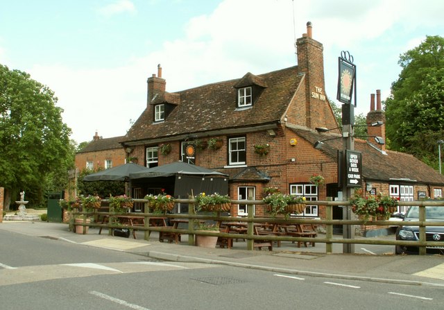
Wheathampstead

Wheathampstead is a village and civil parish in Hertfordshire, England, north of St Albans. The population of the ward at the 2001 census was 6,058. Included...

Wheathampstead railway station

Wheathampstead railway station was a railway station serving Wheathampstead on the Great Northern Railway branch line to Dunstable. While little of it...

St Helen's Church, Wheathampstead

St Helen's Church is the oldest church in Wheathampstead, Hertfordshire, England, although the date of its origins is unknown. The wooden Anglo-Saxon structure...

Stocking Springs Wood

Stocking Springs Wood is a 1.1-hectare (2.7-acre) nature reserve between Ayot St Lawrence and Ayot St Peter in Welwyn Hatfield district in Hertfordshire...

Ayot Green

Ayot Green is a hamlet in Hertfordshire, England and is near the A1(M) Motorway, close to Welwyn Garden City. It is a typical traditional English village...

Lemsford

Lemsford is a village in Hertfordshire, England. It is located close to Welwyn Garden City and Hatfield and is in the Hatfield Villages Ward of the Borough...

Nearby Amenities

Located within 500m of 51.807212,-0.26863594
Bus Stop
Waterend Lane
Bench: no
Bin: no
Naptan AtcoCode: 210021510220
Naptan Bearing: NW
Naptan CommonName: Waterend Lane
Naptan Crossing: Coleman Green Lane
Naptan Indicator: opp
Naptan Landmark: Coleman Green Lane
Naptan NaptanCode: hrtatmgw
Naptan ShortCommonName: NA
Naptan Street: Marford Road
Naptan Verified: no
Public Transport: platform
Shelter: no
Source: naptan_import
Lat/Long: 51.8073509/-0.2620537
Turning Circle
Lat/Long: 51.8056229/-0.2659732
The data included in this document is from www.openstreetmap.org. The data is made available under ODbL.

Have you been to David's Dingle?

Leave your review of David's Dingle below (or comments, questions and feedback).