Coleman Green

Wood, Forest in Hertfordshire St. Albans

England

Coleman Green

Frost's estate agents, Wheathampstead All the Frost's I've seen have been in Surrey, I didn't know they were up here as well.
Frost's estate agents, Wheathampstead Credit: David Howard

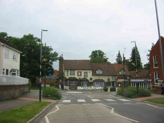
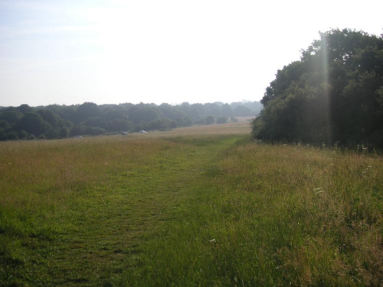
Coleman Green is a charming woodland area located in Hertfordshire, England. Situated near the town of Hertford, this picturesque forest is a popular destination for nature lovers and outdoor enthusiasts. Covering an area of approximately 200 acres, Coleman Green offers a tranquil escape from the hustle and bustle of urban life.

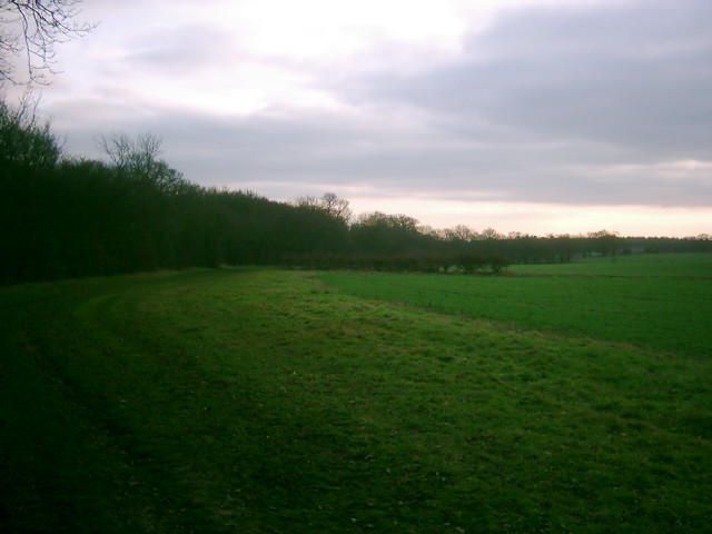
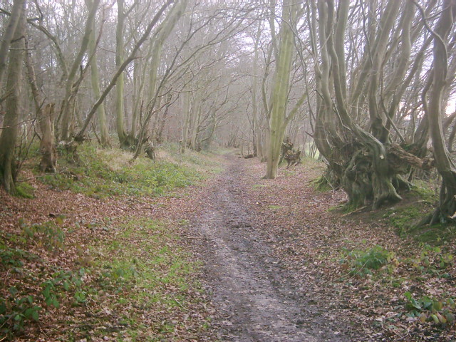
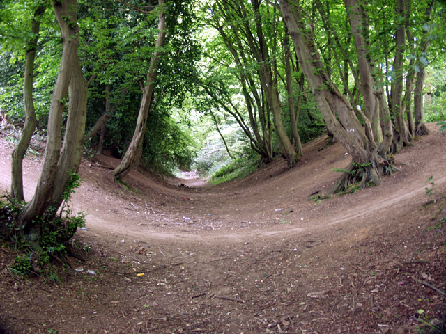
The forest is predominantly composed of oak and beech trees, which provide a stunning display of colors during the autumn season. The dense foliage and well-maintained trails make it an ideal location for hiking, walking, and cycling. The forest floor is carpeted with a variety of wildflowers, adding to its natural beauty.

Wildlife thrives in Coleman Green, with numerous species making their home in the area. Visitors may encounter deer, foxes, rabbits, and a wide array of bird species, making it a haven for birdwatchers and nature photographers.

Facilities in Coleman Green include picnic areas, benches, and designated parking spaces for visitors. The forest is also equipped with well-marked trails, making it easy for visitors to navigate and explore. Additionally, there are information boards placed strategically throughout the area, providing educational insights into the flora and fauna found in the forest.

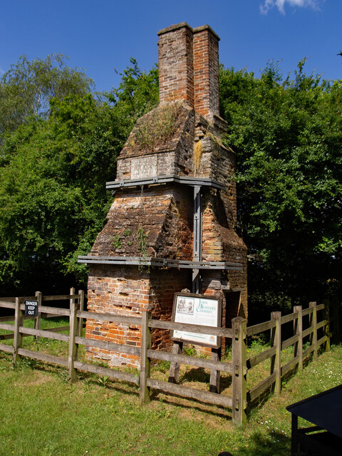
Coleman Green is not only a haven for nature enthusiasts but also a place of historical significance. The area is known to have traces of ancient settlements and archaeological sites, adding an element of intrigue and historical charm to the forest.

Overall, Coleman Green in Hertfordshire offers a peaceful retreat amidst nature, with its vibrant woodland, diverse wildlife, and recreational opportunities, making it a must-visit destination for both locals and tourists alike.

If you have any feedback on the listing, please let us know in the comments section below.

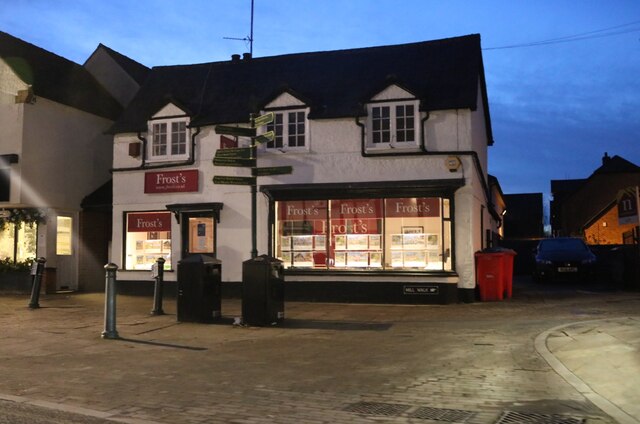
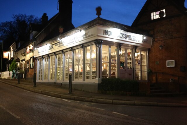
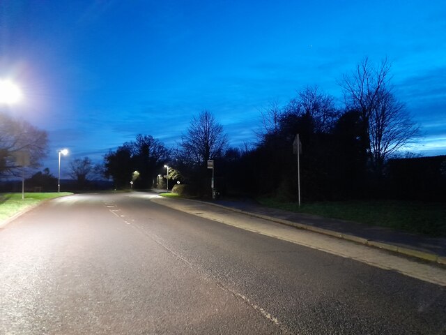
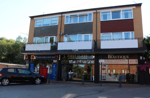
Coleman Green Images

Images are sourced within 2km of 51.798823/-0.27842761 or Grid Reference TL1812. Thanks to Geograph Open Source API. All images are credited.

Frost's estate agents, Wheathampstead All the Frost's I've seen have been in Surrey, I didn't know they were up here as well.
Frost's estate agents, Wheathampstead
All the Frost's I've seen have been in Surrey, I didn't know they were up here as well.
Nonno's Pizza, Wheathampstead
The Hill, Wheathampstead
Shops on Station Road, Wheathampstead
Coleman Green : cottages dated 1877
Coleman Green : John Bunyan's Chimney Grade II listed structure - <span class="nowrap"><a title="https://historicengland.org.uk/listing/the-list/list-entry/1175683?section=official-list-entry" rel="nofollow ugc noopener" href="https://historicengland.org.uk/listing/the-list/list-entry/1175683?section=official-list-entry">Link</a><img style="margin-left:2px;" alt="External link" title="External link - shift click to open in new window" src="https://s1.geograph.org.uk/img/external.png" width="10" height="10"/></span>.
Coleman Green : John Bunyan's Chimney
Grade II listed structure - LinkExternal link.
Waterend Looking North from TL204136 to the ford at Waterend on the River Lea, West of Welwyn Garden City. It's dry, but the water only has to rise a foot or so to flood the road - hence the little footbridge so people can cross without getting their feet wet.
Waterend
Looking North from TL204136 to the ford at Waterend on the River Lea, West of Welwyn Garden City. It's dry, but the water only has to rise a foot or so to flood the road - hence the little footbridge so people can cross without getting their feet wet.
Waterend house The large house just North of the ford (TL204137)
Waterend house
The large house just North of the ford (TL204137)
River from Waterend Ford View of the River Lea taken from Waterend Ford looking South-East
River from Waterend Ford
View of the River Lea taken from Waterend Ford looking South-East
Open land near Long Grove Plantation The photograph is taken just south of Upper Cromer Hyde Farm looking south towards long grove plantation. The plantation straddles TL2012 and TL2011
Open land near Long Grove Plantation
The photograph is taken just south of Upper Cromer Hyde Farm looking south towards long grove plantation. The plantation straddles TL2012 and TL2011
Old Road in Long Grove Plantation This wide footpath runs south from near Upper Cromer Hyde Farm to Symondshyde Farm. This section is wide with evidence of ditches and banks topped with laid hedges. It appears to have been a maintained as a road or track. As the path leaves the plantation it narrows and becomes a narrow footpath.
Old Road in Long Grove Plantation
This wide footpath runs south from near Upper Cromer Hyde Farm to Symondshyde Farm. This section is wide with evidence of ditches and banks topped with laid hedges. It appears to have been a maintained as a road or track. As the path leaves the plantation it narrows and becomes a narrow footpath.
Old laid hedge in Long Grove Plantation This is taken on the footpath/old road from Upper Cromer Hyde Farm to Symondshyde Farm in Long Grove Plantation. The photograph seems to show evidence of a very old laid hedge alongside the path. There are similar remains on both sides of the path.
Old laid hedge in Long Grove Plantation
This is taken on the footpath/old road from Upper Cromer Hyde Farm to Symondshyde Farm in Long Grove Plantation. The photograph seems to show evidence of a very old laid hedge alongside the path. There are similar remains on both sides of the path.
Footpath to Flint Bridge Footpath to Flint Bridge in the Flint Bridge Plantation
Footpath to Flint Bridge
Footpath to Flint Bridge in the Flint Bridge Plantation
Flint Bridge Plantation Parking Flint Bridge Plantation parking by Marford Road (B653)
Flint Bridge Plantation Parking
Flint Bridge Plantation parking by Marford Road (B653)
Devils Dyke, Wheathampstead Part of the 'Belgic oppidum', a defensive earthwork dating from the Iron Age.
Devils Dyke, Wheathampstead
Part of the 'Belgic oppidum', a defensive earthwork dating from the Iron Age.
Road through Symondshyde Great Wood Looking East from TL194115 along the road running through Symondshyde Great Wood
Road through Symondshyde Great Wood
Looking East from TL194115 along the road running through Symondshyde Great Wood
Wheathampstead village villages always seem to be devoid of people.
Wheathampstead village
villages always seem to be devoid of people.
Show me another place!

Coleman Green is located at Grid Ref: TL1812 (Lat: 51.798823, Lng: -0.27842761)

Administrative County: Hertfordshire

District: St. Albans

Police Authority: Hertfordshire

What 3 Words

///wider.holds.detail. Near Wheathampstead, Hertfordshire

Related Wikis

Devil's Dyke, Hertfordshire

Devil's Dyke is the remains of a prehistoric defensive ditch which lies at the east side of the village of Wheathampstead, Hertfordshire, England. It is...

Nomansland Common

Nomansland Common (sometimes simply called No Man's Land) is an area of common land in Hertfordshire, England to the south of Harpenden and the south-west...

Wheathampstead

Wheathampstead is a village and civil parish in Hertfordshire, England, north of St Albans. The population of the ward at the 2001 census was 6,058. Included...

St Helen's Church, Wheathampstead

St Helen's Church is the oldest church in Wheathampstead, Hertfordshire, England, although the date of its origins is unknown. The wooden Anglo-Saxon structure...

Wheathampstead railway station

Wheathampstead railway station was a railway station serving Wheathampstead on the Great Northern Railway branch line to Dunstable. While little of it...
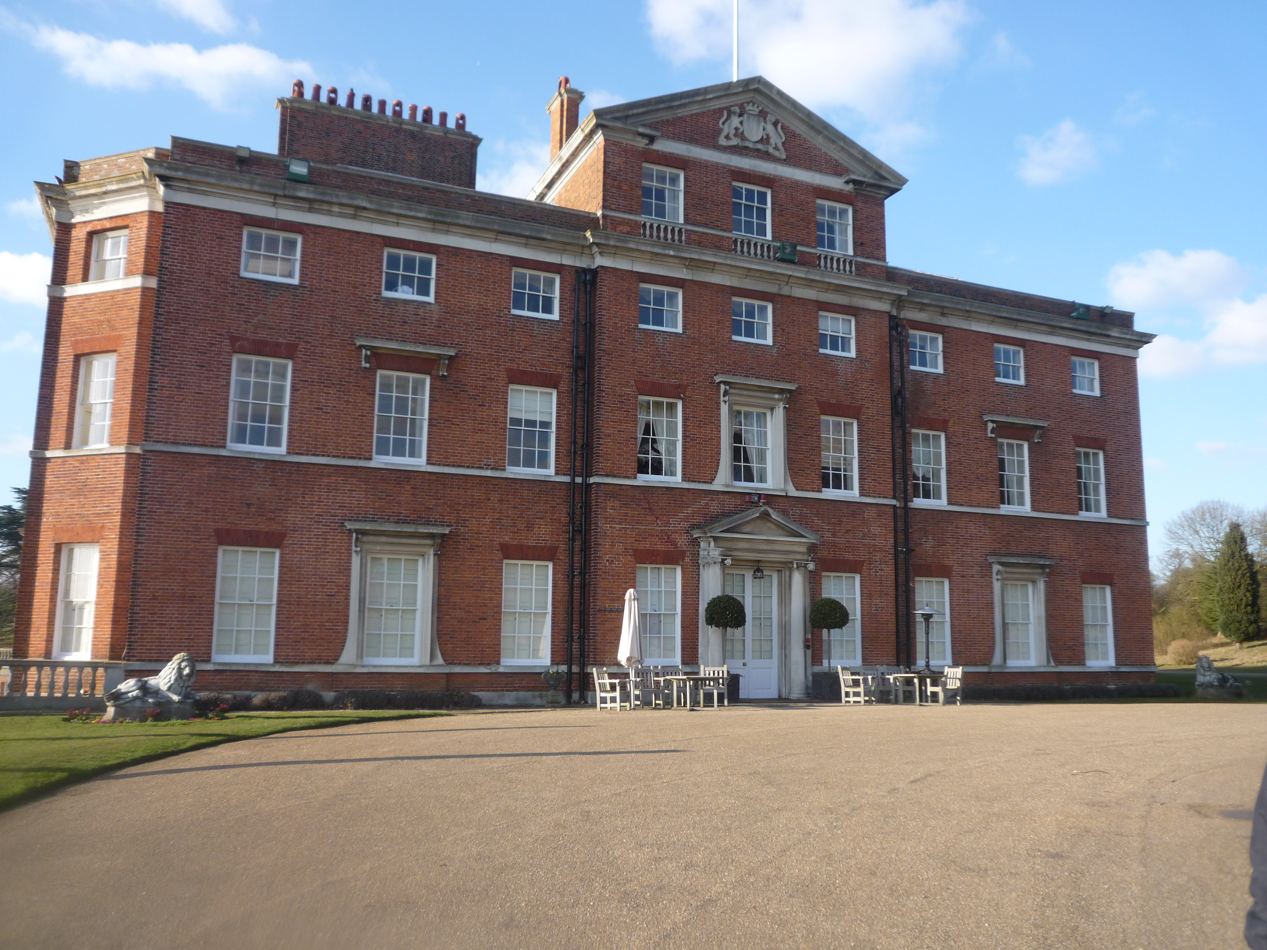
Brocket Hall

Brocket Hall is a neo-classical country house set in a large park at the western side of the urban area of Welwyn Garden City in Hertfordshire, England...

St Leonard's Church, Sandridge

St Leonard's Church is in Sandridge, a village in Hertfordshire, England. It is an active Anglican parish church. The building is Grade II* listed: notable...

Sandridge Lychgate

Sandridge Lychgate is a war memorial in the village of Sandridge, Hertfordshire, England. The timber lychgate with its flanking walls is listed Grade II...

Nearby Amenities

Located within 500m of 51.798823,-0.27842761
Post Box
Collection Times: Mo-Fr 16:00; Sa 12:00
Operator: Royal Mail
Post Box Type: lamp
Ref: AL4 3
Royal Cypher: EIIR
Royal Cypher Wikidata: Q33102113
Lat/Long: 51.7966401/-0.2796522
Fixme: Some of this is access land, but how much?
Lat/Long: 51.7984963/-0.277489
John Bunyan's Chimney
Historic: monument
Lat/Long: 51.7999268/-0.2747447
Board Type: history
Check Date: 2023-12-17
Information: board
Tourism: information
Lat/Long: 51.7999152/-0.2748466
Direction: 140
Generator Method: photovoltaic
Generator Output Electricity: yes
Generator Solar Modules: 17
Generator Source: solar
Generator Type: solar_photovoltaic_panel
Location: roof
Power: generator
Lat/Long: 51.7957079/-0.2774036
Direction: 140
Generator Method: photovoltaic
Generator Output Electricity: yes
Generator Solar Modules: 17
Generator Source: solar
Generator Type: solar_photovoltaic_panel
Location: roof
Power: generator
Lat/Long: 51.7956832/-0.2779596
Direction: 165
Generator Method: photovoltaic
Generator Output Electricity: yes
Generator Solar Modules: 17
Generator Source: solar
Generator Type: solar_photovoltaic_panel
Location: roof
Power: generator
Lat/Long: 51.7961861/-0.27838
Direction: 80
Generator Method: photovoltaic
Generator Output Electricity: yes
Generator Solar Modules: 22
Generator Source: solar
Generator Type: solar_photovoltaic_panel
Location: roof
Power: generator
Lat/Long: 51.7962205/-0.2786142
Direction: 260
Generator Method: photovoltaic
Generator Output Electricity: yes
Generator Solar Modules: 22
Generator Source: solar
Generator Type: solar_photovoltaic_panel
Location: roof
Power: generator
Lat/Long: 51.7962161/-0.2786382
Direction: 140
Generator Method: photovoltaic
Generator Output Electricity: yes
Generator Solar Modules: 12
Generator Source: solar
Generator Type: solar_photovoltaic_panel
Location: roof
Power: generator
Lat/Long: 51.7973357/-0.2780774
Direction: 225
Generator Method: photovoltaic
Generator Output Electricity: yes
Generator Solar Modules: 6
Generator Source: solar
Generator Type: solar_photovoltaic_panel
Location: roof
Power: generator
Lat/Long: 51.7974246/-0.2778455
Ralph Gordon Hayward
Cemetery: grave
Lat/Long: 51.7972957/-0.2806838
Bench
Lat/Long: 51.7973654/-0.2806824
The data included in this document is from www.openstreetmap.org. The data is made available under ODbL.

Have you been to Coleman Green?

Leave your review of Coleman Green below (or comments, questions and feedback).