Furzefield Wood

Wood, Forest in Hertfordshire St. Albans

England

Furzefield Wood

The Hill, Wheathampstead
The Hill, Wheathampstead Credit: David Howard

Furzefield Wood is a picturesque woodland located in Hertfordshire, England. Covering an area of approximately 20 hectares, it is a popular destination for nature enthusiasts and outdoor lovers alike.

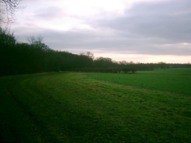
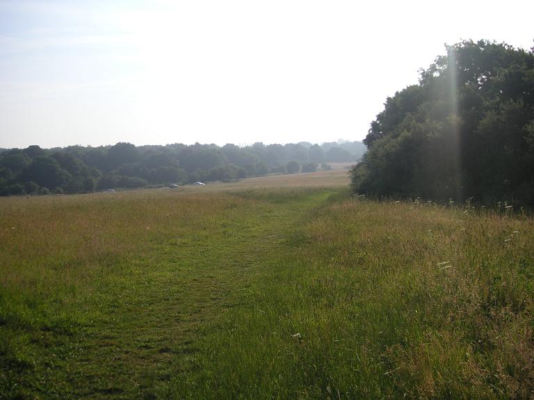
The woodland is predominantly composed of oak and ash trees, creating a dense and diverse ecosystem. Its lush greenery and vibrant flora make it a haven for a variety of wildlife, including birds, squirrels, and deer. The wood's tranquil atmosphere and natural beauty make it a perfect spot for leisurely walks, birdwatching, and photography.

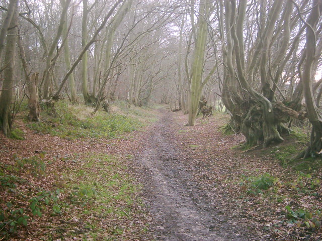
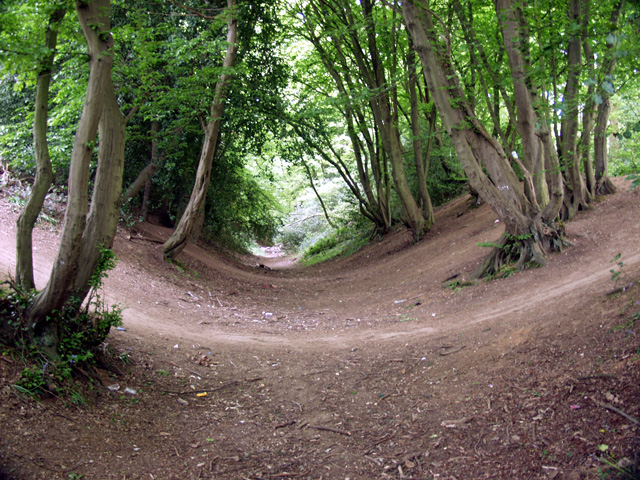
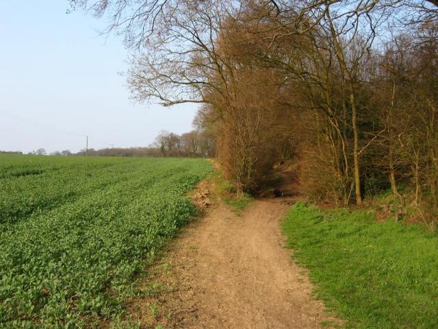
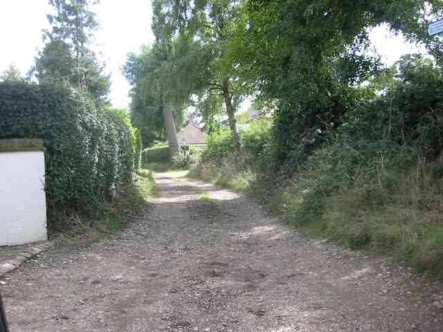
Furzefield Wood is well-maintained, with designated footpaths and trails that allow visitors to explore its entirety. These paths lead through the heart of the woodland, offering breathtaking views of the surrounding countryside. Along the way, visitors may encounter enchanting clearings, babbling brooks, and ancient trees, adding to the wood's charm and mystique.

The wood is also home to a rich history, with evidence of human activity dating back centuries. Ancient earthworks, including a possible Iron Age fort, can be found within its bounds, adding an element of intrigue and archaeological significance to the area.

Furzefield Wood is a protected area, ensuring its preservation for future generations to enjoy. The wood is managed by local authorities, who aim to maintain its natural beauty while also encouraging educational and recreational activities for visitors.

Overall, Furzefield Wood is a hidden gem in Hertfordshire, offering a peaceful retreat from the hustle and bustle of everyday life. Its stunning landscapes, diverse wildlife, and historical significance make it a must-visit destination for nature enthusiasts and history buffs alike.

If you have any feedback on the listing, please let us know in the comments section below.

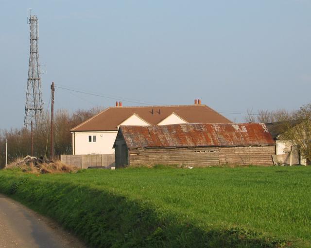
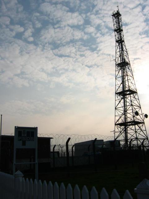
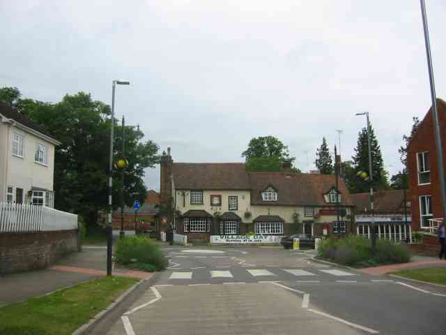
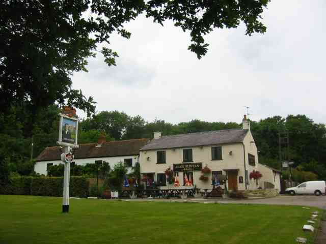
Furzefield Wood Images

Images are sourced within 2km of 51.795677/-0.28040361 or Grid Reference TL1812. Thanks to Geograph Open Source API. All images are credited.

The Hill, Wheathampstead
Coleman Green : cottages dated 1877
Coleman Green : John Bunyan's Chimney Grade II listed structure - <span class="nowrap"><a title="https://historicengland.org.uk/listing/the-list/list-entry/1175683?section=official-list-entry" rel="nofollow ugc noopener" href="https://historicengland.org.uk/listing/the-list/list-entry/1175683?section=official-list-entry">Link</a><img style="margin-left:2px;" alt="External link" title="External link - shift click to open in new window" src="https://s1.geograph.org.uk/img/external.png" width="10" height="10"/></span>.
Coleman Green : John Bunyan's Chimney
Grade II listed structure - LinkExternal link.
Open land near Long Grove Plantation The photograph is taken just south of Upper Cromer Hyde Farm looking south towards long grove plantation. The plantation straddles TL2012 and TL2011
Open land near Long Grove Plantation
The photograph is taken just south of Upper Cromer Hyde Farm looking south towards long grove plantation. The plantation straddles TL2012 and TL2011
Old Road in Long Grove Plantation This wide footpath runs south from near Upper Cromer Hyde Farm to Symondshyde Farm. This section is wide with evidence of ditches and banks topped with laid hedges. It appears to have been a maintained as a road or track. As the path leaves the plantation it narrows and becomes a narrow footpath.
Old Road in Long Grove Plantation
This wide footpath runs south from near Upper Cromer Hyde Farm to Symondshyde Farm. This section is wide with evidence of ditches and banks topped with laid hedges. It appears to have been a maintained as a road or track. As the path leaves the plantation it narrows and becomes a narrow footpath.
Old laid hedge in Long Grove Plantation This is taken on the footpath/old road from Upper Cromer Hyde Farm to Symondshyde Farm in Long Grove Plantation. The photograph seems to show evidence of a very old laid hedge alongside the path. There are similar remains on both sides of the path.
Old laid hedge in Long Grove Plantation
This is taken on the footpath/old road from Upper Cromer Hyde Farm to Symondshyde Farm in Long Grove Plantation. The photograph seems to show evidence of a very old laid hedge alongside the path. There are similar remains on both sides of the path.
Devils Dyke, Wheathampstead Part of the 'Belgic oppidum', a defensive earthwork dating from the Iron Age.
Devils Dyke, Wheathampstead
Part of the 'Belgic oppidum', a defensive earthwork dating from the Iron Age.
Signal mast Looking E to the signal mast at TL184103.
Signal mast
Looking E to the signal mast at TL184103.
Signal mast and razor wire Looking almost straight into the sun from TL185104 at the signal mast on the road coming east out of Sandridge.
No normal phone mast this; the thing's ringed with two layers of razor wire fence and has a sign at the entrance with a royal coat of arms on it. Photo notes: for better results take photo in morning, not afternoon like I did - the mast's partially obscured by trees from the west, so better to be east of it with the sun behind you.
Signal mast and razor wire
Looking almost straight into the sun from TL185104 at the signal mast on the road coming east out of Sandridge. No normal phone mast this; the thing's ringed with two layers of razor wire fence and has a sign at the entrance with a royal coat of arms on it. Photo notes: for better results take photo in morning, not afternoon like I did - the mast's partially obscured by trees from the west, so better to be east of it with the sun behind you.
Fork in the path Looking North from TL188105, the path forking right into Symondshyde Great Wood
Fork in the path
Looking North from TL188105, the path forking right into Symondshyde Great Wood
Road through Symondshyde Great Wood Looking East from TL194115 along the road running through Symondshyde Great Wood
Road through Symondshyde Great Wood
Looking East from TL194115 along the road running through Symondshyde Great Wood
Picnic area, Symonshyde Great Wood Taken looking West from the road at TL199107, toward the entrance of what might win a prize for being Britain's Least Welcoming Picnic Area.
Picnic area, Symonshyde Great Wood
Taken looking West from the road at TL199107, toward the entrance of what might win a prize for being Britain's Least Welcoming Picnic Area.
Wheathampstead village villages always seem to be devoid of people.
Wheathampstead village
villages always seem to be devoid of people.
Coleman Green This is the John Bunyan pub
Coleman Green
This is the John Bunyan pub
Farmhouse at Hammonds Farm Nr Coleman Green This is a fine Victorian building with much dignity
Farmhouse at Hammonds Farm Nr Coleman Green
This is a fine Victorian building with much dignity
Lane opposite Hammonds Farm Nr Coleman Green This track leads to at least two more houses.
Lane opposite Hammonds Farm Nr Coleman Green
This track leads to at least two more houses.
Countryside seen from Hammonds Lane Already the cereals have been harvested and the land tilled for the next crop
Countryside seen from Hammonds Lane
Already the cereals have been harvested and the land tilled for the next crop
Show me another place!

Furzefield Wood is located at Grid Ref: TL1812 (Lat: 51.795677, Lng: -0.28040361)

Administrative County: Hertfordshire

District: St. Albans

Police Authority: Hertfordshire

What 3 Words

///remote.tent.ranch. Near Wheathampstead, Hertfordshire

Related Wikis

Devil's Dyke, Hertfordshire

Devil's Dyke is the remains of a prehistoric defensive ditch which lies at the east side of the village of Wheathampstead, Hertfordshire, England. It is...

Nomansland Common

Nomansland Common (sometimes simply called No Man's Land) is an area of common land in Hertfordshire, England to the south of Harpenden and the south-west...

Wheathampstead

Wheathampstead is a village and civil parish in Hertfordshire, England, north of St Albans. The population of the ward at the 2001 census was 6,058. Included...

St Helen's Church, Wheathampstead

St Helen's Church is the oldest church in Wheathampstead, Hertfordshire, England, although the date of its origins is unknown. The wooden Anglo-Saxon structure...

St Leonard's Church, Sandridge

St Leonard's Church is in Sandridge, a village in Hertfordshire, England. It is an active Anglican parish church. The building is Grade II* listed: notable...

Sandridge Lychgate

Sandridge Lychgate is a war memorial in the village of Sandridge, Hertfordshire, England. The timber lychgate with its flanking walls is listed Grade II...

The Queen's Head, Sandridge

The Queens Head is a public house in the village of Sandridge to the north of St Albans, Hertfordshire, England. The timber framed building is weather...

Sandridge

Sandridge is a village and civil parish between the city centre of St Albans (2.5 miles (4.0 km) to the south-west) and Wheathampstead in Hertfordshire...

Nearby Amenities

Located within 500m of 51.795677,-0.28040361
Post Box
Collection Times: Mo-Fr 16:00; Sa 12:00
Operator: Royal Mail
Post Box Type: lamp
Ref: AL4 3
Royal Cypher: EIIR
Royal Cypher Wikidata: Q33102113
Lat/Long: 51.7966401/-0.2796522
Fixme: Some of this is access land, but how much?
Lat/Long: 51.7984963/-0.277489
Direction: 140
Generator Method: photovoltaic
Generator Output Electricity: yes
Generator Solar Modules: 17
Generator Source: solar
Generator Type: solar_photovoltaic_panel
Location: roof
Power: generator
Lat/Long: 51.7957079/-0.2774036
Direction: 140
Generator Method: photovoltaic
Generator Output Electricity: yes
Generator Solar Modules: 17
Generator Source: solar
Generator Type: solar_photovoltaic_panel
Location: roof
Power: generator
Lat/Long: 51.7956832/-0.2779596
Direction: 165
Generator Method: photovoltaic
Generator Output Electricity: yes
Generator Solar Modules: 17
Generator Source: solar
Generator Type: solar_photovoltaic_panel
Location: roof
Power: generator
Lat/Long: 51.7961861/-0.27838
Direction: 80
Generator Method: photovoltaic
Generator Output Electricity: yes
Generator Solar Modules: 22
Generator Source: solar
Generator Type: solar_photovoltaic_panel
Location: roof
Power: generator
Lat/Long: 51.7962205/-0.2786142
Direction: 260
Generator Method: photovoltaic
Generator Output Electricity: yes
Generator Solar Modules: 22
Generator Source: solar
Generator Type: solar_photovoltaic_panel
Location: roof
Power: generator
Lat/Long: 51.7962161/-0.2786382
Direction: 140
Generator Method: photovoltaic
Generator Output Electricity: yes
Generator Solar Modules: 12
Generator Source: solar
Generator Type: solar_photovoltaic_panel
Location: roof
Power: generator
Lat/Long: 51.7973357/-0.2780774
Direction: 225
Generator Method: photovoltaic
Generator Output Electricity: yes
Generator Solar Modules: 6
Generator Source: solar
Generator Type: solar_photovoltaic_panel
Location: roof
Power: generator
Lat/Long: 51.7974246/-0.2778455
Ralph Gordon Hayward
Cemetery: grave
Lat/Long: 51.7972957/-0.2806838
Bench
Lat/Long: 51.7973654/-0.2806824
The data included in this document is from www.openstreetmap.org. The data is made available under ODbL.

Have you been to Furzefield Wood?

Leave your review of Furzefield Wood below (or comments, questions and feedback).