The Plantation

Wood, Forest in Surrey Mole Valley

England

The Plantation

Lane to Hatchetts
Lane to Hatchetts Credit: Martyn Davies

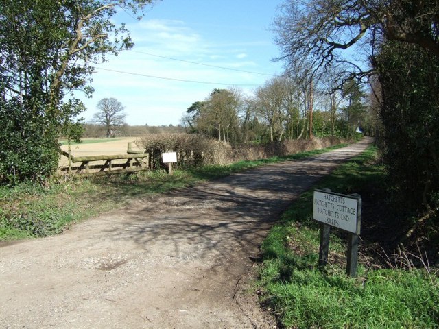
The Plantation, Surrey, also known as Wood or Forest Plantation, is a picturesque woodland located in the county of Surrey, England. Spanning an area of approximately 200 acres, this enchanting plantation is a haven for nature enthusiasts and outdoor adventurers alike.

The Plantation boasts a diverse range of flora and fauna, with a dense canopy of towering trees that create a serene and tranquil atmosphere. The woodland is primarily composed of native species such as oak, beech, and birch, which provide a rich habitat for a variety of wildlife.

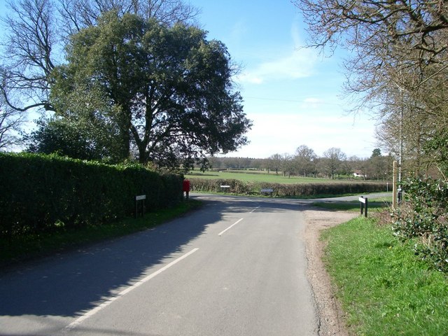
Visitors to The Plantation can enjoy a network of well-maintained walking trails that meander through the woods, offering opportunities for leisurely strolls or more vigorous hikes. These trails are surrounded by a carpet of wildflowers, creating a vibrant and colorful display during the spring and summer months.

Nature lovers will be delighted by the abundance of wildlife that call The Plantation their home. The woodland is home to numerous bird species, including woodpeckers, owls, and songbirds. Lucky visitors may even catch a glimpse of elusive woodland creatures such as deer, foxes, and rabbits.

The Plantation also offers a range of amenities to enhance visitors' experiences. Picnic areas are scattered throughout the woodland, providing the perfect spot to relax and enjoy a meal amid the tranquil surroundings. Additionally, informational signage is placed strategically along the trails, offering insights into the rich history and ecology of the area.

Whether it's a leisurely stroll, a family picnic, or an immersive nature retreat, The Plantation in Surrey is a captivating destination that showcases the natural beauty and biodiversity of the British countryside.

If you have any feedback on the listing, please let us know in the comments section below.

The Plantation Images

Images are sourced within 2km of 51.161896/-0.30400425 or Grid Reference TQ1841. Thanks to Geograph Open Source API. All images are credited.

Lane to Hatchetts
Lane to Hatchetts
Junction of Church Lane (left), Hogspudding Lane (ahead) and Cudworth Lane (foreground) Looking north.
Junction of Church Lane (left), Hogspudding Lane (ahead) and Cudworth Lane (foreground)
Looking north.
Green Lane Farm Looking north along the bridleway.
Green Lane Farm
Looking north along the bridleway.
Simons, Newdigate Formerly the farmhouse to Horsilands farm. The main structure dates from around the 15th-century with the gable-ended bay probably added later.
Simons, Newdigate
Formerly the farmhouse to Horsilands farm. The main structure dates from around the 15th-century with the gable-ended bay probably added later.
Junction of Cudworth Lane and Green Lane Cudworth Lane forks left with Green Lane to the right. To the left there are two gate posts, hidden by the undergrowth, which would have held the gate to the Cudworth Estate.
Junction of Cudworth Lane and Green Lane
Cudworth Lane forks left with Green Lane to the right. To the left there are two gate posts, hidden by the undergrowth, which would have held the gate to the Cudworth Estate.
Hogspudding Lane Wonderfully named country lane east of Newdigate, in the Surrey Weald.
Hogspudding Lane
Wonderfully named country lane east of Newdigate, in the Surrey Weald.
Pond near Hatchetts East of Newdigate, looking across a field to a modern housing development which has some homes designed to look like old Wealden hall houses.
Pond near Hatchetts
East of Newdigate, looking across a field to a modern housing development which has some homes designed to look like old Wealden hall houses.
The End of the Road Change of road surface at Hatchetts, east of Newdigate.
The End of the Road
Change of road surface at Hatchetts, east of Newdigate.
Pond near Green Lane Farm Used by Reigate district anglers, south of green Lane Farm.
Pond near Green Lane Farm
Used by Reigate district anglers, south of green Lane Farm.
Green Lane Farm Roller by the bridleway south of the Wealden farm.
Green Lane Farm
Roller by the bridleway south of the Wealden farm.
Four Ways Crossing of the ways just south of Green Lane Farm, with water trough.
Four Ways
Crossing of the ways just south of Green Lane Farm, with water trough.
Beam Brook Footbridge West of Green Lane Farm, wooden footbridge with metal railings, near Newdigate in the Surrey Weald.
Beam Brook Footbridge
West of Green Lane Farm, wooden footbridge with metal railings, near Newdigate in the Surrey Weald.
Snowdrops Flowering snowdrops by Beam Brook in mid-March - it's been a long winter.
Snowdrops
Flowering snowdrops by Beam Brook in mid-March - it's been a long winter.
Ockley Lodge On Duke's Road, a track leading from Rusper Road to Home Farm.
Ockley Lodge
On Duke's Road, a track leading from Rusper Road to Home Farm.
The Long Barn and The Old Stables  Part of a cluster of buildings on Duke's Road, a track leading from Rusper Road to Home Farm.
The Long Barn and The Old Stables
Part of a cluster of buildings on Duke's Road, a track leading from Rusper Road to Home Farm.
Houses in Mulberry Place, Newdigate Built on the site of Newdigate Brickworks.
Houses in Mulberry Place, Newdigate
Built on the site of Newdigate Brickworks.
Fishing lake by Green Lane There are other lakes along the brook on the other side of the lane, but this one is separate from the brook.
Fishing lake by Green Lane
There are other lakes along the brook on the other side of the lane, but this one is separate from the brook.
Dwelling on Church Road For a different view with more information see <a title="https://www.geograph.org.uk/photo/507709" href="https://www.geograph.org.uk/photo/507709">Link</a>.
Dwelling on Church Road
For a different view with more information see Link.
Show me another place!

The Plantation is located at Grid Ref: TQ1841 (Lat: 51.161896, Lng: -0.30400425)

Administrative County: Surrey

District: Mole Valley

Police Authority: Surrey

What 3 Words

///could.taxi.honey. Near Capel, Surrey

Related Wikis

Capel, Surrey

Capel () is a village and civil parish in southern Surrey, England. It is equidistant between Dorking and Horsham – about 5 miles (8.0 km) away. Around...

Newdigate Brickworks

Newdigate Brickworks is a 24-hectare (59-acre) nature reserve in Newdigate in Surrey. It is managed by the Surrey Wildlife Trust.The clay pits of this...

Holmwood railway station

Holmwood railway station serves the villages of Beare Green and South Holmwood in Surrey, England, on the Sutton and Mole Valley Lines between Dorking...

Ockley railway station

Ockley railway station serves the villages of Ockley and Capel in Surrey, England and is 1.4 miles (2.3 km) from Ockley village and 0.5 miles (0.80 km...

Newdigate

Newdigate is a village and civil parish in the Mole Valley borough of Surrey lying in a relatively flat part of the Weald to the east of the A24 road between...

Clock House Brickworks

Clock House Brickworks is a 35.9-hectare (89-acre) geological Site of Special Scientific Interest south of Capel in Surrey. It is a Geological Conservation...

Auclaye

Auclaye is a 0.6-hectare (1.5-acre) geological Site of Special Scientific Interest south of Capel in Surrey. It is a Geological Conservation Review site...

Broome Hall

Broome Hall is a Grade II-listed country house with grounds including cottages and outhouses on the wooded, upper southern slopes of the Greensand Ridge...

Nearby Amenities

Located within 500m of 51.161896,-0.30400425
Barrier: stile
Bicycle: yes
Foot: yes
Stile: stepover
Lat/Long: 51.1616454/-0.3049872
Barrier: stile
Lat/Long: 51.1574946/-0.3054096
Barrier: kissing_gate
Lat/Long: 51.1613525/-0.2982238
Barrier: kissing_gate
Foot: yes
Material: metal
Source: survey
Lat/Long: 51.1612547/-0.3079646
Barrier: stile
Material: wood
Step Count: 1
Stile: stepover
Lat/Long: 51.1613785/-0.3069623
Barrier: stile
Foot: yes
Stile: stepover
Lat/Long: 51.162502/-0.3031102
Man Made: tower
Tower Type: communication
Lat/Long: 51.1630837/-0.3002156
Barrier: stile
Bicycle: yes
Foot: yes
Stile: stepover
Lat/Long: 51.1636956/-0.3001384
Barrier: stile
Bicycle: yes
Foot: yes
Stile: stepover
Lat/Long: 51.158109/-0.3029842
Barrier: kissing_gate
Bicycle: yes
Foot: yes
Stile: stepover
Lat/Long: 51.1587786/-0.3006334
Broomell's Farm
Place: farm
Lat/Long: 51.1602735/-0.3072128
Power: pole
Lat/Long: 51.1589729/-0.3059006
Power: pole
Lat/Long: 51.1585658/-0.3043127
Power: pole
Lat/Long: 51.1581116/-0.3024137
Power: pole
Lat/Long: 51.1588316/-0.2989429
Power: pole
Lat/Long: 51.1596525/-0.3081295
Power: pole
Lat/Long: 51.1591193/-0.3059891
Power: pole
Lat/Long: 51.1586735/-0.304243
Power: pole
Lat/Long: 51.1582008/-0.3024137
Power: pole
Lat/Long: 51.1585524/-0.3006756
Power: pole
Lat/Long: 51.1588619/-0.2991709
Material: wood
Operator: UK Power Networks
Power: pole
Lat/Long: 51.1576969/-0.3051127
Power: pole
Lat/Long: 51.1582066/-0.3032566
Power: pole
Lat/Long: 51.1589417/-0.2995176
Fixme: might be a pipeline marker at this side in gap in hedge
Lat/Long: 51.1611996/-0.3068341
Colour: white
Marker: post
Material: concrete
Utility: oil
Lat/Long: 51.1612659/-0.3079817
Colour: white
Marker: post
Material: plastic
Utility: oil
Lat/Long: 51.1611891/-0.3068359
The data included in this document is from www.openstreetmap.org. The data is made available under ODbL.

Have you been to The Plantation?

Leave your review of The Plantation below (or comments, questions and feedback).