Allum Lane Spinney

Wood, Forest in Hertfordshire Hertsmere

England

Allum Lane Spinney

Derelict restaurant on Watling Street, Elstree
Derelict restaurant on Watling Street, Elstree Credit: David Howard

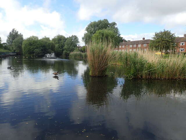
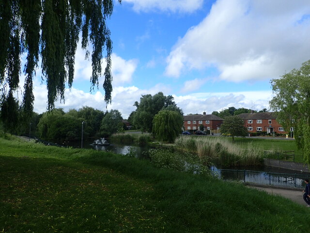
Allum Lane Spinney is a picturesque woodland located in Hertfordshire, England. Spread over an area of approximately 25 acres, it is a haven for nature enthusiasts and a popular spot for leisurely walks and outdoor activities. The spinney is situated on the outskirts of the village of Elstree, making it easily accessible for visitors from nearby towns and cities.

The wood is predominantly composed of broadleaf trees, including oak, beech, and birch, which create a lush and vibrant canopy. The forest floor is covered in a carpet of wildflowers and ferns, adding to its natural beauty. Numerous well-maintained footpaths meander through the spinney, allowing visitors to explore its various nooks and crannies.

Allum Lane Spinney is blessed with a diverse range of wildlife. Birdwatchers can spot a variety of species, including woodpeckers, thrushes, and finches. The wood is also home to mammals such as foxes, squirrels, and rabbits. It is not uncommon to encounter deer gracefully roaming through the trees.

The spinney has a rich history dating back centuries. It was once part of a larger ancient woodland that covered much of the surrounding area. Today, it stands as a remnant of that ancient forest, offering a glimpse into the region's past.

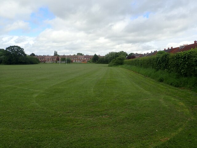
The wood is open to the public year-round and is a popular destination for families, dog walkers, and nature lovers. Its tranquil atmosphere and natural beauty make it an ideal place to escape the hustle and bustle of everyday life and immerse oneself in the wonders of nature.

If you have any feedback on the listing, please let us know in the comments section below.

Allum Lane Spinney Images

Images are sourced within 2km of 51.652555/-0.28748791 or Grid Reference TQ1896. Thanks to Geograph Open Source API. All images are credited.

Derelict restaurant on Watling Street, Elstree
Shenley Road, Borehamwood Heading south the A5 (as was) was closed in Radlett and all traffic was diverted through Borehamwood. I was tempted to pick up a Wimpy as there are very few left now.
Shenley Road, Borehamwood
Heading south the A5 (as was) was closed in Radlett and all traffic was diverted through Borehamwood. I was tempted to pick up a Wimpy as there are very few left now.
Shenley Road, Borehamwood
Lake in Aberford Park Aberford Park was purchased in stages starting in 1888. The lake was formed by the damming of the Borehamwood Brook. On some maps this is known as Tykes Water.

More information can be found at <span class="nowrap"><a title="https://www.greenflagaward.org//park-summary/?park=576" rel="nofollow ugc noopener" href="https://www.greenflagaward.org//park-summary/?park=576">Link</a><img style="margin-left:2px;" alt="External link" title="External link - shift click to open in new window" src="https://s1.geograph.org.uk/img/external.png" width="10" height="10"/></span>  and <span class="nowrap"><a title="https://www.parksherts.co.uk/parks/view/aberford-park" rel="nofollow ugc noopener" href="https://www.parksherts.co.uk/parks/view/aberford-park">Link</a><img style="margin-left:2px;" alt="External link" title="External link - shift click to open in new window" src="https://s1.geograph.org.uk/img/external.png" width="10" height="10"/></span>
Lake in Aberford Park
Aberford Park was purchased in stages starting in 1888. The lake was formed by the damming of the Borehamwood Brook. On some maps this is known as Tykes Water. More information can be found at LinkExternal link and LinkExternal link
Aberford Park Aberford Park was purchased in stages starting in 1888. The lake was formed by the damming of the Borehamwood Brook. On some maps this is known as Tykes Water.

More information can be found at <span class="nowrap"><a title="https://www.greenflagaward.org//park-summary/?park=576" rel="nofollow ugc noopener" href="https://www.greenflagaward.org//park-summary/?park=576">Link</a><img style="margin-left:2px;" alt="External link" title="External link - shift click to open in new window" src="https://s1.geograph.org.uk/img/external.png" width="10" height="10"/></span>  and <span class="nowrap"><a title="https://www.parksherts.co.uk/parks/view/aberford-park" rel="nofollow ugc noopener" href="https://www.parksherts.co.uk/parks/view/aberford-park">Link</a><img style="margin-left:2px;" alt="External link" title="External link - shift click to open in new window" src="https://s1.geograph.org.uk/img/external.png" width="10" height="10"/></span>

See also <a title="https://www.geograph.org.uk/photo/7182331" href="https://www.geograph.org.uk/photo/7182331">Link</a>
Aberford Park
Aberford Park was purchased in stages starting in 1888. The lake was formed by the damming of the Borehamwood Brook. On some maps this is known as Tykes Water. More information can be found at LinkExternal link and LinkExternal link See also Link
Rugby and cricket ground alongside Croxdale Road This is the Old Haberdashers Sports Ground.
Rugby and cricket ground alongside Croxdale Road
This is the Old Haberdashers Sports Ground.
Rugby and cricket ground alongside Croxdale Road This is the Old Haberdashers Sports Ground - see also <a title="https://www.geograph.org.uk/photo/7182342" href="https://www.geograph.org.uk/photo/7182342">Link</a>
Rugby and cricket ground alongside Croxdale Road
This is the Old Haberdashers Sports Ground - see also Link
Theobald Street, Borehamwood The main part of Theobald Street runs parallel to this service road on the other side of the trees on the left
Theobald Street, Borehamwood
The main part of Theobald Street runs parallel to this service road on the other side of the trees on the left
The entrance to Borehamwood FC The ground is currently being rebuilt and this is the road entrance which is not yet in use, the pedestrian entrance runs parallel to the left.
The entrance to Borehamwood FC
The ground is currently being rebuilt and this is the road entrance which is not yet in use, the pedestrian entrance runs parallel to the left.
Meadow Park Stadium, Borehamwood Currently being rebuilt, this is the home of Borehamwood FC.
Meadow Park Stadium, Borehamwood
Currently being rebuilt, this is the home of Borehamwood FC.
Meadow Park, Borehamwood
Construction work at Borehamwood FC The whole stadium is being rebuilt.
Construction work at Borehamwood FC
The whole stadium is being rebuilt.
The pedestrian entrance to Borehamwood FC This is all in the process of construction.
The pedestrian entrance to Borehamwood FC
This is all in the process of construction.
Meadow Park, Borehamwood Looking towards Broughinge Road.
Meadow Park, Borehamwood
Looking towards Broughinge Road.
Liberty Court, Borehamwood
Fairbrook Medical Centre, Borehamwood
Meadow Park car park, Borehamwood
Brook Road, Borehamwood
Show me another place!

Allum Lane Spinney is located at Grid Ref: TQ1896 (Lat: 51.652555, Lng: -0.28748791)

Administrative County: Hertfordshire

District: Hertsmere

Police Authority: Hertfordshire

What 3 Words

///metro.ranch.modern. Near Borehamwood, Hertfordshire

Related Wikis

Elstree & Borehamwood railway station

Elstree & Borehamwood railway station is a railway station in the town of Borehamwood, Hertfordshire, England. It primarily serves Borehamwood as well...

Gate Studios

Gate Studios was one of the many studios known collectively as Elstree Studios in the town of Borehamwood, England. Opened in 1928, the studios were in...

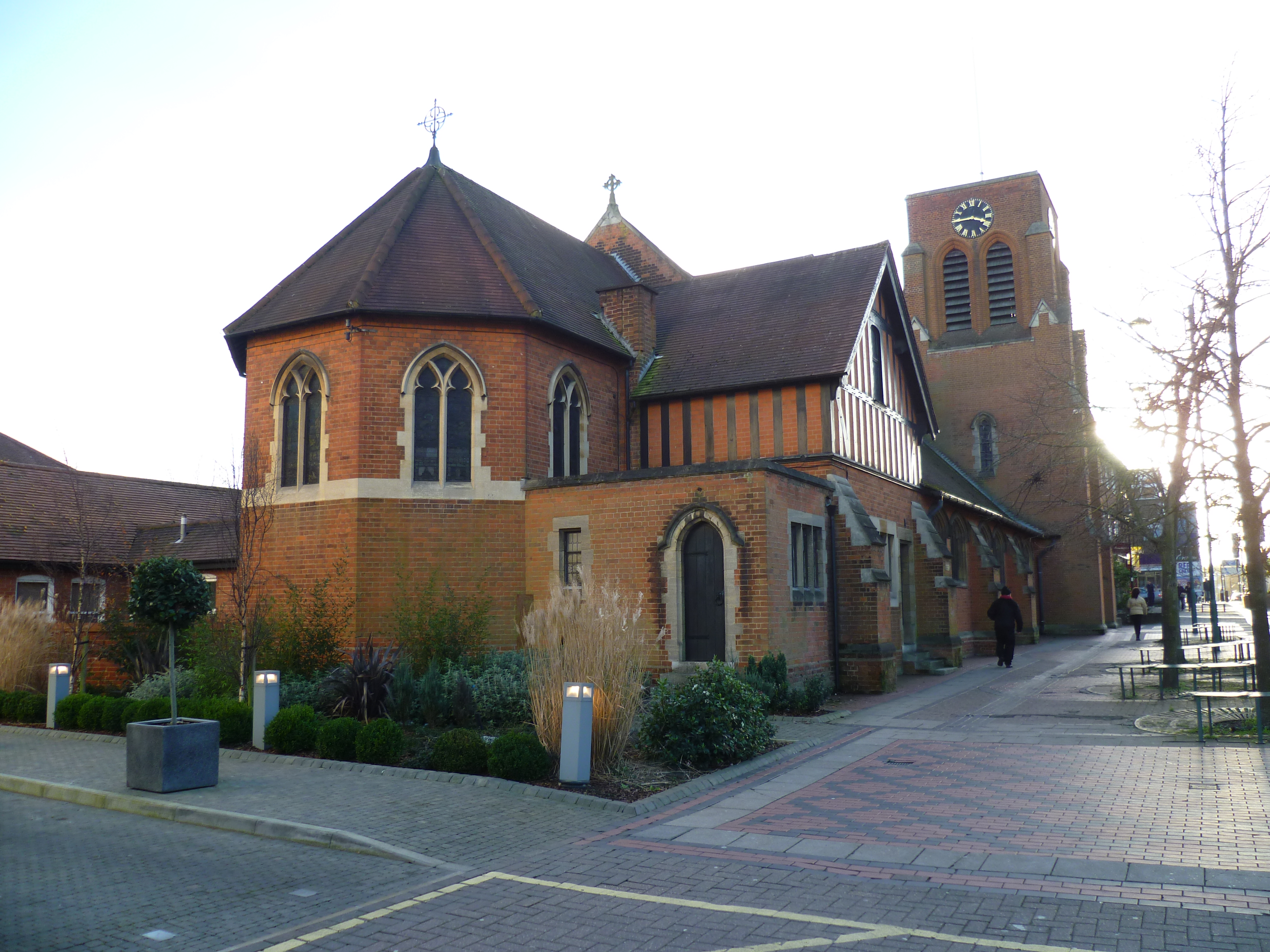
All Saints church, Borehamwood

All Saints church is a Church of England church in Shenley Road, Borehamwood. It is in the parish of Elstree and Borehamwood. The church is built in the...
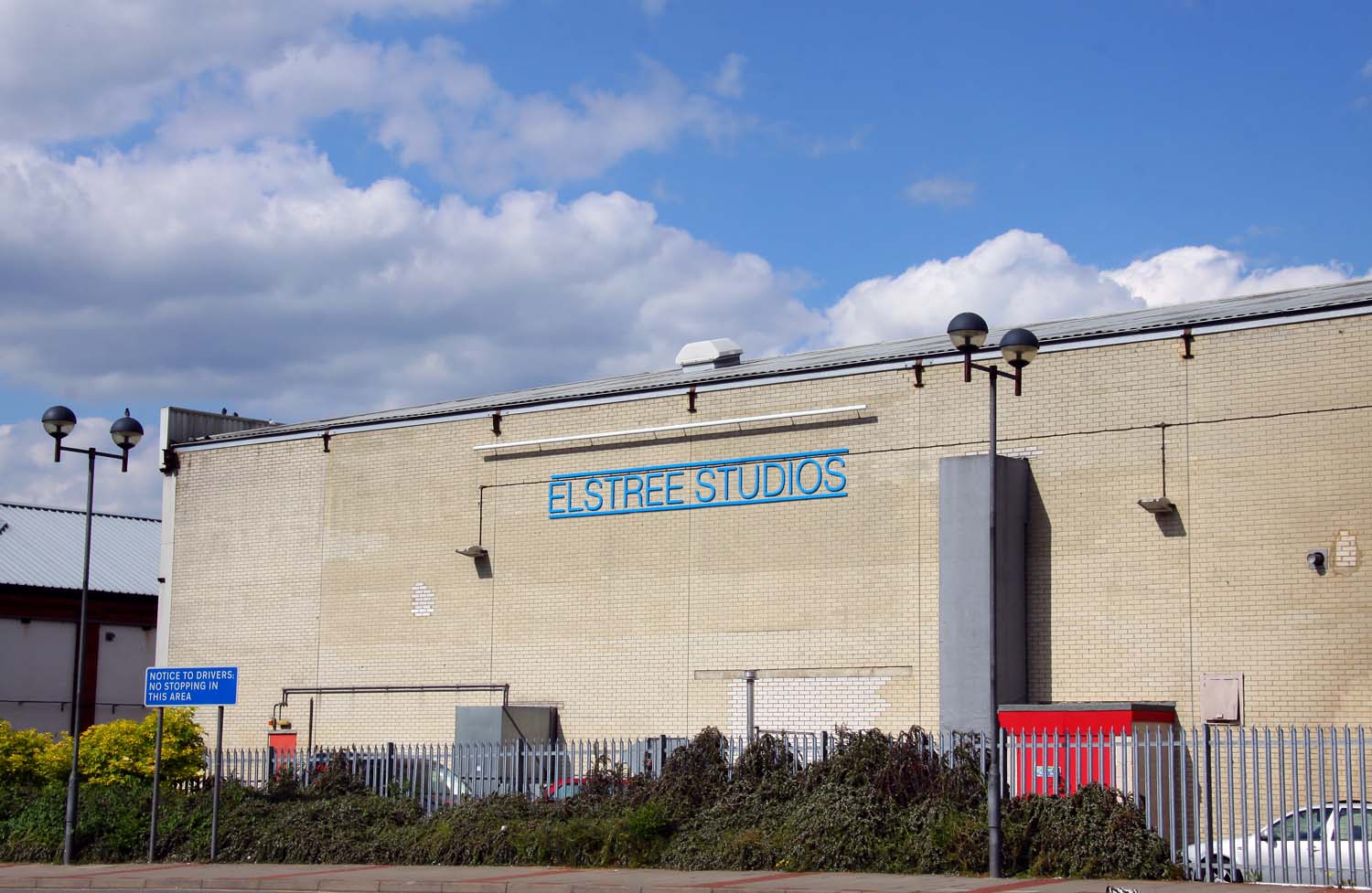
Elstree Studios

Elstree Studios is a generic term which can refer to several current and demolished British film studios and television studios based in or around the...

Deacon's Hill

Deacon's Hill is an area of Elstree, Hertfordshire, England. It is the part of the town which lies to the immediate west of the railway line and is informally...

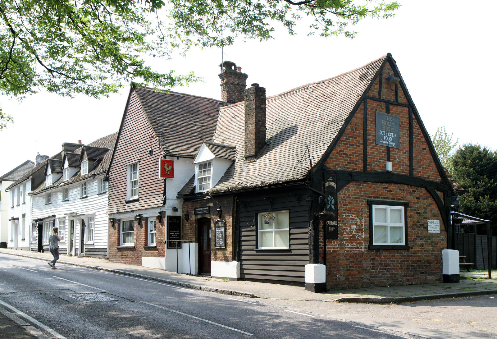
The Holly Bush, Elstree

The Holly Bush is a listed building, formerly a public house, on the High Street, Elstree, Hertfordshire, England. Elstree's High Street was formerly an...

Elstree and Borehamwood

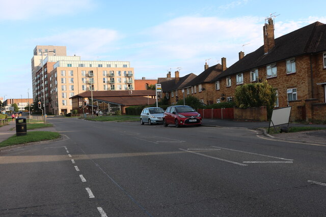
Elstree and Borehamwood is a civil parish in the Hertsmere district, in Hertfordshire, England. Located approximately 12 miles (19 km) northwest of central...

BBC Elstree Centre

The BBC Elstree Centre, sometimes referred to as the BBC Elstree Studios, is a television production facility, currently owned by the BBC. The complex...

Nearby Amenities

Located within 500m of 51.652555,-0.28748791
Turning Circle
Lat/Long: 51.649207/-0.2883033
Give Way
Direction: forward
Lat/Long: 51.6527985/-0.2820568
Crossing
Crossing: unmarked
Crossing Island: yes
Tactile Paving: no
Lat/Long: 51.6529587/-0.2817197
Mini Roundabout
Direction: clockwise
Lat/Long: 51.6528269/-0.28195
Turning Circle
Lat/Long: 51.6501825/-0.2892016
Turning Circle
Lat/Long: 51.6505251/-0.2877152
Bus Stop
Deacon's Hill Road
Bench: yes
Bin: yes
Bus: yes
Lit: yes
Naptan AtcoCode: 210021002700
Naptan Bearing: SW
Naptan CommonName: Deacon's Hill Road
Naptan Indicator: nr
Naptan Landmark: Unknown
Naptan NaptanCode: hrtgpjag
Naptan ShortCommonName: NA
Naptan Street: Allum Lane
Public Transport: platform
Shelter: yes
Source: naptan_import
Tactile Paving: no
Lat/Long: 51.6525039/-0.2823871
Bus Stop
Barham Avenue
Bench: no
Bin: no
Lit: yes
Naptan AtcoCode: 210021002710
Naptan Bearing: SW
Naptan CommonName: Barham Avenue
Naptan Crossing: Nash Close
Naptan Indicator: opp
Naptan Landmark: Nash Close
Naptan NaptanCode: hrtgpjam
Naptan PlusbusZoneRef: ELTR
Naptan ShortCommonName: NA
Naptan Street: Allum Lane
Public Transport: platform
Shelter: no
Source: naptan_import
Tactile Paving: yes
Lat/Long: 51.651836/-0.2856952
Bus Stop
Knowl Way
Bench: yes
Bin: yes
Lit: yes
Naptan AtcoCode: 210021002720
Naptan Bearing: SW
Naptan CommonName: Knowl Way
Naptan Indicator: adj
Naptan Landmark: Unknown
Naptan NaptanCode: hrtgpjat
Naptan ShortCommonName: NA
Naptan Street: Allum Lane
Public Transport: platform
Shelter: yes
Source: naptan_import
Tactile Paving: no
Lat/Long: 51.6502467/-0.2893674
Bus Stop
Knowl Way
Bench: no
Bin: no
Lit: yes
Naptan AtcoCode: 210021004220
Naptan Bearing: NE
Naptan CommonName: Knowl Way
Naptan Crossing: Blattner Close
Naptan Indicator: opp
Naptan Landmark: Blattner Close
Naptan NaptanCode: hrtgpatg
Naptan PlusbusZoneRef: ELTR
Naptan ShortCommonName: NA
Naptan Street: Allum Lane
Public Transport: platform
Shelter: no
Source: naptan_import
Tactile Paving: yes
Lat/Long: 51.6510382/-0.2879971
Bus Stop
Barham Avenue
Bench: yes
Bin: no
Check Date Shelter: 2023-08-12
Naptan AtcoCode: 210021004230
Naptan Bearing: E
Naptan CommonName: Barham Avenue
Naptan Crossing: opp Nash Close
Naptan Indicator: nr
Naptan Landmark: opp Nash Close
Naptan NaptanCode: hrtgpatj
Naptan PlusbusZoneRef: ELTR
Naptan ShortCommonName: NA
Naptan Street: Allum Lane
Public Transport: platform
Shelter: yes
Source: naptan_import
Tactile Paving: yes
Lat/Long: 51.652145/-0.2849299
Bus Stop
Deacon's Hill Road
Bench: yes
Bin: no
Lit: yes
Naptan AtcoCode: 210021004240
Naptan Bearing: NE
Naptan CommonName: Deacon's Hill Road
Naptan Indicator: opp
Naptan Landmark: Unknown
Naptan NaptanCode: hrtgpatp
Naptan ShortCommonName: NA
Naptan Street: Allum Lane
Naptan Verified: no
Public Transport: platform
Shelter: no
Source: naptan_import
Tactile Paving: no
Lat/Long: 51.6530733/-0.2816131
Atm
Note: Was out of order when I visited.
Operator: HSBC
Lat/Long: 51.6526528/-0.2815908
Crossing
Crossing: unmarked
Lat/Long: 51.6532964/-0.2815336
Post Box
Check Date: 2022-08-25
Collection Times: Mo-Fr 17:30; Sa 11:30
Ref: WD6 97
Royal Cypher: EIIR
Lat/Long: 51.6523166/-0.2841769
Waste Basket
Lat/Long: 51.6516704/-0.2865617
Bench
Lat/Long: 51.6517082/-0.2866111
Crossing
Crossing: unmarked
Lat/Long: 51.6521284/-0.2839082
Bench
Lat/Long: 51.6533757/-0.2876695
Traffic Calming: cushion
Lat/Long: 51.6502254/-0.282181
Direction: 155
Generator Method: photovoltaic
Generator Output Electricity: yes
Generator Solar Modules: 22
Generator Source: solar
Generator Type: solar_photovoltaic_panel
Location: roof
Power: generator
Lat/Long: 51.6529175/-0.2811142
Direction: 155
Generator Method: photovoltaic
Generator Output Electricity: yes
Generator Solar Modules: 24
Generator Source: solar
Generator Type: solar_photovoltaic_panel
Location: roof
Power: generator
Lat/Long: 51.6530672/-0.2805488
Give Way
Direction: forward
Lat/Long: 51.6517577/-0.2859655
Barrier: kerb
Kerb: lowered
Tactile Paving: no
Lat/Long: 51.6518731/-0.2858855
Crossing: no
Traffic Calming: island
Lat/Long: 51.6516949/-0.2862301
Give Way
Direction: backward
Lat/Long: 51.6528895/-0.2818772
Crossing
Crossing: unmarked
Crossing Island: no
Tactile Paving: no
Lat/Long: 51.6517492/-0.2859563
Give Way
Direction: backward
Lat/Long: 51.6527741/-0.2818837
Crossing
Crossing: unmarked
Crossing Island: no
Tactile Paving: no
Lat/Long: 51.6527327/-0.2818482
Crossing
Crossing: unmarked
Crossing Island: no
Tactile Paving: yes
Lat/Long: 51.6530027/-0.2814123
Traffic Calming: cushion
Lat/Long: 51.6524687/-0.2816633
Crossing
Crossing: unmarked
Tactile Paving: no
Lat/Long: 51.652963/-0.28153
Crossing
Lat/Long: 51.6519952/-0.2813041
Crossing
Lat/Long: 51.6523592/-0.2815368
Crossing
Crossing: unmarked
Tactile Paving: no
Lat/Long: 51.6525525/-0.2816676
Crossing
Crossing: unmarked
Tactile Paving: no
Lat/Long: 51.6526951/-0.2817552
Traffic Calming: cushion
Lat/Long: 51.6519121/-0.281319
Crossing
Crossing: unmarked
Crossing Island: no
Tactile Paving: no
Lat/Long: 51.6517253/-0.2812644
Give Way
Direction: backward
Lat/Long: 51.6498727/-0.2818481
Crossing
Crossing: unmarked
Crossing Island: no
Tactile Paving: no
Lat/Long: 51.6498777/-0.2818275
Give Way
Direction: forward
Lat/Long: 51.6521509/-0.2839083
Direction: 150
Generator Method: photovoltaic
Generator Output Electricity: yes
Generator Solar Modules: 21
Generator Source: solar
Generator Type: solar_photovoltaic_panel
Location: roof
Power: generator
Lat/Long: 51.6488139/-0.2848085
Direction: 115
Generator Method: photovoltaic
Generator Output Electricity: yes
Generator Solar Modules: 18
Generator Source: solar
Generator Type: solar_photovoltaic_panel
Location: roof
Power: generator
Lat/Long: 51.6492784/-0.2831124
Direction: 150
Generator Method: photovoltaic
Generator Output Electricity: yes
Generator Solar Modules: 15
Generator Source: solar
Generator Type: solar_photovoltaic_panel
Location: roof
Power: generator
Lat/Long: 51.6508536/-0.287226
Direction: 160
Generator Method: photovoltaic
Generator Output Electricity: yes
Generator Solar Modules: 18
Generator Source: solar
Generator Type: solar_photovoltaic_panel
Location: roof
Power: generator
Lat/Long: 51.6535985/-0.286336
Direction: 165
Generator Method: photovoltaic
Generator Output Electricity: yes
Generator Solar Modules: 16
Generator Source: solar
Generator Type: solar_photovoltaic_panel
Location: roof
Power: generator
Lat/Long: 51.654187/-0.2866265
Direction: 150
Generator Method: photovoltaic
Generator Output Electricity: yes
Generator Solar Modules: 9
Generator Source: solar
Generator Type: solar_photovoltaic_panel
Location: roof
Power: generator
Lat/Long: 51.6557484/-0.2872127
Fixme: solar panels?
Lat/Long: 51.655607/-0.2864689
Direction: 185
Generator Method: photovoltaic
Generator Output Electricity: yes
Generator Solar Modules: 42
Generator Source: solar
Generator Type: solar_photovoltaic_panel
Location: roof
Power: generator
Lat/Long: 51.6542051/-0.2849246
Traffic Calming: island
Lat/Long: 51.6522846/-0.2830529
Traffic Calming: island
Lat/Long: 51.6528819/-0.2818861
Direction: 150
Generator Method: photovoltaic
Generator Output Electricity: yes
Generator Solar Modules: 16
Generator Source: solar
Generator Type: solar_photovoltaic_panel
Location: roof
Power: generator
Lat/Long: 51.6489763/-0.2880859
Direction: 235
Generator Method: photovoltaic
Generator Output Electricity: yes
Generator Solar Modules: 18
Generator Source: solar
Generator Type: solar_photovoltaic_panel
Location: roof
Power: generator
Lat/Long: 51.6491173/-0.2885533
Traffic Calming: cushion
Lat/Long: 51.6513056/-0.2818935
Crossing
Crossing: unmarked
Crossing Island: no
Tactile Paving: no
Lat/Long: 51.6549854/-0.2850173
Barrier: kerb
Kerb: lowered
Tactile Paving: no
Lat/Long: 51.6535794/-0.2830075
Barrier: kerb
Kerb: lowered
Tactile Paving: no
Lat/Long: 51.6534745/-0.2829519
Crossing
Crossing: unmarked
Crossing Island: no
Tactile Paving: no
Lat/Long: 51.6535344/-0.2829836
Barrier: kerb
Kerb: lowered
Tactile Paving: no
Lat/Long: 51.6528663/-0.2826427
Crossing
Crossing: unmarked
Tactile Paving: no
Lat/Long: 51.6528283/-0.2826262
Barrier: kerb
Kerb: lowered
Tactile Paving: no
Lat/Long: 51.6519494/-0.2856796
Barrier: kerb
Kerb: lowered
Tactile Paving: no
Lat/Long: 51.6519838/-0.2855848
Crossing
Crossing: unmarked
Tactile Paving: no
Lat/Long: 51.6519643/-0.2856384
Barrier: kerb
Kerb: lowered
Tactile Paving: no
Lat/Long: 51.6519091/-0.2857971
Crossing
Crossing: unmarked
Tactile Paving: no
Lat/Long: 51.6518931/-0.2858364
Barrier: kerb
Kerb: lowered
Tactile Paving: no
Lat/Long: 51.6522544/-0.2836321
Crossing
Crossing: unmarked
Crossing Island: no
Tactile Paving: no
Lat/Long: 51.6522526/-0.2837085
Crossing
Crossing: unmarked
Tactile Paving: no
Lat/Long: 51.6524432/-0.2832439
Barrier: kerb
Kerb: lowered
Tactile Paving: no
Lat/Long: 51.6559775/-0.2857428
Crossing
Crossing: unmarked
Crossing Island: no
Tactile Paving: no
Lat/Long: 51.6559971/-0.2856871
Noexit: yes
Lat/Long: 51.6524837/-0.2841822
Hiking: yes
Information: guidepost
Tourism: information
Lat/Long: 51.6516749/-0.2866155
Crossing
Crossing: unmarked
Lat/Long: 51.652039/-0.283826
Turning Circle
Lat/Long: 51.6520405/-0.2836798
Noexit: yes
Lat/Long: 51.6507953/-0.2828537
Noexit: yes
Lat/Long: 51.6508349/-0.2828094
Turning Circle
Lat/Long: 51.6506719/-0.2810896
Crossing
Crossing: unmarked
Crossing Island: no
Tactile Paving: no
Lat/Long: 51.6516926/-0.2856348
Crossing
Crossing: unmarked
Lat/Long: 51.6515724/-0.2863676
Barrier: kerb
Kerb: regular
Tactile Paving: no
Lat/Long: 51.6529233/-0.2816909
Barrier: kerb
Kerb: regular
Tactile Paving: no
Lat/Long: 51.6530101/-0.2817615
Crossing
Crossing: unmarked
Crossing Island: yes
Tactile Paving: no
Lat/Long: 51.6527791/-0.2820903
The data included in this document is from www.openstreetmap.org. The data is made available under ODbL.

Have you been to Allum Lane Spinney?

Leave your review of Allum Lane Spinney below (or comments, questions and feedback).